

Valencia (Santa Clarita) Travel Guide - Free
Explore Valencia in Santa Clarita with Evendo's free guide. Find the best shops, historic streets, restaurants, and gems on web or mobile.


Valencia, Santa Clarita, pairs master-planned paseos, Six Flags Magic Mountain, local parks, shopping and dining in northern Los Angeles County.
Designed for Movement and Open Space
Valencia occupies the southern part of Santa Clarita, a planned suburban community north-west of Los Angeles. Its identity is unusually legible: broad boulevards, landscaped medians, neighbourhood shopping centres, greenbelts and an extensive network of pedestrian paseos connect residential areas with parks, schools and commercial districts. These separated walking and cycling paths, often crossing roads by distinctive bridges, are one of the clearest expressions of Valencia’s original planning philosophy. The landscape is generally spacious and sunny, framed by the dry hills and mountain ridges of the Santa Clarita Valley.Read more about Valencia
Entertainment, Retail and Everyday California
A Modern History in an Older Valley
Best attractions in Valencia
Six Flags Magic Mountain is Valencia’s dominant visitor attraction, an amusement park known for its large collection of roller coasters and its long association with the Santa Clarita Valley. Beyond the park, Valencia’s more local attractions are connected to its planned landscape: the paseo network offers routes through landscaped greenbelts, while Bridgeport Lake and its surrounding paths provide water, open space and a slower setting for walking. Valencia Heritage Park is another useful neighbourhood green space, with lawns and recreational facilities rather than formal historic monuments. Valencia Town Center and Bridgeport Marketplace add shopping, restaurants and cinema-style entertainment to the sightseeing mix. The interest here lies less in a traditional collection of museums or old streets than in seeing how a master-planned Californian community combines recreation, retail, residential villages and carefully designed pedestrian links.
-
Park
Valencia Heritage Park
Discover the tranquility of Valencia Heritage Park, a lush green oasis in Santa Clarita perfect for relaxation, family outings, and nature walks.
7 min drive · 2.3 km from neighbourhood centre
-
Park
Valencia Glen Park
Discover the natural beauty and recreational charm of Valencia Glen Park in Santa Clarita, an ideal destination for families and nature lovers.
6 min drive · 2.0 km from neighbourhood centre
-
Recreation center
Billy Beez
Discover endless fun and adventure at Billy Beez, Valencia's ultimate indoor playground for kids, featuring exciting attractions and birthday party services.
4 min walk · 0.3 km from neighbourhood centre


Best landmarks in Valencia
Valencia’s landmarks are largely products of twentieth-century planning and recreation rather than inherited civic monuments. The roller-coaster skyline of Six Flags Magic Mountain is its most recognisable visual marker, standing close to Interstate 5 and signalling the neighbourhood from the motorway. The Valencia paseo system, including its landscaped routes, bridges and underpasses, is a landmark of design in a broader sense: it expresses the community’s attempt to connect housing, schools, parks and shopping without relying solely on road travel. Bridgeport Lake and its surrounding development provide another distinctive point of orientation, while the broad commercial frontage of Valencia Town Center represents the area’s retail-centred public life. These places are significant because they explain Valencia’s identity as a carefully planned suburban community rather than because it possesses a concentrated historic core.
-
Park
Valencia Heritage Park
Discover Valencia Heritage Park in Santa Clarita: A scenic 17-acre park with gardens, playgrounds, sports fields, and community events, perfect for family fun and outdoor activities.
7 min drive · 2.3 km from neighbourhood centre
-
Park
Summit Park
Discover a vibrant community hub in Santa Clarita's Summit Park, offering recreation, relaxation, and natural beauty for families, sports enthusiasts, and nature lovers alike.
10 min walk · 0.8 km from neighbourhood centre


Explore Valencia on the map
A handpicked selection of must-see spots in Valencia, mapped for you.
Best hotels in Valencia
Best restaurants in Valencia
Valencia’s dining scene reflects its suburban layout, with restaurants concentrated around shopping and commercial centres rather than along one historic food street. Valencia Town Center, Bridgeport Marketplace and the corridors around McBean Parkway, Magic Mountain Parkway and Valencia Boulevard offer a broad mix of casual restaurants, cafés, bakeries and familiar American dining formats, alongside Asian, Mexican, Mediterranean and contemporary Californian choices. Dining near Six Flags Magic Mountain is oriented towards visitors and families, while the centres used by local residents provide a more everyday rhythm. Independent options exist, but much of the area’s food culture is organised through plazas and retail developments, where parking and outdoor seating are common parts of the experience. Visitors seeking farmers’ markets or a more historic culinary atmosphere may need to explore other parts of Santa Clarita, particularly Old Town Newhall, rather than assuming those characteristics belong to Valencia.
-
American
Lazy Dog Restaurant & Bar
Experience the heart of American cuisine at Lazy Dog Restaurant & Bar in Valencia - where comfort food meets rustic charm.
6 min walk · 0.5 km from neighbourhood centre
-
American
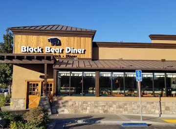
Black Bear Diner Santa Clarita
Experience the charm of Black Bear Diner in Santa Clarita - where hearty American meals meet family-friendly vibes.
7 min walk · 0.6 km from neighbourhood centre
-
Steak
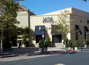
Salt Creek Grille Valencia
Discover culinary excellence at Salt Creek Grille Valencia – where premium steaks meet an inviting atmosphere for an unforgettable dining experience.
12 min walk · 0.9 km from neighbourhood centre
-
Italian
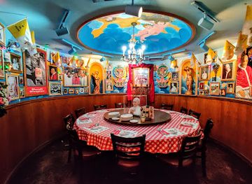
Buca di Beppo Italian Restaurant
Experience authentic Italian cuisine at Buca di Beppo in Valencia—where hearty dishes meet family-style dining in a vibrant atmosphere.
11 min walk · 0.9 km from neighbourhood centre

Best bars in Valencia
Valencia is not a major club district, and its evenings are generally shaped by restaurants, cinema outings, hotel lounges, community events and entertainment connected with the shopping centres rather than by a dense concentration of late-night venues. Bars are commonly attached to restaurants or located within commercial plazas, with the busiest atmosphere found around dining areas and occasional events rather than on a single nightlife street. Six Flags Magic Mountain can extend the evening’s entertainment on selected dates, but its operating calendar and programmes vary. After dark, residential paseos and lakeside areas become quieter and are better suited to calm walks than nightlife. Visitors wanting live music, independent bars or a more concentrated late-night scene may find a broader choice elsewhere in Santa Clarita, especially around Newhall, which is nearby but not part of Valencia.
-
American
The LOCAL Pub & Grill
Experience the heart of American cuisine at The LOCAL Pub & Grill in Valencia, where comfort food meets a welcoming atmosphere.
7 min drive · 2.4 km from neighbourhood centre
-
Bar
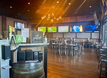
BJ's Restaurant & Brewhouse
Experience the best of American cuisine and craft beer at BJ's Restaurant & Brewhouse in Valencia, where great food meets a vibrant sports bar atmosphere.
11 min walk · 0.9 km from neighbourhood centre
-
Bar
Mabel's Roadhouse
Discover the vibrant atmosphere of Mabel's Roadhouse, a must-visit bar in Santa Clarita, offering live music, refreshing drinks, and a welcoming vibe.
5 min drive · 1.6 km from neighbourhood centre
-
Night club
OLD PROFILE - The Canyon Club - Santa Clarita
Discover the excitement of live music and vibrant nightlife at The Canyon Club, Santa Clarita's premier night club destination.
5 min walk · 0.4 km from neighbourhood centre


Best nightclubs in Valencia
Valencia is not a major club district, and its evenings are generally shaped by restaurants, cinema outings, hotel lounges, community events and entertainment connected with the shopping centres rather than by a dense concentration of late-night venues. Bars are commonly attached to restaurants or located within commercial plazas, with the busiest atmosphere found around dining areas and occasional events rather than on a single nightlife street. Six Flags Magic Mountain can extend the evening’s entertainment on selected dates, but its operating calendar and programmes vary. After dark, residential paseos and lakeside areas become quieter and are better suited to calm walks than nightlife. Visitors wanting live music, independent bars or a more concentrated late-night scene may find a broader choice elsewhere in Santa Clarita, especially around Newhall, which is nearby but not part of Valencia.
-
Bar
Mabel's Roadhouse
Discover Mabel's Roadhouse, a vibrant bar in Santa Clarita perfect for drinks, dancing, and unforgettable nights with friends.
5 min drive · 1.6 km from neighbourhood centre
-
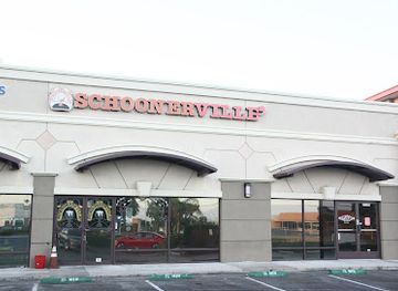
Grill
Schoonerville
Discover the heart of Santa Clarita at Schoonerville, where delicious grilled cuisine and a welcoming atmosphere await every visitor.
18 min walk · 1.4 km from neighbourhood centre
-
Cigar shop
Cigar Clientelle
Discover the luxury of premium cigars at Cigar Clientelle, the ultimate lounge and shop in Santa Clarita, California.
16 min walk · 1.3 km from neighbourhood centre
-
Comedy club
J.R.'s Comedy Club
Experience an unforgettable night of laughter at J.R.'s Comedy Club in Valencia, where talented comedians bring joy and entertainment in an intimate setting.
10 min walk · 0.8 km from neighbourhood centre



Best shops in Valencia
Shopping in Valencia is centred on organised retail districts, with Valencia Town Center serving as the largest and most recognisable commercial destination and Bridgeport Marketplace providing another cluster of shops, services and restaurants. The offer is primarily contemporary and practical: fashion, beauty, homeware, specialist services, cafés and everyday retail sit within plazas designed for driving, with pedestrian areas around individual centres. The area does not have the independent antique shops, historic market halls or traditional craft streets associated with older districts elsewhere in the region. Visitors can combine shopping with dining and cinema entertainment, while the larger retail developments near Magic Mountain Parkway are convenient for families and theme-park visitors. Smaller neighbourhood centres serve local residents, but stock and individual business line-ups change, so Valencia is best approached as a collection of commercial hubs rather than one continuous shopping street.
-
Shopping mall
Valencia Town Center
Explore Valencia Town Center: A premier shopping destination in California with diverse retail options, delightful dining, and entertainment for all ages.
8 min walk · 0.6 km from neighbourhood centre
-
Shopping mall
Valencia Crossroads
Experience the vibrant shopping and dining at Valencia Crossroads, where every visit is a delightful adventure in Valencia, California.
7 min walk · 0.6 km from neighbourhood centre
-
Shopping mall
River Oaks Shopping Center
Experience the best of shopping and dining at River Oaks Shopping Center in Santa Clarita, where every visit is a unique adventure.
11 min walk · 0.9 km from neighbourhood centre
-
Shopping mall
Granary Square
Explore Granary Square, Valencia's premier shopping destination, offering a diverse mix of stores, dining, and entertainment for every visitor's delight.
15 min walk · 1.2 km from neighbourhood centre


Valencia essentials
Getting There
Getting Around
Safety
Emergency Situations
Do's and Don'ts
Local Tips

From Eve
Local phrases worth knowing
You don't need to get them perfect. A few words go a long way, and locals appreciate the effort.
Basics
| English | Local | Say it |
|---|---|---|
| Hello | Hola | [OH-lah] |
| Goodbye | Adiós | [ah-DYOHSS] |
| Yes | Sí | [SEE] |
| No | No | [NOH] |
| Please/You're welcome | Por favor/De nada | [pohr fah-VOHR/deh NAH-dah] |
| Thank you | Gracias | [GRAH-syahss] |
| Excuse me/Sorry | Disculpa/Perdón | [dees-KOOL-pah/pehr-DOHN] |
| How are you? | ¿Cómo estás? | [KOH-moh ehs-TAHS] |
| Fine. And you? | Bien. ¿Y tú? | [BYEHN. ee too] |
| Do you speak English? | ¿Hablas inglés? | [AH-blahss een-GLEHS] |
| I don't understand | No entiendo | [NOH ehn-TYEN-doh] |
Eating & Drinking
| English | Local | Say it |
|---|---|---|
| I'd like to see the menu, please | Me gustaría ver el menú, por favor | [meh goos-tah-REE-ah behr ehl MEH-noo, por fah-VOHR] |
| I don't eat meat | No como carne | [NOH KOH-moh KAHR-neh] |
| Cheers! | ¡Salud! | [sah-LOOD] |
| I would like to pay, please | Me gustaría pagar, por favor | [meh goos-tah-REE-ah pah-GAHR, por fah-VOHR] |
Emergencies
| English | Local | Say it |
|---|---|---|
| Help! | ¡Ayuda! | [ah-YOO-dah] |
| Go away! | ¡Vete! | [VEH-teh] |
| Call the Police! | ¡Llama a la policía! | [YAH-mah ah lah poh-LEE-see-ah] |
| Call a doctor! | ¡Llama a un médico! | [YAH-mah ah oon MEH-dee-koh] |
| I'm lost | Estoy perdido | [ehs-TOY pehr-DEE-doh] |
| I'm ill | Estoy enfermo | [ehs-TOY ehn-FEHR-moh] |
Shopping
| English | Local | Say it |
|---|---|---|
| I'd like to buy... | Me gustaría comprar... | [meh goos-tah-REE-ah kohm-PRAR...] |
| I'm just looking | Solo estoy mirando | [SOH-loh ehs-TOY mee-RAHN-doh] |
| How much is it? | ¿Cuánto cuesta? | [KWAHN-toh KWEHS-tah] |
| That's too expensive | Eso es demasiado caro | [EH-soh ehs deh-mah-SYA-do KAH-roh] |
| Can you lower the price? | ¿Puedes bajar el precio? | [PWEH-dehs BAH-har ehl PREE-syoh] |
Time & Numbers
| English | Local | Say it |
|---|---|---|
| What time is it? | ¿Qué hora es? | [keh OR-ah ehs] |
| It's one o'clock | Es la una | [ehss lah OO-nah] |
| Half past (10) | Y media (10) | [ee MEH-dee-ah (diez)] |
| Morning | Mañana | [mah-NYAH-nah] |
| Afternoon | Tarde | [TAHR-deh] |
| Evening | Noche | [NOH-cheh] |
| Yesterday | Ayer | [ah-YEHR] |
| Today | Hoy | [OY] |
| Tomorrow | Mañana | [mah-NYAH-nah] |
| 1 | Uno | [OO-noh] |
| 2 | Dos | [DOHS] |
| 3 | Tres | [TREHS] |
| 4 | Cuatro | [KWAH-troh] |
| 5 | Cinco | [SEEN-koh] |
| 6 | Seis | [SEYS] |
| 7 | Siete | [SYEH-teh] |
| 8 | Ocho | [OH-choh] |
| 9 | Nueve | [NWAVEH] |
| 10 | Diez | [DYEHS] |
Transport & Directions
| English | Local | Say it |
|---|---|---|
| Where's a/the...? | ¿Dónde está...? | [DOHN-deh ehs-TAH] |
| What's the address? | ¿Cuál es la dirección? | [kwahl ehs lah dee-rehk-SYON] |
| Can you show me (on the map)? | ¿Puedes mostrarme (en el mapa)? | [PWEH-dehs mohs-TRAHR-meh (ehn ehl MAH-pah)] |
| When's the next (bus)? | ¿Cuándo es el próximo (autobús)? | [KWAHN-doh ehs ehl PROHK-see-moh (ow-TOH-boos)] |
| A ticket (to ....) | Un boleto (a ...) | [oon boh-LEH-toh (ah ...)] |
History of Valencia
Rancho San Francisco and Valley Agriculture
Before Valencia was built, the land formed part of the wider Santa Clarita Valley, whose non-Indigenous history was shaped by Spanish and Mexican ranching, later American settlement and agricultural enterprise. Much of the valley was associated with Rancho San Francisco, a Mexican-era land grant awarded to Antonio del Valle in 1839. The property and surrounding lands changed hands during the nineteenth century, while nearby Newhall developed through ranching, oil extraction, rail transport and other industries. Valencia’s later streets and housing estates therefore replaced a landscape with deep agricultural and ranching connections rather than an established urban district.
The Newhall Land Development
Valencia emerged from the Newhall Land and Farming Company’s plans for a large new community in the late 1960s. The developer organised housing, schools, parks, commercial centres and landscaped public spaces as parts of a coordinated plan rather than allowing the area to grow around an older commercial street. Early construction established the low-rise suburban form still visible today, with separated pedestrian routes and greenbelts complementing the road network. The name Valencia reflected the valley’s agricultural associations and the long-standing importance of citrus and other farming enterprises in the region.
Paseos and Master-Planned Suburbia
As Valencia expanded during the late twentieth century, its network of paseos became a defining piece of local infrastructure. These paths, greenbelts, bridges and underpasses linked neighbourhoods to schools, parks and shops while separating many journeys from busy arterial roads. The arrangement expressed contemporary ideas about planned communities: controlled growth, recreational open space and a degree of pedestrian connection within a fundamentally suburban setting. New housing villages, office areas and retail centres continued to spread across the valley, giving Valencia a varied but consistently planned appearance.
From Separate Community to Santa Clarita
Valencia was one of several established communities brought together when the City of Santa Clarita incorporated in 1987. The new city combined Valencia with neighbouring areas including Newhall, Saugus and Canyon Country, creating a municipal framework for services and planning across the valley. Valencia retained its own recognisable landscape and commercial identity within that city. In the following decades, regional roads, newer housing and employment areas increased its connections with the rest of Los Angeles County, while Six Flags Magic Mountain became an increasingly prominent part of its visitor profile.
Valencia in Photos
Browse through our photo collection highlighting the charm and character of the destination.
Explore more

Explore more of Santa Clarita
Santa Clarita combines California film history, family attractions, canyon trails, western heritage and outdoor adventures near Los Angeles for curious travellers.
Explore Santa Clarita