Background

Gniben – Tip of Sjællands Odde and Kattegat Views

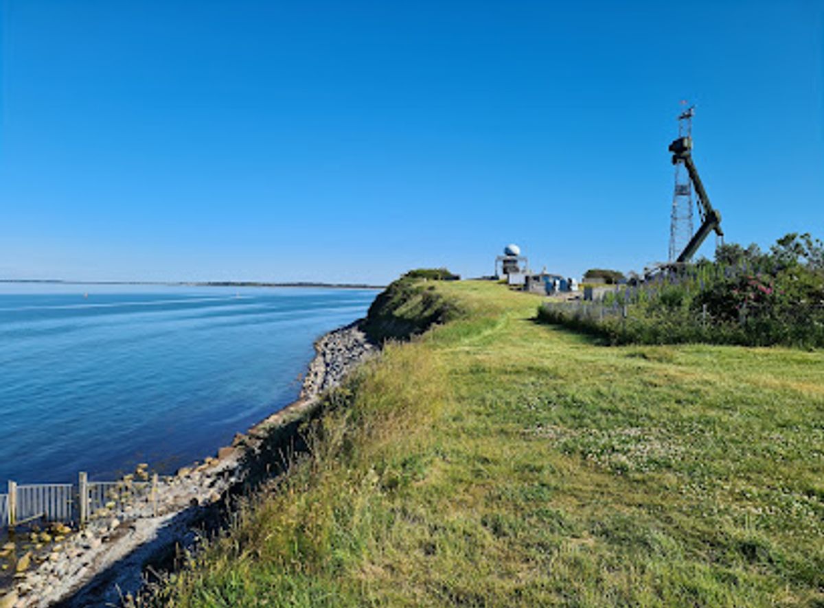
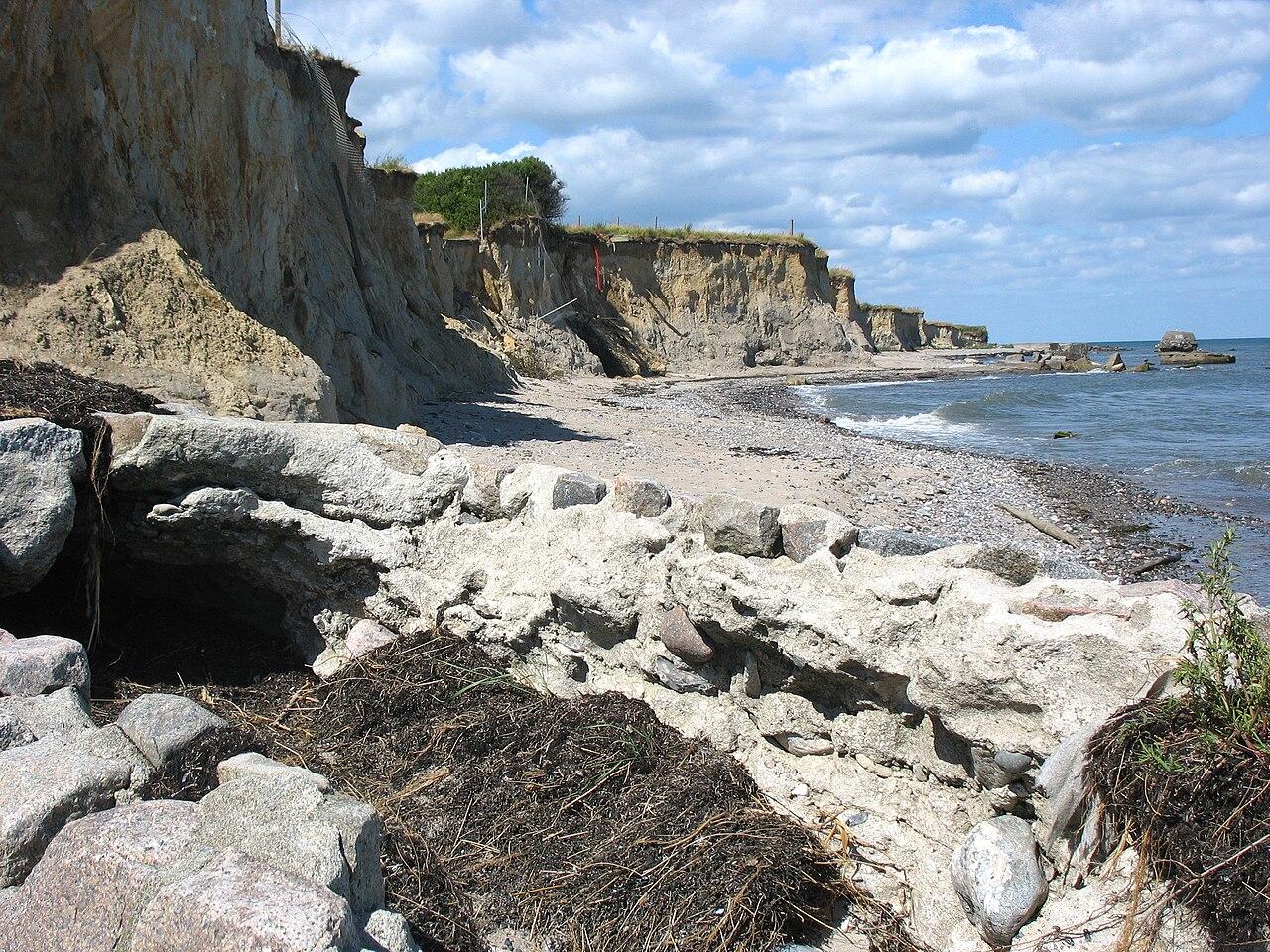
Wind-battered tip of Sjællands Odde where moraine cliffs, military history and a long reef meet the open waters of the Kattegat in wide, cinematic views.

★★★★★4.5 (441)

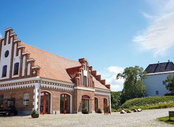
Gniben marks the dramatic outer tip of the Sjællands Odde peninsula, where a low moraine cliff meets open sea and a long reef stretches far into the Kattegat. Once a strategic military area and still home to an artillery training ground, parts of Gniben are today accessible as raw coastal nature with wide skies, shingle beaches and sweeping views towards Jutland and the ferries crossing the water. It is an exposed, wind-battered headland ideal for contemplative walks, bird- and ship-spotting, and feeling the full power of the Danish sea landscape.

Plan your visit

A brief summary to Gniben

Opening times, essentials, and a few local tips gathered into one calmer, easier-to-scan planning section.

Plan your visit

📍
Sjællands Odde, 4583, DK
🕒
Duration: 1 to 3 hours
💷
Free
🏛
Outdoor
📶
Mobile reception: 4 out of 5
Monday
4 pm-12 am
Tuesday
4 pm-12 am
Wednesday
4 pm-12 am
Thursday
4 pm-12 am
Friday
4 pm-12 am
Saturday
12 am-12 am
Sunday
12 am-12 am

Explore places near Gniben

    See all →

    Unlock the Best of Gniben

    Find tickets, tours with entry, and experiences available for this location.

    Buy tickets

    No tickets available

    Book tours with entry

    No tours with entry available

    Book tours without entry

    No tours without entry available

    Getting There

    Car from Holbæk

    Driving from Holbæk to Gniben typically takes about 1 to 1.5 hours via the main road across Odsherred. The route is straightforward but can experience heavy traffic in holiday periods due to ferry connections further out on the peninsula. Parking near the military area is usually free but can be limited on sunny weekends, so arrive early in peak season.

    Regional bus plus walk

    Regional buses run from Holbæk and other Odsherred towns to Sjællands Odde, with journeys usually taking 1.5 to 2 hours depending on connections. Services are less frequent in the evening and on weekends, so check timetables in advance. From the nearest bus stop on the peninsula you should expect a longer walk on quiet roads and tracks to reach the tip, which may be challenging in bad weather.

    Bicycle from Sjællands Odde area

    Cycling from holiday houses and campsites on Sjællands Odde to Gniben is a popular option in summer. Distances along the peninsula are modest, and the terrain is generally flat to gently rolling. Allow 30 to 60 minutes each way from most local settlements, and be mindful of strong crosswinds and sections with narrow shoulders where you share the road with car and ferry traffic.

    For the on-the-go comforts that matter to you

    Seating Areas
    Trash Bins
    Information Boards

    Local tips

    Check local information for artillery training days; access to parts of Gniben can be restricted when military exercises are taking place.
    Wear windproof layers and sturdy shoes, as the headland is very exposed and the shoreline consists of loose stones and uneven ground.
    Bring water and snacks, especially outside summer, as there are no shops or cafés at the tip itself.
    Stay back from unstable cliff edges and be cautious near the water, where waves and slippery stones can be hazardous.

    Gniben location weather suitability

    Catch the right light and the right mood, whether you want a bright city moment or a more cinematic evening visit.

    Weather icon
    Clear Skies
    Weather icon
    Windy Conditions
    Weather icon
    Mild Temperatures
    Weather icon
    Cold Weather
    Weather icon
    Any Weather

    Discover more about Gniben

    Where Peninsula Becomes Open Sea

    Gniben sits at the very outer tip of Sjællands Odde, the narrow peninsula that juts from northwest Zealand between Sejerø Bay and the Kattegat. Here the land simply runs out: a low, 16-metre-high moraine hill tapers into a shingle spit and then into open water. Offshore, a submerged reef continues for around ten kilometres into the Kattegat, shaping currents and wave patterns that you can often see as contrasting stripes and swirling water. The feeling is of standing on the prow of a ship. Wind arrives unhindered from almost every direction, seabirds circle on the updrafts, and on clear days you can trace the coastline of Jutland on the horizon. Ferries shuttling between Sjællands Odde and Aarhus or Ebeltoft appear surprisingly close as they curve around the reef on their way across Denmark’s inner sea.

    Layers of Landscape and Military History

    The modest height of Gniben belies its complex story. The headland is formed by glacial deposits left at the end of the Ice Age, later reshaped by waves, wind and shifting sea levels. The resulting hill and reef created a natural vantage point over one of the country’s busiest stretches of water. During the Second World War the tip became a fortified German position controlling submarine barriers laid in the Kattegat. Later, in the early 1950s, it evolved into an artillery training ground for the Danish armed forces. Today, the military presence is reduced but still visible in fenced-off zones, access roads and scattered installations. Much of the outer area is opened to the public when exercises are not taking place, allowing visitors to wander through a landscape where concrete structures and weathered poles sit amid heather, grasses and exposed stones, a reminder of how strategic this remote-feeling promontory has been.

    Raw Coastal Nature on the Edge of Odsherred

    Gniben’s environment is harsh and surprisingly delicate at the same time. Thin, sandy soils, salt-laden winds and strong sun create tough conditions in which only specially adapted plants thrive. Low shrubs, hardy grasses and small flowering species hug the ground, forming a patchwork of muted greens, greys and late-summer purples. Insects and butterflies make use of the warm, dry niches between stones, providing food for lizards and small birds. The shoreline shifts from rounded boulders to shingle and coarse sand; in places the waves have bitten directly into the moraine, leaving a small, steep face where pebbles clatter down with each tide. Standing here, you can taste salt on the air and hear the constant percussion of stones rolling in the surf. It is a place more about weather and movement than about bathing, although in calm conditions people do sometimes venture into the water with care.

    Walking, Watching and Quiet Contemplation

    For visitors, Gniben is above all a place to walk and watch. Short circuits along the cliff edge and out along the accessible parts of the spit deliver ever-changing perspectives over both Sejerø Bay and the Kattegat. The openness of the headland means you are rarely without a view: distant cargo ships, fast catamaran ferries, small fishing vessels and the pattern of clouds all provide a kind of slow, maritime theatre. Birdlife rewards patient observers, with gulls, terns and migratory species using the tip as a waypoint along coastal routes. The exposed character makes it a memorable spot in all seasons, from bright, still evenings with pastel skies to autumn days when wind and spray batter the shore. Many visitors simply sit on a rock or driftwood log, letting time pass as waves slide up and down the stones.

    Gniben Within the Wider Odsherred Landscape

    Gniben also serves as a striking endpoint to explorations of Odsherred and Sjællands Odde. Inland from the headland, the peninsula narrows between two quite different coasts, with gentle bays on one side and more open Kattegat shore on the other. From the hill you sense how this tongue of land divides and shapes the surrounding waters. The area falls within the broader Geopark Odsherred, recognised for its distinctive glacial forms and coastal landscapes. Visiting Gniben connects you to that story in a visceral way: you are literally standing on the outer edge of the ice-age deposits that built Zealand. Coupled with the military relics and the constant movement of modern shipping, the headland becomes a place where geology, history and contemporary sea routes intersect in a single, windswept panorama.

    A brief summary to Gniben

    Use Tower Bridge as your starting point for nearby food, family ideas, nightlife, and more local discoveries.

    Plan around the quieter times

    A quick look at seasonal patterns and peak visiting hours.

    Busiest months of the year

    Seasonality

    Busiest hours of the day

    Footfall
    Mobile App
    Get the app

    Your all‑in‑one travel companion app

    Explore expert travel guides, compare and book tours, experiences, hotels, and more—all from the palm of your hand. Download now for seamless trip planning wherever your wanderlust takes you.

    File:Gedser Odde1.JPG - Wikipedia

    More about Gedser Odde

    Discover Gedser Odde, Denmark's southernmost point, offering stunning Baltic Sea views, rich birdlife, and a peaceful retreat in untouched nature.

    Tell me more about Gedser Odde

    Select Currency

    Choose the currency you want prices to display in.