World Map at Klejtrup Lake (Verdenskortet ved Klejtrup Sø)
Walk the world in an afternoon on a lakeside, stone-and-grass atlas where continents, flags and family-friendly fun turn geography into a playful countryside escape.
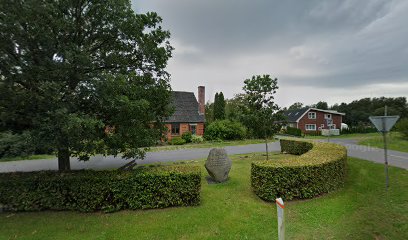
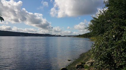
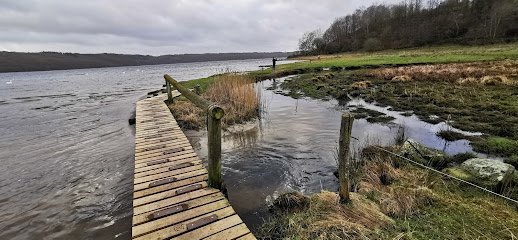
On the shore of Klejtrup Lake near Hobro, the World Map at Klejtrup Lake is a walkable, 4,000 m² atlas built from grass, soil and stones. Created between 1944 and 1969 by farmer Søren Poulsen, this quirky open‑air attraction lets you stroll from Denmark to Australia in a few steps, spot miniature seas, rivers and mountains, and enjoy family-friendly extras such as playgrounds, mini golf, pony rides in season, and lakeside picnic areas with a small café and shop.
A brief summary to Worldmap at Klejtrup Lake
- Søren Poulsens Vej 5, Hobro, 9500, DK
- +4598546132
- Visit website
- Duration: 2 to 4 hours
- Budget
-
 Outdoor
- Mobile reception: 4 out of 5
- Monday 10 am-5 pm
- Tuesday 10 am-3 pm
- Wednesday 10 am-3 pm
- Thursday 10 am-3 pm
- Friday 10 am-3 pm
- Saturday 10 am-5 pm
- Sunday 10 am-5 pm
Local tips
- Bring a picnic or supplies for the on-site grills; enjoying lunch overlooking the miniature continents is one of the most atmospheric ways to experience the park.
- Plan at least half a day if visiting with children so there is time for the playground, mini golf and seasonal activities as well as exploring the map itself.
- Wear comfortable shoes with good grip; you will be walking on grass, small slopes and occasionally slightly uneven ground between the modelled coastlines.
- Check opening hours and seasonal offerings in advance, especially outside the main summer months when activities and café service may be reduced.
- If you are keen on photography, arrive close to opening or later in the afternoon for softer light and clearer views across the map toward Klejtrup Lake.
For the on-the-go comforts that matter to you
- Restrooms
- Drink Options
- Drinking Water
- Food Options
- Seating Areas
- Picnic Areas
- Trash Bins
- Information Boards
- Visitor Center
- Sheltered Areas
Getting There
-
Car from Hobro
Driving from central Hobro to the World Map at Klejtrup Lake typically takes around 15–20 minutes via local country roads. The route passes through open farmland with occasional narrow sections, but it is straightforward for most drivers. Parking is available on site and is generally free, though spaces can fill up during busy summer weekends and school holidays, so arriving earlier in the day provides the most flexibility.
-
Car from Viborg
From Viborg, the drive to Verdenskortet usually takes 30–40 minutes, following regional roads through rolling Jutland countryside. The roads are paved and suitable for standard vehicles in all seasons, but allow a little extra time in winter for possible wet or icy conditions. There is on-site parking close to the entrance, and no special permits or 4x4 vehicles are required.
-
Regional bus and short walk
It is possible to reach the area using regional buses running between Hobro, Viborg and nearby villages, with typical travel times of 40–60 minutes depending on route and connections. Services are less frequent on weekends and outside peak hours, so checking the timetable in advance is important. The nearest bus stops are in the local village area, from where you continue on foot along rural lanes for roughly 20–30 minutes on mostly flat ground; this final stretch is not well suited to heavy luggage or visitors who need completely step-free, roadside paths.
-
Cycling from nearby towns
For confident cyclists, reaching the World Map from Hobro or nearby villages by bike is a pleasant option, taking about 30–45 minutes from Hobro depending on your pace. Expect a mix of small country roads and dedicated cycle paths where available, with some gentle hills typical of the Jutland landscape. There are no formal bike lockers on site, but simple racks and fence lines allow you to secure your bicycle; bring lights and reflective gear if returning in the evening, as some stretches have limited lighting.
Worldmap at Klejtrup Lake location weather suitability
-
 Clear Skies
-
 Mild Temperatures
-
 Hot Weather
-
 Any Weather
Discover more about Worldmap at Klejtrup Lake
A handcrafted world beside a Danish lake
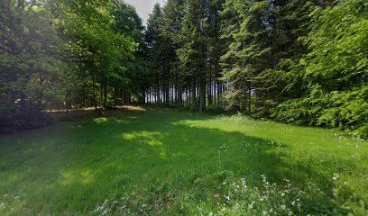
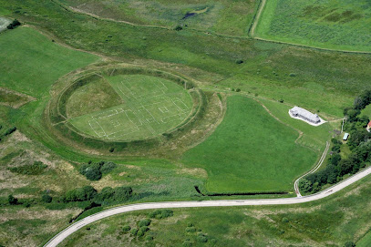
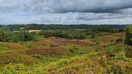
The World Map at Klejtrup Lake is one of Denmark’s most charming curiosities: a full world map laid out on the lakeshore, with continents, seas and islands modeled in turf, soil and stone. Here, the Earth spans roughly 45 by 90 meters, yet every landmass is placed to scale, so each step you take corresponds to vast distances in the real world. Spread out like an atlas against the water, it feels at once playful and surprisingly precise. At the heart of the attraction is the contrast between its modest rural setting and the ambition of its design. The map occupies a gentle meadow by the lake, framed by low trees, open sky and the shimmer of the water. Flags mark individual countries, red posts trace the equator, and low embankments suggest mountain ranges. The result is a landscape that is both cartographic model and giant playground.The vision of farmer and mapmaker Søren Poulsen
The story begins in the 1940s, when local farmer Søren Poulsen was working to drain the surrounding meadows and spotted a stone that reminded him of the Jutland peninsula. That small discovery sparked a grand idea: he would build the whole world out of stones in his backyard. Drawing on a lifelong interest in geography and two decades spent in the United States, Poulsen began plotting continents on the frozen lake. Using only simple tools, a wheelbarrow and sheer determination, he placed heavy boulders on winter ice and tilted them into position as the thaw came. Over 25 years, from 1944 until his death in 1969, his project grew into a complete miniature Earth. Some stones weigh more than two tonnes, yet every coastline was carefully adjusted, and even the borders of the American states are traced with yellow bricks in homage to his years abroad.Walking the globe in an afternoon
Visiting Verdenskortet is as much about the experience as the story. You can literally stroll from Greenland to Africa in a few strides, or follow the curve of South America down towards its southern tip. Children race across oceans on the grass, hop between islands, and search for the tiny flag of their home country. Adults find themselves instinctively checking the shapes of continents and tracing familiar routes from school atlases. The map is edged by paths and lawns, so you can view it from ground level or step down among the continents. Lakes, inlets and channels filled with water stand in for real seas, and small bridges carry you over miniature oceans. It feels light-hearted and hands-on, but it also offers a quietly effective lesson in scale and distance that makes world geography suddenly tangible underfoot.Family activities around the miniature Earth
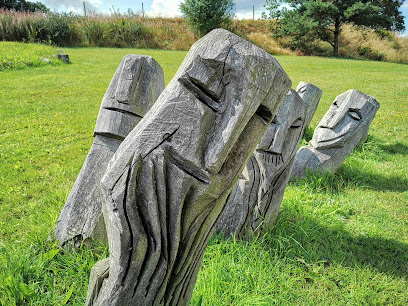
The attraction has grown into a small family park wrapped around the original map. A playground, mini golf course and simple labyrinth add to the fun, and in the warmer months there are extra touches such as pony rides or small boats on the "Pacific" near the lake. Open grassy spaces invite informal ball games and cartwheels between visits to different continents. Picnic tables and grilling areas overlook the map so you can unpack your own lunch with a view of the whole world. A modest café and shop serve snacks, drinks and ice cream, with a glass pavilion that groups can reserve for gatherings. The atmosphere is casual and relaxed, encouraging you to linger for a full afternoon rather than rush through.A gentle countryside setting with a quirky twist
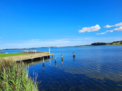
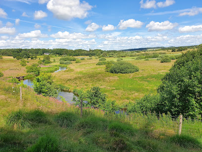
Beyond the map itself, Klejtrup Lake provides a calm backdrop of reeds, waterbirds and open countryside in central Jutland. The setting is rural but accessible, making the site an appealing break on a regional journey or a low‑key day out from nearby towns. Dogs are welcome on a leash, and wide, mostly level paths mean that much of the area is easy to navigate. It is this blend of pastoral landscape, homemade ingenuity and imaginative scale that gives Verdenskortet its unique character. You are never far from a reminder that one determined person with a vision reshaped this corner of the lakeshore into a tiny planet under the Danish sky.Iconic landmarks you can’t miss
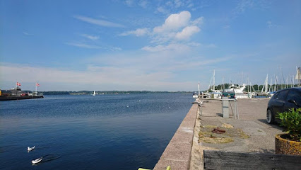
Hobro Lystbådehavn
12.0 km
Denmark's premier fjord marina with historic charm and modern comfort.
Hotel BramslevGaard
15.4 km
Experience tranquility and history at Hotel BramslevGaard, nestled in the scenic Bramslev Bakker by Mariager Fjord, offering gourmet dining, spa retreats, and easy access to Northern Jutland's natural wonders.
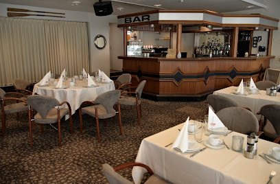
Restaurant BramslevGaard
15.4 km
Experience Danish history and gastronomy at BramslevGaard, a charming manor house nestled in the scenic Bramslev Bakker near Hobro, offering stunning views and French-inspired cuisine.
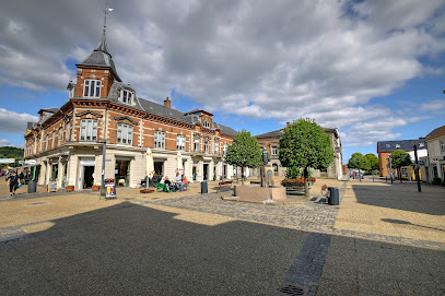
Oberst J.C. Lunds Plads
20.7 km
Historic public square anchoring Viborg's Cathedral Quarter and medieval city center.
Vi er Viborg
21.0 km
Experience Danish innovation at Dokk1, Aarhus’ renowned waterfront library and cultural hub, blending architecture, technology, and vibrant community life.
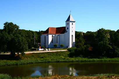
Mariager Church
21.7 km
A towering former abbey church above Mariager Fjord, where Gothic brickwork, noble tombs and a distinctive Aubertin organ keep centuries of faith and history alive.
Mariager Kirke
21.7 km
A lofty Bridgettine abbey church turned parish landmark, where Gothic stone, noble tombs and organ music tell Mariager’s story above the fjord.
Viborg View
21.8 km
Experience Dokk1, Aarhus’ state-of-the-art library and cultural center, where pioneering architecture meets urban vitality on the scenic waterfront.
Hotel Postgaarden Mariager
21.9 km
Experience historic Danish charm and modern comfort at Hotel Postgaarden Mariager, nestled in the heart of the 'City of Roses' with easy access to Mariager Fjord's natural beauty.

Mariager Lystbådehavn
22.1 km
Denmark's most beautiful fjord meets a thriving sailing community in this welcoming maritime harbor.
Mariager Fjord
23.3 km
Denmark's longest fjord winds through pristine Jutland landscapes, offering unspoilt nature, charming villages, and exceptional outdoor adventures.
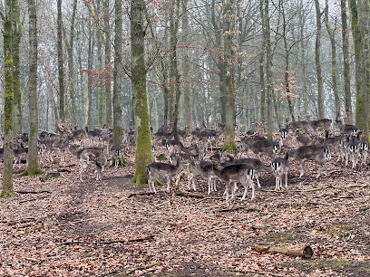
Gravhøjen i Fladbro Dyrehave
25.6 km
Stone Age burial mound in a serene deer forest, where ancient history meets wild nature.
Befrielsessten i Ravnstrup
26.8 km
A modest countryside liberation stone near Viborg, quietly commemorating Denmark’s freedom in 1945 amid open fields and a peaceful village setting.
Randers Railwaystation
27.4 km
Historic rail gateway of Randers, linking East Jutland’s river town with Aarhus, Aalborg and Copenhagen from a compact, practical 19th‑century station hub.
Randers St.
27.4 km
Historic East Jutland railway hub connecting Denmark's east coast with modern InterCity services and comprehensive traveler amenities.
Unmissable attractions to see
Øls Skæppe
5.9 km
A quiet, dramatic earthfall hollow on Hobro’s outskirts, where steep grassy slopes form a natural amphitheatre and reveal the subtle power of shifting ground.
Mindesten
7.8 km
Mariager Strandpark is a peaceful waterfront park offering idyllic fjord views, swimming areas, and open lawns—an inviting escape at the heart of Mariager’s natural beauty.
Hvolris Jernalderlandsby
7.9 km
Step into another tempo in a working Iron Age village where archaeology, reconstructed longhouses and a sculpture-studded valley bring 6,000 years of history to life.
Fyrkat Viking Museum
9.4 km
Step into a perfectly circular Viking fortress, walk a full-scale longhouse, and explore a reconstructed chieftain’s farm at this evocative UNESCO-listed site near Hobro.
Hobro Camping
10.0 km
Terraced hillside camping above Hobro, blending fjord views, green surroundings and easy city access in a relaxed, family-friendly setting.
Torvekonen
10.8 km
Marvel at the Shell House, a one-of-a-kind museum in Thyborøn where seashell mosaics adorn every inch, blending Danish coastal art and maritime heritage.
FjordTours
11.1 km
Mariager Strandpark offers sandy beaches, grassy picnic spots, and serene fjord views—a perfect blend of nature and relaxation on the shores of scenic Mariager Fjord.
Pleasure craft museum
11.1 km
Intimate maritime museum in a historic Hobro harbor warehouse, showcasing classic wooden pleasure craft, local fjord stories, and Danish leisure sailing culture.
Panorama Walking Route
12.0 km
A 10 km premium hillside-and-fjord loop near Hobro, weaving through meadows, juniper slopes and shoreline for some of Denmark’s most evocative panoramic views.
Sildehagen
12.2 km
A calm slice of Mariager Fjord where a circular bridge, productive fishing waters and easy shoreline walks bring everyday fjord life to Hobro’s edge.
Cold Hand Winery
12.5 km
Award‑winning New Nordic fruit wines, atmospheric tastings and quirky glamping stays in an orchard‑ringed countryside winery outside Randers.
Hotel Amerika
13.0 km
Scandinavian forest hotel near Hobro combining woodland calm, thoughtful gastronomy and well-equipped conference facilities on the edge of Mariager Fjord.
Borup Hede
13.2 km
Rolling heath, a winding river valley and quiet traces of Denmark’s deep past create a peaceful nature escape at Borup Hede near Møldrup.
Hjerritsdal Mølle
14.5 km
Historic watermill farmstead in a green tunnel valley, where running water, old buildings and quiet paths reveal centuries of rural life near Mariager Fjord.
Ø, Denmark
14.9 km
A quiet pocket of rural Jutland where open fields, wide skies and working farms create a gently scenic pause from Denmark’s busier, more polished attractions.
Essential places to dine
Esja Bistro
10.7 km
Casual Nordic comfort food with Icelandic flavours, served in a cosy bistro on Hobro’s Adelgade where North Atlantic ingredients meet relaxed Danish dining.
Restaurant Bies Bryghus
10.7 km
Historic Hobro brewery-restaurant serving classic Danish dishes with a modern twist in a warm, brick-and-beam setting on the town’s central street.
Nida's food
10.8 km
Casual harborfront fast-food joint in Hobro serving pizzas, burgers and grill favorites just steps from the marina on Havnegade.
Matios Det Italienske Spisehus
10.9 km
Cosy Italian trattoria-style dining on Hobro’s central square, serving generous pizzas, pasta and classic desserts in a warm, candlelit atmosphere.
Restaurant The Grill Hobro
11.7 km
All-you-can-eat grill buffet and brunch inside Hobro’s Bowl’n’Fun, bringing hearty classics, soft-ice desserts and family-friendly dining under one lively roof.
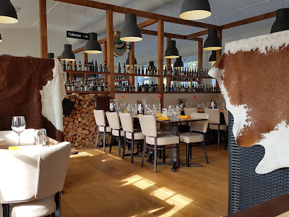
Restaurant Uafhængig
12.9 km
Ambitious Nordic cooking in a calm, forest‑edge dining room at Hotel Amerika, blending seasonal Danish flavors with a relaxed, modern atmosphere near Hobro.
Restaurant Bramslev Bakker
15.5 km
Countryside Danish cooking with sweeping fjord views, where Bramslev Bakker’s rolling hills meet a relaxed, modern restaurant above Mariager Fjord.
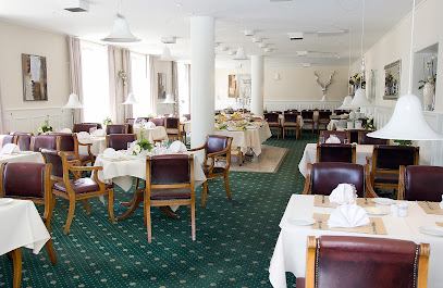
Restaurant Salonen
20.6 km
Lakeside hotel dining in Viborg, where classic Danish and European dishes meet calm views over the town’s serene chain of lakes inside Golf Hotel Viborg.
Restaurant Flammen
20.8 km
Hearty all-you-can-eat grill buffet in a former Viborg barracks, blending rustic warmth, family-friendly comforts and flexible group dining under one spacious roof.
Hjarbæk Kro 2021 Aps
20.8 km
Modern Danish inn cuisine and candlelit hygge on the edge of Hjarbæk Fjord, where classic kromad meets wide water views and glowing Jutland sunsets.
Restaurant Golf Hotel
20.8 km
Calm, classic lakefront dining inside Golf Hotel Viborg, pairing polished Danish-European dishes with tranquil views of Viborg’s green lakeside setting.
Den Kinesiske Mur
20.9 km
All‑you‑can‑eat Chinese and Asian buffet with Mongolian barbecue, sushi and dessert bar in a spacious, family‑friendly setting on Tingvej in Viborg.
Brygger Bauers Grotter
20.9 km
Fine dining and tapas in atmospheric brewery caves beneath central Viborg, where candlelit stone vaults and local history frame a lingering evening of food and wine.
Restaurant Arthur/ Brygger Bauers Grotter
20.9 km
French-inspired gourmet dining in atmospheric brick-lined cellars beneath Viborg’s historic streets, where candlelight, fine wines and thoughtful plates define the evening.
Pemas Food Corner
20.9 km
Casual comfort food in central Viborg, serving burgers, pizza and easygoing plates from late morning to evening in a relaxed neighborhood setting.
Markets, malls and hidden boutiques
PetitePeople
18.9 km
Personalized children's clothing and baby essentials in central Hobro, Denmark.
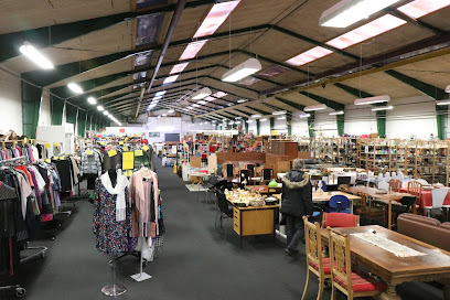
Danmission Op Shop
20.3 km
Spacious Viborg charity thrift warehouse where bargain-hunting, reuse and global-minded giving come together under one practical, volunteer-run roof.
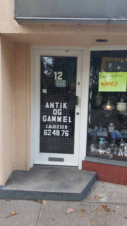
Antik Og Gammel
21.0 km
A cosy antique trove in Viborg’s old town, where Danish vintage finds, homely charm and slow browsing turn a quick stop into a small journey back in time.
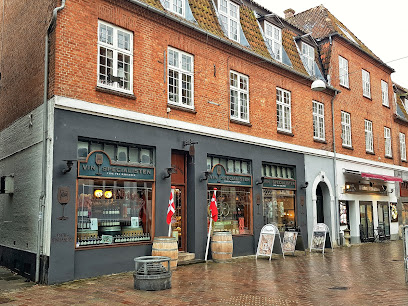
Dahl Vinhandel A / S
21.1 km
Viborg's premier destination for wines with personality, craft spirits, and gourmet discoveries.
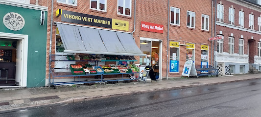
Viborg Vest Marked
21.1 km
Viborg's authentic market hall celebrating seasonal produce, organic goods, and local artisanal specialties.
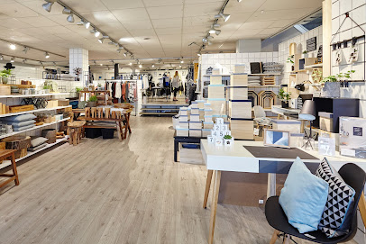
Sinnerup Viborg
21.1 km
Stylish Danish lifestyle store in central Viborg, blending modern interiors, furniture, décor and women’s fashion in one inspiring, design-led space.
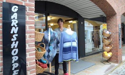
Garnshoppen
21.1 km
A cosy central Viborg knit shop where colourful yarns, expert advice and inspiring patterns come together for creative makers of all levels.
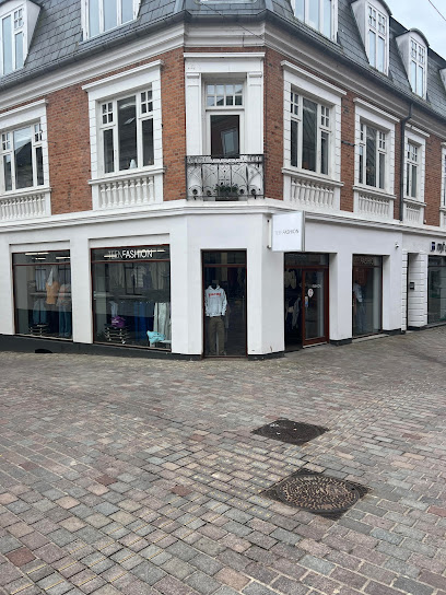
Teenfashion.dk - House of Teens Viborg
21.1 km
Compact, trend-focused fashion boutique in Viborg’s centre, dedicated entirely to stylish clothing and outfits for tweens and teenagers.
Creme Fraiche Viborg
21.1 km
A compact women’s fashion boutique on Viborg’s Vestergade, blending approachable Scandinavian style, practical basics, and seasonal outfits in a relaxed high-street setting.
Kop & Kande
21.2 km
Specialist homeware and kitchenware in Viborg's town centre, staffed by passionate experts.
Saint
21.2 km
Contemporary Nordic fashion and lifestyle boutique in the heart of historic Viborg's shopping district.
Tine Lund Viborg
21.2 km
Curated Scandinavian fashion, footwear, and jewelry in the heart of Viborg.
Femilet
21.3 km
Premier intimate apparel specialist in Viborg with expert fitting and curated brand selection.
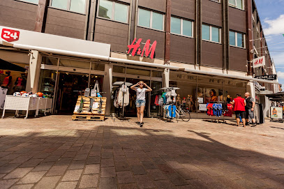
H&M
21.3 km
Contemporary fashion for every style and season in Viborg's shopping heart.
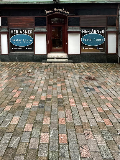
Søster Laura
21.3 km
Viborg's dedicated sanctuary for retro gaming collectors and nostalgic console enthusiasts.
Essential bars & hidden hideouts
Madam Blå's Vandhul
10.6 km
A cozy, day‑time neighborhood bar-café in Hobro where locals linger over coffee, beer and small talk in an easygoing, homely atmosphere.
Torvebaren
10.8 km
Classic Danish bodega in central Hobro, serving traditional beers, darts and down‑to‑earth local atmosphere from morning coffee to late‑night rounds.
Bræddehytten Bar & Pub
10.8 km
Unpretentious local bar on Hobro’s main street, pouring cold beer and warm hygge in a classic Danish pub setting with friendly, small-town atmosphere.
Vognhjulet Pub
10.9 km
Hobro's legendary rock pub where authentic Danish hospitality meets decades of local tradition.
Jazz Hobro
11.0 km
Northern Denmark's premier jazz venue, celebrating tradition and innovation through live performances.
My Way Pub
14.5 km
A cosy small-town Danish pub where darts, pool, bingo and the occasional live band create easygoing evenings in the heart of Aalestrup.
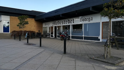
Mødestedet Viborg ApS
20.9 km
Cosy local bar and meeting place in Viborg, blending classic Danish pub vibes with flexible space for social events, dance evenings and everyday gatherings.
Bodega Hegnet
21.0 km
Viborg's cozy neighborhood bar where affordable drinks, free pool, and live music create genuine local warmth.
Café Børsen
21.0 km
A long‑standing Viborg café‑bar where Danish hygge, history and late‑night drinks meet in one cozy, central hangout on Gravene.
Zwei Grosse Bier Bar
21.0 km
High-energy après-ski style beer bar in central Viborg, pouring big drafts, loud music and late-night party vibes with free entry and group-friendly seating.

Sportspub Målet
21.1 km
Classic Danish sports bodega in central Viborg, where cold beer, big matches, karaoke and late-night hygge keep the lights on long after the final whistle.
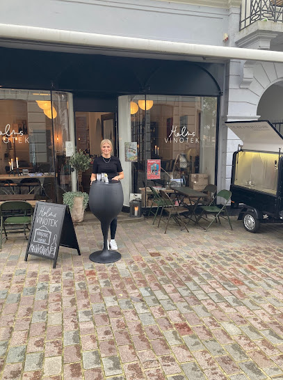
Holms Vinotek
21.1 km
Curated wines and artisanal tapas in a historic pharmacy turned sophisticated gathering place.
Rockabilly Bar
21.2 km
Craft beer meets 1950s rock and roll in Viborg's most distinctive beer bar.

Tema Bar
21.2 km
A loud, late‑night party bar in central Viborg with colorful lights, mainstream beats and no‑frills drinks, perfect for weekend dancing and a casual night out.
Rabalder Bar Viborg
21.2 km
Casual, colorful bar energy in the heart of Viborg’s old town, blending easygoing Danish hygge with lively late-night drinks and sociable weekend parties.
Nightclubs & after hour spots
Buddy Holly
10.8 km
Late-night disco hub in central Hobro, where locals and visitors pack the dance floor to chart hits, lights and drinks until the early hours.

ANDERS LAUSTSEN A/S
22.6 km
Compact, casual late-night bar and dance spot in Viborg, offering simple drinks, music, and a local Danish nightlife vibe just beyond the historic center.
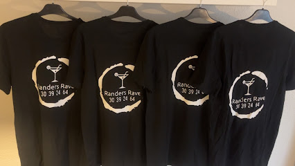
Randers Rave
27.5 km
Compact, bass-heavy nightclub in Randers NØ, where an unassuming façade hides a late-night dance floor fueled by rave-inspired lights, DJs and high energy.
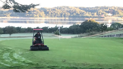
Mariager Fjord Golf
30.6 km
Mariager Fjord Golf blends a challenging 18-hole course with spectacular fjord views, laid-back Danish charm, and a welcoming clubhouse overlooking North Jutland’s scenic waters.
Skørping Bodega
31.0 km
A friendly local bodega near Rold Skov, Skørping Bodega captures the spirit of Danish bar culture with its authentic charm, inviting atmosphere, and vibrant community.
Rold Skov Orienteringsklub
31.1 km
Embark on an orienteering adventure with Rold Skov Orienteringsklub in Denmark's captivating Rold Skov forest.
Der Kuhstall Mønsted
32.1 km
Rural barn vibes meet late-night beats at this countryside nightclub near Viborg, where casual crowds, strong drinks and a compact dance floor power the weekend.
Happy Friday
34.4 km
Experience Støvring's vibrant nightlife at Happy Friday Cocktail Bar, where expertly crafted cocktails meet a lively atmosphere.
Mjølner
41.3 km
Small-town Nibe’s late-night heartbeat, where a compact dance floor, loud party tunes and local crowds turn a quiet fjord town into a lively night out.
Kedelhuset
46.9 km
Kedelhuset: Silkeborg’s buzzing live music and culture venue, blending industrial heritage with creative energy in the lively riverside Papirfabrikken district.
Riverboat Jazz Festival
46.9 km
Scandinavia’s celebrated Riverboat Jazz Festival: riverside concerts, boat gigs, and open-air revelry set against Silkeborg’s scenic lakes and vibrant summer spirit.
Roxy Malt
47.4 km
Retro-chic bar in the heart of Silkeborg offering craft beers, creative cocktails, and regular entertainment, making it a favorite for locals and visitors alike.
Butchers Silkeborg
47.4 km
Late-night meat-focused nightclub and bar in central Silkeborg, open Friday and Saturday until 5 AM.
B'sharp - Silkeborg Rhythm Og Blues Association
47.5 km
Volunteer-run blues stronghold in central Silkeborg, where intimate weekend concerts, affordable drinks and close-up performances keep rhythm & roots music alive.
Rabalder Bar
47.5 km
Lively late-night bar in central Silkeborg, known for energetic weekends, diverse drinks, fun music, and a welcoming, unpretentious atmosphere for locals and travelers.
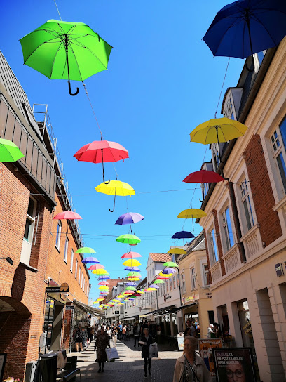
For the vibe & atmosphere seeker
- Scenic
- Fun-filled
- Quirky
- Unique
- Casual
- Relaxing
For the design and aesthetic lover
- Rustic Designs
- Colorful Aesthetics
For the architecture buff
- Parks & Gardens
- Landmarks
- Viewpoints
For the view chaser and sunset hunter
- Iconic Views
- Panoramas
- Sunset Spots
For the social media creator & influencer
- Instagrammable
- Photo Spots
- Selfie Spots
- Architectural Shots
- Reel-Friendly
For the eco-conscious traveler
- Low Impact
- Public-Transport Accessible
- Locally Managed
For the kind of experience you’re after
- Cultural Heritage
- Photowalk
- Adventure Photo Shoot
- Roadtrip Stop
- Day Trip
- Mindfulness
For how adventurous you want the journey to be
- Easy Access
Location Audience
- Family Friendly
- Child Friendly
- Teen Friendly
- Senior Friendly
- Solo Friendly
- Couple Friendly
- Solo Female Friendly
- Vegetarian Friendly
- Vegan Friendly


