Background

Issehoved – Northern Tip of Samsø

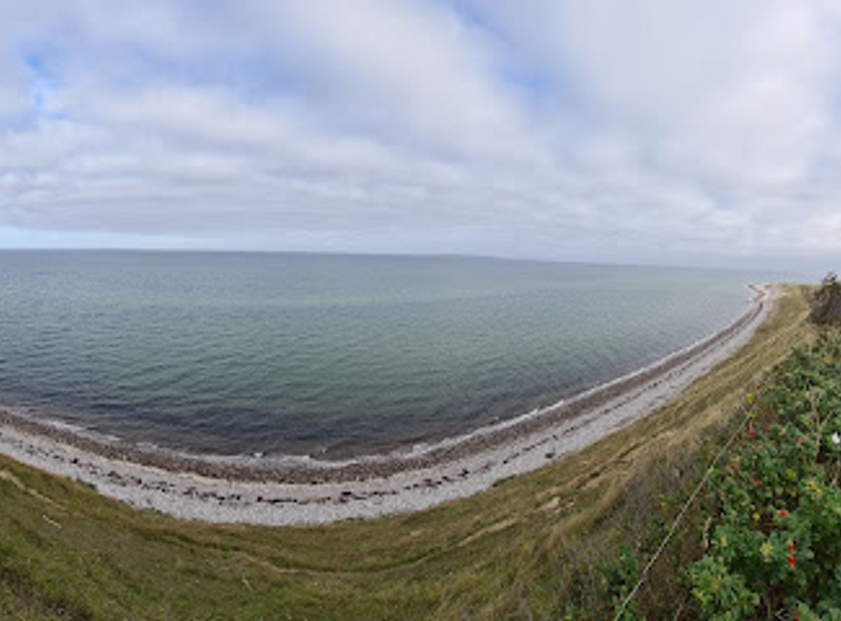
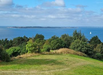
Windswept tip of Samsø where rolling hills meet open Kattegat horizons and the island narrows to a pebble‑fringed point of sea, light and sky.

4.7

Issehoved is the windswept northern tip of Samsø, a narrow spit of land where rolling hills tumble into shingle beaches and the Kattegat surrounds you on three sides. Often compared to a miniature version of Skagen’s famous sandbar, this ever‑shifting headland offers big skies, long horizons and far‑reaching views towards Aarhus, Helgenæs and Mols. It is one of the island’s most atmospheric spots for coastal walks, quiet contemplation and watching the light play across sea and cliff.

A brief summary to Issehoved

  • Issehoved, Samsø Municipality, 8305, DK
  • Duration: 1 to 3 hours
  • Free
  • Environment icon Outdoor
  • Mobile reception: 4 out of 5
  • Monday 12 am-12 am
  • Tuesday 12 am-12 am
  • Wednesday 12 am-12 am
  • Thursday 12 am-12 am
  • Friday 12 am-12 am
  • Saturday 12 am-12 am
  • Sunday 12 am-12 am

Local tips

  • Wear sturdy shoes; paths and beaches are uneven, with pebbles, sandy stretches and short, steep slopes down to the water.
  • Bring windproof layers even in summer, as the exposed headland can feel noticeably cooler and breezier than inland.
  • Plan extra time around sunrise or late afternoon for the most atmospheric light and long views towards Aarhus and Mols.
  • If you explore in bird nesting season, keep to marked paths and avoid disturbing birds resting on the beach or in low vegetation.
widget icon

Getting There

  • Car from Nordby

    From Nordby village, driving to the Issehoved parking area typically takes 5–10 minutes along local roads. The route is short but narrow in places, with passing bays and occasional cyclists. Parking near the headland is free but limited in peak summer, so arriving earlier in the day helps. From the parking area you continue on foot along unpaved paths over low hills to reach the tip.

  • Bicycle from Nordby and northern villages

    Cycling from Nordby or nearby northern settlements to Issehoved usually takes 15–30 minutes, depending on your starting point and pace. The ride follows quiet country lanes with gentle hills and some exposed stretches where wind can be strong. There is no dedicated bike parking infrastructure, but you can lock your bicycle near the main approach and continue on foot. This option is free and suits most reasonably confident cyclists.

  • On foot via Nordby Bakker trails

    Hiking from the Nordby Bakker area to Issehoved takes about 1–2 hours each way, depending on the route and how often you stop. Waymarked trails lead through rolling hills and coastal slopes, with uneven ground, occasional sandy sections and low vegetation. The walk is not technically difficult but can feel moderately strenuous for some visitors. Good footwear and weather‑appropriate clothing are important, and there are no services en route.

  • Taxi or pre‑booked local transport on Samsø

    Taxis or pre‑arranged local transport can bring you from larger villages such as Tranebjerg or Ballen to the Issehoved approach in roughly 20–35 minutes, depending on distance and seasonal traffic. Fares vary with the starting point and time of day, but for typical island journeys expect a range of about 150–350 DKK one way for a standard car. Services should be booked in advance, especially outside the main summer season.

Issehoved location weather suitability

  • Weather icon Clear Skies
  • Weather icon Mild Temperatures
  • Weather icon Windy Conditions
  • Weather icon Hot Weather
  • Weather icon Cold Weather
  • Weather icon Any Weather

Unlock the Best of Issehoved

Buy tickets

    No tickets available

Book tours with entry

    No tours available

Book tours without entry

    No tours available

Discover more about Issehoved

Where Samsø Narrows into the Sea

Issehoved is the northernmost point of Samsø, a slim, tapering headland pushing out into the Kattegat like a miniature version of Denmark’s tip at Skagen. Here the island dwindles to a low tongue of pebbles and sand, flanked by shallow beaches and framed by gently undulating coastal hills. On clear days the horizon is busy: you can pick out Aarhus and the Mols peninsula, Helgenæs with its hilltops, and lighthouses blinking faintly across the water. The sense of exposure is part of the appeal. With open sea on almost all sides, the wind rarely rests, and the light shifts constantly as clouds race over the water. Even on calm summer days there is a salty tang in the air and the soft hiss of waves working at the shore, slowly reshaping the point.

Landscapes Shaped by Wind and Waves

Issehoved is a textbook example of a dynamic coastal landscape. The headland was sculpted after the last Ice Age, as meltwater and currents carried sand and gravel along Samsø’s coast, gradually building up this narrow tip. Prevailing winds and waves still move material today; shorelines advance and retreat, and low dunes and beach ridges are subtly different from season to season. Behind the tip, rounded hills and heather‑topped slopes fall towards the sea, part of the Nordby Bakker landscape that gives northern Samsø its distinctive profile. Sheep and cattle sometimes graze here, keeping the vegetation open and adding to the sense of a working, semi‑wild countryside. From higher knolls you gain sweeping views over fields, coastline and the long spine of the island stretching south.

Walking the Edge of the Island

Most visits to Issehoved revolve around simple pleasures: walking, pausing and looking. Short paths lead over the hills and down to the stony beaches, where you can circle the tip and feel the sea change character from one side to the other. The terrain is easy to moderate, with some short, steeper slopes and uneven ground that reward sturdy footwear. Along the way you notice details: polished pebbles underfoot, patterns of seaweed left by the last high tide, or driftwood bleached nearly white. Birdlife can be rewarding, with coastal species cruising the shoreline and, in the right season, migratory flocks using Samsø as a stepping stone. Many visitors linger simply to sit on the stones, listen to the water and watch ferries and cargo ships thread distant routes across the Kattegat.

Changing Skies and Island Light

Issehoved comes into its own in expressive weather. On bright days the sea glows in bands of green and blue, and the low hills are lit in soft gold. When clouds build, the landscape turns more dramatic, with shafts of light picking out headlands and distant islands. Sunrise and late‑evening light can be especially atmospheric as skies reflect in the water on both sides of the point. Because the headland is so open, conditions can feel cooler and windier than elsewhere on Samsø, particularly outside summer. Layers, wind protection and a readiness for quick changes make it easier to enjoy the shifting moods of the place, whether you come for a brisk winter walk or a slow July evening by the shore.

Part of Samsø’s Nature Story

Issehoved forms a natural full stop at the end of Samsø’s northern landscapes. It links the cultivated interior to a wilder fringe of beach meadows, coastal slopes and open sea that frames much of the island’s character. The area is generally left simple and undeveloped, with basic paths and minimal facilities helping preserve its raw feel. As with many Danish coastal environments, staying on paths where indicated, avoiding disturbance of nesting birds and taking litter away are small but important contributions to keeping this fragile headland intact. In return, Issehoved offers one of Samsø’s purest encounters with wind, light and sea – a reminder of how a small island can feel strikingly expansive at its very edge.

Busiest months of the year

Busiest hours of the day

Popular Experiences near Issehoved

Popular Hotels near Issehoved

Select Currency