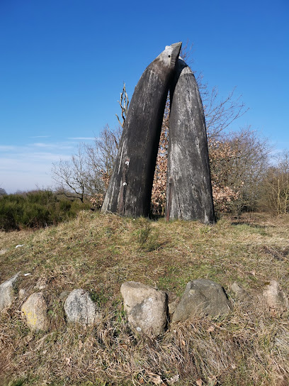
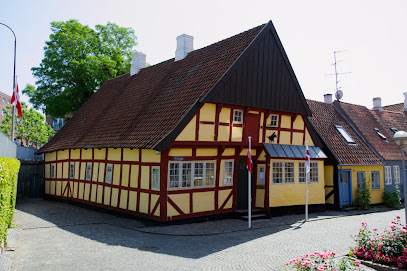
Infotavle Gendarmstien, Vemmingbund – Høruphav
A modest information board on Denmark’s Gendarme Path that unlocks coastal views, border history and stage‑planning between Vemmingbund and Høruphav.
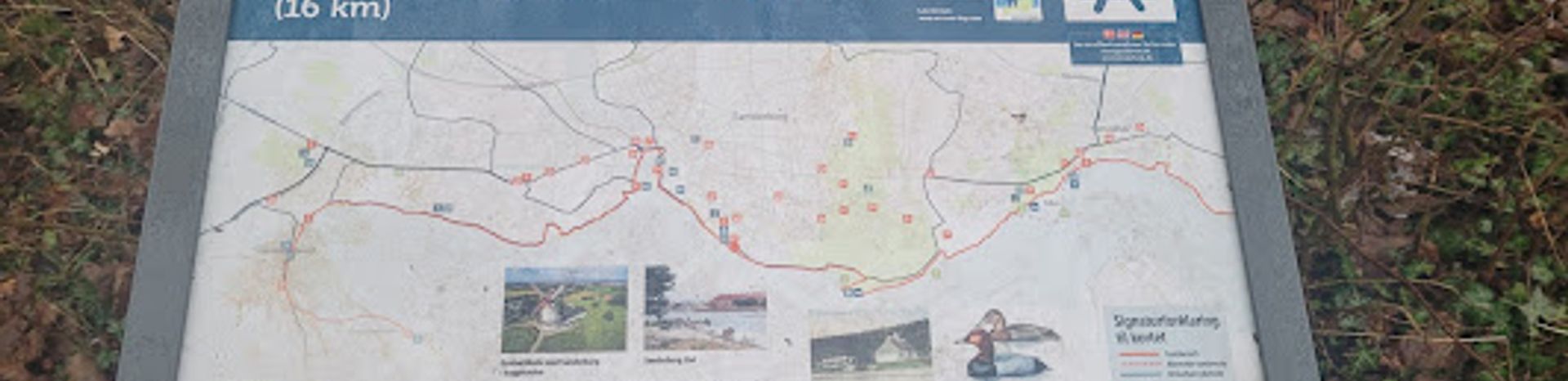
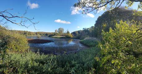
This discreet information board on the Gendarme Path between Vemmingbund and Høruphav is a handy orientation point along one of Denmark’s most scenic coastal trails. Here you step directly into the story of the former border gendarmes who once patrolled the shores between Denmark and Germany, with maps, history and route details bringing the 84 km Gendarmstien to life. It is an ideal place to pause, check your stage and appreciate the mix of beaches, forest and war-history landscape around Sønderborg.
A brief summary to Infotavle Gendarmstien, Vemmingbund - Høruphav
- Sønderborg, 6400, DK
- Visit website
- Duration: 0.5 to 2 hours
- Free
-
 Outdoor
- Mobile reception: 4 out of 5
Local tips
- Bring a detailed map or offline trail app; the board is useful for orientation, but coastal bends and woodland sections can feel similar after several kilometres.
- Wear waterproof or quick‑dry footwear, as parts of the Vemmingbund–Høruphav stretch can be damp or involve short sections directly on the beach.
- Pack snacks and water before setting out; refreshment spots cluster in towns like Sønderborg and Høruphav rather than right at the information board.
- Allow extra time for short detours up towards Dybbøl Banke or to viewpoints above the bay if you are interested in the 1864 battlefield landscape.
For the on-the-go comforts that matter to you
- Information Boards
Getting There
-
Regional train and local bus from Sønderborg Station
From Sønderborg Station, take a regional bus towards Vemmingbund or along the coast east of the town; services typically take 15–25 minutes depending on the specific stop. A single adult ticket within the local zone system usually costs around 20–35 DKK and buses run roughly every 30–60 minutes during the day, less frequently in the evening. Expect limited departures on weekends and public holidays, and note that you will walk a short distance from the nearest bus stop along signed paths to reach the information board.
-
Car access from Sønderborg and surrounding area
By car from central Sønderborg, the drive to the Vemmingbund stretch of Gendarmstien is generally 10–20 minutes depending on traffic and your exact starting point. There are small parking areas near beach access points and roadside lay‑bys, which are usually free but can fill up on warm summer days. From these, expect a few minutes’ walk on footpaths or along the beach to reach the information board. Surfaces are a mix of gravel and sand, and some approaches may not be suitable for low‑mobility visitors.
-
Walking approach from Sønderborg via the Gendarmstien
If you are already in Sønderborg, you can join the Gendarmstien in town and follow it east along the bay towards Vemmingbund, treating the information board as a waypoint on a longer hike. The walk typically takes 2.5–4 hours one way for an average walker, depending on pace and photo stops. Terrain is mostly easy coastal path with some stretches on sand or slightly uneven forest track, so sturdy shoes are recommended. This option is free aside from any refreshments you buy en route and is best attempted in daylight and stable weather.
Infotavle Gendarmstien, Vemmingbund - Høruphav location weather suitability
-
 Clear Skies
-
 Mild Temperatures
-
 Any Weather
-
 Cold Weather
-
 Windy Conditions
Discover more about Infotavle Gendarmstien, Vemmingbund - Høruphav
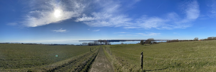
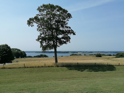
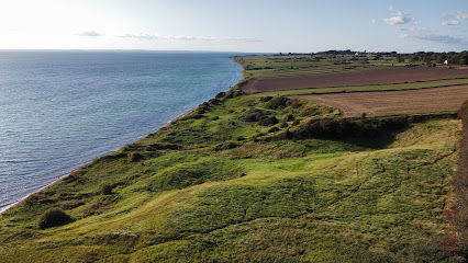
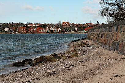
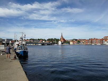
Coastal stop on Denmark’s historic border trail
This information board lies on the Gendarmstien section running between the bay of Vemmingbund and the harbour town of Høruphav on the island of Als. Here the long-distance path follows the coastline east of Sønderborg, threading together sandy beaches, low cliffs and quiet woodland. You are in the heart of Southern Jutland’s borderland, where sea views across Sønderborg Bay constantly remind you how close Germany lies just over the horizon. Gendarmstien itself stretches roughly 84 km from Padborg near the Danish–German border to Skovby on Als, tracing the old patrol route along the shore. The Vemmingbund–Høruphav reach is one of its gentler, more contemplative stages, a place where the rhythm of waves and the cry of seabirds accompany you as you follow the blue gendarme symbols from cove to cove.Stories of smugglers, soldiers and shifting frontiers
The board introduces you to the gendarmes who gave the trail its name. From the nineteenth century until 1958, these border guards walked this same coastline, watching for smugglers using inlets and small coves to slip untaxed goods across the frontier. After the 1920 reunification of Southern Jutland with Denmark, the men in blue uniforms became a visible symbol of the new border, pacing the cliff tops, dunes and pebble beaches. Around Vemmingbund the landscape still carries traces of much older conflicts. Across the bay rises Dybbøl Banke, a key battlefield during the 1864 war, when Denmark lost a large part of Schleswig to Prussia. Interpretation along the path helps link what you see today – farmed fields, windmills and forest edges – with the artillery lines, trenches and lookout points that once dotted these slopes.Reading the landscape between bay and beech woods
Moving south and east towards Høruphav, the character of the coast shifts repeatedly. Open sand gives way to narrow shingle, low clay cliffs and occasional patches of salt meadow cut by small streams. Inland, beech and mixed woodland step in to shelter the route, offering cool shade, birdsong and spring wildflowers. The information board typically highlights these transitions, pointing out common coastal plants, birdlife on the bay and protected wetland areas nearby. Høruphav itself lies at the edge of a shallow inlet with calm water, used today by small boats and kayaks rather than patrol craft. Between the two points you experience how closely nature and culture intertwine along Gendarmstien: sea eagles and terns overhead, war memorials on the hills, livestock grazing right down to the strand.Practical pause for planning your Gendarmstien stage
As a waymarker rather than a stand‑alone attraction, the board is designed to help you understand where you are on the larger route. Clear maps show the division of the Gendarme Path into themed stages – from the more undulating "mountain" stretch near Padborg to the beach and mill sections closer to Als. Elevation profiles, distances and suggested day stages make it easier to decide whether to continue to Sønderborg, stay around Vemmingbund’s family‑friendly beach or push on towards Høruphav and Skovby. The panel also orients you to nearby facilities such as bathing spots, picnic places, simple campgrounds and villages where you can resupply. For multi‑day hikers this short stop can be where you check the weather, adjust your timetable and choose whether to stick to the shoreline or take small signed detours to viewpoints, mills or historic sites.Quiet atmosphere along a certified quality trail
Gendarmstien is recognised as a European Quality Trail, meeting high standards for varied scenery, cultural interest and waymarking. That quality shows even at modest stops like this one. The surf is seldom far away, and on calmer days you may hear only water against stones, the rustle of leaves and occasional voices from the beach or the path. In summer, light lingers long into the evening, giving this stretch a soft, almost luminous feel as the sun dips behind Dybbøl and the colours of the bay deepen. Whether you are thru‑hiking the full 84 km or just exploring a short segment from Sønderborg, the Vemmingbund–Høruphav information board acts as a small gateway into a much wider story. It invites you to see the border landscape not only as pretty coastline, but as a living corridor of nature, history and quiet everyday life in Southern Jutland.Iconic landmarks you can’t miss
Gedenkstein für hingerichtete Widerstandskämpfer
0.1 km
Discreet harborfront memorial in Sønderborg honoring eleven young German sailors executed for mutiny in 1945, inviting quiet reflection on conscience and war.
Sønderborg Kommunale Kommandocentral
1.4 km
Hidden beneath Kongevej lies Sønderborg’s former Cold War nerve center, an underground command bunker built to keep the city running in times of crisis.
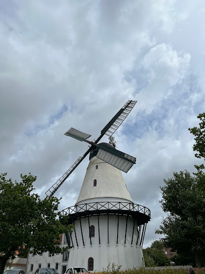
Windmill
1.5 km
Denmark's iconic windmill and national symbol of resilience, rebuilt after war and transformed into a living museum of history.
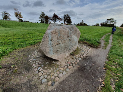
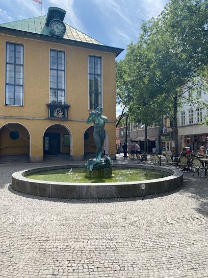
Memory stone
1.6 km
A modest monument on Sønderborg’s town-hall square, the Memory Stone offers a quiet pause for reflection amid the everyday bustle of this historic border town.
Papirgalleriet v/Gitte Kristjansen
1.6 km
A vibrant family-friendly playground in central Roskilde, Byparkens Legeplads offers open-air fun, creativity, and relaxation in the heart of the city’s beloved Byparken.
Iskonditoriet
1.8 km
Byparkens Legeplads in Roskilde fuses creative play equipment and green park scenery for a free, family-friendly experience in the heart of the historic Danish city.
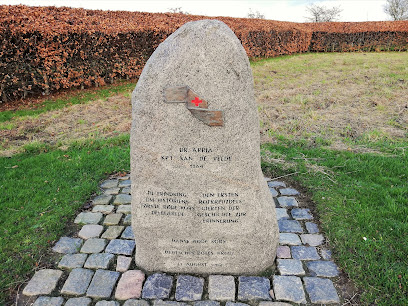
Mindesten for Røde Kors
3.4 km
A quiet memorial to the world's first Red Cross observers amid Denmark's most historic battlefield.
Genforeningsmærke på Dybbøl Skanse II
3.4 km
Memorial marker honoring Danish reunification and the 1864 battle's fallen defenders on a historic fortification site.
Tysk skanse X
3.6 km
Stille jordvolde på Dybbøl Banke, hvor en tysk skanse fortæller om tiden efter 1864 og fæstningsringen, der engang omklamrede Sønderborg.
King's Redoubt
3.6 km
A preserved 1864 military fortress symbolizing Danish resilience and regional heritage.

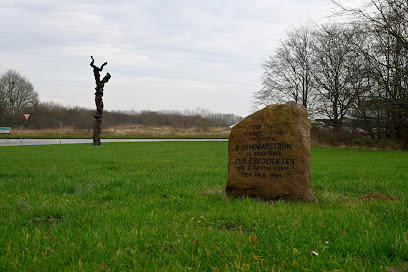
Mindesten for korporal Hammerström og konstabel Frederiksen
3.7 km
A modest stone on Sønderborg’s former shooting range honouring two fallen wartime servicemen, inviting a brief but powerful pause for remembrance and reflection.
Befrielsessten i Vester Sottrup
8.6 km
A quiet stone marking Denmark's liberation and Vester Sottrup's wartime legacy.
Foundation country Schäferhaus
30.8 km
Explore the serene beauty of Foundation country Schaeferhaus, a nature preserve in Flensburg, perfect for relaxation, education, and wildlife observation.
Bregninge Kirke
32.4 km
Medieval island church on a gentle Ærø hillside, where whitewashed stone, quiet fields and seafaring stories meet in a calm, contemplative setting.
Forladt skorsten
33.1 km
A haunting brick ruin marking Ærø's vanished industrial era, standing silent on the island's edge.
Unmissable attractions to see
Fluepapiret
1.4 km
A compact, unspoiled urban beach where locals gather to swim in the Baltic's gentle waters.
Sønderborg Beach
1.4 km
Pristine Danish beach with family-friendly waters, stunning sunsets, and a diving pier—perfect for seaside relaxation and photography.
Historiske Vandringer – På sporet af 1. verdenskrig
1.4 km
A quiet harbour walk in Sønderborg that traces the invisible footprints of World War I through barracks, memorials and everyday streets in a former borderland town.
Genforeningssten i Sønderborg
1.6 km
A monumental tribute to Denmark's 1920 reunification, nestled near historic Sønderborg Castle.
Rådhustorvet
1.6 km
Historic town square with a 16th‑century former town hall, Rådhustorvet is a compact, atmospheric hub in Sønderborg’s old quarter.
Panorama
1.7 km
Historic windmill and museum overlooking the 1864 battlefield, Dybbøl Mill stands as a powerful monument to Danish resilience and a unique window into national history.
Sønderborg Castle
1.7 km
Centuries of royal drama, borderland wars and Southern Jutland stories unfold inside this waterfront fortress‑turned‑museum on the Alssund.
Sønderborghus
1.7 km
Cosy cultural house in central Sønderborg, blending live music, creative workshops and a welcoming café into one relaxed, community-focused venue.
Visselulles Have
1.7 km
Small in size but rich in stories, Visselulles Have is a tranquil memorial garden that honours Sønderborg’s legendary female dockworker in her old neighbourhood.
Dybbøl Strand
1.7 km
A peaceful Danish strand where sandy shores meet centuries of history and heritage.
Spanske trappe
1.8 km
A once-grey stairway turned into a colourful nature mural, the Spanske Trappe is Sønderborg’s playful urban shortcut and small-scale landmark between two city streets.
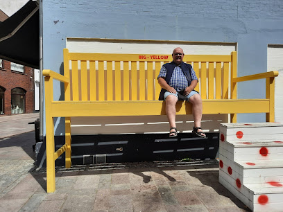
Selfiebænken - Big yellow
1.8 km
Sønderborg's cheerful yellow bench—a playful symbol of local creativity and the perfect photo moment.
Kongevejsparken
1.8 km
A small historic neighborhood park in central Sønderborg, where former hospital gardens, mature trees and a playground create a relaxed everyday green escape.
Ringridermuseet i Sønderborg
1.9 km
Danmarks eneste ringridermuseum i et bindingsværkshus fra 1643, hvor lanser, medaljer og lokale fortællinger bringer Sønderborgs festlige tradition til live.
Rønhaveplads
1.9 km
A peaceful, local-favorite park offering tranquil ponds, leafy lawns, and family-friendly relaxation just outside Sønderborg’s city center. Free, welcoming, and authentic.
Essential places to dine
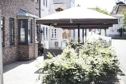
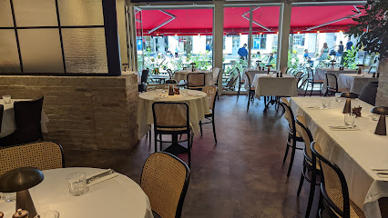
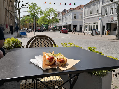
Café Marina
0.6 km
Relaxed waterfront café at Sønderborg Marina, serving hearty brunches, seaside comfort food and drinks with wide‑open views of boats and the sheltered sound.
Bella Italia
1.5 km
Cozy Italian restaurant and small hotel in Sønderborg’s historic heart, pairing brick-vaulted charm with classic pizzas, pasta, and relaxed evening dining.
Hotel Bella Italia
1.5 km
A cozy Nordic-style boutique stay with a lively Italian trattoria downstairs, set right in the historic heart of Sønderborg.
Sushi & More... Sushi
1.5 km
Central Sønderborg spot for easygoing sushi, Asian hot dishes and reliable takeaway, ideal for a quick lunch stop or relaxed, no‑fuss dinner.
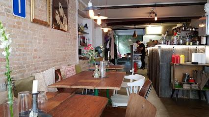
Cafe Stjernen
1.6 km
Hearty Danish café classics, candlelit brasserie ambience and specialty beers in the heart of Sønderborg’s compact historic centre.
Lazy Dog Burgers - Worldclass Burgers from Sønderborg
1.6 km
World-class burgers and cocktails in the heart of historic Sønderborg
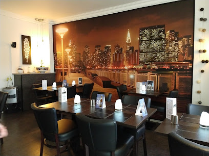
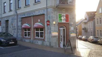
Restaurant Da Nico
1.6 km
Authentic Italian brick-oven pizza and homemade pasta in the heart of Sønderborg.
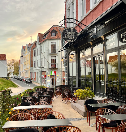
Fox And Hounds
1.6 km
Scottish-style gastropub in central Sønderborg, pairing hearty ribs, burgers and steaks with an expansive beer and whisky selection in a warm, wood-paneled setting.
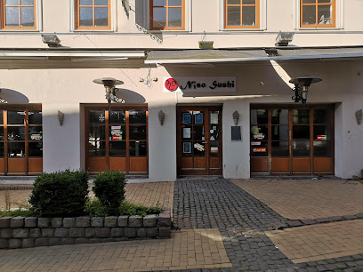
Niso Sushi ApS
1.6 km
Lively running-sushi and Vietnamese restaurant in the heart of Sønderborg, serving endless plates of sushi and Asian bites in a relaxed, central setting.
Biehl
1.6 km
Honest Danish comfort food in the heart of Sønderborg's main street.
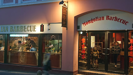
Mongolian Barbecue
1.6 km
Create-your-own stir-fries on a sizzling grill at this lively Asian buffet in central Sønderborg, mixing Mongolian barbecue theatre with Chinese favourites and casual comfort.
The Burger Concept - Burger i Sønderborg
1.6 km
Casual Danish burger bar inside Sønderborg’s Borgen center, serving classic patties, crispy fries and shakes in a bright, urban fast-casual setting.
Kong Kian Sønderborg
1.6 km
Central Sønderborg fast‑casual spot for roasted chicken, spareribs and build‑your‑own sandwiches, serving from lunchtime through late night right on Rådhustorvet.
Cafe Mauritz
1.6 km
Casual Danish café-brasserie in central Sønderborg, serving generous brunches, burgers, coffee and cocktails in relaxed, candlelit surroundings all day.
The Grand Café
1.6 km
Elegant Danish dining on Sønderborg's main square, where refined cuisine meets genuine hospitality.
Markets, malls and hidden boutiques
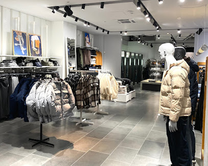
Kings & Queens
1.5 km
Contemporary multi-brand fashion in central Sønderborg, blending Scandinavian style, casual streetwear, and easygoing boutique vibes for men and women.
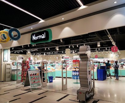
Normal
1.5 km
Bright, budget‑friendly beauty and everyday essentials in the heart of Borgen Shopping, perfect for quick top‑ups and casual browsing between Sønderborg sights.
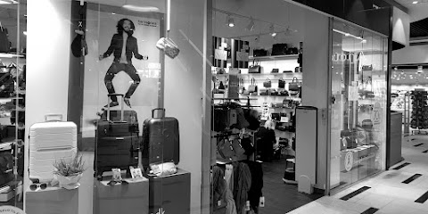
NEYE Borgen
1.6 km
Modern Danish bag and luggage specialist in Borgen Shopping, offering quality brands, expert guidance and everyday purchases that help fund cancer research.
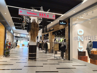
Borgen
1.6 km
Sønderborg's complete shopping experience: 40 stores, dining, cinema, and culture under one roof.
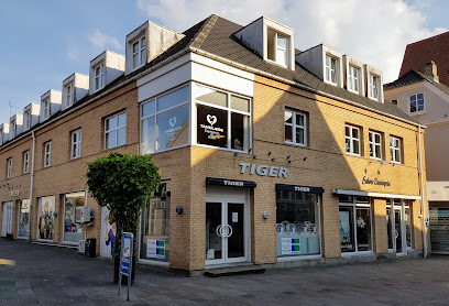
Flying Tiger Copenhagen
1.6 km
Scandinavian creativity and affordable joy in Sønderborg's premier shopping destination.
JACK & JONES
1.6 km
Straightforward Scandinavian menswear in the heart of Borgen Shopping, ideal for denim, casual basics and smart-casual outfits under one convenient indoor roof.
Zizzi - Sønderborg
1.6 km
Modern plus-size fashion for women in the heart of Sønderborg’s Borgen Shopping centre, combining Scandinavian style, generous sizing and friendly fit-focused advice.

Vero Moda
1.6 km
Contemporary Scandinavian women’s fashion inside Borgen Shopping, offering wearable trends, layering pieces and accessories in Sønderborg’s central retail district.

ONLY
1.6 km
Scandinavian high-street style, denim-focused collections and easy everyday fashion inside Borgen Shopping in the heart of Sønderborg.

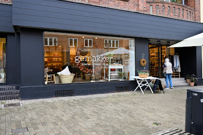
Butik Gemakker
1.6 km
Intimate Nordic lifestyle store in central Sønderborg, curating timeless homeware, textiles and fashion with a focus on quality, calm aesthetics and lasting design.
Twizt Fashion
1.7 km
Compact Danish fashion and lingerie boutique on Sønderborg’s main pedestrian street, combining everyday practicality with relaxed, personal service.
Jim P.
1.7 km
Curated fashion for discerning shoppers seeking distinctive style beyond the mainstream.
Viller
1.7 km
Independent women’s fashion boutique on Sønderborg’s main pedestrian street, blending Scandinavian style, curated brands and personal, one-to-one service.
Tøjeksperten
1.7 km
Denmark's largest menswear chain brings premium brands and accessible style to central Sønderborg.
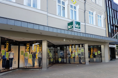
Mr Klausen Herre-og Drengetøj
1.7 km
Classic Danish mens- and boyswear on Sønderborg’s Perlegade, blending everyday essentials, occasion outfits and local Ringridning traditions in one friendly shop.
Essential bars & hidden hideouts
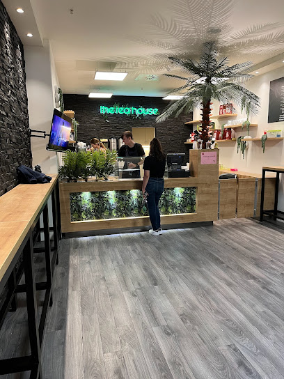
the tea house
1.6 km
South Jutland's premier bubble tea destination with customizable flavors and signature boba varieties.
Nebula.dk ApS
1.6 km
Atmospheric shisha lounge and cocktail bar in Sønderborg’s historic center, offering intimate lighting, cozy seating and slow-paced evenings for adults.
Penny Lane Sønderborg
1.6 km
Lively late‑night bar in central Sønderborg serving cocktails, beer and loud tunes from evening warm‑up to near‑club energy on weekend nights.
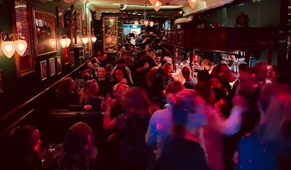
Rabalder Bar - Sønderborg
1.6 km
Tiny in size but big on volume, Rabalder Bar Sønderborg packs sing‑along hits, simple drinks and late‑night energy into one compact old‑town party den.
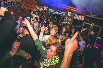
Heidi's Bier Bar Sønderborg
1.6 km
Loud alpine-themed beer hall and late-night party bar bringing après-ski energy, big steins and sing-along hits to Sønderborg’s central Rådhustorvet.
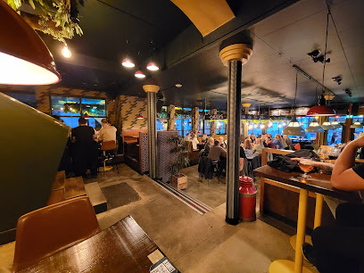
SKAAL Sønderborg
1.6 km
Modern craft beer bar and kitchen on Sønderborg’s main square, pouring rotating Danish brews and serving hearty comfort food in a stylish, urban setting.
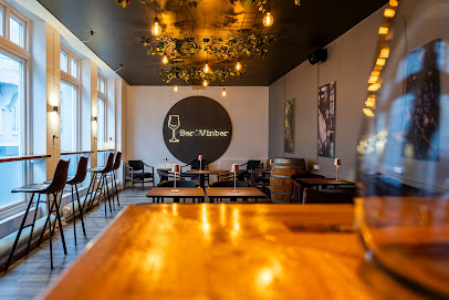
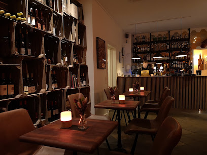
Bar' Vinbar
1.7 km
Central Sønderborg’s relaxed corner wine bar, pouring around 50 wines by the glass plus cocktails, coffee and light bites in a warm, informal atmosphere.
Old Danish Pub
1.7 km
Classic hygge-filled pub near Sønderborg’s main square, with affordable drinks, games, sports on screen and lively karaoke evenings on two cosy floors.

Den Lille Vinbar
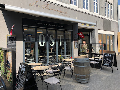
1.7 km
Cosy fromagerie-style wine bar on Perlegade, pairing carefully selected bottles with generous cheese tapas in an intimate, continental-feeling corner of Sønderborg.
Visselulles Vinbar
1.8 km
Intimate waterfront wine bar showcasing world-class vintages and French-inspired ambiance in historic Sønderborg.
Posthuset
1.8 km
Historic post office transformed into Sønderborg's beloved social hub for drinks, conversation, and Danish nightlife.
Restaurant Viking - Pool and billiards Sønderborg
1.9 km
Authentic Danish neighborhood pub where locals gather for affordable drinks, billiards, and genuine community atmosphere.
Værtshus Chr. Iv
1.9 km
Classic brown beer hall on Sønderborg’s main street, serving simple drinks, local atmosphere and everyday Danish hygge from late morning into the evening.
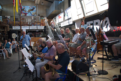
New Orleans Jazz I Sønderborg
2.1 km
Intimate, association-run jazz club in central Sønderborg, serving up New Orleans–inspired live music, close-up performances and a friendly, community atmosphere.
Caféen
2.4 km
Lively, low‑priced bar inside Sønderborg’s Alsion complex, where students and locals meet for music, dancing and late‑night drinks by the harbour.
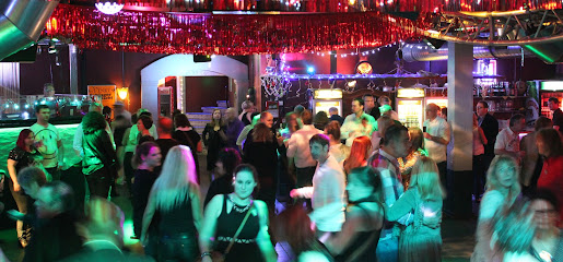
Nightclubs & after hour spots
Kaizen ApS
1.6 km
Compact disco-style nightclub in central Sønderborg, pulsing with late-night beats, colourful lights and a straightforward bar for an unpretentious night out.
Dance All Over
8.5 km
Sønderborg’s sociable dance hub, where fitness, swing and party-ready moves come together in energetic, community-driven classes across the city.
Ærø Whiskey Destilleri
38.9 km
Experience the artisanal charm of Ærø Whisky Distillery in Ærøskøbing, where local ingredients and traditional methods create unique island whiskies.

Ærø Jazzfestival
39.0 km
Experience the soul of Danish jazz at Ærø Jazzfestival, where international rhythms meet island heritage in the historic harbor of Ærøskøbing each summer.
Ela-Ela Schleswig
43.0 km
Discover the electrifying nightlife of Schleswig at Ela-Ela, where music and dancing come alive in an unforgettable disco experience.

Ommel
43.8 km
A small, sociable island nightspot near Marstal where locals and travelers share quiet drinks, simple music and the easygoing charm of Ærø after dark.
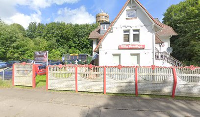
VILLA PRESTIGE Schleswig
44.0 km
Discover the vibrant nightlife at VILLA PRESTIGE Schleswig, a lively night club perfect for dancing and socializing until dawn.
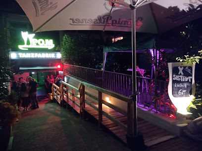
TANZ-FABRIK / Tanzlokal
44.9 km
Discover the vibrant nightlife of Schleswig at TANZ-FABRIK, where music and dance create unforgettable memories every Saturday night.
Discothek Vineta
49.2 km
Discover the lively nightlife of Busdorf at Discothek Vineta, where vibrant music and dancing await in a welcoming atmosphere.
Crazy Daisy Svendborg
54.7 km
Compact, high-energy weekend nightclub in central Svendborg, serving mainstream beats, drinks and a sociable dance floor until the early hours.
Kasket karl
58.3 km
Discover authentic Danish hospitality and local color at Kasket Karl, Rudkøbing’s beloved bodega on Langeland—a lively gathering spot offering drinks, history, and community.
Langelands Jazzklub
59.1 km
Experience the vibrant local jazz scene at Langelands Jazzklub in Rudkøbing, where live music and island hospitality meet in one of Denmark’s most charming settings.
Al Capone
59.8 km
Tønder’s sole nightclub, Al Capone blends a rustic 1920s‑inspired mood, late‑night beats and strong drinks into an intimate speakeasy‑style party den.
P2 Champagne & Cocktail Tønder
59.9 km
Intimate champagne and cocktail lounge bringing late-night sparkle and city-style glamour to the historic heart of Tønder.

Orange Club
65.7 km
Discover the vibrant nightlife of Kiel at Orange Club, where the music is pumping and the dance floor is waiting.
For the vibe & atmosphere seeker
- Scenic
- Relaxing
- Tranquil
- Unique
- Casual
For the architecture buff
- Parks & Gardens
- Viewpoints
- Heritage Neighborhoods
- Landmarks
For the view chaser and sunset hunter
- Iconic Views
- Panoramas
- Sunrise Spots
- Sunset Spots
For the social media creator & influencer
- Photo Spots
- Selfie Spots
- Reel-Friendly
- Architectural Shots
For the eco-conscious traveler
- Low Impact
- Public-Transport Accessible
- Leave-No-Trace Critical
- Locally Managed
For the kind of experience you’re after
- Photowalk
- Nature Escape
- Roadtrip Stop
- Day Trip
- Cultural Heritage
- Mindfulness
For how adventurous you want the journey to be
- Easy Access
Location Audience
- Family Friendly
- Senior Friendly
- Child Friendly
- Teen Friendly
- Solo Friendly
- Couple Friendly
- Solo Female Friendly


