Bjørnø Island, South Funen Archipelago
Tiny, car‑free Bjørnø blends hilly Ice Age landscapes, rich birdlife and easy shoreline walks into one tranquil South Funen island escape.
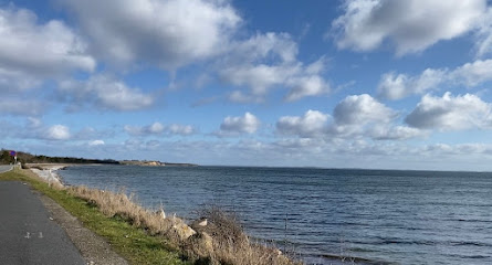
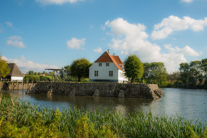
Bjørnø is a tiny, car‑free island just south of Faaborg in the South Funen Archipelago, known for its rolling moraine hills, bird‑rich salt meadows and striking southern sea cliffs. Only about 1.5 km² in size and with a few dozen residents, it feels wonderfully remote yet is only a short ferry hop from mainland Funen. Coastal walks, calm swimming waters, simple camping and a seasonal café make it an easy one‑day escape or tranquil overnight retreat.
A brief summary to Bjørnø
- Faaborg, DK
- Visit website
- Duration: 2 to 8 hours
- Free
-
 Outdoor
- Mobile reception: 3 out of 5
Local tips
- Plan your loop walk around the coast for 2–4 hours, allowing extra time for cliff‑top views on the south side and bird watching at the meadows and lagoons.
- Respect seasonal access restrictions around Holmene and other nesting areas, especially from early spring to mid‑summer, to avoid disturbing breeding birds.
- Bring snacks and drinking water outside the summer season, when the island café may be closed and options for supplies are very limited.
- Wear sturdy shoes: most paths are easy, but exposed cliff sections and farm tracks can be uneven, muddy or slippery after rain.
- If you swim or fish, check local guidance on safe spots and any protected zones, and avoid trampling the shallow pools where rare toads and other wildlife live.
For the on-the-go comforts that matter to you
- Restrooms
- Drink Options
- Food Options
- Seating Areas
- Picnic Areas
- Trash Bins
- Information Boards
Getting There
-
Ferry from Faaborg
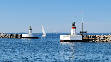
From Faaborg, take the small passenger ferry to Bjørnø; the crossing typically takes around 15–20 minutes and runs several times per day in most seasons. Tickets are usually sold as simple single or return fares, with adult prices commonly in the range of 40–80 DKK each way and discounts for children. Services can be less frequent outside summer and may be affected by strong winds or rough seas, so checking the latest timetable in advance is important.
-
Bicycle and ferry combination
Cyclists based in Faaborg or nearby can ride to the town’s waterfront and board the Bjørnø ferry with their bikes, then use the bicycle to explore the car‑free island. The ferry journey itself still takes about 15–20 minutes, and there is often a small surcharge for taking a bicycle, typically adding around 10–30 DKK to the standard passenger fare. Space for bikes can be limited on busy summer departures, so arriving early for popular sailings is advisable.
-
Regional bus to Faaborg plus ferry
If you are staying elsewhere on Funen, use regional buses to reach Faaborg bus terminal, which lies a short walk from the harbour area where the Bjørnø ferry departs. Depending on your starting point, bus journeys often take 30–70 minutes and cost in the region of 30–80 DKK for a single ticket within the regional public transport system. From Faaborg, connect to the island ferry for the 15–20 minute crossing, bearing in mind that bus and ferry timetables do not always align perfectly.
Bjørnø location weather suitability
-
 Clear Skies
-
 Mild Temperatures
-
 Any Weather
-
 Windy Conditions
-
 Cold Weather
-
 Hot Weather
Discover more about Bjørnø
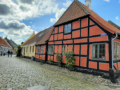
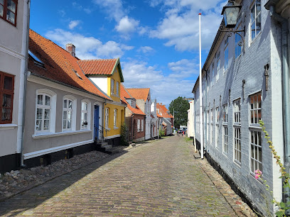
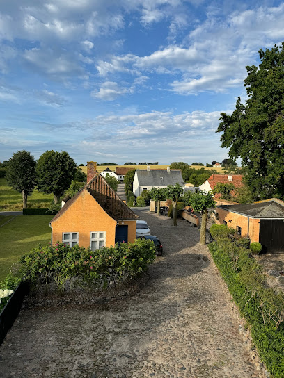
A Small Island with a Big Sense of Escape
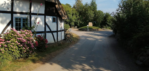
Bjørnø sits just south of Funen in the South Funen Archipelago, only a few kilometres off Faaborg yet worlds away in atmosphere. Covering around 1.5 square kilometres and stretching roughly 3 km from end to end, it is one of the smallest inhabited islands in the archipelago. With only a few dozen permanent residents and no cars, days move slowly here: tractors rumble between fields, bicycles lean against old walls, and the loudest sounds are often wind and waves. The island’s village clusters near the landing place, a compact tangle of lanes, half‑timbered farmhouses and traditional Danish cottages. Stone walls and living fences divide gardens and grazing land, giving the settlement a rural intimacy. It is easy to orient yourself: the sea is never far away, and almost every lane eventually runs out into open fields, meadows or shore.Hilly Landscapes and Coastal Drama
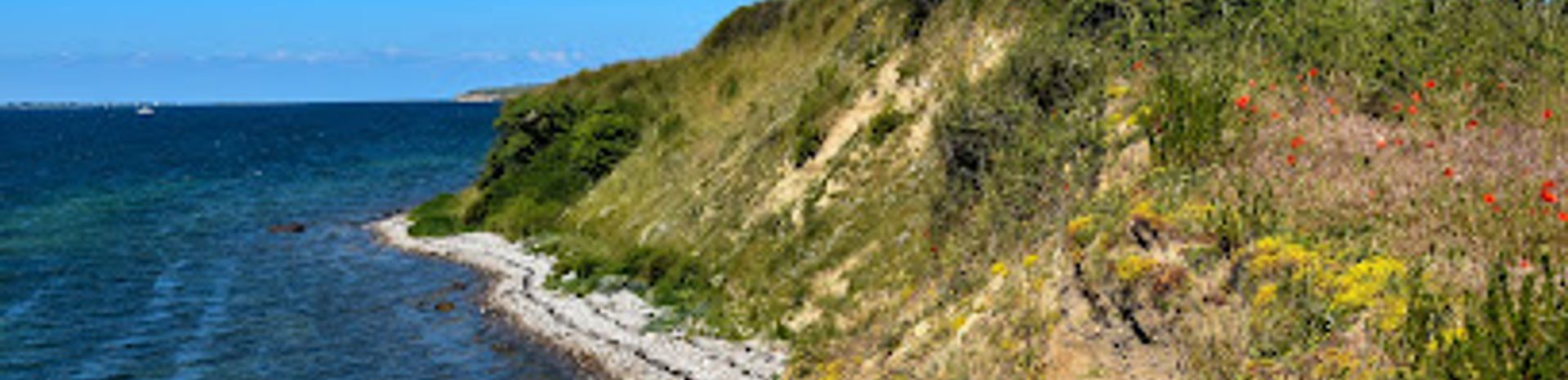
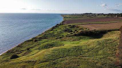
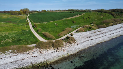
Bjørnø is a distinctly hilly moraine island, shaped by the last Ice Age. Its modest summit, Højberg, rises to about 24 metres above sea level, but here that is enough to offer wide views across the South Funen Archipelago. From the higher ground you can pick out Faaborg’s waterfront, the undulating Svanninge Bakker and neighbouring islands scattered across the shallow sea. Along the southern shore, the land drops sharply into a line of eroding cliffs. The sea continually bites at the edge, exposing layers of glacial deposits and creating a raw, dramatic edge to an otherwise gentle island. In contrast, the northwestern coast is low and open, with a marine foreland of salt meadows and shallow lagoons where the tide seeps quietly in and out.Birdlife, Sand Martins and Toads
For its size, Bjørnø has striking biodiversity, especially for birdwatchers. The flat beach meadows and the marshy centre host breeding ducks and waders, which forage in the damp grass and shallow pools. The southern cliffs are home to large colonies of sand martins, which tunnel into the soft face to nest in dense, noisy clusters during summer. At Holmene, a long, straight spit at the southeastern tip, gulls use the sparsely vegetated land as a breeding site. Parts of this area are seasonally off‑limits to protect nesting birds, underlining the island’s role as a living habitat rather than just a recreational backdrop. Bjørnø is also known for the rare, protected green toad found on its beaches, a reminder to tread carefully on the shore and avoid disturbing shallow pools and dunes.Walking the Shoreline and Swimming the Shallows
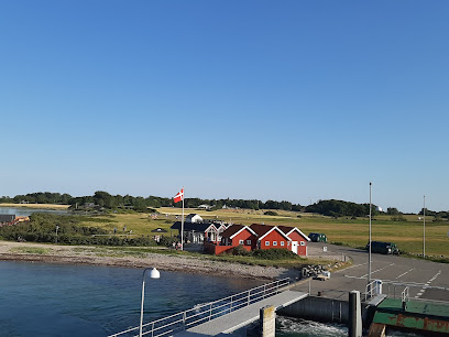
At only about 150 hectares, Bjørnø is perfectly sized for slow exploration on foot. A complete circuit of the coastline fits comfortably into a couple of hours, though many travellers stretch it over half a day, lingering where cliffs are highest or meadows widest. The terrain is mostly easy, with occasional steeper sections near the cliff tops, and almost everything is on farm tracks, village lanes or informal paths. The surrounding waters are popular for both swimming and angling. Sheltered coves and gently shelving beaches suit cautious swimmers and families, while anglers fan out along the coast in search of sea trout and other coastal species. There is no conventional harbour basin, just a jetty with limited berths, which helps keep visiting boat traffic modest and the waterfront quiet.Cafés, Camping and Island Evenings
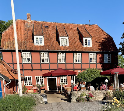
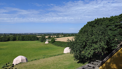
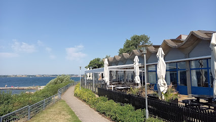
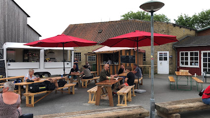
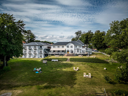
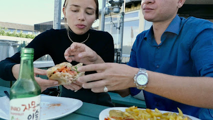
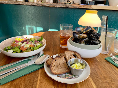
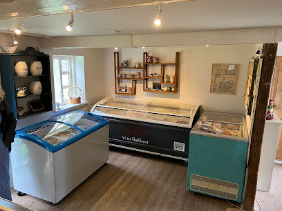
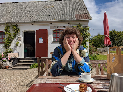
Despite its size, the island offers enough comforts for a simple overnight stay. A small café by the water operates in the warmer months, serving drinks and light meals that taste even better with the sunset glowing over Faaborg and Funen. A primitive campsite and a handful of basic accommodation options provide low‑key places to sleep, often with little more than birdsong and the faint hum of the ferry punctuating the night. Evenings on Bjørnø can feel particularly atmospheric. With limited artificial light, the sky darkens quickly, revealing a rich canopy of stars on clear nights. On windy days the sound of the sea carries far inland; on still days you may hear nothing more than cows in distant fields and the rustle of grass.Geological Stories Written in Sand and Stone
The island’s elongated shape, oriented southeast to northwest, mirrors the direction of the ice flow that formed it. Since the sea flooded the lowlands south of Funen, creating the present‑day archipelago, waves have battered Bjørnø’s coasts, shaving away cliffs and rearranging sand and gravel into spits and ridges. Holmene, the slender spit extending from the southeast corner, is a textbook example of this process: material has been swept along the shore and anchored on a series of low underwater rises, gradually building a narrow, straight tongue of land. On the northwest side, lagoons once open to the sea have been progressively sealed by beach ridges, leaving shallow, brackish lakes. Walking here, you see in miniature how wind, water and time continue to reshape the margins of the island, giving Bjørnø a dynamic character that belies its small footprint.Iconic landmarks you can’t miss
Bregninge Kirke
19.3 km
Medieval island church on a gentle Ærø hillside, where whitewashed stone, quiet fields and seafaring stories meet in a calm, contemplative setting.
Forladt skorsten
21.1 km
A haunting brick ruin marking Ærø's vanished industrial era, standing silent on the island's edge.
Hattesens Konfektfabrik Aps
21.8 km
Discover the sweet artistry of traditional Danish liquorice at Hattesens Konfektfabrik Aps in scenic Ærøskøbing.
Ærø Turist & Erhverv
21.8 km
Explore the beautiful island of Ærø with expert insights and resources from Ærø Turist & Erhverv, your local tourist information center.
Ærøfærgerne
21.8 km
Experience the scenic ferry ride to Ærø Island via Ærøfærgerne, where Danish charm meets breathtaking coastal views.
Hotel Ærøhus
21.9 km
Historic hotel in the heart of Ærøskøbing known for its authentic Danish charm, lush gardens, and local island cuisine—a perfect base for exploring Ærø.
Danish Island Weddings
22.1 km
Experience the magic of weddings on the enchanting Danish island of Ærø, where love meets scenic beauty and unforgettable memories are made.
På Torvet
22.1 km
Experience the unique charm of På Torvet in Ærøskøbing, where historic beauty meets modern comfort in the heart of Denmark.
Andelen Guesthouse
22.2 km
Discover the charm of Ærøskøbing at Andelen Guesthouse, your cozy retreat in the heart of Denmark's picturesque island.
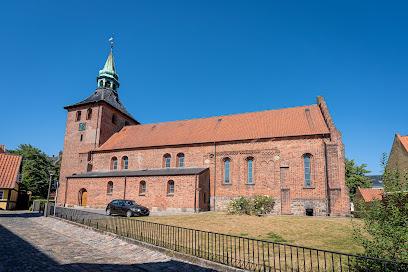
Saint Nicolai's Church
22.9 km
Svendborg’s oldest church and a quiet seafaring sanctuary, where red-brick medieval walls and a calm, whitewashed interior meet just off lively Gerritsgade.
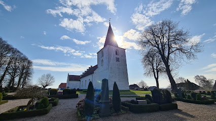
Rise Kirke
25.2 km
A quietly beautiful 12th‑century countryside church on Ærø, where whitewashed walls, historic graves and open fields tell the island’s rural and seafaring story.
Universe
28.2 km
Experience the fusion of fun and science at Universe Science Park in Nordborg, Denmark.

View Point
28.3 km
Sweeping Baltic vistas from Ærø's most scenic overlook between two charming harbors.
Marstal Havn og Marina
28.9 km
Experience the serene beauty and rich maritime heritage at Marstal Havn og Marina, a picturesque seaport in the heart of Denmark.
Monument for Danske Sømænd
28.9 km
A modest harbourfront memorial in Marstal that quietly honours generations of Danish sailors who left this island port and never returned from the sea.
Unmissable attractions to see
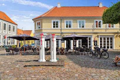
Faaborg Clock Tower
3.4 km
Freestanding medieval bell tower and symbol of Faaborg, offering narrow-stair climbs, chiming bells and wide views over the town and South Funen coast.
Øhavsmuseet
3.6 km
A sensory, barefoot museum journey in Faaborg where sound, light and touch reveal how the South Funen Archipelago’s nature has shaped human lives through the ages.
Holstenshuus
5.8 km
An elegant 18th-century rococo garden where history and horticulture meet in serene Danish countryside.
Svanninge Bjerge
7.0 km
Undulating forested hills, glacial valleys and far‑reaching views over South Funen make Svanninge Bjerge a quietly dramatic corner of the so‑called Funen Alps.
Lyø
7.0 km
Small, green and gently shaped by sea and history, Lyø is a tranquil South Funen island where half-timbered villages, soft hills and bird‑rich coasts invite slow exploration.
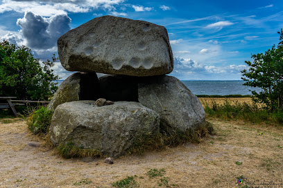
The bell stone
8.0 km
Prehistoric dolmen on a hilltop grove, where a resonant capstone, sweeping sea views and island folklore turn an ancient burial site into a quietly magical stop.
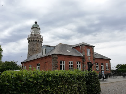
Skjoldnaes Lighthouse
10.9 km
Discover Marstal’s iconic row of colorful bathing huts, a living symbol of Ærø’s seaside heritage and Danish summer life along the Baltic shore.
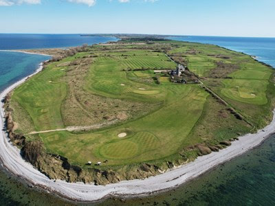
Ærø Golf Klub
10.9 km
Wind-shaped seaside golf wrapped around a working lighthouse at the northern tip of Ærø, with sea views from every hole and a cosy clubhouse in the old keeper’s house.
Trebjerg, Dronningeudsigten
12.7 km
A gentle Funen hill crowned by “the Queen’s View,” where rolling fields, wooded slopes and the South Funen Archipelago unfold in a calm, wide horizon.

Fyrtårn vestmole
13.4 km
Walk across the seabed to encounter 3,000 seals on Denmark's most dynamic tidal landscape.
Fyrtårn østmole
13.4 km
A small harbour lighthouse on Ærøskøbing’s eastern mole, Fyrtårn Østmole adds quiet maritime character and wide sea views to this fairytale Danish island port.
Jørbæk Strand
13.7 km
A tranquil Baltic beach with picnic facilities and authentic island charm on Ærø's quieter southern shore.
Gorilla Park Svendborg
15.1 km
High‑rope thrills in a South Funen beech forest, with eight treetop courses, long zip‑lines and a Big Swing blending outdoor adventure, views and shared laughs.
Ærø Museum
16.2 km
Step into Ærø’s past inside a 1775 bailiff’s house, where island history, quirky traditions and a time‑capsule garden unfold in the heart of Ærøskøbing.
Søbygård
16.2 km
Ærø’s last ducal manor, where moats, manor rooms and a geopark centre bring island history, geology and gentle countryside adventures together in one stop.
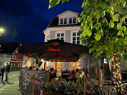
Essential places to dine
Restaurant Klinten
2.7 km
Waterfront Danish dining on Faaborg Fjord, blending fresh seafood, local produce and wide-open views of the South Funen archipelago in a relaxed, modern setting.
Avernakø Havnecafé
2.7 km
Sunlit harbour café on tiny Avernakø, serving local, seasonal dishes and seaside views just steps from the ferry and marina in the South Funen Archipelago.
Lyø Havnegrill
6.1 km
Casual harbourfront grill on tiny Lyø, serving burgers, chicken and classic Danish comfort food with sea views, salty air and a relaxed South Funen island vibe.
Crêperie Ærø
13.7 km
Authentic French crêpes in a serene Danish island harbor village.
Stella Maris
21.0 km
An intimate seaside boutique hotel on Svendborgsund, blending Nordic design, gourmet dining and tranquil garden-and-water views on the edge of South Funen.
Havnegrillen Ærøskøbing YST
21.8 km
Honest harbor grill where ferries meet food, and Danish classics taste best by the sea.
Kraut & Koala
21.8 km
Intimate harbourfront restaurant and wine bar in Ærøskøbing, marrying seasonal island produce with thoughtful European flavours in a warm, candlelit setting.
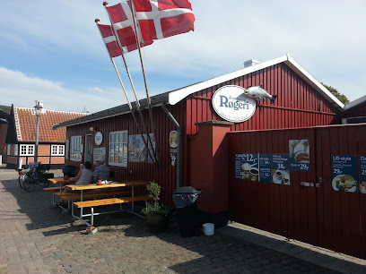
Ærøskøbing Røgeri
21.9 km
Ærø's iconic harbor smokehouse serving freshly prepared smoked fish in a relaxed waterfront setting.
Bang’s Mad & Vinbar
21.9 km
Intimate Nordic wine bar serving seasonal small plates in charming Ærøskøbing.
Landbogården
22.0 km
Ærø's oldest restaurant since 1919, where homemade Danish cuisine meets warm island hospitality.
Arnfeldt Hotel & Restaurant
22.0 km
Small, design‑driven island hotel and ambitious restaurant in the cobbled heart of Ærøskøbing, where fairytale streets meet inventive Nordic cooking.
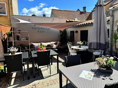
Den Hemmelige Café
22.0 km
A cosy “secret” café hidden behind a shopfront in fairytale Ærøskøbing, serving quality coffee, home-baked cakes and light lunches wrapped in pure Danish hygge.
Hotel The Monica
22.0 km
Experience personalized luxury and island charm at Hotel The Monica in Ærøskøbing.
Badehotel Harmonien
22.0 km
Historic 1850s Danish seaside hotel with Baltic views, Italian dining, and waterfront garden in charming Ærøskøbing.
Cafe På Torvet
22.1 km
Island hospitality and local flavors in Ærøskøbing's beloved main square café.
Markets, malls and hidden boutiques
Høkildegård
13.6 km
Family-run South Funen farm and country shop overlooking Syltemade Valley, where free-range animals, quality meat and gentle rural landscapes meet in one stop.
Herremark
15.1 km
A charming farm shop in a white Ærø cottage, where curated vintage finds, handmade crafts and natural products capture the quiet beauty of island life.
Fun Fyn
17.7 km
A cheerful one-stop party shop in Ringe, stocking balloons, decorations, costumes and tableware for everything from kids’ birthdays to elegant Funen celebrations.
Honninghuset
18.3 km
A cosy countryside honey house on Ærø, where local beekeeping, small-scale farm products and rural calm come together just beyond historic Ærøskøbing.
Denmark's Smallest Gallery
18.7 km
A tiny, characterful art space in the heart of Ærøskøbing, where intimate paintings and island light turn a single small room into a memorable creative stop.
Handweaving & more
19.0 km
A cosy island weaving studio near Ærøskøbing, where handloom textiles, natural fibres and Ærø-inspired colours come together in small-batch garments and scarves.
Ærø Soap Company
19.0 km
Handmade organic soaps crafted from island-grown herbs in a working workshop where visitors observe the ancient craft of soap-making.
Ærø Gårdbutik Uldgården
19.5 km
Rustic island farm shop in Bregninge, where soft wool, natural textiles and sturdy outdoor clothing fill old stables and a hayloft in the heart of Ærø.
Uldgaarden gårdbutik
19.5 km
Artisanal wool shop in a converted barn, celebrating Danish fiber craftsmanship and island heritage.
Bregninge Store Kro
20.0 km
Antique-filled country kro in the village of Øster Bregninge, where island history, rustic objects and rural Ærø atmosphere meet under one creaking roof.

Butik Stokrosen
21.8 km
Small, characterful shoe boutique in Ærøskøbing’s storybook streets, pairing practical island footwear with quietly elegant Scandinavian style.
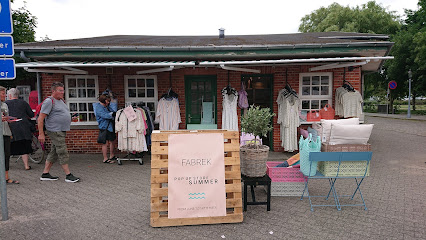
Fabrek Pop Up
21.8 km
A small harbourfront pop-up in Ærøskøbing, blending Scandinavian design, cozy homeware and thoughtful gifts in a calm, contemporary setting by the sea.
Valk Inter Collection
21.9 km
Intimate Ærøskøbing jewelry studio and gift shop crafting refined, personal pieces in gold and silver amid the cobbled charm of historic Vestergade.
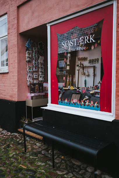
Søstærk Print & Papir
21.9 km
A tiny Ærøskøbing shop devoted to hand-printed stationery, fine pens and the quiet pleasure of handwritten letters and traditional craftsmanship.
Gyden 13
22.0 km
A cosy fashion accessories hideaway on a cobbled lane in Ærøskøbing, where retro-inspired pieces and Danish simplicity meet island charm and slow travel.
Essential bars & hidden hideouts
Rådhuskælderen
14.3 km
Cosy cellar bar in Søby’s former town hall, offering simple drinks, local atmosphere and a low‑key glimpse of everyday life on the island of Ærø.
Kompasset
15.9 km
Cozy village bar on South Funen offering Danish hygge, local drinks, and an authentic small-town atmosphere along the main road through Vester Skerninge.

Skrumpklunk Institute
21.2 km
An unfussy neighbourhood bar with a quirky name, Skrumpklunk Institute offers laid-back drinks, local colour and easygoing evenings in everyday Svendborg.

Arrebo
21.8 km
Island pub where locals and visitors gather for live music, cold drinks, and authentic Ærø atmosphere.
Tingvalla 2013 ApS
22.0 km
Electric nightlife and quality drinks in the heart of Svendborg's vibrant social scene.
HANSTED
22.6 km
Cozy neighborhood bar and intimate live stage bringing late-night music, craft drinks, and local Svendborg atmosphere together on lively Vestergade.
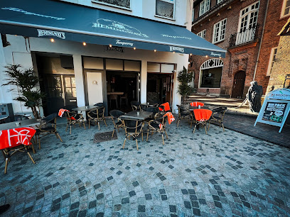
Hemingway's Svendborg
23.0 km
Late-night Nordic bar in historic Svendborg's medieval heart, open weekends until dawn.
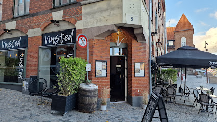
Vinsted
23.0 km
Intimate Svendborg wine bar with shelves of bottles, simple seasonal plates and a warm, candlelit atmosphere on historic Klosterplads.
Trier's Corner
23.0 km
Intimate non-smoking bar on Svendborg’s Klosterplads, serving specialty beers, wine, cocktails and coffee in a warm, Scandinavian-inspired atmosphere.
Rasmus
23.0 km
Intimate live music, specialty beers and a relaxed, bohemian bar atmosphere in the heart of Svendborg’s old town.
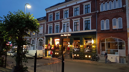
Den Høje Stue
23.0 km
Cosy, inexpensive neighbourhood bar in central Svendborg, blending daytime calm with intimate, pub-style evenings in a warm, unpretentious setting.
Kahytten Svendborg
23.1 km
Dimly lit, smoky and disarmingly honest, Kahytten is Svendborg’s cabin-like pub where cheap beers, local regulars and harbor-town character meet under one low ceiling.
Loftet
23.1 km
Late-opening neighborhood bar in central Svendborg, blending pool, darts and affordable drinks with an easygoing, social atmosphere into the small hours.
The Drunken Sailor
23.1 km
Cozy nautical pub in Svendborg’s harbor quarter, pouring affordable drinks, hearty Danish tartlets and a generous measure of maritime atmosphere late into the night.
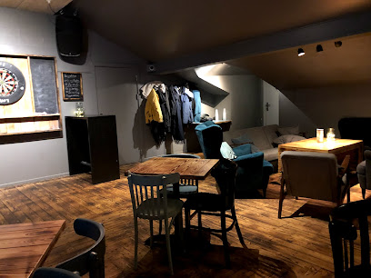
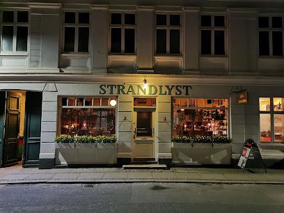
Strandlyst Svendborg ApS
23.1 km
Cozy, maritime-flavored bar in central Svendborg, known for its spirits, live music nights and intimate courtyard that comes alive on long summer evenings.
Nightclubs & after hour spots
Crazy Daisy Svendborg
23.1 km
Compact, high-energy weekend nightclub in central Svendborg, serving mainstream beats, drinks and a sociable dance floor until the early hours.
Ommel
26.1 km
A small, sociable island nightspot near Marstal where locals and travelers share quiet drinks, simple music and the easygoing charm of Ærø after dark.
Old Danish Pub
34.1 km
Central Sønderborg institution blending classic Danish pub ambiance, affordable drinks, and lively atmosphere—perfect for experiencing Southern Denmark’s warmth and social life.

Kaizen ApS
34.3 km
Compact disco-style nightclub in central Sønderborg, pulsing with late-night beats, colourful lights and a straightforward bar for an unpretentious night out.
Dance Odense, Funen Square Dance Club
35.6 km
Community-driven square dancing in a cozy Odense neighborhood hall, where callers, patterns and shared rhythm turn an ordinary evening into a friendly social event.
Dance All Over
37.0 km
Sønderborg’s sociable dance hub, where fitness, swing and party-ready moves come together in energetic, community-driven classes across the city.
Carlsens Kvarter
37.4 km
Atmospheric pub in Odense C, offering unmatched hygge, an impressive selection of craft beers, and a welcoming local vibe in a characterful historic setting.
Heidi's Bier Bar Odense
37.7 km
Dance on tables, drink large beers, and celebrate Alpine-style year-round in Odense's most uninhibited nightclub.
Den Brølende And
37.8 km
Experience the heart of Odense's nightlife at Den Brølende And, where music, dance, and camaraderie come alive.
Dansebar Odense
37.9 km
Lively central Odense nightclub with mainstream hits, colorful lights and a sociable dance floor vibe from late evening into the early hours.
Grand Bar & Lounge
38.0 km
Experience timeless elegance and expertly crafted cocktails at Odense's Grand Bar & Lounge, nestled within the historic First Hotel Grand.
The slaughterhouse Nightclub & Eventhus
38.1 km
Experience industrial-cool nights, live music, and eclectic parties at The Slaughterhouse Nightclub & Eventhus, Odense’s dynamic hub for nightlife and contemporary culture.
Boogie Dance Café
38.1 km
Odense's oldest disco where retro charm meets genuine community dancing.
BUTCHERS Odense
38.2 km
High-energy nightclub on Odense’s Overgade, mixing pounding bass, lights and late-night drinks in a central old-town setting steps from major sights.
The Flower and the Bee
38.2 km
Odense's vibrant weekend dance bar where the city comes alive after dark.

For the vibe & atmosphere seeker
- Tranquil
- Relaxing
- Scenic
- Unique
- Casual
For the design and aesthetic lover
- Rustic Designs
For the architecture buff
- Parks & Gardens
- Viewpoints
- Heritage Neighborhoods
- Landmarks
For the view chaser and sunset hunter
- Iconic Views
- Panoramas
- Sunset Spots
- Stargazing
- Waterfront
For the social media creator & influencer
- Photo Spots
- Selfie Spots
- Reel-Friendly
- Architectural Shots
- Instagrammable
For the eco-conscious traveler
- Low Impact
- Public-Transport Accessible
- Wildlife Habitat
- Leave-No-Trace Critical
- Locally Managed
For the kind of experience you’re after
- Nature Escape
- Photowalk
- Adventure Photo Shoot
- Day Trip
- Roadtrip Stop
- Mindfulness
For how adventurous you want the journey to be
- Easy Access
Location Audience
- Family Friendly
- Senior Friendly
- Child Friendly
- Teen Friendly
- Solo Friendly
- Couple Friendly
- Solo Female Friendly
- Vegetarian Friendly
- Vegan Friendly


