Background

Mount Lamlam: Guam's Highest Peak

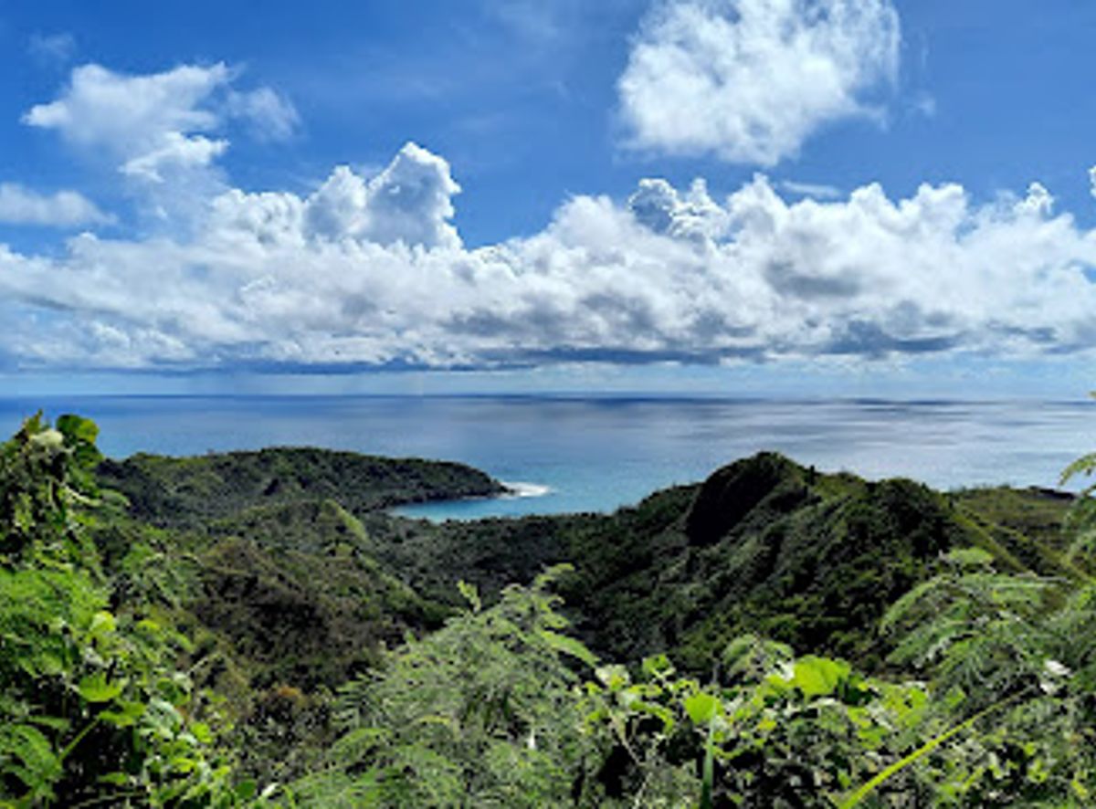
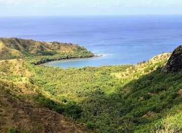
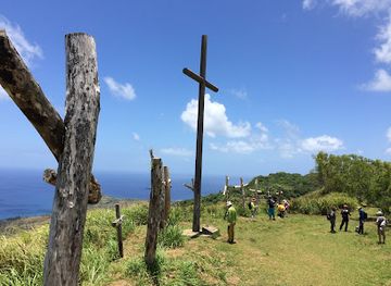
Hike Guam's highest point, Mount Lamlam, for breathtaking views and a glimpse into the island's unique natural and cultural history.

★★★★★4.6 (26)

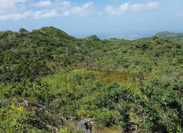
Hike to the summit of Mount Lamlam, Guam's highest peak, for panoramic views and a connection to the island's rich history and culture. The 3.5-mile round trip offers a moderate challenge with rewarding vistas.

Plan your visit

A brief summary to Mount Lamlam Trail Head

Opening times, essentials, and a few local tips gathered into one calmer, easier-to-scan planning section.

Plan your visit

📍
8MG8+9M2, Humåtak, GU

Explore places near Mount Lamlam Trail Head

    See all →

    Unlock the Best of Mount Lamlam Trail Head

    Find tickets, tours with entry, and experiences available for this location.

    Buy tickets

    No tickets available

    Book tours with entry

    No tours with entry available

    Book tours without entry

    No tours without entry available

    Getting There

    Driving

    From Tumon Bay, take Marine Corps Drive (Route 1) south. You'll be forced to turn left before the Navy base, leading you onto Route 2A, then Route 2. Continue through Agat. About 3 miles past Agat, look for a red wall on the right side of the road where you can park. The Mount Lamlam trailhead is across the street on the left, marked by a small green sign. If you reach Umatac, you've gone too far. Parking is free at the Cetti Bay Overlook across from the trailhead.

    Public Transport

    While limited, public transportation to the Mount Lamlam Trailhead is possible. Take a bus from the Guam Regional Transit Authority (GRTA) to the nearest stop on Route 1. From there, it's approximately a 30-minute walk to the trailhead. A one-way bus fare is $1.00, or a day pass is $3.00. Check the GRTA website for schedules, as they may vary.

    Taxi/Rideshare

    Taxis and rideshares are readily available in Guam. A taxi from the Guam airport to Humåtak could cost between $50-$60. From Tumon Bay, expect to pay approximately $40-$50 for a taxi or rideshare to the Mount Lamlam Trailhead. Confirm the fare with the driver before starting your journey. Taxi services can be found at the airport and in major tourist areas.

    Local tips

    Hike during the dry season (December to April) for more comfortable temperatures and less chance of rain.
    Bring plenty of water and sunscreen, as the trail offers little shade.
    Wear sturdy hiking shoes, as the trail can be steep and slippery in places.
    Consider wearing long pants and sleeves to protect against sawgrass.

    Discover more about Mount Lamlam Trail Head

    Mount Lamlam, meaning "lightning" in the Chamorro language, is more than just a mountain; it's a symbol of Guam's natural beauty and cultural heritage. Rising 1,332 feet (406 meters) above sea level near Agat village, this peak offers stunning 360-degree views of the island's southern terrain and coastline. What makes Mount Lamlam truly unique is its connection to the Mariana Trench, the deepest part of the ocean. Measured from its base in the Challenger Deep, Mount Lamlam is considered by some to be the world's tallest mountain. The Mount Lamlam Trail is a 3.5-mile round trip that provides a moderate hiking experience. The trail winds through diverse landscapes, including open areas with views, patches of jungle, and meadows of sawgrass. The final ascent to the summit involves navigating rocky terrain. At the peak, you'll find a concrete platform with a survey marker and flags of Guam and the United States. Mount Lamlam holds spiritual significance for the Chamorro people, who believe it serves as a bridge to the heavens. The mountain's name reflects the reverence with which it has been regarded for generations. Every year, local Catholics participate in an Easter pilgrimage, carrying crosses to the nearby Mount Jumullong Manglo, a tradition that intertwines indigenous beliefs with Catholic faith. The trailhead is located across from the Cetti Bay Overlook.
    Mobile App
    Get the app

    Your all‑in‑one travel companion app

    Explore expert travel guides, compare and book tours, experiences, hotels, and more—all from the palm of your hand. Download now for seamless trip planning wherever your wanderlust takes you.

    File:Fort Nuestra Señora de la Soledåd - Umatac, Guam - DSC00947.JPG -  Wikimedia Commons

    More about Umatac Bay

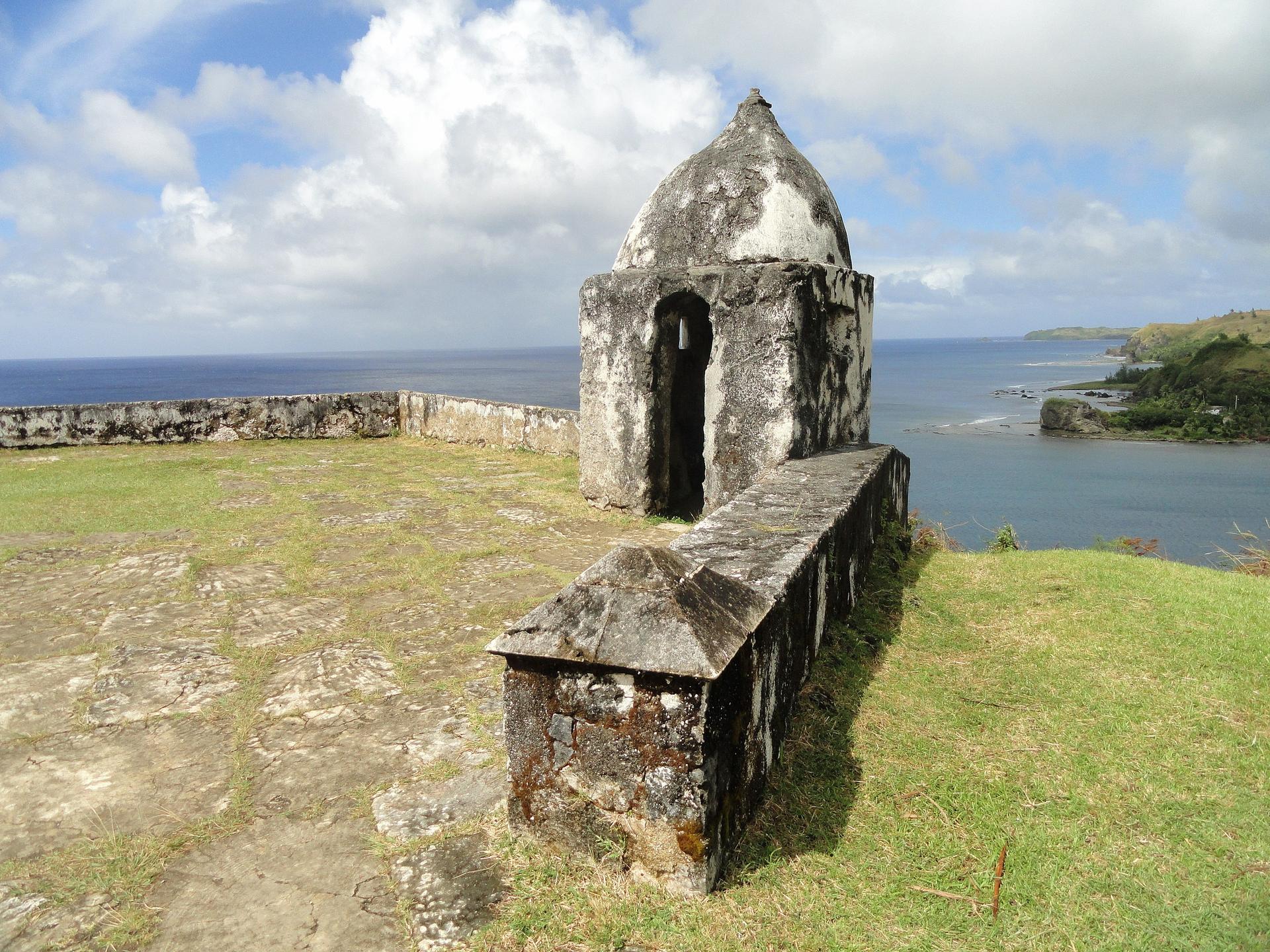
    Discover Umatac Bay in Guam: A blend of historical significance, natural beauty, and cultural richness on the island's southwestern coast.

    Tell me more about Umatac Bay

    Select Currency

    Choose the currency you want prices to display in.