

Free Cserehát Travel Guide & Mobile App
Explore Cserehát with free travel guides. Discover regional history, expert tips, proposed trips, and audio guides on web or mobile app.


Cserehát offers wooded hills, traditional villages, quiet reservoirs and slow rural journeys in north-eastern Hungary between the Hernád and Bódva valleys.
Read more about Cserehát
When is the best time to visit Cserehát?
Best: May–June, September · 22–25°C| Month | High (°C) | Rainfall (mm) |
|---|---|---|
| January | 4 | 30 |
| February | 7 | 30 |
| March | 12 | 40 |
| April | 17 | 50 |
| May (best) | 23 | 60 |
| June (best) | 25 | 70 |
| July | 28 | 70 |
| August | 27 | 70 |
| September (best) | 22 | 60 |
| October | 16 | 50 |
| November | 8 | 40 |
| December | 4 | 30 |
Getting to and around Cserehát
How to get there
Transportation
Top city travel guides in Cserehát
The cities of Cserehát, and the easiest places to base yourself.

Swipe for more cities
Destinations in Cserehát
Resorts, valleys and scenic spots worth a trip of their own.
-

-

-


Swipe for more destinations
Best attractions in Cserehát
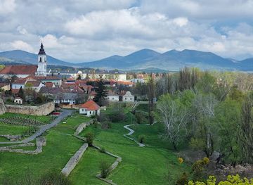
Cserehát’s attractions are primarily landscape-based and cultural rather than built around large visitor complexes. Quiet roads and footpaths lead through wooded ridges, meadows and traditional villages, with the Rakaca Reservoir providing one of the area’s most recognisable waterside settings. The reservoir is suited to peaceful recreation and landscape viewing rather than intensive resort tourism. Small village churches, historic cemeteries and surviving vernacular houses reward visitors who travel slowly and research opening arrangements locally. The surrounding Bódva valley adds access to historic settlements and the distinctive Edelény Castle, which stands near the southern edge of the wider Cserehát area and is best treated as a nearby regional excursion rather than a typical upland attraction. Birdwatching, nature observation, walking and cycling are particularly appropriate activities, although routes should be planned because facilities are sparse. Nearby towns such as Szendrő and Edelény provide museums, historic buildings and practical services, while the internationally known Aggtelek landscape lies beyond Cserehát and should not be confused with the region itself. The appeal is the combination of open agricultural land, forest margins, old churches and a low-density countryside where the journey between places is part of the experience.
-
National park
Bükki National Park
Explore Bükk National Park: A natural haven of breathtaking landscapes, rich biodiversity, and thrilling outdoor adventures in Hungary.
-
Tourist attraction
Fátyol-vízesés
Discover the captivating beauty of Fátyol-vízesés Waterfall in Szilvásvárad, a serene retreat for nature lovers and adventure seekers.
-
Museum
Diósgyőr Castle
Explore the enchanting Diósgyőr Castle in Miskolc, Hungary, where rich history meets stunning architecture amidst beautiful natural scenery.
-
Theme park
Zemplén Adventure Park
Experience the thrill of adventure amidst stunning landscapes at Zemplén Adventure Park, the ultimate family-friendly destination in Hungary.


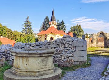

Best landmarks in Cserehát
-
Thermal baths
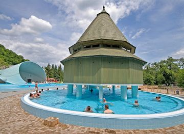
Miskolctapolca Cave Bath
Discover the magical Miskolctapolca Cave Bath, where thermal waters meet stunning cave formations in a relaxing paradise.
-
Tourist attraction
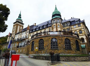
Szinva waterfall
Discover the breathtaking Szinva Waterfall in Lillafüred, Hungary, where nature's beauty meets adventure and tranquility in a stunning landscape.
-
Museum
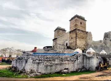
Diósgyőr Castle
Explore the enchanting Diósgyőr Castle in Miskolc, Hungary, where history and beauty intertwine for a memorable experience.
-
Castle
Castle of Sárospatak
Uncover the rich history and stunning architecture of the Castle of Sárospatak, a remarkable tourist attraction in Hungary's scenic landscape.
Explore Cserehát on the map
Plan your trip on one map. See where the top cities, national parks and sights are, and book hotels and experiences in a few clicks.
Best hotels in Cserehát
Best restaurants in Cserehát
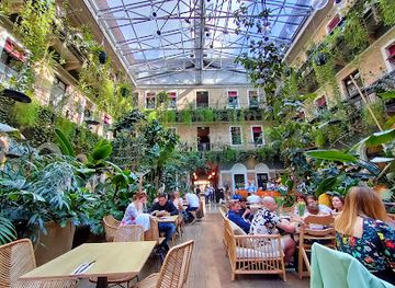
Dining in Cserehát is chiefly found in village guesthouses, small eateries, cafés and traditional restaurants in the surrounding valley towns rather than in a concentrated regional food district. Meals reflect the broader cuisine of northern Hungary: soups, stews, potatoes, seasonal vegetables, pork, poultry, freshwater fish and home-style baked dishes are more likely than elaborate tasting menus. Local gardens and small farms may supply fruit, preserves, honey and eggs, while cooking traditions vary from one household and community to another. In larger nearby settlements, visitors can expect Hungarian grill dishes, bakery goods, cakes and familiar national specialities. Markets and farm-gate sales, when operating, can be useful for fruit, vegetables, honey and preserves, but availability is seasonal and not every village has a regular market. It is sensible to buy provisions before heading into the hills, especially for walking days. Regional wines from other parts of northern Hungary may appear on menus, but Cserehát itself is better understood as a rural food landscape than as a narrowly defined wine or restaurant destination.
-
Mediterranean
Mazel Tov
Discover Mazel Tov in Budapest - an exquisite Mediterranean dining experience blending vibrant atmosphere with authentic flavors.
-
Hungarian
Menza Étterem és Kávéház
Experience the vibrant taste of Hungary at Menza Étterem és Kávéház, where tradition meets modernity in every dish.
-
Restaurant
Twentysix Budapest
Experience exquisite Mediterranean cuisine at Twentysix Budapest – where flavor meets stunning ambiance in the heart of Hungary.
-
Restaurant
Sir Lancelot Medieval Restaurant
Immerse yourself in history while savoring delectable Eastern European cuisine at Budapest's unique Sir Lancelot Medieval Restaurant.



Best bars in Cserehát
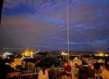
Nightlife in Cserehát is modest and closely tied to village life, local restaurants and the larger settlements around the Bódva and Hernád valleys. Traditional pubs and small cafés are the most typical evening venues, often serving beer, soft drinks and simple snacks rather than operating as late-night clubs. In market towns such as Edelény or Szendrő, visitors may find a broader choice of restaurants, bars and occasional live music, while the upland villages generally become quiet after evening hours. Seasonal village celebrations, community events and cultural programmes can provide more social activity, but dates and arrangements change from year to year. Travellers staying in guesthouses may find that the evening experience centres on a home-cooked meal, conversation and the rural surroundings rather than organised entertainment. Anyone planning a late return should arrange transport in advance, as taxis and public services are less readily available in remote villages.
-
Pub
Szimpla Kert
Discover Szimpla Kert, Budapest's iconic ruin bar, where eclectic decor meets vibrant nightlife and cultural events in a unique setting.
-
Bar
Instant-Fogas Complex
Discover Budapest's nightlife at Instant-Fogas Complex, where vibrant atmosphere, cool music, and delicious drinks create unforgettable moments.
-
Bar
360 Bar
Discover breathtaking views and vibrant nightlife at 360 Bar in Budapest, where every cocktail comes with a side of stunning skyline.
-
Cocktail bar
Rumpus Tiki Bar
Experience the exotic atmosphere and creative cocktails at Rumpus Tiki Bar, Budapest's tropical escape in the heart of the city.



Best nightclubs in Cserehát
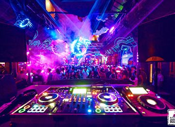
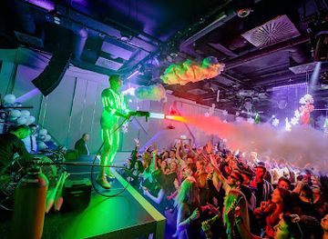
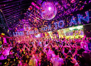
Nightlife in Cserehát is modest and closely tied to village life, local restaurants and the larger settlements around the Bódva and Hernád valleys. Traditional pubs and small cafés are the most typical evening venues, often serving beer, soft drinks and simple snacks rather than operating as late-night clubs. In market towns such as Edelény or Szendrő, visitors may find a broader choice of restaurants, bars and occasional live music, while the upland villages generally become quiet after evening hours. Seasonal village celebrations, community events and cultural programmes can provide more social activity, but dates and arrangements change from year to year. Travellers staying in guesthouses may find that the evening experience centres on a home-cooked meal, conversation and the rural surroundings rather than organised entertainment. Anyone planning a late return should arrange transport in advance, as taxis and public services are less readily available in remote villages.
-
Night club
Instant-Fogas Complex
Discover Budapest's nightlife at Instant-Fogas Complex, where music, drinks, and unforgettable memories come together in a vibrant atmosphere.
-
Night club
Club Heaven Budapest
Discover the electrifying nightlife of Budapest at Club Heaven, where music, dance, and unforgettable experiences come together.
-
Night club
Ötkert
Experience Budapest's vibrant nightlife at Ötkert, a premier night club featuring electrifying music, crafted cocktails, and a lively atmosphere.
-
Night club
Peaches And Cream Club
Experience the vibrant nightlife of Budapest at Peaches And Cream Club, where electrifying music and stylish decor create unforgettable nights.

Best shops in Cserehát
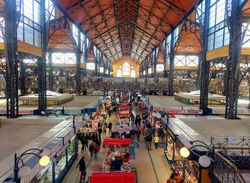
Shopping in Cserehát is practical and small-scale, with the strongest choice found in nearby market towns rather than in dedicated tourist retail districts. Village shops can provide essentials, but opening arrangements and stock vary, so visitors planning walks should buy food and water before entering the uplands. Edelény, Szendrő and Szikszó offer more substantial high-street services, bakeries and everyday shopping, while local markets and seasonal stalls may provide fruit, vegetables, honey, preserves and other farm products. Rural guesthouses sometimes sell homemade goods, although availability depends on the individual host and season. Suitable regional purchases include Hungarian paprika, honey, jams, baked items and locally produced spirits where legally sold and properly labelled. Craft and antique shopping is limited compared with established tourist towns elsewhere in Hungary, but old furniture, ceramics and vernacular objects may appear in specialist or second-hand shops in the larger settlements. Ask before photographing or buying items that appear historic, and distinguish genuine local produce from souvenirs manufactured elsewhere.
-
Traditional market
Central Market Hall
Experience the essence of Budapest at Central Market Hall, a vibrant market filled with local produce, delicious cuisine, and rich culture.
-
Shopping mall
Westend
Explore Westend, Budapest's vibrant shopping mall with a perfect blend of local and international brands, dining, and entertainment options.
-
Shopping mall
Allee Mall
Discover Allee Mall in Budapest: a vibrant shopping center with diverse shops, delicious dining, and endless entertainment options for every traveler.
-
Shopping mall
Mammut
Discover Mammut, Budapest's premier shopping mall with a diverse array of shops, dining options, and entertainment for an unforgettable experience.


Get your free copy of our complete guide to Cserehát, delivered straight to you.
Everything on this page, from attractions and restaurants to essentials and local phrases, in one PDF you can read offline, print or share.
Already have an account? Sign in
Your Cserehát guide is ready.
We'll send it to · Not you? Sign out

Getting your guide ready…
We are putting together a fresh copy of the Cserehát guide. This can take up to a minute.
This can take a few moments. If your browser asks, choose Allow so the download can start. You'll find the guide in your Downloads folder.
Nothing happened? Download it again
Sorry, the guide is taking longer than usual. Please try again in a minute, or get it by email instead.
Cserehát essentials
Currency and Payment
Safety
Emergency Situations
Do's and Don'ts
Local Tips
From Eve
Local phrases worth knowing
You don't need to get them perfect. A few words go a long way, and locals appreciate the effort.
Basics
| English | Local | Say it |
|---|---|---|
| Hello | Helló | [heh-loh] |
| Goodbye | Viszlát | [vees-laht] |
| Yes | Igen | [ee-gen] |
| No | Nem | [nem] |
| Please/You're welcome | Kérem | [keh-rem] |
| Thank you | Köszönöm | [kuh-suh-nuhm] |
| Excuse me/Sorry | Elnézést | [el-neh-zest] |
| How are you? | Hogy vagy? | [hodj vahd] |
| Fine. And you? | Jól. És te? | [yohl. es teh] |
| Do you speak English? | Beszélsz angolul? | [beh-sehlz ahn-goh-lool] |
| I don't understand | Nem értem | [nem air-tem] |
Eating & Drinking
| English | Local | Say it |
|---|---|---|
| I'd like to see the menu, please | Szeretném megnézni az étlapot, kérem | [seh-reht-nehm mehg-nehz-nee ahz eh-tlah-poh-t, keh-rem] |
| I don't eat meat | Nem eszem húst | [nem eh-sehm hoosht] |
| Cheers! | Egészségedre! | [eh-gehs-sheh-ged-reh] |
| I would like to pay, please | Szeretném kifizetni, kérem | [seh-reht-nehm kee-fee-zet-nee, keh-rem] |
Emergencies
| English | Local | Say it |
|---|---|---|
| Help! | Segítség! | [seh-geet-shehg] |
| Go away! | Menj el! | [menj el] |
| Call the Police! | Hívd a rendőrséget! | [heevd ah ren-door-sheh-get] |
| Call a doctor! | Hívd az orvost! | [heevd ahz or-vosht] |
| I'm lost | Elvesztem | [el-ves-tem] |
| I'm ill | Beteg vagyok | [beh-tehg vah-dyok] |
Shopping
| English | Local | Say it |
|---|---|---|
| I'd like to buy... | Szeretnék venni... | [seh-reht-nek veh-nee] |
| I'm just looking | Csak nézelődöm | [chahk nay-zeh-loh-dohm] |
| How much is it? | Mennyibe kerül? | [men-yee-beh keh-rool] |
| That's too expensive | Ez túl drága | [ehz tool drah-gah] |
| Can you lower the price? | Le tudnád csökkenteni az árat? | [leh tood-nahd choh-kken-teh-nee ahz ah-raht] |
Time & Numbers
| English | Local | Say it |
|---|---|---|
| What time is it? | Hány óra van? | [hahn-ee oh-rah vahn] |
| It's one o'clock | Egy óra van | [ehdj oh-rah vahn] |
| Half past (10) | Fél (10) múlva | [fehl (ten) moohl-vah] |
| Morning | Reggel | [reh-gel] |
| Afternoon | Délután | [day-loo-tahn] |
| Evening | Este | [esh-teh] |
| Yesterday | Tegnap | [teh-nahp] |
| Today | Ma | [mah] |
| Tomorrow | Holnap | [hol-nahp] |
| 1 | 1 | [e-gy] |
| 2 | 2 | [kettő] |
| 3 | 3 | [három] |
| 4 | 4 | [négy] |
| 5 | 5 | [öt] |
| 6 | 6 | [hat] |
| 7 | 7 | [hét] |
| 8 | 8 | [nyolc] |
| 9 | 9 | [kilenc] |
| 10 | 10 | [tíz] |
Transport & Directions
| English | Local | Say it |
|---|---|---|
| Where's a/the...? | Hol van a...? | [hol vahn ah] |
| What's the address? | Mi a cím? | [mee ah teem] |
| Can you show me (on the map)? | Meg tudnád mutatni (a térképen)? | [mehg tood-nahd moo-taht-nee (ah tair-kay-pen)] |
| When's the next (bus)? | Mikor jön a következő (busz)? | [mee-kor yohn ah keh-vet-keh-zoe (booz)] |
| A ticket (to ....) | Egy jegy (a ....) | [ehd-y yehd (ah ....)] |
History of Cserehát
Prehistoric Settlement and the Northern Uplands
The hills and valleys of Cserehát have been used since prehistoric times, when woodland, pasture and reliable watercourses supported seasonal movement and settlement. Archaeological traces in the wider Bódva and Hernád region show that communities repeatedly adapted to the area’s ridge-and-valley geography. The landscape was never an empty wilderness: cultivation, grazing and woodland management gradually created the mixture of open fields and forest that travellers see today. Much of the early evidence is dispersed rather than concentrated in a single monumental site, making the region’s historical importance closely connected to its wider northern Hungarian setting.
Medieval Villages and Estate Organisation
During the medieval period, settlements developed along the valleys and around routes linking northern Hungary with the lowlands. Land was divided among noble families, ecclesiastical institutions and royal estates, while village churches became important markers of local identity. Many Cserehát communities remained agricultural and relatively small, with inhabitants cultivating grain, keeping livestock and using surrounding woodland. The survival of old church sites, village layouts and place names preserves elements of this medieval settlement pattern, even where later rebuilding has altered the visible architecture.
The Ottoman Frontier and Repeated Disruption
Cserehát lay beyond the principal Ottoman occupation zone, but the sixteenth and seventeenth centuries still brought insecurity to north-eastern Hungary. Military movement, taxation, raids and the weakening of local estates affected settlements across the Bódva and Hernád hinterlands. Villages faced population losses and economic disruption, while fortified places and market centres in the surrounding region acquired greater importance. The period did not erase local communities, but it contributed to cycles of depopulation, resettlement and rebuilding that shaped the appearance of many northern Hungarian villages.
Reformation and Village Church Traditions
The Reformation gained a strong foothold in much of north-eastern Hungary, and Protestant congregations became influential in several Cserehát communities. Reformed village churches, often modest in scale, served not only as places of worship but also as centres of literacy and communal life. Catholic and Greek Catholic traditions also remained important in the broader region, reflecting the cultural variety of historic Upper Hungary. Church interiors, tower forms and cemeteries can therefore offer useful clues to the religious and social history of individual villages.
Agrarian Society and Rural Change
For centuries, Cserehát’s economy rested on small-scale agriculture, animal husbandry, forestry and local exchange. The upland terrain limited large-scale farming and encouraged a dispersed pattern of holdings, orchards, meadows and common resources. In the nineteenth century, administrative reforms, improved roads and closer links with market towns gradually changed rural life, although the region remained less industrialised than the nearby mining and manufacturing districts. Traditional buildings and field patterns still reflect this agrarian past, even where mechanisation and land consolidation have altered everyday work.
Twentieth-Century Depopulation and a New Rural Identity
The twentieth century brought major social change. Industrial employment in neighbouring towns and cities drew younger residents away from the hills, while collectivisation and later economic restructuring transformed agriculture. Several villages faced population decline, ageing and the loss of local services. Since the late twentieth century, Cserehát has increasingly been valued for its quiet landscapes, traditional settlements and proximity to northern Hungary’s protected and historic areas. New rural initiatives, nature-based travel and heritage interest now sit alongside the region’s continuing demographic challenges.
Cserehát in Photos
Browse through our photo collection highlighting the charm and character of the destination.
Neighbouring regions of Cserehát
The closest regions to Cserehát, if you have time for more than one.
-

-

-

-

-


Swipe for more regions
Explore more

Explore more of Hungary
Discover Hungary: A land of historic cities, scenic landscapes, thermal baths, and rich culinary traditions in the heart of Europe.
Explore Hungary