

Fürstensteig Travel Guide - Free Web & App
Your ultimate guide to Fürstensteig. Discover top landmarks, proposed trips, and local tips. Free on the web or via the Evendo companion app.


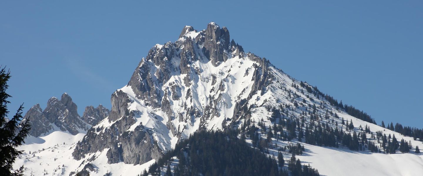


Fürstensteig in Liechtenstein is a dramatic alpine trail above Gaflei, offering exposed limestone paths, mountain panoramas and access to the Rätikon.
A Narrow Route Above the Rhine Valley
Fürstensteig is one of Liechtenstein’s best-known mountain paths, a high-level route cut into the limestone slopes above the Rhine Valley. It begins near Gaflei, in the municipality of Triesenberg, and traverses steep alpine terrain towards the Alpspitz area, with connections to the wider Rätikon mountain landscape. The path is celebrated for its exposed character: sections cross rocky ledges and traverse open slopes where the views extend across Liechtenstein, the Swiss Alps and, on clear days, towards Austria and the distant peaks beyond the Rhine Valley. Its name, meaning ‘Prince’s Path’, reflects its association with Liechtenstein’s princely heritage rather than a formal urban landmark.Read more about Fürstensteig
Mountain Scenery and Walking Character
Gaflei and the Wider Region
When is the best time to visit Fürstensteig?
Best: June–August · 23–25°C| Month | High (°C) | Rainfall (mm) |
|---|---|---|
| January | 3 | 50 |
| February | 4 | 40 |
| March | 7 | 40 |
| April | 12 | 45 |
| May | 18 | 60 |
| June (best) | 23 | 70 |
| July (best) | 25 | 70 |
| August (best) | 24 | 60 |
| September | 20 | 60 |
| October | 14 | 60 |
| November | 9 | 50 |
| December | 5 | 50 |
Getting to and around Fürstensteig
How to get there
Transportation
Best attractions in Fürstensteig
The principal attraction is Fürstensteig itself, a narrow high-level path traversing the limestone mountains above Gaflei and opening towards the Rhine Valley, Liechtenstein’s western lowlands and the surrounding Alps. Its engineered ledges and rocky passages give the walk a distinctly alpine character, while the nearby Alpspitz and Drei Schwestern area provides further marked mountain routes for experienced hikers. Gaflei is the natural starting point and a quiet mountain settlement rather than a large resort. Triesenberg, reached lower on the mountainside, adds cultural interest through its Walser heritage and scattered hillside villages. The views towards Switzerland and Austria depend strongly on weather and visibility, while the vegetation changes from managed pasture to exposed high-mountain terrain as the route gains height. There are no substantial visitor attractions or service complexes along the path itself, so the landscape, route engineering and panoramic setting are the reason to come.
-
Tourist attraction
Heididorf
Step into Heidi's world in Maienfeld: An immersive journey through the classic Swiss story and stunning Alpine scenery.
-
Tourist attraction
Burg Gutenberg
Explore Gutenberg Castle in Balzers, Liechtenstein: a medieval fortress with stunning views, rich history, and cultural events.
-
Bridge
Alte Rheinbrücke
Walk or cycle across the historic Alte Rheinbrücke, a charming wooden bridge connecting Switzerland and Liechtenstein with scenic Rhine River views.
-
Tourist attraction
Obere Burg
Explore the ruins of Obere Burg in Schellenberg, Liechtenstein, for a free and fascinating journey into the country's medieval past.


Best landmarks in Fürstensteig
Fürstensteig is the defining man-made landmark of the area: its name, alpine engineering and narrow limestone traverses preserve the character of a late-nineteenth-century mountain route. The surrounding limestone ridges and the Alpspitz are the principal natural landmarks, rising above the Rhine Valley and forming part of the Rätikon landscape. The nearby Drei Schwestern peaks give the wider mountain network its most recognisable silhouette, although routes towards them should be treated as separate alpine walks. Gaflei marks the route’s principal approach, while Triesenberg’s hillside settlements represent the cultural landscape below the high path. Together, the trail, rocky ridges, alpine pastures and long views towards Switzerland and Austria explain the area’s importance as both a national symbol and a mountain destination.
-
Castle
Vaduz Castle
Experience the grandeur of Vaduz Castle, a historic gem in Liechtenstein offering stunning views and rich cultural heritage.
-
Catholic cathedral
Kathedrale St. Florin
Explore the breathtaking Kathedrale St. Florin in Vaduz, a stunning example of neo-Gothic architecture and a serene place for reflection and worship.
-
Tourist information center
Liechtenstein Center
Explore the heart of Liechtenstein at the Liechtenstein Center, your gateway to discovering the beauty and culture of this unique principality.
-
Bridge
Alte Rheinbrücke
Explore the Alte Rheinbrücke, a stunning bridge connecting Switzerland and Liechtenstein, offering breathtaking views and rich history.


Explore Fürstensteig on the map
Plan your trip on one map. See where the top attractions, landmarks, restaurants and hotels are, and book hotels and experiences in a few clicks.
Best hotels in Fürstensteig
Best restaurants in Fürstensteig
Fürstensteig has no restaurant or café on the mountain path, so walkers should eat before departure or carry provisions. The nearest dependable dining choices are found in Triesenberg, Gaflei and the wider Vaduz area, where menus may include Swiss and Liechtenstein specialities, seasonal alpine produce and straightforward dishes suited to a mountain region. Traditional inns and restaurants in the surrounding settlements are the most natural places to look for regional food, while Vaduz and nearby valley towns offer a broader selection of cafés and restaurants. Local products associated with Liechtenstein include wines from the Rhine Valley, mountain cheese and other farm-based foods, although availability varies by establishment. A packed lunch is the practical choice for the trail, and visitors should not assume that a remote mountain stop will provide food, water or card facilities.
-
Restaurant
New Castle
Experience the best of Liechtenstein's culinary scene at New Castle in Vaduz - where authentic flavors meet cozy ambiance.
-
Restaurant
Berggasthaus Masescha
Discover authentic local cuisine and breathtaking alpine views at Berggasthaus Masescha in Triesenberg, Liechtenstein.
-
Brasserie
Brasserie Burg
Discover Brasserie Burg in Vaduz: A delightful fusion of flavors offering Italian classics and gourmet burgers in an inviting atmosphere.
-
Swiss
Adler
Experience authentic Swiss cuisine at Adler in Vaduz – where tradition meets taste in an inviting atmosphere.


Best bars in Fürstensteig
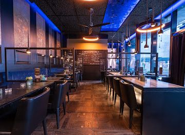
Fürstensteig itself has no nightlife, and the surrounding mountain settlements are quiet once daytime walking is over. Evening options are concentrated in Triesenberg, Vaduz and other valley communities, where visitors can find traditional restaurants, hotel bars and local establishments with a relaxed rather than club-oriented atmosphere. Vaduz offers the country’s broadest choice of evening hospitality, although it remains modest compared with a major Alpine resort. In Triesenberg, a drink or meal in a village inn is more characteristic than late-night entertainment. Seasonal cultural events may add occasional variety, but their timing changes, so visitors should check local listings rather than expect regular performances or nightclubs near the trailhead.
-
Bar
PUR - Restaurant & Bar
Explore gourmet barbecue dishes and a lively atmosphere at PUR - Restaurant & Bar in Schaan, perfect for food lovers and social gatherings.
-
Bar
Esquire Bar.Bistro
Experience the vibrant culinary scene of Vaduz at Esquire Bar.Bistro, where local flavors meet a lively atmosphere in a chic setting.
-
Bar
Black Pearl Bar
Discover the vibrant cocktail scene at Black Pearl Bar in Schaan, where every sip tells a story and every night is an adventure.
-
Restaurant
Zur Alten Eiche
Discover the charm of Zur Alten Eiche, a family-friendly restaurant in Triesen, offering exquisite cuisine and a beautiful beer garden for memorable dining experiences.


Best nightclubs in Fürstensteig
Fürstensteig itself has no nightlife, and the surrounding mountain settlements are quiet once daytime walking is over. Evening options are concentrated in Triesenberg, Vaduz and other valley communities, where visitors can find traditional restaurants, hotel bars and local establishments with a relaxed rather than club-oriented atmosphere. Vaduz offers the country’s broadest choice of evening hospitality, although it remains modest compared with a major Alpine resort. In Triesenberg, a drink or meal in a village inn is more characteristic than late-night entertainment. Seasonal cultural events may add occasional variety, but their timing changes, so visitors should check local listings rather than expect regular performances or nightclubs near the trailhead.
-
Bar
Esquire Bar.Bistro
Experience the vibrant culinary scene of Vaduz at Esquire Bar.Bistro, where local flavors meet international cuisine in a stylish setting.
-
Bar
Zwei Bar
Experience vibrant nightlife at Zwei Bar in Vaduz, offering a diverse drink selection and a lively atmosphere for an unforgettable evening out.
-
Bar
Havanna Latin Club
Havanna Latin Club: A vibrant bar in Buchs, Switzerland, offering a lively atmosphere filled with Latin music and dancing for an unforgettable night out.
-
Bar
Take 5 Vaduz
Discover Take 5 Vaduz, a vibrant bar in Triesen offering a lively atmosphere, delicious drinks, and a perfect setting for unforgettable nights out.


Best shops in Fürstensteig
There is no meaningful shopping scene on Fürstensteig, and Gaflei has only limited visitor infrastructure. Practical supplies are more readily obtained in Triesenberg or Vaduz, while Schaan and other valley settlements provide additional everyday retail and outdoor equipment options. Visitors interested in regional products can look for Liechtenstein wine, mountain cheese, farm produce, locally made crafts and souvenirs connected with the country’s princely and alpine identity. Availability differs between shops and seasons, and a mountain walk should not be planned around finding food or equipment after reaching the trailhead. Vaduz is the most convenient place for combining sightseeing with souvenir shopping, whereas Triesenberg offers a closer connection with local mountain culture and traditional settlement patterns.
-
Gift shop
Hoi Liechtenstein - Souvenir Boutique
Explore Hoi Liechtenstein - your go-to boutique for authentic souvenirs, local wines, and unique gifts in the heart of Vaduz.
-
Chocolate artisan
Läderach | Liechtenstein | Vaduz
Discover the exquisite world of Läderach, Liechtenstein's premier chocolate artisan, offering handcrafted delights in the heart of Vaduz.
-
Watch store
HUBER World of Watches
Explore the world of horology at HUBER World of Watches in Vaduz, where luxury meets craftsmanship in a stunning collection of timepieces.
-
Paper store
Thöny AG Schreibwaren
Explore Thöny AG Schreibwaren in Vaduz for an exquisite collection of quality stationery and unique gifts, capturing the essence of creativity and craftsmanship.


Get your free copy of our complete guide to Fürstensteig, delivered straight to you.
Everything on this page, from attractions and restaurants to essentials and local phrases, in one PDF you can read offline, print or share.
Already have an account? Sign in
Your Fürstensteig guide is ready.
We'll send it to · Not you? Sign out

Getting your guide ready…
We are putting together a fresh copy of the Fürstensteig guide. This can take up to a minute.
This can take a few moments. If your browser asks, choose Allow so the download can start. You'll find the guide in your Downloads folder.
Nothing happened? Download it again
Sorry, the guide is taking longer than usual. Please try again in a minute, or get it by email instead.
Fürstensteig essentials
Currency and Payment
Safety
Emergency Situations
Do's and Don'ts
Local Tips
From Eve
Local phrases worth knowing
You don't need to get them perfect. A few words go a long way, and locals appreciate the effort.
Basics
| English | Local | Say it |
|---|---|---|
| Hello | Hallo | [ha-lo] |
| Goodbye | Tschüss | [tʃʏs] |
| Yes | Ja | [ja] |
| No | Nein | [naɪ̯n] |
| Please/You're welcome | Bitte | [bɪtə] |
| Thank you | Danke | [ˈdaŋkə] |
| Excuse me/Sorry | Entschuldigung | [ɛntˈʃʊldɪɡʊŋ] |
| How are you? | Wie geht es dir? | [viː ɡeːt ɛs dɪr] |
| Fine. And you? | Gut. Und dir? | [ɡuːt ʊnt dɪr] |
| Do you speak English? | Sprechen Sie Englisch? | [ˈʃpʁɛçən ziː ˈɛŋlɪʃ] |
| I don't understand | Ich verstehe nicht | [ɪç fɛɐ̯ˈʃteːə nɪçt] |
Eating & Drinking
| English | Local | Say it |
|---|---|---|
| I'd like to see the menu, please | Ich möchte bitte die Speisekarte sehen | [ɪç mœçtə ˈbɪtə diː ˈʃpaɪ̯zəˌkaʁtə zeːən] |
| I don't eat meat | Ich esse kein Fleisch | [ɪç ˈɛsə kaɪ̯n flaɪ̯ʃ] |
| Cheers! | Prost! | [pʁoːst] |
| I would like to pay, please | Ich möchte bitte zahlen | [ɪç mœçtə ˈbɪtə ˈt͡saːlən] |
Emergencies
| English | Local | Say it |
|---|---|---|
| Help! | Hilfe! | [ˈhɪlfə] |
| Go away! | Geh weg! | [ɡeː vɛk] |
| Call the Police! | Rufen Sie die Polizei! | [ˈʁuːfən ziː diː pɔˈliːt͡saɪ̯] |
| Call a doctor! | Rufen Sie einen Arzt! | [ˈʁuːfən ziː ˈaɪ̯nən ʔaʁt͡s] |
| I'm lost | Ich habe mich verirrt | [ɪç ˈhaːbə mɪç fɛɐ̯ˈɪʁt] |
| I'm ill | Ich bin krank | [ɪç bɪn kraŋk] |
Shopping
| English | Local | Say it |
|---|---|---|
| I'd like to buy... | Ich möchte ... kaufen | [ɪç mœçtə ... kaʊ̯fən] |
| I'm just looking | Ich schaue nur | [ɪç ˈʃaʊ̯ə nuːr] |
| How much is it? | Wie viel kostet es? | [viː fiːl ˈkɔstət ɛs] |
| That's too expensive | Das ist zu teuer | [das ɪst tsu ˈtɔʏ̯ɐ] |
| Can you lower the price? | Können Sie den Preis senken? | [ˈkœnən ziː deːn pʁaɪ̯s ˈzɛŋkən] |
Time & Numbers
| English | Local | Say it |
|---|---|---|
| What time is it? | Wie spät ist es? | [viː ʃpɛt ɪst ɛs] |
| It's one o'clock | Es ist ein Uhr | [ɛs ɪst aɪ̯n ʔuːɐ] |
| Half past (10) | Halb (zehn) | [halb (t͡seːn)] |
| Morning | Morgen | [ˈmɔʁɡən] |
| Afternoon | Nachmittag | [ˈnaχmɪˌtaːk] |
| Evening | Abend | [ˈaːbənt] |
| Yesterday | Gestern | [ˈɡɛstɐn] |
| Today | Heute | [ˈhɔʏ̯tə] |
| Tomorrow | Morgen | [ˈmɔʁɡən] |
| 1 | Eins | [aɪ̯ns] |
| 2 | Zwei | [tsvaɪ̯] |
| 3 | Drei | [dʁaɪ̯] |
| 4 | Vier | [fiːɐ̯] |
| 5 | Fünf | [fʏnf] |
| 6 | Sechs | [zɛks] |
| 7 | Sieben | [ˈziːbən] |
| 8 | Acht | [axt] |
| 9 | Neun | [nɔɪ̯n] |
| 10 | Zehn | [t͡seːn] |
Transport & Directions
| English | Local | Say it |
|---|---|---|
| Where's a/the...? | Wo ist ein/der...? | [vo ɪst aɪ̯n/deːr] |
| What's the address? | Wie ist die Adresse? | [viː ɪst diː ˈaˌdʁɛsə] |
| Can you show me (on the map)? | Können Sie mir zeigen (auf der Karte)? | [ˈkœnən ziː mɪr ˈt͡saɪ̯ɡən (aʊ̯f deːɐ̯ ˈkaʁtə)] |
| When's the next (bus)? | Wann kommt der nächste (Bus)? | [van kɔmt deːɐ̯ ˈnɛkstə (bʊs)] |
| A ticket (to ....) | Eine Fahrkarte (nach ....) | [ˈaɪ̯nə ˈfaːɐ̯kaʁtə (nax)] |
History of Fürstensteig
A Limestone Alpine Landscape
Fürstensteig lies within the Rätikon, a mountain region shaped by the geological structure of the Northern Limestone Alps. The route follows steep formations above the Rhine Valley, where resistant limestone creates rocky ribs, ledges and prominent summits. This geological setting explains the path’s narrow traverses and its open, high-level character. The landscape has also influenced traditional land use: the slopes around Triesenberg and the higher alpine pastures have long been used seasonally for grazing, linking the natural terrain with the agricultural history of Liechtenstein’s mountain communities.
Triesenberg’s Walser Heritage
The mountains above Fürstensteig belong to the cultural landscape of Triesenberg, whose settlement history is strongly associated with Walser migrants who established communities in high valleys and uplands across the Alps during the medieval period. Their presence helped shape local patterns of pasture use, scattered settlement and mountain farming. Triesenberg remains Liechtenstein’s principal highland municipality, and its villages and alpine surroundings provide important context for understanding why paths such as Fürstensteig connected communities, pastures and mountain routes rather than existing solely for recreation.
The Prince’s Path
Fürstensteig was created at the end of the nineteenth century as a carefully engineered mountain route. It is generally dated to 1898 and is associated with the reign of Johann II, whose long rule coincided with important improvements in Liechtenstein’s infrastructure and public life. The path’s German name, ‘Fürstensteig’, means ‘Prince’s Path’, reflecting the country’s princely identity. Built across difficult rocky terrain, it transformed a challenging mountain traverse into an established route and became one of the defining walking routes of Liechtenstein.
From Mountain Route to Alpine Classic
During the twentieth century, Fürstensteig developed from a locally significant mountain path into a recognised destination for hikers visiting Liechtenstein and the wider Rätikon. Its appeal has remained closely tied to the route itself rather than to extensive infrastructure: the narrow engineering works, exposed slopes and views are the principal attractions. Today it forms part of a broader network of marked mountain paths near Gaflei, Alpspitz and the Drei Schwestern area. Weather, rockfall, snow and maintenance continue to influence access, making current local information an essential part of responsible use.
Fürstensteig in Photos
Browse through our photo collection highlighting the charm and character of the destination.
Cities in Fürstensteig
The towns and cities of Fürstensteig, and the easiest places to base yourself.
-

-

-
-

-
-


Swipe for more cities
Neighbouring destination travel guides
The closest destinations to Fürstensteig, if you have time for more than one.
-

-

-

-

-


Swipe for more destinations
Explore more

Explore more of Oberland
Explore Liechtenstein’s Oberland for Vaduz museums, medieval castles, Walser villages and Alpine trails rising from the Rhine Valley.
Explore Oberland
Explore more of Liechtenstein
Discover the charm of Liechtenstein, a tiny Alpine principality offering medieval castles, stunning hiking trails, and a rich cultural heritage in the heart of Europe.
Explore Liechtenstein