

Free Mellieha Bay Area Travel Guide & Mobile App
Explore Mellieha Bay Area with free travel guides. Discover regional history, expert tips, proposed trips, and audio guides on web or mobile app.


Explore the Mellieha Bay Area for Malta’s largest sandy beach, historic hilltop streets, coastal walks and ferry access to the northern islands.
Read more about Mellieha Bay Area
When is the best time to visit Mellieha Bay Area?
Best: May–July · 23–30°C| Month | High (°C) | Rainfall (mm) |
|---|---|---|
| January | 15 | 71 |
| February | 16 | 60 |
| March | 16 | 49 |
| April | 19 | 22 |
| May (best) | 23 | 14 |
| June (best) | 27 | 7 |
| July (best) | 30 | 3 |
| August | 31 | 11 |
| September | 28 | 42 |
| October | 24 | 63 |
| November | 20 | 72 |
| December | 16 | 76 |
Getting to and around Mellieha Bay Area
How to get there
Transportation
Top city travel guides in Mellieha Bay Area
The cities of Mellieha Bay Area, and the easiest places to base yourself.
-

-

-

-


Swipe for more cities
Destinations in Mellieha Bay Area
Resorts, valleys and scenic spots worth a trip of their own.
-

-
-

-

-


Swipe for more destinations
Best attractions in Mellieha Bay Area
The Mellieha Bay Area combines Malta’s most accessible sandy beach with a varied northern landscape of wetland, garigue, rocky coves and historic high ground. Mellieha Bay is the principal bathing centre, while Paradise Bay, Armier Bay and Imgiebah Bay provide different settings for swimming, sunbathing and coastal views. Għadira Nature Reserve offers a protected wetland environment beside the beach, with seasonal opportunities to observe birds and native habitats. Inland and along the peninsula, walking routes lead through dry limestone country towards l-Aħrax tal-Mellieħa, Marfa Ridge and viewpoints facing Comino and Gozo. History is represented by the Sanctuary of Our Lady of Mellieha, the Red Tower, the White Tower and Selmun Palace, as well as wartime shelters and older rural structures. Popeye Village at Anchor Bay occupies a distinctive film-set location and functions as a family-oriented visitor attraction. The area is best explored as a collection of contrasting coastal and historic sites rather than as a single resort strip.
-
Theme park
Popeye Village
Experience the whimsical world of Popeye Village in Malta, where family fun meets stunning coastal views and delightful adventures await every visitor.
-
Beach
Golden Bay
Discover Golden Bay in Mellieħa, Malta – a stunning beach with golden sands, clear waters, and breathtaking views perfect for relaxation and adventure.
-
Tourist attraction
Mellieha Bay
Discover the enchanting Mellieha Bay, Malta's premier beach destination for relaxation, adventure, and stunning coastal views.
-
Resort hotel
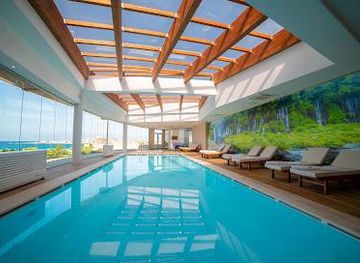
Ramla Bay Resort
Discover the ultimate retreat at Ramla Bay Resort, where luxury meets the serene beauty of Malta's coastline.


Best landmarks in Mellieha Bay Area
The most recognisable landmark is Saint Agatha’s Tower, usually called the Red Tower, standing prominently on Marfa Ridge above the approaches to Comino and Gozo. Its red-painted exterior and angular bastions reflect the coastal defence system built by the Order of Saint John in the seventeenth century. In Mellieha village, the parish church and the rock-cut Sanctuary of Our Lady of Mellieha form the area’s principal religious and architectural focus, with the sanctuary’s hillside setting reinforcing its long pilgrimage tradition. Selmun Palace is a substantial eighteenth-century country residence whose elevated position and formal massing distinguish it from the village’s denser streets. The White Tower at l-Aħrax is another important Hospitaller-era fortification, while Mellieha Bay itself is a geographical landmark: a broad, shallow inlet that has shaped settlement, tourism and transport in northern Malta. The limestone ridges, headlands and open views towards the neighbouring islands complete the area’s visual identity.
-
Theme park
Popeye Village
Step into the world of Popeye! Explore the original film set, enjoy fun activities, and create lasting memories in this unique Maltese village.
-
Tourist attraction
Paradise Bay
Experience the breathtaking beauty of Paradise Bay in Mellieħa, Malta, where pristine beaches and stunning sunsets await every visitor.
-
Tourist attraction
Mellieha Bay
Discover the beauty of Mellieha Bay, Malta's largest sandy beach, perfect for family fun and thrilling water sports in a stunning coastal setting.
-
Historical landmark
The Red Tower
Explore the Red Tower, a historic landmark in Malta offering stunning views and a glimpse into the island's rich military past. A must-visit for every traveler!


Explore Mellieha Bay Area on the map
Plan your trip on one map. See where the top cities, national parks and sights are, and book hotels and experiences in a few clicks.
Best hotels in Mellieha Bay Area
Best restaurants in Mellieha Bay Area
Dining in the Mellieha Bay Area ranges from informal cafés and beach kiosks to restaurants in the village, along the bay and near the northern roads. Menus commonly combine Maltese favourites with Mediterranean and international dishes, reflecting both local life and the area’s large summer visitor population. Look for pastizzi, ftira, ġbejniet, bigilla and rabbit preparations, while fish and seafood are particularly natural choices in coastal restaurants when local supply allows. Maltese wines and the soft drink Kinnie are widely available, and village cafés provide an easy setting for coffee, pastries or a light lunch. Rural and seaside establishments often operate at a slower pace than urban restaurants, so booking or checking arrangements is sensible during busy periods. The strongest sense of place usually comes from combining a traditional Maltese dish with views over the bay or the northern countryside rather than seeking a highly formal dining scene.
-
Mediterranean
Munchies Mellieha Bay
Experience Mediterranean flavors at Munchies Mellieha Bay - where delicious food meets breathtaking coastal views.
-
Restaurant
Blu Beach Club
Experience exquisite dining at Blu Beach Club with breathtaking views of Ghadira Bay - a must-visit destination in Malta.
-
Mediterranean
one80 Kitchen & Lounge
Discover Mediterranean flavors at one80 Kitchen & Lounge in Mellieħa – where exquisite cuisine meets breathtaking views.
-
Restaurant
Apple's Eye Restaurant
Experience authentic Maltese cuisine at Apple's Eye Restaurant with stunning views in Mellieħa.


Best bars in Mellieha Bay Area
Nightlife in the Mellieha Bay Area is generally low-key and concentrated around the village, the beachfront, hotels and restaurants rather than a large club district. Evenings may involve a Maltese or Mediterranean meal, a drink overlooking Mellieha Bay, or a visit to a pub or hotel bar. Some venues offer televised sport, occasional live music or seasonal entertainment, but arrangements and opening patterns change throughout the year. The village has a more local residential atmosphere, while the bay becomes more visitor-oriented in summer. Those seeking major late-night clubbing usually travel elsewhere in Malta, whereas Mellieha suits relaxed socialising, after-dinner walks and early starts for ferries or coastal excursions.
-
Mediterranean
Munchies Mellieha Bay
Experience the vibrant flavors of the Mediterranean at Munchies Mellieha Bay, where stunning views meet exceptional cuisine.
-
Cafe
Sea View Cafe/Bar
Experience the best of Maltese cuisine with stunning sea views at Sea View Cafe/Bar in Mellieħa.
-
Restaurant
Blu Beach Club
Experience the flavors of the Mediterranean at Blu Beach Club, a delightful seaside restaurant in Il-Mellieħa, Malta.
-
Mediterranean
one80 Kitchen & Lounge
Experience Mediterranean culinary excellence at One80 Kitchen & Lounge in Mellieħa, Malta, with stunning views and a diverse menu.


Best nightclubs in Mellieha Bay Area
Nightlife in the Mellieha Bay Area is generally low-key and concentrated around the village, the beachfront, hotels and restaurants rather than a large club district. Evenings may involve a Maltese or Mediterranean meal, a drink overlooking Mellieha Bay, or a visit to a pub or hotel bar. Some venues offer televised sport, occasional live music or seasonal entertainment, but arrangements and opening patterns change throughout the year. The village has a more local residential atmosphere, while the bay becomes more visitor-oriented in summer. Those seeking major late-night clubbing usually travel elsewhere in Malta, whereas Mellieha suits relaxed socialising, after-dinner walks and early starts for ferries or coastal excursions.
-
Restaurant
Blu Beach Club
Experience the best of Mediterranean cuisine at Blu Beach Club, a scenic dining destination in Mellieħa, Malta, perfect for every occasion.
-
Pub
Reflections Sports Pub & Grill
Experience lively sports action and delicious dining at Reflections Sports Pub & Grill in Mellieħa, Malta, where every moment is a celebration.
-
Lounge
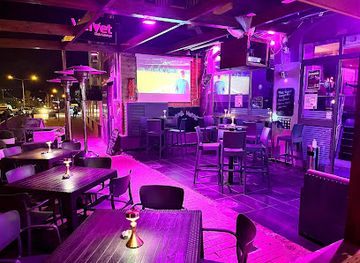
VELVET LOUNGE CLUB (SHISHA AND FOOD )
Velvet Lounge Club: Your go-to destination for shisha and cocktails in St Paul's Bay, Malta. Experience vibrant nightlife and relaxing ambience.
-
Lido
Palm Beach
Discover the captivating beauty of Palm Beach in Mellieħa, Malta, where sun-soaked shores meet delectable dining and thrilling water activities.



Best shops in Mellieha Bay Area
Shopping in the Mellieha Bay Area is centred on the village high street, small supermarkets, convenience shops, beach outlets and independent businesses rather than large commercial centres. Visitors can find Maltese food products, wine, liqueurs, honey, olive-oil products, sweets, ceramics, jewellery and religious items, although quality and provenance vary between shops. The village is a more useful place for practical supplies and locally themed purchases than the beachfront, where seasonal merchandise and beach equipment are more prominent. Small galleries and craft-oriented shops may offer pottery, glass, lace or decorative work associated with Malta, but many products are imported, so ask about origin when buying a purportedly local item. The best approach is to combine shopping with a walk through the older village streets, buying regional food for a picnic or ferry journey rather than expecting an extensive luxury-retail scene.
-
Mediterranean
Munchies Mellieha Bay
Discover Mediterranean flavors at Munchies Mellieha Bay, where stunning views meet delicious cuisine and a lively beach atmosphere.
-
Clothing store
Kiabi
Discover fashion for the whole family at Kiabi, a vibrant clothing store in St Paul's Bay, Malta, offering trendy styles at affordable prices.
-
Supermarket
Welbee's Supermarket
Discover local flavors and gourmet delights at Welbee's Supermarket in Mellieħa, Malta - your one-stop destination for fresh produce and specialty goods.
-
Restaurant
Villager by Munchies
Experience a vibrant culinary journey at Villager by Munchies, where diverse flavors meet a cozy atmosphere in Mellieħa, Malta.


Get your free copy of our complete guide to Mellieha Bay Area, delivered straight to you.
Everything on this page, from attractions and restaurants to essentials and local phrases, in one PDF you can read offline, print or share.
Already have an account? Sign in
Your Mellieha Bay Area guide is ready.
We'll send it to · Not you? Sign out

Getting your guide ready…
We are putting together a fresh copy of the Mellieha Bay Area guide. This can take up to a minute.
This can take a few moments. If your browser asks, choose Allow so the download can start. You'll find the guide in your Downloads folder.
Nothing happened? Download it again
Sorry, the guide is taking longer than usual. Please try again in a minute, or get it by email instead.
Mellieha Bay Area essentials
Currency and Payment
Safety
Emergency Situations
Do's and Don'ts
Local Tips
From Eve
Local phrases worth knowing
You don't need to get them perfect. A few words go a long way, and locals appreciate the effort.
Basics
| English | Local | Say it |
|---|---|---|
| Hello | Bongu | [bong-oo] |
| Goodbye | Saħħa | [sah-ha] |
| Yes | Iva | [ee-vah] |
| No | Le | [leh] |
| Please/You’re welcome | Jekk jogħġbok | [yek-yoh-bok] |
| Thank you | Grazzi | [graht-see] |
| Excuse me/Sorry | Skużani | [skoo-zah-nee] |
| How are you? | Kif inti? | [keef in-tee] |
| Fine. And you? | Tajjeb. U int? | [tie-yeb. oo int] |
| Do you speak English? | Titkellem bl-Ingliż? | [tit-kel-lem bl-ing-leez] |
| I don't understand | Ma nifhimx | [mah neef-imx] |
Eating & Drinking
| English | Local | Say it |
|---|---|---|
| I’d like to see the menu, please | Nixtieq naraw il-menu, jekk jogħġbok | [neex-teeq nah-raw il-men-oo, yek-yoh-bok] |
| I don't eat meat | Ma niekolx laħam | [mah nee-eel-ox lah-ham] |
| Cheers! | Saħħa! | [sah-ha] |
| I would like to pay, please | Nixtieq inħallas, jekk jogħġbok | [neex-teeq in-hah-lass, yek-yoh-bok] |
Emergencies
| English | Local | Say it |
|---|---|---|
| Help! | Għajnuna! | [ah-yee-noo-nah] |
| Go away! | Mur 'il bogħod! | [moor eel bohd] |
| Call the Police! | Iċ-ċempel lill-Pulizija! | [ich-chem-pel lil-Poo-lee-zee-ah] |
| Call a doctor! | Iċ-ċempel dottur! | [ich-chem-pel doht-toor] |
| I’m lost | Ninsab mitluf | [neen-sahb meet-loof] |
| I’m ill | Jiena morda | [yee-nah mor-dah] |
Shopping
| English | Local | Say it |
|---|---|---|
| I’d like to buy... | Nixtieq nixtri... | [neex-teeq neesh-tree] |
| I’m just looking | Qiegħed nara biss | [kee-ed nah-rah biss] |
| How much is it? | Kemm hu? | [kemm hoo] |
| That’s too expensive | Dak huwa wisq għali | [dak hoo-wah wisq ah-lee] |
| Can you lower the price? | Tista’ tnaqqas il-prezz? | [tis-tah tnah-kas il-prets] |
Time & Numbers
| English | Local | Say it |
|---|---|---|
| What time is it? | Kemm hi l-ħin? | [kemm hee l-heen] |
| It’s one o'clock | Hija l-ewwel ħin | [hee-yah l-ewwel heen] |
| Half past (10) | Nofs l-għaxra | [nofs l-gha-sh-ra] |
| Morning | Filgħodu | [fil-ow-doo] |
| Afternoon | Wara nofsinhar | [wah-rah nofs-in-har] |
| Evening | Filgħaxija | [fil-gha-shee-ah] |
| Yesterday | Ilbieraħ | [il-bee-rah] |
| Today | Illum | [il-loom] |
| Tomorrow | Għada | [ah-dah] |
| 1 | 1 | [1] |
| 2 | 2 | [2] |
| 3 | 3 | [3] |
| 4 | 4 | [4] |
| 5 | 5 | [5] |
| 6 | 6 | [6] |
| 7 | 7 | [7] |
| 8 | 8 | [8] |
| 9 | 9 | [9] |
| 10 | 10 | [10] |
Transport & Directions
| English | Local | Say it |
|---|---|---|
| Where's a/the...? | Fejn hemm ...? | [fayn hem] |
| What's the address? | X'inhu l-indirizz? | [sheen-hoo l-in-deer-itz] |
| Can you show me (on the map)? | Tista' turi lili (fuq il-map)? | [tis-tah too-ree lee-lee (fooq il-map)] |
| When's the next (bus)? | Meta ġej (il-linja) li jmiss? | [meh-tah jeh (il-leen-yah) lee im-miss] |
| A ticket (to ....) | Biljetta (għal ...) | [bil-yet-tah (ahl ...)] |
History of Mellieha Bay Area
Prehistoric and Ancient Northern Malta
The Mellieha district contains archaeological evidence of Malta’s long human occupation, including rock-cut features, tombs and remains associated with the prehistoric and Punic-Roman landscapes of the north. Its elevated ridges and sheltered bays made the area useful for settlement, movement and maritime observation, while caves and natural hollows offered protection and storage. Much of the visible evidence is fragmentary, and it is best understood as part of Malta’s wider archaeological record rather than as a single monumental complex. The northern position also gave Mellieha continuing importance as a route towards Gozo and the smaller offshore islands.
The Sanctuary and Medieval Mellieha
Mellieha’s religious identity developed around the Sanctuary of Our Lady of Mellieha, whose tradition is linked to a painted image of the Virgin in a rock-cut church. The sanctuary was enlarged and remodelled over time, becoming an important place of pilgrimage. The settlement’s hilltop position, defensible terrain and proximity to the northern crossing routes shaped its medieval and early modern character. The surviving church, streets and limestone buildings reflect the gradual growth of a community that lived between agricultural land, difficult coastal terrain and the maritime connections of northern Malta.
Hospitaller Fortifications in the Seventeenth Century
Under the Order of Saint John, the exposed northern coast received a network of towers and defensive works intended to detect raids and communicate warnings across Malta. Saint Agatha’s Tower, generally known as the Red Tower, was completed in 1649 on Marfa Ridge and commanded views towards Comino and Gozo. The White Tower at l-Aħrax was built later in the same period, adding another observation point on the peninsula. These structures belonged to a wider coastal defence system and remain among the most recognisable historical markers of the Mellieha landscape.
Hospitaller Estates and Selmun Palace
Selmun Palace, built in the eighteenth century on an elevated site above the northern coast, is associated with the Monte della Redenzione degli Schiavi, a charitable foundation established by the Order of Saint John to support the redemption of Christian captives. The palace and estate demonstrate how the Hospitaller administration combined rural landholding, charitable finance and defensive concerns. Its austere exterior and commanding position are different from the more urban architecture of Valletta, yet they form part of the same institutional history that shaped Malta before the Order’s departure in 1798.
British Rule, Military Infrastructure and the Second World War
After the British took control of Malta at the end of the eighteenth century, the northern peninsula remained strategically important because of its proximity to Gozo, Comino and the sea routes around the islands. Roads, barracks, signalling positions and other military facilities developed within the wider landscape. During the Second World War, Mellieha’s inhabitants used extensive underground shelters and the area formed part of Malta’s wider defensive system. The shelters and military remains illustrate how civilian life and strategic geography were closely connected during the island’s wartime experience.
Tourism and the Modern Coastal Economy
Mellieha’s modern economy changed substantially as Malta developed into an international visitor destination after the Second World War. Mellieha Bay became one of the island’s principal bathing beaches, while hotels, holiday apartments, restaurants and transport links expanded around the village and coast. The northern ferry terminal strengthened the area’s role as a gateway to Gozo and Comino. Tourism now sits alongside farming, conservation and residential life, creating a landscape in which protected wetlands, historic settlements, busy beaches and rural headlands exist close together.
Mellieha Bay Area in Photos
Browse through our photo collection highlighting the charm and character of the destination.
Neighbouring regions of Mellieha Bay Area
The closest regions to Mellieha Bay Area, if you have time for more than one.
-

-

-

-

-


Swipe for more regions
Explore more
Explore more of Malta
Discover Malta's crystal-clear waters, rich history, and vibrant culture. From ancient temples to modern nightlife, this Mediterranean gem offers something for everyone.
Explore Malta