

Annapurna Circuit Travel Guide - Free Web & App
Your ultimate guide to Annapurna Circuit. Discover top landmarks, proposed trips, and local tips. Free on the web or via the Evendo companion app.


Annapurna Circuit, Nepal, links subtropical valleys, Tibetan-influenced villages and Thorong La with trekking, mountain scenery, temples and Himalayan culture.
Across Valleys, Passes and High Mountain Landscapes
The Annapurna Circuit traces a remarkable arc around the Annapurna massif in central Nepal, linking river valleys, subtropical foothills, high alpine terrain and the dry, Tibetan-influenced landscapes beyond the main Himalayan crest. The classic journey begins near Besisahar in Lamjung District and follows the Marsyangdi Valley towards Manang before crossing Thorong La, at approximately 5,416 metres, and descending towards the pilgrimage settlement of Muktinath and the Kali Gandaki Valley. Roads now reach many sections of the route, so modern itineraries vary considerably: some trekkers walk from the lower valleys, while others use local transport to concentrate on the higher and more scenic stages.Read more about Annapurna Circuit
Villages and Cultural Landscapes
Walking Through a Protected Mountain Environment
When is the best time to visit Annapurna Circuit?
Best: April–May, October · 21–24°C| Month | High (°C) | Rainfall (mm) |
|---|---|---|
| January | 12 | 23 |
| February | 13 | 21 |
| March | 17 | 25 |
| April (best) | 22 | 36 |
| May (best) | 24 | 81 |
| June | 27 | 121 |
| July | 28 | 151 |
| August | 27 | 141 |
| September | 25 | 106 |
| October (best) | 21 | 55 |
| November | 16 | 32 |
| December | 13 | 27 |
Getting to and around Annapurna Circuit
How to get there
Transportation
Best attractions in Annapurna Circuit
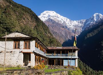
The Annapurna Circuit's principal attractions are spread across several distinct mountain environments. The lower Marsyangdi Valley leads through terraced hills, waterfalls and forested settlements towards Chame, Pisang and the broad alpine basin around Manang, where excursions include the route towards Ice Lake and the atmospheric Braga Monastery. Tilicho Lake is a demanding side journey from the Manang area, reaching a high glacial lake beneath stark mountain slopes. Thorong La provides the circuit's defining high-pass crossing before the trail descends to the sacred pilgrimage site of Muktinath. On the western side, Kagbeni's narrow lanes introduce the cultural landscape of Mustang, while Marpha and the neighbouring Kali Gandaki villages combine stone architecture, orchards and Thakali heritage. Views of Annapurna, Dhaulagiri, Manaslu and surrounding peaks vary by weather and position, with the landscape changing from humid woodland to dry, wind-shaped valleys.
-
Museum
International Mountain Museum
Uncover the rich history and culture of mountain exploration at the International Mountain Museum in Pokhara, Nepal.
-
Place of worship
Tal Barahi Temple, Pokhara
Discover the serenity and spiritual essence of Tal Barahi Temple, a captivating Hindu shrine on Phewa Lake in Pokhara, Nepal.
-
Tourist attraction
Sarangkot View Tower
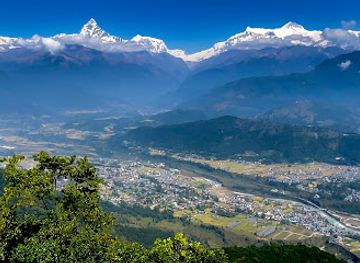
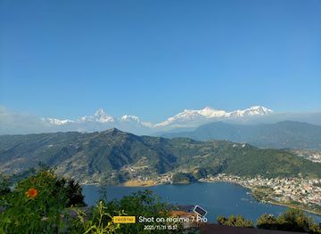
Explore the stunning Sarangkot View Tower in Pokhara, Nepal, for breathtaking views of the Annapurna Range and unforgettable sunrises and sunsets.
-
Park
Basundhara Park
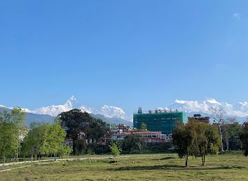
Explore the lush landscapes and stunning views of the Annapurna range at Basundhara Park, a serene retreat in the heart of Pokhara.
Best landmarks in Annapurna Circuit
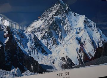
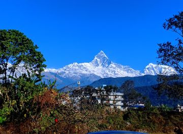
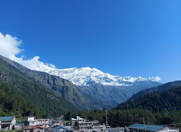
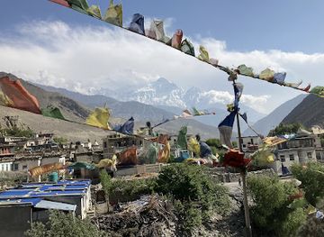
Thorong La is the circuit's best-known natural landmark, a high Himalayan pass connecting the upper Marsyangdi Valley with the Muktinath and Kali Gandaki side of the route. Tilicho Lake, reached on a demanding side journey from the Manang region, is another defining feature of the high landscape. The dramatic valley systems themselves are central landmarks: the Marsyangdi corridor narrows between steep mountains, while the Kali Gandaki route passes through dry, wind-shaped terrain beneath Annapurna and Dhaulagiri. Muktinath is the most significant religious landmark, revered by both Hindu and Buddhist pilgrims, and its temples and sacred water features give the settlement an importance beyond trekking. Braga Monastery near Manang, the old lanes of Kagbeni and the stone architecture of Marpha express the region's Buddhist and Thakali heritage, while mani walls, chortens and prayer flags mark the route's continuing cultural character.
-
Tourist attraction
Pokhara Lakeside
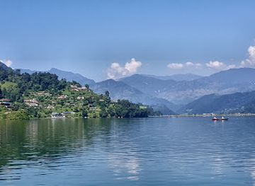
Discover the breathtaking beauty and vibrant culture of Pokhara Lakeside, a serene gem in the heart of Nepal's stunning landscapes.
-
Buddhist temple
World Peace Pagoda
Explore the serene beauty of the World Peace Pagoda in Pokhara, where tranquility meets breathtaking Himalayan views.
-
Tourist attraction
Annapurna Conservation Area
Explore the breathtaking beauty of Annapurna Conservation Area, a UNESCO World Heritage Site, perfect for adventure seekers and nature lovers alike.
-
Hindu temple
Shree Muktinath Temple
Explore the sacred Shree Muktinath Temple, an iconic pilgrimage site nestled in the breathtaking Annapurna region, rich in spirituality and natural beauty.

Explore Annapurna Circuit on the map
Plan your trip on one map. See where the top attractions, landmarks, restaurants and hotels are, and book hotels and experiences in a few clicks.
Best hotels in Annapurna Circuit
Best restaurants in Annapurna Circuit
Food on the Annapurna Circuit is closely tied to trekking logistics and the traditions of the villages along the route. Teahouses and small lodges generally provide practical meals such as dal bhat, the familiar rice-and-lentil combination served with accompaniments, as well as noodles, soups, Tibetan-style breads and other simple dishes suited to long days outdoors. In Gurung, Manang and Thakali settlements, visitors may encounter regional variations in breads, dumplings, buckwheat products and preserved foods, while the Kali Gandaki area is associated with Thakali hospitality and mountain cuisine. Dining options are most concentrated in gateway towns such as Besisahar and in established villages including Manang, Jomsom and Marpha; remote trail sections have far fewer choices, and menus may depend on seasonal supplies, transport and local harvests.
-
Restaurant
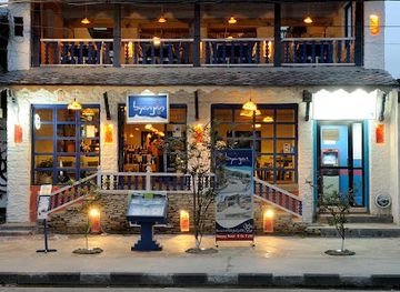
Byanjan
Experience the best of Continental, Indian, and Nepalese cuisine at Byanjan in Pokhara - where every meal is a celebration of flavor.
-
Restaurant
Utopia Garden & Snacks Bar
Experience tranquility and exquisite flavors at Utopia Garden & Snacks Bar in Pokhara – a must-visit culinary retreat for every traveler.
-
Restaurant
Chilly Bar & Restaurant
Discover culinary delights at Chilly Bar & Restaurant in Pokhara - where local flavors meet stunning mountain views.
-
Restaurant
Annapurna Garden Cafe & Lounge
Discover Annapurna Garden Cafe & Lounge in Pokhara: A perfect blend of local flavors and serene ambiance amidst stunning mountain views.


Best bars in Annapurna Circuit
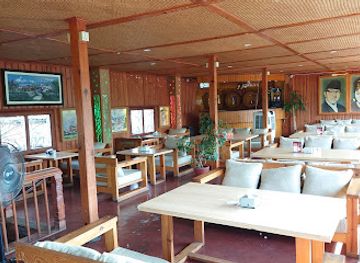
The Annapurna Circuit does not have a conventional nightlife scene, and evening life is shaped by early starts, cold temperatures and the rhythm of trekking. In larger gateways such as Besisahar, and in more established settlements including Manang, Jomsom and Marpha, visitors may find modest lodge dining rooms, cafés or local drinking establishments where travellers and residents share tea, beer or regional spirits. Some villages have a sociable teahouse atmosphere, but opening arrangements and entertainment are informal rather than organised around nightclubs or late venues. Evenings are usually spent talking with guides and fellow trekkers, reading, watching the mountains change colour or learning about local culture. In high settlements, quiet accommodation areas and limited infrastructure make considerate behaviour especially important.
-
Restaurant
Annapurna Jamboree Gastro Pub
Experience the finest of Nepali and international cuisine at Annapurna Jamboree Gastro Pub, with breathtaking views of the majestic Annapurna range.
-
Restaurant
Annapurna Restaurant Cafe & Bar
Experience the flavors of Nepal at Annapurna Restaurant Cafe & Bar, where local ingredients meet international cuisine in a stunning setting.
-
 Restaurant
Annapurna Resturant & Lounge Bar
Discover the flavors of Nepal at Annapurna Restaurant & Lounge Bar in Pokhara, where stunning views meet exquisite cuisine.


Best nightclubs in Annapurna Circuit
The Annapurna Circuit does not have a conventional nightlife scene, and evening life is shaped by early starts, cold temperatures and the rhythm of trekking. In larger gateways such as Besisahar, and in more established settlements including Manang, Jomsom and Marpha, visitors may find modest lodge dining rooms, cafés or local drinking establishments where travellers and residents share tea, beer or regional spirits. Some villages have a sociable teahouse atmosphere, but opening arrangements and entertainment are informal rather than organised around nightclubs or late venues. Evenings are usually spent talking with guides and fellow trekkers, reading, watching the mountains change colour or learning about local culture. In high settlements, quiet accommodation areas and limited infrastructure make considerate behaviour especially important.
-
Tourist attraction
Annapurna Conservation Area
Experience the breathtaking beauty and rich culture of the Annapurna Conservation Area, a Himalayan paradise for adventurers and nature lovers.
-
Night club
Club Catwalk
Discover the best nightlife experience in Pokhara at Club Catwalk, where music, dance, and delicious dining come together for an unforgettable evening.
-
Night club
The Treasure Lounge
Discover the pulse of Pokhara's nightlife at The Treasure Lounge, where vibrant music and exquisite cocktails create unforgettable nights.
-
Night club
Club Sixteen
Discover the vibrant nightlife of Pokhara at Club Sixteen, where electrifying music and a lively atmosphere come together for an unforgettable experience.


Best shops in Annapurna Circuit
Shopping on the circuit is small-scale and practical rather than centred on dedicated retail districts. Besisahar is one of the more useful places for trekking supplies and everyday necessities before entering the higher valleys, while Manang, Jomsom and other larger settlements offer limited equipment, clothing and provisions subject to seasonal availability. In the Kali Gandaki region, Marpha and neighbouring Thakali villages are associated with locally produced food and distinctive mountain hospitality, and visitors may encounter apple products, dried goods or regional spirits, although products vary between businesses. Handicrafts, woven items, prayer objects and locally made souvenirs may be available near established villages and pilgrimage sites, but visitors should buy respectfully and avoid taking religious artefacts or protected natural materials. Smaller settlements have few shops, so essential medicines and specialist equipment should be obtained before the trek.
-
Tourist attraction
Annapurna Conservation Area
Explore the breathtaking Annapurna Conservation Area, a national park filled with stunning mountain views, diverse ecosystems, and rich cultural experiences.
-
Tour operator
Annapurna Base Camp Trek
Experience breathtaking landscapes and rich culture on the unforgettable Annapurna Base Camp Trek in Nepal, a must-visit for every adventure seeker.
-
Tour agency
Nepalmountainbike@Pokhara MTB Adventures| cycling holidays| Bike Rental | Tour operator | company| MTB SHOP | Work Shop| KTM
Explore the breathtaking landscapes of Pokhara with thrilling mountain biking adventures at Nepalmountainbike, your gateway to Nepal's cycling paradise.
-
Outdoor clothing and equipment shop
Yak'n'Yeti Trekking Shop
Discover the best trekking gear at Yak'n'Yeti Trekking Shop in Pokhara, your ultimate outdoor adventure hub.



Get your free copy of our complete guide to Annapurna Circuit, delivered straight to you.
Everything on this page, from attractions and restaurants to essentials and local phrases, in one PDF you can read offline, print or share.
Already have an account? Sign in
Your Annapurna Circuit guide is ready.
We'll send it to · Not you? Sign out

Getting your guide ready…
We are putting together a fresh copy of the Annapurna Circuit guide. This can take up to a minute.
This can take a few moments. If your browser asks, choose Allow so the download can start. You'll find the guide in your Downloads folder.
Nothing happened? Download it again
Sorry, the guide is taking longer than usual. Please try again in a minute, or get it by email instead.
Annapurna Circuit essentials
Currency and Payment
Safety
Emergency Situations
Do's and Don'ts
Local Tips
From Eve
Local phrases worth knowing
You don't need to get them perfect. A few words go a long way, and locals appreciate the effort.
Basics
| English | Local | Say it |
|---|---|---|
| Hello | नमस्ते | [Namaste] |
| Goodbye | फेरी भेटौं | [Feri bhetou] |
| Yes | हो | [Ho] |
| No | होइन | [Hoin] |
| Please/You're welcome | कृपया | [Kripya] |
| Thank you | धन्यवाद | [Dhanyabad] |
| Excuse me/Sorry | क्षमा गर्नुहोस् | [Kshama garnuhos] |
| How are you? | तिमीलाई कस्तो छ? | [Timilai kasto cha?] |
| Fine. And you? | राम्रो छ। र तिमी? | [Ramro cha. Ra timi?] |
| Do you speak English? | तिमी अंग्रेजी बोल्नुहुन्छ? | [Timi angreji bolnuhuncha?] |
| I don't understand | मैले सम्झिन | [Maile samjhina] |
Eating & Drinking
| English | Local | Say it |
|---|---|---|
| I'd like to see the menu, please | कृपया मेनु हेर्न मिल्नुहोस् | [Kripya menu hern milnuhos] |
| I don't eat meat | म मासु खाँदिन | [Ma masu khandina] |
| Cheers! | चियर्स! | [Cheers!] |
| I would like to pay, please | कृपया तिर्न चाहन्छु | [Kripya tirn chahanchu] |
Emergencies
| English | Local | Say it |
|---|---|---|
| Help! | मदद गर्नुहोस्! | [Madad garnuhos!] |
| Go away! | लाग्नुहोस्! | [Lagnuhos!] |
| Call the Police! | प्रहरीलाई बोलाउनुहोस्! | [Praharilai bolaunuhos!] |
| Call a doctor! | डाक्टरलाई बोलाउनुहोस्! | [Doctorlai bolaunuhos!] |
| I'm lost | मलाई गुम भयो | [Malai gum bhayo] |
| I'm ill | मलाई बिरामी छ | [Malai birami cha] |
Shopping
| English | Local | Say it |
|---|---|---|
| I'd like to buy... | मलाई ... किन्न चाहन्छु | [Malai ... kinn chahanchu] |
| I'm just looking | म केवल हेर्न आएको | [Ma keval hern aeko] |
| How much is it? | यो कति हो? | [Yo kati ho?] |
| That's too expensive | यो धेरै महंगो छ | [Yo dherai mahango cha] |
| Can you lower the price? | के तपाईं राम्रो गर्न सक्नुहुन्छ? | [Ke tapain ramro garn saknuhuncha?] |
Time & Numbers
| English | Local | Say it |
|---|---|---|
| What time is it? | कति बजेको छ? | [Kati bajeko cha?] |
| It's one o'clock | एक बजे छ | [Ek baje cha] |
| Half past (10) | दस बजे अर्को अर्धबाजे | [Das baje arko ardhabaje] |
| Morning | बिहान | [Bihan] |
| Afternoon | दिउँसो | [Diunso] |
| Evening | साँझ | [Sanjh] |
| Yesterday | हिजो | [Hijo] |
| Today | आज | [Aaj] |
| Tomorrow | भोलि | [Bholi] |
| 1 | एक | [Ek] |
| 2 | दुई | [Dui] |
| 3 | तीन | [Tin] |
| 4 | चार | [Char] |
| 5 | पाँच | [Panch] |
| 6 | छ | [Chha] |
| 7 | सात | [Saath] |
| 8 | आठ | [Aath] |
| 9 | नौ | [Nau] |
| 10 | दस | [Das] |
Transport & Directions
| English | Local | Say it |
|---|---|---|
| Where's a/the...? | ... कहाँ छ? | [... Kaha cha?] |
| What's the address? | ठेगाना के हो? | [Thegana ke ho?] |
| Can you show me (on the map)? | तपाईं मलाई देखाउन सक्नुहुन्छ? | [Tapain malai dekhau sakhnuhuncha?] |
| When's the next (bus)? | अर्को (बस) कहिले जान्छ? | [Arko (bus) kahile jancha?] |
| A ticket (to ....) | एक टिकट (... सम्म) | [Ek ticket (... samma)] |
History of Annapurna Circuit
A Landscape Formed by Collision
The Annapurna region occupies one of the world's most dramatic mountain environments, where the Indian and Eurasian tectonic plates continue to interact. Uplift, erosion, glaciation and river incision have produced an exceptionally varied landscape of deep valleys, huge relief and high passes. The Marsyangdi and Kali Gandaki systems cut through the massif and connect contrasting ecological zones, from humid foothills to dry trans-Himalayan terrain. This geological setting explains why the circuit changes so rapidly in character as it rises from forested valleys to the exposed slopes around Thorong La and descends into the rain shadow on the Mustang side.
Early Communities and Mountain Trade
Long before trekking became a major activity, the valleys around Annapurna were settled and cultivated by communities adapted to steep terrain, short growing seasons and difficult transport. Gurung communities are strongly associated with the southern and eastern approaches, while Manang and Thakali communities developed distinctive cultural identities along routes connecting Nepal's middle hills with Tibet. Salt, grain, wool and livestock moved through these mountain corridors, and village prosperity depended on agriculture, pastoralism, trade and seasonal movement. Buddhist traditions became especially influential in the upper valleys, where monasteries, chortens and mani walls remain part of the cultural landscape.
Muktinath and the Kali Gandaki Corridor
The northern half of the circuit follows an old cultural and commercial corridor through the Kali Gandaki region. Kagbeni developed as an important settlement near routes leading towards Mustang, while Marpha and neighbouring villages became associated with Thakali trade, hospitality and carefully maintained irrigation landscapes. Muktinath, known to Hindus as a sacred pilgrimage site and revered by Buddhists as well, has drawn religious visitors for generations. The combination of pilgrimage, commerce and local agriculture gave the valley an identity distinct from the more forested Marsyangdi approach, and its stone villages and monasteries still reflect that history.
The Rise of Himalayan Trekking
Organised trekking in the Annapurna region expanded during the twentieth century as Nepal opened more widely to international visitors and walking routes became linked with local lodges and guide services. The circuit gained recognition for allowing trekkers to experience a wide range of Himalayan environments without requiring a technical climbing expedition. Besisahar, Manang, Muktinath and Jomsom became familiar waypoints, while the crossing of Thorong La developed into the route's defining challenge. Tourism brought income, employment and improved services to many villages, although it also increased pressure on paths, water supplies, waste management and traditional land-use patterns.
Conservation and a Changing Route
The Annapurna Conservation Area was established in 1985 and formally launched in 1986 as Nepal's first conservation area, with community participation central to its management. Its approach combines protection of habitats and cultural landscapes with sustainable local development and tourism income. In the twenty-first century, motor roads extended from lower valleys towards Manang and from the Mustang side, changing the experience and logistics of the circuit. Some trekkers now avoid or shorten road sections, while others use vehicles to reach higher trailheads. The route continues to evolve as conservation, infrastructure, local livelihoods and visitor demand are negotiated across a large mountain region.
Annapurna Circuit in Photos
Browse through our photo collection highlighting the charm and character of the destination.
Cities in Annapurna Circuit
The towns and cities of Annapurna Circuit, and the easiest places to base yourself.

Swipe for more cities
Neighbouring destination travel guides
The closest destinations to Annapurna Circuit, if you have time for more than one.
-

-

-
-

-


Swipe for more destinations
Explore more

Explore more of Himalayan
Explore Himalayan Nepal through Everest and Annapurna trails, high valleys, Buddhist heritage, conservation areas and mountain communities.
Explore Himalayan
Explore more of Nepal
Discover Nepal: A land of towering peaks, spiritual harmony, and vibrant culture, offering endless adventures and serene escapes for every traveler.
Explore Nepal