

Bandelier National Monument Travel Guide - Free Web & App
Your ultimate guide to Bandelier National Monument. Discover top landmarks, proposed trips, and local tips. Free on the web or via the Evendo companion app.


Bandelier National Monument in New Mexico reveals Ancestral Pueblo dwellings, canyon trails, volcanic landscapes and cultural history near Los Alamos.
Volcanic Canyons and High Desert
Bandelier National Monument occupies a rugged landscape in north-central New Mexico, where the forested slopes of the Jemez Mountains descend into the deeply cut canyons of the Pajarito Plateau. Its most visited area, Frijoles Canyon, is shaped from soft volcanic tuff and contains pine and ponderosa woodland, seasonal streams, rocky cliffs and sheltered alcoves. The monument also extends across higher country and includes the separate Tsankawi unit, north of the main visitor area. Together, these landscapes form an important setting for understanding both the geology of the Jemez region and the long human history of the plateau.Read more about Bandelier National Monument
Ancestral Pueblo Places
Exploring the Monument
When is the best time to visit Bandelier National Monument?
Best: May–June, September · 23–29°C| Month | High (°C) | Rainfall (mm) |
|---|---|---|
| January | 9 | 23 |
| February | 12 | 21 |
| March | 15 | 28 |
| April | 19 | 25 |
| May (best) | 23 | 23 |
| June (best) | 29 | 27 |
| July | 31 | 61 |
| August | 30 | 61 |
| September (best) | 25 | 43 |
| October | 18 | 33 |
| November | 11 | 25 |
| December | 7 | 26 |
Getting to and around Bandelier National Monument
How to get there
Transportation
Best attractions in Bandelier National Monument
Bandelier's principal attractions lie in and around Frijoles Canyon, where the Main Loop Trail passes the reconstructed Tyuonyi pueblo, the Long House built against the canyon wall and numerous cavates cut into the volcanic tuff. The Alcove House, reached by a steep route and ladders when open, offers a closer encounter with an elevated ceremonial space. The separate Tsankawi unit, north of the main visitor area, presents a quieter archaeological landscape of mesa-top paths, petroglyphs, cliff dwellings and ladders across exposed terrain. Longer trails lead into the monument's pine-covered uplands and canyons, where scenery shifts from open high country to shaded woodland and eroded cliffs. The Frey Trail provides a demanding connection between the visitor area and the surrounding plateau, while wilderness routes offer a more remote experience for properly prepared hikers. Conditions and closures can change after wildfire, flooding or winter weather, so current park information is essential.
-
Tourist attraction
Kasha-Katuwe Tent Rocks National Monument
Explore the stunning rock formations and breathtaking landscapes of Kasha-Katuwe Tent Rocks National Monument in New Mexico, a true outdoor paradise.
-
Park
Ashley Pond
Discover the tranquil beauty of Ashley Pond, a serene park in Los Alamos, New Mexico, perfect for relaxation, picnics, and nature walks.
-
Historical place
Manhattan Project National Historical Park
Discover the pivotal moments of the Manhattan Project at this historical park, where science changed the world forever amidst New Mexico's stunning landscapes.
-
Tourist attraction
Urban Park
Discover the beauty of Urban Park in Los Alamos, NM - a family-friendly destination for relaxation, recreation, and seasonal fun.


Explore Bandelier National Monument on the map
Plan your trip on one map. See where the top attractions, landmarks, restaurants and hotels are, and book hotels and experiences in a few clicks.
Best hotels in Bandelier National Monument
Best restaurants in Bandelier National Monument
Bandelier itself is not a dining destination and visitors should plan to eat before entering the monument or carry appropriate food and water. Los Alamos, the nearest substantial service centre, provides the widest local choice, including cafés, casual restaurants and places serving broadly American and New Mexican food. New Mexican cuisine commonly features red or green chile, beans, blue-corn preparations and regional stews, reflecting the agricultural and Hispanic culinary traditions of northern New Mexico. Santa Fe and Española, both outside the monument, offer a much larger range of restaurants, bakeries, markets and bars, while smaller communities along the Jemez route have fewer and more seasonal options. Farm shops and local producers may be encountered in the wider region, but opening arrangements vary. Food should be kept securely stored in the monument, and visitors should not expect restaurants or regular supplies at remote trailheads.
-
National reserve
Bandelier National Monument
Discover Bandelier National Monument: A breathtaking blend of ancient history and stunning natural beauty in New Mexico.
-
Sandwich
Subway
Enjoy fresh sandwiches at Subway in Los Alamos - the perfect spot for a quick meal during your travels.
-
Cafe
Sirphey in the Canyon
Experience local flavors and stunning views at Sirphey in the Canyon – your perfect dining spot near Bandelier National Park.


Best bars in Bandelier National Monument
Bandelier has no nightlife district, bars or nightclubs, and evenings inside the monument are generally quiet apart from the sounds of the canyon and surrounding woodland. Visitors staying in Los Alamos can find the area's modest selection of pubs, bars, restaurants and community-oriented evening venues, while Santa Fe provides the region's most extensive choice of live music, cultural performances and late-evening hospitality. Española and communities along the Jemez route offer more limited and locally focused options. Evening activity in and around Bandelier is primarily connected with accommodation, dining or occasional organised cultural programming rather than late-night entertainment. Anyone returning after dark should allow for mountain roads, wildlife, changing weather and limited lighting, and should check current arrangements rather than assuming that a venue or programme operates every night.
-
Pub
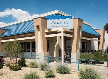
Pajarito Brewpub and Grill
Discover the flavors of New Mexico at Pajarito Brewpub and Grill, where craft beer meets delicious cuisine in a welcoming atmosphere.
-
Cafe
Pig and Fig Cafe
Discover the heart of White Rock at Pig and Fig Cafe, where gourmet breakfast, fresh pastries, and fine wines await every traveler.
-
Bistro
Blue Window Bistro
Discover the flavors of New Mexico at Blue Window Bistro, a charming restaurant in Los Alamos offering fresh, local cuisine for every taste.
-
Restaurant
El Parasol
Experience the vibrant flavors of Mexico at El Parasol, Los Alamos' beloved destination for authentic and delicious Mexican cuisine.


Best shops in Bandelier National Monument
Shopping within Bandelier is limited, with the principal visitor facilities focused on interpretation, conservation and visitor services rather than a broad retail scene. Los Alamos is the nearest dependable place for everyday supplies, outdoor necessities and locally oriented gifts, while Santa Fe and Española provide a wider selection of galleries, markets and independent shops. Northern New Mexico is known for arts and crafts including Pueblo pottery, woven textiles, jewellery, wood carving and other forms of Indigenous and Hispanic artistic practice, but visitors should buy from reputable artists or established galleries and ask about provenance. Regional food products and chile-based specialities may also be found in shops and markets outside the monument. Visitors should not remove artefacts, stones or natural materials from Bandelier, and should distinguish genuine locally made work from generic souvenirs labelled only with the region's name.
-
National reserve
Bandelier National Monument
Explore Bandelier National Monument: A unique blend of ancient history, stunning landscapes, and diverse wildlife in New Mexico's captivating national reserve.
-
Visitor center
Bandelier National Monument Visitor Center
Uncover the ancient Puebloan culture and stunning landscapes at Bandelier National Monument Visitor Center, your gateway to adventure in New Mexico.
-
Grocery store
Smith's Marketplace
Explore the vibrant offerings at Smith's Marketplace in Los Alamos, where fresh produce, gourmet delights, and local specialties await every shopper.
-
Grocery store
Los Alamos Cooperative Market
Explore the flavors of Los Alamos at the Cooperative Market, your go-to destination for fresh produce, local meats, and delicious café offerings.


Get your free copy of our complete guide to Bandelier National Monument, delivered straight to you.
Everything on this page, from attractions and restaurants to essentials and local phrases, in one PDF you can read offline, print or share.
Already have an account? Sign in
Your Bandelier National Monument guide is ready.
We'll send it to · Not you? Sign out

Getting your guide ready…
We are putting together a fresh copy of the Bandelier National Monument guide. This can take up to a minute.
This can take a few moments. If your browser asks, choose Allow so the download can start. You'll find the guide in your Downloads folder.
Nothing happened? Download it again
Sorry, the guide is taking longer than usual. Please try again in a minute, or get it by email instead.
Bandelier National Monument essentials
Currency and Payment
Safety
Emergency Situations
Do's and Don'ts
Local Tips
From Eve
Local phrases worth knowing
You don't need to get them perfect. A few words go a long way, and locals appreciate the effort.
Basics
| English | Local | Say it |
|---|---|---|
| Hello | Hola | [oh-lah] |
| Goodbye | Adios | [ah-dee-ohs] |
| Yes | Sí | [see] |
| No | No | [noh] |
| Please/You're welcome | Por favor/De nada | [por fah-vor/deh nah-dah] |
| Thank you | Gracias | [grah-see-ahs] |
| Excuse me/Sorry | Disculpe/Lo siento | [dees-kool-peh/loh see-en-toh] |
| How are you? | ¿Cómo estás? | [koh-moh ehs-tahs] |
| Fine. And you? | Bien. ¿Y tú? | [byen. ee too] |
| Do you speak English? | ¿Hablas inglés? | [ah-blahs een-glehs] |
| I don't understand | No entiendo | [noh ehn-tyen-doh] |
Eating & Drinking
| English | Local | Say it |
|---|---|---|
| I'd like to see the menu, please | Me gustaría ver el menú, por favor | [meh goo-stah-ree-ah vehr ehl meh-noo, poor fah-vor] |
| I don't eat meat | No como carne | [noh koh-moh kahr-neh] |
| Cheers! | ¡Salud! | [sah-lood] |
| I would like to pay, please | Me gustaría pagar, por favor | [meh goo-stah-ree-ah pah-gahr, poor fah-vor] |
Emergencies
| English | Local | Say it |
|---|---|---|
| Help! | ¡Ayuda! | [ah-yoo-dah] |
| Go away! | ¡Vete! | [veh-teh] |
| Call the Police! | ¡Llame a la policía! | [yah-meh ah lah poh-lee-see-ah] |
| Call a doctor! | ¡Llame a un médico! | [yah-meh ah oon meh-dee-koh] |
| I'm lost | Estoy perdido | [ehs-toy pehr-dee-doh] |
| I'm ill | Estoy enfermo | [ehs-toy ehn-fehr-moh] |
Shopping
| English | Local | Say it |
|---|---|---|
| I'd like to buy... | Me gustaría comprar... | [meh goo-stah-ree-ah kohm-prahr] |
| I'm just looking | Solo estoy mirando | [soh-loh ehs-toy meer-ahn-doh] |
| How much is it? | ¿Cuánto cuesta? | [kwan-toh kwehs-tah] |
| That's too expensive | Eso es muy caro | [eh-soh ehs moo-ee kah-roh] |
| Can you lower the price? | ¿Puede bajar el precio? | [pweh-deh bah-har ehl pree-see-oh] |
Time & Numbers
| English | Local | Say it |
|---|---|---|
| What time is it? | ¿Qué hora es? | [keh oh-rah ehs] |
| It's one o'clock | Es la una | [ehs lah oo-nah] |
| Half past (10) | Media hora (10) | [meh-dee-ah oh-rah (dheez)] |
| Morning | Mañana | [mah-nyah-nah] |
| Afternoon | Tarde | [tahr-deh] |
| Evening | Noche | [noh-cheh] |
| Yesterday | Ayer | [ah-yehr] |
| Today | Hoy | [oy] |
| Tomorrow | Mañana | [mah-nyah-nah] |
| 1 | Uno | [oo-noh] |
| 2 | Dos | [dohs] |
| 3 | Tres | [trehs] |
| 4 | Cuatro | [kwah-troh] |
| 5 | Cinco | [seen-koh] |
| 6 | Seis | [saze] |
| 7 | Siete | [syeh-teh] |
| 8 | Ocho | [oh-choh] |
| 9 | Nueve | [nwheh-veh] |
| 10 | Diez | [dyehs] |
Transport & Directions
| English | Local | Say it |
|---|---|---|
| Where's a/the...? | ¿Dónde está el/la...? | [dohn-deh ehs-tah ehl/lah] |
| What's the address? | ¿Cuál es la dirección? | [kwal ehs lah dee-rehk-syon] |
| Can you show me (on the map)? | ¿Puede mostrarme (en el mapa)? | [pweh-deh mohs-trar-meh (ehn ehl mah-pah)] |
| When's the next (bus)? | ¿Cuándo es el próximo (autobús)? | [kwan-doh ehs ehl proh-ksy-moh (ow-toh-boos)] |
| A ticket (to ....) | Un boleto (para ....) | [oon boh-leh-toh (pah-rah)] |
History of Bandelier National Monument
Volcanic Foundations of the Plateau
Bandelier's cliffs and canyons are formed chiefly from volcanic tuff deposited by enormous eruptions in the Jemez volcanic field. The soft, pale rock of the Pajarito Plateau could be excavated relatively easily, while later erosion cut the ravines and alcoves that define Frijoles Canyon and other parts of the monument. These geological processes created both the natural setting and the building material that later communities used for homes, retaining walls and ceremonial spaces. The landscape therefore links deep geological time with the human history preserved in the monument.
Ancestral Pueblo Settlement
Ancestral Pueblo people lived in the Pajarito Plateau region for centuries, with especially important settlement at Bandelier from approximately the twelfth to the sixteenth centuries. Communities built masonry pueblos on canyon floors and mesa tops, while also shaping rooms into the soft cliff walls. Tyuonyi, Long House and the sites at Tsankawi demonstrate the range of domestic, communal and agricultural arrangements used in this environment. Farming, water management and movement between canyon and mesa connected the settlements to the wider plateau rather than making them isolated cliff residences.
Migration and Changing Communities
By the late sixteenth century, the communities associated with the Pajarito Plateau had largely moved away from the Bandelier area. The reasons involved a combination of environmental pressures, social change and wider regional developments, and the history should not be reduced to a single event. Descendant Pueblo communities remain connected to the ancestral places of the region. Spanish colonial expansion altered patterns of land use across northern New Mexico, while later Hispanic and Anglo settlement introduced ranching, farming and other uses to the surrounding landscape.
Scientific and Public Recognition
The archaeological remains attracted growing attention from researchers and visitors during the late nineteenth and early twentieth centuries. Bandelier National Monument was established by presidential proclamation in 1916, protecting the principal archaeological and scenic resources. Its name commemorates Adolph F. A. Bandelier, a nineteenth-century scholar whose research contributed to the study of Pueblo history, although modern archaeological interpretation places greater emphasis on Indigenous knowledge and descendant communities. The monument subsequently became part of the National Park Service system and developed facilities that made its canyons and ruins more accessible.
Conservation and Landscape Management
The Civilian Conservation Corps built roads, trails, walls and other infrastructure at Bandelier during the 1930s, much of it in the rustic style associated with early national-park development. The monument's later history has been shaped by archaeological conservation, wildfire, flooding, erosion and the need to manage visitation in a dry, fire-prone mountain environment. Fires in the surrounding Jemez region have altered vegetation and affected access at different times. Today, protection of cultural sites, habitat and traditional connections remains central to the monument's management.
Bandelier National Monument in Photos
Browse through our photo collection highlighting the charm and character of the destination.
Cities in Bandelier National Monument
The towns and cities of Bandelier National Monument, and the easiest places to base yourself.

Swipe for more cities
Neighbouring destination travel guides
The closest destinations to Bandelier National Monument, if you have time for more than one.
-

-

-
-

-


Swipe for more destinations
Explore more

Explore more of Jemez Mountains
Explore New Mexico’s Jemez Mountains for volcanic calderas, pine forests, hot springs, Pueblo heritage, hiking and high-country scenery.
Explore Jemez Mountains
Explore more of New Mexico
Discover the enchanting blend of rich history, diverse cultures, and stunning landscapes in New Mexico, the Land of Enchantment, where adventure and relaxation await.
Explore New Mexico