

Free Canterbury Travel Guide & Mobile App
Explore Canterbury with free travel guides. Discover regional history, expert tips, proposed trips, and audio guides on web or mobile app.


Explore Canterbury’s Christchurch culture, Banks Peninsula harbours, fertile plains, glacial lakes and Southern Alps landscapes across New Zealand’s South Island.
Read more about Canterbury
When is the best time to visit Canterbury?
Best: December–February · 22°C| Month | High (°C) | Rainfall (mm) |
|---|---|---|
| January (best) | 22 | 50 |
| February (best) | 22 | 40 |
| March | 20 | 50 |
| April | 16 | 50 |
| May | 13 | 50 |
| June | 11 | 50 |
| July | 10 | 60 |
| August | 13 | 60 |
| September | 17 | 50 |
| October | 19 | 50 |
| November | 21 | 50 |
| December (best) | 22 | 50 |
Getting to and around Canterbury
How to get there
Transportation
Top city travel guides in Canterbury
The cities of Canterbury, and the easiest places to base yourself.
-

-

-
-


Swipe for more cities
Destinations in Canterbury
Resorts, valleys and scenic spots worth a trip of their own.
-

-

-


Swipe for more destinations
Best attractions in Canterbury
Canterbury’s attractions range from the urban museums, galleries, gardens and riverside spaces of Christchurch to the volcanic coast and sheltered harbours of Banks Peninsula. Lyttelton and Akaroa provide maritime history and access to wildlife-focused excursions, while the peninsula’s roads and walking tracks reveal steep valleys and changing sea views. Across the plains, rural museums, heritage buildings, gardens, farmers’ markets and historic town centres reflect the region’s agricultural development. Further inland, the Mackenzie Basin offers glacial lakes, dark-sky viewing, cycling, scenic drives and walks beneath the Southern Alps. Aoraki/Mount Cook National Park is the centrepiece for alpine scenery, with marked tracks leading through valleys and towards glaciers and high peaks. The Canterbury foothills and Arthur’s Pass approaches add forests, rivers and mountain passes, although weather and road conditions demand preparation. Families can find accessible wildlife, science and cultural attractions in Christchurch and Timaru, while outdoor travellers can choose from boating, fly-fishing, hiking, cycling and winter activities. The attraction landscape is defined less by a single resort than by the contrast between city, coast, productive plains and high country.
-
Museum
Canterbury Museum
Explore the rich tapestry of New Zealand's history and culture at the Canterbury Museum in Christchurch. A must-visit destination for every traveler.
-
Tourist attraction
Kura Tawhiti Conservation Area
Discover the breathtaking rock formations and rich Maori heritage at Kura Tawhiti Conservation Area, a hiker's paradise in New Zealand.
-
Museum
Quake City
Explore Quake City, a museum dedicated to the resilience of Christchurch through its earthquake history and personal stories of recovery.
-
Tourist attraction
Dark Sky Project
Explore the wonders of the universe at Lake Tekapo's Dark Sky Project, offering stargazing tours, dining, and unique shopping experiences.


Best landmarks in Canterbury
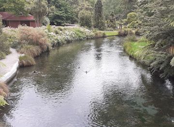
Aoraki/Mount Cook is Canterbury’s most recognisable natural landmark, rising above the Southern Alps and carrying deep significance in Ngāi Tahu tradition as well as national mountaineering history. The turquoise waters of Lake Tekapo and Lake Pukaki, framed by high peaks and wide tussock country, define the Mackenzie Basin’s visual identity. The Church of the Good Shepherd at Lake Tekapo is a small but widely recognised stone church associated with the region’s early pastoral communities. In Christchurch, the Avon River corridor, central squares, surviving heritage buildings and the damaged yet historically important ChristChurch Cathedral reveal the city’s layered history and post-earthquake transformation. Banks Peninsula contributes volcanic ridges, Akaroa Harbour and the historic settlements of Akaroa and Lyttelton, while Timaru’s Victorian civic buildings and Caroline Bay mark its coastal role in South Canterbury. The braided Waimakariri and Rakaia rivers are major geographical features, demonstrating the powerful river systems that descend from the Alps across the plains. Together these landmarks express Canterbury through mountains, water, settlement and agricultural space rather than through a single monument.
-
 Museum
Canterbury Museum
Explore the fascinating history and culture of New Zealand at Canterbury Museum, a premier destination in Christchurch for history buffs and families.
-
Park
Riccarton House and Bush
Explore the lush gardens and historical charm of Riccarton House and Bush in Christchurch, a serene escape into New Zealand's natural beauty.
-
Museum
Quake City
Discover the resilience of Christchurch at Quake City, where the story of the 2011 earthquakes comes to life through immersive exhibits and personal narratives.
-
Tourist attraction
Dark Sky Project
Discover the wonders of the universe at the Dark Sky Project in Lake Tekapo, where stargazing meets conservation in a breathtaking setting.


Explore Canterbury on the map
Plan your trip on one map. See where the top cities, national parks and sights are, and book hotels and experiences in a few clicks.
Best hotels in Canterbury
Best restaurants in Canterbury
Canterbury’s dining reflects the productive plains, coastal waters and growing urban culture of Christchurch. Menus commonly draw on New Zealand lamb and beef, dairy products, grains, seasonal fruit and vegetables, with seafood particularly prominent in coastal settlements and the Banks Peninsula area. Christchurch offers the widest range, from cafés and bakeries to contemporary restaurants, international kitchens and modern interpretations of local produce. Timaru, Ashburton, Rangiora and smaller towns provide practical cafés, pubs and family restaurants, while rural inns and cellar doors offer a slower way to sample the region’s agricultural output. Farmers’ markets are useful for fruit, preserves, bread, cheese and prepared foods when operating, and seasonal availability matters more than a single defining Canterbury dish. Visitors should also look for menus that acknowledge Māori ingredients or local provenance without assuming that every regional speciality is exclusive to Canterbury. In the Mackenzie Basin, dining is concentrated in a small number of settlements and accommodation venues, so advance planning is sensible outside Christchurch.
-
Restaurant
Fiddlesticks Restaurant and Bar
Experience the vibrant flavors of New Zealand at Fiddlesticks Restaurant and Bar in Christchurch - where every meal is a celebration.
-
New Zealand
The Old Vicarage Cafe, Restaurant & Bar
Discover culinary delights at The Old Vicarage Cafe & Restaurant in Halswell – where exceptional flavors meet inviting ambiance.
-
Italian
Tutto Bene
Experience authentic Italian cuisine at Tutto Bene in St Albans, Christchurch - where every dish tells a story.
-
Japanese
Kohan Restaurant
Experience exquisite Japanese cuisine at Kohan Restaurant with breathtaking views of Lake Tekapo's stunning landscapes.


Best bars in Canterbury
Christchurch is Canterbury’s main centre for evening entertainment, with city bars, pubs, cocktail venues, live music, cultural performances and a modest selection of late-night establishments. The central city and surrounding neighbourhoods offer the greatest variety, while university influences are noticeable in some parts of the evening economy. Timaru and Ashburton have a quieter scene centred on pubs, restaurants, local events and occasional live music rather than a large club circuit. Akaroa and other Banks Peninsula settlements are oriented towards harbour dining, historic pubs and early-evening hospitality, with activity often becoming more seasonal. In rural Canterbury and the Mackenzie Basin, evenings are generally about restaurants, hotel bars, stargazing or small community venues. Breweries and cellar-door experiences can be part of the region’s drinks culture, but opening arrangements vary, and alcohol should not be treated as the sole focus of local nightlife.
-
Pub
Pomeroy's Old Brewery Inn
Experience the charm of Pomeroy's Old Brewery Inn, a historic pub in Christchurch offering local cuisine and craft beers in a warm, inviting atmosphere.
-
Bar
Dux Central
Experience the vibrant atmosphere of Dux Central, Christchurch's premier gastropub and beer garden, serving local flavors and craft drinks.
-
Bar
Tavern Harewood
Discover the vibrant atmosphere and delectable cuisine at Tavern Harewood, a must-visit bar and restaurant in Christchurch, New Zealand.
-
Bar
Smash Palace
Experience the lively ambiance and delicious offerings at Smash Palace, a premier bar in Christchurch Central City.


Best nightclubs in Canterbury
Christchurch is Canterbury’s main centre for evening entertainment, with city bars, pubs, cocktail venues, live music, cultural performances and a modest selection of late-night establishments. The central city and surrounding neighbourhoods offer the greatest variety, while university influences are noticeable in some parts of the evening economy. Timaru and Ashburton have a quieter scene centred on pubs, restaurants, local events and occasional live music rather than a large club circuit. Akaroa and other Banks Peninsula settlements are oriented towards harbour dining, historic pubs and early-evening hospitality, with activity often becoming more seasonal. In rural Canterbury and the Mackenzie Basin, evenings are generally about restaurants, hotel bars, stargazing or small community venues. Breweries and cellar-door experiences can be part of the region’s drinks culture, but opening arrangements vary, and alcohol should not be treated as the sole focus of local nightlife.
-
Live Music
darkroom
Discover Darkroom, Christchurch's vibrant live music venue and bar, offering an unforgettable night of entertainment and local culture.
-
Social club
Canterbury Club Inc
Experience the charm of the historic Canterbury Club in Christchurch, a social hub offering a glimpse into local culture and camaraderie.
-
Cocktail bar
The Poplar Social Club
Experience the vibrant cocktail culture of Christchurch at The Poplar Social Club, a stylish bar offering innovative drinks and a lively atmosphere.
-
Club
The Christchurch Club
Experience the warm hospitality of The Christchurch Club, a charming social hub in the heart of Christchurch, perfect for relaxation and cultural immersion.


Best shops in Canterbury
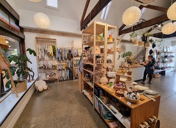
Christchurch offers Canterbury’s broadest shopping choice, from central streets and rebuilt retail areas to independent boutiques, galleries, bookshops, food halls and suburban centres. The Riverside Market and other regular markets provide opportunities to buy prepared food and locally produced goods, though individual trading days and stall availability should be checked. In the surrounding plains, towns such as Rangiora, Ashburton and Geraldine combine practical high-street shopping with cafés, antiques, craft outlets and small galleries. Akaroa is suited to browsing art, locally made products and food-oriented souvenirs in a historic harbour setting, while Timaru has a mix of independent retailers and everyday services. Useful regional purchases include honey, preserves, wine from nearby South Island districts, woollen goods, ceramics, art and packaged local produce. In rural areas, farm-gate sales and honesty boxes may appear seasonally, but visitors should carry payment options and respect private property. Shopping is generally independent and local in character outside Christchurch, rather than dominated by luxury fashion or large specialist malls.
-
Shopping mall
Westfield Riccarton
Explore over 150 stores, diverse dining options, and vibrant entertainment at Westfield Riccarton, Christchurch's ultimate shopping destination.
-
Shopping mall
The Tannery
Explore The Tannery in Christchurch: A unique shopping mall blending boutique shopping, live music, and local events in a historic setting.
-
Gift shop
Backcountry Gifts
Discover unique New Zealand gifts at Backcountry Gifts in Rangiora, where local craftsmanship meets unforgettable souvenirs.
-
Shopping mall
New Regent Street Precinct
Explore the historic and vibrant New Regent Street Precinct in Christchurch, where shopping, dining, and culture come together in a charming setting.



Get your free copy of our complete guide to Canterbury, delivered straight to you.
Everything on this page, from attractions and restaurants to essentials and local phrases, in one PDF you can read offline, print or share.
Already have an account? Sign in
Your Canterbury guide is ready.
We'll send it to · Not you? Sign out

Getting your guide ready…
We are putting together a fresh copy of the Canterbury guide. This can take up to a minute.
This can take a few moments. If your browser asks, choose Allow so the download can start. You'll find the guide in your Downloads folder.
Nothing happened? Download it again
Sorry, the guide is taking longer than usual. Please try again in a minute, or get it by email instead.
Canterbury essentials
Currency and Payment
Safety
Emergency Situations
Do's and Don'ts
Local Tips
From Eve
Local phrases worth knowing
You don't need to get them perfect. A few words go a long way, and locals appreciate the effort.
Basics
| English | Local | Say it |
|---|---|---|
| Hello | Kia ora | [kee-ah or-ah] |
| Goodbye | Ka kite | [kah kee-teh] |
| Yes | Ae | [ah-eh] |
| No | Kao | [kah-oh] |
| Please/You're welcome | Tena koa | [teh-nah koh-ah] |
| Thank you | Ngā mihi | [ngah mee-hee] |
| Excuse me/Sorry | Aroha mai | [ah-roh-hah my] |
| How are you? | Kei te pēhea koe? | [kay teh peh-heh-ah koy] |
| Fine. And you? | Pai. Aroha mai? | [pie. ah-roh-hah my?] |
| Do you speak English? | Ka korero koe i te reo Pākehā? | [kah koh-reh-roh koy ee teh reh-oh pah-keh-hah?] |
| I don't understand | Kaore au e mohio | [kah-oh-reh ow eh moh-he-oh] |
Eating & Drinking
| English | Local | Say it |
|---|---|---|
| I'd like to see the menu, please | Ka hiahia au ki te kite i te rārangi kai | [kah hee-ah-hee-ah ow kee teh kee-teh ee teh rah-rah-ngi kye] |
| I don't eat meat | Kaore au e kai i te mutton | [kah-oh-reh ow eh kye ee teh muht-ton] |
| Cheers! | Kia ora! | [kee-ah or-ah!] |
| I would like to pay, please | Ka hiahia au ki te utu, please | [kah hee-ah-hee-ah ow kee teh oo-too, please] |
Emergencies
| English | Local | Say it |
|---|---|---|
| Help! | Tautoko! | [tau-toh-koh!] |
| Go away! | Haere atu! | [hye-reh ah-too!] |
| Call the Police! | Karanga ki te Pirihimana! | [kah-rahng-ah kee teh pee-ree-hee-mah-nah!] |
| Call a doctor! | Karanga ki te taakuta! | [kah-rahng-ah kee teh tah-koot-ah!] |
| I'm lost | Kua ngaro au | [koo-ah nah-roh ow] |
| I'm ill | Kei te mate au | [kay teh mah-teh ow] |
Shopping
| English | Local | Say it |
|---|---|---|
| I'd like to buy... | Ka hiahia au ki te hoko... | [kah hee-ah-hee-ah ow kee teh hoh-koh...] |
| I'm just looking | Kei te tirohia au | [kay teh tee-roh-hee-ah ow] |
| How much is it? | E hia te utu? | [eh hee-ah teh oo-too?] |
| That's too expensive | He tino utu nui tēnā | [he tee-noh oo-too noo-ee teh-nah] |
| Can you lower the price? | Ka taea e koe te whakaiti i te utu? | [kah tah-eh ah ee koh-eh teh fuh-kai-tee ee teh oo-too?] |
Time & Numbers
| English | Local | Say it |
|---|---|---|
| What time is it? | He aha te haora? | [he ah-hah teh how-rah?] |
| It's one o'clock | Kei te tahi karaka | [kay teh tah-hee kah-rah-kah] |
| Half past (10) | Haere ki te haurua i te tekau | [hye-reh kee teh how-roo-ah ee teh teh-kah] |
| Morning | Ata | [ah-tah] |
| Afternoon | Ahiahi | [ah-hee-ah-hee] |
| Evening | Pō | [poh] |
| Yesterday | Inā ia | [ee-nah ee-ah] |
| Today | I tēnei rā | [ee tay-nay rah] |
| Tomorrow | I āpōpō | [ee ah-poh-poh] |
| 1 | Tahi | [tah-hee] |
| 2 | Rua | [roo-ah] |
| 3 | Toru | [toh-roo] |
| 4 | Whā | [fah] |
| 5 | Rima | [ree-mah] |
| 6 | Ona | [oh-nah] |
| 7 | Whitu | [fee-too] |
| 8 | Waru | [wah-roo] |
| 9 | Iwa | [ee-wah] |
| 10 | Tekau | [teh-kah-oo] |
Transport & Directions
| English | Local | Say it |
|---|---|---|
| Where's a/the...? | Kei hea te...? | [kay heh-ah teh...?] |
| What's the address? | He aha te wāhitau? | [he ah-hah teh wah-hee-tah-oo?] |
| Can you show me (on the map)? | Ka taea e koe te whakaatu (i te mapi)? | [kah tah-eh ah ee koh-eh teh fuh-kah-ah-too (ee teh mah-pee)?] |
| When's the next (bus)? | Kāti te waka e haere mai? | [kah-tee teh wah-kah eh hye-reh my?] |
| A ticket (to ....) | He tikiti (ki ....) | [he tee-key-tee (kee ....)] |
History of Canterbury
Māori Settlement and Ngāi Tahu Heritage
Māori settlement in Canterbury predates European colonisation by centuries. The wider region was used for seasonal travel, food gathering and trade, with mahinga kai, or traditional food-gathering places, associated with rivers, wetlands, lakes and the coast. Ngāi Tahu are the principal iwi of the South Island, and their history remains closely connected with Banks Peninsula, the Canterbury Plains, the alpine interior and the major waterways. Place names, archaeological evidence and contemporary cultural interpretation provide important reminders that Canterbury’s history did not begin with the arrival of British settlers.
The Canterbury Association and Christchurch’s Foundation
The organised European settlement of Canterbury accelerated in 1850, when the Canterbury Association sent settlers from Britain to establish a planned colony. Christchurch was laid out around an English-inspired grid, with the Avon River, central squares and ecclesiastical institutions helping to shape its early identity. The settlement’s founders promoted an Anglican social vision, although Canterbury soon developed beyond that original design. The surviving street plan, early civic buildings and historic townships across the plains reflect the ambitions and limitations of this colonial project.
Pastoral Expansion across the Plains
During the nineteenth century, pastoral farming transformed the Canterbury Plains and foothills. Large sheep stations, followed later by more intensive mixed farming, occupied land approached through developing roads, bridges and stock routes. The region’s broad grasslands and relatively dry climate encouraged a strong agricultural economy, while Christchurch became a centre for commerce, administration and processing. Much of Canterbury’s contemporary landscape—open paddocks, shelterbelts, irrigation systems, farm settlements and river crossings—derives from this long shift from seasonal Indigenous use to an export-oriented colonial rural economy.
Railways, Ports and Regional Development
Rail and port infrastructure connected Canterbury’s farms, towns and industries with domestic and overseas markets. Christchurch’s port at Lyttelton, reached by rail through the Port Hills, became especially important for importing goods and exporting agricultural products. Branch railway lines once extended deep into the plains and foothills, supporting town growth and rural settlement even where some routes have since closed. Timaru also developed as a significant South Canterbury port. These transport links helped establish the regional pattern of a major urban centre supported by a network of agricultural towns.
Gold, Coal and Industrial Change
Canterbury was not New Zealand’s principal goldfield, but mineral extraction and industrial activity still influenced parts of the region. Coal mining occurred around areas such as Malvern in the foothills, while quarrying, engineering, wool processing and food production became more durable elements of the regional economy. Water management and later hydroelectric development altered inland valleys and river systems, particularly around the Mackenzie Basin and the Waitaki catchment. These industries connected Canterbury’s rural economy with wider national programmes of infrastructure and energy production.
Aoraki/Mount Cook and the Growth of Alpine Tourism
Mountaineering and organised exploration around Aoraki/Mount Cook expanded from the late nineteenth century, supported by guides, accommodation and improving roads. The mountain’s cultural significance to Ngāi Tahu and its importance to New Zealand’s national identity are central to its interpretation. The establishment and later development of Aoraki/Mount Cook National Park helped protect a landscape of glaciers, high peaks and alpine valleys while making selected areas accessible to visitors. Today the region’s walking, climbing, scenic-flight and conservation economies are closely linked to this heritage.
The Canterbury Earthquakes and Urban Renewal
A major earthquake struck Canterbury in September 2010, followed by the devastating Christchurch earthquake of 22 February 2011. Lives were lost, buildings were damaged or demolished, and the effects extended through Christchurch and surrounding communities. The disaster prompted extensive rebuilding, changes to building practice, new public spaces and difficult debates about heritage, housing and urban form. Christchurch’s present-day centre therefore reflects both the city’s nineteenth-century foundations and a continuing process of reconstruction, adaptation and civic renewal.
Canterbury in Photos
Browse through our photo collection highlighting the charm and character of the destination.
Neighbouring regions of Canterbury
The closest regions to Canterbury, if you have time for more than one.
-

-

-

-

-


Swipe for more regions
Explore more

Explore more of New Zealand
New Zealand: Discover awe-inspiring landscapes, vibrant Maori culture, and thrilling adventures in a land of breathtaking natural beauty and welcoming locals.
Explore New Zealand