

Ohiopyle State Park Travel Guide - Free Web & App
Your ultimate guide to Ohiopyle State Park. Discover top landmarks, proposed trips, and local tips. Free on the web or via the Evendo companion app.


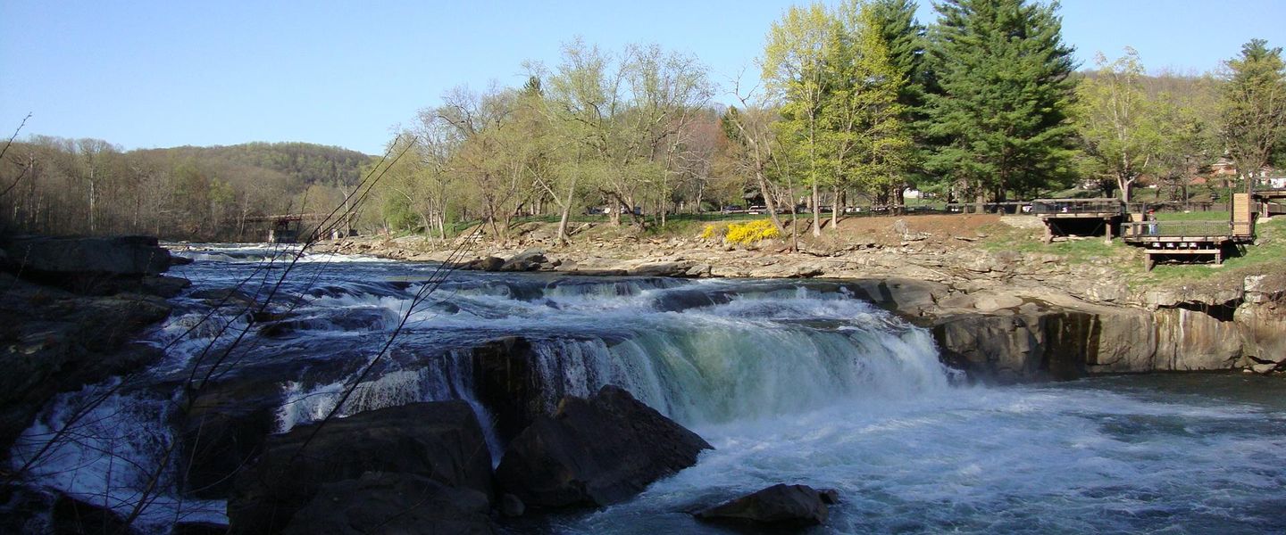


Ohiopyle State Park in Pennsylvania offers Youghiogheny River rapids, waterfalls, gorge trails, cycling on the Great Allegheny Passage and Laurel Highlands scenery.
River Landscape and Outdoor Character
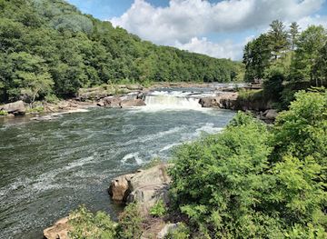
Ohiopyle State Park occupies roughly 19,000 acres in Pennsylvania’s Laurel Highlands, where the Youghiogheny River cuts through the Allegheny Plateau south-east of Pittsburgh. The park is defined by moving water and steep woodland: the river narrows into rapids, drops over Ohiopyle Falls and passes beneath forested slopes, while Meadow Run feeds a series of natural water features and cascades. The small borough of Ohiopyle forms the principal visitor hub, with roads, river access, the state park office and the Great Allegheny Passage converging near the river.Read more about Ohiopyle State Park
Waterfalls, Trails and the Youghiogheny
A Gateway to the Laurel Highlands
When is the best time to visit Ohiopyle State Park?
Best: June–August · 24–25°C| Month | High (°C) | Rainfall (mm) |
|---|---|---|
| January | 2 | 75 |
| February | 4 | 70 |
| March | 8 | 80 |
| April | 14 | 90 |
| May | 20 | 100 |
| June (best) | 24 | 105 |
| July (best) | 25 | 110 |
| August (best) | 25 | 105 |
| September | 21 | 95 |
| October | 15 | 90 |
| November | 8 | 85 |
| December | 4 | 80 |
Getting to and around Ohiopyle State Park
How to get there
Transportation
Best attractions in Ohiopyle State Park
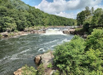
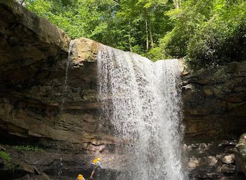
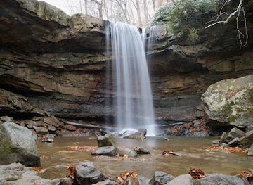
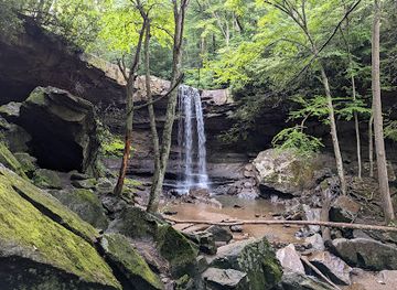
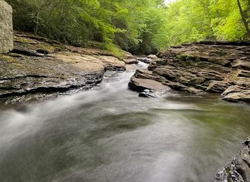
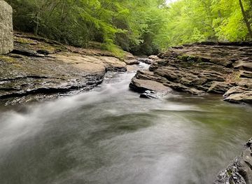
Ohiopyle Falls is the park’s defining river sight, where the Youghiogheny narrows and tumbles through a broad rocky channel close to the visitor hub. Nearby Cucumber Falls drops through a wooded ravine and is one of the area’s most photographed natural features, while the Ferncliff Peninsula offers trails through a distinctive riverside plant community shaped by its sheltered microclimate. Meadow Run provides cascades, rock formations and water-carved channels, although visitors should follow current guidance before entering the water. Across the wider park, hiking routes explore forested slopes, gorge rims and quiet sections of the river valley. The Great Allegheny Passage offers a contrasting experience on a former railway alignment, linking Ohiopyle with Confluence and Connellsville while accommodating walkers and cyclists. The surrounding Laurel Highlands add rural roads, farms and historic communities to the park experience without being part of the state park itself.
-
Tourist attraction
Fallingwater
Discover Fallingwater, Frank Lloyd Wright's iconic architectural masterpiece harmonizing with nature in Pennsylvania's breathtaking landscape.
-
Tourist attraction
Frank Lloyd Wright's Kentuck Knob
Explore Frank Lloyd Wright's Kentuck Knob, a stunning architectural landmark blending nature and design in the heart of Pennsylvania.
-
Tourist attraction
Fort Necessity National Battlefield
Explore the rich history and natural beauty of Fort Necessity National Battlefield, where George Washington's legacy began amid breathtaking Pennsylvania landscapes.
-
Tourist attraction
Bear Run Nature Reserve
Explore Bear Run Nature Reserve, a stunning nature preserve in Pennsylvania offering breathtaking views, diverse wildlife, and serene hiking trails.


Best landmarks in Ohiopyle State Park
The Youghiogheny River is Ohiopyle’s principal natural landmark, its gorge and rapids providing the physical and cultural focus of the park. Ohiopyle Falls marks a prominent break in the river’s course and is closely associated with the identity of the village, while Cucumber Falls is a smaller but highly distinctive waterfall set within a wooded ravine. Ferncliff Peninsula is significant for its unusual riverside environment and plant communities, created by the peninsula’s position within the river. The Great Allegheny Passage is a landmark of a different kind: its trail follows a former railway corridor and represents the area’s transition from transport and timber-related use towards recreation. Together, these features express Ohiopyle’s relationship between geology, water, woodland, transport history and modern conservation without relying on a dense collection of buildings or monuments.
-
Visitor center
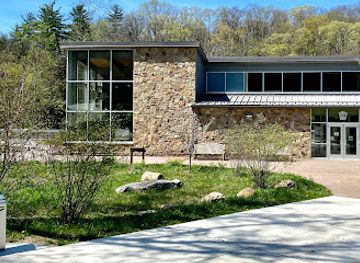
Ohiopyle State Park Visitor Center
Discover the natural beauty and adventure opportunities at Ohiopyle State Park Visitor Center, your gateway to Pennsylvania's outdoor wonders.
-
Hiking area
Natural Water Slides
Experience the exhilarating Natural Water Slides at Ohiopyle, a stunning natural attraction perfect for adventure seekers and nature lovers in Pennsylvania.
-
Raft trip outfitter
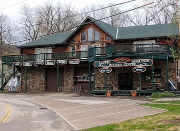
Laurel Highlands River Tours and Outdoor Center
Experience the thrill of adventure at Laurel Highlands River Tours and Outdoor Center, the ultimate destination for outdoor fun in Ohiopyle, Pennsylvania.
-
Waterfall
Ohiopyle Falls
Discover the breathtaking beauty of Ohiopyle Falls in Pennsylvania, where nature's splendor meets thrilling outdoor adventures.
Explore Ohiopyle State Park on the map
Plan your trip on one map. See where the top attractions, landmarks, restaurants and hotels are, and book hotels and experiences in a few clicks.
Best hotels in Ohiopyle State Park
Best restaurants in Ohiopyle State Park
Ohiopyle State Park has a limited dining scene within its boundaries, with most food choices concentrated in Ohiopyle borough and nearby Laurel Highlands communities rather than beside remote trails or river access points. Visitors can find casual meals, refreshments and provisions around the main visitor hub, while Confluence, Farmington and other nearby settlements provide additional options depending on the route. The regional food culture reflects Pennsylvania’s rural interior: diners and small eateries commonly draw on American comfort food, bakery traditions, seasonal produce and locally made goods, while farm shops in the wider area may sell regional provisions. Cyclists and hikers using the Great Allegheny Passage should plan food and water ahead, particularly when travelling beyond the central village. Opening patterns and seasonal availability vary, so independent businesses should be checked before making a specific journey.
-
State park
Ohiopyle State Park
Explore Ohiopyle State Park: A Nature Lover's Paradise with Adventure Awaits at Every Turn.
-
Visitor center
Ohiopyle State Park Visitor Center
Explore Ohiopyle State Park Visitor Center – Your gateway to adventure in Pennsylvania's breathtaking landscapes.
-
Hiking area
Natural Water Slides
Experience thrilling fun at Ohiopyle's Natural Water Slides - an enchanting blend of adventure and nature in Pennsylvania's stunning landscapes.
-
Bar
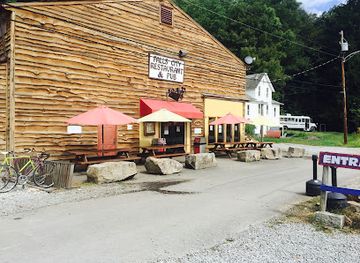
Falls City Pub & Restaurant
Discover Falls City Pub & Restaurant: where hearty meals meet local charm in picturesque Ohiopyle.
Best bars in Ohiopyle State Park
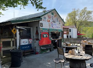
Evenings in Ohiopyle are generally quiet and outdoors-oriented rather than centred on nightlife. The village and surrounding Laurel Highlands have traditional pubs, casual bars and restaurant-based evening hospitality, but the park itself does not have a concentrated bar or nightclub district. After a day on the river or trails, the characteristic atmosphere is a relaxed meal, a drink at a rural inn or time spent at accommodation outside the core park area. Confluence, Farmington and larger regional communities may offer further evening choices, although visitors should expect distances between settlements and limited late-night transport. Seasonal events and outdoor tourism create a sociable atmosphere in warmer months, but performances and venue schedules are not constant, so evening plans need to be arranged around current local information rather than assumed availability.
-
Restaurant
Braddock's Restaurant and Tavern
Discover Braddock's Restaurant and Tavern in Farmington, PA - a delightful blend of American cuisine, ice cream delights, and local charm.
-
Bar
The Stone House Restaurant and Country Inn
Discover the charm of The Stone House Restaurant and Country Inn in Farmington, PA - where rustic beauty meets exquisite dining.
-
Bar
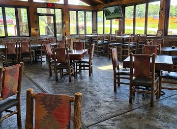
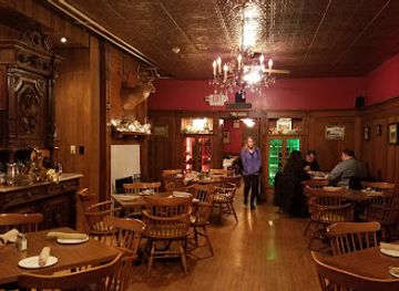
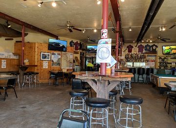
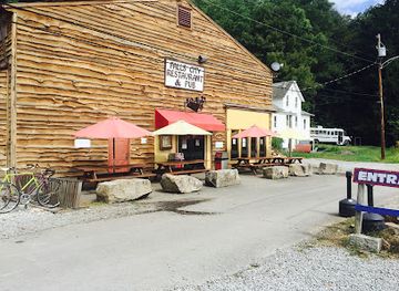
Falls City Pub & Restaurant
Discover Falls City Pub & Restaurant: Your go-to spot in Ohiopyle for craft beer, delicious food, and a cozy atmosphere.
-
Bar
Ohiopyle House Cafe
Experience the perfect blend of delicious dining and breathtaking views at Ohiopyle House Cafe, your family-friendly spot in nature's paradise.
Best nightclubs in Ohiopyle State Park
Evenings in Ohiopyle are generally quiet and outdoors-oriented rather than centred on nightlife. The village and surrounding Laurel Highlands have traditional pubs, casual bars and restaurant-based evening hospitality, but the park itself does not have a concentrated bar or nightclub district. After a day on the river or trails, the characteristic atmosphere is a relaxed meal, a drink at a rural inn or time spent at accommodation outside the core park area. Confluence, Farmington and larger regional communities may offer further evening choices, although visitors should expect distances between settlements and limited late-night transport. Seasonal events and outdoor tourism create a sociable atmosphere in warmer months, but performances and venue schedules are not constant, so evening plans need to be arranged around current local information rather than assumed availability.
-
Bar
Falls City Pub & Restaurant
Experience the vibrant atmosphere and delicious cuisine at Falls City Pub & Restaurant in Ohiopyle, PA, perfect for relaxation and local flavor.
Best shops in Ohiopyle State Park
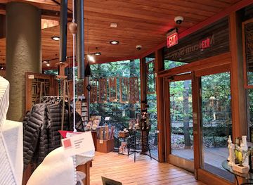
Shopping in Ohiopyle is modest and practical, focused on visitor essentials, outdoor equipment, souvenirs and locally themed goods rather than a large retail district. The borough’s visitor-oriented businesses and outfitters are the most convenient places to look for items connected with the river, hiking and cycling, while nearby Laurel Highlands communities provide additional groceries, fuel and everyday supplies. In the wider region, farm shops, small galleries, craft businesses and independent food producers may offer Pennsylvania-made products, seasonal provisions and locally inspired gifts, although these are dispersed rather than gathered in one market street. Visitors travelling the Great Allegheny Passage should obtain specialist equipment and substantial provisions before heading into quieter sections of the route. Retail choice and opening patterns can be seasonal, particularly outside the main summer period.
-
Nature preserve
Bear Run Nature Reserve
Discover the tranquility and natural beauty of Bear Run Nature Reserve, a premier nature preserve in Pennsylvania perfect for hiking and wildlife observation.
-
Visitor center
Ohiopyle State Park Visitor Center
Discover the natural beauty and adventure at Ohiopyle State Park Visitor Center, the ultimate gateway to outdoor exploration in Pennsylvania.
-
Hiking area
Natural Water Slides
Experience the thrill of nature at Ohiopyle's Natural Water Slides, a stunning outdoor attraction perfect for adventurers and families alike.
-
Raft trip outfitter
Laurel Highlands River Tours and Outdoor Center
Discover thrilling outdoor adventures at the Laurel Highlands River Tours and Outdoor Center, where excitement meets the stunning beauty of nature.
Get your free copy of our complete guide to Ohiopyle State Park, delivered straight to you.
Everything on this page, from attractions and restaurants to essentials and local phrases, in one PDF you can read offline, print or share.
Already have an account? Sign in
Your Ohiopyle State Park guide is ready.
We'll send it to · Not you? Sign out

Getting your guide ready…
We are putting together a fresh copy of the Ohiopyle State Park guide. This can take up to a minute.
This can take a few moments. If your browser asks, choose Allow so the download can start. You'll find the guide in your Downloads folder.
Nothing happened? Download it again
Sorry, the guide is taking longer than usual. Please try again in a minute, or get it by email instead.
Ohiopyle State Park essentials
Currency and Payment
Safety
Emergency Situations
Do's and Don'ts
Local Tips
From Eve
Local phrases worth knowing
You don't need to get them perfect. A few words go a long way, and locals appreciate the effort.
Basics
| English | Local | Say it |
|---|---|---|
| Hello | Howdy | [haw-dee] |
| Goodbye | See ya | [see yuh] |
| Yes | Yep | [yep] |
| No | Nah | [nah] |
| Please/You're welcome | Please/No problem | [pleez/no prob-lem] |
| Thank you | Thanks | [thanks] |
| Excuse me/Sorry | Pardon me/My bad | [par-dun me/my bad] |
| How are you? | Howdy | [haw-dee] |
| Fine. And you? | Great. You? | [grayt. yuh?] |
| Do you speak English? | Ya speak English? | [ya speak ing-glish?] |
| I don't understand | I ain't gettin' it | [I aint get-tin it] |
Eating & Drinking
| English | Local | Say it |
|---|---|---|
| I'd like to see the menu, please | Can I see the menu, please | [can eye see the menu, please] |
| I don't eat meat | I don't eat meat | [I don't eat meat] |
| Cheers! | Cheers! | [cheers!] |
| I would like to pay, please | Can I pay, please | [can eye pay, please] |
Emergencies
| English | Local | Say it |
|---|---|---|
| Help! | Help! | [help!] |
| Go away! | Beat it! | [beat it!] |
| Call the Police! | Call the coppers! | [call the cop-pers!] |
| Call a doctor! | Get a doc! | [get a doc!] |
| I'm lost | I'm lost | [I'm lost] |
| I'm ill | I'm feelin' poorly | [I'm feel-in poor-lee] |
Shopping
| English | Local | Say it |
|---|---|---|
| I'd like to buy... | I wanna buy... | [I wanna buy...] |
| I'm just looking | I'm just browsin' | [I'm just brow-sin] |
| How much is it? | How much? | [how much?] |
| That's too expensive | Too steep | [too steep] |
| Can you lower the price? | Can ya do me a deal? | [can ya do me a deal?] |
Time & Numbers
| English | Local | Say it |
|---|---|---|
| What time is it? | What's the time? | [what's the time?] |
| It's one o'clock | It's one | [it's one] |
| Half past (10) | Half ten | [half ten] |
| Morning | Mornin' | [morn-in] |
| Afternoon | Afternoon | [after-noon] |
| Evening | Evenin' | [even-in] |
| Yesterday | Yest'day | [yest-day] |
| Today | Today | [today] |
| Tomorrow | Tomorrow | [tomorrow] |
| 1 | One | [wun] |
| 2 | Two | [too] |
| 3 | Three | [three] |
| 4 | Four | [four] |
| 5 | Five | [five] |
| 6 | Six | [six] |
| 7 | Seven | [seven] |
| 8 | Eight | [eight] |
| 9 | Nine | [nine] |
| 10 | Ten | [ten] |
Transport & Directions
| English | Local | Say it |
|---|---|---|
| Where's a/the...? | Where's the...? | [where's the...?] |
| What's the address? | What's the addy? | [what's the addy?] |
| Can you show me (on the map)? | Can ya show me (on the map)? | [can ya show me (on the map)?] |
| When's the next (bus)? | When's the next (bus)? | [when's the next (bus)?] |
| A ticket (to ....) | A ticket (to ....) | [A ticket (to ....)] |
History of Ohiopyle State Park
A River-Shaped Landscape
Ohiopyle’s physical setting was formed over immense geological timescales as the Youghiogheny River cut through resistant rocks of the Allegheny Plateau. The resulting gorge, rapids, waterfalls and exposed river margins shaped the area’s later human history by concentrating travel, industry and settlement along the valley. The river’s name comes from an Indigenous language and is commonly interpreted as referring to a place where the water turns white or foams, an apt description of the rapids around Ohiopyle.
Indigenous Routes and Early Settlement
Long before the creation of the state park, the Youghiogheny valley formed part of a wider network of Indigenous travel routes and hunting territories. European-American settlement expanded in the surrounding Laurel Highlands during the eighteenth and nineteenth centuries, bringing farms, mills and small communities into the valleys. The difficult terrain limited large-scale agriculture, but the river corridors provided practical routes through the uplands and connected local settlements with markets beyond the immediate area.
Timber, Railways and the River Valley
The forests and waterways of the Laurel Highlands supported timbering, milling and other extractive activities during the nineteenth and early twentieth centuries. Railways reached the Youghiogheny valley and helped move timber, agricultural produce and passengers through the region, leaving a transport legacy that is still visible in the rail-trail corridor used by the Great Allegheny Passage. As industrial patterns changed, some former railway and working landscapes gradually acquired new importance for recreation and heritage tourism.
From Working Landscape to State Park
Pennsylvania acquired land along the Youghiogheny River and established Ohiopyle State Park in the 1960s, protecting a large section of the gorge and its surrounding forest. Park development introduced public trails, picnic areas, access points and interpretive facilities while retaining the river’s central role. Conservation management has had to balance public recreation with protection of steep slopes, woodland habitats, river ecosystems and sensitive areas such as the Ferncliff Peninsula.
Modern Recreation and Conservation
Ohiopyle grew into one of Pennsylvania’s principal outdoor recreation destinations as white-water rafting, hiking, cycling and nature study became increasingly important to the Laurel Highlands economy. The conversion of former railway corridors into the Great Allegheny Passage strengthened links between the park and neighbouring communities, including Confluence and Connellsville. Today, the park’s identity rests on managing intense recreational use around the river while preserving the geological, ecological and cultural character of the Youghiogheny valley.
Ohiopyle State Park in Photos
Browse through our photo collection highlighting the charm and character of the destination.
Neighbouring destination travel guides
The closest destinations to Ohiopyle State Park, if you have time for more than one.
-

-
-

-

-


Swipe for more destinations
Explore more

Explore more of Laurel Highlands
Explore Pennsylvania’s Laurel Highlands for Fallingwater, Ohiopyle’s rivers, Appalachian trails, historic battlefields and mountain-town culture.
Explore Laurel Highlands
Explore more of Pennsylvania
Discover Pennsylvania: A blend of rich history, breathtaking nature, and vibrant culture awaits you in the Keystone State.
Explore Pennsylvania