

Huaraz Region Travel Guide - Free Web & App
Your ultimate guide to Huaraz Region. Discover top landmarks, proposed trips, and local tips. Free on the web or via the Evendo companion app.


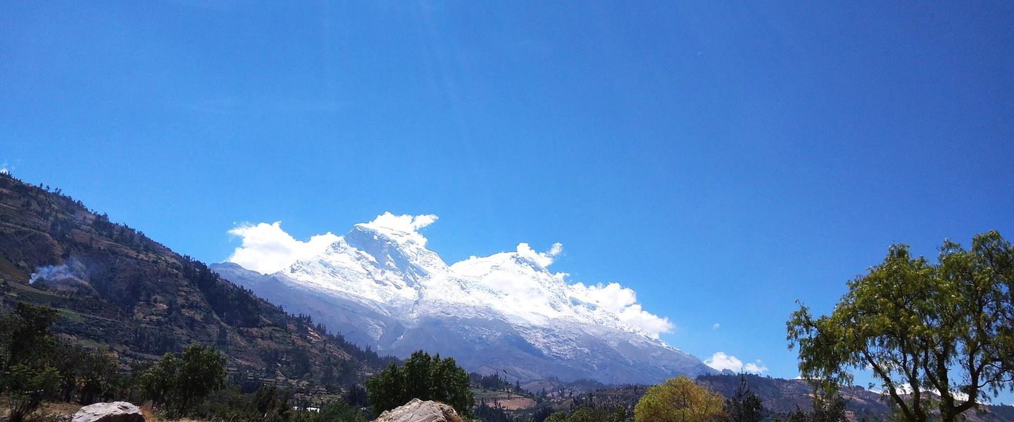


Huaraz Region, Peru, brings together the Cordillera Blanca, Huascarán National Park, high-altitude trekking, Andean villages, glacial lakes and living mountain culture.
Mountain Geography
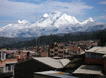
Huaraz Region occupies Peru’s central Andean highlands, where the city of Huaraz serves as the principal base for exploring the Cordillera Blanca, the Cordillera Negra and the broad Callejón de Huaylas valley. The eastern skyline is dominated by snow-covered summits, including Peru’s highest mountain, Huascarán, while turquoise glacial lakes, deep valleys and high passes shape one of the country’s most important trekking landscapes. Much of the Cordillera Blanca lies within Huascarán National Park, a protected area recognised for its glaciers, alpine ecosystems, geological formations and high-altitude wildlife.Read more about Huaraz Region
Valleys, Villages and Culture
Outdoor Exploration
When is the best time to visit Huaraz Region?
Best: December–February · 18–19°C| Month | High (°C) | Rainfall (mm) |
|---|---|---|
| January (best) | 19 | 15 |
| February (best) | 19 | 15 |
| March | 18 | 20 |
| April | 18 | 25 |
| May | 18 | 30 |
| June | 18 | 30 |
| July | 17 | 25 |
| August | 17 | 25 |
| September | 17 | 25 |
| October | 18 | 25 |
| November | 18 | 20 |
| December (best) | 18 | 15 |
Getting to and around Huaraz Region
How to get there
Transportation
Best attractions in Huaraz Region
Huaraz Region’s principal attractions are spread across the Callejón de Huaylas, the Cordillera Blanca and the valleys beyond. Huascarán National Park contains some of the area’s most recognisable destinations, including the vividly coloured waters of Laguna 69, the walk to Laguna Churup and the Pastoruri Glacier route, where high-altitude landscapes include puna grassland and distinctive puya raimondii plants. The Santa Cruz valley is a major trekking landscape, while the Huayhuash Circuit begins farther south and extends across a separate mountain range beyond the immediate Huascaraz area. In the valley, Yungay provides access to the Campo Santo memorial landscape, and Caraz is a useful base for northern excursions. East of the Cordillera Blanca, Chavín de Huántar offers a very different experience through its ceremonial architecture, carved stones and subterranean galleries.
-
Tourist attraction
Iglesia Del Señor De La Soledad
Discover the serene beauty and architectural splendor of Iglesia Del Señor De La Soledad in Huaraz, a must-visit spiritual landmark of Peru.
-
Park
Plazuela de la Soledad
Discover the peaceful ambiance and cultural richness of Plazuela de la Soledad, a serene park in the heart of Huaraz, Peru, perfect for relaxation and exploration.
-
Tourist attraction
Mirador de Rataquenua
Discover stunning panoramic views of the Andes at Mirador de Rataquenua, a must-visit destination for nature lovers and adventure seekers in Huaraz, Peru.
-
Tourist attraction
leones Park
Discover the serene beauty of Leones Park in Huaraz, a perfect blend of nature and recreation in the stunning Peruvian Andes.


Best landmarks in Huaraz Region
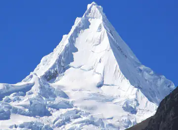
The defining natural landmark of Huaraz Region is the Cordillera Blanca, whose serrated skyline includes Nevado Huascarán, Peru’s highest mountain, together with peaks such as Alpamayo and Artesonraju. Within Huascarán National Park, glacial lakes including Laguna 69 and Laguna Churup reveal the region’s relationship with ice, rock and high-altitude water, while the Pastoruri Glacier provides one of the more accessible ways to encounter a retreating tropical glacier. The Campo Santo at Yungay is a deeply significant memorial landscape associated with the 1970 earthquake and subsequent disaster. Chavín de Huántar, east of the main mountain chain, is the region’s outstanding archaeological landmark, with carved stone monuments, ceremonial courtyards and underground galleries that testify to the influence of an early Andean civilisation.
-
Park
Main Square of Huaraz
Experience the vibrant Main Square of Huaraz, a cultural hub surrounded by stunning Andean mountains, local crafts, and rich Peruvian traditions.
-
Tourist attraction
Mirador de Rataquenua
Experience the stunning panoramic views of Huaraz at Mirador de Rataquenua, a breathtaking tourist attraction in the heart of the Andes.
-
Archaeological museum
Templo de Wilcahuain
Explore the ancient wonder of Templo de Wilcahuain, an archaeological museum nestled in Peru's stunning highlands, rich in history and natural beauty.
-
Historical landmark
Monumento a la Madre
Discover the Monumento a la Madre in Huaraz, a heartfelt tribute to motherhood surrounded by stunning Andean landscapes.


Explore Huaraz Region on the map
Plan your trip on one map. See where the top attractions, landmarks, restaurants and hotels are, and book hotels and experiences in a few clicks.
Best hotels in Huaraz Region
Best restaurants in Huaraz Region
Dining in Huaraz combines everyday Peruvian cooking with dishes and ingredients associated with the Ancash highlands. Restaurants and cafés in the city serve regional specialities such as picante de cuy, pachamanca and hearty soups, while trout from Andean waters is widely encountered on menus in the wider valley, although preparation and availability vary. Chicha de jora and other traditional drinks form part of the region’s culinary heritage, and local markets provide fruit, potatoes, maize, grains and cheeses for independent travellers or trekking provisions. Carhuaz, Yungay, Caraz and other Callejón de Huaylas settlements offer additional informal eateries and bakeries, but choices become limited near trailheads and in remote villages. Trekkers commonly arrange meals through lodges, guides or cooks rather than expecting restaurants at high-altitude camps.
-
Restaurant
Don Cuy
Discover authentic Peruvian flavors at Don Cuy in Huaraz – where every dish tells a story!
-
Restaurant
El Fogón
Discover the rich flavors of Peru at El Fogón in Huaraz – where culinary excellence meets local charm.
-
Restaurant
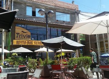
Trivio Resto Bar
Discover the flavors of Peru at Trivio Resto Bar in Huaraz - where local ingredients meet international culinary artistry.
-
Italian
Mi Comedia - Pizzeria
Discover authentic Italian flavors at Mi Comedia - Pizzeria in Huaraz; where every pizza tells a story amidst stunning Andean vistas.



Best bars in Huaraz Region
Huaraz has the region’s most established evening scene, with casual bars, cafés and restaurants where trekking visitors, local residents and mountain guides gather, as well as occasional live music and social events. The atmosphere is generally informal rather than centred on a large club district, and the availability of venues can change with the season. In Caraz, Carhuaz, Yungay and smaller valley communities, evenings are quieter and tend to revolve around local restaurants, cafés, festivities and traditional establishments rather than dedicated nightlife. Remote villages, national-park areas and trekking routes have little or no evening entertainment infrastructure, so visitors staying outside the main towns should expect dark, peaceful evenings and plan food, transport and refreshments in advance.
-
Grill
Trece Buhos
Discover Trece Buhos, a grill restaurant in Huaraz offering a delectable fusion of local flavors and grilled dishes to delight every palate.
-
Bar
El Tío Enrique
Discover the vibrant nightlife of Huaraz at El Tío Enrique, where local culture meets refreshing drinks and great company.
-
Cocktail bar
Kuya Kuya Coctelería Profesional Novoandina - Huaraz
Discover Kuya Kuya Coctelería Profesional Novoandina, where traditional Peruvian ingredients meet innovative mixology in a vibrant cocktail bar in Huaraz.
-
Grill
Laberinto Resto Bar
Experience the vibrant flavors of Huaraz at Laberinto Resto Bar, a grill haven for food lovers seeking unforgettable culinary adventures.


Best nightclubs in Huaraz Region
Huaraz has the region’s most established evening scene, with casual bars, cafés and restaurants where trekking visitors, local residents and mountain guides gather, as well as occasional live music and social events. The atmosphere is generally informal rather than centred on a large club district, and the availability of venues can change with the season. In Caraz, Carhuaz, Yungay and smaller valley communities, evenings are quieter and tend to revolve around local restaurants, cafés, festivities and traditional establishments rather than dedicated nightlife. Remote villages, national-park areas and trekking routes have little or no evening entertainment infrastructure, so visitors staying outside the main towns should expect dark, peaceful evenings and plan food, transport and refreshments in advance.
-
Night club
Zona vip
Immerse yourself in the lively nightlife of Huaraz at Zona Vip, where music and dance create unforgettable memories.
-
Disco club
Amadeus
Experience the vibrant nightlife of Huaraz at Amadeus, the disco club where music and energy collide for an unforgettable night.
-
Disco club
La huaca - Taberna Pub
Experience the vibrant nightlife of Huaraz at La Huaca - Taberna Pub, where local beats meet international vibes in an unforgettable disco setting.
-
Night club
Vichay Night Club
Experience the vibrant nightlife at Vichay Night Club in Huaraz, where music, drinks, and dancing come together for an unforgettable night out.


Best shops in Huaraz Region
Shopping is concentrated in Huaraz and the larger Callejón de Huaylas settlements rather than at remote mountain attractions. Huaraz’s markets are useful for fresh produce, snacks, coca-based products, warm clothing and practical trekking supplies, while specialist outdoor shops and agencies cater to hiking and climbing visitors. Regional crafts include woven textiles, knitted goods, carved objects and religious or festival-related items, though quality and provenance vary, so buying directly from recognised artisan initiatives or community businesses is preferable where possible. Chacas is particularly associated with woodcarving and religious art connected with local craft traditions. Caraz, Carhuaz and other valley towns offer smaller selections of food products, sweets and everyday goods; high-altitude trailheads generally have few dependable retail facilities.
-
Market
Mercado Central de Huaraz
Experience the heart of Huaraz at Mercado Central, a vibrant market offering local flavors, crafts, and the essence of Peruvian culture.
-
Supermarket
Novaplaza
Discover Novaplaza in Huaraz: Your one-stop supermarket for local flavors and essentials in the heart of Peru.
-
Supermarket
Disley Market
Discover the flavors of Huaraz at Disley Market, a vibrant supermarket filled with local produce, artisanal goods, and authentic Peruvian delicacies.
-
Grocery store
Don Queso
Discover local flavors and gourmet delights at Don Queso, Huaraz's culinary gem for food enthusiasts and travelers.


Get your free copy of our complete guide to Huaraz Region, delivered straight to you.
Everything on this page, from attractions and restaurants to essentials and local phrases, in one PDF you can read offline, print or share.
Already have an account? Sign in
Your Huaraz Region guide is ready.
We'll send it to · Not you? Sign out

Getting your guide ready…
We are putting together a fresh copy of the Huaraz Region guide. This can take up to a minute.
This can take a few moments. If your browser asks, choose Allow so the download can start. You'll find the guide in your Downloads folder.
Nothing happened? Download it again
Sorry, the guide is taking longer than usual. Please try again in a minute, or get it by email instead.
Huaraz Region essentials
Currency and Payment
Safety
Emergency Situations
Do's and Don'ts
Local Tips
From Eve
Local phrases worth knowing
You don't need to get them perfect. A few words go a long way, and locals appreciate the effort.
Basics
| English | Local | Say it |
|---|---|---|
| Hello | Ñawi | [nyaw-ee] |
| Goodbye | Allinllachu | [ah-yin-yah-chu] |
| Yes | Arí | [ah-ree] |
| No | Manam | [mah-nam] |
| Please/You're welcome | Sumajkama | [soo-mahy-kah-mah] |
| Thank you | Sulpayki | [sool-pahy-kee] |
| Excuse me/Sorry | Pipas | [pee-pahs] |
| How are you? | Imataq kashanki? | [ee-mah-tahk kah-shahn-kee] |
| Fine. And you? | Allin. Ñuqa? | [ah-yin. nyoo-kah] |
| Do you speak English? | Inglisparlanki? | [een-glees-pahr-lahn-kee] |
| I don't understand | Mana riqsisunki | [mah-nah reeks-see-soon-kee] |
Eating & Drinking
| English | Local | Say it |
|---|---|---|
| I'd like to see the menu, please | Menu rimankichkanki, kay? | [meh-noo ree-mahn-keech-kahn-kee, kahy] |
| I don't eat meat | Chirpuska charquismi | [cheer-poo-skah chahr-keez-mee] |
| Cheers! | ¡Chischa! | [chees-chah] |
| I would like to pay, please | Tikachikkanki, kay? | [tee-kah-cheek-kahn-kee, kahy] |
Emergencies
| English | Local | Say it |
|---|---|---|
| Help! | ¡Yachay! | [yah-chai] |
| Go away! | ¡Away! | [ah-way] |
| Call the Police! | ¡Puliqman llamanki! | [poo-leeq-mahn yah-mahn-kee] |
| Call a doctor! | ¡Yachay wasi llamanki! | [yah-chai wah-see yah-mahn-kee] |
| I'm lost | Qusqayki | [koos-kahy-kee] |
| I'm ill | Manchayki | [mahn-chahy-kee] |
Shopping
| English | Local | Say it |
|---|---|---|
| I'd like to buy... | Rimaspa... | [ree-mah-spah] |
| I'm just looking | Rikuspa nomás | [ree-koos-pah noh-mahs] |
| How much is it? | Imataq kay? | [ee-mah-tahk kahy] |
| That's too expensive | Kayta qhali | [kahy-tah khah-lee] |
| Can you lower the price? | Kayta qhipa chayanki? | [kahy-tah khee-pah chah-yahn-kee] |
Time & Numbers
| English | Local | Say it |
|---|---|---|
| What time is it? | Imataq p'unchaw? | [ee-mah-tahk poon-chow] |
| It's one o'clock | Junk'aymanta | [hoon-kahy-mahn-tah] |
| Half past (10) | Iskay p'unchawmanta | [ees-kai poon-chow-mahn-tah] |
| Morning | P'unchaw | [poon-chow] |
| Afternoon | Tarpuy | [tahr-poo-ee] |
| Evening | Inti | [een-tee] |
| Yesterday | Qayna | [kahy-nah] |
| Today | K'ay | [kahy] |
| Tomorrow | Maypi | [mahy-pee] |
| 1 | Huk | [hook] |
| 2 | Iskay | [ees-kai] |
| 3 | Kimsa | [keem-sah] |
| 4 | Tawa | [tah-wah] |
| 5 | Pichqa | [peech-kah] |
| 6 | Suqta | [sook-tah] |
| 7 | Qanchis | [kahn-chees] |
| 8 | Pusaq | [poo-sahk] |
| 9 | Isqun | [ees-koon] |
| 10 | Chunka | [choon-kah] |
Transport & Directions
| English | Local | Say it |
|---|---|---|
| Where's a/the...? | ¿Imataq...? | [ee-mah-tahk] |
| What's the address? | ¿Imataq wasipi? | [ee-mah-tahk wah-see-pee] |
| Can you show me (on the map)? | ¿Kay pachata munayki? | [kahy pah-chah-tah moo-nahy-kee] |
| When's the next (bus)? | ¿Imataq wakachina? | [ee-mah-tahk wah-kah-chee-nah] |
| A ticket (to ....) | Tikiti (manamanta ...) | [tee-kee-tee mah-nah-mahn-tah] |
History of Huaraz Region
Uplifted Andes and Glacial Valleys
The physical setting of Huaraz Region was shaped over geological timescales by the uplift of the Andes, erosion and the action of glaciers. The Cordillera Blanca forms the world’s highest tropical mountain range, while the Callejón de Huaylas is a long intermontane valley separated from the drier Cordillera Negra. Glacial retreat has altered the appearance of high valleys and lakes, and the region remains exposed to environmental change associated with warming temperatures. These geological and climatic processes explain the area’s sharp relief, snow peaks, moraines and alpine wetlands, but they belong to a much earlier timescale than the human history of the Ancash highlands.
Chavín and Early Andean Civilisation
The most influential early heritage site in the wider Huaraz area is Chavín de Huántar, an archaeological and ceremonial complex east of the Cordillera Blanca. Dating principally from the first millennium BC, Chavín became an important centre of religious and artistic influence across the central Andes. Its underground galleries, carved stonework and distinctive iconography reveal sophisticated planning and ritual practice. The site is associated with the Chavín cultural horizon rather than with the later Inca state, and its position between coast, valley and high mountain routes helps explain its regional importance. Chavín de Huántar is now a UNESCO World Heritage Site.
Colonial Rule and Andean Communities
Spanish colonial rule brought new administrative, religious and economic structures to the Ancash highlands, while Quechua-speaking communities continued to farm, herd animals and maintain local social traditions. Settlements in the Callejón de Huaylas developed around agriculture, trade and church institutions, and colonial influence remains visible in aspects of religious life, place names and town architecture. The region’s economy continued to depend on mountain valleys and high pastures, linking communities through roads and seasonal travel. Local traditions today combine Catholic festivals with older Andean relationships to mountains, water and agricultural cycles.
Earthquakes, Mining and Conservation
Modern Huaraz Region has been shaped by transport, tourism, mining and major natural disasters. The Ancash earthquake of 1970 caused catastrophic loss of life and destroyed much of Huaraz, while a massive landslide from the Nevado Huascarán buried the town of Yungay and altered the region’s collective memory. Huascarán National Park was established in 1975 to protect the Cordillera Blanca’s glaciers, high-altitude habitats, flora, fauna and cultural landscapes, and it later became a UNESCO Biosphere Reserve and World Heritage site. Trekking, climbing and mountaineering have since become important forms of tourism, alongside continuing agricultural and mining activity.
Huaraz Region in Photos
Browse through our photo collection highlighting the charm and character of the destination.
Cities in Huaraz Region
The towns and cities of Huaraz Region, and the easiest places to base yourself.
-

-


Swipe for more cities
Neighbouring destination travel guides
The closest destinations to Huaraz Region, if you have time for more than one.
-
-

-

-

-


Swipe for more destinations
Explore more
Explore more of Ancash
Discover Ancash, Peru: A region of towering mountains, ancient ruins, and breathtaking landscapes, perfect for adventure seekers and history enthusiasts alike.
Explore Ancash
Explore more of Peru
Discover the wonders of Peru: ancient ruins, stunning landscapes, and a vibrant culture that will captivate your heart and soul.
Explore Peru