

Inca Trail Travel Guide - Free Web & App
Your ultimate guide to Inca Trail. Discover top landmarks, proposed trips, and local tips. Free on the web or via the Evendo companion app.


Inca Trail Peru offers guided hikes through the Andes to Machu Picchu, with Inca ruins, cloud forest, mountain history and practical planning advice.
Across the High Andes
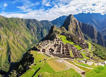
The Inca Trail is Peru’s best-known trekking route, a high-altitude journey through the Andes to Machu Picchu. The classic route begins near Piscacucho at kilometre 82 of the railway line from Ollantaytambo and covers roughly 43 kilometres before reaching the citadel through the Sun Gate, or Intipunku. It is not a single wilderness path but a carefully protected archaeological landscape combining stone paving, mountain passes, cloud forest and Inca settlements.Read more about Inca Trail
Ruins, Passes and Changing Landscapes
Planning the Journey
When is the best time to visit Inca Trail?
Best: April, September–October · 22–23°C| Month | High (°C) | Rainfall (mm) |
|---|---|---|
| January | 20 | 90 |
| February | 21 | 80 |
| March | 22 | 70 |
| April (best) | 23 | 60 |
| May | 21 | 50 |
| June | 20 | 40 |
| July | 20 | 40 |
| August | 20 | 40 |
| September (best) | 22 | 50 |
| October (best) | 22 | 60 |
| November | 23 | 70 |
| December | 22 | 80 |
Getting to and around Inca Trail
How to get there
Transportation
Best attractions in Inca Trail
The classic Inca Trail’s attractions unfold as a sequence rather than a collection of isolated stops. At Piscacucho, the route enters the protected landscape beside the Urubamba Valley before climbing towards the archaeological complex of Patallacta, whose terraces and structures occupy a dramatic slope above the river. The highest section crosses Warmiwañusqa, or Dead Woman’s Pass, followed by the descent into Pacaymayu and a demanding climb towards the ruins of Runkurakay and the mountain pass beyond. Forested sections lead to Sayacmarca and the finely terraced complex of Phuyupatamarca, often surrounded by cloud and steep valley views. Wiñay Wayna is the route’s most celebrated intermediate site, with extensive terraces, stairways and ritual water features. The final approach passes through humid vegetation to Intipunku, the Sun Gate, where the first framed view of Machu Picchu appears before the trail descends towards the citadel.
-
Tourist attraction
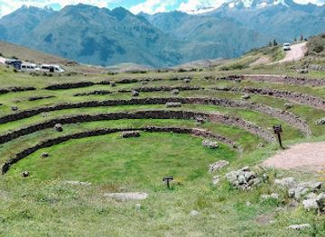
Moray
Experience the extraordinary circular terraces of Moray, an archaeological wonder showcasing Incan agricultural innovation nestled in Peru's Sacred Valley.
-
Tourist attraction
Sitio arqueológico Pinkuylluna
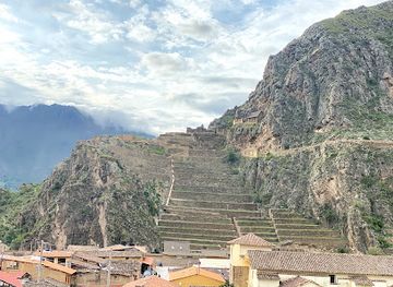
Explore Pinkuylluna, an archaeological gem near Ollantaytambo, where Inca history meets breathtaking Andean vistas.
-
Hotel
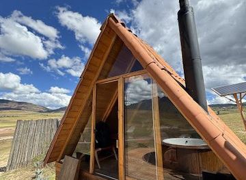
MOUNTAIN VIEW EXPERIENCE
Discover the perfect blend of stunning Andean views and exquisite dining at the Mountain View Experience in Maras, Peru.
-
Tourist attraction
Patallacta
Discover the ancient Inca site of Patallacta, where stunning terraced landscapes meet rich cultural heritage in the heart of the Peruvian Andes.


Best landmarks in Inca Trail
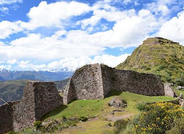
The defining landmarks of the Inca Trail combine monumental engineering with dramatic Andean terrain. Patallacta is marked by broad terraces and rectangular structures above the Urubamba Valley, while Warmiwañusqa, or Dead Woman’s Pass, is the route’s highest point at approximately 4,200 metres and a geographical as well as physical landmark. Runkurakay’s semi-circular ruins, Sayacmarca’s elevated stonework and Phuyupatamarca’s terraces and water channels reveal how the Inca road was integrated with settlements and ritual spaces. Wiñay Wayna is especially notable for its densely layered terraces, stairways and fountains set above a cloud-forest valley. Intipunku, the Sun Gate, forms the historic entrance to Machu Picchu from the trail, linking the route to the citadel’s wider significance as an Inca architectural complex in a steep mountain setting.
-
Historical landmark
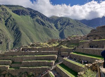
Ollantaytambo Sanctuary
Discover the breathtaking Ollantaytambo Sanctuary, a historical gem in Peru's Sacred Valley, rich in Inca heritage and stunning landscapes.
-
Tourist attraction
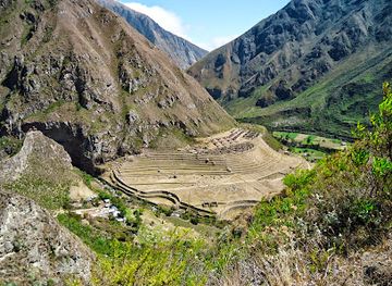
Patallacta
Explore Patallacta, an ancient Incan archaeological site on the Inca Trail, surrounded by breathtaking landscapes and rich cultural heritage.
-
Hiking area
Inca Trail Camino Inca
Embark on an unforgettable journey along the Inca Trail, where stunning landscapes meet ancient history, leading you to the iconic Machu Picchu.
-
Archaeological site
Wat'a, Cusco
Explore the ancient wonders of Wat'a, an archaeological gem in Cusco, Peru, revealing the mysteries of past civilizations amidst breathtaking landscapes.
Explore Inca Trail on the map
Plan your trip on one map. See where the top attractions, landmarks, restaurants and hotels are, and book hotels and experiences in a few clicks.
Best hotels in Inca Trail
Best restaurants in Inca Trail
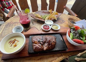
There are no conventional restaurants along the regulated Inca Trail; meals are generally prepared by the trekking team and served at camps, with menus planned around the operator’s logistics and the needs of a strenuous high-altitude walk. In the gateway settlements and staging areas, visitors can find Andean and Peruvian cooking featuring potatoes, maize, quinoa, soups, rice, chicken and other familiar trekking staples. Cusco and the Sacred Valley provide the broadest range of dining, from everyday regional eateries to restaurants serving dishes such as lomo saltado, ají de gallina and trout from the Andean highlands. Ollantaytambo is a practical place for meals before or after a trek, while Aguas Calientes has a larger visitor-oriented dining scene at the end of the route. Travellers with dietary requirements should notify the operator before departure rather than relying on trail-side alternatives.
-
Restaurant
Apu Ausangate Restaurant
Experience authentic Peruvian flavors at Apu Ausangate Restaurant in Ollantaytambo's vibrant Plaza de Armas.
Best bars in Inca Trail
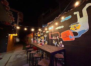
The Inca Trail itself has almost no nightlife: evenings are spent at camps, where darkness, early starts and mountain conditions make rest more important than entertainment. There are no bars, clubs or permanent social venues along the route, and visitors should not expect informal drinking facilities in archaeological areas or remote camps. Cusco offers Peru’s most established evening scene in the wider trekking region, including traditional bars, restaurants and music venues, while Ollantaytambo and other Sacred Valley settlements provide quieter places to eat or have a drink. Aguas Calientes, the usual settlement associated with the Machu Picchu arrival and departure point, has more visitor-oriented evening hospitality, although the atmosphere remains linked to railway arrivals, accommodation and early excursions rather than a late-night club circuit.
-
Brewpub
Cerveceria del Valle Sagrado
Discover the best of local craft beers and delicious food at Cerveceria del Valle Sagrado in Pachar, Peru, surrounded by breathtaking views.
-
Grill
Inka's Tower
Experience the flavors of Peru at Inka's Tower, a grill restaurant offering stunning views and a delightful menu in Ollantaytambo.
-
Bar
Antes de Cristo - TAPROOM
Experience the best of Peruvian craft beers at Antes de Cristo - TAPROOM, the perfect spot for relaxation in Urubamba's vibrant bar scene.
-
Bar
Destilería Andina
Discover Peru's rich spirit heritage at Destilería Andina—where tradition meets taste in the heart of Ollantaytambo.
Best shops in Inca Trail
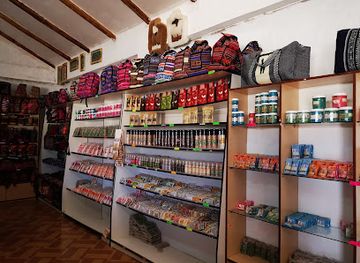
Shopping opportunities on the Inca Trail are extremely limited, with no conventional retail area between the trailhead and Machu Picchu. Visitors normally buy missing supplies, walking clothing, snacks and practical equipment in Cusco, the Sacred Valley or another gateway settlement before departure. Cusco has the widest selection of Peruvian textiles, alpaca products, handicrafts, jewellery and regional foodstuffs, while markets and artisan businesses in the Sacred Valley offer woven goods and locally made souvenirs. Ollantaytambo is useful for last-minute provisions and small purchases, though availability varies. At the end of the journey, Aguas Calientes has shops aimed at Machu Picchu visitors, but travellers should distinguish mass-produced souvenirs from products made by local or regional artisans. Do not remove stones, plants or archaeological material from the trail as keepsakes.
-
Souvenir store
Inkac Qachi Store
Discover authentic Peruvian craftsmanship at Inkac Qachi Store, your go-to destination for unique souvenirs in Maras.
-
Craft store
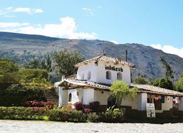
Inlakesh Peruvian Art & Design Store
Explore the rich heritage of Peru through unique handcrafted arts and crafts at Inlakesh Peruvian Art & Design Store in Urubamba.
Get your free copy of our complete guide to Inca Trail, delivered straight to you.
Everything on this page, from attractions and restaurants to essentials and local phrases, in one PDF you can read offline, print or share.
Already have an account? Sign in
Your Inca Trail guide is ready.
We'll send it to · Not you? Sign out

Getting your guide ready…
We are putting together a fresh copy of the Inca Trail guide. This can take up to a minute.
This can take a few moments. If your browser asks, choose Allow so the download can start. You'll find the guide in your Downloads folder.
Nothing happened? Download it again
Sorry, the guide is taking longer than usual. Please try again in a minute, or get it by email instead.
Inca Trail essentials
Currency and Payment
Safety
Emergency Situations
Do's and Don'ts
Local Tips
From Eve
Local phrases worth knowing
You don't need to get them perfect. A few words go a long way, and locals appreciate the effort.
Basics
| English | Local | Say it |
|---|---|---|
| Hello | Qanmi | [KAN-mee] |
| Goodbye | Allinllachu | [AHL-leen-YA-choo] |
| Yes | Arí | [AH-ree] |
| No | Manan | [MAH-nahn] |
| Please/You're welcome | Sulpayki | [SOOL-pie-kee] |
| Thank you | Sulpay | [SOOL-pie] |
| Excuse me/Sorry | Dispinsayki | [DEES-peen-sie-kee] |
| How are you? | Imarayku? | [ee-ma-RAI-koo] |
| Fine. And you? | Allin. Qanmi? | [AHL-leen. KAN-mee] |
| Do you speak English? | Imaynallam kastilla simi rimaykuy? | [ee-mine-YA-lyam kahs-TEE-ya SIM-ee ree-MY-koo-ee] |
| I don't understand | Manam rikurini | [MAH-nahm ree-koo-REE-nee] |
Eating & Drinking
| English | Local | Say it |
|---|---|---|
| I'd like to see the menu, please | Menuyta qillqani kanki | [MAY-noo-ee-tah keel-YAH-nee KAHN-kee] |
| I don't eat meat | Qhali mana uqunmi | [KHA-lee MAH-nah oo-KOON-mee] |
| Cheers! | Kanpai! | [KAN-pie] |
| I would like to pay, please | Yaykuyta yatichiy | [YAI-koo-ee-tah yah-TEE-chee] |
Emergencies
| English | Local | Say it |
|---|---|---|
| Help! | Janiyoq! | [HAH-nee-yok] |
| Go away! | Qhaway! | [KHA-wai] |
| Call the Police! | Polisiq qallariy! | [poh-lee-SEEK kahl-LAH-ree] |
| Call a doctor! | Yachachiq qallariy! | [YA-cha-cheek kahl-LAH-ree] |
| I'm lost | Umaqmi | [OO-mahk-mee] |
| I'm ill | Uqsumi | [OOK-soo-mee] |
Shopping
| English | Local | Say it |
|---|---|---|
| I'd like to buy... | Suyayta qhatichiy... | [SOO-yai-tah KAH-tee-chee] |
| I'm just looking | Ñawi qawachiy | [NYA-wee kah-WAH-chee] |
| How much is it? | Imataq chaynallata | [ee-MAH-tahk CHAI-nahl-LAH-tah] |
| That's too expensive | Chaypi lliwqan | [CHAI-pee LEE-wkan] |
| Can you lower the price? | Chaypi llimpiykachiy? | [CHAI-pee LLEEMP-yee-KAH-chee] |
Time & Numbers
| English | Local | Say it |
|---|---|---|
| What time is it? | Imataq waqta | [ee-MAH-tahk WAHK-tah] |
| It's one o'clock | Huk paqarina | [hook pah-kah-REE-nah] |
| Half past (10) | Chaymanta (10) | [CHAI-MAHN-tah (10)] |
| Morning | Punchaw | [POON-chow] |
| Afternoon | P'unchaw | [POON-chow] |
| Evening | Tuta | [TOO-tah] |
| Yesterday | Illapa p'unchaw | [ee-LAH-pah POON-chow] |
| Today | Kay p'unchaw | [KYAH POON-chow] |
| Tomorrow | Kan p'unchaw | [KAN POON-chow] |
| 1 | Huk | [hook] |
| 2 | Iskay | [ees-KAI] |
| 3 | Kimsa | [keem-sah] |
| 4 | Tawa | [TAH-wah] |
| 5 | Pisqa | [PEES-kah] |
| 6 | Suyu | [SOO-yoo] |
| 7 | Qanchis | [KAN-chees] |
| 8 | Pusak | [POO-sahk] |
| 9 | Isqun | [ees-KOON] |
| 10 | Chunka | [CHOON-kah] |
Transport & Directions
| English | Local | Say it |
|---|---|---|
| Where's a/the...? | Pisqa nispa... | [PEES-kah NEES-pah] |
| What's the address? | Maypin sutiyki? | [ma-E-peen soo-TEE-kee] |
| Can you show me (on the map)? | Imaynallam mapa qhawaychikuy? | [ee-mine-YA-lyam MAH-pah KHA-wai-CHEE-koo-ee] |
| When's the next (bus)? | Imataq hukta... | [ee-MAH-tahk hook-tah] |
| A ticket (to ....) | Tikiti (....-manta) | [tee-KEE-tee (...-MAHN-tah)] |
History of Inca Trail
Andean Landscape and Earlier Paths
The Inca Trail crosses landscapes shaped by the steep eastern Andes, moving from the Urubamba Valley through high puna grassland and into humid cloud forest. Long before modern tourism, mountain paths connected settlements, cultivated terraces and ceremonial places across the region. The route’s difficult gradients reflect the terrain rather than a modern hiking design, while its stone paving and retaining walls show how Andean engineers adapted movement and agriculture to sharply changing elevations.
The Inca Road System
Under the Inca state, the route formed part of the wider Qhapaq Ñan, the extensive road network that linked the Andes through present-day Peru and neighbouring countries. Roads supported administration, communication, military movement and religious journeys. Along the approach to Machu Picchu, terraces, stairways, drainage works and settlements such as Wiñay Wayna demonstrate the integration of infrastructure, farming and ritual within a demanding mountain environment.
Machu Picchu and Spanish Rule
Machu Picchu is generally understood to have been built in the fifteenth century during the expansion of the Inca state, probably under the ruler Pachacuti. Its precise function remains debated, although its terraces, plazas and ceremonial architecture reveal a major royal and sacred complex. Spanish colonial forces did not record the citadel as a conquered centre, and the surrounding route gradually lost its political importance as colonial administration and transport followed different corridors.
Rediscovery and Archaeological Study
Machu Picchu became internationally prominent after Hiram Bingham reached the site in 1911 with local guidance, although local people already knew of and used the area. Subsequent archaeological research, conservation and improved mapping placed the citadel and its access routes within a broader understanding of Inca settlement and engineering. The trail’s significance therefore rests not only on its destination but also on the surviving relationship between paths, terraces, water management and mountain geography.
Protection and Managed Tourism
The Inca Trail now lies within the protected Machu Picchu Historic Sanctuary, where archaeological conservation and environmental management shape access. Permits, seasonal closures and daily visitor limits are used to reduce pressure on fragile paving, vegetation and ruins; exact arrangements can change and must be checked before travel. Guided trekking has become an important part of the region’s tourism economy, while conservation continues to balance public access with the protection of an exceptionally sensitive cultural landscape.
Inca Trail in Photos
Browse through our photo collection highlighting the charm and character of the destination.
Neighbouring destination travel guides
The closest destinations to Inca Trail, if you have time for more than one.
-

-
-

-

-


Swipe for more destinations
Explore more

Explore more of Apurímac
Discover Apurímac: Peru's hidden gem with stunning landscapes, rich cultural heritage, and thrilling adventures, perfect for nature enthusiasts and history buffs alike.
Explore Apurímac
Explore more of Peru
Discover the wonders of Peru: ancient ruins, stunning landscapes, and a vibrant culture that will captivate your heart and soul.
Explore Peru