

Poloniny National Park Travel Guide - Free Web & App
Your ultimate guide to Poloniny National Park. Discover top landmarks, proposed trips, and local tips. Free on the web or via the Evendo companion app.


Poloniny National Park in Slovakia offers primeval beech forests, Rusyn wooden churches, dark skies, quiet trails and Carpathian wildlife near Ukraine.
Forests, Mountains and Borderlands
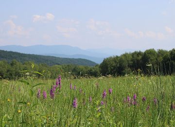
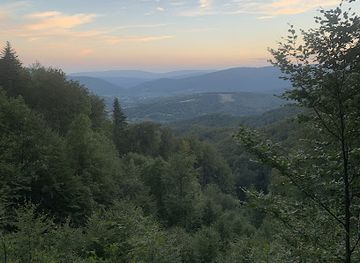
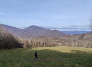
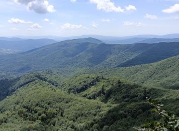
Poloniny National Park occupies Slovakia’s far north-eastern corner, where the Bukovské vrchy mountains meet the borders of Poland and Ukraine. Established in 1997, it is Slovakia’s easternmost national park and one of the country’s least densely populated landscapes. Long ridges, wooded valleys and flower-rich mountain meadows define the scenery, while the park’s name refers to the high open grasslands known locally as poloniny. The area is especially valued for its extensive beech forests, including the Stužica primeval forest, and forms part of the wider East Carpathian biosphere landscape.Read more about Poloniny National Park
Rusyn Heritage and Rural Landscapes
Walking, Wildlife and Dark Skies
When is the best time to visit Poloniny National Park?
Best: June–August · 24–26°C| Month | High (°C) | Rainfall (mm) |
|---|---|---|
| January | 1 | 35 |
| February | 3 | 30 |
| March | 6 | 30 |
| April | 13 | 40 |
| May | 20 | 50 |
| June (best) | 24 | 60 |
| July (best) | 26 | 70 |
| August (best) | 25 | 70 |
| September | 18 | 60 |
| October | 10 | 50 |
| November | 5 | 40 |
| December | 4 | 35 |
Getting to and around Poloniny National Park
How to get there
Transportation
Best attractions in Poloniny National Park
The core attractions of Poloniny are its extensive beech forests, high meadows and quiet mountain valleys rather than a concentration of built visitor facilities. Stužica, part of the UNESCO-listed Ancient and Primeval Beech Forests of the Carpathians and Other Regions of Europe, offers one of the clearest encounters with the park’s mature woodland environment, subject to route and access rules. Marked trails cross the Bukovské vrchy towards viewpoints and ridges around Kýčera, Ďurkovec and the Riaba skala area, where open uplands contrast with dark forest. Nová Sedlica is a natural starting point for walks, while Runina and the upper valleys provide access to meadows and mountain scenery. The villages of Topoľa, Ruský Potok and Uličské Krivé are known for their traditional wooden churches. Starina reservoir and the abandoned village sites around its catchment add a powerful layer of recent history, although access may be regulated because the reservoir is a drinking-water source.
-
Tourist attraction
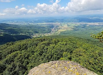
Sninský kameň
Experience the breathtaking beauty and tranquility of Sninský kameň, a natural gem in Slovakia perfect for hiking and outdoor adventures.
-
Park
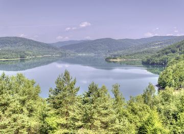
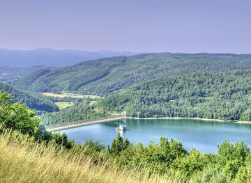
Vyhliadková Veža Starina
Experience stunning views and tranquility at Vyhliadková Veža Starina, a picturesque park and lookout tower in Slovakia's natural landscape.
-
Nature preserve
Gazdoráň
Explore Gazdoraň, a stunning nature preserve in Stakčín, Slovakia, perfect for hiking, birdwatching, and reconnecting with nature's tranquility.
-
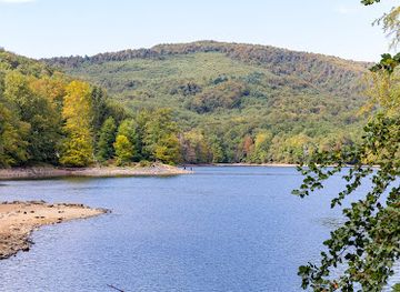
Náučný chodník Morské oko – Sninský kameň – Sninské rybníky
Explore the breathtaking natural wonders of Morské Oko - Sninský Kameň - Sninské Rybníky, a haven for nature lovers in Slovakia.
Best landmarks in Poloniny National Park
Poloniny’s defining natural landmark is the forested Bukovské vrchy, whose long ridges and open poloniny give the park its character. Stužica is the best-known forest landmark, representing the structural complexity of an old beech ecosystem and forming part of the UNESCO World Heritage property Ancient and Primeval Beech Forests of the Carpathians and Other Regions of Europe. Starina reservoir is a major modern landmark, both as a water-supply project and as a landscape associated with villages removed during its construction. The wooden Greek Catholic churches of Topoľa, Ruský Potok and Uličské Krivé are significant cultural landmarks, preserving the timber architecture and religious heritage of the region’s Rusyn communities. Ridge viewpoints around Ďurkovec, Kýčera and Riaba skala reveal the cross-border Carpathian landscape, while old cemeteries and traces of abandoned settlements recall the area’s changing population and borderland history.
-
Ecological park
Poloniny Dark-Sky Park
Experience the breathtaking starlit skies and vibrant ecosystems of Poloniny Dark-Sky Park, a haven for nature lovers and stargazers in Slovakia.
-
Nature preserve
Prales Stužica
Explore Prales Stužica: Slovakia's pristine nature preserve offering breathtaking landscapes, diverse wildlife, and peaceful hiking trails in a serene setting.
-
Nature preserve
Rožok
Explore the tranquil beauty of Rožok Nature Preserve, a hidden gem in Uličské Krivé, offering lush landscapes and diverse wildlife for nature lovers.
-
Environment office
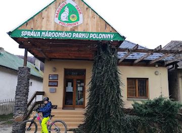
Správa Národného parku Poloniny
Explore the breathtaking landscapes and rich biodiversity of Poloniny National Park, a serene escape into nature in Slovakia.
Explore Poloniny National Park on the map
Plan your trip on one map. See where the top attractions, landmarks, restaurants and hotels are, and book hotels and experiences in a few clicks.
Best hotels in Poloniny National Park
Best restaurants in Poloniny National Park
Dining in Poloniny is modest and closely tied to small villages, guesthouses and the gateway towns of Stakčín and Snina rather than to a concentrated restaurant scene inside the national park. Visitors may encounter home-style cooking, soups, dumplings, potatoes, seasonal mushrooms and dishes influenced by the Rusyn and wider Carpathian traditions. Local food culture reflects a history of mountain farming, forest gathering and household preservation, with honey, dairy products and fruit preparations among the regional ingredients. Village accommodation may provide meals by arrangement, but this should never be assumed without prior confirmation. Snina and the surrounding larger settlements offer the broadest choice of restaurants, cafés and everyday food shops, making them practical places to stock up before heading into the more remote valleys. Hikers should carry provisions for longer routes, as temporary refreshments and rural shops are not consistently available along trails.
Best bars in Poloniny National Park
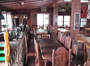
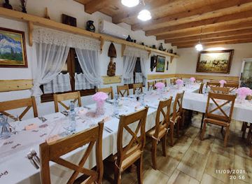
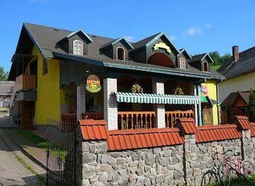
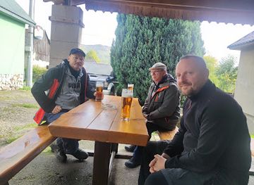
Poloniny has no significant nightclub district or large-scale evening entertainment scene. After dark, the atmosphere is shaped by quiet villages, guesthouse dining and traditional pubs in settlements such as Stakčín, Ulič and nearby communities, with a more varied choice of cafés and bars in Snina. Evening social life is generally local and informal rather than organised for late-night tourism, and opening arrangements can vary. The region’s outstanding night-time experience is natural rather than commercial: low light pollution creates excellent conditions for observing stars, subject to weather and local guidance. Visitors should keep noise and light levels low in rural areas, especially near homes, forest edges and protected habitats, and should plan transport in advance rather than relying on late public services.
-
Bar
Reštaurácia a Penzión Kremenec
Discover the authentic flavors of Slovakia at Reštaurácia a Penzión Kremenec, where traditional cuisine meets warm hospitality in a picturesque setting.
-
Bar
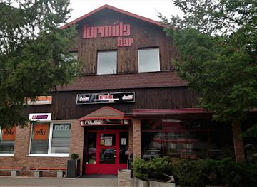
Formula bar
Discover the lively Formula Bar in Snina, where great drinks meet a welcoming atmosphere, perfect for tourists looking to unwind.
-
Bar
Krčma Runina
Discover the charm of Slovak culture at Krčma Runina, where traditional hospitality meets local flavors in a cozy bar atmosphere.
-
Bar
Krcma Kolonica
Discover the charm of Krcma Kolonica, a cozy bar in Kolonica offering local drinks and a warm atmosphere for an unforgettable experience.
Best shops in Poloniny National Park
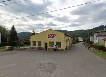
Shopping within Poloniny is limited and practical, with small village shops and occasional local products rather than a substantial retail scene. Snina and Stakčín are the most useful places for food, walking supplies and everyday necessities before travelling deeper into the park. Visitors may find honey, preserves, herbal products, dairy goods and other farm or woodland-related produce through local households, guesthouses and small regional businesses, although availability is seasonal and should not be assumed. Rusyn cultural heritage is reflected more strongly in churches, cemeteries, music and village traditions than in a large established craft-shopping market. Regional artworks, woodwork, textiles or locally produced foods may appear at community events and tourism venues, while larger selections of souvenirs and outdoor equipment are more likely in eastern Slovak towns outside the park itself.
-
National park
Poloniny National Park
Explore the breathtaking landscapes and rich biodiversity of Poloniny National Park, a haven for hikers and nature lovers in Slovakia.
-
Store
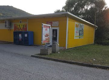
GVP P002
Explore the unique offerings at GVP P002, a charming store in Stakčín, where local culture meets delightful shopping experiences.
-
Grocery store
Coop Jednota
Explore the authentic Slovak culture and local products at Coop Jednota in Ulič, a charming store for every traveler.
-
Grocery store
GVP Potraviny
Explore the flavors of Slovakia at GVP Potraviny, your go-to grocery store in Ulič for local produce and delightful snacks.

Get your free copy of our complete guide to Poloniny National Park, delivered straight to you.
Everything on this page, from attractions and restaurants to essentials and local phrases, in one PDF you can read offline, print or share.
Already have an account? Sign in
Your Poloniny National Park guide is ready.
We'll send it to · Not you? Sign out

Getting your guide ready…
We are putting together a fresh copy of the Poloniny National Park guide. This can take up to a minute.
This can take a few moments. If your browser asks, choose Allow so the download can start. You'll find the guide in your Downloads folder.
Nothing happened? Download it again
Sorry, the guide is taking longer than usual. Please try again in a minute, or get it by email instead.
Poloniny National Park essentials
Currency and Payment
Safety
Emergency Situations
Do's and Don'ts
Local Tips
From Eve
Local phrases worth knowing
You don't need to get them perfect. A few words go a long way, and locals appreciate the effort.
Basics
| English | Local | Say it |
|---|---|---|
| Hello | Ahoj | [ahoy] |
| Goodbye | Dovidenia | [doh-vee-de-nyah] |
| Yes | Áno | [ah-no] |
| No | Nie | [nye] |
| Please/You're welcome | Prosím | [pro-seem] |
| Thank you | Ďakujem | [dyah-koo-yem] |
| Excuse me/Sorry | Prepáčte | [pre-pahch-te] |
| How are you? | Ako sa máš? | [ah-ko sa mahsh] |
| Fine. And you? | Dobre. A ty? | [doh-bre. ah tee] |
| Do you speak English? | Hovoríte po anglicky? | [ho-vo-ree-teh poh ahn-gleet-skee] |
| I don't understand | Nerozumiem | [neh-roh-zoo-myem] |
Eating & Drinking
| English | Local | Say it |
|---|---|---|
| I'd like to see the menu, please | Chcel by som vidieť jedálny lístok, prosím | [kh-tsel bee som vee-dyeht ye-dahl-nee lees-tohk pro-seem] |
| I don't eat meat | Nemám rád mäso | [neh-mahm raad mah-soh] |
| Cheers! | Na zdravie! | [nah zdrah-vee-eh] |
| I would like to pay, please | Chcel by som zaplatiť, prosím | [kh-tsel bee som zah-plah-teet pro-seem] |
Emergencies
| English | Local | Say it |
|---|---|---|
| Help! | Pomoc! | [poh-mohts] |
| Go away! | Choď preč! | [khohd prech] |
| Call the Police! | Volajte políciu! | [voh-lah-yteh po-lee-tsyoo] |
| Call a doctor! | Volajte doktora! | [voh-lah-yteh dohk-toh-rah] |
| I'm lost | Zablúdil som | [zah-bloo-deel sohm] |
| I'm ill | Som chorý | [sohm khor-y] |
Shopping
| English | Local | Say it |
|---|---|---|
| I'd like to buy... | Chcel by som kúpiť... | [kh-tsel bee som koo-peet] |
| I'm just looking | Len sa pozerám | [len sa poh-zeh-rahm] |
| How much is it? | Koľko to stojí? | [kohl-koh toh stoh-yee] |
| That's too expensive | To je príliš drahé | [toh yeh pree-leesh dra-heh] |
| Can you lower the price? | Môžete znížiť cenu? | [moh-zheh-teh znee-zheet tseh-noo] |
Time & Numbers
| English | Local | Say it |
|---|---|---|
| What time is it? | Koľko je hodín? | [kohl-koh yeh hoh-deen] |
| It's one o'clock | Je jedna hodina | [yeh yehd-nah hoh-dee-nah] |
| Half past (10) | Polovičná (desať) | [po-lo-veech-nah deh-saht] |
| Morning | Ráno | [rah-noh] |
| Afternoon | Popoludní | [poh-poh-loo-dnee] |
| Evening | Večer | [veh-chehr] |
| Yesterday | Včera | [vche-ra] |
| Today | Dnes | [dnes] |
| Tomorrow | Zajtra | [zai-tra] |
| 1 | Jedna | [yehd-nah] |
| 2 | Dve | [dveh] |
| 3 | Tri | [tree] |
| 4 | Štyri | [shtee-ree] |
| 5 | Päť | [paht] |
| 6 | Šesť | [shest] |
| 7 | Sedem | [seh-dem] |
| 8 | Osem | [oh-sehm] |
| 9 | Deviat | [deh-vyat] |
| 10 | Desať | [deh-saht] |
Transport & Directions
| English | Local | Say it |
|---|---|---|
| Where's a/the...? | Kde je... | [kdeh yeh] |
| What's the address? | Aká je adresa? | [ah-kah yeh ah-dreh-sah] |
| Can you show me (on the map)? | Môžete mi ukázať (na mape)? | [moh-zheh-teh mee oo-kah-zah-t na mah-peh] |
| When's the next (bus)? | Kedy je ďalší (autobus)? | [keh-dee yeh dyahl-shee ow-toh-boos] |
| A ticket (to ....) | Jedno lístok (do ...) | [yehd-no lees-tohk doh] |
History of Poloniny National Park
Carpathian Geological Foundations
Poloniny lies within the Outer Eastern Carpathians, a mountain system formed over immense geological timescales through the folding and uplift of sedimentary rocks. The Bukovské vrchy are characterised by long, rounded ridges rather than sharply alpine summits, with valleys shaped by streams flowing through the Cirocha basin and towards the San watershed. These geological foundations created the forested slopes, upland meadows and narrow valleys that later determined patterns of settlement, forestry and pastoral land use.
Settlement and Rusyn Communities
Human settlement developed gradually in the remote valleys and foothills, with communities associated strongly with the Rusyn cultural tradition of the eastern Carpathians. Villages such as Topoľa, Ruský Potok and Uličské Krivé grew around agriculture, livestock keeping and woodland resources. The region’s historic wooden churches, often accompanied by small cemeteries, preserve the religious and architectural character of communities that lived at the meeting point of Slovak, Rusyn, Polish and Ukrainian cultural influences.
Forestry and Mountain Land Use
For centuries, local livelihoods combined small-scale farming, haymaking, grazing, beekeeping and the use of forest resources. Meadows on the high ridges were maintained through mowing and grazing, creating the open poloniny that contrast with the surrounding beech forests. Forestry later became increasingly important, although the remoteness of the area and its borderland position limited large-scale urban development. Surviving meadow systems are now valued both as cultural landscapes and as habitats for plants and insects.
War and Borderland Change
The eastern Carpathians became a military corridor during the First and Second World Wars, when armies crossed the mountain passes and surrounding settlements experienced disruption. Remnants of wartime earthworks and military traces can be found in the wider region, although the park is primarily experienced for its forests and villages rather than as a battlefield destination. After 1945, the creation of the Czechoslovak-Soviet border brought tighter controls and contributed to the area’s economic isolation and low population density.
The Starina Reservoir
The construction of Starina reservoir during the 1980s marked one of the most profound modern changes to the upper Cirocha valley. The reservoir was created as a major drinking-water source for eastern Slovakia, and several settlements were evacuated as its catchment and protection zone were established. Villages including Dara, Ostrožnica, Ruské, Smolník, Starina, Veľká Poľana and Zvala disappeared from the inhabited landscape. Their former sites and surviving traces form an important, sometimes poignant, part of the region’s recent history.
National Park and Conservation
Poloniny National Park was established in 1997 to protect the forests, meadows and mountain ecosystems of the Bukovské vrchy. Its conservation importance extends beyond Slovakia: the Stužica, Havešová and Rožok beech forests form part of the UNESCO World Heritage property Ancient and Primeval Beech Forests of the Carpathians and Other Regions of Europe. The park also belongs to the East Carpathian biosphere reserve, reflecting the ecological connections that cross the Slovak, Polish and Ukrainian borders.
Poloniny National Park in Photos
Browse through our photo collection highlighting the charm and character of the destination.
Neighbouring destination travel guides
The closest destinations to Poloniny National Park, if you have time for more than one.
-

-

-

-
-


Swipe for more destinations
Explore more

Explore more of Košice Region
Explore Košice Region for medieval Košice, Slovak Paradise gorges, karst caves, Tokaj vineyards and the broad landscapes of eastern Slovakia.
Explore Košice Region
Explore more of Slovakia
Discover Slovakia: A land of majestic mountains, charming castles, and vibrant culture in the heart of Europe.
Explore Slovakia