

Free South Central South Dakota Travel Guide & Mobile App
Explore South Central South Dakota with free travel guides. Discover regional history, expert tips, proposed trips, and audio guides on web or mobile app.


Explore South Central South Dakota for Missouri River reservoirs, prairie landscapes, Indigenous heritage, museums and wide-open outdoor adventures.
Read more about South Central South Dakota
Getting to and around South Central South Dakota
How to get there
Transportation
Top city travel guides in South Central South Dakota
The cities of South Central South Dakota, and the easiest places to base yourself.
-

-

-

-


Swipe for more cities
Destinations in South Central South Dakota
Resorts, valleys and scenic spots worth a trip of their own.
-
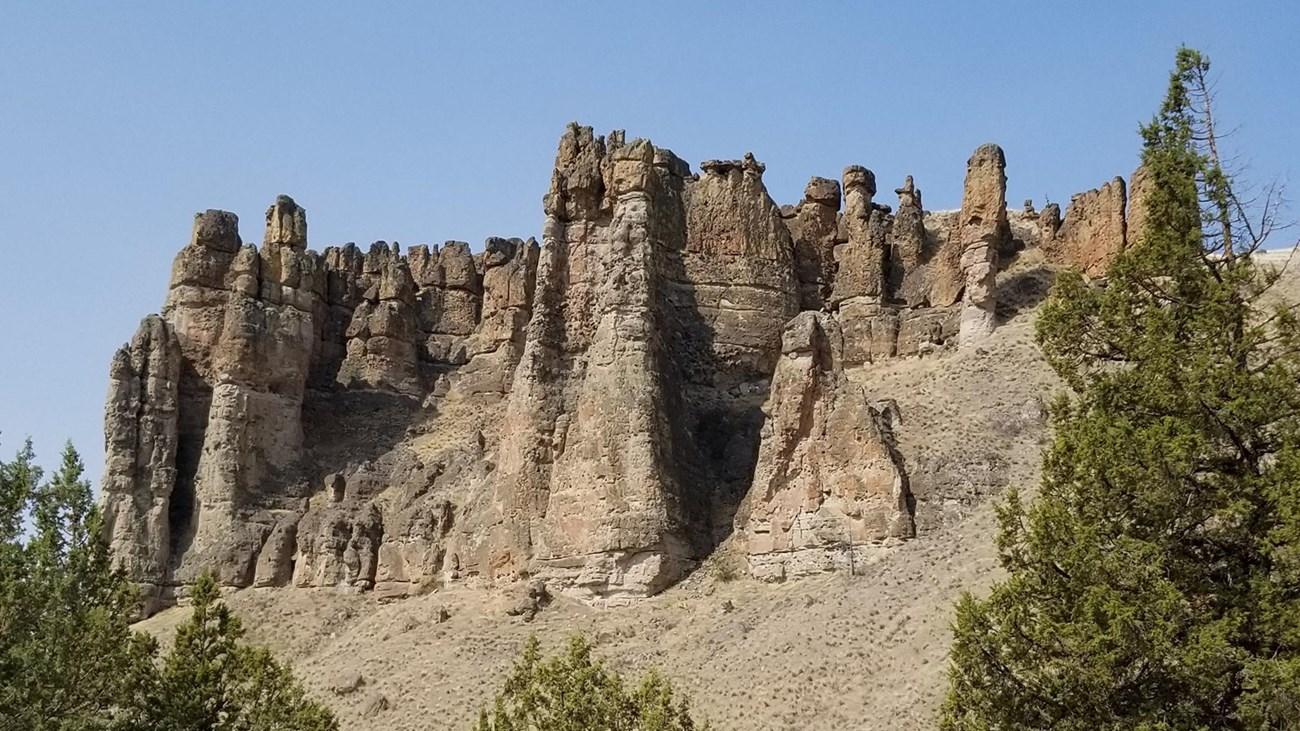 Palisades State Park
 in South Dakota features quartzite cliffs, the Split Rock River, hiking, camping, climbing and scenic landscapes near Garretson and Sioux Falls.
Palisades State Park
Palisades State Park in South Dakota features quartzite cliffs, the Split Rock River, hiking, camping, climbing and scenic landscapes near Garretson and Sioux Falls.
-

-

-

-

-


Swipe for more destinations
Best attractions in South Central South Dakota
South Central South Dakota's attractions are organised around the Missouri River, its reservoirs and the communities that grew beside them. Pierre offers the South Dakota State Capitol, the South Dakota Cultural Heritage Center and the South Dakota State Historical Society's museum collection, providing useful context for the state's political, Indigenous and settler histories. Across the river, Fort Pierre adds frontier, fur-trade and ranching associations, while nearby public recreation areas provide boating, fishing, camping and birdwatching on Lake Oahe. Chamberlain is home to the Akta Lakota Museum and Cultural Center, which presents contemporary and historical Lakota art and culture, as well as the South Dakota Hall of Fame. The river bluffs and reservoir shorelines invite scenic drives, paddling and angling, while Lake Sharpe and the landscapes around Big Bend Dam offer further outdoor access. Smaller communities such as Fort Thompson and Winner provide local services and connections to a working prairie region. These experiences are best combined with realistic driving times: the area's appeal lies in the transitions between museums, river overlooks, grassland and wide horizons rather than in a compact cluster of ticketed attractions.
-
National park
Badlands National Park
Explore the breathtaking landscapes and rich wildlife of Badlands National Park, a natural wonder located in South Dakota.
-
Park
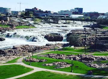
Falls Park
Explore the breathtaking landscapes and vibrant events at Falls Park, the heart of Sioux Falls, SD's natural beauty and community spirit.
-
State park
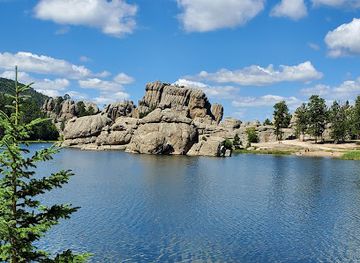
Custer State Park
Experience the breathtaking beauty and abundant wildlife at Custer State Park, a true gem of South Dakota's natural wonders.
-
Wildlife park
Bear Country USA
Explore Bear Country USA, a premier wildlife park in Rapid City, SD, home to bears, bison, and other North American wildlife in a stunning natural setting.


Best landmarks in South Central South Dakota
The Missouri River and its broad reservoirs are the region's most important natural landmarks, creating a changing sequence of bluffs, wooded draws, open water and prairie shorelines. In Pierre, the South Dakota State Capitol is a notable civic building and an expression of the state's twentieth-century governmental history, while the nearby Capitol grounds provide a formal contrast to the river landscape. Fort Pierre's historic associations with the former fur-trade post give the town symbolic importance even though the original Fort Pierre Chouteau structures are not preserved as a complete standing complex. The Akta Lakota Museum and Cultural Center in Chamberlain is an important cultural landmark because of its focus on Lakota art, history and continuing identity. The Big Bend Dam and the surrounding Lake Sharpe landscape mark a major engineering transformation of the Missouri, while the bridges and elevated approaches around Chamberlain offer memorable views of the river corridor. These landmarks are significant not only for appearance but also for the Indigenous, commercial, governmental and environmental histories layered across the waterway.
-
Cultural landmark
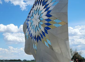
Dignity of Earth and Sky
Discover the Dignity of Earth and Sky, a stunning cultural landmark in Chamberlain, SD, celebrating Native American heritage and offering breathtaking views.
-
Historical landmark
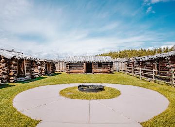
Gordon Stockade Historical Landmark
Explore the rich history and scenic beauty of Gordon Stockade Historical Landmark in Custer, South Dakota, a must-visit for history buffs and nature lovers.
-
Historical landmark
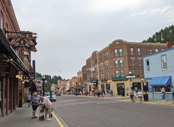
Historic Downtown Deadwood
Discover the rich history and vibrant culture of Historic Downtown Deadwood, where the Wild West comes alive in every corner.
-
Historical landmark
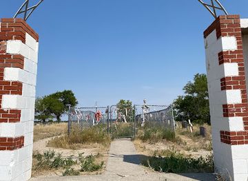
Wounded Knee National Historic Landmark
Explore the profound history at Wounded Knee National Historic Landmark, a site honoring the resilience of the Lakota Sioux and a pivotal moment in American history.
Explore South Central South Dakota on the map
Plan your trip on one map. See where the top cities, national parks and sights are, and book hotels and experiences in a few clicks.
Best hotels in South Central South Dakota
Best restaurants in South Central South Dakota
Dining in South Central South Dakota reflects the practical food culture of a ranching, farming and river region. Pierre, Fort Pierre and Chamberlain have the broadest choice of cafés, family restaurants, grills and places serving breakfast to road travellers, while smaller communities tend to offer straightforward local dining rather than a concentrated restaurant scene. Beef and other familiar Great Plains staples feature prominently, alongside sandwiches, burgers, soups, baked goods and freshwater fish where local supply and menus allow. Convenience stores and independent grocers are useful for provisions on reservoir or prairie trips, but visitors should not expect food services at every recreation access point. Seasonal farmers' markets and local retail outlets may offer South Dakota produce, preserves and baked items, with availability varying through the year. In culturally focused settings, Indigenous foodways and regional history are presented through interpretation and community institutions; approach these experiences with respect rather than assuming they are interchangeable with general regional cuisine.
-
Hamburger
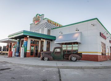
Sickies Garage Burgers & Brews
Experience gourmet burgers and craft beers at Sickies Garage Burgers & Brews in Rapid City – where flavor meets fun!
-
Inn
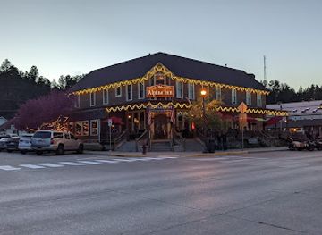
Alpine Inn
Discover comfort and charm at Alpine Inn in Hill City—your perfect base for exploring South Dakota's stunning Black Hills.
-
Hotel
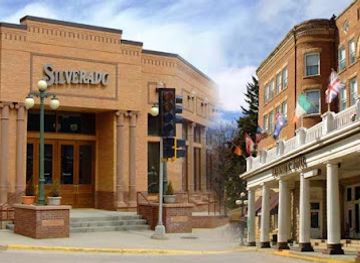
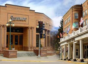
Silverado Franklin Historic Hotel & Gaming Complex, Legends Steakhouse & Silverado Grand Buffet
Discover luxury and history at Silverado Franklin Historic Hotel & Gaming Complex in Deadwood - a unique blend of comfort and entertainment.
-
Bar
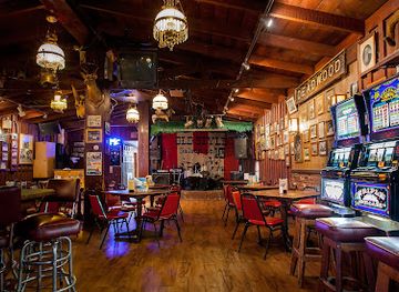
Saloon No. 10
Discover the historic charm and delectable flavors at Saloon No. 10 in Deadwood, where great food meets Wild West nostalgia.
Best bars in South Central South Dakota
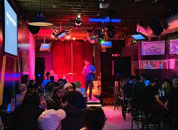
Evening life is modest and community-oriented rather than built around a large nightclub circuit. Pierre and Fort Pierre have the region's broadest selection of traditional bars, casual restaurants and places to meet after work or following a day on the water, while Chamberlain provides a smaller selection serving residents, travellers and visitors staying near the Missouri. Rural evenings generally centre on local pubs, grills, social gatherings and quiet time at campsites or lodges. Live entertainment and seasonal community events may occur, but schedules change and should be checked locally. Breweries and cocktail-focused venues are less prominent than in larger South Dakota cities, and alcohol is not central to the region's outdoor or cultural experience. Visitors should arrange a sober driver on long rural routes, as distances between accommodation and evening venues can be considerable and taxi availability outside the main towns may be limited.
-
Bar
Silverado Franklin Historic Hotel & Gaming Complex, Legends Steakhouse & Silverado Grand Buffet
Discover the rich history and vibrant entertainment at Silverado Franklin Historic Hotel & Gaming Complex in South Dakota's Deadwood.
-
Bar
Saloon No. 10
Discover the historic charm and delicious steak offerings at Saloon No. 10, a lively bar in the heart of Deadwood, South Dakota.
-
American
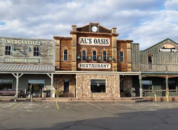
Al’s Oasis
Discover the charm of Al's Oasis, where delicious American cuisine meets unique shopping in Oacoma, South Dakota.
-
Bar
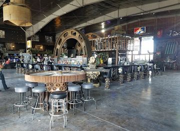
Full Throttle Saloon
Experience the ultimate biker paradise at Full Throttle Saloon in South Dakota, where live music, camping, and camaraderie come together.

Best nightclubs in South Central South Dakota
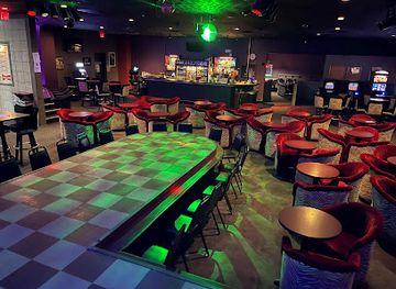
Evening life is modest and community-oriented rather than built around a large nightclub circuit. Pierre and Fort Pierre have the region's broadest selection of traditional bars, casual restaurants and places to meet after work or following a day on the water, while Chamberlain provides a smaller selection serving residents, travellers and visitors staying near the Missouri. Rural evenings generally centre on local pubs, grills, social gatherings and quiet time at campsites or lodges. Live entertainment and seasonal community events may occur, but schedules change and should be checked locally. Breweries and cocktail-focused venues are less prominent than in larger South Dakota cities, and alcohol is not central to the region's outdoor or cultural experience. Visitors should arrange a sober driver on long rural routes, as distances between accommodation and evening venues can be considerable and taxi availability outside the main towns may be limited.
-
Bar
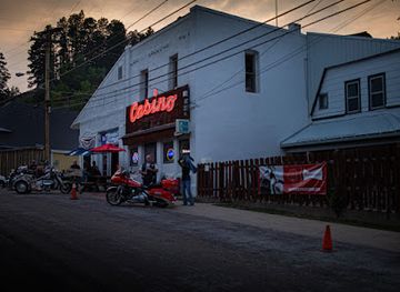
Lumpys Casino Bar
Discover the lively atmosphere and affordable drinks at Lumpys Casino Bar in Central City, a perfect blend of gaming and entertainment.
-
Lake
Lake Francis Case
Experience the natural beauty and outdoor adventures at Lake Francis Case in South Dakota, a perfect getaway for nature lovers and adventure seekers.
-
Night club
Club David
Discover the vibrant nightlife at Club David in Sioux Falls, where great music, tasty drinks, and unforgettable experiences await.
-
Night club
Scarlett O'Haras Gentlemen's Club
Dive into Sioux Falls nightlife at Scarlett O'Hara's Gentlemen's Club, where entertainment, atmosphere, and great service combine for an unforgettable evening.
Best shops in South Central South Dakota
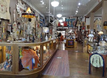
Shopping is concentrated in the main towns and is oriented towards practical supplies, regional food and locally meaningful gifts rather than extensive luxury retail. Pierre has the widest selection of everyday shops, galleries, books, outdoor equipment and state-related souvenirs, while Chamberlain and Fort Pierre offer smaller independent businesses serving residents and travellers on the highway. Shops and cultural institutions may stock Lakota art, beadwork, jewellery, books and other Indigenous-made goods; purchase from reputable sources that identify artists and respect cultural ownership. Farm and ranch country also supports seasonal produce, preserves, baked goods and locally branded food products, although market dates vary. Outdoor shops are useful for fishing, camping and boating supplies before heading towards Lake Oahe or Lake Sharpe. In rural communities, opening arrangements can be limited, so treat shopping as part of a planned town stop rather than expecting continuous retail along the highway.
-
Shopping mall
Uptown Rapid
Experience the vibrant shopping scene at Uptown Rapid, where retail therapy meets delightful dining and entertainment in Rapid City, South Dakota.
-
Gift shop
Prairie Edge Trading Co & Galleries
Explore the rich Native American heritage and artistry at Prairie Edge Trading Co & Galleries, a must-visit cultural gem in Rapid City.
-
Book store
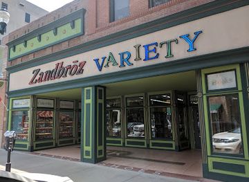
Zandbroz Variety
Experience the unique charm of Zandbroz Variety, a bookstore that blends literature and local artistry in the heart of Sioux Falls.
-
Gift shop
Jewel of the West
Explore Jewel of the West, a unique gift shop in Hill City, SD, offering authentic clothing, jewelry, and Native American crafts for every traveler.

Get your free copy of our complete guide to South Central South Dakota, delivered straight to you.
Everything on this page, from attractions and restaurants to essentials and local phrases, in one PDF you can read offline, print or share.
Already have an account? Sign in
Your South Central South Dakota guide is ready.
We'll send it to · Not you? Sign out

Getting your guide ready…
We are putting together a fresh copy of the South Central South Dakota guide. This can take up to a minute.
This can take a few moments. If your browser asks, choose Allow so the download can start. You'll find the guide in your Downloads folder.
Nothing happened? Download it again
Sorry, the guide is taking longer than usual. Please try again in a minute, or get it by email instead.
South Central South Dakota essentials
Currency and Payment
Safety
Emergency Situations
Do's and Don'ts
Local Tips
From Eve
Local phrases worth knowing
You don't need to get them perfect. A few words go a long way, and locals appreciate the effort.
Basics
| English | Local | Say it |
|---|---|---|
| Hello | Howdy | [hau-dee] |
| Goodbye | See ya | [see yah] |
| Yes | Yup | [yup] |
| No | Naw | [naw] |
| Please/You're welcome | Sure thing | [shur thing] |
| Thank you | Thanks a lot | [thanks uh lot] |
| Excuse me/Sorry | Pardon me | [pardn me] |
| How are you? | How ya doin'? | [how ya doin'] |
| Fine. And you? | Good, you? | [gud, you?] |
| Do you speak English? | Do ya speak English? | [do ya speak English?] |
| I don't understand | I ain't following ya | [I ain't follo-in' ya] |
Eating & Drinking
| English | Local | Say it |
|---|---|---|
| I'd like to see the menu, please | Can I see the menu, please? | [can I see the menu, pleez?] |
| I don't eat meat | I don’t eat meat | [I don’t eat meat] |
| Cheers! | Cheers! | [cheers] |
| I would like to pay, please | I’d like to pay now, please | [I’d like to pay now, pleez] |
Emergencies
| English | Local | Say it |
|---|---|---|
| Help! | Help! | [help] |
| Go away! | Leave me alone! | [leave me alone!] |
| Call the Police! | Call the cops! | [call the cops!] |
| Call a doctor! | Get a doctor! | [get a doctor!] |
| I'm lost | I’m turned around | [I’m turned around] |
| I'm ill | I feel bad | [I feel bad] |
Shopping
| English | Local | Say it |
|---|---|---|
| I'd like to buy... | I wanna buy... | [I wanna buy...] |
| I'm just looking | Just browsing | [just browsin'] |
| How much is it? | What’s the price? | [what's the price?] |
| That's too expensive | That’s a bit steep | [that’s a bit steep] |
| Can you lower the price? | Can ya knock down the price? | [can ya knock down the price?] |
Time & Numbers
| English | Local | Say it |
|---|---|---|
| What time is it? | What’s the time? | [what's the time?] |
| It's one o'clock | It's one | [it's one] |
| Half past (10) | Half past ten | [half past ten] |
| Morning | Morning | [morning] |
| Afternoon | Afternoon | [afternoon] |
| Evening | Evening | [evening] |
| Yesterday | Yesterday | [yesterday] |
| Today | Today | [today] |
| Tomorrow | Tomorrow | [tomorrow] |
| 1 | One | [one] |
| 2 | Two | [two] |
| 3 | Three | [three] |
| 4 | Four | [four] |
| 5 | Five | [five] |
| 6 | Six | [six] |
| 7 | Seven | [seven] |
| 8 | Eight | [eight] |
| 9 | Nine | [nine] |
| 10 | Ten | [ten] |
Transport & Directions
| English | Local | Say it |
|---|---|---|
| Where's a/the...? | Where's the...? | [where's the...?] |
| What's the address? | What’s the address? | [what's the address?] |
| Can you show me (on the map)? | Can ya point it out on the map? | [can ya point it out on the map?] |
| When's the next (bus)? | When’s the next bus? | [when's the next bus?] |
| A ticket (to ....) | A ticket to... | [a ticket to...] |
History of South Central South Dakota
Indigenous Missouri River Cultures
The Missouri River corridor has long supported Indigenous communities through fishing, hunting, agriculture and trade. Arikara communities maintained villages along the upper and central Missouri, while Lakota and Dakota peoples developed extensive cultural, economic and spiritual relationships with the prairie and river country. These histories remain important in the region today, particularly through museums, cultural institutions and the continuing presence of tribal communities. European-American accounts often reduced these complex societies to frontier episodes; responsible interpretation recognises Indigenous sovereignty, resilience and contemporary life.
The Fur Trade and Fort Pierre
The river became a major route for commercial exchange during the early nineteenth century. Fort Pierre Chouteau, established by the American Fur Company in 1832 near the mouth of the Bad River, developed as a trading centre linking merchants with Lakota and other Plains peoples. Although the original post no longer survives intact, its location helped give Fort Pierre lasting importance in regional history. The settlement later became associated with transport, cattle and the broader transformation of the northern Great Plains.
Lewis and Clark on the Missouri
The Lewis and Clark Expedition travelled through the Missouri corridor in 1804 and 1806, recording landscapes and encounters that subsequently influenced American expansion. The expedition did not arrive in an empty wilderness: it moved through territories known and used by Indigenous nations, whose knowledge was essential to travel and survival. Modern interpretive sites around Pierre, Fort Pierre and the river help place the expedition within the longer history of Indigenous diplomacy, trade and territorial authority.
Dakota Territory and Frontier Settlement
During the later nineteenth century, the United States extended military, governmental and commercial control across the region. Treaties, conflict, land surveys, railways and settler migration altered Indigenous landholding and movement, with particularly profound consequences for Lakota communities. Towns grew as administrative and trading centres, while ranching and agriculture became central to the regional economy. The eventual creation of South Dakota as a state in 1889 formalised a political geography imposed over much older Indigenous landscapes.
The Missouri River Reservations
The construction of dams on the Missouri during the twentieth century transformed transport, flood patterns, communities and local economies. It also caused major losses for tribal nations, including the flooding of homes, farms, cultural sites and fertile bottomland on reservations. The Fort Randall and Big Bend projects affected the lower and central reaches of the river, while the Oahe project reshaped the landscape near Pierre and Fort Pierre. The reservoirs now support recreation, but their history must also be understood through displacement and unresolved social consequences.
Modern Ranching, Farming and Outdoor Recreation
South Central South Dakota remains closely connected to cattle ranching, crop production and public-land activities, although government, healthcare, education and tourism are also important. Reservoir creation brought boating, angling and camping to a river system once defined more by transport and flood cycles. Pierre's role as the state capital added an administrative dimension, while museums and cultural attractions in Chamberlain and elsewhere broadened the visitor economy. The region's contemporary identity therefore combines working prairie communities with a growing interest in heritage and outdoor travel.
South Central South Dakota in Photos
Browse through our photo collection highlighting the charm and character of the destination.
Neighbouring regions of South Central South Dakota
The closest regions to South Central South Dakota, if you have time for more than one.
-

-

-

-

-


Swipe for more regions
Explore more

Explore more of South Dakota
Discover South Dakota: From the iconic Mount Rushmore and Crazy Horse Memorial to the stunning Badlands and charming small towns, it's a land of history and natural beauty.
Explore South Dakota