

Lewis and Clark Recreation Area, South Dakota Travel Guide
Discover the natural beauty and historical significance of Lewis and Clark Recreation Area, where outdoor adventure meets tranquil landscapes along the Missouri River.
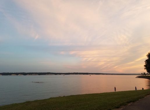
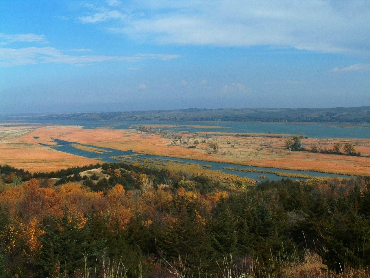
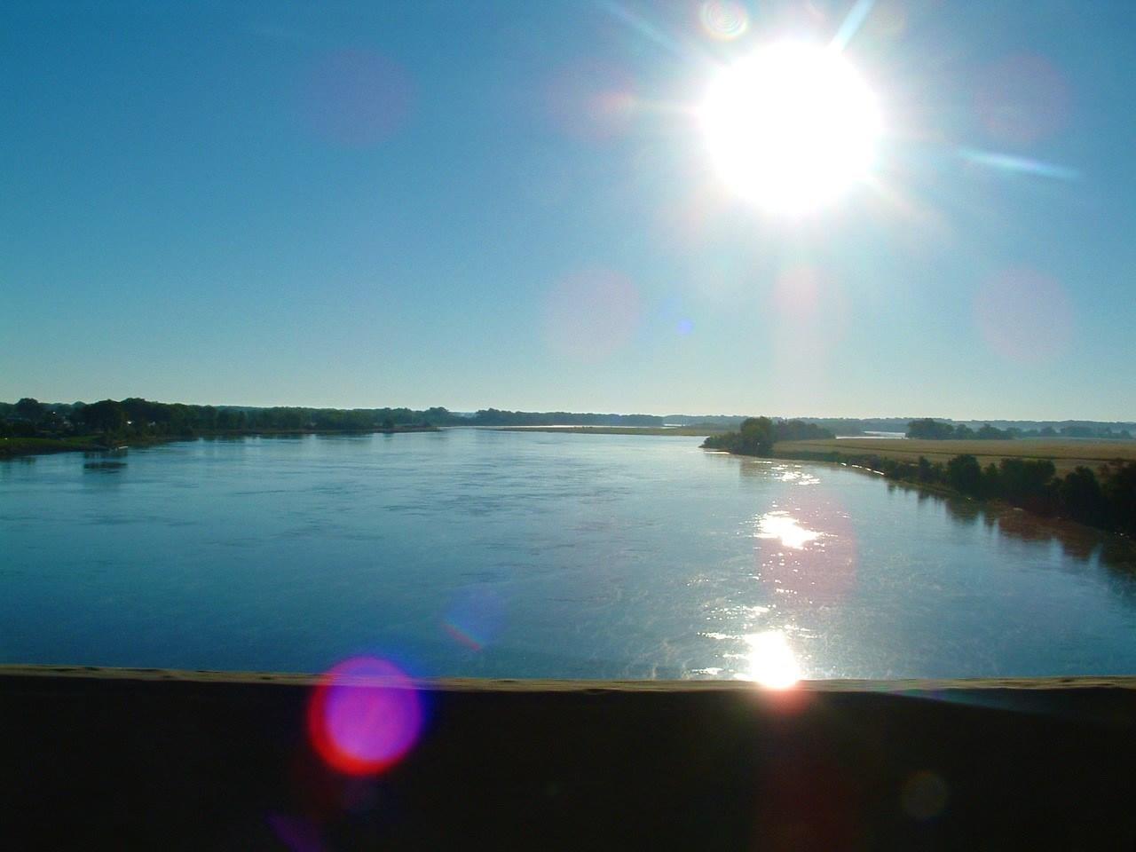
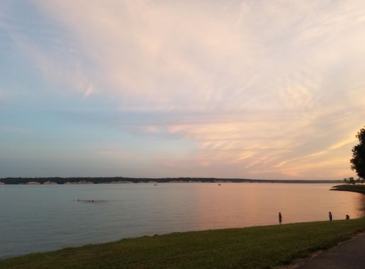
Lewis and Clark Recreation Area is a splendid haven for nature lovers and outdoor enthusiasts, located along the majestic Missouri River. This expansive park offers a mix of activities that cater to families, adventurers, and anyone looking to unwind in nature's embrace. The park is named after the famed explorers Meriwether Lewis and William Clark, who journeyed through this region during their historic expedition. Today, visitors can explore the same landscapes that these explorers once traversed. The area is rich with history and natural beauty, making it an ideal spot for both relaxation and adventure. Activities abound in this recreation area. Visitors can enjoy boating, fishing, and swimming in the clear waters of Lewis and Clark Lake. The park also boasts numerous hiking and biking trails, perfect for those looking to explore the scenic surroundings. For the more laid-back traveler, there are ample spots for picnicking and bird watching, with diverse wildlife often seen throughout the park. Camping is a popular activity at Lewis and Clark Recreation Area, with well-maintained campgrounds offering both modern amenities and rustic charm. Whether you're in an RV or a tent, you'll find a welcoming spot to set up camp. The park's facilities include shower houses, playgrounds, and even a marina, ensuring a comfortable and enjoyable stay for all visitors.

Know before you go
Hi, I'm Eve. Here are a few practical things to know before exploring Lewis and Clark Recreation Area.
- Visit during the off-peak season for a quieter experience and more wildlife sightings.
- Bring a pair of binoculars for bird watching; the area is home to a variety of bird species.
- Check the weather forecast in advance as conditions can change rapidly near the river.
- Reserve your campsite early, especially during summer weekends and holidays.
- Pack plenty of sunscreen and insect repellent to stay comfortable during your visit.
Explore Lewis and Clark Recreation Area: Things to Do, Places to Eat, Hotels & More
Handpicked recommendations for top attractions, local dining, accommodations, and more

Best attractions in Lewis and Clark Recreation Area
Top-rated picks
Best Attractions

Lewis & Clark Resort
Experience the perfect blend of relaxation and adventure at Lewis & Clark Resort, where stunning river views and outdoor activities await.

Gavins Point Recreation Area
Explore the stunning Gavins Point Recreation Area in Yankton, SD - a paradise for outdoor enthusiasts with beautiful trails, beaches, and abundant wildlife.

House of Mary Shrine
Discover the serene beauty and spiritual significance of the House of Mary Shrine in Yankton, South Dakota, a peaceful retreat for the soul.

Lewis & Clark Marina
Explore the scenic beauty and recreational opportunities at Lewis & Clark Marina in Yankton, South Dakota - a perfect getaway for water lovers.

Best landmarks in Lewis and Clark Recreation Area


Best restaurants in Lewis and Clark Recreation Area


Best bars in Lewis and Clark Recreation Area
Top-rated picks
Best Bars
Lewis & Clark Resort
Discover the serene beauty and recreational adventures at Lewis & Clark Resort, the perfect getaway for relaxation and fun in South Dakota.

Marina Bar & Grill
Indulge in a lakeside dining experience at Marina Bar & Grill, where delicious food and stunning views meet in Yankton, South Dakota.

Cottonwood Inn & Suites
Explore Yankton, SD, with ease from Cottonwood Inn & Suites—a convenient stop with essential amenities for every traveler.

Best shops in Lewis and Clark Recreation Area
Top-rated picks
Best Shops

Lewis & Clark State Recreation Area
Discover outdoor adventures at Lewis & Clark State Recreation Area, where nature and history intertwine along the beautiful Missouri River.

Dam Fireworks
Discover a world of fireworks at Dam Fireworks in Yankton, SD, where your celebrations come alive with vibrant displays and expert guidance.

Lewis & Clark Marina
Experience adventure and tranquility at Lewis & Clark Marina, your gateway to outdoor fun on the stunning Lewis and Clark Lake in Yankton, South Dakota.

Explore Lewis and Clark Recreation Area on the Map
A handpicked selection of must-see spots in Lewis and Clark Recreation Area, mapped for you.
Lewis and Clark Recreation Area Essentials
-
Lewis and Clark Recreation Area is located near Yankton, South Dakota. The nearest major airport is Sioux Falls Regional Airport (FSD), approximately 90 miles away. From Sioux Falls, you can rent a car and drive to the recreation area, which takes about 1.5 to 2 hours. Alternatively, you can take a bus to Yankton and then a taxi or rideshare service to the park.
-
The best way to explore Lewis and Clark Recreation Area is by car, as public transportation options within the park are limited. Rental cars are available in Yankton and Sioux Falls. Biking is also a popular way to get around, with various trails available. For those staying at the campgrounds, walking is a convenient option for short distances.
-
The official currency is the U.S. Dollar (USD). Credit and debit cards are widely accepted at most facilities in the recreation area, including the marina, campgrounds, and visitor centers. However, it's advisable to carry some cash for smaller vendors or in case of connectivity issues that may affect card payments.
-
Lewis and Clark Recreation Area is generally safe for tourists. Standard precautions should be taken, such as securing your belongings and not leaving valuables in plain sight in your vehicle. There are no specific high-crime areas within the park, but always remain vigilant. Be cautious when engaging in water activities and follow all posted safety guidelines.
-
In case of an emergency, dial 911 for immediate assistance. The park has ranger stations and first aid facilities. It's recommended to carry a basic first aid kit. For medical emergencies, the nearest hospital is in Yankton, approximately 15 minutes away by car. Make sure to have travel insurance that covers medical emergencies.
-
Fashion: Do wear comfortable and weather-appropriate clothing. Don't forget to bring swimwear if you plan on engaging in water activities. Religion: Do respect any religious practices or ceremonies you may encounter. Public Transport: Do note that public transport within the park is limited. Car rentals or bikes are recommended. Greetings: Do greet people with a friendly hello or wave. Eating & Drinking: Do try local food offerings at nearby towns. Don't litter; always use designated trash bins.
-
To experience Lewis and Clark Recreation Area like a local, consider visiting during off-peak times for a more tranquil experience. Engage in fishing or boating, popular activities among locals. Take a hike on the Gavins Point Nature Trail for stunning views and wildlife spotting. Visit nearby wineries and breweries in Yankton for a taste of local flavors.
When is the best time to visit Lewis and Clark Recreation Area?
Useful Local Phrases for Lewis and Clark Recreation Area
You don't need to speak the language perfectly. Even learning a few simple words can make conversations warmer—and locals usually appreciate the effort.
— Eve

Here are the phrases I use most often in Lewis and Clark Recreation Area. Try a few—you'll be surprised how far they go! 😊
❤️
-
- HelloHau
[h-ow] - GoodbyeBidin
[bi-din] - YesYe
[yeh] - NoNo
[no] - Please/You're welcomeTena
[teh-nah] - Thank youPilamaya
[pee-lah-mah-yah] - Excuse me/SorrySica
[see-chah] - How are you?He nipi kiŋ
[heh nee-pee keen] - Fine. And you?Wopila. Kiŋ aŋni?
[woh-pee-lah. keen ah-nee?] - Do you speak English?Wihakta English kiŋ hwo?
[wee-hahk-tah English keen hwoh?] - I don't understandYuonihan
[yoo-oh-nee-hahn]
- HelloHau
-
- I'd like to see the menu, pleaseMenu waŋ yelo, hena
[meh-noo wahng yeh-loh, heh-nah] - I don't eat meatWamni yelo
[wahm-nee yeh-loh] - Cheers!Oyate kiŋ
[oh-yah-teh keen] - I would like to pay, pleaseKiwipaha yelo, hena
[kee-wee-pah-hah yeh-loh, heh-nah]
- I'd like to see the menu, pleaseMenu waŋ yelo, hena
-
- Help!Ape
[ah-pay] - Go away!Aŋpethi
[ahng-pay-thee] - Call the Police!Woslati kiŋ
[woh-slah-thee keen] - Call a doctor!Wicahpi kiŋ
[wee-chah-pi keen] - I'm lostNahotakiŋ
[nah-hoh-tah-keen] - I'm illWíčhaša yelo
[wee-chah-shah yeh-loh]
- Help!Ape
-
- I'd like to buy...Kaŋyaha yelo...
[kahng-yah-hah yeh-loh...] - I'm just lookingItakuye
[ee-tah-koo-yeh] - How much is it?Hena tawaŋyelo?
[heh-nah tah-wahng-yeh-loh?] - That's too expensiveLakota yelo
[lah-koh-tah yeh-loh] - Can you lower the price?Tawaŋyelo kiŋ hwo?
[tah-wahng-yeh-loh keen hwoh?]
- I'd like to buy...Kaŋyaha yelo...
-
- What time is it?Tawaŋyelo tawaŋyelo?
[tah-wahng-yeh-loh tah-wahng-yeh-loh?] - It's one o'clockTokaŋ tawaŋyelo
[toh-kahng tah-wahng-yeh-loh] - Half past (10)Nahasapa
[nah-hah-sah-pah] - MorningWíyawa
[wee-yah-wah] - AfternoonIyomakȟa
[ee-yoh-mah-khah] - EveningIyuskinyan
[ee-yoos-keen-yahn] - YesterdayIyektaŋ
[ee-yeh-kh-tahng] - TodayLílaŋ
[lee-lahng] - TomorrowAŋpétu
[ahng-pay-too] - 1Tokaŋ
[toh-kahng] - 2Napé
[nah-pay] - 3Yamni
[yahm-nee] - 4Topa
[toh-pah] - 5Zaptan
[zahp-tahn] - 6Šakpá
[shahk-pah] - 7Šakówi
[shahk-ow-wee] - 8Šakpáŋ
[shahk-pahng] - 9Šakówiŋ
[shahk-ow-weeng] - 10Wí
[wee]
- What time is it?Tawaŋyelo tawaŋyelo?
-
- Where's a/the...?Heháŋ...
[heh-hahng...] - What's the address?Tawaŋyelo tókahe?
[tah-wahng-yeh-loh toh-kah-hay?] - Can you show me (on the map)?Tawaŋyelo yelókiŋ?
[tah-wahng-yeh-loh yeh-loh-keeng?] - When's the next (bus)?Tawaŋyelo hwo wóuŋ...
[tah-wahng-yeh-loh hwoh woh-uhng...] - A ticket (to ....)Wamakȟa tawaŋ...
[wah-mah-khah tah-wahng...]
- Where's a/the...?Heháŋ...
History of Lewis and Clark Recreation Area
-
The Lewis and Clark Recreation Area gets its name from the famous Corps of Discovery Expedition led by Meriwether Lewis and William Clark. This historic journey, commissioned by President Thomas Jefferson, aimed to explore the newly acquired Louisiana Purchase and find a practical route to the Pacific Ocean. In 1804, the expedition traveled through what is now the recreation area, documenting the rich biodiversity and interacting with various Native American tribes. Their detailed journals provide a glimpse into the untouched landscape and the lives of the indigenous people at the time.
-
Long before the arrival of Lewis and Clark, the area was home to various Native American tribes, including the Yankton Sioux. These tribes lived harmoniously with the land, relying on the Missouri River for sustenance and trade. They constructed earth lodges and tepees, hunted buffalo, and engaged in intricate trade networks. The Yankton Sioux, in particular, were known for their skilled craftsmanship and played a significant role in the area's cultural heritage.
-
The Missouri River, which borders the Lewis and Clark Recreation Area, became a vital transportation route during the steamboat era of the 19th century. Steamboats transported goods and passengers, playing a crucial role in the westward expansion of the United States. The bustling river traffic brought economic prosperity and facilitated the movement of settlers, goods, and ideas. The remnants of steamboat landings and trade posts can still be found in the area, providing a tangible connection to this transformative period.
-
Fort Randall, established in 1856, was a key military outpost located near the present-day recreation area. The fort served as a base for U.S. Army operations during the Indian Wars and played a pivotal role in maintaining peace and order in the region. Soldiers stationed at Fort Randall constructed roads and bridges, contributing to the development of the surrounding area. Today, the remnants of Fort Randall provide visitors with a glimpse into the military history and strategic importance of the area.
-
The construction of Gavins Point Dam in the 1950s brought significant changes to the region, leading to the creation of Lewis and Clark Lake. The dam, part of the larger Pick-Sloan Missouri Basin Program, was built to provide flood control, hydroelectric power, and recreational opportunities. The resulting reservoir transformed the landscape, offering visitors a scenic and recreational paradise. The dam's construction also had an impact on local communities, leading to the relocation of some residents and the creation of new economic opportunities.
-
The establishment of the Lewis and Clark Recreation Area in the mid-20th century marked a new chapter in the region's history. The area was developed to provide a wide range of recreational activities, including boating, fishing, hiking, and camping. Over the years, the park has expanded its facilities and amenities, becoming a popular destination for outdoor enthusiasts. Today, it continues to honor the legacy of Lewis and Clark while offering a modern recreational experience for visitors from around the world.
Neighbouring destination travel guides
Browse our curated selection of top destinations, scenic points, and must-visit spots in the area.



Your all‑in‑one travel companion app
Explore expert travel guides, compare and book tours, experiences, hotels, and more—all from the palm of your hand. Download now for seamless trip planning wherever your wanderlust takes you.


Explore More of Yankton Area

Looking beyond Lewis and Clark Recreation Area? Discover Yankton Area for broader travel guides, local hot-spots, and regional highlights.
Explore Yankton AreaExplore More of South Dakota

Looking beyond Lewis and Clark Recreation Area? Discover South Dakota for broader travel guides, local hot-spots, and regional highlights.
Explore South DakotaLewis and Clark Recreation Area in Photos
Browse through our photo collection highlighting the charm and character of the destination.




Lewis and Clark Recreation Area: A Riverside Retreat in South Dakota
Lewis and Clark Recreation Area is a splendid haven for nature lovers and outdoor enthusiasts, located along the majestic Missouri River. This expansive park offers a mix of activities that cater to families, adventurers, and anyone looking to unwind in nature's embrace. The park is named after the famed explorers Meriwether Lewis and William Clark, who journeyed through this region during their historic expedition. Today, visitors can explore the same landscapes that these explorers once traversed. The area is rich with history and natural beauty, making it an ideal spot for both relaxation and adventure. Activities abound in this recreation area. Visitors can enjoy boating, fishing, and swimming in the clear waters of Lewis and Clark Lake. The park also boasts numerous hiking and biking trails, perfect for those looking to explore the scenic surroundings. For the more laid-back traveler, there are ample spots for picnicking and bird watching, with diverse wildlife often seen throughout the park. Camping is a popular activity at Lewis and Clark Recreation Area, with well-maintained campgrounds offering both modern amenities and rustic charm. Whether you're in an RV or a tent, you'll find a welcoming spot to set up camp. The park's facilities include shower houses, playgrounds, and even a marina, ensuring a comfortable and enjoyable stay for all visitors.