

Free Highland Rim Travel Guide & Mobile App
Explore Highland Rim with free travel guides. Discover regional history, expert tips, proposed trips, and audio guides on web or mobile app.


Explore Tennessee’s Highland Rim for limestone uplands, caves, waterfalls, state parks, whiskey heritage and small-town landscapes near Nashville.
Read more about Highland Rim
Getting to and around Highland Rim
How to get there
Transportation
Top city travel guides in Highland Rim
The cities of Highland Rim, and the easiest places to base yourself.
-

-
-

-

-

-


Swipe for more cities
Destinations in Highland Rim
Resorts, valleys and scenic spots worth a trip of their own.
-
-
-

-


Swipe for more destinations
Best attractions in Highland Rim
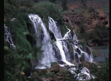
The Highland Rim’s attractions are primarily landscape-based, historic and dispersed. Around Clarksville, Dunbar Cave State Park combines a cave system, woodland trails and an important archaeological setting, while Fort Donelson National Battlefield, near Dover, interprets a decisive Civil War campaign in the western uplands. Montgomery Bell State Park offers hiking, water-based recreation and reminders of Middle Tennessee’s iron industry. In the eastern Highland Rim, Cummins Falls State Park and Burgess Falls State Park centre on streams dropping through wooded limestone country; access can involve steep paths and conditions should be checked before travelling. Cedars of Lebanon State Park presents unusual cedar glades, where thin limestone soils support specialised plant life, alongside camping and walking. Reservoirs such as Center Hill Lake provide boating and fishing, while the Natchez Trace Parkway offers scenic driving, short walks and historical sites. Mound Bottom, where access arrangements are controlled, adds archaeological depth. Together these places create a destination better suited to linked day trips, outdoor exploration and landscape interpretation than to a concentrated urban sightseeing itinerary.
-
National park
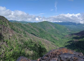
Great Smoky Mountains National Park
Discover the breathtaking landscapes and diverse wildlife of Great Smoky Mountains National Park, a haven for outdoor enthusiasts and nature lovers.
-
Tourist attraction
Nashville Zoo at Grassmere
Discover Nashville Zoo at Grassmere: a captivating wildlife sanctuary featuring diverse species and engaging exhibits for an unforgettable family adventure.
-
Escape room center
The Escape Game Nashville (Berry Hill)
Experience the thrill of adventure at The Escape Game Nashville, where teamwork meets mystery in challenging escape room experiences.
-
Art museum
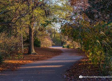
The Parthenon
Explore The Parthenon in Nashville, a breathtaking replica of the Athens original, blending art, history, and stunning architecture in a beautiful park setting.


Best landmarks in Highland Rim
The Highland Rim’s most recognisable landmarks are formed by its relationship with limestone, water and historic movement. Dunbar Cave near Clarksville is both a prominent natural feature and an archaeological site, with a substantial underground system that has shaped human use of the surrounding landscape. Cummins Falls is a defining eastern-rim landmark, where the Blackburn Fork River descends through a steep, wooded gorge; Burgess Falls offers a related expression of the region’s dissected stream valleys. The limestone cedar glades of Cedars of Lebanon are less dramatic in height but highly significant ecologically, supporting plant communities adapted to shallow, alkaline soils. Mound Bottom’s earthen structures mark the scale and importance of a Mississippian ceremonial centre. In the west, Fort Donelson’s historic earthworks and river setting recall the strategic importance of the Cumberland corridor during the Civil War. The Natchez Trace Parkway is a linear landmark in its own right, following a much older route across the uplands and linking scenery with Indigenous, frontier and commercial history.
-
Museum of space history
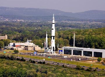
U.S. Space & Rocket Center
Discover the history of space exploration at the U.S. Space & Rocket Center, featuring rockets, interactive exhibits, and planetarium shows for all ages.
-
State park
Fall Creek Falls State Park
Experience the breathtaking waterfalls, hiking trails, and serene landscapes of Fall Creek Falls State Park, a natural wonder in Tennessee.
-
History museum
Andrew Jackson’s Hermitage
Visit Andrew Jackson's Hermitage, an iconic history museum in Tennessee, to explore the life of a pivotal U.S. President and his enduring legacy.
-
State park
Rock Island State Park
Explore the breathtaking landscapes and outdoor adventures of Rock Island State Park, a premier destination for nature lovers in Tennessee.


Explore Highland Rim on the map
Plan your trip on one map. See where the top cities, national parks and sights are, and book hotels and experiences in a few clicks.
Best hotels in Highland Rim
Best restaurants in Highland Rim
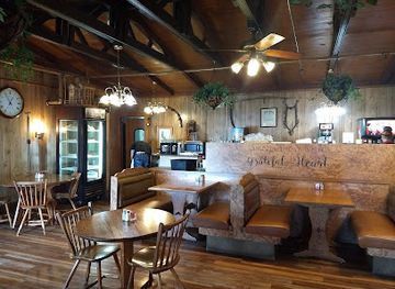
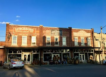
Dining across the Highland Rim reflects Middle Tennessee’s rural economy and the wider Southern food tradition. Expect barbecue, fried chicken, biscuits, cornbread, country ham, beans, seasonal vegetables and sweet desserts in diners, cafés and family-run restaurants, with recipes and emphasis varying from one community to another. Small-town cafés and traditional restaurants are useful stops near county seats, while rural inns and contemporary kitchens may focus on locally sourced produce without presenting a single standardised regional cuisine. Farmers’ markets and farm stands commonly provide seasonal fruit, vegetables, baked goods, preserves and honey. In the southern rim, Lynchburg’s food culture is closely connected with visitors exploring Tennessee whiskey, although whiskey is a product and heritage associated with the wider state as well as the town. Near lakes and parks, menus may include catfish and other Southern comfort dishes, while larger communities offer broader American and international choices.
-
Truck stop
Tennessean Travel Stop
Discover Southern hospitality at Tennessean Travel Stop—your ultimate pit stop with great food and cozy rest areas.
-
American
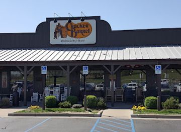
Cracker Barrel Old Country Store
Discover delightful Southern cuisine and unique gifts at Cracker Barrel Old Country Store – where every meal feels like home.
-
Southern
Log Cabin Restaurant
Experience authentic Southern cuisine at Log Cabin Restaurant in Hurricane Mills - where comfort food meets warm hospitality.
-
Barbecue
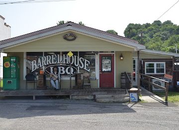
Barrel House BBQ
Experience the authentic taste of Southern barbecue at Barrel House BBQ in Lynchburg, TN - where flavor meets tradition!

Best bars in Highland Rim
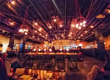
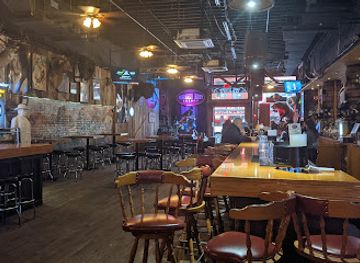
Evening life in the Highland Rim is generally sociable and low-key rather than built around a large nightclub circuit. Traditional pubs, bar-and-grills, breweries, live-music rooms and historic-style local bars are most common in the larger communities, including Clarksville and Cookeville, while smaller county seats tend to centre their evening activity on restaurants and longstanding local establishments. Lynchburg’s visitor economy includes whiskey-related experiences, but responsible tasting and distillery tourism are only one part of the area’s identity. Rural nightlife often depends on community events, music performances and seasonal gatherings rather than dedicated entertainment districts. Nashville, outside the Highland Rim in the Central Basin, provides the nearest major concentration of late-night venues, music clubs and theatres, but should be treated as a separate urban destination rather than as the region’s representative nightlife scene.
-
Bar
Pinewood
Experience the unique blend of culinary delights and vibrant atmosphere at Pinewood, Nashville's premier New American restaurant and bar.
-
Live music bar
Whiskey Bent Saloon
Discover the heart of Nashville's nightlife at Whiskey Bent Saloon, where live music and great drinks come together in a vibrant atmosphere.
-
Family-friendly
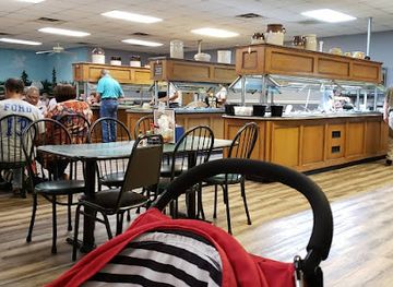
Marvin's Family Restaurant
Experience the heart of Fayetteville dining at Marvin's Family Restaurant, where every meal is a family celebration!
-
Bar
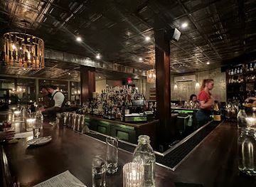
The Patterson House
Discover the vibrant cocktail culture at The Patterson House, Nashville's premier bar offering exquisite drinks and a chic atmosphere for nightlife lovers.
Best nightclubs in Highland Rim
-
Visitor center
Jack Daniel's Distillery Visitor Center
Explore the rich heritage of Jack Daniel's whiskey at its iconic distillery in Lynchburg, Tennessee, and savor the craftsmanship behind every drop.
-
Grill
Bar Louie - The Avenue at Murfreesboro
Experience the vibrant atmosphere and diverse menu at Bar Louie in Murfreesboro, where every meal is a celebration.
-
Night club
The Stage on Broadway
Discover the heart of Nashville's nightlife at The Stage on Broadway, where live music and vibrant atmosphere create unforgettable experiences.
-
Sports bar
Twin Peaks
Experience the ultimate sports bar at Twin Peaks Brentwood, TN – where American cuisine meets a lively atmosphere and thrilling game day excitement.


Best shops in Highland Rim
Shopping in the Highland Rim is concentrated in the commercial centres of towns rather than in one region-wide retail district. Clarksville and Cookeville provide the broadest mix of national retailers, independent shops, cafés, galleries and practical services, while smaller county seats offer historic main streets, antique shops, bookshops and locally oriented businesses. Farmers’ markets and farm stands are good places to look for seasonal produce, honey, jams, baked goods and crafts, although operating days vary by community and season. Around Lynchburg, whiskey-related merchandise and Tennessee-made gifts are prominent, alongside pottery, woodwork and regional food products. Rural craft shops and galleries may sell handmade objects, paintings and textiles, but opening arrangements can be limited outside peak periods. Visitors should distinguish durable regional products from generic Tennessee souvenirs, and allow time for market stalls or independent shops that may close earlier than urban retailers.
-
Shopping mall
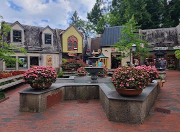
The Village Shops
Explore The Village Shops in Gatlinburg: Unique boutiques, local crafts, and delightful dining amidst the beauty of the Smoky Mountains.
-
Shopping mall
The Factory at Franklin
Explore the rich history and vibrant culture at The Factory at Franklin, a unique shopping and cultural destination in Tennessee.
-
Shopping mall
Kimball Crossing
Explore Kimball Crossing: A Unique Shopping and Dining Experience in Tennessee with Diverse Stores and Ample Parking.
-
Gift shop
Jack Daniels Personalized Gifts
Explore Jack Daniels Personalized Gifts in Lynchburg, TN, for unique souvenirs and personalized treasures that embody local culture and heritage.

Get your free copy of our complete guide to Highland Rim, delivered straight to you.
Everything on this page, from attractions and restaurants to essentials and local phrases, in one PDF you can read offline, print or share.
Already have an account? Sign in
Your Highland Rim guide is ready.
We'll send it to · Not you? Sign out

Getting your guide ready…
We are putting together a fresh copy of the Highland Rim guide. This can take up to a minute.
This can take a few moments. If your browser asks, choose Allow so the download can start. You'll find the guide in your Downloads folder.
Nothing happened? Download it again
Sorry, the guide is taking longer than usual. Please try again in a minute, or get it by email instead.
Highland Rim essentials
Currency and Payment
Safety
Emergency Situations
Do's and Don'ts
Local Tips
From Eve
Local phrases worth knowing
You don't need to get them perfect. A few words go a long way, and locals appreciate the effort.
Basics
| English | Local | Say it |
|---|---|---|
| Hello | Howdy | [How-dee] |
| Goodbye | See ya later | [See ya lay-ter] |
| Yes | Yep | [Yep] |
| No | Nope | [Nope] |
| Please/You're welcome | Sure thing | [Shur thing] |
| Thank you | Thanks a bunch | [Thanks a bunch] |
| Excuse me/Sorry | Pardon me | [Par-don me] |
| How are you? | How ya doin'? | [How ya doin'?] |
| Fine. And you? | I’m good, how 'bout you? | [I’m good, how 'bout you?] |
| Do you speak English? | Ya speakin' English? | [Ya speakin' English?] |
| I don't understand | I ain't got it | [I ain't got it] |
Eating & Drinking
| English | Local | Say it |
|---|---|---|
| I'd like to see the menu, please | Can I see the menu? | [Can I see the menu?] |
| I don't eat meat | I don't do meat | [I don't do meat] |
| Cheers! | Cheers! | [Cheers!] |
| I would like to pay, please | Can I settle up? | [Can I settle up?] |
Emergencies
| English | Local | Say it |
|---|---|---|
| Help! | Help! | [Help!] |
| Go away! | Leave me be! | [Leave me be!] |
| Call the Police! | Call the cops! | [Call the cops!] |
| Call a doctor! | Get a doctor! | [Get a doctor!] |
| I'm lost | I’m all turned around | [I’m all turned around] |
| I'm ill | I ain't feelin' well | [I ain't feelin' well] |
Shopping
| English | Local | Say it |
|---|---|---|
| I'd like to buy... | I wanna buy... | [I wanna buy...] |
| I'm just looking | Just browsin' | [Just browsin'] |
| How much is it? | How much's this? | [How much's this?] |
| That's too expensive | That's too pricey | [That's too pricey] |
| Can you lower the price? | Can ya bring it down? | [Can ya bring it down?] |
Time & Numbers
| English | Local | Say it |
|---|---|---|
| What time is it? | What time ya got? | [What time ya got?] |
| It's one o'clock | It's one o'clock | [It's one o'clock] |
| Half past (10) | Half past ten | [Half past ten] |
| Morning | Mornin' | [Mornin'] |
| Afternoon | Afternoon | [Afternoon] |
| Evening | Evenin' | [Evenin'] |
| Yesterday | Yestiddy | [Yestiddy] |
| Today | Today | [Today] |
| Tomorrow | Tomorrah | [Tomorrah] |
| 1 | One | [One] |
| 2 | Two | [Two] |
| 3 | Three | [Three] |
| 4 | Four | [Four] |
| 5 | Five | [Five] |
| 6 | Six | [Six] |
| 7 | Seven | [Seven] |
| 8 | Eight | [Eight] |
| 9 | Nine | [Nine] |
| 10 | Ten | [Ten] |
Transport & Directions
| English | Local | Say it |
|---|---|---|
| Where's a/the...? | Where's a ... at? | [Where's a ... at?] |
| What's the address? | What's the address? | [What's the address?] |
| Can you show me (on the map)? | Can ya point it out? | [Can ya point it out?] |
| When's the next (bus)? | When's the next bus comin'? | [When's the next bus comin'?] |
| A ticket (to ....) | A ticket to ... | [A ticket to ...] |
History of Highland Rim
Indigenous Landscapes and Mound-Building Communities
The Highland Rim was inhabited and travelled by Indigenous peoples for thousands of years, supported by springs, forests, river corridors and fertile openings in the limestone uplands. The Mound Bottom complex in Cheatham County, on the western Highland Rim, preserves the remains of a major Mississippian-period ceremonial and political centre dating from roughly the eleventh to the fourteenth centuries. Its platform mounds and settlement landscape demonstrate that the region was connected to organised societies and long-distance exchange networks well before European-American expansion. Archaeological places across the rim should be understood as cultural landscapes, not merely as scenic curiosities.
The Natchez Trace and Early Regional Travel
The route now associated with the Natchez Trace developed from Indigenous pathways through the interior South and was later used by hunters, traders, boatmen and settlers travelling between the Mississippi Valley and the Cumberland settlements. Sections crossing the Highland Rim illustrate how ridges, springs and river crossings shaped movement across Middle Tennessee. The later Natchez Trace Parkway follows much of this historic corridor while preserving related archaeological and natural sites. Its presence helps explain why the region’s uplands were never isolated from wider commercial and political networks.
Frontier Settlement and the Formation of County Communities
During the late eighteenth and nineteenth centuries, Euro-American settlement expanded across the Highland Rim from established river corridors and roads. Farms, mills, ferries, churches and county seats appeared on land that could be cultivated among woods and limestone clearings. Communities such as Clarksville, Cookeville, Lebanon and Lynchburg developed different relationships with trade routes, agriculture and nearby waterways. The resulting landscape of courthouse towns, family farms and dispersed rural settlements remains one of the region’s most recognisable historical legacies.
Ironworking, Agriculture and Rural Industry
The Highland Rim’s forests, limestone and watercourses supported several forms of early industry. Iron production became important in parts of Middle Tennessee, including the area associated with Montgomery Bell, whose nineteenth-century ironworks contributed to the growth of regional manufacturing. Agriculture remained fundamental, with livestock, grains, tobacco and other crops varying by locality and market conditions. Small mills, tanneries, distilleries and later workshops added to an economy that connected rural communities to Nashville and markets beyond Tennessee.
Civil War in the Middle Tennessee Uplands
The Highland Rim occupied a strategically important position during the American Civil War because roads, rivers and rail connections across Middle Tennessee linked the Confederate interior with Union-held territory and the Cumberland River system. Fort Donelson, at Dover on the western side of the rim, fell to Union forces in 1862 and opened a major route into the Confederate heartland. The conflict also affected farms, towns and transport routes across the wider region. Military sites and cemeteries provide reminders that the war was experienced through occupation, supply and disruption as well as through major battles.
Railways, Roads and the Consolidation of Market Towns
Nineteenth-century railways and improved roads altered the Highland Rim by making it easier to move agricultural goods, timber and manufactured products to larger markets. Towns gained depots, warehouses, banks and commercial streets, while communities that lay away from major lines often retained a more dispersed character. In the twentieth century, highways encouraged commuting, tourism and industrial development, but they also changed the scale of travel across the uplands. Today’s mixture of historic town centres, roadside commerce and rural roads reflects these successive transport systems.
Conservation, Outdoor Recreation and Tennessee Whiskey
Twentieth-century conservation established state parks, protected caves and developed reservoirs for recreation, wildlife management and public access. Montgomery Bell, Cedars of Lebanon and other protected areas preserve representative upland forests, unusual limestone habitats and historic landscapes. At the same time, Tennessee whiskey became an increasingly visible part of the southern Highland Rim’s cultural economy, particularly around Lynchburg, where distilling traditions are closely associated with the town. These developments have added tourism to an area still shaped by farming, manufacturing and local community life.
Highland Rim in Photos
Browse through our photo collection highlighting the charm and character of the destination.
Neighbouring regions of Highland Rim
The closest regions to Highland Rim, if you have time for more than one.
-

-

-

-

-


Swipe for more regions
Explore more

Explore more of Tennessee
Discover Tennessee: A melting pot of music, history, and natural beauty, offering visitors an authentic taste of Southern hospitality and unforgettable experiences.
Explore Tennessee