

Carpathian Mountains Travel Guide - Free Web & App
Your ultimate guide to Carpathian Mountains. Discover top landmarks, proposed trips, and local tips. Free on the web or via the Evendo companion app.


Carpathian Mountains, Ukraine: explore Hoverla, Synevyr, Hutsul villages, forest trails, mountain railways and winter resorts amid vibrant regional culture.
Mountain Landscapes and Living Traditions
The Ukrainian Carpathians form the country’s western mountain region, extending across Zakarpattia, Ivano-Frankivsk, Lviv and Chernivtsi oblasts along the eastern arc of the Carpathian range. Their landscape changes noticeably from wooded foothills and broad river valleys to high grassland ridges, spruce forests, rocky summits and glacial lakes. Hoverla, Ukraine’s highest mountain at 2,061 metres, rises in the Chornohora range, while the Gorgany and Svydovets ranges offer a more remote character. The mountains are drained by rivers including the Prut, Tysa and Cheremosh, whose valleys guide roads, railways and settlements through the uplands.Read more about Carpathian Mountains
Villages, Resorts and Cultural Character
Nature, Heritage and Responsible Travel
When is the best time to visit Carpathian Mountains?
Best: June–August · 21–24°C| Month | High (°C) | Rainfall (mm) |
|---|---|---|
| January | -2 | 30 |
| February | -1 | 28 |
| March | 4 | 26 |
| April | 11 | 22 |
| May | 16 | 21 |
| June (best) | 21 | 22 |
| July (best) | 24 | 24 |
| August (best) | 23 | 26 |
| September | 19 | 24 |
| October | 13 | 23 |
| November | 8 | 27 |
| December | 2 | 28 |
Getting to and around Carpathian Mountains
How to get there
Transportation
Best attractions in Carpathian Mountains
The Ukrainian Carpathians offer contrasting landscapes rather than one concentrated sightseeing circuit. In the Chornohora range, the ascent of Hoverla is the country’s best-known high-mountain outing, while nearby ridges around Petros and Brebeneskul provide broad views when weather permits. Synevyr Lake, within Synevyr National Nature Park, is one of the region’s most recognised natural sights, and the Gorgany range is valued for its rugged, sparsely settled character. The Carpathian National Nature Park surrounds much of the Prut valley near Yaremche and Vorokhta, where forest paths, waterfalls and mountain viewpoints are reached from established settlements. The Dovbush Rocks near Yaremche combine sandstone formations with local historical tradition, while Shypit Waterfall attracts visitors in the Volovets area. Verkhovyna’s museums and cultural institutions introduce Hutsul music, clothing and pastoral life, and the narrow-gauge railway from Vygoda offers a distinctive journey through forested foothills.
-
Tourist attraction
Maniava waterfall
Experience the enchanting beauty of Maniava Waterfall in Ivano-Frankivsk Oblast, a serene natural wonder perfect for adventure and tranquility.
-
Tourist attraction
Manyava Skete
Experience the serene beauty and spiritual essence of Manyava Skete, a historic monastery nestled in the stunning landscapes of Ivano-Frankivsk Oblast.
-
Memorial park
Veretsky pass conquest Memorial
Discover the Veretsky Pass Conquest Memorial: a serene tribute to heroism in the stunning landscapes of Zakarpattia Oblast, Ukraine.
-
Tourist attraction
Gorgany Nature Preserve
Discover the breathtaking landscapes and rich biodiversity of Gorgany Nature Preserve, a serene escape in Ivano-Frankivsk Oblast, Ukraine.


Best landmarks in Carpathian Mountains
Hoverla is the defining natural landmark of the Ukrainian Carpathians and the highest point in Ukraine, rising above the Chornohora ridge. Other major physical features include the forested Gorgany mountains, the Svydovets range, the broad polonyny of the high pastures and Synevyr Lake, whose position in a mountain basin gives it particular visual character. The Prut and Cheremosh valleys have long served as routes through the highlands, while the Tysa valley links eastern Carpathian communities with Transcarpathia. At Yaremche, the Dovbush Rocks are prominent sandstone formations associated with local stories of the opryshky, or mountain outlaws. Wooden churches and traditional houses in Carpathian villages reveal regional building traditions, although their styles and histories differ between Hutsul, Boyko and Zakarpattian areas. Historic railway structures and narrow-gauge lines also testify to the region’s forestry and transport past.
-
Ski resort
Bukovel
Experience unparalleled skiing and year-round adventure at Bukovel, Ukraine's largest and most popular ski resort in the heart of the Carpathians.
-
State park
Carpathian National Nature Park
Explore the breathtaking landscapes and rich biodiversity of Carpathian National Nature Park, a must-visit destination for nature lovers in Ukraine.
-
Tourist attraction
Maniava waterfall
Discover the breathtaking beauty of Maniava Waterfall, a natural wonder in Ivano-Frankivsk Oblast, where adventure meets tranquility.
-
Hotel
Koruna
Experience unparalleled comfort and natural beauty at Koruna, your ideal retreat in the breathtaking Carpathian Mountains.


Explore Carpathian Mountains on the map
Plan your trip on one map. See where the top attractions, landmarks, restaurants and hotels are, and book hotels and experiences in a few clicks.
Best hotels in Carpathian Mountains
Best restaurants in Carpathian Mountains
Food in the Ukrainian Carpathians reflects pastoral mountain life, forest produce and the overlapping traditions of Hutsul, Boyko, Zakarpattian and neighbouring Central European communities. In Yaremche, Vorokhta, Verkhovyna, Bukovel, Rakhiv, Mukachevo and other larger settlements, restaurants and cafés commonly serve regional interpretations of banosh made with maize porridge and dairy products, varenyky, holubtsi, mushroom dishes, trout where locally sourced, and soups such as bograch in Zakarpattia. Bryndza and other sheep’s-milk products are associated with highland shepherding, while berry preserves, honey, herbal teas and fruit spirits reflect the forest and orchard economy. Village households and guesthouses may offer home-style meals by arrangement, but availability varies. In remote hiking areas, food options are limited, so provisions should be bought in a gateway town rather than assumed to be available on the trail.
-
Restaurant
Krasna sadyba
Discover authentic Ukrainian flavors at Krasna Sadyba in Yaremche - where tradition meets comfort amidst stunning natural beauty.
-
Ukrainian
Mushroom House
Experience authentic Ukrainian cuisine at Mushroom House while surrounded by stunning Carpathian Mountain scenery.
-
Ukrainian
Stara Vorokhta
Experience authentic Ukrainian flavors at Stara Vorokhta, nestled in scenic Vorokhta with stunning mountain views.
-
Hotel
Vedmezha gora
Experience unparalleled comfort and nature at Vedmezha Gora – your ultimate destination for relaxation and adventure in Yaremche.


Best bars in Carpathian Mountains
Evening life in the Ukrainian Carpathians is concentrated in resort towns and village centres rather than spread across a continuous nightlife district. Yaremche, Bukovel, Slavske, Mukachevo and larger Zakarpattian settlements have the broadest choice of restaurants, hotel bars, cafés and occasional live entertainment. Traditional village pubs and guesthouse dining rooms provide a quieter setting for local beer, horilka, wine from Zakarpattia and conversation, while some resort properties offer seasonal music or après-ski activity. Verkhovyna and smaller mountain villages are better suited to slow evenings, folk performances arranged through cultural institutions or time spent around a guesthouse than to clubbing. Opening patterns can change with the season, weather, power supply and security situation, and remote trailheads generally have no evening venues at all.
-
Restaurant
Krasna sadyba
Experience the best of Ukrainian cuisine at Krasna Sadyba in Yaremche, where grilled meats and relaxation await in a picturesque setting.
-
Ukrainian
Mushroom House
Experience the charm of Ukrainian cuisine at the Mushroom House, where traditional flavors meet enchanting architecture in a serene setting.
-
Restaurant
Vedmezha gora
Experience the charm of Vedmezha Gora in Yaremche - a family-friendly restaurant and ecological park blending nature with culinary delights.
-
Restaurant
Synevyrsʹkyy Pereval
Discover the authentic tastes of Ukraine at Synevyrsʹkyy Pereval, a restaurant and hotel nestled in the breathtaking Carpathian Mountains.


Best nightclubs in Carpathian Mountains
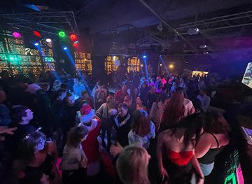
Evening life in the Ukrainian Carpathians is concentrated in resort towns and village centres rather than spread across a continuous nightlife district. Yaremche, Bukovel, Slavske, Mukachevo and larger Zakarpattian settlements have the broadest choice of restaurants, hotel bars, cafés and occasional live entertainment. Traditional village pubs and guesthouse dining rooms provide a quieter setting for local beer, horilka, wine from Zakarpattia and conversation, while some resort properties offer seasonal music or après-ski activity. Verkhovyna and smaller mountain villages are better suited to slow evenings, folk performances arranged through cultural institutions or time spent around a guesthouse than to clubbing. Opening patterns can change with the season, weather, power supply and security situation, and remote trailheads generally have no evening venues at all.
-
Night club
Buka
Experience the vibrant nightlife at Buka, where bar allure meets disco excitement and the charm of a hookah lounge in Polyanytsya.
-
Disco club
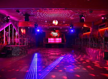
Flame Club
Experience the vibrant nightlife at Flame Club, Zakarpattia's premier disco destination with unforgettable music and dancing.
-
Night club
Club Hollywood
Discover the electrifying nightlife at Club Hollywood, the ultimate destination for dancing, live music, and unforgettable fun in Yablunytsya.
-
Restaurant
Night Club
Dive into Yaremche's nightlife at this premier disco club, where vibrant music and exciting energy create unforgettable moments every night.


Best shops in Carpathian Mountains
Shopping is modest in remote mountain areas but becomes more varied in Yaremche, Verkhovyna, Bukovel, Rakhiv, Mukachevo, Uzhhorod and other sizeable settlements. Markets and small craft shops may sell woven textiles, embroidered clothing, carved wooden objects, ceramics, woollen goods, leatherwork, honey, berry preserves, herbal products and sheep’s-milk cheeses. Hutsul craft traditions are particularly visible around Yaremche and Verkhovyna, although visitors should distinguish genuinely local workmanship from mass-produced souvenirs. Zakarpattian towns add regional wines, paprika-based products and Central European-influenced foods to the range of mountain goods. Farm shops and village producers can provide direct contact with local food culture, but opening patterns and stock are variable. In trail villages, retail may be limited to basic provisions, so specialist outdoor equipment and substantial food supplies are best obtained in a larger town or resort.
-
Ski resort
Bukovel
Discover Bukovel: A stunning ski resort in the Carpathians, offering year-round adventure, luxurious accommodations, and breathtaking landscapes.
-
Mountain range
Carpathian Mountains
Explore the breathtaking landscapes of the Carpathian Mountains, a paradise for nature lovers and adventure seekers in Eastern Europe.
-
Monastery
Manyava Skete
Discover the tranquility of Manyava Skete, a historic monastery nestled in the breathtaking landscapes of Ivano-Frankivsk Oblast, Ukraine.
-
Mountain peak
Makovytsia Mountain
Explore Makovytsia Mountain in Ivano-Frankivsk Oblast - a natural paradise offering stunning views and a chance to connect with the beauty of Ukraine.


Get your free copy of our complete guide to Carpathian Mountains, delivered straight to you.
Everything on this page, from attractions and restaurants to essentials and local phrases, in one PDF you can read offline, print or share.
Already have an account? Sign in
Your Carpathian Mountains guide is ready.
We'll send it to · Not you? Sign out

Getting your guide ready…
We are putting together a fresh copy of the Carpathian Mountains guide. This can take up to a minute.
This can take a few moments. If your browser asks, choose Allow so the download can start. You'll find the guide in your Downloads folder.
Nothing happened? Download it again
Sorry, the guide is taking longer than usual. Please try again in a minute, or get it by email instead.
Carpathian Mountains essentials
Currency and Payment
Safety
Emergency Situations
Do's and Don'ts
Local Tips
From Eve
Local phrases worth knowing
You don't need to get them perfect. A few words go a long way, and locals appreciate the effort.
Basics
| English | Local | Say it |
|---|---|---|
| Hello | Привіт | [pryvit] |
| Goodbye | До побачення | [do pobachennya] |
| Yes | Так | [tak] |
| No | Ні | [ni] |
| Please/You're welcome | Будь ласка | [budʲ laska] |
| Thank you | Дякую | [dyakuyu] |
| Excuse me/Sorry | Вибачте | [vybachte] |
| How are you? | Як справи? | [yak spravy?] |
| Fine. And you? | Добре. А ви? | [dobre. A vy?] |
| Do you speak English? | Ви говорите англійською? | [vy hovoryte anhliysʲkoyu?] |
| I don't understand | Я не розумію | [ya ne rozumiyu] |
Eating & Drinking
| English | Local | Say it |
|---|---|---|
| I'd like to see the menu, please | Я б хотів подивитися меню, будь ласка | [ya b khotiv podyvytysya menyu, budʲ laska] |
| I don't eat meat | Я не їм м'ясо | [ya ne yim m'yaso] |
| Cheers! | Будьмо! | [budʲmo] |
| I would like to pay, please | Я б хотів заплатити, будь ласка | [ya b khotiv zaplatyty, budʲ laska] |
Emergencies
| English | Local | Say it |
|---|---|---|
| Help! | Допомога! | [dopomoha!] |
| Go away! | Піди геть! | [pidy hetʲ!] |
| Call the Police! | Виклич поліцію! | [vyklych politsiyu!] |
| Call a doctor! | Виклич лікаря! | [vyklych likarya!] |
| I'm lost | Я загубився | [ya zahubyvsya] |
| I'm ill | Я хворий | [ya khvoryy] |
Shopping
| English | Local | Say it |
|---|---|---|
| I'd like to buy... | Я б хотів купити... | [ya b khotiv kupity...] |
| I'm just looking | Я просто дивлюсь | [ya prosto dyvlyusʲ] |
| How much is it? | Скільки це коштує? | [skilʲky tse koshtuye?] |
| That's too expensive | Це занадто дорого | [tse zanadto doroho] |
| Can you lower the price? | Чи можете ви знизити ціну? | [chy mozhete vy znyzyty tsinu?] |
Time & Numbers
| English | Local | Say it |
|---|---|---|
| What time is it? | Котра година? | [kotra hodyna?] |
| It's one o'clock | Однієї години | [odniyeyi hodyny] |
| Half past (10) | Пів на (десять) | [piv na (desyatʲ)] |
| Morning | Ранок | [ranok] |
| Afternoon | Пополудні | [popoludni] |
| Evening | Вечір | [vechir] |
| Yesterday | Вчора | [vchora] |
| Today | Сьогодні | [sohodni] |
| Tomorrow | Завтра | [zavtra] |
| 1 | один | [odyn] |
| 2 | два | [dva] |
| 3 | три | [try] |
| 4 | чотири | [chotyry] |
| 5 | п'ять | [pyatʲ] |
| 6 | шість | [shistʲ] |
| 7 | сім | [sim] |
| 8 | вісім | [visim] |
| 9 | дев'ять | [devyatʲ] |
| 10 | десять | [desyatʲ] |
Transport & Directions
| English | Local | Say it |
|---|---|---|
| Where's a/the...? | Де знаходиться...? | [de znakhodytʲsya...?] |
| What's the address? | Яка адреса? | [yaka adresa?] |
| Can you show me (on the map)? | Чи можете ви мені показати (на мапі)? | [chy mozhete vy meni pokazaty (na mapi)?] |
| When's the next (bus)? | Коли наступний (автобус)? | [koly nastupnyy (avtobus)?] |
| A ticket (to ....) | Квиток (до ...) | [kvitok (do ...)] |
History of Carpathian Mountains
A Mountain Range Shaped by Earth
The Ukrainian Carpathians are part of the larger Carpathian arc, formed through complex geological processes associated with the collision and movement of tectonic plates over millions of years. Folded sedimentary rocks, resistant ridges and deeply cut river valleys give the ranges their varied form. In the highest sectors, including Chornohora, past glacial activity contributed to steep cirques, broad upland basins and mountain lakes. These geological and climatic processes created the forests, alpine meadows and watershed landscapes that later shaped settlement, forestry, pastoralism and tourism.
Early Communities and Mountain Pastoralism
People have used the Carpathian valleys and passes since prehistoric times, although the surviving evidence belongs to several different archaeological cultures and periods rather than to one continuous mountain civilisation. Medieval settlement expanded through river corridors and forest clearings, while high pastures became important to pastoral communities. Seasonal movement with sheep and cattle produced the polonyna tradition, in which shepherds spend part of the warmer months on upland grazing grounds. Hutsul, Boyko and Lemko communities developed distinctive forms of music, craft, architecture and social life in response to the terrain and to long-distance links across the mountain passes.
Borderlands of Medieval Europe
The Ukrainian Carpathians have long occupied a borderland between political and cultural spheres. Galicia was connected with the medieval Kingdom of Galicia–Volhynia and later with the Polish–Lithuanian Commonwealth, while Transcarpathia was linked at different times to the Hungarian Crown and other Central European states. Mountain towns and passes supported timber work, animal husbandry and regional trade. Churches, wooden houses and village layouts preserve aspects of this layered history, although borders and administrative systems changed repeatedly. The region’s mixed cultural inheritance remains visible in language, cuisine, religious buildings and material traditions.
Forestry, Railways and Resort Development
From the eighteenth and nineteenth centuries, expanding states and enterprises exploited the Carpathians’ timber resources, while salt extraction, rafting and small-scale craft industries contributed to local economies in particular valleys. Railways later connected mountain settlements with larger regional centres and helped transform places such as Yaremche, Vorokhta and nearby resorts into destinations for leisure and health tourism. The railway routes also altered the movement of timber and people. By the early twentieth century, mountain landscapes were appearing in regional art, literature and photography, even as industrial forestry changed the composition and extent of some forests.
Protected Landscapes and Modern Ukraine
The twentieth century brought shifting borders, war, state collectivisation and new administrative divisions to the Carpathians. During the Soviet period, sanatoria, hiking facilities and winter-sports centres expanded, while traditional rural economies were increasingly integrated into state systems. Independent Ukraine subsequently developed national parks and other protected areas, including the Carpathian National Nature Park, Ukraine’s first national park, established in 1980, and Synevyr National Nature Park, established in 1989. Conservation now coexists with forestry, villages, resorts and infrastructure development, creating continuing debates about habitat protection, tourism pressure and the future of mountain communities.
Carpathian Mountains in Photos
Browse through our photo collection highlighting the charm and character of the destination.
Cities in Carpathian Mountains
The towns and cities of Carpathian Mountains, and the easiest places to base yourself.
-

-

-


Swipe for more cities
Neighbouring destination travel guides
The closest destinations to Carpathian Mountains, if you have time for more than one.
-

-

-

-

-


Swipe for more destinations
Explore more
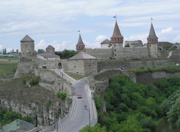
Explore more of Podolia
Discover Podolia, Ukraine's hidden gem, where medieval fortresses, breathtaking landscapes, and rich traditions converge in a timeless embrace.
Explore Podolia
Explore more of Ukraine
Explore Ukraine: From Kyiv's golden domes to the Carpathian Mountains, discover a country rich in history, culture, and natural beauty in the heart of Eastern Europe.
Explore Ukraine