

West End (Glasgow) Travel Guide - Free
Explore West End in Glasgow with Evendo's free guide. Find the best shops, historic streets, restaurants, and gems on web or mobile.


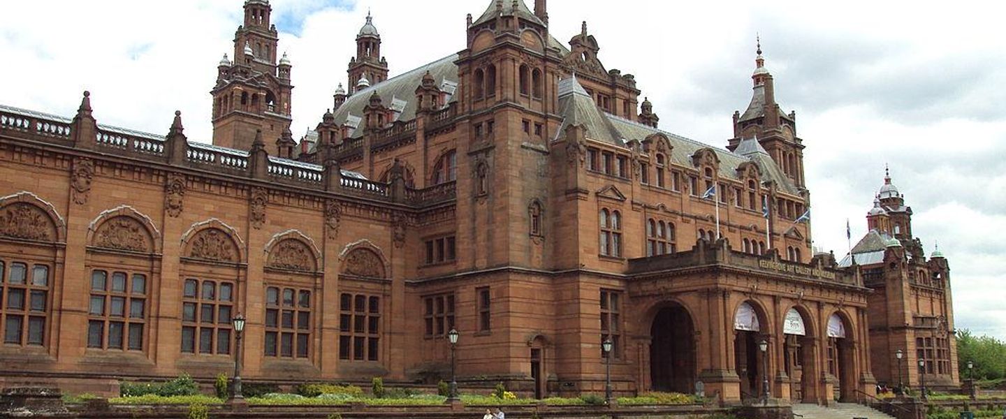


West End Glasgow blends Victorian terraces, the University, Kelvingrove Park, Byres Road cafés, museums, music venues and the Botanic Gardens.
Streets, Parks and Architecture
Glasgow’s West End stretches broadly around Byres Road, the University of Glasgow, Kelvingrove Park and the Botanic Gardens, with the exact edges understood more locally than administratively. It is a neighbourhood of contrasting spaces: busy cafés and independent shops along Byres Road, sandstone terraces in Hillhead and Dowanhill, leafy avenues around the university, and the grand cultural institutions gathered beside Kelvingrove Park. The River Kelvin threads through the area, creating wooded paths and a sense of separation from the surrounding streets.Read more about West End
Culture and Everyday Life
Museums, Gardens and Music
Explore West End on the map
A handpicked selection of must-see spots in West End, mapped for you.
Best hotels in West End
West End essentials
Getting There
Getting Around
Safety
Emergency Situations
Do's and Don'ts
Local Tips

From Eve
Local phrases worth knowing
You don't need to get them perfect. A few words go a long way, and locals appreciate the effort.
Basics
| English | Local | Say it |
|---|---|---|
| Hello | Alright | [al-right] |
| Goodbye | Ta-ra | [ta-ra] |
| Yes | Aye | [aye] |
| No | Nah | [nah] |
| Please/You're welcome | Cheers | [cheers] |
| Thank you | Ta | [ta] |
| Excuse me/Sorry | Sorry | [sorry] |
| How are you? | Alright? | [al-right] |
| Fine. And you? | Sound. You? | [sound. you] |
| Do you speak English? | Do you speak English? | [do you speak English] |
| I don't understand | I ain't got a scooby | [I ain't got a scooby] |
Eating & Drinking
| English | Local | Say it |
|---|---|---|
| I'd like to see the menu, please | Can I see the menu, love? | [Can I see the menu, love] |
| I don't eat meat | I'm veggie | [I'm veggie] |
| Cheers! | Cheers! | [Cheers] |
| I would like to pay, please | Can I settle up, ta? | [Can I settle up, ta] |
Emergencies
| English | Local | Say it |
|---|---|---|
| Help! | Help! | [Help] |
| Go away! | Bog off! | [Bog off] |
| Call the Police! | Ring the Old Bill! | [Ring the Old Bill] |
| Call a doctor! | Get a quack! | [Get a quack] |
| I'm lost | I'm all over the shop | [I'm all over the shop] |
| I'm ill | I'm poorly | [I'm poorly] |
Shopping
| English | Local | Say it |
|---|---|---|
| I'd like to buy... | I wanna get... | [I wanna get] |
| I'm just looking | Just browsing, mate | [Just browsing, mate] |
| How much is it? | How much is that? | [How much is that] |
| That's too expensive | That's a rip-off | [That's a rip-off] |
| Can you lower the price? | Can you do it cheaper? | [Can you do it cheaper] |
Time & Numbers
| English | Local | Say it |
|---|---|---|
| What time is it? | What's the time? | [What's the time] |
| It's one o'clock | It's one | [It's one] |
| Half past (10) | Half ten | [Half ten] |
| Morning | Morning | [Morning] |
| Afternoon | Afternoon | [Afternoon] |
| Evening | Evening | [Evening] |
| Yesterday | Yesterday | [Yesterday] |
| Today | Today | [Today] |
| Tomorrow | Tomorrow | [Tomorrow] |
| 1 | One | [One] |
| 2 | Two | [Two] |
| 3 | Three | [Three] |
| 4 | Four | [Four] |
| 5 | Five | [Five] |
| 6 | Six | [Six] |
| 7 | Seven | [Seven] |
| 8 | Eight | [Eight] |
| 9 | Nine | [Nine] |
| 10 | Ten | [Ten] |
Transport & Directions
| English | Local | Say it |
|---|---|---|
| Where's a/the...? | Where's the...? | [Where's the] |
| What's the address? | What's the address? | [What's the address] |
| Can you show me (on the map)? | Can you show me? | [Can you show me] |
| When's the next (bus)? | When's the next (bus)? | [When's the next (bus)] |
| A ticket (to ....) | A ticket (to ....) | [A ticket (to ....)] |
History of West End
From Rural Estate to Suburb
Much of the modern West End developed from estates and farmland west of Glasgow’s older centre. The area’s transformation accelerated in the nineteenth century as Glasgow expanded during industrialisation and prosperous residents sought larger houses beyond the most crowded central districts. New roads, villas and tenements gradually replaced rural land, while the River Kelvin remained a defining natural feature. Hillhead, Partick and neighbouring districts developed at different speeds and retain distinct local identities, although visitors commonly group them within the wider West End. This suburban expansion established the pattern still visible today: broad avenues, substantial sandstone buildings, planted squares and a mixture of institutional, commercial and residential land uses.
The University Moves West
The University of Glasgow’s move from the High Street to Gilmorehill was completed in the 1870s, giving the emerging West End a major architectural and intellectual focus. Designed by George Gilbert Scott in a Gothic Revival style, the new campus introduced courtyards, towers and monumental stone buildings on elevated ground above the River Kelvin. Its presence influenced surrounding development, attracting academic institutions, professional households, shops and public transport connections. The university remains central to the neighbourhood’s identity, while the historic campus and adjoining Hunterian collections provide an unusually concentrated link between West End streets and Glasgow’s educational history.
Parks, Museums and Public Culture
The late nineteenth century brought public amenities that shaped the West End’s visitor character. Kelvingrove Park, laid out earlier in the century and later improved, became a major open space beside the river. The 1901 Glasgow International Exhibition was held in the park and surrounding area, connecting the district with the city’s enthusiasm for industry, art and international display; the event also helped establish the cultural importance of the Kelvingrove area. The Kelvingrove Art Gallery and Museum opened in 1901 and became one of Glasgow’s principal civic museums. Nearby, the Botanic Gardens and the university reinforced the neighbourhood’s role as a place of learning, recreation and public culture.
Twentieth-Century Change and Renewal
The West End avoided the scale of industrial redevelopment seen in parts of Glasgow, but its social and commercial character changed significantly during the twentieth century. Traditional tenements and villas were adapted, university activity expanded and Byres Road became a major local shopping corridor. The opening of the Glasgow Subway in 1896 had already strengthened connections between the West End and the city centre, with later improvements supporting commuting, study and leisure. From the late twentieth century onwards, restaurants, cafés, specialist shops and cultural venues helped create the area’s present reputation, alongside rising property demand and continuing debate about conservation, affordability and the pressures of urban change.
West End in Photos
Browse through our photo collection highlighting the charm and character of the destination.
Neighbourhoods near West End
The closest neighbourhoods to West End, if you have time for more than one stop.
-

-

-

-


Swipe for more neighbourhoods
Explore more

Explore more of Glasgow
Glasgow blends Victorian architecture, major museums, live music and riverside culture with welcoming neighbourhoods and Scotland’s landscapes.
Explore Glasgow