

Norfolk Broads Travel Guide - Free Web & App
Your ultimate guide to Norfolk Broads. Discover top landmarks, proposed trips, and local tips. Free on the web or via the Evendo companion app.


Norfolk Broads holidays combine boating, reed-fringed waterways, wildlife-rich wetlands, historic villages and waterside walks across eastern England.
Waterways and Wetlands
The Norfolk Broads are a sprawling network of shallow lakes, rivers, reedbeds and marshes in eastern England, extending across much of Norfolk and into neighbouring Suffolk. Although often imagined as a single lake district, the Broads are a connected landscape of more than 60 named broads and several navigable rivers, including the Bure, Yare, Ant, Thurne, Waveney and Chet. Much of the scenery is low-lying and open, with willow-lined banks, windmills, grazing marshes and long horizons shaped by water, weather and agriculture.Read more about Norfolk Broads
Villages, Boats and Wildlife
Heritage and Local Character
When is the best time to visit Norfolk Broads?
Best: June–August · 19–21°C| Month | High (°C) | Rainfall (mm) |
|---|---|---|
| January | 7 | 45 |
| February | 8 | 33 |
| March | 9 | 32 |
| April | 11 | 36 |
| May | 15 | 43 |
| June (best) | 19 | 47 |
| July (best) | 21 | 49 |
| August (best) | 21 | 49 |
| September | 18 | 45 |
| October | 14 | 41 |
| November | 10 | 43 |
| December | 8 | 45 |
Getting to and around Norfolk Broads
How to get there
Transportation
Best attractions in Norfolk Broads
The Broads' main attractions are its waterways and the varied landscapes connected by them. The River Bure leads through Wroxham, Horning and the open marshes towards the northern broads, while the River Thurne reveals wide skies, reedbeds and the distinctive Thurne Dyke Windmill. Hickling Broad, Horsey Broad and nearby wetlands are associated with wildlife watching, including seasonal opportunities to see marsh harriers and other wetland birds. In the south, the River Waveney links Beccles with quieter marshland scenery, while the Yare passes broad grazing landscapes east of Norwich. The Museum of the Broads at Stalham explains the area's boats, industries and social history, and riverside villages such as Ludham, Potter Heigham and Reedham provide access to local heritage. Nature reserves, footpaths and boardwalks offer alternatives to boating, although routes and access conditions vary. Historic drainage mills, village churches and working quays add cultural interest to the predominantly wetland scenery.
-
National park
The Broads National Park
Britain's largest protected wetland where medieval peat pits transformed into a timeless landscape of water, wildlife and wonder.
-
Shopping Centre
Castle Quarter
Castle Quarter Norwich: Five levels of shopping, dining, and entertainment in the city centre.
-
Shopping Centre
Market Gates Shopping Centre (Great Yarmouth)
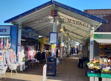
A practical indoor shopping centre in Great Yarmouth’s town heart, blending chain stores and local shops for everyday needs.
-
Department store
Jarrolds
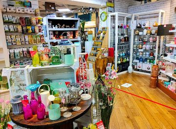
Historic family-owned department store in Norwich blending heritage charm with modern retail across fashion, home, and local crafts.
Best landmarks in Norfolk Broads
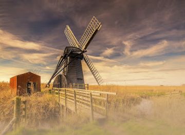
The Broads' defining landmarks are often functional structures and natural water landscapes rather than grand monuments. Thurne Dyke Windmill is one of the best-known drainage mills, while Horsey Windpump and the mills around the wider marshes express the engineering history of water management. The rivers Bure, Yare, Waveney, Ant and Thurne form the framework of the destination, linking broads, reedbeds and grazing marshes. Potter Heigham Bridge is an important historic crossing and a recognised point on the northern navigation, while the villages of Reedham, Horning and Beccles retain strong riverside identities. Hickling Broad and the surrounding wetlands are significant for their habitats and wildlife as well as their scenery. Churches, quays, drainage dykes and windmills together show how human settlement has developed within, and continually adapted to, a low-lying landscape shaped by water.
-
Historical landmark
Pull's Ferry
A tranquil 15th-century watergate and ferry house on the River Wensum, symbolizing Norwich’s medieval river trade and architectural heritage.
-
Monument
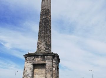
Nelson's Monument
A towering 44m Doric column in Great Yarmouth honoring Admiral Nelson with panoramic views and rich maritime history.
-
Historical landmark
Potter Heigham bridge
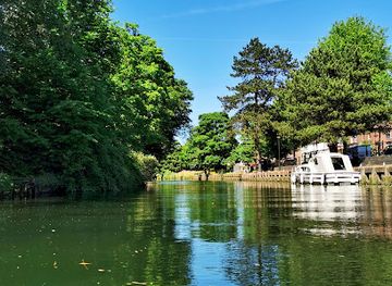
Historic 14th-century bridge and boating hub in Norfolk Broads, blending medieval charm with scenic waterways and vibrant village life.
Explore Norfolk Broads on the map
Plan your trip on one map. See where the top attractions, landmarks, restaurants and hotels are, and book hotels and experiences in a few clicks.
Best hotels in Norfolk Broads
Best restaurants in Norfolk Broads
Eating in the Broads is centred on waterside pubs, village inns, cafés and restaurants in gateway settlements rather than on a dense dining scene within the marshes. Menus commonly draw on East Anglian produce, including seafood from the nearby coast, local vegetables, farm meats, bread, cheeses and seasonal ingredients, while traditional pub food remains an important part of the regional hospitality. Wroxham and Hoveton have the broadest concentration of places to eat in the northern area, with further options in Stalham, Horning, Acle, Beccles, Loddon and other villages. Farm shops and local producers can be useful for picnics when spending a day on the water or walking remote paths. Riverside locations may be busy in the boating season, and smaller villages can have limited choice outside their main hospitality venues.
-
Restaurant
Acle Bridge Inn
Historic riverside inn on the Norfolk Broads offering hearty British fare, family-friendly charm, and scenic waterside hospitality.
-
Restaurant
Rising Sun Coltishall
Historic riverside pub and inn in Coltishall offering wood-fired pizzas, cozy rooms, and warm Norfolk hospitality by the Broads.
-
Hotel
Dunston Hall Restaurant
Elegant dining in an 1859 Elizabethan mansion amid Norfolk parkland, blending historic charm with modern British flavors and garden vistas.
-
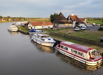
Restaurant
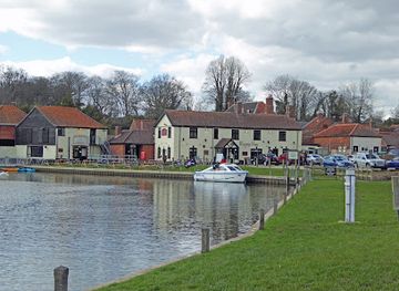
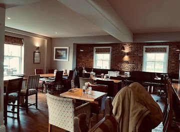
The Boathouse | Restaurant | Wedding Venue | Pub | Accommodation
Charming waterside restaurant, pub, and accommodation with stunning Norfolk Broads views and seasonal British cuisine.

Best bars in Norfolk Broads
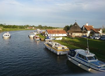
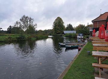
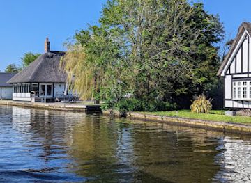
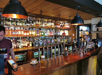
Evenings in the Norfolk Broads are generally quiet and social rather than club-oriented. Village pubs and traditional inns in places such as Wroxham, Horning, Acle, Stalham, Beccles and Loddon provide the principal settings for local ales, wine, food and conversation, with some venues hosting occasional seasonal entertainment or live music. The atmosphere is particularly suited to sitting beside a quay, watching boats return or exploring a village after a day outdoors. Larger nightlife options are found outside the core Broads in Norwich and Great Yarmouth, rather than along the more rural waterways themselves. Visitors should expect evening facilities to be concentrated in settlements, with many isolated areas becoming very quiet after dark and transport between villages requiring advance planning.
-
Pub
Acle Bridge Inn
Historic riverside inn on the Norfolk Broads offering hearty British fare, warm hospitality, and family-friendly charm in a scenic waterside setting.
-
Pub
Rising Sun Coltishall
A charming riverside pub and inn in Coltishall offering hearty food, cozy rooms, and a warm, traditional English atmosphere.
-
Pub
The Ferry Inn of Horning
A lively traditional pub on the Norfolk Broads offering hearty fare, riverside charm, and a family-friendly atmosphere.
-
Pub
The Swan Inn
Charming riverside pub and inn in Horning offering cozy rooms, hearty British fare, and scenic views along the Norfolk Broads.
Best nightclubs in Norfolk Broads
Evenings in the Norfolk Broads are generally quiet and social rather than club-oriented. Village pubs and traditional inns in places such as Wroxham, Horning, Acle, Stalham, Beccles and Loddon provide the principal settings for local ales, wine, food and conversation, with some venues hosting occasional seasonal entertainment or live music. The atmosphere is particularly suited to sitting beside a quay, watching boats return or exploring a village after a day outdoors. Larger nightlife options are found outside the core Broads in Norwich and Great Yarmouth, rather than along the more rural waterways themselves. Visitors should expect evening facilities to be concentrated in settlements, with many isolated areas becoming very quiet after dark and transport between villages requiring advance planning.
-
Sports bar
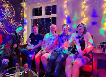
The Jube
A lively Great Yarmouth hotspot blending casual dining, games, live music, and a welcoming community atmosphere under one roof.
-
Nightclub
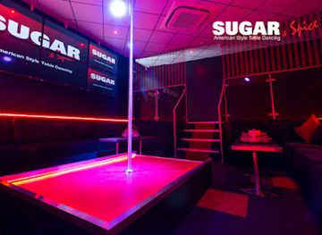
Sugar & Spice - Strip Club and Lap Dancing Norwich
Norwich’s premier American-style strip club offering vibrant entertainment, VIP experiences, and a welcoming atmosphere for all guests.
-
Night Club
Loft Nightclub
Norwich’s vibrant gay and lesbian nightclub with cutting-edge sound, inclusive spirit, and a lively dancefloor for unforgettable nights.
-
Nightclub
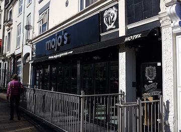
Mojo's
Mojo's: Norwich's gritty, no-frills nightclub pulsing with late-night beats and authentic urban energy.

Best shops in Norfolk Broads
Shopping in the Broads is mainly practical and locally focused, with independent shops, small supermarkets, galleries, craft outlets, farm shops and outdoor suppliers concentrated in gateway settlements. Wroxham and Hoveton provide the broadest range for visitors exploring the northern waterways, while Stalham, Beccles, Acle and Loddon offer smaller selections of everyday goods and regional produce. Farm shops and local food producers are useful places to look for East Anglian cheeses, preserves, baked goods, vegetables and other provisions for a boat or picnic, although stock varies. Art connected with the waterways, handmade goods and nautical or countryside items may also appear in village galleries and specialist shops. The Broads do not have a single large market or continuous shopping district, and remote villages may offer little retail provision beyond essential services.
-
Department store
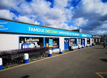
Lathams of Potter Heigham
The Norfolk Broads’ largest discount superstore blending value shopping, fishing heritage, garden delights, and artisan café treats.
-
Department store
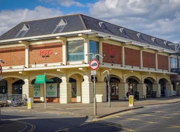
Roys of Wroxham Department store
Discover traditional British charm and a vast array of goods at Roys of Wroxham, Norfolk’s iconic department store and festive shopping haven.
-
Shopping Centre
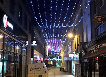
Norwich Lanes
Explore Norwich Lanes, a vibrant maze of independent shops, historic alleys, and charming eateries in the heart of Norwich’s cultural quarter.
-
General Store
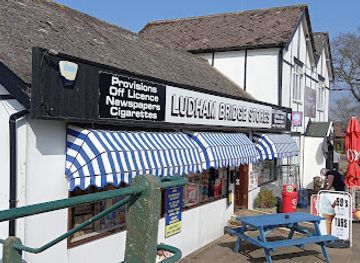
Ludham Bridge Stores
Charming general store offering fresh local produce, souvenirs, and essentials in the heart of the Norfolk Broads’ boating community.
Get your free copy of our complete guide to Norfolk Broads, delivered straight to you.
Everything on this page, from attractions and restaurants to essentials and local phrases, in one PDF you can read offline, print or share.
Already have an account? Sign in
Your Norfolk Broads guide is ready.
We'll send it to · Not you? Sign out

Getting your guide ready…
We are putting together a fresh copy of the Norfolk Broads guide. This can take up to a minute.
This can take a few moments. If your browser asks, choose Allow so the download can start. You'll find the guide in your Downloads folder.
Nothing happened? Download it again
Sorry, the guide is taking longer than usual. Please try again in a minute, or get it by email instead.
Norfolk Broads essentials
Currency and Payment
Safety
Emergency Situations
Do's and Don'ts
Local Tips
From Eve
Local phrases worth knowing
You don't need to get them perfect. A few words go a long way, and locals appreciate the effort.
Basics
| English | Local | Say it |
|---|---|---|
| Hello | Alright | [uh-ryte] |
| Goodbye | Ta-ra | [tah-rah] |
| Yes | Aye | [eye] |
| No | Nah | [nah] |
| Please/You're welcome | Cheers | [cheers] |
| Thank you | Thanks a lot | [thanks uh lot] |
| Excuse me/Sorry | Sorry mate | [saw-ree mate] |
| How are you? | How's it going? | [how's it goin'] |
| Fine. And you? | Not too bad, you? | [not too bad, you?] |
| Do you speak English? | Can you chat in English? | [can you chat in English?] |
| I don't understand | I ain't got a clue | [I ain't got a clew] |
Eating & Drinking
| English | Local | Say it |
|---|---|---|
| I'd like to see the menu, please | Can I have a butcher's at the menu? | [can I have a boo-chers at the menu?] |
| I don't eat meat | I’m a veggie | [I’m a vedge-ee] |
| Cheers! | Cheers! | [cheers] |
| I would like to pay, please | Can I settle up, please? | [can I settle up, please?] |
Emergencies
| English | Local | Say it |
|---|---|---|
| Help! | Help! | [help] |
| Go away! | Clear off! | [clear off] |
| Call the Police! | Ring the coppers! | [ring the coppers] |
| Call a doctor! | Get a doc! | [get a doc] |
| I'm lost | I’m a bit lost | [I’m a bit lost] |
| I'm ill | I’m not feeling great | [I’m not feelin' great] |
Shopping
| English | Local | Say it |
|---|---|---|
| I'd like to buy... | I want to get... | [I want to get...] |
| I'm just looking | Just browsing, thanks | [just browsing, thanks] |
| How much is it? | What’s the damage? | [what's the damage?] |
| That's too expensive | That's a bit steep | [that's a bit steep] |
| Can you lower the price? | Can you knock a bit off? | [can you knock a bit off?] |
Time & Numbers
| English | Local | Say it |
|---|---|---|
| What time is it? | What’s the time? | [what's the time?] |
| It's one o'clock | It's one | [it's one] |
| Half past (10) | Half ten | [half ten] |
| Morning | Mornin' | [mornin'] |
| Afternoon | Afternoon | [afternoon] |
| Evening | Evenin' | [evenin'] |
| Yesterday | Yesterday | [yesterday] |
| Today | Today | [today] |
| Tomorrow | Tomorrow | [tomorrow] |
| 1 | One | [one] |
| 2 | Two | [two] |
| 3 | Three | [three] |
| 4 | Four | [four] |
| 5 | Five | [five] |
| 6 | Six | [six] |
| 7 | Seven | [seven] |
| 8 | Eight | [eight] |
| 9 | Nine | [nine] |
| 10 | Ten | [ten] |
Transport & Directions
| English | Local | Say it |
|---|---|---|
| Where's a/the...? | Where’s the...? | [where's the...?] |
| What's the address? | What's the address? | [what's the address?] |
| Can you show me (on the map)? | Can you point it out? | [can you point it out?] |
| When's the next (bus)? | When’s the next bus? | [when's the next bus?] |
| A ticket (to ....) | A ticket to... | [a ticket to...] |
History of Norfolk Broads
A Wetland Shaped by Ice and Water
The Broads occupy a low-lying part of eastern England formed through long geological and climatic change. Glacial deposits and later river processes helped create the broad, level terrain, while the proximity of the North Sea has influenced drainage, flooding and settlement. The modern landscape is therefore not simply a collection of lakes but a changing system of rivers, marshes, dykes and shallow basins. Its flatness, fertile soils and access to waterways encouraged agriculture and settlement, while the difficulty of controlling water became a lasting feature of local life.
Medieval Peat Extraction
Most of the Broads were created by people rather than by natural lake formation. During the medieval period, peat was excavated from the marshes for fuel, probably on a considerable scale as local populations and settlements expanded. When rising water levels eventually flooded the workings, the pits became the broads seen today. Rivers and drainage channels connected many of them, creating a navigable wetland network. This history explains why the Broads vary in shape and depth and why their identity combines industrial archaeology with wildlife conservation.
Drainage, Farming and Windmills
From the early modern period onwards, communities continued to manage the wet landscape for grazing, hay production, reed cutting and transport. Drainage mills became characteristic landmarks, using wind power to move water through dykes and drainage channels before later mechanical and electric systems altered the infrastructure. Marshes and rivers remained economically important, carrying agricultural goods and supporting boat-building, fishing and local trade. Many mills, churches, riverside villages and field patterns still reveal the long relationship between settlement and water management.
The Rise of Leisure Boating
The Broads developed as a leisure destination during the nineteenth century, when improved rail connections made the waterways more accessible to visitors from larger towns and cities. Pleasure boating gradually became a defining part of the regional economy, alongside sailing, fishing and riverside tourism. The arrival of hire boats and changing patterns of recreation brought new pressure as well as prosperity. Villages such as Wroxham, Horning and Stalham became associated with boating services, while the waterways acquired the relaxed holiday character that remains central to their image.
National Park and Conservation
The Broads became a national park in 1989, although its formal title is the Broads. The designation recognised a landscape where biodiversity, navigation, farming, settlement and tourism are closely intertwined. Conservation work now addresses reedbed management, water quality, erosion, invasive species, flood risk and the protection of habitats for birds, mammals and insects. Unlike many national parks, the Broads are governed through an authority whose responsibilities include navigation as well as landscape and environmental management, reflecting the area's continuing role as a working waterway.
Norfolk Broads in Photos
Browse through our photo collection highlighting the charm and character of the destination.
Cities in Norfolk Broads
The towns and cities of Norfolk Broads, and the easiest places to base yourself.

Swipe for more cities
Neighbouring destination travel guides
The closest destinations to Norfolk Broads, if you have time for more than one.
-

-

-

-

-


Swipe for more destinations
Explore more
Explore more of East of England
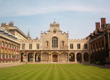
Explore the East of England for university cities, Roman heritage, fenland landscapes, North Sea beaches, coastal food and historic market towns.
Explore East of England
Explore more of United Kingdom
Discover the United Kingdom: A blend of rich history, stunning landscapes, and vibrant cities, offering a unique travel experience for every visitor.
Explore United Kingdom