

Mount Mansfield Travel Guide - Free Web & App
Your ultimate guide to Mount Mansfield. Discover top landmarks, proposed trips, and local tips. Free on the web or via the Evendo companion app.


Mount Mansfield, Vermont’s highest peak, offers Long Trail hikes, alpine views, scenic drives and gondola access above Stowe and Underhill.
The Mountain and Its Ridge
Mount Mansfield is Vermont’s highest mountain, rising to 4,393 feet above sea level in the northern Green Mountains. Its distinctive summit ridge is traditionally described through human features: the Chin forms the high point, with the Nose, Forehead and other named contours extending along the skyline. The mountain lies principally within Mount Mansfield State Forest, with its eastern slopes associated with the town of Stowe and its western side reaching towards Underhill and the Champlain Valley.Read more about Mount Mansfield
Trails, Views and Highland Ecology
Gateway Communities and Seasonal Access
When is the best time to visit Mount Mansfield?
Best: June–August · 21–23°C| Month | High (°C) | Rainfall (mm) |
|---|---|---|
| January | -5 | 61 |
| February | -4 | 56 |
| March | 2 | 66 |
| April | 10 | 78 |
| May | 16 | 87 |
| June (best) | 21 | 94 |
| July (best) | 23 | 96 |
| August (best) | 23 | 91 |
| September | 18 | 86 |
| October | 12 | 81 |
| November | 4 | 76 |
| December | -2 | 71 |
Getting to and around Mount Mansfield
How to get there
Transportation
Best attractions in Mount Mansfield
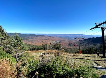
The central attraction is Mount Mansfield’s summit ridge, where the Chin, Nose and Forehead create the mountain’s recognisable profile and the Long Trail traverses exposed high ground. Hiking routes from Underhill State Park lead through forest towards the crest, while the eastern side can be approached through Stowe Mountain Resort, whose seasonal gondola provides access towards the upper mountain when operating. The Mount Mansfield Auto Toll Road offers a scenic ascent by vehicle when open, ending near high-elevation hiking routes and viewpoints. Lower slopes provide woodland walks, streams and changing forest communities, while the surrounding Stowe area adds the recreational landscape of a major four-season mountain resort. On clear days, vistas encompass the Green Mountains, Lake Champlain and the Adirondacks, although summit cloud is frequent. Underhill and Stowe also provide contrasting gateways: one quieter and state-forest oriented, the other more developed and equipped for visitors.
-
Tourist attraction
Bolton Valley Resort
Discover year-round adventures at Bolton Valley Resort, Vermont's premier destination for skiing, hiking, and breathtaking mountain views.
-
 Ski resort
Stowe Mountain Resort
Discover Stowe Mountain Resort, a premier ski destination in Vermont, perfect for winter sports enthusiasts and summer adventurers alike.
-
Ski resort
Gondola Skyride
Discover stunning views and outdoor adventures at the Gondola Skyride in Stowe, Vermont, the gateway to breathtaking mountain landscapes.
-
Tourist attraction
ArborTrek Canopy Adventures
Discover the thrill of zip-lining through Vermont's lush forests at ArborTrek Canopy Adventures, where adventure meets breathtaking natural beauty.
Best landmarks in Mount Mansfield
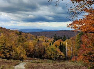
Mount Mansfield’s principal landmark is the summit ridge, whose named contours—the Chin, Nose and Forehead—give the mountain its distinctive human-profile appearance when viewed from the surrounding valleys. At 4,393 feet, the Chin is Vermont’s highest point and a defining geographical feature of the state. The Long Trail is an important cultural and recreational landmark as it crosses this high ridge, while the Mount Mansfield Auto Toll Road represents the mountain’s long history as a scenic destination accessible beyond the hiking community. The upper slopes are also notable for their exposed subalpine environment, where wind-shaped vegetation contrasts with the forests below. On the eastern side, Stowe Mountain Resort forms a prominent modern recreational landmark; on the west, Underhill State Park provides a protected trail gateway. These features together express the mountain’s natural, historic and contemporary identity.
-
Visitor center
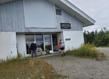
Mt Mansfield Peak Visitor Center
Experience breathtaking views and outdoor adventures at the Mt. Mansfield Peak Visitor Center in Vermont, a gateway to the Green Mountains.
-
Mountain peak
Mt Mansfield
Discover the breathtaking beauty of Mt. Mansfield, Vermont's highest peak, with stunning views, diverse trails, and unparalleled natural adventures.
-
Historical landmark
Mount Mansfield Snow Stake
Explore the iconic Mount Mansfield Snow Stake in Stowe, Vermont, where history meets the stunning beauty of the Green Mountains, perfect for outdoor enthusiasts.
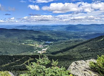
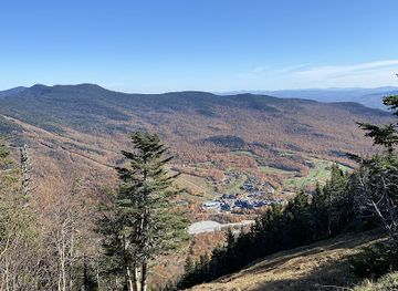
Explore Mount Mansfield on the map
Plan your trip on one map. See where the top attractions, landmarks, restaurants and hotels are, and book hotels and experiences in a few clicks.
Best hotels in Mount Mansfield
Best restaurants in Mount Mansfield
Mount Mansfield itself has no continuous dining district; most meals are found in Stowe and, to a more limited extent, in nearby Underhill and surrounding villages. Stowe offers a broad selection of restaurants, cafés, bakeries, bars and traditional inns, ranging from casual food suited to hikers and skiers to more polished dining. Vermont’s culinary identity is reflected in ingredients such as local dairy, apples, maple products, craft beverages and produce from nearby farms, while menus may also draw on New England traditions. Underhill is a quieter rural community with fewer dedicated visitor dining options, so walkers using western trailheads should plan provisions in advance rather than expect facilities at the mountain. Farm shops and general stores in the wider area can be useful for picnic supplies, but stock and opening arrangements vary seasonally.
-
Pizza
Piecasso
Discover gourmet pizza perfection at Piecasso in Stowe, Vermont – where local ingredients meet Italian tradition.
-
Restaurant
The Bench
Experience delightful American cuisine at The Bench in Stowe; perfect for families seeking great food amidst stunning mountain views.
-
Restaurant
Doc Ponds
Experience the vibrant flavors of Vermont at Doc Ponds—where great food meets a lively atmosphere in scenic Stowe.
-
Breakfast
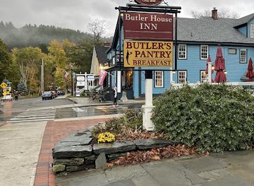
Butler's Pantry
Discover Butler's Pantry: A delightful gastropub in Stowe offering scrumptious breakfasts made with local ingredients.
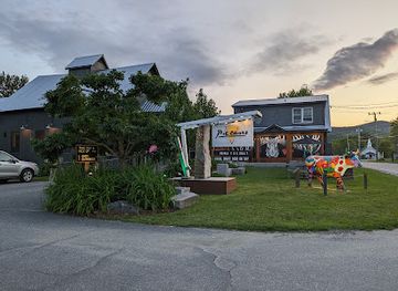
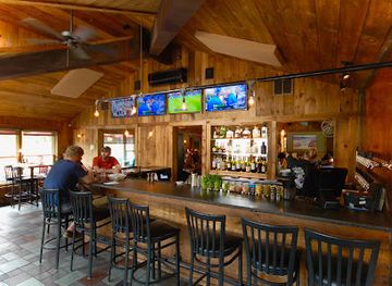
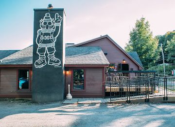
Best bars in Mount Mansfield
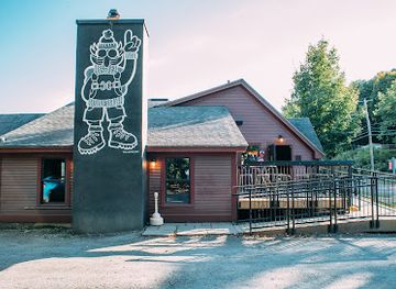
Evening entertainment is concentrated in Stowe rather than on Mount Mansfield itself. The town has established pubs, restaurant bars, breweries and traditional inns where visitors can find conversation, local drinks and occasional music, with the atmosphere generally oriented towards après-ski and relaxed rural hospitality rather than late-night clubbing. Underhill and the western side of the mountain are considerably quieter, offering little dedicated nightlife beyond community venues and licensed establishments in nearby settlements. Seasonal events may add live performances or local gatherings, but programmes and opening arrangements change. Visitors staying close to the mountain should expect darkness and limited services after outdoor activities, while those seeking a wider choice of evening venues should base themselves in or near Stowe.
-
Brewery
Idletyme Tap & Tavern
Discover Idletyme Tap & Tavern: A Craft Brewery, American Restaurant, and Bar in Stowe, Vermont, Perfect for Beer Lovers and Foodies Alike.
-
American
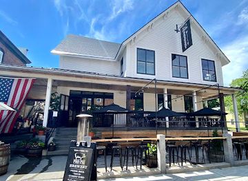
Prohibition Pig - Restaurant & Brewery
Discover the taste of Vermont at Prohibition Pig, where craft beer meets American cuisine in a vibrant setting.
-
Bar
The Bench
Experience the vibrant atmosphere and delectable American cuisine at The Bench in Stowe, Vermont, where every meal tells a story.
-
Bar
Doc Ponds
Discover the vibrant flavors and welcoming atmosphere of Doc Ponds in Stowe, Vermont, where craft cocktails and delicious food await.
Best nightclubs in Mount Mansfield
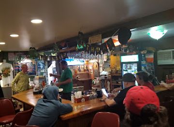
Evening entertainment is concentrated in Stowe rather than on Mount Mansfield itself. The town has established pubs, restaurant bars, breweries and traditional inns where visitors can find conversation, local drinks and occasional music, with the atmosphere generally oriented towards après-ski and relaxed rural hospitality rather than late-night clubbing. Underhill and the western side of the mountain are considerably quieter, offering little dedicated nightlife beyond community venues and licensed establishments in nearby settlements. Seasonal events may add live performances or local gatherings, but programmes and opening arrangements change. Visitors staying close to the mountain should expect darkness and limited services after outdoor activities, while those seeking a wider choice of evening venues should base themselves in or near Stowe.
-
Bar
Burt's Irish Pub
Discover Burt's Irish Pub in Stowe, Vermont – an authentic Irish experience with great food, drinks, and lively karaoke entertainment.
-
Cocktail bar
Apres
Experience the best cocktails in Stowe at Apres, where innovative mixology meets a cozy mountain atmosphere.
Best shops in Mount Mansfield
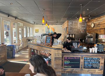
Shopping associated with Mount Mansfield is concentrated in Stowe and nearby settlements rather than at the summit or trailheads. Stowe’s village and surrounding commercial areas contain outdoor-equipment retailers, galleries, independent shops, food businesses and places selling Vermont products such as maple goods, cheese, craft beverages and locally made items. Visitors using the western approach through Underhill will find a more limited rural retail scene, with provisions and everyday supplies concentrated in small community businesses rather than a dedicated shopping district. Outdoor shops are particularly useful for maps, clothing and equipment, while farm shops and local producers reflect the agricultural character of the valleys around the mountain. Product ranges, markets and seasonal businesses vary, so visitors should obtain specialist supplies before heading to remote trail access points.
-
Coffee shop
GiraKofi
Discover the charm of GiraKofi in Stowe, Vermont, where exceptional coffee meets cozy ambiance in a picturesque setting.
-
Souvenir store
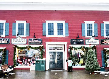
Stowe Mercantile
Explore Stowe Mercantile, the ultimate souvenir store in Stowe, Vermont, featuring local crafts, gourmet foods, and unique gifts.
-
Gift shop
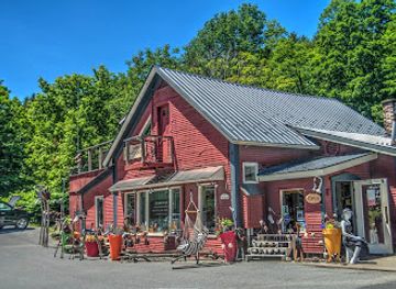
Remarkable Things at Stowe Craft
Explore Stowe Craft for a unique selection of artisanal gifts, hand-crafted jewelry, and local art that captures the essence of Vermont.
-
Visitor center
Mt Mansfield Peak Visitor Center
Explore the breathtaking landscapes and outdoor adventures at Mt Mansfield Peak Visitor Center in Stowe, Vermont, your gateway to nature's wonders.
Get your free copy of our complete guide to Mount Mansfield, delivered straight to you.
Everything on this page, from attractions and restaurants to essentials and local phrases, in one PDF you can read offline, print or share.
Already have an account? Sign in
Your Mount Mansfield guide is ready.
We'll send it to · Not you? Sign out

Getting your guide ready…
We are putting together a fresh copy of the Mount Mansfield guide. This can take up to a minute.
This can take a few moments. If your browser asks, choose Allow so the download can start. You'll find the guide in your Downloads folder.
Nothing happened? Download it again
Sorry, the guide is taking longer than usual. Please try again in a minute, or get it by email instead.
Mount Mansfield essentials
Currency and Payment
Safety
Emergency Situations
Do's and Don'ts
Local Tips
From Eve
Local phrases worth knowing
You don't need to get them perfect. A few words go a long way, and locals appreciate the effort.
Basics
| English | Local | Say it |
|---|---|---|
| Hello | Howdy | [hah-dee] |
| Goodbye | See ya later | [see yah lay-tur] |
| Yes | Yup | [yuhp] |
| No | Nah | [nah] |
| Please/You're welcome | Please 'n thank ya | [pleez 'n thangk yuh] |
| Thank you | Much obliged | [muhch uh-blahyj] |
| Excuse me/Sorry | Pardon me | [pahr-dn mee] |
| How are you? | How ya doin'? | [haw yuh doo-in'] |
| Fine. And you? | Dooin' fine. How 'bout y'all? | [doo-in' fahyn. how 'bout y'all?] |
| Do you speak English? | Ya speak English? | [yah speek ing-glish?] |
| I don't understand | I ain't catchin' on | [ahynt kach-in awn] |
Eating & Drinking
| English | Local | Say it |
|---|---|---|
| I'd like to see the menu, please | Can I check out the grub, please? | [kan ahy chek awt thuh gruhb, pleez?] |
| I don't eat meat | I ain't a meat eater | [ahynt uh meet ee-ter] |
| Cheers! | Bottoms up! | [baa-tuhmz uh-p] |
| I would like to pay, please | I'll settle up, if y' don't mind | [ahyl set-l uh-p, ihf y' dohnt mahynd] |
Emergencies
| English | Local | Say it |
|---|---|---|
| Help! | SOS! | [es-oh-es] |
| Go away! | Scram! | [skram] |
| Call the Police! | Ring up the Law! | [ring uhp thuh law] |
| Call a doctor! | Get me a sawbones! | [get mee uh saw-bohnz] |
| I'm lost | I'm turned around | [ahym turnd uh-round] |
| I'm ill | I'm feelin' poorly | [ahym feel-in' pawr-lee] |
Shopping
| English | Local | Say it |
|---|---|---|
| I'd like to buy... | I'm lookin' to purchase... | [ahym look-in tuh pur-chuhs...] |
| I'm just looking | Just browsin' | [juhst browz-in'] |
| How much is it? | What's the damage? | [wahts thuh dam-ij] |
| That's too expensive | That costs an arm 'n a leg | [thaht kawsts ahn ahrm 'n ah leg] |
| Can you lower the price? | Can ya cut me a deal? | [kan yuh kuht mee uh deel?] |
Time & Numbers
| English | Local | Say it |
|---|---|---|
| What time is it? | What's the hour? | [wahts thuh awr] |
| It's one o'clock | It's one | [its wuhn] |
| Half past (10) | Ten-thirty | [ten-thur-tee] |
| Morning | Mornin' | [mawrn-in'] |
| Afternoon | Afternoon | [af-ter-noon] |
| Evening | Evenin' | [eev-nin'] |
| Yesterday | Yest'day | [yest-day] |
| Today | Today | [tuh-day] |
| Tomorrow | Tomorrer | [tuh-mawr-er] |
| 1 | One | [wuhn] |
| 2 | Two | [too] |
| 3 | Three | [three] |
| 4 | Four | [for] |
| 5 | Five | [fahyv] |
| 6 | Six | [siks] |
| 7 | Seven | [sev-uhn] |
| 8 | Eight | [eyt] |
| 9 | Nine | [nahyn] |
| 10 | Ten | [ten] |
Transport & Directions
| English | Local | Say it |
|---|---|---|
| Where's a/the...? | Where's the... | [wheres thuh] |
| What's the address? | What's the location? | [wahts thuh loh-key-shun] |
| Can you show me (on the map)? | Can ya show me (on the map)? | [kan yuh show mee (on thuh map)] |
| When's the next (bus)? | When's the next (bus)? | [whens thuh nekst (bus)] |
| A ticket (to ....) | A pass (to ....) | [uh pass (tu)] |
History of Mount Mansfield
A Green Mountain Landscape
Mount Mansfield belongs to the Green Mountains, an ancient range shaped by geological folding, uplift, erosion and repeated climatic change over very long timescales. Its present form is a high, elongated ridge rather than a sharply isolated peak. The exposed summit environment supports vegetation adapted to wind, cold and a short growing season, while lower slopes carry forests characteristic of northern New England. These contrasts between summit, subalpine woodland and valley help explain the mountain’s importance as both a natural landmark and a subject of scientific and recreational interest.
Indigenous and Early Vermont Context
The mountain stands within the wider homeland and travel landscape of the Abenaki peoples, whose communities used the forests, waterways and valleys of what is now Vermont. European settlement expanded in the region during the eighteenth and nineteenth centuries, bringing farms, roads, timber use and new towns. Mansfield’s name reflects the naming practices of the colonial and early American period, when prominent peaks were increasingly recorded on maps and linked to nearby settlements and emerging transport routes.
Roads and Early Mountain Tourism
As Stowe developed as a farming and trading community, Mount Mansfield gradually became a destination for visitors interested in scenery, walking and mountain air. The Mount Mansfield Auto Toll Road, constructed in the nineteenth century, made the upper mountain accessible to visitors who did not wish to make the full ascent on foot. Its existence helped establish the mountain as a scenic attraction as well as a local natural feature, while the developing road network connected the high ridge more closely with Stowe and the surrounding towns.
The Long Trail Era
The Long Trail, Vermont’s long-distance hiking route, was developed by the Green Mountain Club between 1910 and 1930 and crosses Mount Mansfield’s summit ridge. Its construction gave the mountain a central place in Vermont’s growing hiking culture, linking the peak with a continuous route along the Green Mountains. The trail also encouraged a more deliberate approach to route marking, backcountry travel and stewardship, traditions that remain important for visitors crossing the exposed ridge today.
Skiing, Conservation and Modern Recreation
Twentieth-century skiing transformed Stowe and the eastern slopes of Mount Mansfield into one of Vermont’s best-known winter recreation areas. At the same time, public ownership and conservation management protected extensive forest and summit environments from unrestricted development. Mount Mansfield State Forest now provides the setting for hiking, scenic access and habitat protection, while Stowe Mountain Resort manages developed recreational facilities on part of the eastern side. The mountain’s modern identity therefore combines tourism infrastructure with continuing efforts to protect alpine vegetation, forests and water resources.
Mount Mansfield in Photos
Browse through our photo collection highlighting the charm and character of the destination.
Cities in Mount Mansfield
The towns and cities of Mount Mansfield, and the easiest places to base yourself.

Swipe for more cities
Neighbouring destination travel guides
The closest destinations to Mount Mansfield, if you have time for more than one.
-

-

-

-

-


Swipe for more destinations
Explore more

Explore more of Lamoille County
Explore Lamoille County’s Vermont villages, ski slopes, maple farms, mountain passes, lakes and river valleys across every season.
Explore Lamoille County
Explore more of Vermont
Discover Vermont: A year-round haven of natural beauty, charming towns, and rich heritage in the Green Mountain State.
Explore Vermont