

Mount Rogers National Recreation Area Travel Guide - Free Web & App
Your ultimate guide to Mount Rogers National Recreation Area. Discover top landmarks, proposed trips, and local tips. Free on the web or via the Evendo companion app.


Mount Rogers National Recreation Area in Virginia offers Appalachian trails, high-country forests, camping, wildlife and access to Mount Rogers and Whitetop Mountain.
High Ridges and Open Country
Mount Rogers National Recreation Area occupies a broad mountain landscape in south-western Virginia within the Jefferson National Forest. Its centrepiece is Mount Rogers, at 5,729 feet the highest point in Virginia, reached through a high-elevation environment of spruce-fir woodland, grassy balds, rocky ridges and long Appalachian views. The recreation area is spread across a substantial rural region rather than arranged around a single visitor centre or town, so roads, trailheads and facilities are separated by forested valleys and mountain roads.Read more about Mount Rogers National Recreation Area
Trails, Forests and Neighbouring Landscapes
Mountain Communities and Outdoor Character
When is the best time to visit Mount Rogers National Recreation Area?
Best: June, August–September · 22–26°C| Month | High (°C) | Rainfall (mm) |
|---|---|---|
| January | 3 | 80 |
| February | 6 | 70 |
| March | 10 | 90 |
| April | 16 | 100 |
| May | 20 | 110 |
| June (best) | 25 | 100 |
| July | 27 | 110 |
| August (best) | 26 | 100 |
| September (best) | 22 | 90 |
| October | 17 | 80 |
| November | 11 | 90 |
| December | 5 | 100 |
Getting to and around Mount Rogers National Recreation Area
How to get there
Transportation
Best attractions in Mount Rogers National Recreation Area
Mount Rogers is the recreation area’s defining attraction, with trails climbing through spruce-fir forest and open highland terrain towards Virginia’s highest summit. The Appalachian Trail crosses the area and offers both demanding day walks and longer backpacking possibilities, while the Virginia Highlands Horse Trail provides an important route for equestrian exploration. Whitetop Mountain, Virginia’s second-highest peak, forms another major high-country destination, with forest roads and trails leading into a landscape of broad ridges and distant views. The Lewis Fork Wilderness and Little Wilson Creek Wilderness preserve quieter, more rugged sections of the Jefferson National Forest, subject to wilderness regulations and limited facilities. Nearby Grayson Highlands State Park is outside the national recreation area but is commonly visited on the same trip for its open balds, Massie Gap and free-roaming ponies. Campgrounds, trout streams, waterfalls and forested valleys add lower-elevation variety, while Damascus provides a cultural and practical connection with the Appalachian Trail.
-
State park
Grayson Highlands State Park
Experience the breathtaking beauty of Grayson Highlands State Park, home to wild ponies and stunning hiking trails in Virginia's Appalachian Mountains.
-
Tourist attraction
Damascus Town Park
Discover the natural beauty and family-friendly fun at Damascus Town Park, a serene escape in Virginia's Appalachian Mountains.
-
Park
Virginia Creeper Abingdon Terminus
Explore the breathtaking beauty and rich history of the Virginia Creeper Abingdon Terminus, a must-visit destination for nature lovers and outdoor adventurers.
-
Tourist attraction
The Lincoln Theatre
Discover the cultural heart of Marion, Virginia, at The Lincoln Theatre, a historic venue showcasing arts, music, and community spirit.


Best landmarks in Mount Rogers National Recreation Area
Mount Rogers is the principal natural landmark, rising to 5,729 feet and forming the highest summit in Virginia, although its heavily forested summit is less of a panoramic viewpoint than the open ridges approaching it. Whitetop Mountain is another defining high point, while the spruce-fir forests and grassy balds create a landscape more commonly associated with colder northern Appalachian elevations. The Appalachian Trail is a cultural and recreational landmark as well as a physical route, linking the area to one of the United States’ best-known long-distance trails. Lewis Fork Wilderness and Little Wilson Creek Wilderness mark sections where roads and development give way to more protected mountain terrain. Nearby Grayson Highlands State Park, including Massie Gap and its open uplands, is an important neighbouring landmark but lies outside the national recreation area. Historic significance is expressed more through mountain roads, settlement patterns and working landscapes than through a concentration of major monuments.
-
Campground
Mt. Rogers National Recreation Area Work Center (Konnarock)
Discover the natural beauty and outdoor adventures at Mt. Rogers National Recreation Area Work Center in Virginia's Blue Ridge Mountains.

Explore Mount Rogers National Recreation Area on the map
Plan your trip on one map. See where the top attractions, landmarks, restaurants and hotels are, and book hotels and experiences in a few clicks.
Best hotels in Mount Rogers National Recreation Area
Best restaurants in Mount Rogers National Recreation Area
There is no concentrated restaurant district within Mount Rogers National Recreation Area, and visitors should plan meals around supplies carried into the mountains or establishments in nearby gateway communities. Damascus has cafés, casual eateries and food services associated with its Appalachian Trail economy, while Marion, Independence, Wytheville, Troutdale and other surrounding settlements provide broader choices depending on the route. The regional food culture reflects south-western Virginia’s rural traditions, with home-style cooking, biscuits, barbecue, country breakfasts, seasonal produce and locally made baked goods appearing more often than destination-specific fine dining. Farm shops and small general stores can be useful for provisions, although opening arrangements vary and should not be assumed at remote trailheads. Campers commonly rely on self-catering, using food bought before travelling into the recreation area and following all food-storage and fire guidance.
-
National reserve
Mount Rogers National Recreation Area
Discover the breathtaking beauty and endless outdoor adventures at Mount Rogers National Recreation Area in Virginia.

Best bars in Mount Rogers National Recreation Area
Evening entertainment around Mount Rogers National Recreation Area is modest and community-oriented rather than centred on nightclubs. Damascus has the area’s most recognisable concentration of Appalachian Trail hospitality, including traditional pubs, casual bars and places where hikers and residents may gather, while Marion, Independence and Wytheville offer a wider selection of restaurants and evening venues outside the recreation area. In smaller settlements, trading hours and entertainment options can be limited, particularly outside the main visitor seasons. The recreation area itself is better suited to quiet evenings at a permitted campsite, stargazing away from developed areas and listening to the sounds of the forest than to organised nightlife. Local music, craft events and community gatherings occur in the wider region, but schedules are seasonal and should be checked locally rather than assumed.
-
Hot Dog
Dip Dog Stand
Discover the ultimate hot dog experience at Dip Dog Stand in Marion, Virginia, where delicious flavors meet friendly service in a cozy setting.
-
Bar
Macado's
Discover Macado's in Marion, VA: A charming bar and restaurant known for its delicious sandwiches and lively atmosphere, perfect for tourists seeking local flavors.
-
American
Riverfront Cafe
Experience the heart of American cuisine at the Riverfront Cafe, where every meal is a delightful journey through local flavors.
-
Restaurant
Wooden Pickle
Experience the best of Marion, Virginia at Wooden Pickle, a restaurant where culinary creativity and local flavors come together in a warm, inviting atmosphere.


Best nightclubs in Mount Rogers National Recreation Area
Evening entertainment around Mount Rogers National Recreation Area is modest and community-oriented rather than centred on nightclubs. Damascus has the area’s most recognisable concentration of Appalachian Trail hospitality, including traditional pubs, casual bars and places where hikers and residents may gather, while Marion, Independence and Wytheville offer a wider selection of restaurants and evening venues outside the recreation area. In smaller settlements, trading hours and entertainment options can be limited, particularly outside the main visitor seasons. The recreation area itself is better suited to quiet evenings at a permitted campsite, stargazing away from developed areas and listening to the sounds of the forest than to organised nightlife. Local music, craft events and community gatherings occur in the wider region, but schedules are seasonal and should be checked locally rather than assumed.
-
National reserve
Mount Rogers National Recreation Area
Explore the breathtaking landscapes and diverse wildlife of Mount Rogers National Recreation Area, Virginia's hidden gem for outdoor adventures.

Best shops in Mount Rogers National Recreation Area
Shopping within Mount Rogers National Recreation Area is limited, with no sizeable commercial centre inside the forest. Visitors generally buy food, fuel, outdoor supplies and basic necessities in Damascus, Marion, Independence, Wytheville or other approach communities before heading for the trailheads. Damascus has the strongest visitor economy and is associated with Appalachian Trail services, hiking equipment, souvenirs and locally oriented small businesses. Around the wider region, independent craft shops, galleries, farm stores and makers may offer Appalachian textiles, woodwork, pottery, artwork, preserves and other rural products, although the range varies between settlements and seasons. Outdoor equipment is more readily available in gateway towns than at isolated access points. The wider area’s craft identity is connected with mountain communities and regional traditions, but visitors should distinguish permanent retail businesses from occasional fairs, farmers’ markets and seasonal events.
-
State park
Grayson Highlands State Park
Discover the pristine beauty and adventure of Grayson Highlands State Park, Virginia's gem for hiking, camping, and breathtaking views.
-
General store
Grayson Highlands General Store & Inn
Experience the heart of Virginia's mountains at Grayson Highlands General Store & Inn, where local charm meets rustic comfort.
-
Clothing store
Mt Rogers Outfitters
Discover top-notch outdoor gear and local expertise at Mt Rogers Outfitters in Damascus, Virginia, the ultimate stop for adventure enthusiasts.
-
 Campground
Grindstone Campground
Discover the natural beauty of Grindstone Campground, a serene destination for camping, hiking, and fishing in the heart of Virginia.


Get your free copy of our complete guide to Mount Rogers National Recreation Area, delivered straight to you.
Everything on this page, from attractions and restaurants to essentials and local phrases, in one PDF you can read offline, print or share.
Already have an account? Sign in
Your Mount Rogers National Recreation Area guide is ready.
We'll send it to · Not you? Sign out

Getting your guide ready…
We are putting together a fresh copy of the Mount Rogers National Recreation Area guide. This can take up to a minute.
This can take a few moments. If your browser asks, choose Allow so the download can start. You'll find the guide in your Downloads folder.
Nothing happened? Download it again
Sorry, the guide is taking longer than usual. Please try again in a minute, or get it by email instead.
Mount Rogers National Recreation Area essentials
Currency and Payment
Safety
Emergency Situations
Do's and Don'ts
Local Tips
From Eve
Local phrases worth knowing
You don't need to get them perfect. A few words go a long way, and locals appreciate the effort.
Basics
| English | Local | Say it |
|---|---|---|
| Hello | Howdy | [haw-dee] |
| Goodbye | See ya | [see ya] |
| Yes | Yep | [yep] |
| No | Nah | [na] |
| Please/You're welcome | Please/No problem | [please/no problem] |
| Thank you | Thanks | [thanks] |
| Excuse me/Sorry | Pardon me/My bad | [par-dn mee/my bad] |
| How are you? | How y'all doin'? | [how y'all doin'] |
| Fine. And you? | Jus' fine. How 'bout you? | [jus' fine. how 'bout you?] |
| Do you speak English? | Ya speak English? | [ya speak English?] |
| I don't understand | I don't git it | [I don't git it] |
Eating & Drinking
| English | Local | Say it |
|---|---|---|
| I'd like to see the menu, please | I reckon I'll take a gander at the menu | [I reckon I'll take a gander at the menu] |
| I don't eat meat | I ain't eatin' no meat | [I ain't eatin' no meat] |
| Cheers! | Bottoms up! | [bottoms up!] |
| I would like to pay, please | I reckon I'll settle up now, if you don't mind | [I reckon I'll settle up now, if you don't mind] |
Emergencies
| English | Local | Say it |
|---|---|---|
| Help! | SOS! | [SOS!] |
| Go away! | Git! | [git!] |
| Call the Police! | Call the Sheriff! | [Call the Sheriff!] |
| Call a doctor! | Get a doc! | [Get a doc!] |
| I'm lost | I'm turned around | [I'm turned around] |
| I'm ill | I ain't feelin' right | [I ain't feelin' right] |
Shopping
| English | Local | Say it |
|---|---|---|
| I'd like to buy... | I reckon I'll buy... | [I reckon I'll buy...] |
| I'm just looking | Jus' browsin' | [jus' browsin'] |
| How much is it? | How much fer that? | [how much fer that?] |
| That's too expensive | That's mighty pricey | [that's mighty pricey] |
| Can you lower the price? | Can ya do better on the price? | [can ya do better on the price?] |
Time & Numbers
| English | Local | Say it |
|---|---|---|
| What time is it? | What's the time? | [What's the time?] |
| It's one o'clock | It's one | [It's one] |
| Half past (10) | Half past ten | [Half past ten] |
| Morning | Mornin' | [Mornin'] |
| Afternoon | Afternoon | [Afternoon] |
| Evening | Evenin' | [Evenin'] |
| Yesterday | Yest'day | [Yest'day] |
| Today | Today | [Today] |
| Tomorrow | Tomorrah | [Tomorrah] |
| 1 | One | [One] |
| 2 | Two | [Two] |
| 3 | Three | [Three] |
| 4 | Four | [Four] |
| 5 | Five | [Five] |
| 6 | Six | [Six] |
| 7 | Seven | [Seven] |
| 8 | Eight | [Eight] |
| 9 | Nine | [Nine] |
| 10 | Ten | [Ten] |
Transport & Directions
| English | Local | Say it |
|---|---|---|
| Where's a/the...? | Where's the...? | [Where's the...?] |
| What's the address? | What's the addy? | [What's the addy?] |
| Can you show me (on the map)? | Can ya show me on the map? | [Can ya show me on the map?] |
| When's the next (bus)? | When's the next bus? | [When's the next bus?] |
| A ticket (to ....) | A ticket to... | [A ticket to...] |
History of Mount Rogers National Recreation Area
Ancient Appalachian Foundations
The mountains of Mount Rogers National Recreation Area are part of the ancient Appalachian system, shaped over immense geological periods by uplift, erosion and weathering. Their rounded ridges and high plateaux differ from the sharply alpine forms of younger ranges, while altitude and exposure have helped preserve spruce-fir communities unusual in Virginia. High-elevation wetlands, rocky outcrops and grassy balds reflect the interaction of climate, soils, fire, grazing and long-term human use. This geological and ecological inheritance provides the underlying character for the area’s forests, streams and open summits.
Indigenous Homelands and Early Travel
Before Euro-American settlement, the southern Appalachian uplands and valleys were used and occupied by Indigenous peoples whose hunting, travel and trading networks extended across the region. The area lies within a wider cultural landscape associated with historic Cherokee and other Native communities, although modern boundaries do not represent the extent of those homelands. Later routes followed mountain gaps, watersheds and valleys, linking settlements on either side of the Blue Ridge and Allegheny ranges. Indigenous history remains an essential part of understanding the landscape, even where visible archaeological evidence is limited along today’s recreational trails.
Settlement, Farming and Forest Use
European-American settlement expanded through south-western Virginia during the eighteenth and nineteenth centuries, bringing small farms, livestock grazing, mills and roads into the mountain valleys. High ridges were used seasonally for grazing and travel, while timber became increasingly important as communities and transport links developed. The open balds and meadows associated with the high country are therefore not simply untouched natural clearings; in places, their character has been influenced by generations of grazing, mowing and other land management. The surrounding settlements retain traditions connected with farming, forestry, horse culture and Appalachian craft.
The Forest Service Landscape
Much of the modern recreation area’s forestland entered public management during the twentieth century, when the United States acquired and consolidated mountain lands for watershed protection, timber management and recreation. The Jefferson National Forest was established in the 1930s, during a period when federal conservation programmes also improved roads, campgrounds and trails. Civilian Conservation Corps work across the national forests contributed to the wider recreational infrastructure of the southern Appalachians. Public ownership helped protect extensive uplands from more intensive development while maintaining a landscape in which forestry, habitat management and outdoor recreation coexist.
Mount Rogers National Recreation Area
Mount Rogers National Recreation Area was established in 1966 within the Jefferson National Forest, giving the high country a distinct recreational identity and encouraging coordinated management of its trails, campgrounds, forests and scenic landscapes. The Appalachian Trail later became a defining element of the visitor experience as long-distance hiking developed into a major form of Appalachian tourism. Nearby Grayson Highlands State Park, created by Virginia as a separate protected area, complements the national recreation area but is not part of it. Today, land managers balance public access with protection of high-elevation habitats, water resources and heavily used trails.
Mount Rogers National Recreation Area in Photos
Browse through our photo collection highlighting the charm and character of the destination.
Neighbouring destination travel guides
The closest destinations to Mount Rogers National Recreation Area, if you have time for more than one.
-

-

-

-
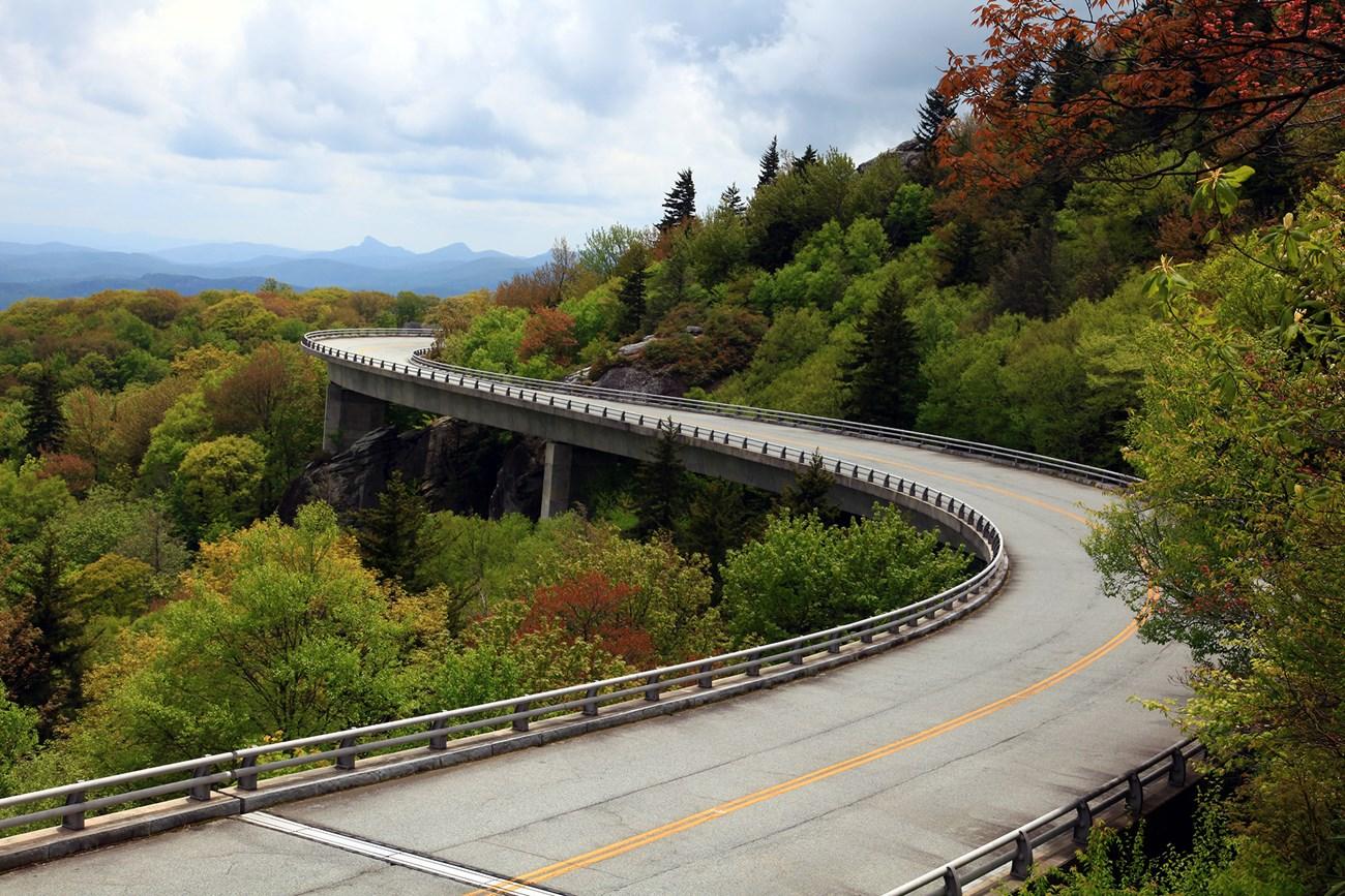 Blue Ridge Mountains
, North Carolina, offer scenic parkway drives, Appalachian trails, waterfalls, high peaks, Cherokee culture and mountain towns.
-


Swipe for more destinations
Explore more
Explore more of Southwest Virginia
Southwest Virginia combines Appalachian mountain scenery, country music heritage, historic trails, rivers and small-town culture across the Commonwealth's western highlands.
Explore Southwest Virginia
Explore more of Virginia
Discover Virginia: A blend of historic landmarks, natural beauty, and vibrant culture perfect for history buffs, nature lovers, and culture seekers.
Explore Virginia