

Glen Canyon National Recreation Area Travel Guide - Free Web & App
Your ultimate guide to Glen Canyon National Recreation Area. Discover top landmarks, proposed trips, and local tips. Free on the web or via the Evendo companion app.


Glen Canyon National Recreation Area in Arizona reveals Lake Powell, red-rock canyons, Rainbow Bridge, desert history and boating, hiking and stargazing.
Landscape and Scale
Glen Canyon National Recreation Area occupies a vast desert region around the Colorado River, extending across northern Arizona and into southern Utah. Its defining feature is Lake Powell, the long, branching reservoir created behind Glen Canyon Dam, but the recreation area is far more than a boating destination. Water-filled canyons, sculpted sandstone walls, high plateaux, dry washes and broad desert horizons create a landscape whose character changes markedly between the lake shore, the river corridor and the surrounding uplands.Read more about Glen Canyon National Recreation Area
Places to Begin Exploring
Water, Desert and Cultural Heritage
When is the best time to visit Glen Canyon National Recreation Area?
Best: April–May, October · 22–28°C| Month | High (°C) | Rainfall (mm) |
|---|---|---|
| January | 9 | 13 |
| February | 12 | 10 |
| March | 17 | 13 |
| April (best) | 22 | 5 |
| May (best) | 28 | 5 |
| June | 33 | 3 |
| July | 37 | 15 |
| August | 37 | 15 |
| September | 32 | 10 |
| October (best) | 24 | 8 |
| November | 15 | 10 |
| December | 9 | 13 |
Getting to and around Glen Canyon National Recreation Area
How to get there
Transportation
Best attractions in Glen Canyon National Recreation Area
The southern gateway around Page brings together several of Glen Canyon’s most accessible experiences, including Lake Powell’s Wahweap shoreline, boat launches and viewpoints near Glen Canyon Dam. The reservoir itself is the recreation area’s defining attraction, with long arms extending into red-rock canyons and offering opportunities for boating, paddling, fishing where permitted and shoreline exploration. Lees Ferry presents a very different landscape, where the Colorado River passes through the historic crossing and opens into the lower canyon corridor. Further north, the lake’s Escalante and San Juan arms lead into increasingly remote scenery reached primarily by boat. Rainbow Bridge National Monument, administered separately but surrounded by the recreation area, can be approached by water or by established trails from the surrounding plateau. Short walks, longer desert hikes, scenic drives and dark-sky viewing reveal the contrast between the engineered lake, the surviving river landscape and the high desert beyond the shoreline.
-
Bridge
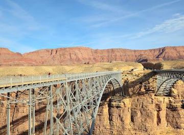
Historic Navajo Bridge
Discover the Historic Navajo Bridge, an architectural marvel offering stunning views of the Colorado River and rich cultural history in Arizona's breathtaking landscapes.
-
Visitor center
Carl Hayden Visitor Center
Explore the Carl Hayden Visitor Center, your gateway to the magnificent Glen Canyon and the remarkable Glen Canyon Dam.
-
Scenic spot
Lees Ferry
Experience the breathtaking landscapes of Lees Ferry, a scenic gem in Marble Canyon, Arizona, perfect for outdoor enthusiasts and history buffs alike.
-
 Hydroelectric power plant
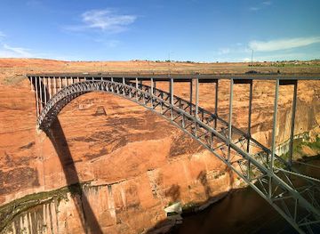
Glen Canyon Dam
Discover the breathtaking Glen Canyon Dam, where engineering brilliance meets stunning natural beauty in Page, Arizona.
Best landmarks in Glen Canyon National Recreation Area
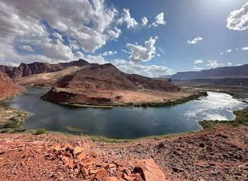
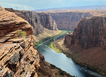
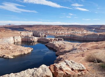
Glen Canyon Dam is the dominant human landmark, a major concrete structure at the Colorado River that created Lake Powell and changed the geography and economy of the region; nearby overlooks provide perspectives on both the engineering project and the canyon it transformed. Lake Powell itself is the defining natural-and-engineered landmark, with water occupying a branching network of former river gorges beneath towering sandstone walls. At Lees Ferry, the Colorado River, historic crossing and surviving buildings mark an important point in regional transport history. Rainbow Bridge, a vast natural sandstone arch protected as a separate national monument within the surrounding recreation area, carries geological and cultural significance and is one of the region’s best-known formations. The layered cliffs, side canyons and high desert mesas are landmarks in their own right, revealing the long interaction of erosion, river movement and human use.
-
Vista point
Glen Canyon Dam Overlook
Experience breathtaking panoramic views of Glen Canyon Dam and the Colorado River from this easily accessible overlook in Page, Arizona.
-
Vista point
Wahweap Overlook
Experience breathtaking panoramic views of Lake Powell and Glen Canyon's stunning landscapes from this easily accessible vista point.
-
Visitor center
Carl Hayden Visitor Center
Explore the history and impact of Glen Canyon Dam at this informative visitor center with stunning views of Lake Powell and the Colorado River.
-
Hydroelectric power plant
Glen Canyon Dam
Explore the Glen Canyon Dam: An engineering marvel shaping the Southwest's water and power, offering history and stunning views.


Explore Glen Canyon National Recreation Area on the map
Plan your trip on one map. See where the top attractions, landmarks, restaurants and hotels are, and book hotels and experiences in a few clicks.
Best hotels in Glen Canyon National Recreation Area
Best restaurants in Glen Canyon National Recreation Area
Glen Canyon is not a restaurant-centred destination, and dining is concentrated in gateway settlements and developed lake facilities rather than in remote canyons. Page offers the widest choice, ranging from casual restaurants and cafés to provisions for self-catering, with menus reflecting the practical needs of a road-and-outdoor tourism hub more than a single distinctive regional cuisine. Wahweap and other established marina areas may provide dining or takeaway services, but seasonal operation and changing facility arrangements should be checked in advance. Visitors staying around Bullfrog or Halls Crossing can find limited food services associated with developed recreation facilities, while those travelling to Lees Ferry or remote lake arms should carry suitable provisions. Navajo-influenced food traditions and regional specialities can be encountered in the wider northern Arizona area, but the most reliable culinary experience here is often a picnic or carefully planned camp meal beside the desert landscape.
-
Vista point
Glen Canyon Dam Overlook
Experience breathtaking views at Glen Canyon Dam Overlook – a stunning vista point showcasing nature's beauty and human ingenuity.
-
Restaurant
Sunset 89
Experience exquisite dining and stunning views at Sunset 89 in Page, Arizona - where culinary delights meet breathtaking landscapes.
-
Nature preserve
Glen Canyon National Recreation Area
Explore Glen Canyon National Recreation Area: A Natural Wonder in Arizona Offering Scenic Views, Hiking Trails, and Water Adventures.
-
Park
Glen Canyon National Recreation Area Visitor Center
Discover breathtaking landscapes and rich cultural history at Glen Canyon National Recreation Area Visitor Center in Arizona.



Best bars in Glen Canyon National Recreation Area
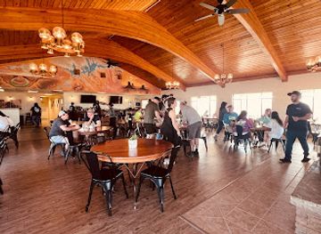
Evening entertainment in Glen Canyon is quiet and dispersed rather than organised around nightlife districts. Page has the broadest selection of bars and casual evening venues, while accommodation and marina areas may offer a drink or meal in a more scenic, resort-oriented setting. Around Bullfrog and Halls Crossing, evening activity is generally shaped by boating, conversation and the practical rhythm of staying in a remote recreation area; services may be seasonal and limited. Lees Ferry has no conventional nightlife scene, but the river corridor and open desert create strong conditions for sunset viewing and stargazing where access and weather permit. Visitors should not expect nightclubs or late-night entertainment inside the recreation area, and anyone driving after dark should account for long distances, wildlife on roads, minimal lighting and the possibility of limited mobile coverage.
-
Nature preserve
Glen Canyon National Recreation Area
Discover the stunning landscapes and outdoor adventures at Glen Canyon National Recreation Area, a true gem of Utah's natural beauty.
-
Vista point
Glen Canyon Dam Overlook
Explore the stunning Glen Canyon Dam Overlook for breathtaking views of the Colorado River and the majestic Glen Canyon landscape.
-
Hydroelectric power plant
Glen Canyon Dam
Explore the grandeur of Glen Canyon Dam, an engineering marvel with breathtaking views and fascinating tours in the heart of Arizona.
-
Restaurant
Sunset 89
Experience delightful dining at Sunset 89, where flavorful dishes meet breathtaking views of the Glen Canyon Dam in Page, Arizona.

Best shops in Glen Canyon National Recreation Area
Shopping within Glen Canyon National Recreation Area is limited and functional, centred mainly on supplies, boating needs and visitor merchandise at developed facilities rather than on a conventional retail scene. Page is the principal shopping base, with supermarkets, outdoor equipment, fuel, souvenirs and businesses serving visitors heading to Lake Powell and the surrounding desert. Local and regional crafts, including Navajo jewellery, woven goods, pottery and artwork, may be found in Page and in the wider northern Arizona region, but visitors should buy from reputable sellers and ask about provenance where appropriate. Small shops and services around lake settlements are more restricted, especially outside the main season, so food, water, fuel and specialist equipment should be obtained before travelling into remote areas. The recreation area itself is better suited to collecting photographs and landscape memories than to browsing a large market or shopping district.
-
Department store
Walmart Supercenter
Explore Walmart Supercenter in Page, AZ: your ultimate destination for affordable groceries, clothing, electronics, and more while enjoying the scenic beauty of the area.
-
Vista point
Glen Canyon Dam Overlook
Discover the stunning vistas at Glen Canyon Dam Overlook, where nature and engineering meet in breathtaking harmony.
-
Hydroelectric power plant
Glen Canyon Dam
Explore the breathtaking Glen Canyon Dam, a stunning hydroelectric power plant and tourist attraction in Arizona offering spectacular views and rich history.
-
Nature preserve
Glen Canyon National Recreation Area
Explore the breathtaking beauty and outdoor adventures at Glen Canyon National Recreation Area, a natural gem in Arizona's stunning landscape.


Get your free copy of our complete guide to Glen Canyon National Recreation Area, delivered straight to you.
Everything on this page, from attractions and restaurants to essentials and local phrases, in one PDF you can read offline, print or share.
Already have an account? Sign in
Your Glen Canyon National Recreation Area guide is ready.
We'll send it to · Not you? Sign out

Getting your guide ready…
We are putting together a fresh copy of the Glen Canyon National Recreation Area guide. This can take up to a minute.
This can take a few moments. If your browser asks, choose Allow so the download can start. You'll find the guide in your Downloads folder.
Nothing happened? Download it again
Sorry, the guide is taking longer than usual. Please try again in a minute, or get it by email instead.
Glen Canyon National Recreation Area essentials
Currency and Payment
Safety
Emergency Situations
Do's and Don'ts
Local Tips
From Eve
Local phrases worth knowing
You don't need to get them perfect. A few words go a long way, and locals appreciate the effort.
Basics
| English | Local | Say it |
|---|---|---|
| Hello | Yá'át'ééh | [yah-ah-tay] |
| Goodbye | Hágoónee' | [ha-goo-nay] |
| Yes | Haa | [haa] |
| No | T'a | [ta] |
| Please/You're welcome | Baa hózhǫ́ǫgo | [baa-hozh-ohn-go] |
| Thank you | Ahéhee' | [ah-hay-hay] |
| Excuse me/Sorry | Másání | [mah-sah-nee] |
| How are you? | Díí baa akó nínízin? | [dee-baa-ah-koh-nee-nee-zeen] |
| Fine. And you? | Díí baa akó nínízin. Ákót'éego? | [dee-baa-ah-koh-nee-nee-zeen, ah-koh-tay-go] |
| Do you speak English? | Dóósh'įįd yee hólǫ́ǫ nídídiitah? | [doh-shi-dee-hol-ohn-nee-dee-dee-tah] |
| I don't understand | Nínízin | [nee-nee-zeen] |
Eating & Drinking
| English | Local | Say it |
|---|---|---|
| I'd like to see the menu, please | Baa hózhǫ́ǫgo yá'át'ééhgo níłchʼi | [baa-hozh-ohn-go yah-ah-tay-go neel-chee] |
| I don't eat meat | Naakaii nishłį́ | [naa-kay-nee-shlee] |
| Cheers! | Ahéhee' | [ah-hay-hay] |
| I would like to pay, please | Baa hózhǫ́ǫgo níłchʼi | [baa-hozh-ohn-go neel-chee] |
Emergencies
| English | Local | Say it |
|---|---|---|
| Help! | Áłtah | [al-tah] |
| Go away! | Béésh baa hózhǫ́ǫgo | [bay-sh baa-hozh-ohn-go] |
| Call the Police! | Naaltsoos binaaltsoos | [naal-tsohs bee-naal-tsohs] |
| Call a doctor! | Ánóshí | [ah-noh-shee] |
| I'm lost | Hwó' dootł'izh | [hwoh-doh-tl-eezh] |
| I'm ill | Béé shinii | [bay-shee-nee] |
Shopping
| English | Local | Say it |
|---|---|---|
| I'd like to buy... | Baa hózhǫ́ǫgo níłchʼi... | [baa-hozh-ohn-go neel-chee] |
| I'm just looking | Níłchʼi hólǫ́ǫgo | [neel-chee hol-ohn-go] |
| How much is it? | T'áá hwó' shoozhí? | [taa-hwoh-shoh-zhee] |
| That's too expensive | Yá'át'ééhgo t'áá hwó' | [yah-ah-tay-go taa-hwoh] |
| Can you lower the price? | Háadishíísh daaztsąą? | [haa-ah-dee-shee-sh daa-ztsaan] |
Time & Numbers
| English | Local | Say it |
|---|---|---|
| What time is it? | T'áá hwó' | [taa-hwoh] |
| It's one o'clock | Hwó' yázhí | [hwoh-yah-zhee] |
| Half past (10) | Neesézlíí' | [nee-say-zlee] |
| Morning | Aak'ei | [aah-kay] |
| Afternoon | Bééhózin | [bay-hoh-zeen] |
| Evening | Yízhí | [yee-zhee] |
| Yesterday | Akaad | [ah-kad] |
| Today | Yázhí | [yah-zhee] |
| Tomorrow | T'áá hwó' | [taa-hwoh] |
| 1 | Bee | [bee] |
| 2 | Naaki | [naa-kee] |
| 3 | Táá | [taa] |
| 4 | Dįį' | [dee] |
| 5 | Ashdla' | [ah-shlah] |
| 6 | Hashké | [hash-kay] |
| 7 | Tódí | [toh-dee] |
| 8 | Nihí | [nee-hee] |
| 9 | Tááłá' | [taa-laah] |
| 10 | Náhást'éí | [nah-has-tay] |
Transport & Directions
| English | Local | Say it |
|---|---|---|
| Where's a/the...? | Háísh | [haa-eesh] |
| What's the address? | T'áá hwó' bił hólǫ́ǫ? | [taa-hwoh bihl hol-ohn] |
| Can you show me (on the map)? | Háadishíísh bíl saadí? | [haa-ah-dee-shee-sh beel saa-dee] |
| When's the next (bus)? | Nízahígíí nishłį́ | [nee-zaa-hee-gee nee-shlee] |
| A ticket (to ....) | Bee át'éego (....) | [bee ah-tay-go] |
History of Glen Canyon National Recreation Area
A River-Carved Desert
The landscapes of Glen Canyon were shaped over immense geological timescales as the Colorado River and its tributaries cut through layered sedimentary rocks, exposing sandstone walls, terraces and narrow side canyons. Wind and water continue to alter the cliffs, benches and washes, while the modern reservoir has submerged much of the former river corridor. This geological setting explains the destination’s dramatic contrast between broad, elevated desert plateaux and deeply incised canyons, but it should be understood as a natural process rather than a product of human history.
Ancestral Puebloan Landscapes
People have lived in and travelled through the canyon country for thousands of years. Ancestral Puebloan communities used the river corridors, side canyons and mesas of the wider region, leaving archaeological evidence that may include dwellings, storage structures, tools and rock art. Later Indigenous communities, including the Navajo, Paiute and Ute peoples, maintained enduring connections with the surrounding landscapes. Archaeological sites within the recreation area are protected, and their presence is a reminder that Glen Canyon is a cultural landscape as well as a scenic one.
River Crossings and Exploration
The Colorado River was difficult to cross and navigate, but Lees Ferry became an important crossing point in the late nineteenth century, linking settlements on either side of the river. The surrounding corridor also attracted surveyors, explorers, missionaries and river expeditions seeking routes through the canyon country. Lees Ferry later supported transport and communication across the sparsely settled region, and surviving historic buildings and river infrastructure help explain its importance before modern roads and bridges transformed movement through northern Arizona.
Glen Canyon Dam and Lake Powell
Construction of Glen Canyon Dam began in 1956 and was completed in 1966 as part of the Colorado River Storage Project. The dam created Lake Powell, flooded the former Glen Canyon river corridor and profoundly altered the region’s ecology, transport and visitor economy. Page grew as a planned community associated with the project, while marinas and lake access points developed along the new shoreline. The dam also became the focus of a major environmental debate, as campaigners argued that the canyon’s natural and cultural values had been sacrificed to water storage and power generation.
Conservation and Recreation
Glen Canyon National Recreation Area was established in 1972 to provide public recreation and protect the scenic, scientific and historic resources associated with the Colorado River and Lake Powell. Its management has had to balance boating, fishing, tourism, water infrastructure, archaeological protection, wildlife habitat and changing reservoir conditions. Contemporary stewardship includes safeguarding cultural sites, managing developed areas and responding to drought, fluctuating lake levels and increasing pressure on desert environments. The recreation area remains a place where the consequences of large-scale engineering and the value of protected landscapes are particularly visible together.
Glen Canyon National Recreation Area in Photos
Browse through our photo collection highlighting the charm and character of the destination.
Cities in Glen Canyon National Recreation Area
The towns and cities of Glen Canyon National Recreation Area, and the easiest places to base yourself.

Swipe for more cities
Neighbouring destination travel guides
The closest destinations to Glen Canyon National Recreation Area, if you have time for more than one.
-

-

-

-

-


Swipe for more destinations
Explore more

Explore more of Coconino County
Explore Coconino County for the Grand Canyon, red-rock country, ponderosa forests, ancient sites and wide-open northern Arizona landscapes.
Explore Coconino County
Explore more of Arizona
Discover Arizona: From the majestic Grand Canyon and red rocks of Sedona to the vibrant cities of Phoenix and Scottsdale, explore the diverse beauty and culture of the Grand Canyon State.
Explore Arizona