

Free Escalante Travel Guide & Mobile App
Plan your Escalante trip with Evendo. Get free guides to top attractions, restaurants, hotels, and bars. Web access or download the mobile app.


Escalante, Utah, opens onto Grand Staircase landscapes, Scenic Byway 12, red-rock trails, petrified wood and quiet desert-town culture in southern Utah.
Desert Town on Scenic Byway 12
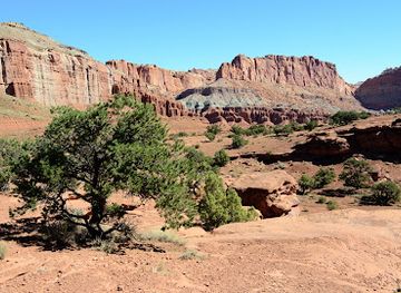
Escalante is a small community in south-central Utah, set along Scenic Byway 12 between the red-rock country of Bryce Canyon and the high plateaux around Boulder. Its low-slung streets, broad skies and distant sandstone escarpments provide an unhurried base for exploring the rugged landscapes of Grand Staircase-Escalante National Monument. The town’s setting feels distinctly rural: services are modest, distances are considerable and the surrounding public land is a larger presence than the built-up centre.Read more about Escalante
A Name Rooted in Exploration
Red Rock, Juniper and Petrified Wood
When is the best time to visit Escalante?
Best: May–June, September · 22–28°C| Month | High (°C) | Rainfall (mm) |
|---|---|---|
| January | 5 | 20 |
| February | 7 | 20 |
| March | 11 | 25 |
| April | 16 | 25 |
| May (best) | 22 | 30 |
| June (best) | 28 | 10 |
| July | 32 | 25 |
| August | 32 | 25 |
| September (best) | 26 | 20 |
| October | 19 | 20 |
| November | 11 | 20 |
| December | 6 | 20 |
Getting to and around Escalante
How to get there
Transportation
Best attractions in Escalante
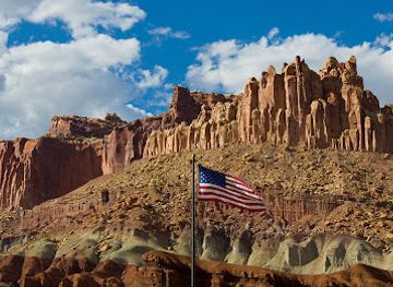
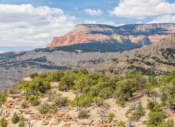
Escalante’s principal attractions are closely tied to the surrounding landscape. Escalante Petrified Forest State Park, just west of town, combines accessible trails with fossilised tree trunks and the waters of Wide Hollow Reservoir, offering an approachable introduction to the geology of the Colorado Plateau. In town, the Escalante Heritage Center interprets local settlement and community history, while the Escalante Interagency Visitor Center provides context for Grand Staircase-Escalante National Monument and practical orientation for public-land travel. Scenic Byway 12 is itself a major sightseeing experience, passing through changing red-rock, juniper and high-plateau scenery between Escalante, Boulder and Bryce Canyon Country. Farther from the centre, the monument contains slot canyons, slickrock routes and remote viewpoints, but these are regional excursions rather than urban attractions and demand careful planning for weather, water and road conditions.
-
Non-profit organization
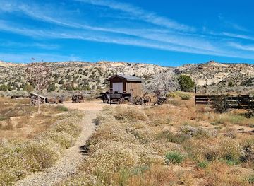
Escalante Heritage Center
Explore the rich history and culture of Escalante at the Heritage Center, where local stories and natural beauty intertwine.
5 min drive · 1.6 km from city centre
-
Visitor center
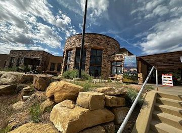
Escalante Interagency Visitor Center
Explore the breathtaking landscapes of Escalante at the Interagency Visitor Center, your gateway to adventure in Utah's stunning natural wonders.
6 min drive · 2.0 km from city centre
-
Visitor center
Escalante Interagency Visitor Center
Explore the stunning landscapes of southern Utah at Escalante Interagency Visitor Center, your gateway to adventure and natural beauty.
6 min drive · 2.0 km from city centre
Best landmarks in Escalante
Escalante’s landmarks are modest in scale but closely connected with the town’s settlement history and landscape setting. The Escalante Heritage Center is an important place for understanding the Latter-day Saint community established here in the 1870s and the practical challenges of life on the plateau. The town’s historic buildings and civic spaces preserve elements of that rural settlement pattern, while the Escalante Interagency Visitor Center represents the modern importance of public-land interpretation and conservation. Outside the centre, the organised trails and fossilised timber of Escalante Petrified Forest State Park form a geological landmark associated with the community. Scenic Byway 12, with its high plateaux, sandstone formations and expansive overlooks, is a cultural as well as physical marker of Escalante’s identity, linking the town to the wider history of travel across southern Utah.
-
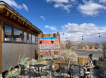
Restaurant
Escalante Outfitters
Experience the heart of Escalante at Escalante Outfitters, where adventure meets delicious local cuisine amidst stunning natural landscapes.
15 min walk · 1.2 km from city centre
-
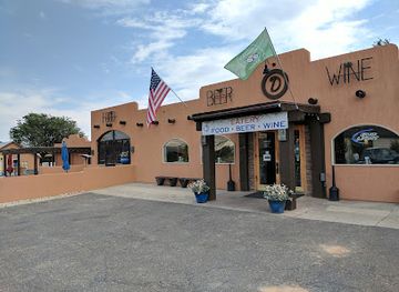
American
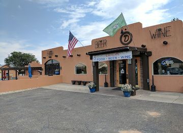
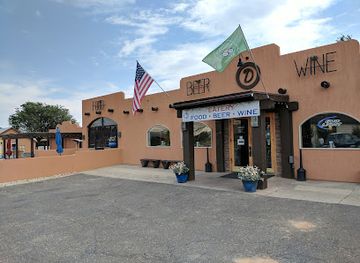
Circle D Restaurant
Discover Circle D Restaurant in Escalante, Utah, where hearty American dishes meet local charm in a cozy dining atmosphere.
17 min walk · 1.4 km from city centre
-
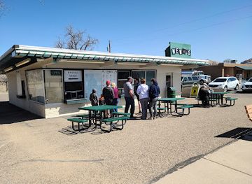
Restaurant
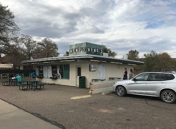
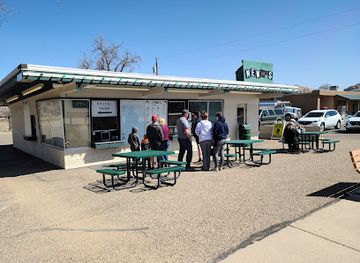
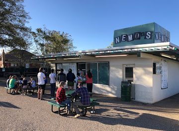
Nemo's Drive Thru
Experience the charm of classic American diner fare at Nemo's Drive Thru in Escalante, Utah, where delicious meals meet affordable prices.
12 min walk · 0.9 km from city centre
-
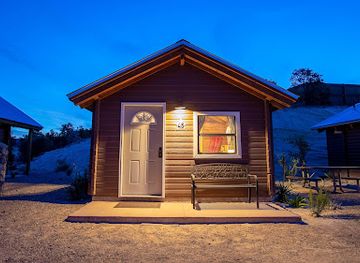
RV park
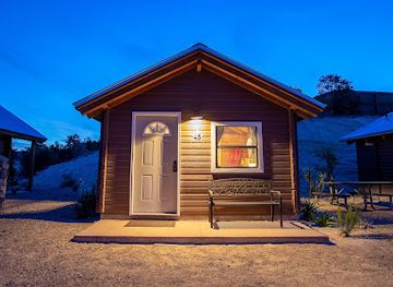
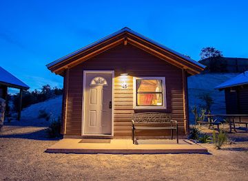
Escalante Cabins & RV Park
Experience the natural beauty and comfort of Escalante Cabins & RV Park, your ideal retreat in the heart of Utah's stunning landscapes.
6 min drive · 1.9 km from city centre
Explore Escalante on the map
Plan your Escalante trip on one map. See where the top attractions, landmarks, restaurants, bars and hotels are, find what's near where you're staying, and book hotels and experiences in a few clicks.
Best hotels in Escalante
Best restaurants in Escalante
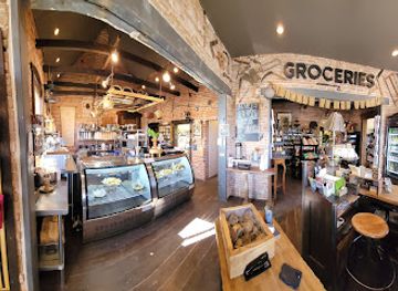
Escalante’s dining scene is small, seasonal and shaped by its role as a remote stop on Scenic Byway 12. Visitors find casual cafés, bakery-style counters, family-run restaurants and provisions for picnics and self-catering rather than a broad choice of international dining. Menus commonly suit road travellers and hikers, with hearty breakfasts, sandwiches, burgers, salads and other practical meals, while local food shops are useful for stocking water and trail supplies. The town’s restaurants reflect the wider rural culture of southern Utah, where independent businesses serve residents, passing motorists and visitors heading into Grand Staircase-Escalante. Dining hours and seasonal openings can vary, particularly outside the main travel months, so meal planning is wise when exploring remote roads. More varied dining is available in larger communities along the byway, but these are separate destinations rather than part of Escalante itself.
-
Restaurant
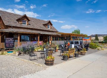
Escalante Outfitters
Explore the best of Escalante with delicious food, cozy lodging, and outdoor gear all under one roof.
15 min walk · 1.2 km from city centre
-
American
Circle D Restaurant
Discover authentic American cuisine at Circle D Restaurant in Escalante – your perfect dining companion after exploring stunning landscapes.
17 min walk · 1.4 km from city centre
-
Restaurant
Nemo's Drive Thru
Discover Nemo's Drive Thru in Escalante: where fresh ingredients meet friendly service in a delightful fast-food experience.
12 min walk · 0.9 km from city centre
-
RV park
Escalante Cabins & RV Park
Discover adventure and tranquility at Escalante Cabins & RV Park - your gateway to Utah's stunning landscapes.
6 min drive · 1.9 km from city centre
Best bars in Escalante
Escalante has a quiet evening scene rather than a developed bar or nightclub culture. After dark, activity centres on independent restaurants, cafés, accommodation common areas and the simple pleasure of sitting beneath exceptionally dark skies. Visitors may encounter occasional community events or informal live entertainment, but Escalante should not be approached as a destination for late-night venues, clubbing or a concentrated entertainment district. The absence of bright urban lighting makes the surrounding plateau particularly suited to stargazing when conditions are clear, although visitors should remain on permitted land and respect private property. Evening driving requires care because wildlife, limited lighting and long distances are part of the local road environment.
-
Restaurant
Escalante Outfitters
Discover the ultimate gateway to adventure at Escalante Outfitters, where delicious food, outdoor gear, and cozy lodging meet the stunning landscapes of Utah.
15 min walk · 1.2 km from city centre
-
American
Circle D Restaurant
Experience the heart of American cuisine at Circle D Restaurant in Escalante, Utah, where comfort food meets local flavors and warm hospitality.
17 min walk · 1.4 km from city centre
-
Restaurant
Nemo's Drive Thru
Savor delicious, freshly made burgers at Nemo's Drive Thru in Escalante, Utah – a quick and tasty stop for hungry travelers.
12 min walk · 0.9 km from city centre
-
Restaurant
Magnolia's Kitchen
Discover the heart of Escalante's culinary scene at Magnolia's Kitchen, where home-cooked meals and local flavors come together in a cozy setting.
11 min walk · 0.9 km from city centre
Best nightclubs in Escalante
Escalante has a quiet evening scene rather than a developed bar or nightclub culture. After dark, activity centres on independent restaurants, cafés, accommodation common areas and the simple pleasure of sitting beneath exceptionally dark skies. Visitors may encounter occasional community events or informal live entertainment, but Escalante should not be approached as a destination for late-night venues, clubbing or a concentrated entertainment district. The absence of bright urban lighting makes the surrounding plateau particularly suited to stargazing when conditions are clear, although visitors should remain on permitted land and respect private property. Evening driving requires care because wildlife, limited lighting and long distances are part of the local road environment.
-
American
Circle D Restaurant
Experience the essence of American comfort food at Circle D Restaurant in Escalante, where every meal is a memorable occasion.
17 min walk · 1.4 km from city centre
-
Restaurant
Nemo's Drive Thru
Discover delicious burgers and local flavors at Nemo's Drive Thru, a must-visit dining spot in the heart of Escalante, Utah.
12 min walk · 0.9 km from city centre
-
Bar
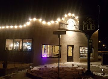
4th West Pub
Experience the local flavors and cozy atmosphere at 4th West Pub, the perfect bar and grill in Escalante, Utah.
16 min walk · 1.3 km from city centre
-
Cafe
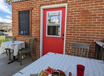
Esca-latte Restaurant
Experience the best of Escalante with fresh, local flavors at Esca-latte Restaurant, the perfect café for travelers seeking comfort and delicious meals.
15 min walk · 1.2 km from city centre


Best shops in Escalante
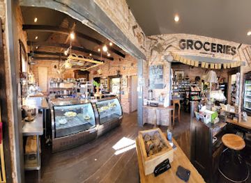
Shopping in Escalante is practical and locally oriented rather than centred on a large retail district. Small shops and galleries serve visitors looking for regional art, outdoor supplies, books, souvenirs and locally made items, while food stores and convenience outlets are important for assembling provisions before heading into the monument. The most characteristic purchases are connected with the landscape and rural culture of southern Utah, including artwork inspired by red-rock country, locally produced foods and practical hiking supplies. There is no extensive luxury or department-store scene, and specialist shopping is limited compared with larger towns. Visitors should buy essential fuel, water and trail supplies before remote excursions and should treat fossils, archaeological objects and natural materials found on public land as protected resources rather than souvenirs.
-
Restaurant
Escalante Outfitters
Discover Escalante Outfitters, your ultimate stop for food, lodging, and adventure gear in the heart of Utah's breathtaking landscapes.
15 min walk · 1.2 km from city centre
-
American
Circle D Restaurant
Experience the heart of American dining at Circle D Restaurant in Escalante, where every meal is a celebration of flavor and hospitality.
17 min walk · 1.4 km from city centre
-
Restaurant
Nemo's Drive Thru
Experience the taste of Escalante at Nemo's Drive Thru, where delicious burgers and friendly service await you in the heart of Utah.
12 min walk · 0.9 km from city centre
-
RV park
Escalante Cabins & RV Park
Explore the great outdoors at Escalante Cabins & RV Park, your gateway to adventure in Utah's breathtaking landscapes.
6 min drive · 1.9 km from city centre
Get your free copy of our complete guide to Escalante, delivered straight to you.
Everything on this page, from attractions and restaurants to essentials and local phrases, in one PDF you can read offline, print or share.
Already have an account? Sign in
Your Escalante guide is ready.
We'll send it to · Not you? Sign out

Getting your guide ready…
We are putting together a fresh copy of the Escalante guide. This can take up to a minute.
This can take a few moments. If your browser asks, choose Allow so the download can start. You'll find the guide in your Downloads folder.
Nothing happened? Download it again
Sorry, the guide is taking longer than usual. Please try again in a minute, or get it by email instead.
Escalante essentials
Currency and Payment
Safety
Emergency Situations
Do's and Don'ts
Local Tips
From Eve
Local phrases worth knowing
You don't need to get them perfect. A few words go a long way, and locals appreciate the effort.
Basics
| English | Local | Say it |
|---|---|---|
| Hello | Howdy | [hau-dee] |
| Goodbye | See ya | [see yah] |
| Yes | Yup | [yuhp] |
| No | Nope | [nohp] |
| Please/You're welcome | Please n' thank ya | [pleez n' thangk yah] |
| Thank you | Thanks a heap | [thanks uh heep] |
| Excuse me/Sorry | Pardon me | [pahr-dn me] |
| How are you? | Howdy, doin' fine? | [hau-dee, doin' fain?] |
| Fine. And you? | Jes fine. An' yerself? | [jes fain. an' yur-self?] |
| Do you speak English? | Ya talk English? | [yah tawk ing-glish?] |
| I don't understand | Ain't catchin' ya | [aynt katch-in yah] |
Eating & Drinking
| English | Local | Say it |
|---|---|---|
| I'd like to see the menu, please | Mind showin' me the grub list? | [meynd show-in' mee thuh gruhb list?] |
| I don't eat meat | I don't touch flesh | [ay dont tuch flesh] |
| Cheers! | Bottoms up! | [baht-uhms up] |
| I would like to pay, please | Cash out, if ya will | [cash out, ihf yah will] |
Emergencies
| English | Local | Say it |
|---|---|---|
| Help! | S.O.S! | [S.O.S!] |
| Go away! | Git! | [git!] |
| Call the Police! | Holler for the Law! | [hah-ler fer thuh law!] |
| Call a doctor! | Send fer a sawbones! | [send fer uh saw-bohns!] |
| I'm lost | Done gone astray | [dun gawn uh-stray] |
| I'm ill | I'm ailin' | [aim ayl-in'] |
Shopping
| English | Local | Say it |
|---|---|---|
| I'd like to buy... | Fixin' ta buy... | [fik-sin' tuh bahy...] |
| I'm just looking | Just browsin' | [juhst brow-zin'] |
| How much is it? | What's the damage? | [wuts thuh dam-ij?] |
| That's too expensive | That's highfalutin | [thats hahy-fuh-lootin] |
| Can you lower the price? | Can ya cut me a deal? | [can yuh kut me a deel?] |
Time & Numbers
| English | Local | Say it |
|---|---|---|
| What time is it? | What's the hour? | [whuts thuh ow-er?] |
| It's one o'clock | It's one bell | [its wun bel] |
| Half past (10) | Ten an' a half | [ten an' uh haff] |
| Morning | Mornin' | [morn-in'] |
| Afternoon | Afternoon | [after-noon] |
| Evening | Evenin' | [even-in'] |
| Yesterday | Yesteryear | [yest-er-year] |
| Today | Today | [tuh-day] |
| Tomorrow | Tomorra | [tuh-mor-uh] |
| 1 | One | [wun] |
| 2 | Two | [too] |
| 3 | Three | [three] |
| 4 | Four | [for] |
| 5 | Five | [fahyv] |
| 6 | Six | [siks] |
| 7 | Seven | [sev-in] |
| 8 | Eight | [ayt] |
| 9 | Nine | [nahn] |
| 10 | Ten | [ten] |
Transport & Directions
| English | Local | Say it |
|---|---|---|
| Where's a/the...? | Where's the... | [wheres thuh...] |
| What's the address? | What's the locale? | [whuts thuh loh-kul?] |
| Can you show me (on the map)? | Can ya point me the way (on the map)? | [can yuh point me thuh way (on thuh map)?] |
| When's the next (bus)? | When's the next stage? | [whens thuh nekst stayj?] |
| A ticket (to ....) | A ticket (ta ....) | [uh tick-it (tuh ....)] |
History of Escalante
Indigenous Landscapes Before Settlement
The Escalante area lies within the ancestral homelands of Indigenous peoples, including Southern Paiute communities whose knowledge, travel routes and seasonal use of water and plant resources belong to a much older history than the modern town. Archaeological evidence across the surrounding plateaux and canyons records earlier inhabitants as well, although individual sites require protection and should not be disturbed. The region’s dry washes, springs and sheltered canyon spaces shaped movement through the landscape, while its remoteness limited later agricultural development. This long Indigenous presence remains an essential part of understanding Grand Staircase-Escalante and the wider Colorado Plateau.
The Escalante Expedition of 1776
In 1776, the Franciscan friars Silvestre Vélez de Escalante and Francisco Atanasio Domínguez led an expedition from Santa Fe in an attempt to find a route to the Spanish settlements of coastal California. Their journey crossed parts of present-day Utah, including the broader Escalante region, and produced early European descriptions of its terrain and waterways. The modern town was named for Escalante, although he did not establish the community and the expedition did not create a permanent settlement there. The name reflects the area’s place in the mapped history of Spanish exploration rather than a town founded during the expedition.
Latter-day Saint Settlement in the 1870s
Escalante was settled in the 1870s as part of Latter-day Saint colonisation in southern Utah. Families adapted to an isolated environment where farming depended on limited water, irrigation and careful use of the river valleys. The settlement’s distance from larger towns made self-reliance important, while roads and trails connected it with communities across the plateau. Local agriculture, livestock and small-scale trade formed the basis of community life. Surviving historic structures and the Escalante Heritage Center help interpret this period, when the town developed as a rural settlement rather than as a mining or railway centre.
Isolation and Regional Connections
For much of its history, Escalante remained separated from major population centres by rugged terrain, river crossings and long stretches of unpaved road. That isolation shaped local institutions, transport and economic life, but it also preserved a strong connection with the surrounding landscape. Improved highways gradually made the town more accessible, particularly after modern routes across the plateau were developed. Tourism joined ranching, agriculture and local services as an important part of the economy. The completion and designation of Scenic Byway 12 gave Escalante a more visible place on southern Utah itineraries while retaining its small-town scale.
Grand Staircase-Escalante and Public Lands
The creation of Grand Staircase-Escalante National Monument in 1996 placed the surrounding canyons, plateaux and fossil-rich landscapes at the centre of national debate about public-land protection and local economic interests. The monument has been managed and politically revised in different ways over time, but the wider landscape remains publicly administered and central to Escalante’s identity. Visitor services, scientific research and outdoor recreation now sit alongside the town’s older agricultural traditions. Its contemporary character is therefore shaped both by the history of settlement and by the continuing effort to understand and manage a vast, fragile desert environment.
Escalante in Photos
Browse through our photo collection highlighting the charm and character of the destination.
Cities near Escalante
The closest cities to Escalante, if you have time for more than one stop.
-

-
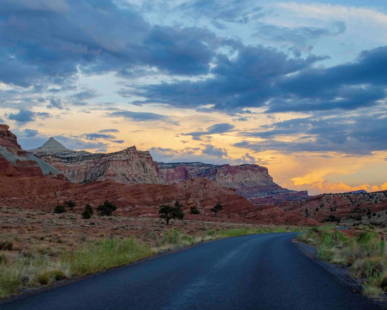 Torrey
, Utah, pairs a welcoming high-desert town with Capitol Reef scenery, red-rock hikes, Scenic Byway 12, dark skies and memorable outdoor adventures.
1 h 22 min drive · 62 km from city centre
Torrey
Torrey, Utah, pairs a welcoming high-desert town with Capitol Reef scenery, red-rock hikes, Scenic Byway 12, dark skies and memorable outdoor adventures.
1 h 22 min drive · 62 km from city centre
-

-

-
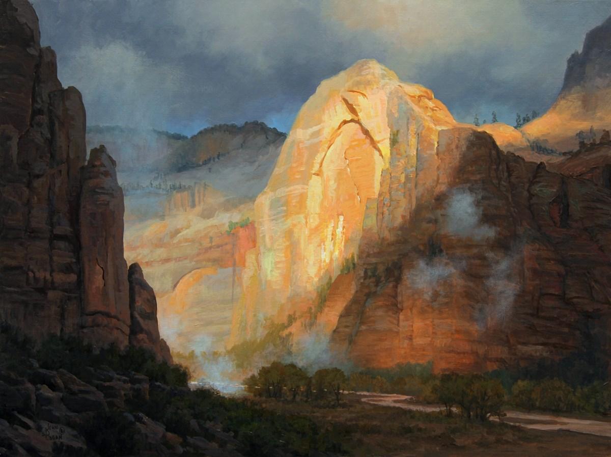 Mt Carmel
, Utah, offers quiet high-desert scenery, pioneer history and easy access to Zion National Park, scenic drives and canyon-country adventures.
2 h 10 min drive · 110 km from city centre
Mt Carmel
Mt Carmel, Utah, offers quiet high-desert scenery, pioneer history and easy access to Zion National Park, scenic drives and canyon-country adventures.
2 h 10 min drive · 110 km from city centre


Swipe for more cities
Explore more

Explore more of Utah
Explore Utah's stunning national parks, rich cultural heritage, and year-round outdoor adventures. Discover why this diverse state is a top destination for travelers.
Explore Utah