

Free Shasta Cascade Travel Guide & Mobile App
Explore Shasta Cascade with free travel guides. Discover regional history, expert tips, proposed trips, and audio guides on web or mobile app.


Explore Shasta Cascade’s volcanoes, forests, waterfalls, high-desert landscapes and outdoor towns across northern California.
Read more about Shasta Cascade
Getting to and around Shasta Cascade
How to get there
Transportation
Top city travel guides in Shasta Cascade
The cities of Shasta Cascade, and the easiest places to base yourself.
-

-

-

-

-

-


Swipe for more cities
Destinations in Shasta Cascade
Resorts, valleys and scenic spots worth a trip of their own.
-
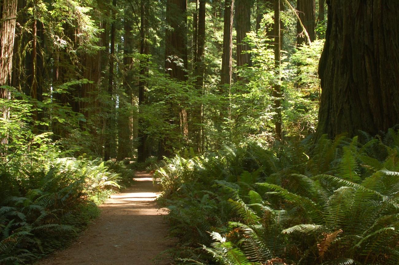 Redwood National and State Parks
 in California offer ancient redwood forests, Pacific beaches, elk meadows, scenic drives and remarkable hiking.
-

-

-


Swipe for more destinations
Best attractions in Shasta Cascade
Shasta Cascade’s attractions are shaped by geology, distance and open space. Lassen Volcanic National Park combines volcanic peaks, lava landscapes, hydrothermal features and high-country trails, while Lava Beds National Monument offers cave exploration and interpretation of Modoc history on the Modoc Plateau. Around Mount Shasta, Castle Crags State Park, the McCloud River and forested mountain roads provide opportunities for hiking, climbing, fishing and photography. Shasta Lake supports boating and shoreline recreation, and the Sacramento River corridor around Redding is associated with cycling, angling, water sports and museums. McArthur-Burney Falls Memorial State Park is known for its spring-fed waterfall, while the Hat Creek and Fall River areas offer fishing and wildlife habitats. Further east, Lassen and Modoc country brings wide skies, volcanic remnants and fewer services; west towards Trinity County, forests, rivers and rugged mountain scenery dominate. Winter adds skiing and snow play around selected mountain communities, although access is weather-dependent. The region’s appeal lies less in a concentrated list of paid attractions than in the combination of protected landscapes, working towns, scenic drives, trails and waterways.
-
Bridge
Sundial Bridge
Explore the Sundial Bridge in Redding, CA, where modern architecture meets natural beauty along the Sacramento River Trail.
-

Lassen Volcanic National Park
Discover a land of steaming volcanoes, pristine lakes, and dark night skies in Northern California's Lassen Volcanic National Park.
-
Lake Shasta Caverns National Natural Landmark
Experience the stunning beauty and geological wonders of Lake Shasta Caverns, a natural landmark and adventure hub in California.
-
Burney Falls
Experience the majesty of Burney Falls, a year-round spectacle of nature's beauty in Northern California's McArthur-Burney Falls Memorial State Park.


Best landmarks in Shasta Cascade
Mount Shasta is Shasta Cascade’s most recognisable natural landmark, rising above the surrounding valleys as a major volcanic peak and a place of deep significance to Indigenous peoples. Lassen Peak, within Lassen Volcanic National Park, is another defining summit and the southernmost major volcano in the Cascade Range; its 1915 eruption helped demonstrate the need for lasting protection of the landscape. Castle Crags forms a dramatic cluster of granite spires beside the Sacramento River corridor, while Burney Falls is a particularly distinctive water landmark created by springs emerging through basalt. Shasta Dam is both an imposing engineering structure and a marker of the twentieth-century transformation of the Sacramento River system. In the north-east, the lava fields and cave systems of Lava Beds National Monument provide a stark geological landscape as well as places associated with the Modoc War. The Sacramento River, McCloud River and Shasta Lake are less singular architectural objects than enduring geographic features, but they are central to the region’s visual identity, recreation and settlement history.
-
Bridge
Sundial Bridge
Experience the architectural marvel of the Sundial Bridge in Redding, California: a stunning blend of art, engineering, and nature, offering breathtaking views and a unique sundial experience.
-
National forest
Shasta-Trinity National Forest
Discover California's largest National Forest: Shasta-Trinity, a vast and diverse landscape offering endless outdoor adventures, from Mount Shasta's peak to the serene Trinity Alps.
-
Scenic spot
Lake Shasta Caverns National Natural Landmark
Discover the stunning geological wonders and serene beauty of Lake Shasta Caverns National Natural Landmark, a must-visit destination for outdoor enthusiasts and nature lovers.
-
Scenic spot
Burney Falls
Discover the breathtaking beauty of Burney Falls, a 129-foot natural wonder in Northern California's McArthur-Burney Falls Memorial State Park, offering year-round adventure and stunning scenery.


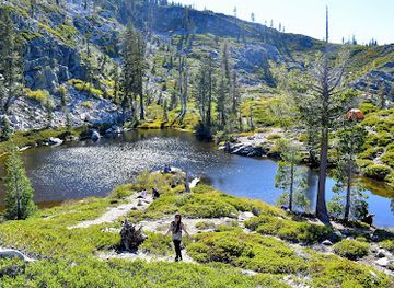

Explore Shasta Cascade on the map
Plan your trip on one map. See where the top cities, national parks and sights are, and book hotels and experiences in a few clicks.
Best hotels in Shasta Cascade
Best restaurants in Shasta Cascade
Dining in Shasta Cascade is practical, varied and closely tied to the distances between communities. Redding has the broadest choice, including independent restaurants, cafés, bakeries, breweries and cuisines reflecting contemporary California. In Mount Shasta, Dunsmuir, Chester, Burney and other smaller towns, visitors commonly find cafés, diners, pubs and restaurants serving travellers, residents and outdoor workers. Local menus may feature trout, salmon where legally and sustainably available, beef, seasonal produce, wild mushrooms and farm products, although no single dish defines the whole region. Farmers’ markets and roadside stands can be good places to find fruit, preserves, baked goods and locally produced drinks. Craft breweries and wineries are more visible around larger population centres and agricultural valleys, while rural kitchens often emphasise hearty breakfasts, sandwiches and familiar American fare. Reservations are sensible for popular summer evenings, but opening patterns in small communities can be seasonal, so carrying provisions is wise when heading towards remote parks, forests or high plateaux.
-
Casino
Win-River Resort & Casino
Discover excitement and relaxation at Win-River Resort & Casino in Redding - your ultimate gaming and entertainment destination.
-
American
Black Bear Diner Mt. Shasta
Experience hearty American comfort food at Black Bear Diner in scenic Mt. Shasta—perfect for families and travelers alike!
-
Hamburger
YAKS on the 5
Experience delicious hamburgers and American cuisine at YAKS on the 5 in Dunsmuir - where great food meets charming ambiance.
-
Scenic spot
Lake Shasta Caverns National Natural Landmark
Explore the mesmerizing Lake Shasta Caverns: a stunning blend of geological wonders, outdoor adventures, and scenic beauty in California.



Best bars in Shasta Cascade
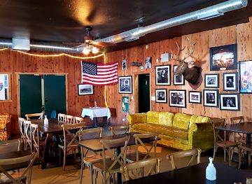
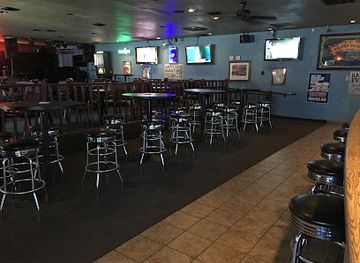
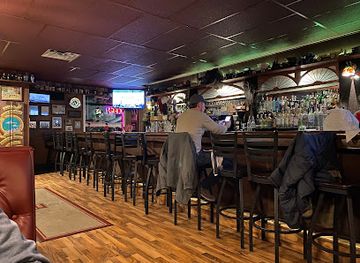
Evening life in Shasta Cascade is centred on pubs, breweries, restaurants, live music and community events rather than a large nightclub circuit. Redding has the region’s broadest selection of bars and evening venues, including places associated with craft beer, cocktails, music and social dining. Mount Shasta and Dunsmuir offer a smaller mountain-town scene, while other communities generally rely on taverns, hotel bars, breweries and occasional seasonal or local events. In rural areas, evenings often finish early, particularly outside the summer season, and distances make drinking and driving especially hazardous. Visitors should arrange a designated driver or use available local transport rather than assuming a taxi or rideshare will operate in remote areas. Breweries and taprooms can provide a relaxed way to sample northern Californian brewing culture, but they are only one part of the region’s evening life, which also includes theatre, galleries, riverside dining and dark-sky stargazing.
-
Tapas Bar
Pipeline Craft Taps & Kitchen
Discover the perfect blend of craft brews and mouthwatering tacos at Pipeline Craft Taps & Kitchen in Mt. Shasta.
-
Bar
Basshole Brews
Experience the vibrant craft beer scene and stunning lakeside views at Basshole Brews, the perfect spot for food lovers and beer enthusiasts alike.
-
Lounge
Castle Lounge
Experience the vibrant atmosphere and unique cocktails at Castle Lounge, Redding's go-to spot for relaxation and socializing.
-
Italian
Mike & Tony's Restaurant
Experience the essence of Italy in the scenic Mt. Shasta at Mike & Tony's Restaurant, where authentic flavors and warm hospitality meet.
Best nightclubs in Shasta Cascade
Evening life in Shasta Cascade is centred on pubs, breweries, restaurants, live music and community events rather than a large nightclub circuit. Redding has the region’s broadest selection of bars and evening venues, including places associated with craft beer, cocktails, music and social dining. Mount Shasta and Dunsmuir offer a smaller mountain-town scene, while other communities generally rely on taverns, hotel bars, breweries and occasional seasonal or local events. In rural areas, evenings often finish early, particularly outside the summer season, and distances make drinking and driving especially hazardous. Visitors should arrange a designated driver or use available local transport rather than assuming a taxi or rideshare will operate in remote areas. Breweries and taprooms can provide a relaxed way to sample northern Californian brewing culture, but they are only one part of the region’s evening life, which also includes theatre, galleries, riverside dining and dark-sky stargazing.
-
Brewpub
Pipeline Craft Taps & Kitchen
Experience the vibrant flavors of craft beer and tacos at Pipeline Craft Taps & Kitchen in scenic Mt. Shasta, California.
-
Lounge
Castle Lounge
Experience the vibrant lifestyle of Redding at Castle Lounge, your go-to destination for creative cocktails and a welcoming atmosphere.
-
Cocktail bar
Showboat Lounge
Experience the best cocktails and sports in Redding at Showboat Lounge, a vibrant cocktail bar perfect for relaxation and entertainment.
-
Karaoke bar
Monroe's Nightclub & Karaoke
Discover Redding's nightlife at Monroe's Nightclub & Karaoke, where you can sing, dance, and enjoy vibrant entertainment in a fun atmosphere.


Best shops in Shasta Cascade
Shopping in Shasta Cascade is concentrated in town centres rather than extensive retail districts. Redding provides the widest range of national retailers, independent businesses, outdoor equipment shops, galleries and everyday services, while Mount Shasta and Dunsmuir have smaller selections of books, clothing, art, gifts and locally themed goods. Market towns and rural communities are useful for farm produce, preserves, honey, baked goods and seasonal fruit, particularly when local farmers’ markets or roadside stands are operating. Visitors may also find pottery, woodwork, photographs, textiles and other crafts inspired by the region’s forests, rivers and volcanic landscapes. Outdoor shops are practical sources of maps, clothing and equipment, but remote areas should not be approached on the assumption that supplies will be available locally. Regional food products, locally made drinks and books about natural or Indigenous history make more meaningful souvenirs than collecting rocks, lava or archaeological material from protected landscapes.
-
Shopping mall
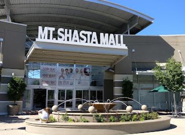
Mt. Shasta Mall
Explore Mt. Shasta Mall in Redding, California - a shopping paradise with diverse stores, dining options, and entertainment for the whole family.
-
Scenic spot
Lake Shasta Caverns National Natural Landmark
Explore the stunning Lake Shasta Caverns, a natural wonder filled with breathtaking geological formations and outdoor adventures in Northern California.
-
Shopping mall
Shasta Gateway - Anderson
Experience shopping like never before at Shasta Gateway - Anderson, your go-to destination for retail therapy, dining, and local culture.
-
Gift shop
The Weed Store
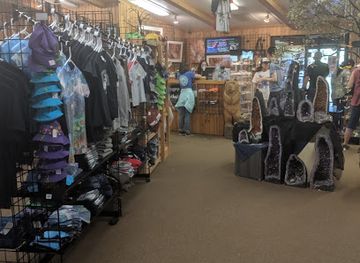
Explore The Weed Store in Weed, California – your go-to destination for unique gifts, local souvenirs, and unforgettable T-shirts.

Get your free copy of our complete guide to Shasta Cascade, delivered straight to you.
Everything on this page, from attractions and restaurants to essentials and local phrases, in one PDF you can read offline, print or share.
Already have an account? Sign in
Your Shasta Cascade guide is ready.
We'll send it to · Not you? Sign out

Getting your guide ready…
We are putting together a fresh copy of the Shasta Cascade guide. This can take up to a minute.
This can take a few moments. If your browser asks, choose Allow so the download can start. You'll find the guide in your Downloads folder.
Nothing happened? Download it again
Sorry, the guide is taking longer than usual. Please try again in a minute, or get it by email instead.
Shasta Cascade essentials
Currency and Payment
Safety
Emergency Situations
Do's and Don'ts
Local Tips
From Eve
Local phrases worth knowing
You don't need to get them perfect. A few words go a long way, and locals appreciate the effort.
Basics
| English | Local | Say it |
|---|---|---|
| Hello | Howdy | [haʊdi] |
| Goodbye | See ya later | [siː jə ˈleɪtə] |
| Yes | Yep | [jɛp] |
| No | Nah | [nɑː] |
| Please/You're welcome | Sure thing | [ʃʊr θɪŋ] |
| Thank you | Thanks a lot | [θæŋks ə lɑt] |
| Excuse me/Sorry | Pardon me | [ˈpɑrdən mi] |
| How are you? | How's it going? | [haʊz ɪt ˈɡoʊɪŋ] |
| Fine. And you? | Good. How about you? | [ɡʊd. haʊ əˈbaʊt ju] |
| Do you speak English? | Can you talk English? | [kæn ju tɔk ˈɪŋɡlɪʃ] |
| I don't understand | I'm not following | [aɪm nɑt ˈfɑloʊɪŋ] |
Eating & Drinking
| English | Local | Say it |
|---|---|---|
| I'd like to see the menu, please | Can I check out the menu? | [kæn aɪ tʃɛk aʊt ðə ˈmɛnju] |
| I don't eat meat | I'm a vegetarian | [aɪm ə ˌvɛdʒɪˈtɛriən] |
| Cheers! | To good times! | [tu ɡʊd taɪmz] |
| I would like to pay, please | Can I settle up? | [kæn aɪ ˈsɛtəl ʌp] |
Emergencies
| English | Local | Say it |
|---|---|---|
| Help! | I need help! | [aɪ nid hɛlp] |
| Go away! | Leave me alone! | [liv mi əˈloʊn] |
| Call the Police! | Get the cops! | [ɡɛt ðə kɑps] |
| Call a doctor! | Get me a doc! | [ɡɛt mi ə dɑk] |
| I'm lost | I'm turned around | [aɪm tɜrnd əˈraʊnd] |
| I'm ill | I'm not feeling well | [aɪm nɑt ˈfiːlɪŋ wɛl] |
Shopping
| English | Local | Say it |
|---|---|---|
| I'd like to buy... | I'm looking to get... | [aɪm ˈlʊkɪŋ tə ɡɛt] |
| I'm just looking | Just browsing | [dʒʌst ˈbraʊzɪŋ] |
| How much is it? | What's the price? | [wʌts ðə praɪs] |
| That's too expensive | That's out of my budget | [ðæts aʊt əv maɪ ˈbʌdʒɪt] |
| Can you lower the price? | Can you cut me a deal? | [kæn ju kʌt mi ə dil] |
Time & Numbers
| English | Local | Say it |
|---|---|---|
| What time is it? | What's the time? | [wʌts ðə taɪm] |
| It's one o'clock | It's 1:00 | [ɪts wʌn əˈklɒk] |
| Half past (10) | Half past ten | [hæf pæst tɛn] |
| Morning | Morning | [ˈmɔrnɪŋ] |
| Afternoon | Afternoon | [ˌæftərˈnun] |
| Evening | Evening | [ˈivnɪŋ] |
| Yesterday | Yesterday | [ˈjɛstərdeɪ] |
| Today | Today | [təˈdeɪ] |
| Tomorrow | Tomorrow | [təˈmɔroʊ] |
| 1 | One | [wʌn] |
| 2 | Two | [tu] |
| 3 | Three | [θri] |
| 4 | Four | [fɔr] |
| 5 | Five | [faɪv] |
| 6 | Six | [sɪks] |
| 7 | Seven | [ˈsɛvən] |
| 8 | Eight | [eɪt] |
| 9 | Nine | [naɪn] |
| 10 | Ten | [tɛn] |
Transport & Directions
| English | Local | Say it |
|---|---|---|
| Where's a/the...? | Where's the...? | [wɛrz ðə...?] |
| What's the address? | What's the location? | [wʌts ðə loʊˈkeɪʃən] |
| Can you show me (on the map)? | Can you point it out? | [kæn ju pɔɪnt ɪt aʊt] |
| When's the next (bus)? | When's the next ride? | [wɛn z ðə nɛkst raɪd] |
| A ticket (to ....) | One ticket to ... | [wʌn ˈtɪkɪt tə ...] |
History of Shasta Cascade
Indigenous homelands before American settlement
Shasta Cascade is the homeland of many Indigenous peoples, including the Wintu, Yana, Pit River tribes, Modoc, Karuk, Shasta, Okwanuchu and others whose territories extend across the region’s river valleys, mountains and plateaux. Communities developed detailed knowledge of salmon rivers, acorns, medicinal plants, fire management and seasonal movement. The Pit River region, the McCloud and Sacramento valleys, and the volcanic country around Mount Shasta all retain profound cultural significance. Visitors encounter this history not only in museums and interpretation but also in living communities, language revitalisation and continuing cultural relationships with land and water.
Spanish and Mexican-era northern California
The far north remained distant from the principal Spanish missions and Mexican settlements of coastal and central California, but explorers, trappers and traders gradually entered its river corridors and mountain routes. European diseases, introduced livestock and expanding commercial networks disrupted Indigenous life before the American period. Mission influence was much weaker here than in southern California, and the region’s rugged terrain helped preserve a degree of separation from colonial centres. This early period is important because it explains why later American settlement often followed existing Indigenous travel corridors rather than an established Spanish town network.
Gold Rush migration and the creation of towns
The discovery of gold in northern California during the 1840s and 1850s brought prospectors, merchants, transport workers and new political institutions into the upper Sacramento and Trinity river systems. Mining camps and supply settlements appeared rapidly, while roads and trails connected the interior with Sacramento and the coast. The boom brought severe dispossession and violence against Indigenous peoples, as well as environmental changes caused by hydraulic and river mining. Some communities declined when easily accessible gold was exhausted, but the roads, trading centres and county boundaries established during this era helped shape later regional settlement.
The Modoc War, 1872–1873
The Modoc War arose from conflict between Modoc people and the United States government after forced relocation and disputes over return to traditional territory near Tule Lake and the present Lava Beds National Monument. Modoc fighters used the monument’s rugged lava-tube landscape as a defensive refuge, while the US Army conducted a prolonged campaign. The conflict ended with executions and imprisonment of Modoc leaders and the removal of many Modoc people to Indian Territory, although descendants and communities remain connected to the region. Lava Beds preserves important sites associated with this painful history.
Railways, timber and extractive industries
From the late nineteenth century, railways transformed northern California’s interior by linking mining districts, farms, timber camps and towns with larger markets. The Southern Pacific route through the Sacramento River corridor helped establish Redding as a major regional centre, while branch lines served timber and agricultural areas. Logging expanded dramatically in the twentieth century, supporting mills and settlements around Shasta, Siskiyou, Tehama and neighbouring counties. Mining, ranching and hydroelectric development also shaped employment and landscapes. The surviving rail alignments, mill towns and forest roads reflect this industrial phase, even as many former operations have closed or changed scale.
Dams, reservoirs and twentieth-century transformation
Large water and power projects altered the Sacramento River system during the twentieth century. Shasta Dam, completed in 1945, created Shasta Lake and became a major component of the Central Valley Project, regulating water for agriculture, cities and industry far south of the region. Construction displaced communities and changed river ecology, while later reservoirs and hydroelectric facilities continued to influence recreation and settlement. Today, boating, fishing and shoreline tourism coexist with debates about fisheries, water allocation, Indigenous rights and environmental restoration, making the region’s reservoirs both scenic destinations and significant infrastructure.
Conservation and the modern outdoor economy
National forests, state parks and protected volcanic landscapes gradually gave recreation and conservation a larger role alongside timber, ranching and agriculture. Lassen Volcanic National Park was established in 1916 after Lassen Peak’s eruptions demonstrated the area’s geological activity, while Lava Beds National Monument and other protected areas preserved caves, wildlife habitat and cultural sites. Redding, Mount Shasta, Chester, Burney and other communities now serve visitors pursuing hiking, climbing, paddling, fishing, skiing and wildlife watching. Contemporary Shasta Cascade remains a working region, but its natural landscapes are also central to its identity and economy.
Shasta Cascade in Photos
Browse through our photo collection highlighting the charm and character of the destination.
Neighbouring regions of Shasta Cascade
The closest regions to Shasta Cascade, if you have time for more than one.
-
 North Coast
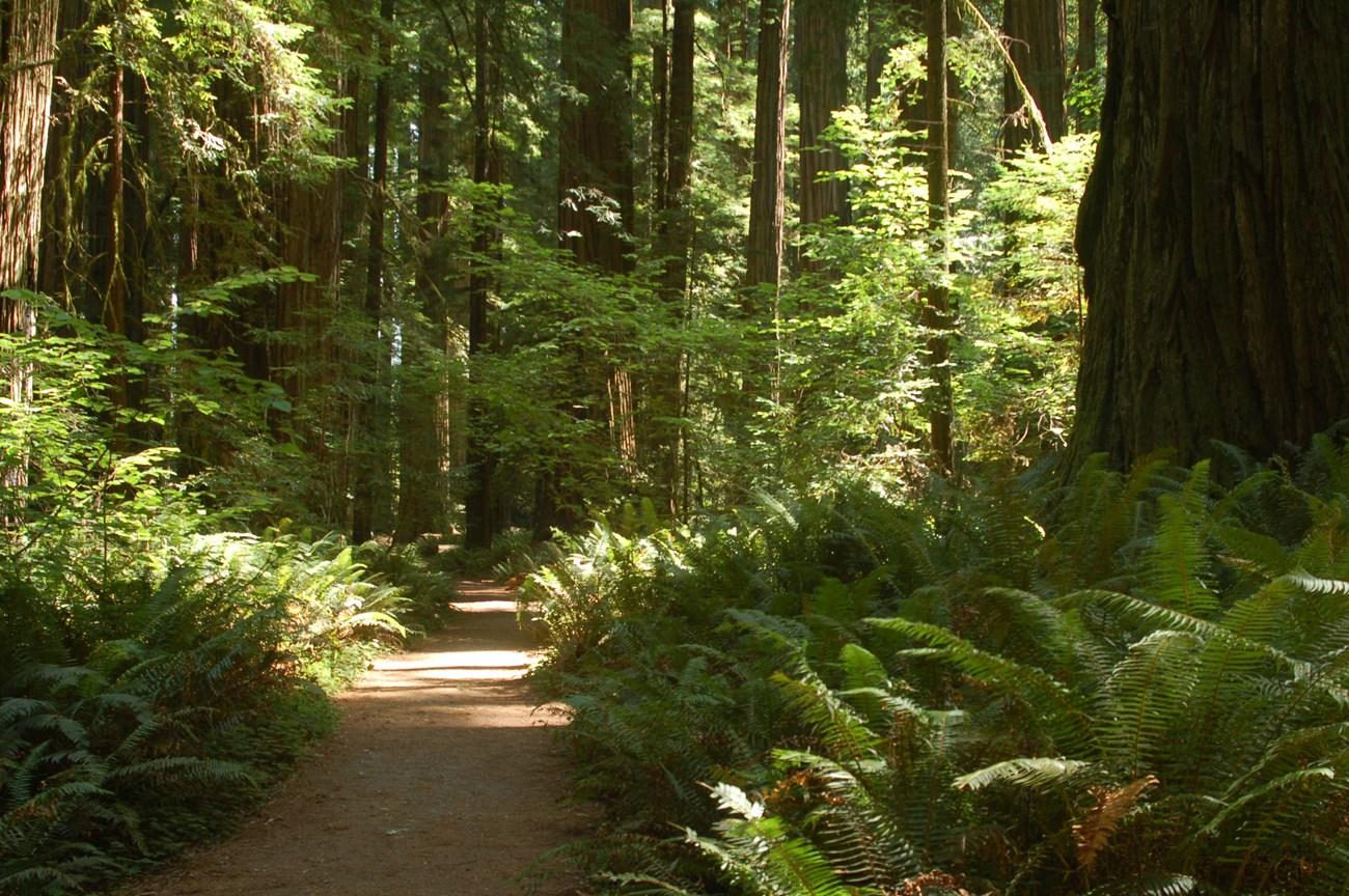
Explore North Coast California for ancient redwoods, rugged beaches, Victorian towns, harbour food and scenic drives from Sonoma to the Oregon border.
-

-

-

-


Swipe for more regions
Explore more
Explore more of California
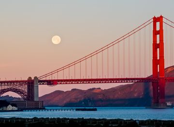
Discover California: A land of diverse landscapes, iconic cities, and endless adventures, from sun-soaked beaches to towering redwoods and vibrant cultural experiences.
Explore California