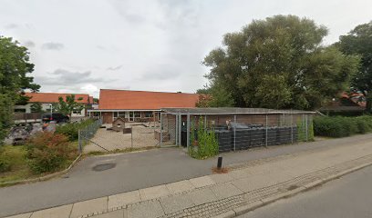
Yding Skovhøj Parking Area
Denmark's highest point awaits at this forest gateway, crowned with ancient Bronze Age mounds.
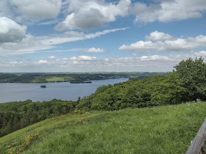
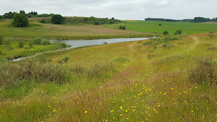
The parking area at Yding Skovhøj serves as the gateway to Denmark's highest point at 172.54 meters. Located in the Ejer Bjerge region near Skanderborg, this modest facility provides essential access to the summit and its Bronze Age burial mounds. The site features parking, restrooms, picnic tables, and panoramic views across the forested landscape and surrounding countryside.
A brief summary to Yding Skovhøjs parkeringsplads
- Skanderborg, 8660, DK
- Duration: 1.5 to 3 hours
- Free
-
 Outdoor
- Mobile reception: 3 out of 5
Local tips
- Visit during clear weather to maximize visibility from the summit and fully appreciate the panoramic views across the Gudenå valley and surrounding landscape.
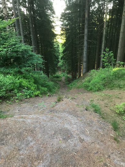
- Wear sturdy hiking boots for the steep forest path leading to the summit, as the terrain becomes challenging and can be muddy or slippery in wet conditions.
- Combine your visit with nearby attractions such as Sukkertoppen for alternative viewpoints or Den Genfundne Bro for cultural heritage exploration.
- Pack a picnic to enjoy at the tables provided near the parking area, taking advantage of the forest setting and peaceful atmosphere.
- Allow at least 1.5 to 2 hours for the round trip from the parking area, including time to explore the Bronze Age mounds and enjoy the summit views.
For the on-the-go comforts that matter to you
- Restrooms
- Seating Areas
- Picnic Areas
- Information Boards
Getting There
-
Car from Skanderborg
From Skanderborg town center, drive approximately 20 kilometers southwest on regional roads toward the Ejer Bjerge area. Follow signs for Yding Skovhøj or Skovhøjvej. The journey takes approximately 25–35 minutes depending on traffic and exact starting point. Parking is free at the dedicated parking area near Skovhøjvej. The route passes through rural countryside with winding roads typical of the region.
-
Bicycle from Silkeborg
From Silkeborg, cycle approximately 18 kilometers northeast toward the Ejer Bjerge region via regional cycling routes. The journey takes approximately 45–60 minutes and involves moderate elevation changes characteristic of the rolling terrain. The final approach includes a steep 85-meter climb from the base of the hill, though cyclists can dismount and walk the final forest section to the summit. Cycling is popular in this region, and dedicated routes connect several viewpoints.
-
Public transport from Horsens
From Horsens train station, take a regional bus service toward Skanderborg or Silkeborg. Service frequency varies seasonally, typically operating several times daily. The journey takes approximately 40–50 minutes. Confirm current schedules with local transport providers, as rural bus services may have limited weekend and evening service. From the bus stop, you may need to walk 1–2 kilometers to reach the parking area.
-
Hiking from nearby villages
Several small villages in the Ejer Bjerge region offer starting points for longer hiking routes that incorporate Yding Skovhøj. Walking routes typically range from 8–15 kilometers and take 2–4 hours depending on the chosen path and terrain. The landscape offers varied terrain with forest sections and open viewpoints. Detailed hiking maps and route information are available through local tourism resources.
Yding Skovhøjs parkeringsplads location weather suitability
-
 Clear Skies
-
 Mild Temperatures
-
 Cold Weather
Discover more about Yding Skovhøjs parkeringsplads
Gateway to Denmark's Highest Point
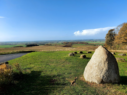
Yding Skovhøj parking area is the primary access point for visitors seeking to reach Denmark's highest elevation at 172.54 meters above sea level. Situated in the Ejer Bjerge region between Horsens and Silkeborg, this functional facility marks the beginning of the journey into one of Denmark's most distinctive natural landmarks. The parking area itself occupies a modest footprint within the forested landscape, designed to accommodate both day-trippers and serious hikers exploring the rolling terrain of East Jutland.Bronze Age Heritage and Summit Significance
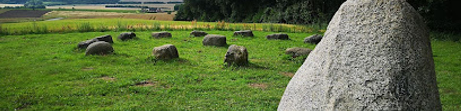
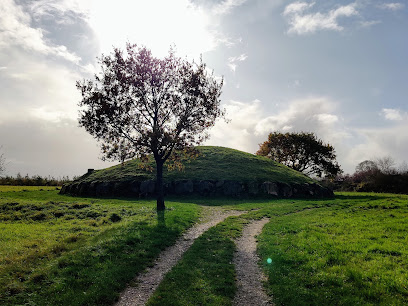
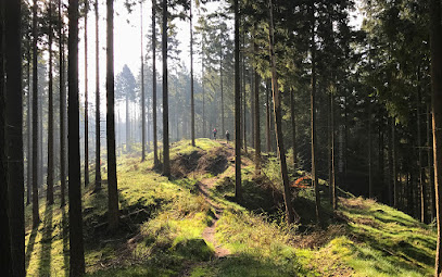
Atop Yding Skovhøj stand three Bronze Age burial mounds, with the highest point of the central mound reaching exactly 172.54 meters—more than one meter higher than Denmark's second-highest natural point. These ancient structures, created thousands of years ago, form an integral part of the site's character and historical importance. The mounds are partially situated within the surrounding forest, and interpretive signage at the location provides detailed information about their archaeological significance and the Bronze Age civilization that created them. This combination of natural elevation and archaeological heritage makes the site unique within Denmark's landscape.Practical Facilities and Accessibility
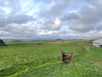
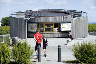
The parking area provides essential amenities for visitors, including restroom facilities, picnic tables, and benches. These conveniences make the location suitable for families and visitors of varying fitness levels. The site offers a pleasant outlook across the forested surroundings, with views extending into the broader Ejer Bjerge landscape. However, the parking area itself is not wheelchair accessible, and visitors seeking to reach the summit must be prepared for a steep forest path that requires leaving the parking area and ascending on foot through dense woodland.Landscape and Regional Context
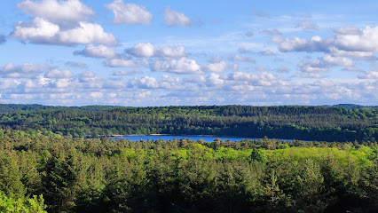
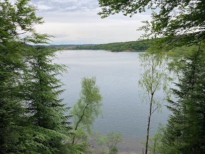
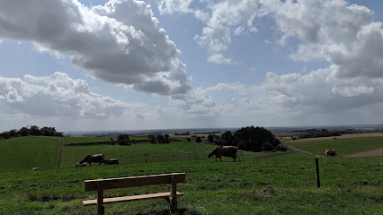
The parking area sits within the distinctive moraine landscape created during the final phase of the last ice age, characterized by rolling hills, dense forests, and winding rural roads. The Ejer Bjerge region is known for its idyllic villages nestled between woodland and agricultural land, creating a picturesque backdrop for outdoor recreation. Nearby attractions include Sukkertoppen, another significant viewpoint offering expansive vistas across the Gudenå valley and Mossø lake, as well as the historic Klostermølle and Den Genfundne Bro, a cultural heritage site of considerable importance.Seasonal Conditions and Weather Considerations
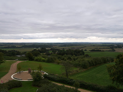
The site experiences typical Danish weather patterns, with winter months bringing cold temperatures and occasional snow, while summer offers mild to warm conditions ideal for hiking. The forested setting provides some shelter from wind, though the exposed summit can be blustery in adverse conditions. Clear weather significantly enhances the experience, as visibility from the top extends across the surrounding landscape, revealing the distinctive topography of the Ejer Bjerge region and distant features of the Danish countryside.Iconic landmarks you can’t miss
Ejer Bavnehøj
2.8 km
A modest Danish hill with a mighty horizon, Ejer Bavnehøj blends reunification history, beacon legends and big-sky views into an easy, rewarding countryside stop.
Genforeningssten på Ejer Bavnehøj
2.8 km
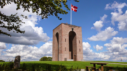
Denmark's third-highest point crowned with a monumental 1920 reunification memorial and iconic tower.
Ejerbavnehøj MØDESTED
5.0 km
Denmark's third-highest peak crowned by a 1924 monument to national reunification, offering panoramic views and historic significance.
Horsens Tourist Information Centre
13.4 km
Experience the heart of Danish comedy at Odense Comediehuus, where culture and laughter unite in the vibrant city center.
Jættestuen grønhøj
13.4 km
5.000 år gammel jættestue midt i det østjyske kulturlandskab – et stille møde mellem bondestenalderens stenkonstruktioner, skov, marker og Bygholm Sø.
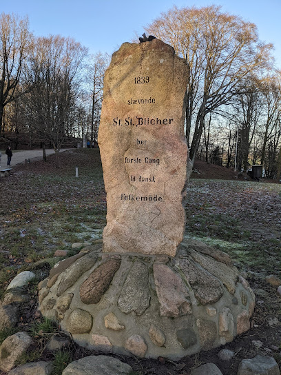
Folkemøde Mindesten anno 1839
14.2 km
Denmark's first democratic gathering, 1839—where ordinary citizens claimed their political voice.
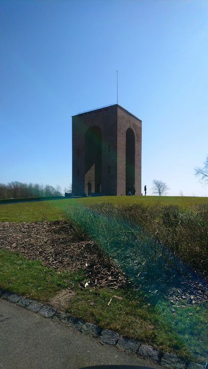
Det gamle vandtårn
14.3 km
Skanderborg's 41.5-meter castle-style water tower from 1908—a striking symbol of industrial heritage and urban progress.
Himmelbjerget rutebåd
14.7 km
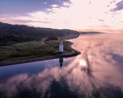
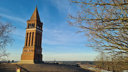
Denmark's highest point crowned by a historic tower, accessible by scenic lake cruise or forest trail.
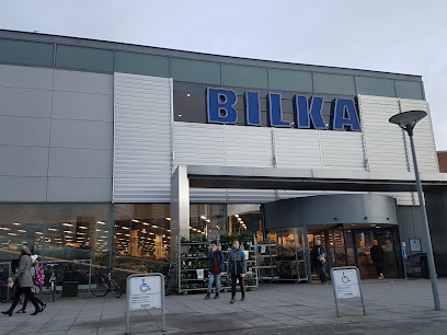
Bilka Horsens
15.4 km
Experience the rich theatrical heritage of Odense at the historic Comediehuus, a cultural landmark since its inception.
Årtusindeskifte Eg
15.5 km
An ancient oak rooted in Horsens' heart, where nature and urban life converge in timeless harmony.
Duedal Bjerg
20.9 km
A gentle 117-meter hill offering accessible hiking and scenic forest views in Denmark's Lake District.
De Små Fisk
21.3 km
Discover De Små Fisk near Silkeborg: a serene lakeside escape with a child-friendly beach, scenic trails, and primitive camping, perfect for nature lovers and families seeking outdoor adventures.
Lovisehøj
21.9 km
A 73-meter forest hill with royal heritage and sweeping views across Danish lakes and woodlands.
Knagerne Silkeborg
22.9 km
Explore Knagerne Silkeborg, an untouched ancient forest where time stands still, offering a unique and immersive nature experience in the heart of Denmark's Lake District.
Kroghs Bænk
23.1 km
Elevated forest sanctuary with panoramic lake views and 19th-century heritage
Unmissable attractions to see
Yding Skovhøj
1.0 km
Ancient Bronze Age burial mounds, gentle forest trails and a long-running “highest point” debate meet atop this modest yet characterful hill in East Jutland.
Møllehøj, DK's highest hill
2.5 km
A modest hill with a millstone marker, Møllehøj turns Denmark’s highest natural point into a gentle countryside detour packed with quiet geographic significance.
Møllehøj
2.6 km
Stand on Denmark’s highest natural point atop a quiet Jutland farm hill, marked by a lone millstone and wide views across the gently rolling Ejerbjerge.
Møllehjulet
2.7 km
Compact circular kiosk and information hub on Denmark’s rooftop at Ejer Bavnehøj, combining refreshments, facilities and landscape insight amid sweeping views.
Genforeningstårn på Ejer Bavnehøj
2.8 km
Step inside a living time capsule at Mølholmgård Købmandsmuseum, where the charm of Denmark’s rural merchant life is preserved in a historic village setting.
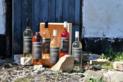
Justenborg Vin & Juletræer
4.8 km
Cut your own Christmas tree and taste estate-grown Danish wine in Skanderborg's countryside.
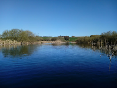
Tåning Å
5.0 km
A serene stream through Denmark's lake highlands, perfect for canoeing and wildlife observation.
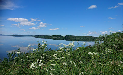
Mossø
5.1 km
Jutland’s largest lake, where wide horizons, protected birdlife and easygoing outdoor adventures meet in the rolling Danish Lake Highlands.
Slaggård Banke
6.5 km
Bronze Age barrows, big-sky vistas and a stargazing shelter on a glacial ridge above the Gudenå Valley, just beyond the village of Østbirk in Central Jutland.
The Uncovered Bridge
6.9 km
Step back in time at Høgdal, Central Jutland’s idyllic open-air museum, where authentic farm life, heritage crafts, and Danish rural traditions come vividly to life.
Øm Klostermuseum
7.3 km
Atmospheric monastery ruins and a specialist museum in skeletal archaeology, set between Jutland’s lakes with herb gardens, graves and traces of medieval monastic life.
Abbey Mill
8.2 km
Historic monastery mill turned lakeside retreat, where Denmark’s longest wooden building, canoe-filled waterways and big-sky views meet in the Mossø hills.
Fugletårn
8.9 km
Unassuming yet atmospheric, Skanderborg’s Fugletårn lifts you above reeds and water for calm, close-up encounters with East Jutland’s wetland birdlife all year round.

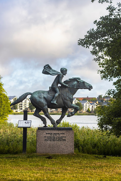
Skulptur, Dronning Dagmars dreng
9.1 km
A quiet bronze tribute to Queen Dagmar’s child, set between lake and forest outside Hotel Skanderborghus in Skanderborg’s tranquil parkland.
Kallehave bålhytte
10.1 km
A modest grill shelter tucked into the Kallehave woods near Gl. Rye, perfect for unhurried campfire cooking and a quiet break on forest hikes.
Essential places to dine
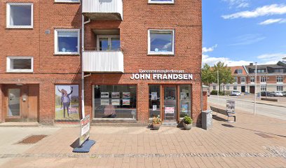
Restaurant Møllebæk
6.4 km
Rural Danish restaurant and events venue near Gedved, renowned for hearty stegt flæsk evenings and relaxed, homely celebrations in a countryside setting.
Rasses Skovpølser
8.4 km
Legendary forest grill in Skanderborg serving award‑winning bøfsandwich, juicy burgers and hotdogs in a casual beech‑wood setting since 1962.
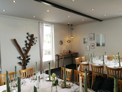
Svejstrup Præstegård
9.2 km
Historic rectory garden transformed into a seasonal summer restaurant and cultural venue.
Lunch Time ApS
9.9 km
Weekday Danish lunch spot in Skanderborg's town center, open 7:30 AM–5:00 PM Monday–Friday.
Restaurant Sølyst
10.5 km
Lakeside Danish dining on the edge of Skanderborg Lake, where classic “from soil to table” cooking meets relaxed marina views and long, light-filled evenings.
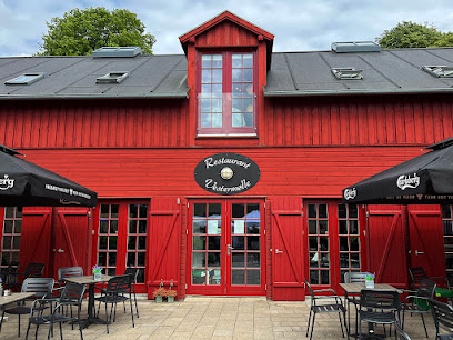
Vestermølle
11.0 km
Historic lakeside mill turned modern Nordic restaurant, blending seasonal Danish flavours with broad views over Skanderborg Lake and a relaxed countryside atmosphere.
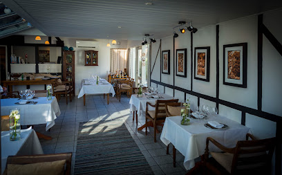
Lyng Dal Hotel og Restaurant
11.0 km
Intimate family-run hotel and seasonal restaurant in Ry, where garden-driven Danish cuisine, good wine and quiet countryside surroundings create a cosy Jutland escape.
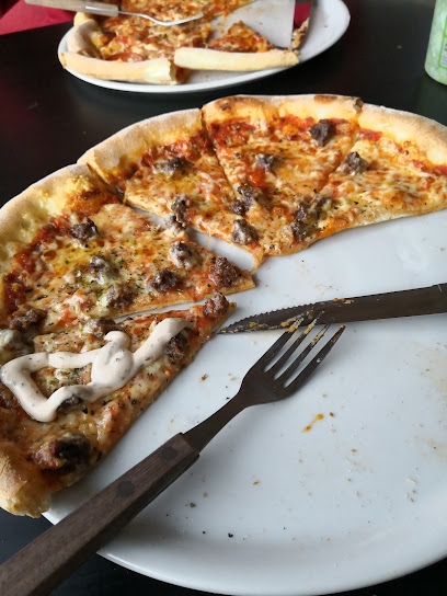
Dayny Restaurant
11.1 km
Casual neighborhood pizzeria and takeaway in Skanderborg’s Højvang Center, serving generous pizzas, grills and rolls in a relaxed, everyday setting.
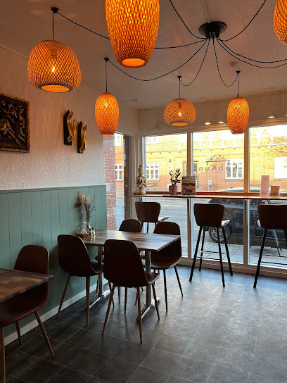
KobKun
11.3 km
Tiny Thai kitchen in the heart of Ry, serving fragrant curries and stir-fries in an intimate 13-seat space with a strong local takeaway following.
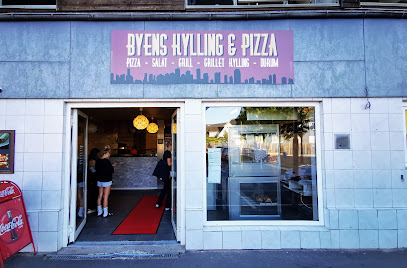
Byens Kylling & Pizza Ry
11.3 km
Casual neighborhood pizza and chicken takeaway in Ry, serving hearty portions and familiar flavors for easy, budget‑friendly dinners after a day outdoors.
Umisushi
11.3 km
Neighbourhood sushi and takeaway in the lakeside town of Ry, serving fresh rolls and casual Japanese favourites in a relaxed, modern setting.

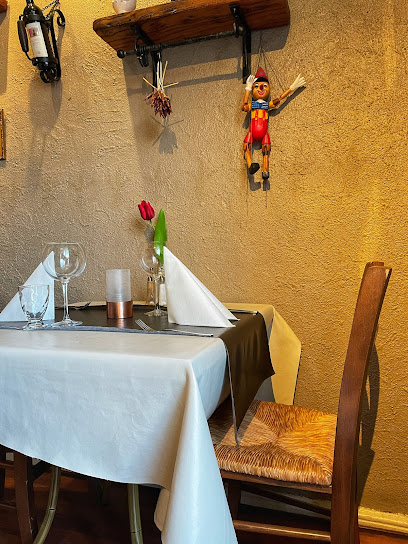
Restaurant Da Angelo
11.4 km
Authentic Italian dining in the heart of Ry's charming lakeside town center.
Ry Gastropub
11.4 km
Relaxed gastropub heart of Ry, serving comforting pub favourites, modern Danish flavours and easygoing drinks in a warm, social setting from lunch to late evening.
Hotel Ry
11.4 km
Contemporary comfort in Denmark's scenic heartland, where golf, hiking, and local gastronomy meet.
Brasseri Ry'tteriet
11.4 km
Intimate hotel brasserie in lakeside Ry, pairing French‑inspired comfort food, seasonal Danish ingredients and candlelit evening ambience in the heart of Søhøjlandet.
Markets, malls and hidden boutiques
Anne & Lotte
4.0 km
A cozy little gift shop on Østbirk’s main street, filled with Scandinavian-style homewares and thoughtful presents in a relaxed, small-town atmosphere.
Ville vintage
4.0 km
Discover timeless treasures and unique vintage finds at Ville Vintage in Skanderborg.
Red Cross Op Shop
4.1 km
Volunteer-run Red Cross thrift shop in Østbirk where low-priced fashion, furniture and curios support both local community life and international humanitarian work.
Shell / 7-Eleven Ejer Bavnehøj West
4.6 km
24/7 motorway pit stop at Ejer Bavnehøj, combining Shell fuel and a compact 7‑Eleven shop for coffee, snacks and essentials on the E45 through Jutland.
Provence Antik
5.8 km
Curated Provençal antiques and vintage treasures in the heart of Skanderborg.
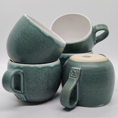
Boserup Keramik
6.3 km
Intimate countryside ceramics studio in East Jutland, where handcrafted stoneware cups, vases and sculptures are created and sold directly from the potter’s own workshop.
Christys Festtøj
7.1 km
Gedved's premier boutique for bridal gowns and elegant occasion wear.
Else Rønne Keramik
7.4 km
Handcrafted Danish ceramics emphasizing minimalist design and functional beauty in a rural Jutland workshop.
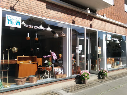
Deko Home - Danish Recycling Furniture
7.8 km
Timeless Danish furniture crafted entirely from recycled wood in a working studio.
Kjærsgaard Kød
8.3 km
Traditional Danish butcher preserving heritage craft and sustainable meat sourcing in rural Skanderborg.
Dagli'Brugsen Gl. Rye
11.0 km
Community-owned supermarket where every purchase strengthens local bonds and supports sustainable living.
Made by Ella
11.1 km
Intimate goldsmith’s studio in Ry, where local jewelry artist Julie Ella Jappe handcrafts custom designs and contemporary pieces in a calm, small-town setting.
by Diana
11.3 km
An intimate Ry lingerie boutique offering personal fittings, Scandinavian style and a carefully curated selection of everyday essentials and special-occasion pieces.
Taste
11.3 km
Intimate Ry boutique for thoughtfully chosen lingerie and womenswear, offering calm, personal service and understated Nordic style on Skanderborgvej.
Toft suits men & women
11.4 km
Distinctive menswear and womenswear for those who value timeless quality and personal style.
Essential bars & hidden hideouts
Sprutskuret I/S
4.0 km
A cosy, no-fuss neighborhood bar on Østbirk’s main street, where simple drinks, local life and unhurried conversations create a classic small-town Danish atmosphere.
Værtshus
9.6 km
A compact, unpretentious local bar on Adelgade where Skanderborg’s everyday life gathers over simple beers, easy conversation and a relaxed evening atmosphere.
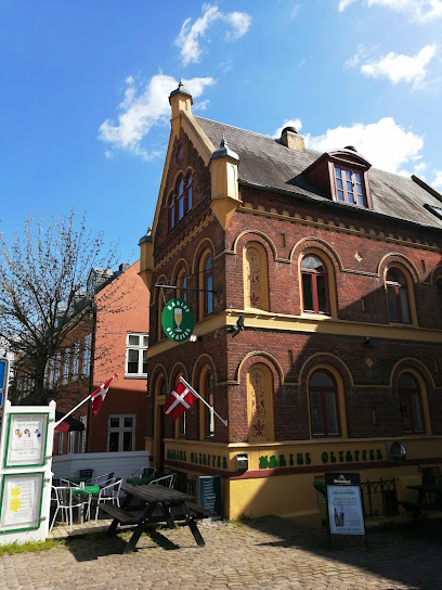
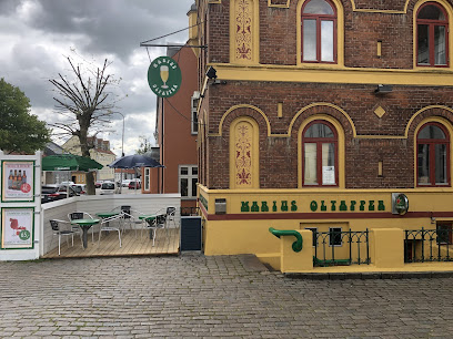
Marius Øltapper
9.6 km
Unpretentious Skanderborg bar on Adelgade pouring well-kept beers and offering a relaxed slice of Danish pub life from midday pints to late weekend nights.
Bar Bund
9.8 km
Cozy neighborhood bar on Adelgade in central Skanderborg, pouring classic drinks in an intimate, low-lit setting that comes alive on weekend evenings.
Bar 8660
9.8 km
Cosy local pub and brewery bar on Adelgade, pouring Skanderborg Bryghus beers, classic drinks and simple bar bites for relaxed evenings in central Skanderborg.
Ambolten Ry
11.3 km
Cosy neighborhood bar and social hub in the heart of Ry, mixing cold beers, live music and small-town charm in a laid-back, living-room atmosphere.
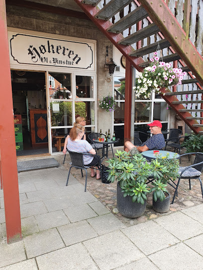
Høkeren
11.4 km
Possibly Denmark’s smallest pub, Høkeren in Ry distills classic Danish tavern culture into 18 sociable square meters of wood, warmth and well‑poured drinks.
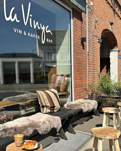
La Vinya
11.4 km
Chic wine bar and tapas lounge in Ry, offering curated wines, local bites, and cozy ambiance—perfect for unwinding after your Himmelbjerget adventure.
Gerd Bär Gmbh
13.2 km
Casual neighborhood bar with friendly service and solid drink selection in Skanderborg.
Kom Tit
14.0 km
Smoky, old-school Horsens pub in a yellow 19th-century building, with cheap beers, billiards, darts and a laid-back local crowd from midday to late night.
The Long Field Road
14.0 km
AC Horsens’ Irish-inspired fan pub, where yellow-and-black passion, cold beer and stadium buzz come together in one lively Horsens clubhouse.
Værtshuse
14.4 km
A compact, traditional Danish bar on Allegade in Horsens, serving simple drinks and everyday atmosphere for those who enjoy classic brown‑pub charm.
Horsens Sport og Pool Bar
14.6 km
Central Horsens sports bar with 23 screens, pool tables, and competitive games in a welcoming, energetic atmosphere.
Stalden
14.6 km
Relaxed pool and sports bar in central Horsens, blending cue sports, big-screen matches, board games, casual bites and easygoing drinks in one social hangout.
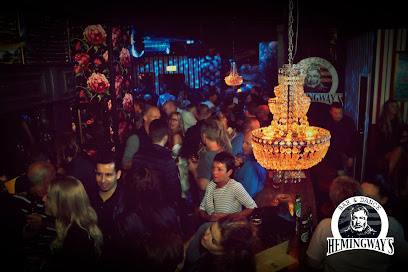
Hemingway's Horsens
14.6 km
Late-night bar and nightclub in central Horsens, delivering cocktail-fueled weekends, loud music, and a packed dance floor until the early morning hours.
Nightclubs & after hour spots
Team Paderborner
8.8 km
Nightclub entertainment in Denmark's scenic Dyrehaven forest and lakeside setting.
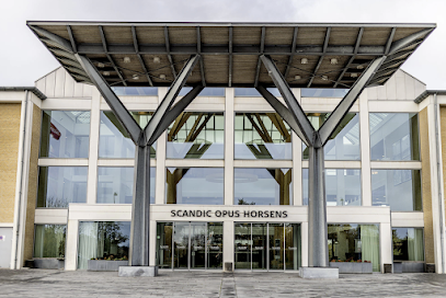
Scandic Opus Horsens
13.1 km
A contemporary Scandinavian hotel in Horsens with spa, dining, and panoramic city-to-nature views—an elegant gateway to both urban and outdoor experiences.
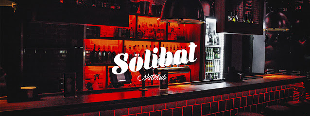
Sölibat Natklub
14.6 km
Late-night, no-frills clubbing in central Horsens, where loud music, simple drinks and a compact dance floor create an unapologetically local party vibe.
Oskar hossman
15.0 km
Compact, high-energy nightclub in central Horsens, where pulsing beats, colourful lights and a sociable crowd define the city’s after-hours heartbeat.
PDD
15.2 km
Compact, no-frills nightclub on Lindvigsvej in Horsens, offering late-night dancing, simple drinks and an intimate, local-party atmosphere on weekends.
Horsens New Style Dance Club
18.4 km
Horsens' premier line dancing venue where beginners and advanced dancers unite in movement and community.
Bastian Bar & Nightclub, Odder - Nightclub
22.0 km
Odder's central nightlife destination for weekend entertainment and social gathering

B'sharp - Silkeborg Rhythm Og Blues Association
24.7 km
Volunteer-run blues stronghold in central Silkeborg, where intimate weekend concerts, affordable drinks and close-up performances keep rhythm & roots music alive.
Kedelhuset
24.8 km
Kedelhuset: Silkeborg’s buzzing live music and culture venue, blending industrial heritage with creative energy in the lively riverside Papirfabrikken district.
Riverboat Jazz Festival
24.8 km
Scandinavia’s celebrated Riverboat Jazz Festival: riverside concerts, boat gigs, and open-air revelry set against Silkeborg’s scenic lakes and vibrant summer spirit.
Luksusmassage Århus
29.3 km
Experience Aarhus's dynamic nightlife at Luksusmassage, where music and energy blend for an unforgettable evening.
KLUB22
30.6 km
Discover the ultimate nightlife experience at KLUB22 in Aarhus, where electrifying music and vibrant atmosphere await.
Flintstone Pub
31.1 km
Flintstone Pub in Aarhus blends retro décor, affordable drinks, and live music, offering a lively gathering place for locals and visitors in the city’s central quarter.
V58
31.2 km
Experience the vibrant nightlife at V58 in Aarhus, where live music meets an energetic atmosphere for an unforgettable night out.
equalclub
31.2 km
Discover the thriving nightlife of Aarhus at Equal Club, where music, dance, and unforgettable experiences come together.

For the vibe & atmosphere seeker
- Scenic
- Adventurous
- Nature Escape
- Tranquil
For the architecture buff
- Historic
- Sacred Sites
For the view chaser and sunset hunter
- Panoramas
- Iconic Views
For the social media creator & influencer
- Photo Spots
- Architectural Shots
For the eco-conscious traveler
- Protected Area
- Locally Managed
- Wildlife Habitat
For the kind of experience you’re after
- Cultural Heritage
- Myth & Legends
- Nature Escape
- Day Trip
For how adventurous you want the journey to be
- Easy Access
- Requires Hike
- Physically Demanding
Location Audience
- Family Friendly
- Senior Friendly
- Solo Friendly
- Couple Friendly


