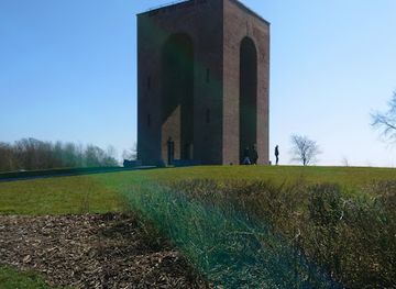
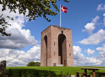
The Uncovered Bridge
A century-hidden railway bridge restored to glory, now a scenic riverside landmark with woodland trails and engineering heritage.
A remarkable steel lattice bridge spanning the Gudenå River near Brædstrup, this 1899 engineering marvel was buried beneath a dam for 85 years before its dramatic excavation and restoration in 2014. Rising 13.4 metres above the water, it once served as part of a private railway and stands as Denmark's tallest Nordic bridge of its era. Today, it anchors a scenic destination with woodland trails, picnic facilities, and riverside views, attracting visitors year-round.
A brief summary to The Uncovered Bridge
- Vestbirkvej 2, Braedstrup, 8740, DK
- Duration: 1 to 4 hours
- Free
-
Outdoor
- Mobile reception: 4 out of 5
Local tips
- Combine your bridge visit with the surrounding hiking routes—the 1.3 km forest walk to Vestbirk Lakes or the longer 7 km trail to Brædstrup town centre offer natural extensions to your visit.
- Bring a picnic and use the tables and benches near the bridge to enjoy a meal with river views. The peaceful Gudenå setting creates an ideal atmosphere for a leisurely lunch.
- Visit during warm, sunny days to fully appreciate the bridge's red steel lattice design and enjoy clear views across the river valley and surrounding woodland.
- If using GPS navigation, enter 'Brædstrup' as your destination rather than 'Østbirk' to ensure you arrive at the correct car park on Vestbirkvej.
- Read the informative signboards on-site to learn the full story of the bridge's construction, burial, and rediscovery—they provide fascinating context for your visit.
For the on-the-go comforts that matter to you
- Restrooms
- Seating Areas
- Picnic Areas
- Trash Bins
- Information Boards
Getting There
-
By Car
From Horsens, drive north approximately 20 kilometres towards Brædstrup. Follow signs to Vestbirkvej and the car park at Vestbirkvej 2A, Brædstrup (8752). The journey takes approximately 25–30 minutes. Free parking is available for 85 vehicles, including accessible spaces. From the car park, a well-maintained paved path leads 300 metres to the bridge. GPS coordinates: 55.973199, 9.689758. Note: enter 'Brædstrup' in GPS rather than 'Østbirk' to reach the correct location.
-
By Bicycle
The bridge sits on established regional cycling routes connecting Horsens and Brædstrup. From Horsens town centre, follow cycling route signs northward towards Brædstrup (approximately 20 kilometres, 1–1.5 hours depending on fitness and route). The bridge is well-signposted along these routes. Secure bicycle parking is available near the car park area.
-
By Public Transport and Walking
Bus services operate between Horsens and Brædstrup, with journey times of approximately 40–50 minutes depending on the route and stops. Alight at Brædstrup town centre or nearby stops. From Brædstrup, the bridge is accessible via a 7-kilometre woodland walking trail (approximately 1.5–2 hours), which also serves as a scenic route for cyclists. Alternatively, some bus routes may stop closer to the site—check local transport schedules for the most direct option.
-
By Horse
Equestrian access is accommodated via a ford constructed specifically for horseback riders. Approach from established bridleways in the region. The site welcomes riders and provides safe crossing facilities at the Gudenå.
The Uncovered Bridge location weather suitability
-
Any Weather
-
Clear Skies
-
Mild Temperatures
Discover more about The Uncovered Bridge
A Bridge Rediscovered After Nearly a Century
The Uncovered Bridge—known locally as Den Genfundne Bro—is one of Denmark's most compelling historical sites, combining industrial heritage with natural beauty. Built in 1899 as part of a private railway connection between Horsens and Bryrup, this striking red steel lattice structure was engineered to span the Gudenå River at a height of 13.4 metres. At the time of its construction, it was the tallest bridge of its kind in the entire Nordic region, a testament to the ambition and skill of its builders. The bridge's extraordinary story took an unexpected turn in 1929, when changing railway standards rendered it obsolete. Rather than modify the expensive structure, railway authorities made a fateful decision: they buried it. A massive dam was constructed directly over the bridge, completely concealing it beneath sand and earth. For 85 years, the bridge vanished from public memory, hidden from view while the Gudenå's waters were diverted through pipes beneath the embankment.The Dramatic Excavation and Restoration
In 2014, the Municipality of Horsens initiated an ambitious restoration project that would transform the site forever. On April 7, 2014, the first steel grid saw daylight after nearly nine decades of darkness. The excavation captured widespread media attention and drew crowds of spectators eager to witness this rediscovery. The restoration process was meticulous and labour-intensive: the bridge was carefully sandblasted using 3000-bar pressure, stripped of its old lead-heavy paint, ground, primed, and repainted with meticulous attention to every detail. The supporting towers underwent the same rigorous treatment. Once restored to its original splendour, the bridge was fitted with modern safety railings and a robust wooden pedestrian walkway made from Azobe wood, allowing visitors to cross safely while preserving its historical integrity. The creek itself was stabilized with large rocks and enhanced with spawning sites for trout, restoring ecological balance to the waterway. The official inauguration ceremony on December 13, 2014, marked the bridge's triumphant return to public life.Engineering Excellence Preserved in Steel
The bridge's physical specifications remain impressive: 50 metres in length and 13.4 metres in height, constructed with the precision and craftsmanship characteristic of late 19th-century industrial engineering. Its red steel lattice design is both functional and visually striking, creating a distinctive silhouette against the surrounding landscape. The bridge originally cost 691,800 Danish kroner when built—a substantial sum reflecting the quality of its construction. Today, it stands as a living museum of engineering achievement, demonstrating how thoughtful restoration can honour historical significance while making heritage accessible to contemporary visitors.A Gateway to Nature and Outdoor Exploration
The bridge serves as an ideal starting point for exploring the surrounding Bakkelandet region. Well-maintained woodland trails radiate outward, offering routes ranging from leisurely 1.3-kilometre walks to more ambitious 11-kilometre hikes. To the southeast, a scenic path leads through forest to the Vestbirk Lakes, where visitors can enjoy views over Naldal Lake and Vestbirk Lake. The newer natural area of Natur Østbirk lies a few kilometres further along this route. Heading northwest, a 7-kilometre trail connects to the charming town of Brædstrup, where cafés and restaurants await. The bridge also sits on established cycling routes, making it accessible to cyclists exploring the region's network of paths. For equestrian enthusiasts, a ford has been constructed to accommodate horseback riders.Facilities and Practical Amenities
The site is well-equipped for visitors of all abilities. A spacious car park with capacity for 85 vehicles sits approximately 300 metres from the bridge, with two accessible spaces and two coach bays. The paved path from the car park is smooth and suitable for wheelchair users, ensuring inclusive access to the bridge itself. Picnic tables and benches are scattered throughout the area, providing comfortable spots for meals and rest. Modern facilities including restrooms and information boards enhance the visitor experience. The site is open to the public at all times, though daylight hours are recommended for optimal enjoyment. Entry is completely free, and parking incurs no charge.Seasonal Character and Best Times to Visit
While the bridge and surrounding trails are accessible year-round, the site reveals different characters across the seasons. Warm, sunny days enhance the natural beauty and make riverside walks particularly pleasant. Winter visits offer their own appeal, with snow-covered landscapes creating a serene atmosphere and transforming the industrial heritage into a striking contrast with nature. Spring and autumn bring vibrant foliage and comfortable temperatures for extended exploration. The area experiences moderate visitor numbers throughout the year, with slightly higher crowds during peak summer months and weekends.For the vibe & atmosphere seeker
- Scenic
- Tranquil
- Unique
- Adventurous
For the design and aesthetic lover
- Industrial Designs
- Retro Vibes
For the architecture buff
- Historic
- Landmarks
- Industrial
For the view chaser and sunset hunter
- Iconic Views
- Panoramas
- Waterfront
For the social media creator & influencer
- Instagrammable
- Photo Spots
- Architectural Shots
For the eco-conscious traveler
- Protected Area
- Locally Managed
- Wildlife Habitat
For the kind of experience you’re after
- Cultural Heritage
- Photowalk
- Nature Escape
- Day Trip
For how adventurous you want the journey to be
- Easy Access
- Requires Hike
Location Audience
- Family Friendly
- Senior Friendly
- Wheelchair Access
- Pet Friendly
- Solo Friendly
- Couple Friendly