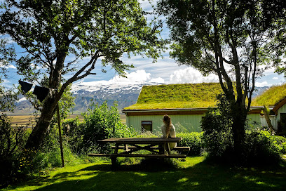
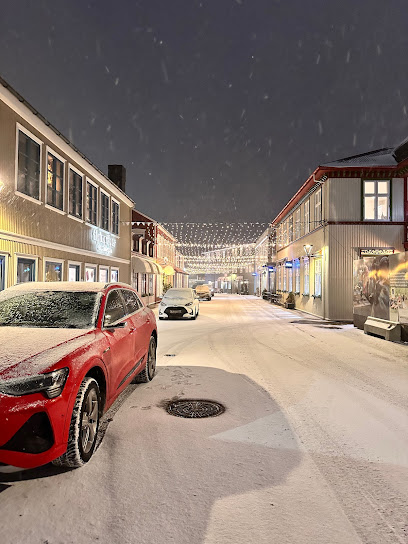
Discover the Majestic Fimmvorduhals Trailhead
Explore the stunning Fimmvorduhals Trailhead in Iceland, where breathtaking landscapes and exhilarating hikes await every adventurer.
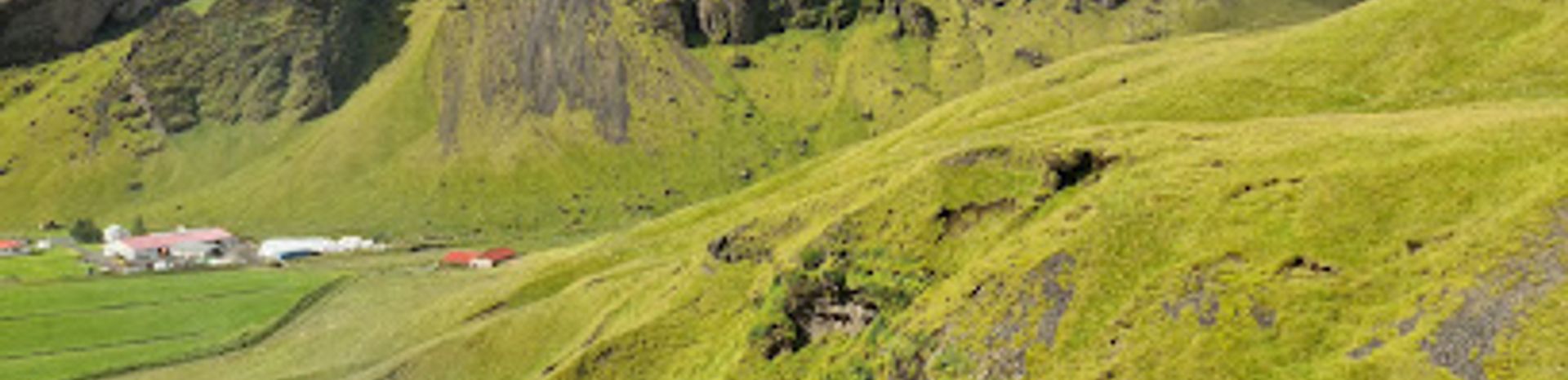
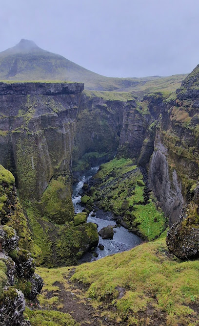
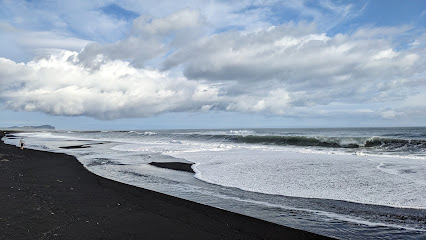
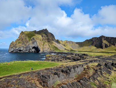
Nestled between two glaciers, the Fimmvorduhals Trailhead is an adventurer's paradise, offering breathtaking views and challenging hikes for tourists eager to explore Iceland's stunning landscapes.
A brief summary to Fimmvorduhals Trailhead
- Gönguleið um Fimmvörðuháls, IS
Local tips
- Start your hike early in the morning to avoid crowds and enjoy the peaceful surroundings.
- Check the weather forecast before your hike, as conditions can change rapidly in Iceland.
- Wear sturdy hiking boots and dress in layers to accommodate varying temperatures.
- Be sure to carry enough water and snacks, as there are no facilities along the trail.
- Consider taking a guided tour if you're unfamiliar with hiking in rugged terrains.
Getting There
-
Car
If you are driving to the Fimmvorduhals Trailhead, start from the nearest town, Hvolsvöllur. Head east on Route 1 (the Ring Road) for approximately 37 km. Then, take a left onto Route 249, which will lead you towards Þórsmörk. Follow Route 249 for about 20 km until you reach the parking area near the trailhead. Be aware that the road may be gravel and could require a 4x4 vehicle, especially during certain weather conditions.
-
Public Transportation
To reach the Fimmvorduhals Trailhead using public transportation, take a bus from Reykjavik to Hvolsvöllur. Buses are operated by Straeto and the journey takes approximately 1.5 to 2 hours. Once in Hvolsvöllur, you will need to arrange a taxi or shuttle service to take you to the trailhead, as public transport does not go directly there. Expect to pay around 10,000 ISK for a taxi from Hvolsvöllur to the trailhead.
-
Taxi or Shuttle Service
If you prefer a more direct route after arriving in Hvolsvöllur, consider hiring a local taxi or shuttle service. Several companies offer rides to the Fimmvorduhals Trailhead. It is advisable to book this in advance, especially during peak tourist season. Prices may vary, but you can expect to pay around 10,000 ISK to 15,000 ISK for a one-way trip.
-
Hiking
Once you arrive at the Fimmvorduhals Trailhead, you can begin your hike. The trailhead is located at coordinates 63.5326° N, 19.5092° W, marked clearly along the hiking path. Ensure to bring appropriate hiking gear, food, and water, as this hike can take several hours.
Discover more about Fimmvorduhals Trailhead
Iconic landmarks you can’t miss
Fremri-Fellsfoss
1.3 km
Experience the breathtaking beauty of Fremri-Fellsfoss, a stunning waterfall along the Fimmvörðuháls hiking trail in Iceland's majestic landscapes.
Gamla fjósið
9.4 km
Experience the flavors of Iceland at Gamla fjósið, a cozy restaurant in Eyjafjöll that offers traditional dishes with a modern twist.

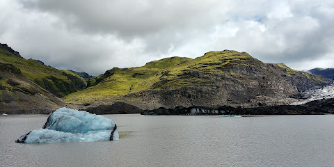
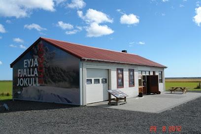
Eyjafjallajökull
12.0 km
Discover the breathtaking beauty of Eyjafjallajökull Glacier, a stunning natural wonder in Iceland, perfect for adventure and exploration.
Eyjahóll
13.9 km
Explore Eyjahóll, a historical landmark in Iceland, where rich heritage meets stunning natural beauty in a serene landscape.

Básar Hut & campsite
16.0 km
Discover the breathtaking landscapes of Þórsmörk at Básar Hut & Campsite, offering cozy accommodations and a taste of Icelandic hospitality.

Básar, Þórsmörk
16.1 km
Explore the breathtaking beauty of Þórsmörk at Bálar, a unique campground offering adventure, relaxation, and local flavors in the heart of Iceland's nature.

Thorsmork Skagfjörðsskáli
16.9 km
Experience the natural beauty and adventure of Thorsmork Skagfjörðsskáli, Iceland's enchanting valley perfect for hikers and nature lovers.

Volcano Huts Húsadalur
17.7 km
Discover the serene beauty of Volcano Huts Húsadalur, your gateway to Iceland's stunning landscapes and adventure-filled days.

Farmhouse Lodge
19.0 km
Experience the tranquility and breathtaking scenery at Farmhouse Lodge, your perfect Icelandic retreat in Vik, surrounded by nature's wonders.
Porsmork
19.3 km
Explore the stunning Porsmork Ravine, a natural wonder in Iceland with breathtaking landscapes, diverse wildlife, and unforgettable hiking adventures.

Sauðhúsvöllur Kofinn
21.1 km
Explore the serene beauty and rich history of Sauðahúsvellur Kofinn, an enchanting historical landmark in Iceland's stunning landscapes.

Þórólfsfell
21.2 km
Discover the breathtaking beauty of Þórólfsvell, a majestic mountain peak in Iceland perfect for hiking and nature exploration.

Katla volcano
22.6 km
Explore Katla Volcano, an iconic Icelandic landmark, known for its breathtaking landscapes, adventurous activities, and fascinating geological features.

Fljotsdalur HI Hostel
23.2 km
Experience the heart of Iceland at Fljotsdalur HI Hostel, your home away from home amidst stunning natural landscapes.
Dyrhólaey Viewpoint
23.9 km
Explore the stunning Dyrhólaey Viewpoint near Vik, Iceland — a must-see for breathtaking coastal views and unique rock formations.

Unmissable attractions to see
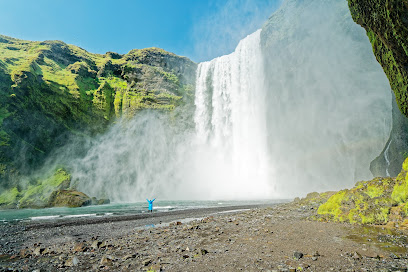
Skógafoss
0.1 km
Explore the captivating beauty of Skógafoss, one of Iceland's most stunning waterfalls, and experience the magic of nature's artistry.
Steinbogafoss
0.7 km
Discover Steinbogafoss, a serene waterfall in Iceland, perfect for nature lovers and photographers seeking a peaceful escape amidst stunning landscapes.

Skógar Museum
1.1 km
Explore Iceland's captivating past at Skógar Museum, where history comes alive through traditional buildings and rich cultural exhibits.
Innri-Fellsfoss
1.4 km
Discover the breathtaking beauty of Innri-Fellsfoss, a mesmerizing waterfall in Iceland's stunning landscapes, perfect for nature lovers and adventurers.

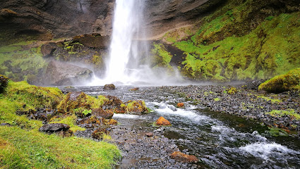
Kvernufoss
1.5 km
Experience the breathtaking beauty of Kvernufoss, a hidden waterfall nestled in Iceland's stunning landscapes, perfect for nature lovers and adventurers alike.
Rollutorfufoss
1.5 km
Experience the stunning beauty of Rollutorfufoss, a hidden waterfall gem in Iceland, surrounded by breathtaking landscapes and serene tranquility.

Skalabrekkufoss waterfall
1.9 km
Explore the enchanting Skalabrekkufoss waterfall, a hidden gem in Iceland offering breathtaking views and serene natural beauty.

Kæfufoss
2.0 km
Explore Kæfufoss: A Hidden Gem of Iceland's Natural Beauty Awaits You.

Drangurinn í Drangshlíð 2
2.4 km
Explore Drangurinn í Drangshlíð, a historical landmark in Iceland offering breathtaking views and a deep connection to the region's rich heritage.

Fimmvörðuháls trail
2.9 km
Discover the breathtaking beauty of the Fimmvörðuháls Trail, a top hiking destination showcasing Iceland's stunning landscapes and natural wonders.
Rutshellir Caves
3.3 km
Unveil the natural beauty and historical significance of Rutshellir Caves, a remarkable geological wonder in Iceland's breathtaking landscape.

Bridge Falls
5.8 km
Discover the breathtaking beauty of Bridge Falls, a natural gem in Iceland, perfect for nature lovers and adventure seekers alike.

Termální koupaliště
6.0 km
Experience the soothing mineral waters of Termálním koupališti, Iceland's tranquil geothermal spa surrounded by breathtaking natural beauty.
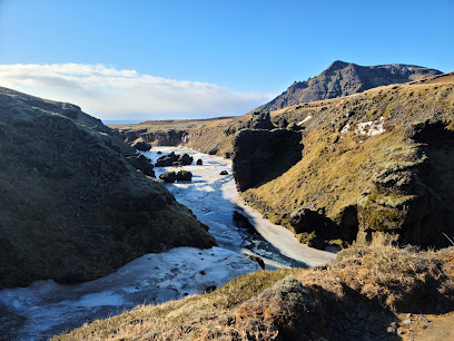
Sólheimajökull
7.5 km
Explore the breathtaking beauty of Sólheimajökull glacier, where adventure and stunning Icelandic landscapes await every visitor.
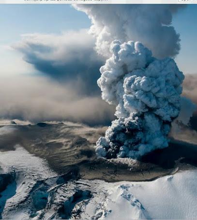
Eyjafjallajökull Erupts
7.9 km
Explore the majestic Eyjafjallajökull, a stunning glacier and volcano in Iceland, renowned for its dramatic eruptions and breathtaking landscapes.
Essential places to dine
Skogafoss Bistro Bar
0.6 km
Savor authentic Icelandic cuisine at Skogafoss Bistro Bar near stunning waterfalls – an unmissable culinary experience!

Mia's Country Van - Local Fish & Chips
0.9 km
Experience authentic Icelandic flavors at Mia's Country Van - your go-to spot for delicious fish & chips in Hvolsvöllur.

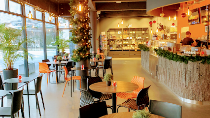
Freyacafe
1.2 km
Experience delightful dining at Freyacafe in Skogar Museum, where local flavors meet Icelandic culture in a picturesque setting.

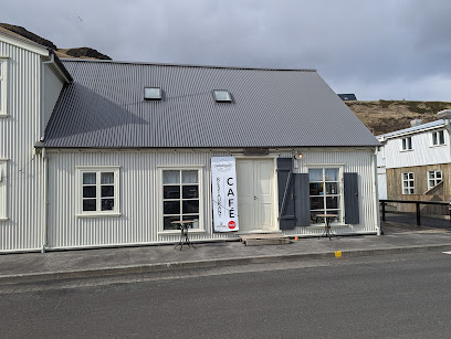
Heimamenn
3.0 km
Discover authentic Icelandic flavors at Heimamenn in Hvolsvöllur—a cozy restaurant and coffee store perfect for every traveler.

Lángos Factory
6.9 km
Discover authentic Icelandic street food at Lángos Factory - where traditional flavors meet stunning natural beauty.

Boutique Hotel Anna
14.8 km
Experience exceptional dining and luxurious accommodations at Boutique Hotel Anna, where Icelandic beauty meets gourmet cuisine.

Black Beach Restaurant
27.2 km
Experience exquisite Icelandic cuisine at Black Beach Restaurant while enjoying stunning views of Reynisfjara's black sands and dramatic cliffs.

Restaurant Suður-Vík
27.7 km
Experience authentic Icelandic cuisine with stunning views at Restaurant Suður-Vík in Vík.

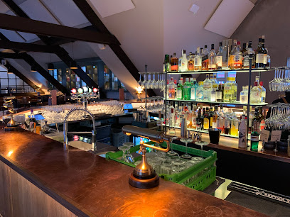
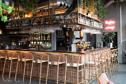
Kjallarinn - Cocktail Bar
27.7 km
Discover Kjallarinn Cocktail Bar in Vik: A hidden gem serving expertly crafted cocktails in an inviting speakeasy atmosphere.

Black Burger Kitchen
27.9 km
Savor gourmet burgers made from fresh local ingredients at Black Burger Kitchen in Vik, Iceland - a true taste sensation!

Hótel Vík
28.2 km
Discover comfort at Hótel Vík - your gateway to Iceland's stunning south coast landscapes and unforgettable adventures.
Berg Restaurant
28.2 km
Experience authentic Icelandic cuisine with breathtaking views at Berg Restaurant in Vík.

Ströndin • Pub
28.3 km
Discover Ströndin Pub in Vík: A perfect blend of local flavors and cozy ambiance amidst breathtaking Icelandic scenery.

Drangar Restaurant
28.6 km
Experience authentic Icelandic cuisine at Drangar Restaurant in Vik – where local flavors meet breathtaking views.

Hótel Kría
28.6 km
Discover Hótel Kría: A perfect blend of comfort and local charm in Vík, Iceland's scenic South Coast.
Markets, malls and hidden boutiques
Langidalur Volunteer Camp
16.9 km
Experience the serene beauty of Thórsmörk at Langidalur Volunteer Camp, your gateway to Iceland's breathtaking landscapes and outdoor adventures.

EY Collection
21.1 km
Explore the captivating EY Collection in Vik, an art studio that beautifully encapsulates Iceland's stunning landscapes and vibrant creativity.

Seljalandfoss Shop
25.6 km
Experience the spirit of Iceland at Seljalandfoss Shop, your go-to destination for unique souvenirs and local crafts near the stunning Seljalandsfoss waterfall.

Reyniskirkja Church
26.2 km
Discover the serene beauty of Reyniskirkja Church, a Lutheran treasure in Vík, Iceland, surrounded by stunning landscapes and rich cultural heritage.

Crepes.is
27.7 km
Discover the best crepes in Vík, Iceland, at Crepes.is, where flavor meets convenience in a cozy atmosphere.
Kötlusetur - Katla visitor centre
27.7 km
Explore the captivating Katla Visitor Centre in Vik, where Icelandic culture, history, and stunning volcanic landscapes converge.

Halldórskaffi
27.7 km
Experience the heart of Icelandic cuisine at Halldórskaffi in Vík, where local flavors meet warm hospitality.
Guesthouse Galleri Vík
27.8 km
Discover the comfort and breathtaking views at Guesthouse Galleri Vík, your perfect Icelandic sanctuary amidst stunning landscapes.
Aldan Verslun
27.8 km
Discover authentic Icelandic products at Aldan Verslun in Vík - a must-visit store for travelers seeking local treasures and unique souvenirs.
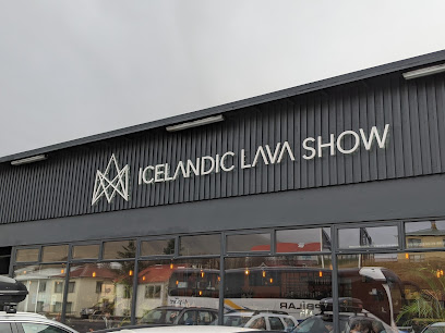
Lava Show in Vík
27.8 km
Discover the Lava Show in Vík, an unforgettable experience showcasing the power of volcanic activity in a thrilling and educational setting.
The Soup Company
27.9 km
Experience the warmth and comfort of Icelandic cuisine at The Soup Company, where hearty soups and local flavors await in the heart of Vik.
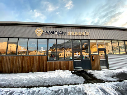
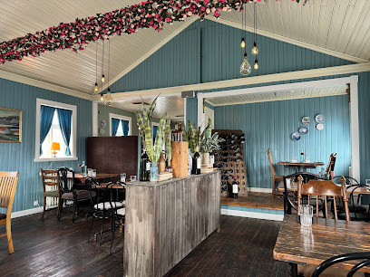
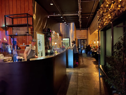
Smiðjan Brugghús
27.9 km
Discover the flavors of Iceland at Smiðjan Brugghús, Vík's delightful restaurant and brewery offering local cuisine and craft beers.
Katla Wool Studio
27.9 km
Experience the artistry of Icelandic wool at Katla Wool Studio in Vik, where craftsmanship meets tradition in every stitch.

Vík Swimming Pool
28.0 km
Experience relaxation and stunning views at Vík Swimming Pool, a perfect escape in Iceland's enchanting landscapes.

Víkurfjara Black Sand Beach
28.0 km
Discover the enchanting Víkurfjara Black Sand Beach, a breathtaking landscape of black sands, basalt columns, and dramatic sea stacks in Iceland.
Essential bars & hidden hideouts
Lundinn (Original Puffin Bar)
38.9 km
Discover the charm of Icelandic nightlife at Lundinn, the Original Puffin Bar in Vestmannaeyjabær, where good company and local flavors await.

Tanginn
39.1 km
Experience the best of Icelandic cuisine at Tanginn, where fresh seafood meets stunning views in the heart of Vestmannaeyjar.

Slippurinn
39.3 km
Experience authentic Icelandic cuisine at Slippurinn, a premier restaurant in the breathtaking Westman Islands, renowned for its seasonal local ingredients.

næs
39.4 km
Discover Næs, a top-rated restaurant in Vestmannaeyjar, offering a unique blend of traditional Icelandic cuisine and stunning island views.

Höllin
39.4 km
Discover Höllin, the vibrant bar in Vestmannaeyjabær, where locals and tourists unite for drinks, music, and unforgettable memories.

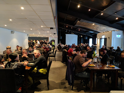
Midgard Restaurant & Bar
42.7 km
Discover the taste of Iceland at Midgard Restaurant & Bar, where local flavors meet warm hospitality and unforgettable experiences await.

Midgard Base Camp
42.7 km
Experience the essence of Icelandic adventure at Midgard Base Camp, a vibrant hub for exploration, relaxation, and unforgettable memories.
Landmannalaugar gönguleið
54.4 km
Experience the enchanting beauty of Landmannalaugar, Iceland's premier hiking area, with its vibrant mountains and geothermal wonders.

Landmannalaugar roadside parking
55.9 km
Discover the stunning landscapes and geothermal wonders at Landmannalaugar roadside parking, your gateway to Iceland's Highlands.

Fagrifoss
72.6 km
Experience the breathtaking beauty of Fagrifoss Waterfall, a hidden gem in Iceland's stunning landscapes, perfect for nature lovers and photographers.

Hotel Highland | Hótel Háland
75.4 km
Discover the charm of Hella at Hotel Highland, where comfort meets local flavors in a beautiful Icelandic setting.

Cafe Munkar
76.9 km
Experience the delightful flavors of Iceland at Cafe Munkar, a cozy restaurant in Kirkjubæjarklaustur, perfect for breakfast and lunch.

Klaustur Restaurant & Bar
77.3 km
Discover Icelandic cuisine at Klaustur Restaurant & Bar, where local flavors meet inspired cocktails in a stunning setting.

Systrakaffi
77.6 km
Discover the authentic taste of Iceland at Systrakaffi, where local ingredients meet warm hospitality in the heart of Kirkjubæjarklaustur.

Nightclubs & after hour spots
Golfklúbbur Vestmannaeyja
40.6 km
Discover the stunning landscapes of Vestmannaeyjar while enjoying a round of golf at Golfklúbbur Vestmannaeyja, where nature meets sport.
Bankinn Vinnustofa
85.9 km
Discover a perfect blend of relaxation and productivity at Bankinn Vinnustofa, where comfort meets functionality in Selfoss, Iceland.
Kaffi Krús
86.1 km
Discover the flavors of Iceland at Kaffi Krús, a beloved restaurant and café in Selfoss, offering delicious burgers, pizzas, and a cozy atmosphere.
Fröken Selfoss – Nordic Tapas & Drinks
86.2 km
Discover Fröken Selfoss, a culinary hotspot in Selfoss, Iceland, where Nordic tapas and exquisite drinks create an unforgettable dining experience.
Miðbar
86.2 km
Experience the vibrant nightlife and welcoming atmosphere at Miðbar, the perfect bar for tourists in Selfoss, Iceland.
Sviðið
86.2 km
Discover the heart of Selfoss at Sviðið, a live music venue that showcases the best local and international talent in an unforgettable atmosphere.
Risið Vínbar
86.2 km
Discover the charm of Risið Vínbar in Selfoss, where exquisite wines meet a warm atmosphere perfect for any occasion.
The Old Dairy Food Hall - Mjólkurbúið Mathöll
86.2 km
Experience the culinary delights at The Old Dairy Food Hall in Selfoss, where local flavors meet global cuisine in a vibrant food court setting.
Tryggvaskáli
86.2 km
Discover the exquisite flavors of Iceland at Tryggvaskáli, a fine dining restaurant and vibrant bar in Selfoss.
Hvítahúsið
87.1 km
Discover the lively ambiance and authentic Icelandic flavors at Hvítahúsið, a premier pub in Selfoss for drinks, food, and fun.
Hofland Eatery
97.3 km
Discover the flavors of Iceland at Hofland Eatery in Hveragerði, where fresh, local ingredients meet a welcoming atmosphere.
Cocktail Lounge Kormáks & Skjaldar
97.4 km
Experience the vibrant nightlife at Cocktail Lounge Kormáks & Skjaldar in Hveragerði, where innovative cocktails meet a cozy atmosphere for a memorable night.
Ölverk Pizza & Brewery
97.4 km
Discover delicious pizzas and artisanal craft beers at Ölverk Pizza & Brewery, an iconic culinary destination in Hveragerði, Iceland.
Hveragerði
97.4 km
Explore the geothermal delights and artistic spirit of Hveragerði, Iceland’s vibrant hot spring town, perfect for nature lovers and culture enthusiasts.
Skyrgerðin Restaurant
97.5 km
Enjoy authentic Icelandic flavors in a cozy setting at Skyrgerðin Restaurant, a must-visit dining destination in Hveragerði.