

Fimmvorduhals Pass Travel Guide - Free Web & App
Your ultimate guide to Fimmvorduhals Pass. Discover top landmarks, proposed trips, and local tips. Free on the web or via the Evendo companion app.


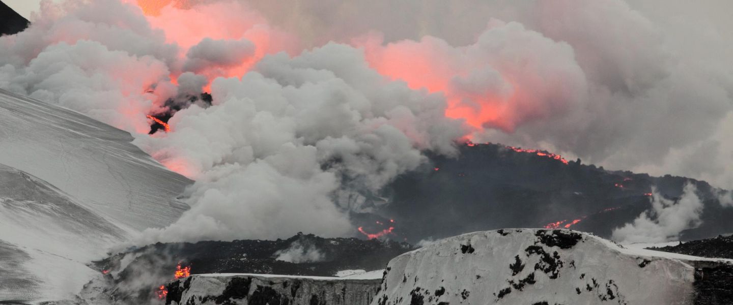


Fimmvörðuháls Pass in Iceland links Skógar and Þórsmörk through glaciers, volcanic craters and highland scenery on a demanding hiking route.
Between Waterfalls, Glaciers and Volcanoes
Fimmvörðuháls Pass is one of Iceland’s most compelling highland crossings, linking the southern village of Skógar with Þórsmörk, a sheltered valley surrounded by glaciers and mountains. The walking route rises from the famous Skógafoss waterfall through the upper Skógá valley, passing a succession of waterfalls before reaching the exposed pass between Eyjafjallajökull and Mýrdalsjökull. At roughly 1,000 metres, the pass is a serious mountain environment rather than a casual day excursion, with snow, wind, fog and rapidly changing visibility possible even in summer.Read more about Fimmvorduhals Pass
A Route Shaped by Fire and Ice
A Demanding Highland Journey
When is the best time to visit Fimmvorduhals Pass?
Best: June–August · 16–18°C| Month | High (°C) | Rainfall (mm) |
|---|---|---|
| January | 1 | 40 |
| February | 1 | 40 |
| March | 3 | 40 |
| April | 7 | 40 |
| May | 12 | 40 |
| June (best) | 16 | 40 |
| July (best) | 18 | 40 |
| August (best) | 17 | 40 |
| September | 12 | 40 |
| October | 8 | 40 |
| November | 3 | 40 |
| December | 1 | 40 |
Getting to and around Fimmvorduhals Pass
How to get there
Transportation
Best attractions in Fimmvorduhals Pass
The principal attraction is the route itself, beginning at Skógar and following the Skógá river past a remarkable sequence of waterfalls before climbing towards the open saddle of Fimmvörðuháls. At the high point, the trail passes between the ice caps Eyjafjallajökull and Mýrdalsjökull, with views that change quickly according to cloud and snow conditions. The volcanic craters Magni and Móði, formed during the 2010 Eyjafjallajökull eruption, provide a distinctive geological focus near the pass. Beyond the summit, the descent leads into Þórsmörk, a network of wooded valleys, ridges and glacial landscapes associated with longer hiking routes. Baldvinsskáli and Fimmvörðuskáli are important mountain-hut locations along the crossing, although they are basic facilities rather than visitor attractions with broad services. Skógafoss, at the southern trailhead, is a major waterfall and a natural starting point for exploring the route, while the changing contrast between river gorge, volcanic upland and sheltered birch woodland defines the journey.
-
Beach
Kirkjufjara Beach
Discover the breathtaking beauty of Kirkjufjara Beach, Iceland's stunning black sand shoreline surrounded by dramatic cliffs and rich wildlife.
-
 Restaurant
Gott restaurant
Discover the best of Icelandic cuisine at Gott Restaurant, a delightful spot in Vestmannaeyjar known for its fresh, local flavors and cozy ambiance.
-
Historical landmark
Rutshellir Caves
Unveil the natural beauty and historical significance of Rutshellir Caves, a remarkable geological wonder in Iceland's breathtaking landscape.
-
Bakery
Vigtin bakhús
Experience the heart of Icelandic baking at Vigtin Bakhús, where every pastry tells a story and every cup of coffee warms the soul.


Best landmarks in Fimmvorduhals Pass
Fimmvörðuháls is defined by a series of natural landmarks rather than buildings. Skógafoss marks the southern gateway, where the Skógá river drops from the uplands and the trail begins its ascent past numerous waterfalls. Above the valley, the saddle lies between Eyjafjallajökull and Mýrdalsjökull, placing the route in a striking corridor of glaciers, snowfields and volcanic rock. Magni and Móði are the pass’s most distinctive human-timescale geological landmarks, formed during the 2010 eruption of Eyjafjallajökull. The shelters of Baldvinsskáli and Fimmvörðuskáli reflect the route’s history as a challenging mountain crossing, while the descent into Þórsmörk introduces birch woodland, ridges and glacial valleys. Together these features show how water, ice and active volcanism have shaped the landscape around the pass.
-
Local history museum
Skógar Museum
Explore Iceland's heritage at Skógar Museum, showcasing local history, culture, and stunning artifacts in a beautiful natural setting.
-
Nature preserve
Þórsmörk
Discover the stunning landscapes and adventure opportunities at Þórsmörk, Iceland's breathtaking nature reserve nestled between glaciers and mountains.
-
Historical landmark
Rutshellir Caves
Unveil the mysteries of the Rutshellir Caves, a must-visit historical landmark in Iceland, where nature and adventure await.
-
Mountain peak
Thórsmörk
Explore Thórsmörk: Iceland’s breathtaking mountain range, offering stunning landscapes and unforgettable hiking experiences in nature's paradise.


Explore Fimmvorduhals Pass on the map
Plan your trip on one map. See where the top attractions, landmarks, restaurants and hotels are, and book hotels and experiences in a few clicks.
Best hotels in Fimmvorduhals Pass
Best restaurants in Fimmvorduhals Pass
There is no restaurant scene on Fimmvörðuháls itself, and walkers must carry provisions for the crossing. The principal nearby eating options are found in Skógar and along Iceland’s south-coast settlements, where cafés, guesthouse dining rooms and food outlets serve visitors travelling Route 1. These are useful places to obtain breakfast, packed food or a meal before or after the hike, although opening patterns can be seasonal. Þórsmörk has limited visitor infrastructure, with food availability connected to individual accommodation or hut arrangements rather than a conventional village dining area. Icelandic menus commonly draw on lamb, fish, dairy products, rye bread and soups, while the wider south coast also reflects farming and fishing traditions. Anyone staying in a hut or mountain accommodation should confirm whether self-catering facilities or food services are provided and plan on the assumption that shops will not be available on the trail.
-
Fish & Chips
Mia's Country Van - Local Fish & Chips
Experience mouthwatering fish & chips at Mia's Country Van in Hvolsvöllur - a must-visit culinary gem for tourists seeking authentic Icelandic flavors.
-
Restaurant
Gamla fjósið
Discover authentic Icelandic cuisine at Gamla fjósið in Eyjafjöllum - where tradition meets taste amidst stunning landscapes.


Best bars in Fimmvorduhals Pass
Fimmvörðuháls has no bars, nightclubs or organised nightlife. Evening activity centres on quiet mountain huts, camps or accommodation in Skógar and Þórsmörk, where walkers may rest, prepare food and discuss route conditions rather than seek entertainment. Skógar and nearby south-coast settlements have a small number of pubs, hotel bars and casual hospitality venues, but they are dispersed rather than forming a nightlife district. Þórsmörk is still more remote, and evening facilities depend on the particular accommodation base and season. Visitors looking for a broader choice of bars or live entertainment need to travel to larger towns elsewhere on Iceland’s south coast or in the capital area, outside the destination itself. In the pass, darkness, weather and early starts make a low-key evening routine the practical norm.
-
Restaurant
Ströndin • Pub
Experience the vibrant atmosphere and delicious Icelandic cuisine at Ströndin Pub in Vík, your perfect retreat after exploring Iceland's stunning landscapes.
-
Nature preserve
Þórsmörk
Explore the breathtaking beauty of Þórsmörk, a nature preserve in Iceland, with stunning landscapes and adventurous outdoor activities.
-
Restaurant
Gamla fjósið
Discover the flavors of Iceland at Gamla Fjósið, where local ingredients meet warm hospitality in a stunning setting.
-
Hiking area
Fimmvorduhals Trailhead
Explore the stunning landscapes of Fimmvorduhals Trailhead, a hiker's paradise with breathtaking views, waterfalls, and rich geological history.


Best nightclubs in Fimmvorduhals Pass
Fimmvörðuháls has no bars, nightclubs or organised nightlife. Evening activity centres on quiet mountain huts, camps or accommodation in Skógar and Þórsmörk, where walkers may rest, prepare food and discuss route conditions rather than seek entertainment. Skógar and nearby south-coast settlements have a small number of pubs, hotel bars and casual hospitality venues, but they are dispersed rather than forming a nightlife district. Þórsmörk is still more remote, and evening facilities depend on the particular accommodation base and season. Visitors looking for a broader choice of bars or live entertainment need to travel to larger towns elsewhere on Iceland’s south coast or in the capital area, outside the destination itself. In the pass, darkness, weather and early starts make a low-key evening routine the practical norm.
-
Mountain pass
Fimmvörðuháls
Explore the breathtaking Fimmvörðuháls Mountain Pass, a hidden gem in Iceland with stunning landscapes and unforgettable hiking adventures.

Best shops in Fimmvorduhals Pass
Shopping on Fimmvörðuháls is limited to the practical supplies arranged before a mountain crossing; there are no shops, craft markets or retail streets on the pass. Skógar and the wider south-coast corridor provide the nearest opportunities for snacks, packed food, basic travel requirements and locally made goods, generally through small shops, cafés, museums or accommodation businesses rather than a concentrated shopping district. Visitors may find Icelandic wool products, outdoor clothing, local food items and craftwork in larger south-coast settlements, but stock and opening arrangements vary. Þórsmörk is a remote outdoor base, not a shopping centre, so it is unwise to depend on buying fuel, specialist equipment or provisions there. Regional products such as woollen knitwear, preserves and other food gifts offer a more relevant connection with local rural life than souvenir shopping at the trail itself.
-
Store
UNA Local Product / Sveitabúðin Una
Explore UNA Local Product for unique Icelandic souvenirs and local delicacies in Hvolsvöllur, celebrating authentic craftsmanship and culture.
-
Hiking area
Fimmvorduhals Trailhead
Explore the breathtaking Fimmvorduhals Trailhead, where stunning landscapes and unforgettable hiking experiences await in Iceland's wilderness.
-
Volcano
Fimmvörðuháls
Explore Fimmvörðuháls, a stunning volcanic trek in Iceland offering breathtaking landscapes, waterfalls, and unique geological formations.
-
Mountain cabin
Fimmvörðuskáli
Experience the breathtaking beauty of Iceland at Fimmvörðuskáli, your gateway to the stunning Fimmvörðuháls trail and surrounding landscapes.


Get your free copy of our complete guide to Fimmvorduhals Pass, delivered straight to you.
Everything on this page, from attractions and restaurants to essentials and local phrases, in one PDF you can read offline, print or share.
Already have an account? Sign in
Your Fimmvorduhals Pass guide is ready.
We'll send it to · Not you? Sign out

Getting your guide ready…
We are putting together a fresh copy of the Fimmvorduhals Pass guide. This can take up to a minute.
This can take a few moments. If your browser asks, choose Allow so the download can start. You'll find the guide in your Downloads folder.
Nothing happened? Download it again
Sorry, the guide is taking longer than usual. Please try again in a minute, or get it by email instead.
Fimmvorduhals Pass essentials
Currency and Payment
Safety
Emergency Situations
Do's and Don'ts
Local Tips
From Eve
Local phrases worth knowing
You don't need to get them perfect. A few words go a long way, and locals appreciate the effort.
Basics
| English | Local | Say it |
|---|---|---|
| Hello | Halló | [haa-loh] |
| Goodbye | Bless | [bless] |
| Yes | Já | [ya] |
| No | Nei | [nay] |
| Please/You're welcome | Gjörðu svo vel | [gyur-thoo svoh vel] |
| Thank you | Takk fyrir | [tahk fur-eer] |
| Excuse me/Sorry | Afsakið | [af-sah-kith] |
| How are you? | Hvernig hefurðu það? | [kver-nig hev-ur-thoo thah-th] |
| Fine. And you? | Fínt. Og þú? | [feent. ohg thoo] |
| Do you speak English? | Talar þú ensku? | [tar-lar thoo ens-koo] |
| I don't understand | Ég skil ekki | [yeh skil ekk-ee] |
Eating & Drinking
| English | Local | Say it |
|---|---|---|
| I'd like to see the menu, please | Ég ætla að sjá matseðilinn, takk | [yeh eye-tla ath syah mat-se-thil-inn, tahk] |
| I don't eat meat | Ég borða ekki kjöt | [yeh bor-tha ekk-ee chot] |
| Cheers! | Skál! | [skowl] |
| I would like to pay, please | Ég vil greiða, takk | [yeh vil gray-tha, tahk] |
Emergencies
| English | Local | Say it |
|---|---|---|
| Help! | Hjálp! | [hyowlp] |
| Go away! | Farðu í burtu! | [far-thoo ee bur-too] |
| Call the Police! | Hringdu í lögreglu! | [hring-doo ee luh-greh-glue] |
| Call a doctor! | Hringdu í læknir! | [hring-doo ee laik-nir] |
| I'm lost | Ég er týnd(ur) | [yeh air teenth(ur)] |
| I'm ill | Ég er veik(ur) | [yeh air vaik(ur)] |
Shopping
| English | Local | Say it |
|---|---|---|
| I'd like to buy... | Ég ætla að kaupa... | [yeh eye-tla ath cow-pa] |
| I'm just looking | Ég er bara að skoða | [yeh air bar-ah ath skotha] |
| How much is it? | Hvað kostar það? | [kvath kost-ar thah-th] |
| That's too expensive | Það er of dýrt | [thah-th air ov deert] |
| Can you lower the price? | Getur þú lækkad verðið? | [get-ur thoo ligh-kad ver-thith] |
Time & Numbers
| English | Local | Say it |
|---|---|---|
| What time is it? | Hvað er klukkan? | [kvath air kluth-kan] |
| It's one o'clock | Klukkan er eitt | [kluth-kan air ait] |
| Half past (10) | Hálf tíu | [haowlf tee-oo] |
| Morning | Morgunn | [mor-gun] |
| Afternoon | Síðdegis | [seeth-dey-ees] |
| Evening | Kvöld | [kvohld] |
| Yesterday | Í gær | [ee gai-r] |
| Today | Í dag | [ee dag] |
| Tomorrow | Á morgun | [auh mor-gun] |
| 1 | Eitt | [ait] |
| 2 | Tvö | [tvuh] |
| 3 | Þrír | [threer] |
| 4 | Fjórir | [fyow-reer] |
| 5 | Fimm | [feem] |
| 6 | Sex | [sehx] |
| 7 | Sjö | [syow] |
| 8 | Átta | [auh-thah] |
| 9 | Níu | [nee-oo] |
| 10 | Tíu | [tee-oo] |
Transport & Directions
| English | Local | Say it |
|---|---|---|
| Where's a/the...? | Hvar er... | [kvar air] |
| What's the address? | Hvað er heimilisfangið? | [kvath air hay-mil-is-fang-ith] |
| Can you show me (on the map)? | Getur þú sýnt mér (á kortinu)? | [get-ur thoo seent meyr (au kort-inu)] |
| When's the next (bus)? | Hvenær kemur næsti (strætisvagn)? | [kver-nair kem-ur nai-sti (strait-is-vagn)] |
| A ticket (to ....) | Miða (til ....) | [mee-tha (til)] |
History of Fimmvorduhals Pass
A Glacial and Volcanic Landscape
Fimmvörðuháls occupies a high saddle between Eyjafjallajökull and Mýrdalsjökull, two ice caps that have shaped the surrounding valleys and slopes. The route connects the Skógá drainage on the south side with the glacial valleys leading towards Þórsmörk. Its landscape reflects the close relationship between Icelandic fire and ice: snowfields and glaciers occupy the high ground, while volcanic rock and ash appear along the pass. The landform is part of Iceland’s active volcanic zone, where geological processes continue to influence the terrain rather than belonging only to the distant past.
Travel Between Skógar and Þórsmörk
The crossing historically served as a demanding route between communities and grazing areas on Iceland’s south coast and the interior valleys. Before modern roads and organised trekking, movement across such high ground depended heavily on weather, snow conditions and knowledge of the terrain. Skógar developed as a rural settlement beneath the route, while Þórsmörk remained a remote valley environment associated with summer travel, pasture and later outdoor recreation. The pass’s importance has therefore been practical as well as scenic, providing a highland link between two contrasting parts of southern Iceland.
The 2010 Eyjafjallajökull Eruption
Fimmvörðuháls gained renewed international attention during the 2010 Eyjafjallajökull eruptions. The initial phase occurred near the pass in March 2010, producing the craters Magni and Móði and a basaltic lava flow. A later eruption beneath the Eyjafjallajökull ice cap caused widespread ash disruption to European air travel. The newly formed craters remain among the route’s most significant landmarks, although their appearance and surrounding ground can change through erosion, snow cover and continuing volcanic processes.
From Mountain Route to Trekking Classic
Improved footpaths, mountain huts and seasonal transport gradually made the crossing more accessible to experienced walkers, and Fimmvörðuháls became associated with the wider Laugavegur hiking network through Þórsmörk. Tourism has not removed the route’s highland character: the distance, elevation, exposure and weather still demand careful preparation. Modern management focuses on directing walkers along established paths, protecting fragile volcanic and alpine ground, and balancing growing interest in the route with the limited infrastructure of Iceland’s interior.
Fimmvorduhals Pass in Photos
Browse through our photo collection highlighting the charm and character of the destination.
Cities in Fimmvorduhals Pass
The towns and cities of Fimmvorduhals Pass, and the easiest places to base yourself.

Swipe for more cities
Neighbouring destination travel guides
The closest destinations to Fimmvorduhals Pass, if you have time for more than one.
-

-

-

-
-


Swipe for more destinations
Explore more
Explore more of Southern Region
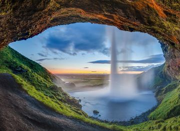
Explore the Southern Region of Iceland: From majestic waterfalls to black sand beaches, glaciers, and geothermal wonders, this is a land of dramatic contrasts and natural beauty.
Explore Southern Region
Explore more of Iceland
Discover Iceland, where glaciers meet volcanoes, Northern Lights dance in the skies, and natural wonders await at every turn.
Explore Iceland