

Myvatn Region Travel Guide - Free Web & App
Your ultimate guide to Myvatn Region. Discover top landmarks, proposed trips, and local tips. Free on the web or via the Evendo companion app.


Myvatn Region, Iceland: explore volcanic craters, geothermal fields, birdlife, lava formations and outdoor adventures around Lake Myvatn in every season.
Volcanic Landscapes and Living Geology
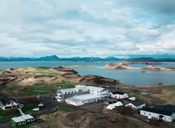
Myvatn Region lies in north-east Iceland, centred on Lake Mývatn and the volcanic landscapes extending around its shores. The lake sits within the Krafla volcanic system, where lava fields, pseudocraters, fumaroles, mud pools and steaming ground reveal the continuing relationship between Iceland’s surface and its subterranean heat. Around the lake, the terrain shifts rapidly from fertile wetlands and low birch scrub to dark lava formations, crater rims and broad open horizons. Reykjahlíð is the principal service settlement, while Skútustaðir and smaller farms provide access to different parts of the lake.Read more about Myvatn Region
Birdlife, Lava and Water
Exploring the Region
When is the best time to visit Myvatn Region?
Best: June–August · 12–14°C| Month | High (°C) | Rainfall (mm) |
|---|---|---|
| January | 1 | 36 |
| February | 1 | 31 |
| March | 2 | 35 |
| April | 4 | 34 |
| May | 7 | 34 |
| June (best) | 12 | 34 |
| July (best) | 14 | 34 |
| August (best) | 13 | 34 |
| September | 9 | 31 |
| October | 4 | 35 |
| November | 3 | 38 |
| December | 1 | 38 |
Getting to and around Myvatn Region
How to get there
Transportation
Best attractions in Myvatn Region
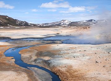
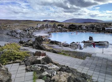
The attractions of the Mývatn Region are dispersed across a compact but varied volcanic landscape. At Skútustaðir, a series of grassy pseudocraters rises beside the lake and wetlands, offering short walks and birdwatching. Dimmuborgir presents a maze of lava pillars, arches and caves created by an unusual eruption, while Hverfjall is a broad, dark tephra crater whose rim provides an expansive view when conditions permit. At Hverir, sulphurous steam, bubbling mud and vividly coloured earth reveal the area’s geothermal energy. Further north, the Krafla zone includes the Víti crater and the Leirhnjúkur lava field, where recent volcanic terrain remains clearly visible. The lake shore, shallow bays and surrounding farms provide opportunities to observe waterfowl, especially in the brighter months. Mývatn Nature Baths add a managed geothermal bathing experience near Reykjahlíð, complementing the region’s more rugged natural sites.
-
Tourist attraction
Sulfuric smoker
Experience the breathtaking beauty and unique geothermal activity of the Sulfuric Smoker in Reykjahlíð, Iceland - a must-visit attraction for nature lovers.
-
Tourist attraction
Skútustadagrig pseudo craters
Explore the stunning Skútustaðagígar pseudo craters, a geological wonder near Lake Mývatn, rich in natural beauty and wildlife.
-
The Fly Lands
Discover The Fly Lands, a breathtaking tourist attraction near Lake Mývatn, showcasing unique ecosystems and stunning landscapes in Iceland.
-
Tourist attraction
Lake Mývatn View Point
Discover the breathtaking beauty of Lake Mývatn View Point, a stunning natural attraction in Iceland known for its unique landscapes and diverse wildlife.


Best landmarks in Myvatn Region
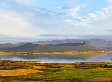
Lake Mývatn is the defining natural landmark, a shallow volcanic lake surrounded by wetlands, pseudocraters and lava landscapes that support important birdlife. The Skútustaðagígar pseudocraters are notable for their formation by steam explosions, while Hverfjall’s near-symmetrical dark cone dominates views across the eastern side of the lake. Dimmuborgir is distinguished by its elaborate lava pillars and passageways, and the Hverir geothermal field by steaming vents, mud pools and mineral-stained ground. In the Krafla volcanic zone, Víti and the Leirhnjúkur lava field record more recent volcanic activity. Reykjahlíð Church, rebuilt after an earlier church was destroyed by lava during the Mývatn Fires of 1729, provides a human landmark linked directly with the region’s volcanic history. Together these features express the close relationship between geology, settlement and local cultural memory.
-
Tourist attraction
Hverir
Discover the mesmerizing geothermal wonders of Hverir, where bubbling mud pots and steaming fumaroles create a unique Icelandic landscape.
-
Thermal baths
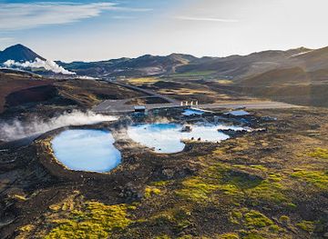
Mývatn Nature Baths
Experience the serene geothermal waters of Mývatn Nature Baths, where relaxation meets the stunning landscapes of Northern Iceland.
-
Tourist attraction
Grjótagjá
Explore the enchanting geothermal cave of Grjótagjá, a hidden gem in Iceland's breathtaking landscapes, perfect for relaxation and adventure.
-
Restaurant
Vogafjós Farm Resort
Discover the charm of Vogafjós Farm Resort, where authentic Icelandic cuisine meets stunning views of Lake Myvatn.
Explore Myvatn Region on the map
Plan your trip on one map. See where the top attractions, landmarks, restaurants and hotels are, and book hotels and experiences in a few clicks.
Best hotels in Myvatn Region
Best restaurants in Myvatn Region
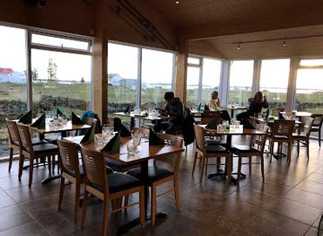
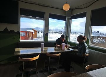
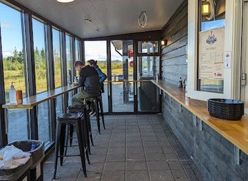
Dining in the Mývatn Region is concentrated around Reykjahlíð and the small settlements near the lake, with additional options associated with local accommodation and farms rather than a large independent restaurant scene. Menus commonly reflect Icelandic ingredients, including lamb, dairy, freshwater fish and seasonal produce, while visitors may also find familiar international dishes suited to travellers following the Ring Road. Cafés and guesthouse dining rooms provide useful stops between excursions, but opening patterns and availability can vary with season. The region’s farm-based character is also apparent in local food production and the importance of simple, warming meals after time outdoors. Those travelling beyond Reykjahlíð should carry snacks and water, since services become more limited around remote volcanic attractions and rural roads.
-
Restaurant
Vogafjós Farm Resort
Experience authentic Icelandic hospitality at Vogafjós Farm Resort with fresh farm-to-table cuisine near beautiful Lake Mývatn.
-
Pizza
Daddi's Pizza
Experience the best pizza in Mývatn at Daddi's Pizza—where quality ingredients meet Icelandic hospitality.
-
Restaurant
Fish and Chips Lake Mývatn
Experience the authentic taste of Iceland at Fish and Chips Lake Mývatn – where fresh ingredients meet breathtaking views.
-
Restaurant
Kaffi Borgir
Discover delicious homemade meals and unique souvenirs at Kaffi Borgir, set against the stunning backdrop of Dimmuborgir's lava formations.
Best bars in Myvatn Region
The Mývatn Region has little conventional nightlife, and evening entertainment is generally centred on the quiet hospitality of guesthouses, hotels and rural dining venues around Reykjahlíð rather than dedicated clubs or a late-night bar district. A local pub-style atmosphere may be found where accommodation businesses serve drinks with meals, but availability depends on the individual property and season. In summer, long daylight hours encourage walks and bird observation rather than conventional evening entertainment; in winter, darkness and clear conditions can create opportunities for viewing the northern lights when activity and weather align. Visitors seeking a broader selection of bars, live music or cultural events will generally need to look towards larger northern centres such as Akureyri, outside the Mývatn Region.
-
Thermal baths
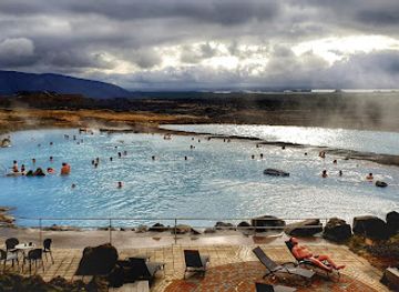
Mývatn Nature Baths
Discover the tranquility of Mývatn Nature Baths, where geothermal waters and stunning landscapes offer the ultimate relaxation experience in Iceland.
-
Restaurant
Vogafjós Farm Resort
Experience authentic Icelandic cuisine at Vogafjós Farm Resort, where farm-fresh ingredients meet stunning landscapes in Myvatn.
-
Pizza
Daddi's Pizza
Experience the best pizza in Mývatn at Daddi's Pizza, where flavors meet Icelandic charm in a cozy atmosphere.
-
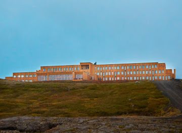
Hotel
Fosshotel Mývatn
Discover the stunning natural beauty and warm hospitality at Fosshotel Mývatn, your ultimate Icelandic escape surrounded by breathtaking landscapes.
Best nightclubs in Myvatn Region
The Mývatn Region has little conventional nightlife, and evening entertainment is generally centred on the quiet hospitality of guesthouses, hotels and rural dining venues around Reykjahlíð rather than dedicated clubs or a late-night bar district. A local pub-style atmosphere may be found where accommodation businesses serve drinks with meals, but availability depends on the individual property and season. In summer, long daylight hours encourage walks and bird observation rather than conventional evening entertainment; in winter, darkness and clear conditions can create opportunities for viewing the northern lights when activity and weather align. Visitors seeking a broader selection of bars, live music or cultural events will generally need to look towards larger northern centres such as Akureyri, outside the Mývatn Region.
-
Restaurant
Vogafjós Farm Resort
Discover the authentic Icelandic experience at Vogafjós Farm Resort, where farm-fresh dining meets stunning natural beauty in Myvatn.
-
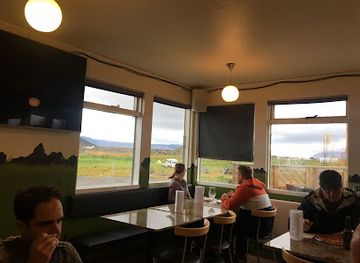
Pizza
Daddi's Pizza
Discover the best gourmet pizzas at Daddi's Pizza in Mývatn, a delightful stop for tourists seeking authentic flavors in a cozy setting.
-
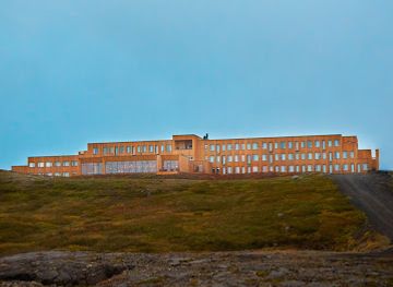
Bar
Fosshotel Mývatn
Experience the serene beauty of Lake Mývatn at Fosshotel Mývatn, your perfect base for exploring Iceland's stunning natural landscapes.
-
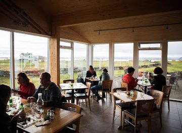
Restaurant
Kaffi Borgir
Experience the perfect blend of local flavors and stunning landscapes at Kaffi Borgir, the culinary jewel of Dimmuborgir.
Best shops in Myvatn Region
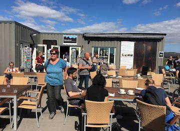
Shopping in the Mývatn Region is limited and practical rather than concentrated in a large retail district. Reykjahlíð has the area’s main cluster of supplies and visitor-oriented purchases, while accommodation businesses, farm shops and small local producers may offer food, woollen goods, souvenirs or crafts connected with north Iceland. Typical regional products include knitted woollens, locally made preserves and other Icelandic food items, although availability varies by business and season. Visitors should buy specialist outdoor equipment and substantial provisions before reaching the lake if possible, since the region’s rural settlements have a narrower range than Akureyri. Geological sites should be appreciated without removing stones, lava or other natural material, and locally made products are preferable to collecting from the landscape.
-
Grocery store
Krambúðin Reykjahlíð
Explore the best of local flavors and essentials at Krambúðin Reykjahlíð, your go-to grocery store in the heart of Iceland.
-
Cafe
Kaffi Sel and Mývatn öl brewery
Experience the flavors of Iceland at Kaffi Sel and Mývatn Öl Brewery, where local brews and homemade delights meet stunning natural beauty.
-
Clothing store
Handicrafts Market
Explore the Handicrafts Market in Reykjahlíð for authentic Icelandic sweaters and unique artisanal crafts, perfect for memorable souvenirs.

Get your free copy of our complete guide to Myvatn Region, delivered straight to you.
Everything on this page, from attractions and restaurants to essentials and local phrases, in one PDF you can read offline, print or share.
Already have an account? Sign in
Your Myvatn Region guide is ready.
We'll send it to · Not you? Sign out

Getting your guide ready…
We are putting together a fresh copy of the Myvatn Region guide. This can take up to a minute.
This can take a few moments. If your browser asks, choose Allow so the download can start. You'll find the guide in your Downloads folder.
Nothing happened? Download it again
Sorry, the guide is taking longer than usual. Please try again in a minute, or get it by email instead.
Myvatn Region essentials
Currency and Payment
Safety
Emergency Situations
Do's and Don'ts
Local Tips
From Eve
Local phrases worth knowing
You don't need to get them perfect. A few words go a long way, and locals appreciate the effort.
Basics
| English | Local | Say it |
|---|---|---|
| Hello | Halló | [HAH-loh] |
| Goodbye | Bless | [BLESS] |
| Yes | Já | [YOW] |
| No | Nei | [NAY] |
| Please/You're welcome | Gjörðu svo vel | [GYUR-thu svoh vel] |
| Thank you | Takk fyrir | [TAKK feer-ir] |
| Excuse me/Sorry | Afkvæmið | [AHF-kvye-meeth] |
| How are you? | Hvernig hefur þú það? | [KVER-nig HEH-ur thoo thahd] |
| Fine. And you? | Fínt. En þú? | [FEENT. Ehn thoo] |
| Do you speak English? | Talar þú ensku? | [TAH-lar thoo EHN-skoo] |
| I don't understand | Ég skil ekki | [YEG skil EHK-ki] |
Eating & Drinking
| English | Local | Say it |
|---|---|---|
| I'd like to see the menu, please | Ég myndi vilja sjá matsedilinn, takk | [YEG MUN-dee VIL-ya syah MAT-seh-dil-inn, tahk] |
| I don't eat meat | Ég borða ekki kjöt | [YEG BOR-tha EHK-ki chyut] |
| Cheers! | Skál! | [SKOWL] |
| I would like to pay, please | Ég myndi vilja greiða, takk | [YEG MUN-dee VIL-ya gray-tha, tahk] |
Emergencies
| English | Local | Say it |
|---|---|---|
| Help! | Hjálp! | [HYOWLP] |
| Go away! | Farðu í burtu! | [FAHR-thu ee BUHR-too] |
| Call the Police! | Hringðu í lögregluna! | [HRING-thu ee LER-eg-loo-na] |
| Call a doctor! | Hringðu í lækninn! | [HRING-thu ee LAYK-nin] |
| I'm lost | Ég er týndur | [YEG AIR TEEN-thur] |
| I'm ill | Ég er veikur | [YEG AIR VAKE-ur] |
Shopping
| English | Local | Say it |
|---|---|---|
| I'd like to buy... | Ég myndi vilja kaupa... | [YEG MUN-dee VIL-ya KOW-pa] |
| I'm just looking | Ég er bara að skoða | [YEG AIR BAH-rah ath SKO-tha] |
| How much is it? | Hvað kostar það? | [Kvath KOS-tar thahd] |
| That's too expensive | Það er of dýrt | [Thath air ov DEERT] |
| Can you lower the price? | Getur þú lækkað verðið? | [GEH-tur thoo LAI-kath VER-thith] |
Time & Numbers
| English | Local | Say it |
|---|---|---|
| What time is it? | Hvað er klukkan? | [Kvath air KLOO-khan] |
| It's one o'clock | Klukkan er eitt | [KLOO-khan air ayth] |
| Half past (10) | Hálftíu | [HOWLFT-yoo] |
| Morning | Morgun | [MOR-gun] |
| Afternoon | Síðdegi | [SEETH-deh-ye] |
| Evening | Kvöld | [KVUHLTH] |
| Yesterday | Í gær | [EE gire] |
| Today | Í dag | [EE dahg] |
| Tomorrow | Á morgun | [OW MOR-gun] |
| 1 | Eitt | [ayth] |
| 2 | Tvö | [tvoe] |
| 3 | Þrjú | [thryoo] |
| 4 | Fjögur | [fyuh-gur] |
| 5 | Fimm | [fim] |
| 6 | Sex | [sehx] |
| 7 | Sjö | [syuh] |
| 8 | Átta | [owt-ta] |
| 9 | Níu | [nee-oo] |
| 10 | Tíu | [tee-oo] |
Transport & Directions
| English | Local | Say it |
|---|---|---|
| Where's a/the...? | Hvar er... | [Kvahr air] |
| What's the address? | Hvað er heimilisfangið? | [Kvath air HAY-me-lee-sfang-ith] |
| Can you show me (on the map)? | Getur þú sýnt mér (á kortinu)? | [GEH-tur thoo seent mehr (ow KORT-inn-oo)] |
| When's the next (bus)? | Hvenær kemur næsti (strætisvagn)? | [KVER-ni-air KEH-mur NAI-sti (STRAI-tis-vahg-n)] |
| A ticket (to ....) | Einn miða (til ...) | [ayth MI-tha (til ...)] |
History of Myvatn Region
Volcanic Formation and the Lake
Lake Mývatn and its surroundings were shaped by repeated volcanic activity, with lava flows, explosive eruptions and water-filled depressions creating the present landscape. The lake is associated with the Krafla volcanic system, one of Iceland’s active volcanic zones. Its pseudocraters, particularly around Skútustaðir, formed when hot lava flowed across wet ground and triggered steam explosions rather than developing as conventional volcanic vents. The region’s geology remains visible in its crater cones, lava fields and geothermal springs, giving the landscape a readable record of changing volcanic processes.
Settlement and Farming
People have farmed around Mývatn for centuries, using the lake, wetlands and surrounding grasslands as part of a rural economy. The area’s name refers to its abundance of midges, which are an important part of the lake’s food chain as well as a seasonal nuisance for visitors. Fishing and egg gathering historically contributed to local livelihoods, while farming communities adapted to a landscape influenced by volcanic soils, harsh weather and fluctuating water conditions. The settlement pattern remains dispersed, with farms and small communities rather than a large town.
Dimmuborgir and Local Tradition
The lava formations of Dimmuborgir were created during an eruption when molten material accumulated around a lake or body of trapped water before draining away, leaving behind pillars, arches and cavernous structures. Their unusual forms have long stimulated local folklore, and in modern Icelandic culture Dimmuborgir is closely associated with the Yule Lads, the country’s traditional Christmas figures. The landscape therefore carries both geological importance and a strong place in Icelandic storytelling, while paths through the formations have made it one of the region’s best-known visitor sites.
The Krafla Eruptions
The Krafla volcanic system experienced a major period of activity between 1975 and 1984, commonly known as the Krafla Fires. Repeated fissure eruptions, earthquakes and ground movements affected the area and produced fresh lava fields. The episode demonstrated that the region is an active volcanic environment rather than simply a collection of ancient formations. Today, the Krafla area includes visible lava landscapes and geothermal infrastructure, while access and routes can be affected by volcanic conditions and local management decisions.
Tourism and Conservation
Mývatn’s combination of accessible geology, birdlife and geothermal scenery brought increasing numbers of visitors during the twentieth century, particularly as the Ring Road improved travel through north Iceland. Tourism developed alongside scientific interest in the lake’s wetlands and volcanic features. Conservation has become increasingly important because nesting birds, geothermal sites, mosses and lava formations are vulnerable to disturbance and erosion. Modern visits are shaped by marked paths, managed viewpoints and guidance intended to protect the landscape while allowing access to sites such as Skútustaðagígar, Dimmuborgir and Hverir.
Myvatn Region in Photos
Browse through our photo collection highlighting the charm and character of the destination.
Neighbouring destination travel guides
The closest destinations to Myvatn Region, if you have time for more than one.
-

-

-

-

-


Swipe for more destinations
Explore more
Explore more of Northeastern Region
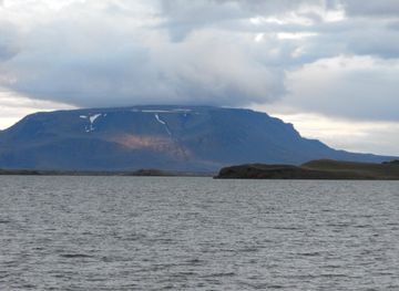
Explore the Northeastern Region of Iceland: A land of dramatic landscapes, geothermal wonders, and unforgettable natural beauty. Perfect for nature lovers and adventure seekers.
Explore Northeastern Region
Explore more of Iceland
Discover Iceland, where glaciers meet volcanoes, Northern Lights dance in the skies, and natural wonders await at every turn.
Explore Iceland