

Wye Island Natural Resource Management Area Travel Guide - Free Web & App
Your ultimate guide to Wye Island Natural Resource Management Area. Discover top landmarks, proposed trips, and local tips. Free on the web or via the Evendo companion app.


Wye Island in Maryland combines Chesapeake waterways, quiet trails, farmland and wildlife-rich marshes near Queenstown for walking, paddling and birdwatching.
A Chesapeake Peninsula of Fields and Water
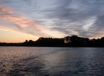
Wye Island Natural Resource Management Area occupies roughly 2,800 acres on Maryland’s Eastern Shore, where the Wye River and Wye East River meet the wider Chesapeake Bay landscape. Despite its name, the area is best understood as a broad, rural peninsula reached by a narrow causeway rather than as a built-up island community. Its roads and trails pass through open agricultural fields, mature woodland, marshy edges and quiet waterfront habitats, creating a strong sense of distance from Maryland’s main highways even though US 50 is relatively close.Read more about Wye Island Natural Resource Management Area
Landscape, Wildlife and Conservation
Exploring the Area
When is the best time to visit Wye Island Natural Resource Management Area?
Best: May–June, September · 23–28°C| Month | High (°C) | Rainfall (mm) |
|---|---|---|
| January | 7 | 78 |
| February | 8 | 73 |
| March | 13 | 85 |
| April | 17 | 85 |
| May (best) | 23 | 95 |
| June (best) | 28 | 95 |
| July | 31 | 100 |
| August | 30 | 100 |
| September (best) | 26 | 95 |
| October | 20 | 85 |
| November | 13 | 78 |
| December | 7 | 83 |
Getting to and around Wye Island Natural Resource Management Area
How to get there
Transportation
Best attractions in Wye Island Natural Resource Management Area
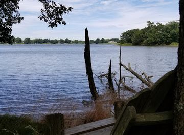
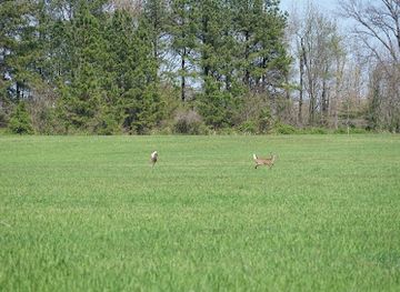
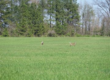
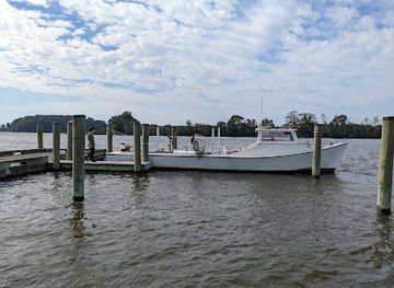
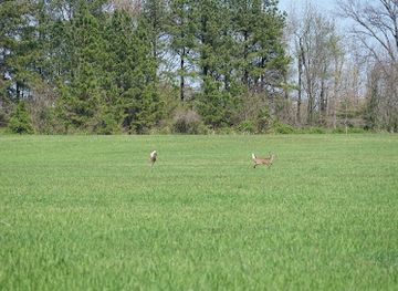
Wye Island’s principal attraction is the landscape itself: a broad Chesapeake peninsula of farm fields, mature woods, tidal creeks and river-facing marsh. Rural roads and designated trails lead through changing habitats rather than to a single monumental viewpoint, making the area well suited to walking, cycling, photography and quiet wildlife observation. The Wye River and Wye East River provide the defining setting for paddling and fishing where access and regulations permit, while open fields offer expansive Eastern Shore views. Woodland areas bring shade and seasonal colour, and field margins can be productive for birdwatching. The reserve’s agricultural character is also significant, preserving the visual relationship between working land and tidal water that distinguishes much of Queen Anne’s County. Nearby Queenstown, Centreville and Easton function as service and cultural bases, but they are separate communities rather than attractions within Wye Island itself.
-
Tourist attraction
Wye Island NRMA
Explore Wye Island NRMA, a picturesque nature preserve in Maryland, ideal for hiking, wildlife viewing, and enjoying the natural beauty of the Chesapeake Bay.
-
Hiking area
Holly Tree Trail
Discover the serene beauty of Holly Tree Trail in Queenstown, Maryland, a perfect hiking destination for nature lovers and adventure seekers.
-
Hiking area
Schoolhouse Woods Nature Trail
Discover the scenic Schoolhouse Woods Nature Trail in Queenstown, Maryland, where nature's beauty meets peaceful hiking adventures in a tranquil woodland setting.
-
Tourist attraction
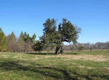
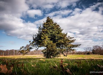
Wye Island Holly Tree
Explore the enchanting Wye Island Holly Tree, a historical landmark offering a serene escape and a glimpse into Maryland's rich heritage.

Best landmarks in Wye Island Natural Resource Management Area
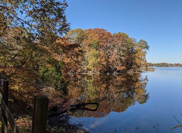
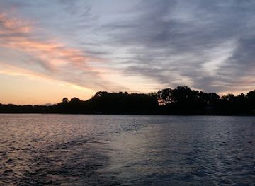
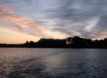
The most important landmarks at Wye Island are natural: the meeting waters of the Wye River and Wye East River, the narrow causeway approach, the tidal shorelines and the broad fields and woodlands protected within the management area. Together they express the geography of Maryland’s Eastern Shore, where low agricultural ground meets the branching waters of the Chesapeake system. The river edges are also ecological landmarks, linking marsh, shallow water and woodland habitats used by migratory and resident birds. Historic significance is present through the wider Wye River landscape and its plantation-era associations, including Wye House on the mainland, but that private site is distinct from Wye Island Natural Resource Management Area and should not be presented as a public landmark inside the reserve. The island’s value lies in the continuity of landscape, water and working countryside rather than in a concentration of monumental architecture.
-
Nature preserve
Wye Island NRMA
Discover the serene beauty of Wye Island NRMA, a nature lover's paradise in Maryland with scenic trails, diverse wildlife, and peaceful river views.
-
Island
Wye Island
Experience the natural wonders of Wye Island, a serene escape in Maryland, perfect for outdoor adventures and wildlife observation.
Explore Wye Island Natural Resource Management Area on the map
Plan your trip on one map. See where the top attractions, landmarks, restaurants and hotels are, and book hotels and experiences in a few clicks.
Best hotels in Wye Island Natural Resource Management Area
Best bars in Wye Island Natural Resource Management Area
Evening entertainment is limited around Wye Island because the destination is a rural conservation area rather than a resort or town centre. The most characteristic evening option is a quiet meal or drink at an established pub, inn or restaurant in Queenstown, Centreville or Easton, where local hospitality is concentrated. Easton generally offers the widest choice of later dining and cultural activity in the surrounding area, although visitors should verify current venue arrangements rather than expect a fixed nightlife district. There are no nightclubs or dense bar scene within the management area itself, and the peninsula becomes primarily a dark, quiet landscape after daylight. Seasonal community events and cultural programming may occur in nearby towns, but these should be treated as occasional local activities rather than guaranteed features of every visit.
-
Nature preserve
Wye Island NRMA
Discover the tranquil beauty of Wye Island NRMA, where nature thrives and outdoor adventures await in Maryland's lush landscapes.
-
Island
Wye Island
Experience the tranquility and natural beauty of Wye Island, a serene retreat for nature lovers and outdoor enthusiasts in Maryland.
Best nightclubs in Wye Island Natural Resource Management Area
Evening entertainment is limited around Wye Island because the destination is a rural conservation area rather than a resort or town centre. The most characteristic evening option is a quiet meal or drink at an established pub, inn or restaurant in Queenstown, Centreville or Easton, where local hospitality is concentrated. Easton generally offers the widest choice of later dining and cultural activity in the surrounding area, although visitors should verify current venue arrangements rather than expect a fixed nightlife district. There are no nightclubs or dense bar scene within the management area itself, and the peninsula becomes primarily a dark, quiet landscape after daylight. Seasonal community events and cultural programming may occur in nearby towns, but these should be treated as occasional local activities rather than guaranteed features of every visit.
-
Nature preserve
Wye Island NRMA
Explore the serene beauty of Wye Island NRMA, a nature preserve in Maryland featuring lush landscapes, scenic trails, and diverse wildlife.
Best shops in Wye Island Natural Resource Management Area
Shopping opportunities are limited within Wye Island itself, where there are no declared retail streets or substantial commercial facilities. Visitors should obtain food, fuel, maps and outdoor supplies in Queenstown, Centreville or Easton before entering the rural area. The wider Eastern Shore is known for agricultural and Chesapeake products, and farm stands, local food producers, independent shops and galleries may be encountered around the surrounding communities, although availability is seasonal and products vary. Easton provides the broadest general retail and gallery selection among the nearby towns, while Queenstown is a convenient stop for travellers using US 50. Any crafts, produce or seafood purchased locally should be regarded as regional Eastern Shore goods rather than as products made specifically at Wye Island. There is no basis for expecting a large visitor market or extensive souvenir trade inside the management area.
-
Nature preserve
Wye Island NRMA
Explore the natural beauty of Wye Island NRMA, a serene nature preserve in Maryland perfect for outdoor adventures and wildlife observation.
-
Boat ramp
Wye Landing
Discover Wye Landing, the ultimate boat ramp for fishing, kayaking, and enjoying the serene beauty of Maryland's waterways.
-
Island
Wye Island
Explore Wye Island, Maryland's hidden gem for hiking, wildlife watching, and serene natural beauty amidst picturesque landscapes.
-
 State government office
Natural Resource Department
Discover the Natural Resource Department in Queenstown, Maryland, where conservation meets community engagement in the heart of nature.
Get your free copy of our complete guide to Wye Island Natural Resource Management Area, delivered straight to you.
Everything on this page, from attractions and restaurants to essentials and local phrases, in one PDF you can read offline, print or share.
Already have an account? Sign in
Your Wye Island Natural Resource Management Area guide is ready.
We'll send it to · Not you? Sign out

Getting your guide ready…
We are putting together a fresh copy of the Wye Island Natural Resource Management Area guide. This can take up to a minute.
This can take a few moments. If your browser asks, choose Allow so the download can start. You'll find the guide in your Downloads folder.
Nothing happened? Download it again
Sorry, the guide is taking longer than usual. Please try again in a minute, or get it by email instead.
Wye Island Natural Resource Management Area essentials
Currency and Payment
Safety
Emergency Situations
Do's and Don'ts
Local Tips
From Eve
Local phrases worth knowing
You don't need to get them perfect. A few words go a long way, and locals appreciate the effort.
Basics
| English | Local | Say it |
|---|---|---|
| Hello | Howdy | [haw-dee] |
| Goodbye | See ya | [see yuh] |
| Yes | Yep | [yep] |
| No | Nah | [nah] |
| Please/You're welcome | Please | [pleez] |
| Thank you | Thanks | [thanks] |
| Excuse me/Sorry | Excuse me | [ex-kyooz mee] |
| How are you? | How y'all doin'? | [how y'all doin'] |
| Fine. And you? | Fine. And y'all? | [fine. and y'all?] |
| Do you speak English? | Y'all speak English? | [y'all speak english?] |
| I don't understand | I don't git it | [I don't git it] |
Eating & Drinking
| English | Local | Say it |
|---|---|---|
| I'd like to see the menu, please | Let me see the menu, please | [let me see the menu, please] |
| I don't eat meat | I don't eat meat | [I don't eat meat] |
| Cheers! | Cheers! | [cheers!] |
| I would like to pay, please | I wanna pay now, please | [I wanna pay now, please] |
Emergencies
| English | Local | Say it |
|---|---|---|
| Help! | Help! | [help!] |
| Go away! | Git outta here! | [git outta here!] |
| Call the Police! | Call the cops! | [call the cops!] |
| Call a doctor! | Call a doc! | [call a doc!] |
| I'm lost | I'm lost | [I'm lost] |
| I'm ill | I'm sick | [I'm sick] |
Shopping
| English | Local | Say it |
|---|---|---|
| I'd like to buy... | I wanna buy... | [I wanna buy...] |
| I'm just looking | I'm just lookin' | [I'm just lookin'] |
| How much is it? | How much does it cost? | [how much does it cost?] |
| That's too expensive | That's too pricey | [That's too pricey] |
| Can you lower the price? | Can y'all lower the price? | [Can y'all lower the price?] |
Time & Numbers
| English | Local | Say it |
|---|---|---|
| What time is it? | What time is it? | [What time is it?] |
| It's one o'clock | It's one | [It's one] |
| Half past (10) | Half past ten | [Half past ten] |
| Morning | Mornin' | [Mornin'] |
| Afternoon | Afternoon | [Afternoon] |
| Evening | Evenin' | [Evenin'] |
| Yesterday | Yest'day | [Yest'day] |
| Today | Today | [Today] |
| Tomorrow | Tomorra | [Tomorra] |
| 1 | One | [One] |
| 2 | Two | [Two] |
| 3 | Three | [Three] |
| 4 | Four | [Four] |
| 5 | Five | [Five] |
| 6 | Six | [Six] |
| 7 | Seven | [Seven] |
| 8 | Eight | [Eight] |
| 9 | Nine | [Nine] |
| 10 | Ten | [Ten] |
Transport & Directions
| English | Local | Say it |
|---|---|---|
| Where's a/the...? | Where's the...? | [Where's the...?] |
| What's the address? | What's the address? | [What's the address?] |
| Can you show me (on the map)? | Can y'all show me (on the map)? | [Can y'all show me (on the map)?] |
| When's the next (bus)? | When's the next (bus)? | [When's the next (bus)?] |
| A ticket (to ....) | A ticket (to ....) | [A ticket (to ....)] |
History of Wye Island Natural Resource Management Area
A Tidal Eastern Shore Landscape
Wye Island’s present form reflects the low, river-shaped geography of Maryland’s Eastern Shore. The peninsula lies among tidal waters connected to the Chesapeake Bay, with broad alluvial flats, creeks, marsh margins and gently rolling ground rather than dramatic relief. These physical conditions created a landscape well suited to farming and waterborne movement. Over long periods, changing shorelines, sediment and tidal processes shaped the fields, woods and wetlands that visitors encounter today, while the surrounding rivers linked the area to the wider Chesapeake ecology and economy.
Indigenous Chesapeake Country
Before English colonisation, the Eastern Shore was occupied and used by Indigenous peoples whose lives were closely connected with its rivers, forests and wetlands. The region is associated with Algonquian-speaking communities, including the Nanticoke and other peoples of the Chesapeake watershed. Fishing, hunting, gathering and cultivation formed part of a seasonal relationship with the land and water. Surviving place names and the enduring geography of the rivers provide reminders that Wye Island’s history began long before the arrival of colonial land surveys and plantation agriculture.
Colonial Landholding and Agriculture
During the colonial period, English settlement extended across the Eastern Shore through land grants, farms and large estates. The Wye area became part of a plantation landscape dependent on the cultivation of tobacco and later other agricultural products, with waterways providing practical routes for transport. Enslaved Africans and African Americans were forced to labour across this regional agricultural system, and their work was fundamental to the wealth of nearby estates. The wider Wye River district includes the historic Wye House plantation, although that private historic property should not be confused with public access to Wye Island Natural Resource Management Area.
The Wye Region and Enslaved Communities
The broader Wye River landscape is connected with the history of slavery, emancipation and African American life on Maryland’s Eastern Shore. Wye House is particularly associated with Frederick Douglass, who was enslaved there as a child in the nineteenth century before becoming an influential abolitionist, writer and statesman. His connection belongs to the wider Wye district rather than representing a visitor attraction inside the natural resource management area. This history is essential to understanding how the region’s apparently pastoral fields and waterways were shaped by unequal landownership and coerced labour.
Public Conservation and Recreation
In the modern era, Wye Island was protected as a public natural resource area, preserving a substantial tract of Eastern Shore farmland, woodland, shoreline and wildlife habitat. Maryland’s management combines conservation with compatible recreation and continued attention to the property’s agricultural character. Trails, rural access roads and waterfront opportunities allow visitors to experience the landscape without transforming it into a developed resort. Contemporary management also reflects the wider Chesapeake concerns of habitat protection, water quality, seasonal wildlife needs and responsible public access.
Wye Island Natural Resource Management Area in Photos
Browse through our photo collection highlighting the charm and character of the destination.
Neighbouring destination travel guides
The closest destinations to Wye Island Natural Resource Management Area, if you have time for more than one.
-

-

-

-

-


Swipe for more destinations
Explore more
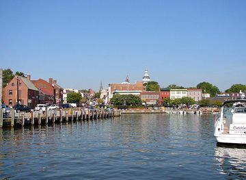
Explore more of Chesapeake Bay Area
Explore Maryland’s Chesapeake Bay Area for historic ports, sailing towns, tidal marshes, seafood traditions and distinctive waterfront landscapes.
Explore Chesapeake Bay Area
Explore more of Maryland
Discover Maryland, where coastal charm meets rich history and outdoor adventure. Experience the best of the East Coast in this small but diverse state.
Explore Maryland