

Quabbin Reservoir Travel Guide - Free Web & App
Your ultimate guide to Quabbin Reservoir. Discover top landmarks, proposed trips, and local tips. Free on the web or via the Evendo companion app.


Quabbin Reservoir in Massachusetts offers forest trails, quiet overlooks, wildlife, fishing and the vanished Swift River Valley’s compelling history.
A Vast Inland Landscape
Quabbin Reservoir occupies a broad, forested basin in central Massachusetts, where the former Swift River Valley was transformed into one of the largest public water-supply reservoirs in the United States. Its waters serve communities in eastern Massachusetts, including Greater Boston, while the surrounding Quabbin Reservation protects an extensive landscape of woodland, wetlands, streams and quiet shoreline. The reservoir is not a conventional lakeside resort: swimming is prohibited, much of the shoreline is inaccessible, and recreation is managed to safeguard drinking water.Read more about Quabbin Reservoir
Overlooks, Forests and Wildlife
The Human Landscape
When is the best time to visit Quabbin Reservoir?
Best: June, August–September · 23–27°C| Month | High (°C) | Rainfall (mm) |
|---|---|---|
| January | 1 | 81 |
| February | 3 | 77 |
| March | 8 | 91 |
| April | 16 | 96 |
| May | 21 | 91 |
| June (best) | 26 | 100 |
| July | 28 | 98 |
| August (best) | 27 | 102 |
| September (best) | 23 | 94 |
| October | 16 | 99 |
| November | 10 | 94 |
| December | 2 | 95 |
Getting to and around Quabbin Reservoir
How to get there
Transportation
Best attractions in Quabbin Reservoir
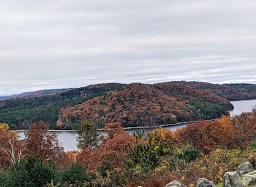
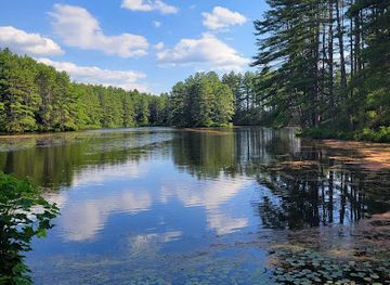
The Quabbin Visitor Center in New Salem is the principal place to learn about the reservoir, the Swift River Valley communities and the water-supply system. At the southern end, Winsor Dam provides a powerful sense of the project’s scale, while Quabbin Park and Enfield Lookout offer accessible perspectives across the water and forested islands. Designated roads, paths and viewpoints lead into a landscape of hardwood woodland, wetlands and quiet coves, where birdwatching, photography and walking are more characteristic than intensive waterside recreation. Historical interest extends to the former town sites, cemetery areas and traces of roads associated with Dana, Enfield, Greenwich and Prescott, although access is controlled and not every remnant is open to visitors. Anglers may fish in authorised areas under Massachusetts regulations, and some permitted boating opportunities may be available under specific rules. The attraction is the combination of expansive water, managed forest and a human landscape deliberately reshaped for public water supply.
-
Tourist attraction
Quabbin Observation Tower
Experience the breathtaking views and natural beauty at Quabbin Observation Tower, a must-visit tourist attraction in Massachusetts.
-
Tourist attraction
Enfield Lookout
Discover the breathtaking views and rich history at Enfield Lookout, a scenic gem in Ware, Massachusetts, perfect for nature lovers and history buffs.
-
Tourist attraction
Hanks Meadow
Discover Hanks Meadow in Ware, MA - a serene natural oasis with picturesque trails and stunning landscapes, perfect for outdoor adventures.
-
Hiking area
Quabbin Park
Discover the serene landscapes and hiking trails of Quabbin Park, a hidden gem in Massachusetts perfect for nature lovers and outdoor enthusiasts.
Best landmarks in Quabbin Reservoir
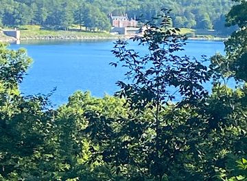
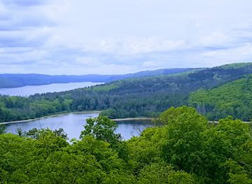
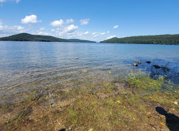
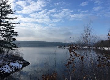
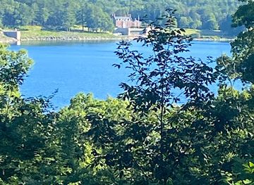
Winsor Dam is Quabbin’s defining built landmark, the major structure that holds back the Swift River and explains the reservoir’s role in Massachusetts’s water-supply system. The broad water surface, wooded islands and forested ridges form the destination’s principal natural landmarks, changing in character with season, weather and viewing position. Quabbin Park, Enfield Lookout and other authorised viewpoints provide different perspectives on this engineered landscape. Beneath the reservoir lies the former Swift River Valley, including the areas associated with Dana, Enfield, Greenwich and Prescott; surviving cemeteries, markers and road traces preserve fragments of that displaced human geography. The Quabbin Visitor Center adds an interpretive landmark rather than an architectural monument, connecting the visible dam and water with the communities that once occupied the valley. Together, these places express Quabbin’s unusual identity as both a major reservoir and a memorial landscape.
-
Park
Quabbin Observation Tower
Discover the breathtaking views and rich history at Quabbin Observation Tower, a peaceful retreat in the heart of Massachusetts.
-
Scenic spot
Enfield Lookout
Discover the breathtaking views and serene atmosphere of Enfield Lookout in Ware, Massachusetts, a perfect retreat for nature lovers and explorers.
-
Historical landmark
Dana Town Common
Explore Dana Town Common, a historical landmark in Massachusetts, where nature meets rich cultural heritage in a serene environment.
Explore Quabbin Reservoir on the map
Plan your trip on one map. See where the top attractions, landmarks, restaurants and hotels are, and book hotels and experiences in a few clicks.
Best hotels in Quabbin Reservoir
Best restaurants in Quabbin Reservoir
There is no restaurant district within the Quabbin Reservation, and visitors should not expect cafés or food outlets beside every viewpoint. Eating opportunities are concentrated in the surrounding towns and villages, including Belchertown, Ware, New Salem, Petersham and other communities on the approaches. These places provide the practical setting for diners seeking independent restaurants, cafés, bakeries, general stores and traditional pub-style meals, though the choice varies by settlement and day. The wider region’s food culture reflects central Massachusetts agriculture, with seasonal produce, dairy products, baked goods and locally made foods appearing more readily at farm shops and small markets than inside the reservation itself. A picnic can suit a day of walking where permitted, but visitors should check local rules, carry out all waste and bring provisions when exploring remote access points.
-
Fast Food
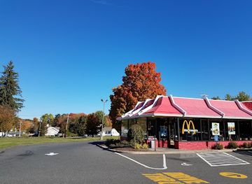
McDonald's
Discover fast food favorites at McDonald's in Belchertown—where convenience meets comfort in every bite.
-
Family-friendly
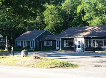
Quabbin Woods Restaurant
Discover Quabbin Woods Restaurant: A charming breakfast spot in Petersham offering delicious meals and a family-friendly atmosphere.
-
Pizza
La Trattoria Pizzeria & Ristorante
Experience authentic Italian cuisine and mouth-watering pizzas at La Trattoria Pizzeria & Ristorante in Belchertown.
-
Sandwich
Subway
Discover delicious custom sandwiches at Subway in Ware, Massachusetts—perfect for travelers seeking quick bites on their journey.


Best bars in Quabbin Reservoir
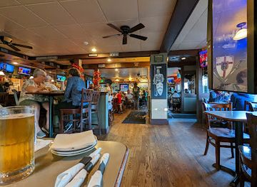
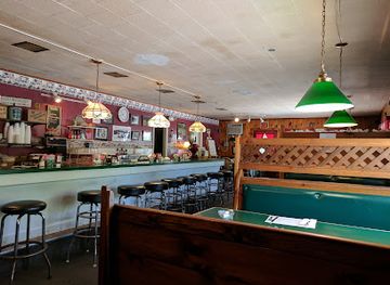
Quabbin Reservoir has no nightlife district and little evening entertainment within the protected reservation. After dark, the experience is defined by quiet roads, forest and the need to leave managed visitor areas in accordance with current access arrangements rather than by bars or performances. Traditional pubs, restaurants and occasional community events may be found in gateway settlements such as Belchertown, Ware, New Salem and Petersham, with the atmosphere generally local and unhurried rather than club-oriented. Larger choices for cinemas, music and late-evening venues are more likely in regional centres outside the immediate Quabbin area, including Amherst or Northampton, but these are separate destinations rather than facilities at the reservoir. Visitors staying nearby should confirm evening opening arrangements independently, particularly in small rural communities.
-
Mexican
Mexicali Cantina Grill
Discover the vibrant flavors of Mexico at Mexicali Cantina Grill, a family-friendly restaurant offering authentic dishes and a lively atmosphere.
-
Pub
McCarthy's Pub
Discover the heart of Belchertown at McCarthy's Pub, a cozy spot for great food, local brews, and a vibrant community atmosphere.
-
Family-friendly
Quabbin Woods Restaurant
Experience a family-friendly haven at Quabbin Woods Restaurant, where delicious breakfast delights meet cozy New England charm.
-
Bar
Shutesbury Athletic Club
Experience the local charm and camaraderie at Shutesbury Athletic Club, your go-to bar for relaxation and socializing in Shutesbury, Massachusetts.


Best shops in Quabbin Reservoir
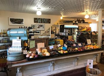
Shopping within Quabbin is deliberately limited because the reservation is managed for water protection and conservation rather than commercial tourism. Visitors should obtain food, fuel, walking supplies and other essentials in surrounding towns such as Belchertown, Ware, New Salem or Petersham before entering the more remote parts of the area. Small local businesses, farm shops and general stores in the wider region may offer seasonal produce, baked goods, preserves and other Massachusetts-made foods, while craft and cultural items are more likely to be found through local museums, galleries or community events than at the reservoir itself. The Quabbin Visitor Center may provide interpretive material, but visitors should not assume a large permanent shop. Retail opportunities are therefore best understood as part of the rural gateway communities rather than as an attraction inside the reservation.
-
Store
The Country Store
Discover authentic New England charm at The Country Store, offering handmade goods, local delicacies, and a taste of Petersham's rich heritage.
-
Outdoor sports store
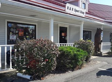
R & R Sport Shop
Discover the best outdoor sports gear at R & R Sport Shop in Belchertown, your one-stop shop for archery, fishing, and hunting essentials.
-
Bicycle Shop
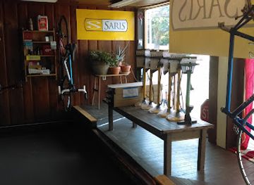
Green Light Bicycle Shop
Discover the ultimate cycling experience at Green Light Bicycle Shop, your go-to destination for bikes and expert repairs in Belchertown.
-
Smoke shop
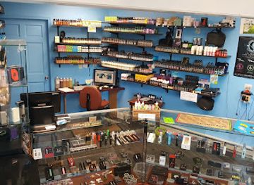
Cloud-9 Curiosities
Explore Cloud-9 Curiosities in Ware, MA for unique smoking accessories and vibrant local glass art, a true gem for discerning tourists.
Get your free copy of our complete guide to Quabbin Reservoir, delivered straight to you.
Everything on this page, from attractions and restaurants to essentials and local phrases, in one PDF you can read offline, print or share.
Already have an account? Sign in
Your Quabbin Reservoir guide is ready.
We'll send it to · Not you? Sign out

Getting your guide ready…
We are putting together a fresh copy of the Quabbin Reservoir guide. This can take up to a minute.
This can take a few moments. If your browser asks, choose Allow so the download can start. You'll find the guide in your Downloads folder.
Nothing happened? Download it again
Sorry, the guide is taking longer than usual. Please try again in a minute, or get it by email instead.
Quabbin Reservoir essentials
Currency and Payment
Safety
Emergency Situations
Do's and Don'ts
Local Tips
From Eve
Local phrases worth knowing
You don't need to get them perfect. A few words go a long way, and locals appreciate the effort.
Basics
| English | Local | Say it |
|---|---|---|
| Hello | Wicked good | [wick-ed good] |
| Goodbye | Catch ya later | [catch ya lay-tah] |
| Yes | Ayuh | [ay-uh] |
| No | Nah | [na] |
| Please/You're welcome | Pah-leez/No problum | [pah-leez/no pro-blum] |
| Thank you | Much obliged | [much o-blaiged] |
| Excuse me/Sorry | Pah-den me/Sowwy | [pah-den me/sow-ee] |
| How are you? | How's it goin'? | [hows it go-in] |
| Fine. And you? | Wicked good. You? | [wick-ed good. you?] |
| Do you speak English? | Ya tawk Inglish? | [ya talk in-glish] |
| I don't understand | I ain't got no idear | [I aint got no idear] |
Eating & Drinking
| English | Local | Say it |
|---|---|---|
| I'd like to see the menu, please | I'd like ta see the menu, please | [I'd like ta see the menu, please] |
| I don't eat meat | I don't eat no meat | [I don't eat no meat] |
| Cheers! | Skoal! | [skoal] |
| I would like to pay, please | I'd like ta settle up, please | [I'd like ta settle up, please] |
Emergencies
| English | Local | Say it |
|---|---|---|
| Help! | Hee-ulp! | [hee-ulp] |
| Go away! | Git outta hee-uh! | [Git outta hee-uh] |
| Call the Police! | Call the Staties! | [Call the Staties] |
| Call a doctor! | Call the sawbones! | [Call the sawbones] |
| I'm lost | I'm wicked lost | [I'm wicked lost] |
| I'm ill | I'm feelin' rough | [I'm feelin' rough] |
Shopping
| English | Local | Say it |
|---|---|---|
| I'd like to buy... | I wanna git... | [I wanna git] |
| I'm just looking | I'm just browsin' | [I'm just browsin'] |
| How much is it? | How much fer that? | [How much fer that] |
| That's too expensive | That's wicked pricey | [That's wicked pricey] |
| Can you lower the price? | Kin ya do bettah on the price? | [Kin ya do bettah on the price] |
Time & Numbers
| English | Local | Say it |
|---|---|---|
| What time is it? | What's the toime? | [What's the toime] |
| It's one o'clock | It's one | [It's one] |
| Half past (10) | Half past ten | [Half past ten] |
| Morning | Mornin' | [Mornin'] |
| Afternoon | Aftanoon | [Aftanoon] |
| Evening | Evenin' | [Evenin'] |
| Yesterday | Yestaday | [Yestaday] |
| Today | T'day | [T'day] |
| Tomorrow | Tomorra | [Tomorra] |
| 1 | One | [One] |
| 2 | Two | [Two] |
| 3 | Tree | [Tree] |
| 4 | Fo' | [Fo'] |
| 5 | Fahv | [Fahv] |
| 6 | Six | [Six] |
| 7 | Seven | [Seven] |
| 8 | Ate | [Ate] |
| 9 | Nine | [Nine] |
| 10 | Ten | [Ten] |
Transport & Directions
| English | Local | Say it |
|---|---|---|
| Where's a/the...? | Where's the... | [Where's the] |
| What's the address? | What's the addy? | [What's the addy] |
| Can you show me (on the map)? | Kin ya show me where it's at? | [Kin ya show me where it's at] |
| When's the next (bus)? | When's the next one comin'? | [When's the next one comin'] |
| A ticket (to ....) | A ticket to... | [A ticket to] |
History of Quabbin Reservoir
The Swift River Valley Before the Reservoir
Before Quabbin Reservoir was created, the Swift River flowed through a settled agricultural valley in central Massachusetts. The towns of Dana, Enfield, Greenwich and Prescott occupied the valley, with farms, mills, churches, schools, cemeteries and local roads shaping community life. The surrounding uplands supported woodland and rural industries, while the river connected the settlements along the valley floor. Although the area was never a major urban centre, its communities possessed established civic identities and long-standing family connections. Their history remains central to understanding Quabbin, because the modern reservoir covers the physical centre of a populated landscape rather than an empty wilderness.
The Water-Supply Project
The creation of Quabbin arose from eastern Massachusetts’s growing demand for dependable drinking water. Following legislation and planning in the early twentieth century, the Swift River Valley was selected for a major reservoir project. Land was acquired, residents were relocated and the four valley towns were formally discontinued during the 1930s. Buildings and infrastructure were removed or demolished, although some cemeteries and fragments of the former road network survived. The project involved constructing Winsor Dam and associated works to impound the Swift River. The scale of the undertaking altered the geography of central Massachusetts and permanently separated displaced communities from their original town sites.
Building the Reservoir
Construction of the reservoir and dam brought large engineering works to a rural valley during the years of the Great Depression. The impounded Swift River gradually filled the basin, submerging roads, farms and most of the former settlements. The resulting body of water became a strategic source for the Massachusetts water-supply system, linked by the Quabbin Aqueduct to reservoirs and treatment infrastructure serving eastern communities. The visible landscape therefore represents both an engineering achievement and a profound social transformation. Winsor Dam and the surrounding roads remain the most tangible reminders of the project’s construction history.
Memory Beneath the Water
The former towns have not disappeared from local memory. Dana’s centre, the Prescott area and other lost places are remembered through cemetery sites, surviving markers, oral history and historical interpretation. The Quabbin Visitor Center presents information about the valley communities, the reservoir project and the continuing importance of the water supply. Former roads and cellar holes may be encountered in permitted areas, but they should be treated as historical traces rather than unrestricted ruins. The history of displacement also gives the reservation a cultural dimension that distinguishes it from a purely scenic recreation area.
Conservation and Public Access
Once the reservoir was established, protection of water quality became the governing principle of the surrounding reservation. Massachusetts state agencies have managed the land and water through regulated access, restrictions on shoreline use and careful control of recreation. Forest management, habitat protection and public education now exist alongside the reservoir’s primary function as drinking-water infrastructure. Walking, nature observation, photography and selected fishing opportunities are permitted in designated circumstances, while activities that could compromise water quality are restricted. Modern Quabbin is consequently both a working public utility and a large protected landscape shaped by twentieth-century engineering and ongoing environmental management.
Quabbin Reservoir in Photos
Browse through our photo collection highlighting the charm and character of the destination.
Neighbouring destination travel guides
The closest destinations to Quabbin Reservoir, if you have time for more than one.
-

-

-

-

-


Swipe for more destinations
Explore more
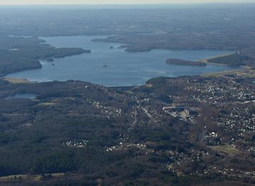
Explore more of Quabbin and Ware River Valley
Discover the serene beauty of Quabbin Reservoir and Ware River Valley in Massachusetts, a perfect retreat for nature lovers and history enthusiasts.
Explore Quabbin and Ware River Valley
Explore more of Massachusetts
Discover Massachusetts: A blend of rich history, stunning landscapes, and vibrant culture. From Boston's historic sites to Cape Cod's beaches, it's the heart of New England.
Explore Massachusetts