

Centro Histórico (Oaxaca) Travel Guide - Free
Explore Centro Histórico in Oaxaca with Evendo's free guide. Find the best shops, historic streets, restaurants, and gems on web or mobile.


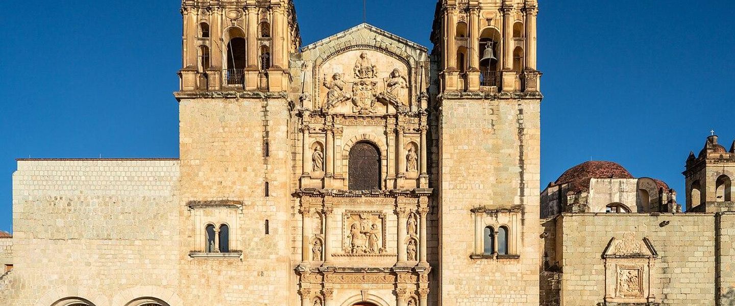


Centro Histórico Oaxaca blends colonial streets, Santo Domingo, lively markets, mezcal, Indigenous crafts, regional food and memorable cultural walks.
Streets Shaped by History
Oaxaca’s Centro Histórico is the city’s cultural and civic heart, a broad central district of low-rise stone and stucco buildings, arcaded façades, shaded plazas and streets laid out around the Zócalo. Its historic fabric reflects the Spanish colonial city of Antequera, yet the area is inseparable from the Indigenous cultures, languages, crafts and food traditions of the surrounding valleys and mountains. The result is not a museum quarter but an intensively used part of daily Oaxacan life.Read more about Centro Histórico
Public Squares and Sacred Architecture
Food, Craft and Evening Life
Explore Centro Histórico on the map
A handpicked selection of must-see spots in Centro Histórico, mapped for you.
Best hotels in Centro Histórico
Centro Histórico essentials
Getting There
Getting Around
Safety
Emergency Situations
Do's and Don'ts
Local Tips

From Eve
Local phrases worth knowing
You don't need to get them perfect. A few words go a long way, and locals appreciate the effort.
Basics
| English | Local | Say it |
|---|---|---|
| Hello | Hola | [oh-lah] |
| Goodbye | Adiós | [ah-dee-ohs] |
| Yes | Sí | [see] |
| No | No | [noh] |
| Please/You're welcome | Por favor/De nada | [por fah-vor/deh nah-dah] |
| Thank you | Gracias | [grah-see-ahs] |
| Excuse me/Sorry | Perdón/Lo siento | [pair-dohn/loh see-en-toh] |
| How are you? | ¿Cómo estás? | [koh-moh ehs-tahs] |
| Fine. And you? | Bien. ¿Y tú? | [bee-en. ee too] |
| Do you speak English? | ¿Hablas inglés? | [ah-blahs een-glehs] |
| I don't understand | No entiendo | [noh ehn-tee-ehn-doh] |
Eating & Drinking
| English | Local | Say it |
|---|---|---|
| I'd like to see the menu, please | Me gustaría ver el menú, por favor | [meh goo-stah-ree-ah vehr ehl meh-noo, pohr fah-vor] |
| I don't eat meat | No como carne | [noh koh-moh kahr-neh] |
| Cheers! | ¡Salud! | [sah-lood] |
| I would like to pay, please | Me gustaría pagar, por favor | [meh goo-stah-ree-ah pah-gahr, pohr fah-vor] |
Emergencies
| English | Local | Say it |
|---|---|---|
| Help! | ¡Ayuda! | [ah-yoo-dah] |
| Go away! | ¡Vete! | [veh-teh] |
| Call the Police! | ¡Llama a la policía! | [yah-mah ah lah poh-lee-see-ah] |
| Call a doctor! | ¡Llama a un doctor! | [yah-mah ah oon dohk-tohr] |
| I'm lost | Estoy perdido | [ehs-toy pair-dee-doh] |
| I'm ill | Estoy enfermo | [ehs-toy ehn-fehr-moh] |
Shopping
| English | Local | Say it |
|---|---|---|
| I'd like to buy... | Me gustaría comprar... | [meh goo-stah-ree-ah kohm-prahr] |
| I'm just looking | Sólo estoy mirando | [soh-loh ehs-toy mee-rahn-doh] |
| How much is it? | ¿Cuánto cuesta? | [kwan-toh kwehs-tah] |
| That's too expensive | Eso es demasiado caro | [eh-soh ehs deh-mah-see-ah-doh kah-roh] |
| Can you lower the price? | ¿Puedes bajar el precio? | [pweh-dehs bah-hahr ehl pree-syoh] |
Time & Numbers
| English | Local | Say it |
|---|---|---|
| What time is it? | ¿Qué hora es? | [keh oh-rah ehs] |
| It's one o'clock | Es la una | [ehs lah oo-nah] |
| Half past (10) | Las diez y media | [lahs dee-ehs ee meh-dee-ah] |
| Morning | Mañana | [mah-nyah-nah] |
| Afternoon | Tarde | [tahr-deh] |
| Evening | Noche | [noh-cheh] |
| Yesterday | Ayer | [ah-yehr] |
| Today | Hoy | [oy] |
| Tomorrow | Mañana | [mah-nyah-nah] |
| 1 | Uno | [oo-noh] |
| 2 | Dos | [dohs] |
| 3 | Tres | [trehs] |
| 4 | Cuatro | [kwah-troh] |
| 5 | Cinco | [seen-koh] |
| 6 | Seis | [says] |
| 7 | Siete | [syeh-teh] |
| 8 | Ocho | [oh-choh] |
| 9 | Nueve | [nweh-veh] |
| 10 | Diez | [dyehs] |
Transport & Directions
| English | Local | Say it |
|---|---|---|
| Where's a/the...? | ¿Dónde está...? | [dohn-deh ehs-tah] |
| What's the address? | ¿Cuál es la dirección? | [kwal ehs lah dee-rehk-syon] |
| Can you show me (on the map)? | ¿Puedes mostrarme (en el mapa)? | [pweh-dehs mohs-trar-meh (ehn ehl ma-pah)] |
| When's the next (bus)? | ¿Cuándo es el próximo (autobús)? | [kwan-doh ehs ehl proh-ksee-moh (ow-toh-boos)] |
| A ticket (to ....) | Un boleto (a ....) | [oon boh-leh-toh (ah)] |
History of Centro Histórico
Antequera and the Colonial Grid
The Spanish settlement of Antequera was formally established in the sixteenth century in the Oaxaca Valley, on territory shaped by much older Indigenous communities and close to the great Zapotec centre of Monte Albán. The colonial town developed around a regular grid, with the principal square, churches, civic buildings and domestic courtyards forming the pattern still visible in Centro Histórico. Local building traditions, available stone and the seismic conditions of the region encouraged sturdy, relatively low-rise construction rather than tall structures. The district’s identity therefore emerged from an interaction between Spanish urban planning and the people, materials and regional networks of Oaxaca.
Dominican Foundations and Urban Growth
Dominican religious institutions played a major role in shaping the historic centre. The complex of Santo Domingo de Guzmán, developed over several centuries from the late sixteenth century, became one of the city’s defining architectural and intellectual landmarks. Churches, convents and neighbourhood chapels established a network of religious and civic spaces around the central grid, while markets and workshops linked the town to communities across the valley. Indigenous artisans and merchants remained essential to the city’s economy and culture, even as colonial administration and ecclesiastical power gave the centre its formal layout and monumental buildings.
Reform, Juárez and the Modern City
The nineteenth century brought political upheaval and changes to religious property, civic administration and urban life. Oaxaca was closely associated with Benito Juárez, who was born in the state and later became Mexico’s president; the city took the name Oaxaca de Juárez in 1872. Former religious spaces were adapted to new public and cultural uses, while commercial activity around the markets and central streets expanded. These changes did not erase the older urban fabric, but they added civic institutions and secular functions to a district already marked by churches, convents and colonial houses.
Heritage Protection and Living Continuity
The historic centre’s colonial architecture and the nearby archaeological zone of Monte Albán were inscribed together as a UNESCO World Heritage Site in 1987. Recognition encouraged conservation of the grid, façades, churches and public spaces, while Oaxaca’s traditional arts, festivals and food culture continued to give the centre its living character. Restoration and tourism have brought galleries, restaurants, mezcalerías and boutique accommodation to streets once dominated by local commerce, creating economic opportunities alongside pressures familiar to historic districts. The Centro Histórico remains a working centre of administration, worship, trade and community celebration rather than a preserved enclave removed from ordinary life.
Centro Histórico in Photos
Browse through our photo collection highlighting the charm and character of the destination.
Neighbourhoods near Centro Histórico
The closest neighbourhoods to Centro Histórico, if you have time for more than one stop.

Swipe for more neighbourhoods
Explore more

Explore more of Oaxaca
Oaxaca, Mexico, blends Zapotec heritage, colonial architecture, celebrated cuisine, lively markets and memorable cultural experiences in the Central Valleys.
Explore Oaxaca