

Free Prairie Pothole Region Travel Guide & Mobile App
Explore Prairie Pothole Region with free travel guides. Discover regional history, expert tips, proposed trips, and audio guides on web or mobile app.


Explore Minnesota’s Prairie Pothole Region for migratory birds, glacial wetlands, open prairie, rural heritage and wide-sky outdoor journeys.
Read more about Prairie Pothole Region
When is the best time to visit Prairie Pothole Region?
Best: May–June, September · 22–27°C| Month | High (°C) | Rainfall (mm) |
|---|---|---|
| January | -7 | 20 |
| February | -4 | 25 |
| March | 5 | 35 |
| April | 15 | 50 |
| May (best) | 22 | 70 |
| June (best) | 27 | 90 |
| July | 29 | 100 |
| August | 28 | 90 |
| September (best) | 24 | 70 |
| October | 15 | 60 |
| November | 3 | 40 |
| December | -4 | 30 |
Getting to and around Prairie Pothole Region
How to get there
Transportation
Top city travel guides in Prairie Pothole Region
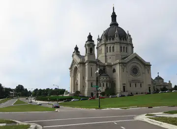
The cities of Prairie Pothole Region, and the easiest places to base yourself.
-

-
-

-

-


Swipe for more cities
Destinations in Prairie Pothole Region
Resorts, valleys and scenic spots worth a trip of their own.
-

-

-

-


Swipe for more destinations
Best attractions in Prairie Pothole Region
The Prairie Pothole Region’s attractions are primarily landscape-based. Big Stone National Wildlife Refuge offers a broad wetland complex, observation opportunities and trails around shallow lakes and grassland, while Glacial Ridge National Wildlife Refuge protects a large prairie restoration landscape in north-western Minnesota. State wildlife management areas, scientific and natural areas and county parks add smaller-scale opportunities for birdwatching, photography, fishing, hiking and seasonal hunting where authorised. Around Fergus Falls, Detroit Lakes, Moorhead, Crookston, Morris, Ortonville and other regional centres, museums and historic districts explain settlement, agriculture and local community life. Visitors can also look for prairie wildflowers, nesting waterfowl, shorebirds and raptors, although sightings are never guaranteed. The experience is less about a dense chain of ticketed attractions than about linking protected wetlands, open grasslands, farm-country towns and long scenic drives. Distances, weather and access conditions are part of the itinerary, so a good visit combines one or two carefully chosen reserves with time for local services, food and regional history.
-
Arboretum
Minnesota Landscape Arboretum
Discover the stunning gardens and serene landscapes of the Minnesota Landscape Arboretum, a premier destination for nature lovers and art enthusiasts.
-
State park
Itasca State Park
Explore Itasca State Park in Minnesota, a natural wonder filled with hiking, camping, and the headwaters of the Mississippi River.
-
Visitor center
Pipestone National Monument
Explore the sacred landscapes of Pipestone National Monument, where history, culture, and nature unite in stunning harmony.
-
Park
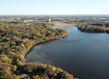
Bryant Lake Regional Park
Experience the natural beauty and recreational opportunities at Bryant Lake Regional Park in Eden Prairie, Minnesota, a perfect escape for outdoor enthusiasts.


Best landmarks in Prairie Pothole Region
The most characteristic landmarks are geological and ecological rather than monumental. The shallow lakes, grass-covered ridges and scattered basins of Big Stone National Wildlife Refuge express the glacial processes that formed the region, while Glacial Ridge National Wildlife Refuge is notable for its extensive prairie restoration and broad open horizons. In settled areas, grain elevators, historic courthouses, railway depots, churches and compact downtown streets record the agricultural and transport systems that built modern communities. The Minnesota side of the Bois de Sioux and Red rivers also reflects the importance of waterways and the wider Red River country, though the region’s boundaries are ecological rather than sharply marked on the ground. Individual prairie remnants and wetland complexes can be visually modest, but their significance lies in their scarcity and role in supporting migratory and breeding birds. Together, these places create a landscape landmark system in which water, grassland, farming and small-town architecture are inseparable.
-
History museum
Andrew J. Volstead House Museum
Discover the history of Prohibition at Andrew J. Volstead House Museum in Granite Falls, MN, and explore the life of the man behind the Volstead Act.
-
Tourist attraction
Headwaters of the Minnesota River
Explore the tranquil Headwaters of the Minnesota River, a stunning natural attraction offering wildlife encounters and outdoor adventures.


Explore Prairie Pothole Region on the map
Plan your trip on one map. See where the top cities, national parks and sights are, and book hotels and experiences in a few clicks.
Best hotels in Prairie Pothole Region
Best restaurants in Prairie Pothole Region
Dining is shaped by the small-town and agricultural character of western Minnesota. In regional centres, visitors will find cafés, bakeries, family restaurants, supper clubs and contemporary establishments serving familiar Upper Midwestern food alongside broader American fare. Menus may feature locally produced beef, pork, poultry, dairy products and seasonal vegetables, while fish from Minnesota lakes appears in some restaurants and community events. Farmers’ markets and farm stands can provide berries, vegetables, preserves, baked goods and locally made products when in season, although schedules vary by town and season. Scandinavian and German-American influences remain visible in parts of the region’s baking and home-cooking traditions, but the food culture is not uniform and has been shaped by many later communities as well. In rural areas, plan meals around opening patterns and distances rather than expecting a concentration of restaurants near every refuge or prairie reserve.
-
American
Kona Grill - Eden Prairie
Experience the best of American dining with a twist at Kona Grill - Eden Prairie; where delicious sushi meets classic comfort food.
-
Restaurant
Tavern 4&5
Discover Tavern 4&5 in Eden Prairie - where American comfort food meets vibrant nightlife.
-
American
Redstone American Grill
Experience the finest in American cuisine at Redstone American Grill, where delicious food meets inviting ambiance in Eden Prairie.
-
Restaurant
Pink Ivy Kitchen and Bar
Savor innovative dishes at Pink Ivy Kitchen and Bar in Hopkins - where local flavors meet global influences for an unforgettable dining experience.


Best bars in Prairie Pothole Region
Evening life is concentrated in regional towns rather than spread through the countryside. Fergus Falls, Detroit Lakes, Moorhead, Marshall, Alexandria, Crookston and similar centres offer combinations of traditional bars, neighbourhood pubs, restaurants, breweries, live music and community entertainment, with the scale and choice varying by town. Detroit Lakes has a more pronounced seasonal leisure atmosphere around its lake and summer visitor period, while university-linked Moorhead offers a broader range of evening venues through the adjacent Fargo–Moorhead area; Fargo is outside Minnesota’s Prairie Pothole Region and should not be confused with a regional destination. Smaller communities generally rely on local bars, supper clubs, social halls and occasional events rather than nightclubs. Check current arrangements locally, as independent venues and seasonal programming can change, and remember that rural driving distances make a designated driver or overnight stay important.
-
New American
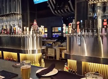
Yard House
Experience the best of New American cuisine at Yard House in St. Louis Park, a lively gastropub with an extensive beer selection and vibrant atmosphere.
-
Bar
10 Spot Bar & Lounge
Discover the lively 10 Spot Bar & Lounge in Royalton, MN, where friendly service and a vibrant atmosphere await every visitor.

Best nightclubs in Prairie Pothole Region
Evening life is concentrated in regional towns rather than spread through the countryside. Fergus Falls, Detroit Lakes, Moorhead, Marshall, Alexandria, Crookston and similar centres offer combinations of traditional bars, neighbourhood pubs, restaurants, breweries, live music and community entertainment, with the scale and choice varying by town. Detroit Lakes has a more pronounced seasonal leisure atmosphere around its lake and summer visitor period, while university-linked Moorhead offers a broader range of evening venues through the adjacent Fargo–Moorhead area; Fargo is outside Minnesota’s Prairie Pothole Region and should not be confused with a regional destination. Smaller communities generally rely on local bars, supper clubs, social halls and occasional events rather than nightclubs. Check current arrangements locally, as independent venues and seasonal programming can change, and remember that rural driving distances make a designated driver or overnight stay important.
-
Bar
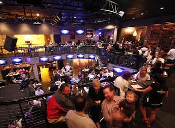
Bunker's Music Bar & Grill
Discover the lively energy of Bunker's Music Bar & Grill in Minneapolis, where great food meets electrifying live music in a welcoming atmosphere.
-
Night club
The Pourhouse
Experience the vibrant nightlife and delicious American cuisine at The Pourhouse, Minneapolis' premier night club and live music venue.
-
Gay bar
The Saloon
Experience the pulse of Minneapolis nightlife at The Saloon, a premier gay bar and dance club celebrating diversity and inclusivity.
-
Gay bar
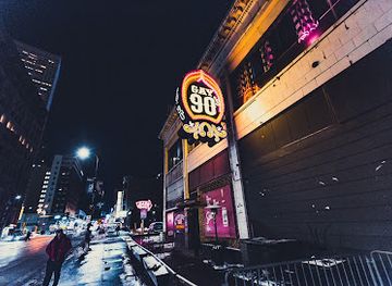
Gay 90's Minneapolis
Discover the vibrant nightlife and unforgettable drag shows at Gay 90's Minneapolis – a premier gay bar and nightclub experience.


Best shops in Prairie Pothole Region
Shopping is centred on the main streets and commercial districts of regional towns rather than on large destination malls. Fergus Falls, Detroit Lakes, Moorhead, Crookston, Morris, Ortonville, Alexandria and Marshall provide practical shopping, independent retailers, galleries, bookshops, outdoor suppliers and locally focused food outlets, with the range differing from town to town. Seasonal farmers’ markets and farm stands are useful for regional produce, preserves, baked goods and gifts, while craft fairs and county events may offer pottery, textiles, woodwork, artwork and handmade decorations. Visitors interested in the landscape can look for field guides, birding equipment, locally produced food and work by artists depicting prairie and wetland scenery. Retail hours may be shorter in small communities and some markets operate only during warmer months, so check locally rather than relying on metropolitan shopping expectations.
-
Shopping mall
Eden Prairie Center
Discover a premier shopping experience at Eden Prairie Center, featuring diverse shops, dining options, and family-friendly activities in Minnesota.
-
Toy store
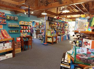
LARK Toys
Explore the enchanting world of LARK Toys in Kellogg, MN, where nostalgia meets fun with toys, games, and delightful attractions for everyone.
-
Gift shop
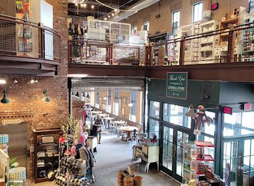
General Store of Minnetonka
Explore the General Store of Minnetonka for unique gifts, boutique clothing, and cozy café experiences in a charming Minnesota setting.
-
Department store
Von Maur
Discover the elegance of shopping at Von Maur, a premier department store offering a unique selection of clothing and exceptional customer service.


Get your free copy of our complete guide to Prairie Pothole Region, delivered straight to you.
Everything on this page, from attractions and restaurants to essentials and local phrases, in one PDF you can read offline, print or share.
Already have an account? Sign in
Your Prairie Pothole Region guide is ready.
We'll send it to · Not you? Sign out

Getting your guide ready…
We are putting together a fresh copy of the Prairie Pothole Region guide. This can take up to a minute.
This can take a few moments. If your browser asks, choose Allow so the download can start. You'll find the guide in your Downloads folder.
Nothing happened? Download it again
Sorry, the guide is taking longer than usual. Please try again in a minute, or get it by email instead.
Prairie Pothole Region essentials
Currency and Payment
Safety
Emergency Situations
Do's and Don'ts
Local Tips
From Eve
Local phrases worth knowing
You don't need to get them perfect. A few words go a long way, and locals appreciate the effort.
Basics
| English | Local | Say it |
|---|---|---|
| Hello | Howdy | [How-dee] |
| Goodbye | Take care | [Tayk kair] |
| Yes | Yup | [Yup] |
| No | Nah | [Nah] |
| Please/You're welcome | Please | [Pleez] |
| Thank you | Thanks a lot | [Thangs a lot] |
| Excuse me/Sorry | Sorry | [Sor-ee] |
| How are you? | How's it going? | [How's it goin'?] |
| Fine. And you? | Good. And you? | [Good. And you?] |
| Do you speak English? | Do ya speak English? | [Doo yah speek English?] |
| I don't understand | I ain't got it | [I ain't got it] |
Eating & Drinking
| English | Local | Say it |
|---|---|---|
| I'd like to see the menu, please | Can I see the menu? | [Can I see the men-yoo?] |
| I don't eat meat | I don't eat meat | [I don't eet meat] |
| Cheers! | Cheers! | [Cheers!] |
| I would like to pay, please | Can I get the bill? | [Can I get the bill?] |
Emergencies
| English | Local | Say it |
|---|---|---|
| Help! | Help! | [Help!] |
| Go away! | Leave me alone! | [Leev me alone!] |
| Call the Police! | Call the cops! | [Call the cops!] |
| Call a doctor! | Get a doctor! | [Get a doctor!] |
| I'm lost | I'm lost | [I'm lost] |
| I'm ill | I'm not feeling well | [I'm not feelin' well] |
Shopping
| English | Local | Say it |
|---|---|---|
| I'd like to buy... | I want to buy... | [I want to buy...] |
| I'm just looking | Just browsing | [Just browsing] |
| How much is it? | What’s the price? | [What’s the price?] |
| That's too expensive | That's too pricey | [That's too pricey] |
| Can you lower the price? | Can ya make it cheaper? | [Can ya make it cheaper?] |
Time & Numbers
| English | Local | Say it |
|---|---|---|
| What time is it? | What time is it? | [What time is it?] |
| It's one o'clock | It's one o'clock | [It's one o'clock] |
| Half past (10) | Half past ten | [Half past ten] |
| Morning | Morning | [Morning] |
| Afternoon | Afternoon | [Afternoon] |
| Evening | Evening | [Evening] |
| Yesterday | Yesterday | [Yesterday] |
| Today | Today | [Today] |
| Tomorrow | Tomorrow | [Tomorrow] |
| 1 | One | [One] |
| 2 | Two | [Two] |
| 3 | Three | [Three] |
| 4 | Four | [Four] |
| 5 | Five | [Five] |
| 6 | Six | [Six] |
| 7 | Seven | [Seven] |
| 8 | Eight | [Eight] |
| 9 | Nine | [Nine] |
| 10 | Ten | [Ten] |
Transport & Directions
| English | Local | Say it |
|---|---|---|
| Where's a/the...? | Where's the...? | [Where's the...?] |
| What's the address? | What's the address? | [What's the address?] |
| Can you show me (on the map)? | Can ya show me on the map? | [Can ya show me on the map?] |
| When's the next (bus)? | When's the next bus? | [When's the next bus?] |
| A ticket (to ....) | A ticket to... | [A ticket to...] |
History of Prairie Pothole Region
Glacial Formation and the Prairie Wetlands
The region’s physical character was shaped during the late stages of the last Ice Age, when retreating glaciers left behind uneven deposits of sediment and isolated blocks of ice. As buried ice melted, it formed thousands of shallow depressions, or potholes, that collected water across the prairie. These wetlands became part of one of North America’s major waterfowl-breeding landscapes. Glacial ridges, lake basins and poorly drained soils also influenced later farming patterns, roads and settlement. The region’s ecological history therefore begins with geology: the distinctive combination of open grassland and scattered water is a direct legacy of glacial retreat.
Dakota Homelands and Indigenous Continuity
The prairies and river systems of western Minnesota are within the longstanding homelands of Dakota peoples, whose communities developed deep relationships with the region’s lakes, rivers, grasslands and wildlife. Indigenous knowledge shaped seasonal movement, plant use, hunting and fishing, while trade connected communities across the upper Mississippi and Red River country. Ojibwe communities are also part of Minnesota’s continuing Indigenous presence, particularly across the wider northern and central state. Colonisation, warfare, treaties and forced displacement profoundly altered Indigenous life, but Indigenous nations, cultural institutions and citizens remain part of Minnesota’s present rather than only its past.
Fur Trade, River Routes and the Red River Trails
Before railways, waterways and overland trails linked the prairie interior to regional trading centres. The Red River system supported movement between present-day Minnesota, North Dakota and Manitoba, while routes around the Minnesota and Upper Mississippi river valleys connected the interior with larger markets. Red River carts, distinctive two-wheeled vehicles suited to rough prairie travel, carried furs, hides, agricultural goods and supplies. Trading posts and frontier settlements did not form a continuous urban network, but they established transport patterns that later influenced roads, town sites and the commercial importance of communities on the western Minnesota prairie.
Treaties, Settlement and Agricultural Expansion
During the nineteenth century, United States treaty-making and land policies opened large areas of western Minnesota to non-Indigenous settlement, profoundly reducing Dakota landholding and sovereignty. New settlers established farms and towns on land that had supported Indigenous communities for generations. Wheat, livestock and later diversified crops became central to the regional economy, while timber was less dominant here than in northern Minnesota. Surveyed townships, churches, schools, grain elevators and courthouse communities created the rural landscape familiar today. Railways accelerated the process by connecting prairie production to markets and attracting businesses and migrants.
Drainage, Farming and Wetland Loss
Agricultural development brought extensive drainage of shallow lakes and seasonal wetlands, especially where flat land could be converted into fields. Roads, ditches and cultivation altered water flows and reduced the amount of original prairie habitat. The changes increased farmable acreage but also contributed to soil erosion, water-quality pressures and the decline of breeding habitat for waterfowl. The region’s modern appearance is therefore a mixture of highly productive agriculture and fragments of its earlier ecosystem. Remaining wetlands, native prairie and restored grasslands are especially important because they preserve ecological functions that are scarce across the intensively farmed landscape.
Conservation and the National Wildlife Refuge System
Concern about declining wetlands and migratory birds helped drive twentieth-century conservation across the Prairie Pothole Region. Federal and state programmes protected waterfowl habitat, acquired wetlands and grasslands, and encouraged restoration on public and private land. Places such as Big Stone National Wildlife Refuge and Glacial Ridge National Wildlife Refuge illustrate different conservation approaches, from protecting shallow wetland complexes to restoring extensive native prairie. Wildlife refuges, state management areas and conservation partnerships now support breeding birds, migrating species and outdoor recreation, although habitat protection remains an ongoing task rather than a completed project.
Modern Rural Communities and Prairie Restoration
Today, the region combines mechanised agriculture with conservation science, small-town institutions and a growing interest in wildlife tourism and outdoor recreation. Farmers, local organisations, public agencies and land trusts may manage grasslands and wetlands for soil health, water retention, pollinators and birds alongside commercial production. Towns continue to serve as service centres for broad rural areas, even as population change and agricultural consolidation affect their economies. The contemporary Prairie Pothole Region is consequently neither untouched wilderness nor simply farmland: it is a working landscape in which restoration, production and community life continue to shape one another.
Prairie Pothole Region in Photos
Browse through our photo collection highlighting the charm and character of the destination.
Neighbouring regions of Prairie Pothole Region
The closest regions to Prairie Pothole Region, if you have time for more than one.
-
-
-

-

-


Swipe for more regions
Explore more

Explore more of Minnesota
Discover Minnesota: From the bustling Twin Cities and cultural landmarks to the serene lakes and expansive wilderness, experience the diverse beauty and welcoming spirit of the North Star State.
Explore Minnesota