

Charleston Area Beaches Travel Guide - Free Web & App
Your ultimate guide to Charleston Area Beaches. Discover top landmarks, proposed trips, and local tips. Free on the web or via the Evendo companion app.


Charleston Area Beaches in South Carolina offer surf, tidal marshes, historic islands, wildlife, seafood and relaxed coastal escapes near Charleston.
A Lowcountry Coast of Distinctive Shores
Charleston Area Beaches describe a chain of very different Atlantic shores around Charleston, South Carolina, rather than one continuous resort coastline. Folly Beach lies on a barrier island south of the city and has the area's most recognisably relaxed surf-town atmosphere, while Sullivan's Island and Isle of Palms stretch east and north across Charleston Harbor. Farther south, Kiawah Island and Seabrook Island offer quieter, more managed coastal settings shaped by maritime forest, tidal creeks and broad beaches. These islands are linked by water, marsh and tidal inlets, but each has its own rules, character and pattern of development.Read more about Charleston Area Beaches
Beaches, Marshes and Wildlife
Coastal Communities and Charleston Access
When is the best time to visit Charleston Area Beaches?
Best: April, October–November · 21–27°C| Month | High (°C) | Rainfall (mm) |
|---|---|---|
| January | 16 | 80 |
| February | 18 | 85 |
| March | 22 | 101 |
| April (best) | 27 | 83 |
| May | 30 | 101 |
| June | 34 | 147 |
| July | 35 | 177 |
| August | 34 | 190 |
| September | 32 | 158 |
| October (best) | 27 | 91 |
| November (best) | 21 | 83 |
| December | 17 | 79 |
Getting to and around Charleston Area Beaches
How to get there
Transportation
Best attractions in Charleston Area Beaches
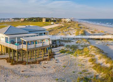
Folly Beach is the liveliest of the principal public beach communities, with a wide Atlantic shore, surf-oriented atmosphere and the long Folly Beach Pier extending into the ocean. Sullivan's Island combines a quieter strand with Fort Moultrie and views towards Charleston Harbor, while Isle of Palms offers a broad beach, a pier area and a more developed seaside settlement. South of the city, Kiawah Island is known for its beaches, maritime forest, tidal creeks and managed wildlife habitat, though access varies across the island; neighbouring Seabrook Island is similarly residential and controlled. Morris Island, at the harbour entrance, is a striking undeveloped barrier island with the isolated Morris Island Lighthouse offshore, generally approached by boat rather than ordinary beach access. Nearby marshes, estuaries and tidal creeks add a different dimension to the open shore, revealing the Lowcountry landscape through kayaking, birdwatching and quiet shoreline walks.
-
Boat tour agency
Charleston Outdoor Adventures
Discover adventure and tranquility at Charleston Outdoor Adventures. Experience fishing, kayaking, and wildlife tours in scenic Charleston, SC.
-
Tourist attraction
Rainbow Row
Explore Rainbow Row, Charleston’s iconic pastel homes that showcase the city's historic charm and vibrant architecture in a picturesque setting.
-
Park
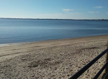
Folly Beach County Park
Discover the natural beauty and recreational charm of Folly Beach County Park in South Carolina, a perfect beach getaway for tourists and nature lovers.
-
Park
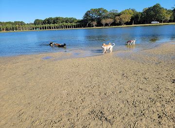
James Island County Park
Discover the tranquility and recreational opportunities of James Island County Park, a must-visit natural oasis in Charleston, South Carolina.

Explore Charleston Area Beaches on the map
Plan your trip on one map. See where the top attractions, landmarks, restaurants and hotels are, and book hotels and experiences in a few clicks.
Best hotels in Charleston Area Beaches
Best restaurants in Charleston Area Beaches
Dining is concentrated in the beach communities and in Charleston rather than spread evenly along the shoreline. Folly Beach has the broadest choice of casual seafood restaurants, cafés, bars and relaxed eateries, while Isle of Palms provides dining around its beachfront and residential commercial areas. Sullivan's Island is quieter, with a small selection of restaurants and cafés rather than an extensive dining district. Visitors staying on Kiawah or Seabrook may find food within their managed communities, but should expect a more dispersed pattern and may use Johns Island or Charleston for additional choice. Lowcountry cooking draws on shrimp, oysters, crab, fish, rice, seasonal vegetables and the culinary traditions of coastal South Carolina; menus range from straightforward seafood and barbecue to contemporary interpretations of regional ingredients. Farm shops and Charleston restaurants broaden the choice beyond the islands.
-
Seafood
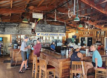
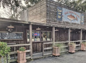
Bowens Island Restaurant
Discover fresh Lowcountry seafood in a picturesque setting at Bowens Island Restaurant near Charleston.
-
Southern
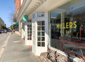
Millers All Day
Experience authentic Southern breakfasts at Millers All Day in Charleston – where tradition meets innovation on every plate.
-
Seafood
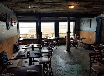
Ellis Creek Fish Camp
Savor fresh seafood with stunning waterfront views at Ellis Creek Fish Camp in Charleston - a true taste of Lowcountry charm.
-
Seafood
LoLo's
Experience fresh seafood delights at LoLo's in Charleston, SC – where every bite tells a story of coastal flavors and Southern hospitality.
Best bars in Charleston Area Beaches
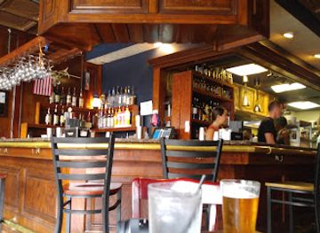
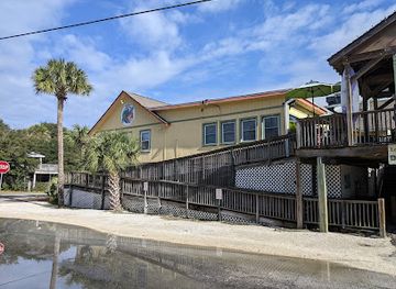
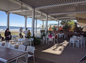
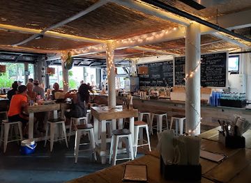
Evening entertainment is modest and community-based rather than centred on nightclubs. Folly Beach has the most recognisable nightlife, with casual bars, beachfront-adjacent venues, live music and a sociable atmosphere that reflects its surf-town identity, although individual offerings and schedules vary. Isle of Palms also has places for an evening drink and seasonal entertainment around its developed beachfront area. Sullivan's Island is quieter, with evenings generally focused on restaurants, small bars and residential calm. Kiawah and Seabrook offer a low-key resort atmosphere, where evening options are linked to accommodation and dining facilities rather than a public nightlife district. Visitors seeking theatres, larger music venues or a wider late-night choice generally travel into Charleston, which is outside the beach communities themselves. Local noise, alcohol, parking and beach-access rules should be observed after dark.
-
Pub
Blind Tiger Pub
Discover Blind Tiger Pub: A Historic Charleston Bar with Delicious Food and a Unique Atmosphere in the Heart of the French Quarter.
-
Grill
Loggerhead's Beach Grill
Discover Loggerhead's Beach Grill, where fresh seafood meets vibrant beach vibes in the heart of Folly Beach, South Carolina.
-
Seafood
BLU Beach Bar & Grill
Savor delicious seafood and American classics with stunning ocean views at Folly Beach's BLU Beach Bar & Grill.
-
Bar
Lowlife Bar
Discover Lowlife Bar in Folly Beach, SC - a lively destination for brunch, cocktails, and coastal vibes.
Best shops in Charleston Area Beaches
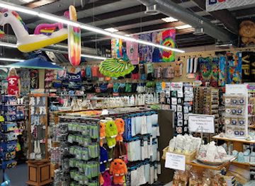
Shopping is small-scale and practical rather than extensive, with the greatest concentration in Folly Beach and Isle of Palms. Visitors can find beachwear, surf equipment, casual clothing, souvenirs, gifts and locally made art in the commercial areas serving those communities, while Sullivan's Island has a more limited selection of independent businesses. Food shops and everyday supplies are easier to locate in the larger settlements and on the approaches from Charleston, Mount Pleasant and Johns Island. Charleston itself offers a much wider range of galleries, craft shops, regional food products and design-led retailers, making it the main destination for Lowcountry gifts and provisions. Typical purchases may include coastal artwork, South Carolina food products, beach equipment and locally themed goods, but stock varies seasonally. Kiawah and Seabrook have quieter, managed retail environments rather than conventional shopping streets.
-
Beach clothing store
Treasure Island
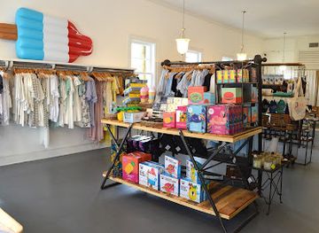
Discover stylish beachwear and accessories at Treasure Island in Charleston, where your seaside fashion adventure begins.
-
Boutique
Grit & Grace Studio
Explore unique local art and handcrafted goods at Grit & Grace Studio, a boutique treasure in the heart of Charleston, South Carolina.
-
Gift shop
Local Love CHS
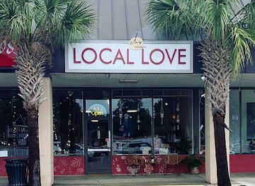
Explore Local Love CHS: A charming gift shop in Charleston, SC, featuring unique handcrafted items and local artisan products.
-
Clothing store
E. Blackhurst
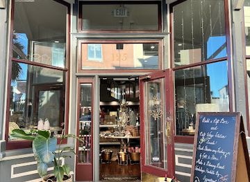
Explore E. Blackhurst in Charleston, a boutique offering a curated selection of clothing and gifts that embody Southern charm and elegance.
Get your free copy of our complete guide to Charleston Area Beaches, delivered straight to you.
Everything on this page, from attractions and restaurants to essentials and local phrases, in one PDF you can read offline, print or share.
Already have an account? Sign in
Your Charleston Area Beaches guide is ready.
We'll send it to · Not you? Sign out

Getting your guide ready…
We are putting together a fresh copy of the Charleston Area Beaches guide. This can take up to a minute.
This can take a few moments. If your browser asks, choose Allow so the download can start. You'll find the guide in your Downloads folder.
Nothing happened? Download it again
Sorry, the guide is taking longer than usual. Please try again in a minute, or get it by email instead.
Charleston Area Beaches essentials
Currency and Payment
Safety
Emergency Situations
Do's and Don'ts
Local Tips
From Eve
Local phrases worth knowing
You don't need to get them perfect. A few words go a long way, and locals appreciate the effort.
Basics
| English | Local | Say it |
|---|---|---|
| Hello | Hey y'all | [hey y'all] |
| Goodbye | Catch ya later | [ketch ya lay-tuh] |
| Yes | Yeah | [yeh] |
| No | Nah | [nah] |
| Please/You're welcome | Please/Welcome | [pleez/welcome] |
| Thank you | Thanks y'all | [thanks y'all] |
| Excuse me/Sorry | Pardon me/Sorry | [pah-dun me/saw-ree] |
| How are you? | How yuh doin'? | [how yuh doin'] |
| Fine. And you? | Fine. And y'all? | [fine. and y'all?] |
| Do you speak English? | Y'all speak English? | [y'all speak ing-glish?] |
| I don't understand | I don't git it | [ah don't git it] |
Eating & Drinking
| English | Local | Say it |
|---|---|---|
| I'd like to see the menu, please | Lemme see the menu, please | [lem-mee see the menu, please] |
| I don't eat meat | I don't eat meat | [ah don't eat meet] |
| Cheers! | Cheers! | [cheers!] |
| I would like to pay, please | I wanna pay, please | [ah wanna pay, please] |
Emergencies
| English | Local | Say it |
|---|---|---|
| Help! | Help! | [help!] |
| Go away! | Git outta here! | [git outta here!] |
| Call the Police! | Call the Law! | [call the law!] |
| Call a doctor! | Call a doc! | [call a doc!] |
| I'm lost | I'm lost | [ah'm lost] |
| I'm ill | I ain't feelin' right | [ah ain't feelin' right] |
Shopping
| English | Local | Say it |
|---|---|---|
| I'd like to buy... | I wanna buy... | [ah wanna buy...] |
| I'm just looking | I'm just lookin' | [ah'm just lookin'] |
| How much is it? | How much fer it? | [how much fur it?] |
| That's too expensive | That's too pricey | [that's too pry-see] |
| Can you lower the price? | Can y'all lower the price? | [can y'all lower the price?] |
Time & Numbers
| English | Local | Say it |
|---|---|---|
| What time is it? | What time is it? | [what time is it?] |
| It's one o'clock | It's one | [it's one] |
| Half past (10) | Half past ten | [half past ten] |
| Morning | Mornin' | [mornin'] |
| Afternoon | Afternoon | [afternoon] |
| Evening | Evenin' | [evenin'] |
| Yesterday | Yest'day | [yest'day] |
| Today | Today | [today] |
| Tomorrow | Tomorra | [tomorra] |
| 1 | One | [one] |
| 2 | Two | [two] |
| 3 | Three | [three] |
| 4 | Four | [four] |
| 5 | Five | [five] |
| 6 | Six | [six] |
| 7 | Seven | [seven] |
| 8 | Eight | [eight] |
| 9 | Nine | [nine] |
| 10 | Ten | [ten] |
Transport & Directions
| English | Local | Say it |
|---|---|---|
| Where's a/the...? | Where's a/the...? | [where's a/the...?] |
| What's the address? | What's the address? | [what's the address?] |
| Can you show me (on the map)? | Can y'all show me (on the map)? | [can y'all show me (on the map)?] |
| When's the next (bus)? | When's the next (bus)? | [when's the next (bus)?] |
| A ticket (to ....) | A ticket (to ....) | [a ticket (to ....)] |
History of Charleston Area Beaches
Barrier Islands and Tidal Formation
The beaches around Charleston occupy a dynamic Atlantic shoreline shaped by waves, tides, storms and sediment movement. Barrier islands such as Folly, Sullivan's and Isle of Palms separate the ocean from extensive estuaries and salt marshes, while Kiawah and Seabrook form part of a larger island and creek system south of Charleston Harbor. Their sandy shores and inlets have never been fixed landscapes: storms can move dunes and reshape beach profiles, and tidal channels migrate over time. Understanding this physical instability is central to the area's history, since settlement, transport, defence and recreation have always had to accommodate a changing coast.
Indigenous Landscapes and Colonial Settlement
Long before European colonisation, the Lowcountry coast was used by Indigenous peoples who travelled through its rivers, marshes and barrier islands and relied on the resources of estuarine environments. English colonists established Charleston in 1670, and the surrounding islands became connected to the colonial economy through plantations, timber, fishing and maritime trade. The coastal setting was productive but demanding, with waterways serving as essential routes between settlements. Enslaved Africans and their descendants formed a central part of the region's agricultural and cultural history, leaving enduring influences on Lowcountry foodways, language and traditions.
Harbour Defences and Fort Moultrie
Charleston's island beaches have long had strategic importance because they face the approaches to the harbour. Fort Moultrie on Sullivan's Island began as a Revolutionary-era defence built largely from palmetto logs, whose fibrous structure helped absorb cannon shot; the fort was later rebuilt and modified through successive periods of American military history. During the Civil War, Charleston's harbour and surrounding islands became significant theatres of conflict, with forts, batteries and naval positions controlling access to the city. Fort Moultrie survives as the most substantial historic military landmark directly associated with the beach district.
From Seaside Retreats to Beach Towns
In the nineteenth and early twentieth centuries, improved transport made the islands increasingly accessible for excursions and seasonal recreation. Sullivan's Island and Isle of Palms developed as seaside retreats, while Folly Beach gained a distinct identity as an accessible barrier-island community south of Charleston. Railways, causeways and later roads changed the relationship between the city and the coast, allowing more residents and visitors to spend time by the ocean. The growth of these communities produced a mixture of permanent homes, holiday properties, small businesses and public beach facilities rather than one uniform resort landscape.
Modern Conservation and Coastal Management
Twentieth- and twenty-first-century development brought both greater recreational access and growing pressure on dunes, marshes and freshwater supplies. Kiawah and Seabrook became planned island communities with extensive attention to landscape management, while municipal beaches have had to balance public access, erosion, storm damage and habitat protection. Sea-turtle monitoring, dune conservation and restrictions on disturbing nesting wildlife reflect a broader recognition that the coast is an ecological system as well as a leisure destination. Hurricanes and severe storms continue to expose the limits of fixed infrastructure on a shifting shoreline.
Charleston Area Beaches in Photos
Browse through our photo collection highlighting the charm and character of the destination.
Neighbouring destination travel guides
The closest destinations to Charleston Area Beaches, if you have time for more than one.
-

-

-

-
-


Swipe for more destinations
Explore more

Explore more of Lowcountry
Explore South Carolina's Lowcountry for Charleston heritage, Gullah Geechee culture, tidal marshes, sea islands, seafood and coastal wildlife.
Explore Lowcountry
Explore more of South Carolina
Explore South Carolina: A blend of historic charm, natural beauty, and southern hospitality. From Charleston's cobblestone streets to Myrtle Beach's sandy shores, adventure awaits.
Explore South Carolina