

Rwenzori Mountains National Park Travel Guide - Free Web & App
Your ultimate guide to Rwenzori Mountains National Park. Discover top landmarks, proposed trips, and local tips. Free on the web or via the Evendo companion app.


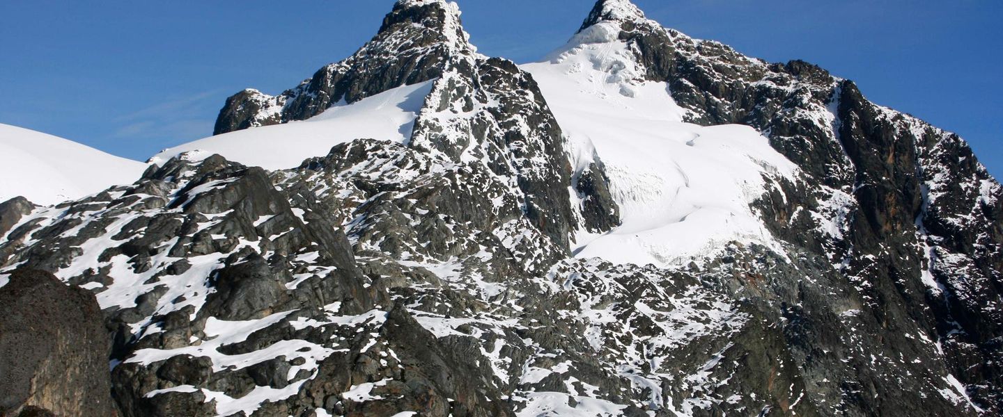


Rwenzori Mountains National Park, Uganda: trek glacier-capped peaks, Afro-alpine valleys and rare montane habitats from Kasese on guided mountain routes.
Glaciers, Valleys and Afro-Alpine Landscapes
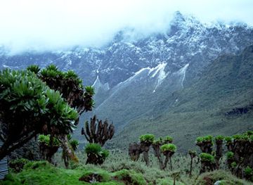
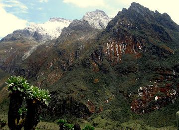
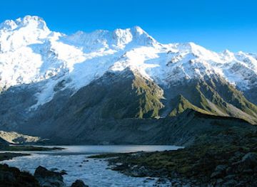
Rwenzori Mountains National Park protects a dramatic section of western Uganda’s Rwenzori range, rising between Lake Edward and the border with the Democratic Republic of the Congo. Covering roughly 1,000 square kilometres, the park contains deep valleys, steep forested slopes, high moorlands and some of Africa’s few remaining equatorial glaciers. The highest summit, Margherita Peak on Mount Stanley, reaches 5,109 metres, while Mount Speke and Mount Baker form part of the same jagged alpine chain.Read more about Rwenzori Mountains National Park
A Mountain Ecosystem with a Strong Local Identity
Exploring the Park
When is the best time to visit Rwenzori Mountains National Park?
Best: January–February, July · 15–16°C| Month | High (°C) | Rainfall (mm) |
|---|---|---|
| January (best) | 15 | 70 |
| February (best) | 15 | 77 |
| March | 15 | 100 |
| April | 16 | 147 |
| May | 16 | 168 |
| June | 16 | 138 |
| July (best) | 16 | 100 |
| August | 16 | 102 |
| September | 16 | 142 |
| October | 16 | 185 |
| November | 15 | 164 |
| December | 15 | 101 |
Getting to and around Rwenzori Mountains National Park
How to get there
Transportation
Best attractions in Rwenzori Mountains National Park
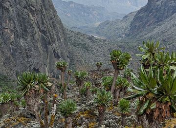
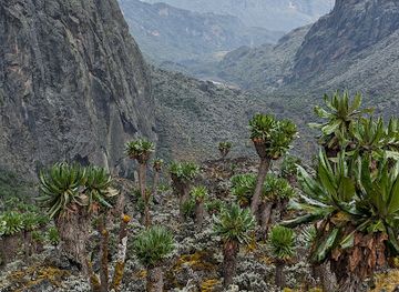
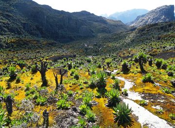
The principal attraction is the mountain landscape itself, which changes dramatically from the cultivated foothills around Kasese to dense montane forest, bamboo, giant-heather zones, high bogs and the rock and ice of the central peaks. Multi-day routes lead into valleys such as Bujuku, where Mount Stanley, Mount Speke and Mount Baker form a powerful alpine backdrop, while Nyamwamba and other valleys reveal the range’s steep drainage patterns and remote character. Margherita Peak attracts experienced climbers with suitable equipment and acclimatisation, although summit access depends on route conditions and authorised arrangements. The park’s forests support Albertine Rift birdlife and primates, while the upper reaches are notable for giant lobelias, groundsels and other specialised plants rather than easy wildlife viewing. Kasese and communities around the trailheads provide the cultural and practical gateway to these landscapes, with local guides and porters helping visitors understand terrain that cannot be appreciated from a roadside viewpoint.
-
Tourist attraction
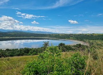
Lake Nyamunuka
Explore the natural beauty of Lake Nyamunuka, Uganda's tranquil escape offering stunning views and vibrant wildlife.
-
 Tourist attraction
Mount Gessi
Explore the breathtaking landscapes of Mount Gessi in Nyakalengija, Uganda, a perfect destination for adventure lovers and nature enthusiasts.
-
Tourist attraction
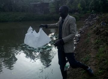
Kanyansti Fish Ponds
Explore the tranquil Kanyansti Fish Ponds, a picturesque destination in Uganda perfect for nature lovers and those seeking peace amidst stunning aquatic beauty.
-
Hiking area
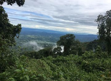
Karangura Peak
Experience the breathtaking beauty and adventure of Karangura Peak, a premier hiking destination in Uganda's stunning natural landscapes.
Best landmarks in Rwenzori Mountains National Park
Margherita Peak, rising to 5,109 metres on Mount Stanley, is the Rwenzori’s highest summit and one of its defining alpine landmarks, while Mount Speke and Mount Baker create a distinctive chain of high ridges and valleys. The remaining glaciers and glacial landforms around the upper mountains are environmentally significant reminders of the range’s changing climate, although access is demanding and conditions are variable. Bujuku Valley is a recognised natural landmark of the trekking landscape, combining high wetlands, dramatic peaks and specialised Afro-alpine vegetation. Lower down, the Rwenzori forest belt and bamboo zones form an important part of the Albertine Rift ecosystem. Kasese and the Bakonzo communities around the foothills provide the principal cultural setting for understanding these physical landmarks and the long relationship between people and the mountains.
-
Mountain range
Rwenzori Mountains
Explore the breathtaking Rwenzori Mountains, a UNESCO World Heritage site with stunning landscapes, rich biodiversity, and cultural experiences in the heart of Africa.
-
Mountain peak
Mount Stanley
Discover the breathtaking beauty of Mount Stanley, a majestic peak in the Rwenzori Mountains, perfect for adventure seekers and nature lovers.
-
Serviced accommodation
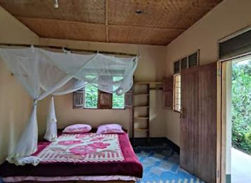
Ruboni Community Camp
Discover Ruboni Community Camp, your gateway to the Rwenzori Mountains and a unique cultural experience in Uganda.
-
Tour operator
Bujo Safaris
Discover the breathtaking Rwenzori Mountains and rich wildlife through tailored tours with Bujo Safaris in Kasese, Uganda.
Explore Rwenzori Mountains National Park on the map
Plan your trip on one map. See where the top attractions, landmarks, restaurants and hotels are, and book hotels and experiences in a few clicks.
Best hotels in Rwenzori Mountains National Park
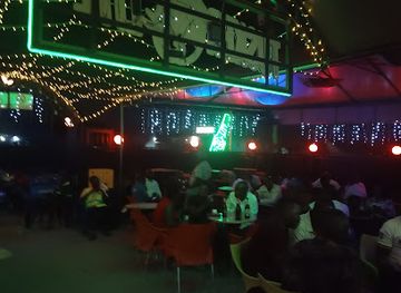
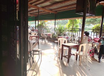
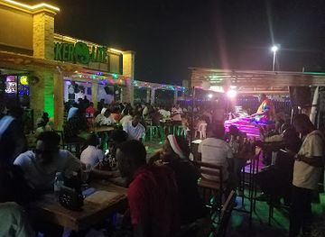
Best bars in Rwenzori Mountains National Park
Rwenzori Mountains National Park is not a nightlife destination, and evening entertainment is largely confined to Kasese and nearby trading centres. After a day of preparation or trekking, visitors are more likely to spend the evening at a lodge, guesthouse, hotel restaurant or local bar than in a dedicated nightclub district. Kasese has the greatest concentration of casual drinking places and social venues in the area, while smaller settlements offer a quieter local atmosphere with limited facilities. Mountain camps are functional and remote, with darkness, cold, weather and conservation requirements shaping the evening routine. Cultural events and music may occur locally, but schedules and availability are not fixed, so they should not be assumed as part of a park visit.
-
Bar
Skyz Lounge, Kasese
Experience the vibrant nightlife of Kasese at Skyz Lounge, where great drinks and live entertainment come together for an unforgettable evening.
-
Bar
SILVER SPRINGS BAR AND GUEST HOUSE
Discover the lively atmosphere of Silver Springs Bar and Guest House, where locals and travelers unite over drinks and good times in Kasese.
-
Lounge
Elephant Lounge Kasese
Discover the charm of Elephant Lounge in Kasese, a perfect spot for relaxation and local flavors along the Fort Portal-Mpondwe Road.
-
Bar
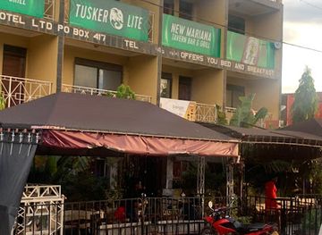
New Mariana Bar
Discover the vibrant nightlife and welcoming atmosphere at New Mariana Bar in Kasese, a must-visit for tourists seeking local culture and refreshing drinks.
Best nightclubs in Rwenzori Mountains National Park
Rwenzori Mountains National Park is not a nightlife destination, and evening entertainment is largely confined to Kasese and nearby trading centres. After a day of preparation or trekking, visitors are more likely to spend the evening at a lodge, guesthouse, hotel restaurant or local bar than in a dedicated nightclub district. Kasese has the greatest concentration of casual drinking places and social venues in the area, while smaller settlements offer a quieter local atmosphere with limited facilities. Mountain camps are functional and remote, with darkness, cold, weather and conservation requirements shaping the evening routine. Cultural events and music may occur locally, but schedules and availability are not fixed, so they should not be assumed as part of a park visit.
-
National park
Rwenzori Mountains National Park
Discover the breathtaking beauty of Rwenzori Mountains National Park, a UNESCO World Heritage site in Uganda, offering unique wildlife and stunning hiking trails.
-
Mountain range
Rwenzori Mountains
Explore the stunning Rwenzori Mountains, a UNESCO World Heritage site known for its breathtaking landscapes, rich biodiversity, and unforgettable trekking experiences.
-
Serviced accommodation
Ruboni Community Camp
Experience the beauty of nature at Ruboni Community Camp, your perfect base for adventure and cultural immersion in Uganda.
-
Hotel
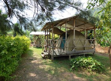
Rwenzori Turaco View Campsite
Discover the stunning beauty of Rwenzori Turaco View Campsite, your gateway to adventure and tranquility in the heart of Uganda.
Best shops in Rwenzori Mountains National Park
Shopping within the park is minimal, with the most useful supplies and locally made goods found in Kasese and surrounding gateway settlements. Visitors may find small shops selling food, drinks, toiletries and basic trekking necessities, while local markets provide produce and an opportunity to observe everyday trade rather than browse a dedicated tourist retail quarter. Crafts, woven items, artwork and souvenirs may be available through community businesses or accommodation areas, but stock and opening arrangements vary. It is sensible to obtain specialist equipment, medicines and substantial expedition provisions before leaving the main town. Purchases from local artisans and community enterprises can support the people living around the mountain, provided visitors choose products responsibly and avoid anything made from protected wildlife or natural materials.
-
National park
Rwenzori Mountains National Park
Explore the breathtaking Rwenzori Mountains National Park, a UNESCO World Heritage Site, with stunning landscapes and diverse wildlife in Uganda.
-
Supermarket
SIDDIQUE SHOPPERS LTD
Discover local shopping at Siddique Shoppers Ltd in Kasese, where you can find everything from fresh produce to everyday essentials.
-
Supermarket
Kasese Supermarket
Discover local flavors and vibrant culture at Kasese Supermarket, a must-visit hub for tourists in Kasese, Uganda.
-
Supermarket
Rwenzori Supermarket
Explore Rwenzori Supermarket in Kasese for a taste of local culture and fresh Ugandan produce, perfect for both shopping and culinary adventures.
Get your free copy of our complete guide to Rwenzori Mountains National Park, delivered straight to you.
Everything on this page, from attractions and restaurants to essentials and local phrases, in one PDF you can read offline, print or share.
Already have an account? Sign in
Your Rwenzori Mountains National Park guide is ready.
We'll send it to · Not you? Sign out

Getting your guide ready…
We are putting together a fresh copy of the Rwenzori Mountains National Park guide. This can take up to a minute.
This can take a few moments. If your browser asks, choose Allow so the download can start. You'll find the guide in your Downloads folder.
Nothing happened? Download it again
Sorry, the guide is taking longer than usual. Please try again in a minute, or get it by email instead.
Rwenzori Mountains National Park essentials
Currency and Payment
Safety
Emergency Situations
Do's and Don'ts
Local Tips
From Eve
Local phrases worth knowing
You don't need to get them perfect. A few words go a long way, and locals appreciate the effort.
Basics
| English | Local | Say it |
|---|---|---|
| Hello | Mwiriwe | [mwee-ree-weh] |
| Goodbye | Webale | [weh-bah-leh] |
| Yes | Eego | [ee-go] |
| No | Ndee | [n-deh] |
| Please/You're welcome | Mwakare | [mwa-kah-reh] |
| Thank you | Webale munonga | [weh-bah-leh moo-noh-nga] |
| Excuse me/Sorry | Nsalire | [n-sah-lee-reh] |
| How are you? | Oli otya? | [oh-lee oh-cha] |
| Fine. And you? | Gyendi. Naawe otya? | [gyen-dee. nah-weh oh-cha] |
| Do you speak English? | Olimala olungereza? | [oh-lee-mah-lah oh-loon-geh-reh-zah] |
| I don't understand | Siibaleeko | [see-bah-leh-ko] |
Eating & Drinking
| English | Local | Say it |
|---|---|---|
| I'd like to see the menu, please | Nzinkanga emenyu, kubanga | [n-zeen-kah-ngah eh-men-yoo, koo-bah-ngah] |
| I don't eat meat | Simulina okulya enyama | [see-moo-lee-nah oh-kool-yah eh-nya-mah] |
| Cheers! | Nyumya | [nyoo-myah] |
| I would like to pay, please | Nkola nyo | [n-koh-lah nyoh] |
Emergencies
| English | Local | Say it |
|---|---|---|
| Help! | Tusabe | [too-sah-beh] |
| Go away! | Tutwale | [too-twa-leh] |
| Call the Police! | Tuyambe Pulis | [too-yahm-beh poo-lees] |
| Call a doctor! | Tuyambe daktari | [too-yahm-beh dahk-tah-ree] |
| I'm lost | Njagala | [n-jah-gah-lah] |
| I'm ill | Njagala kusinziira | [n-jah-gah-lah koo-seen-zee-rah] |
Shopping
| English | Local | Say it |
|---|---|---|
| I'd like to buy... | Nkola okunyiga... | [n-koh-lah oh-koo-nyee-gah] |
| I'm just looking | Nkola kulya | [n-koh-lah kool-yah] |
| How much is it? | Kikumi kino? | [kee-koo-mee kee-noh] |
| That's too expensive | Eno yeyinza | [eh-noh yey-in-zah] |
| Can you lower the price? | Omanyi kwongereeza? | [oh-mahn-yee kwohn-geh-reh-zah] |
Time & Numbers
| English | Local | Say it |
|---|---|---|
| What time is it? | Saa ngapi? | [sah-ah ngah-pee] |
| It's one o'clock | Saa moja | [sah-ah moh-jah] |
| Half past (10) | Saa moja na nusu | [sah-ah moh-jah nah noo-soo] |
| Morning | Bukyejo | [boo-chay-joh] |
| Afternoon | Ekyaayi | [eh-chah-yee] |
| Evening | Olwogi | [ohl-woh-gee] |
| Yesterday | Lwezo | [lweh-zoh] |
| Today | Lelo | [leh-loh] |
| Tomorrow | Ensi | [ehn-see] |
| 1 | Mmoja | [m-moh-jah] |
| 2 | Biri | [bee-ree] |
| 3 | Ssatu | [ssah-too] |
| 4 | Nnya | [nyah] |
| 5 | Ttano | [tah-noh] |
| 6 | Mukaaga | [moo-kah-gah] |
| 7 | Munaana | [moo-nah-nah] |
| 8 | Mwenda | [mwehn-dah] |
| 9 | Mwenda takati | [mwehn-dah tah-kah-tee] |
| 10 | Kumi | [koo-mee] |
Transport & Directions
| English | Local | Say it |
|---|---|---|
| Where's a/the...? | Wapi...? | [wah-pee] |
| What's the address? | Yi adiresi gye? | [yee ah-dee-reh-see jyeh] |
| Can you show me (on the map)? | Omanyi kundisa (mu mapu)? | [oh-mahn-yee koon-dee-sah moo mah-poo] |
| When's the next (bus)? | Naye busi eyo? | [nah-yeah boo-see eh-yoh] |
| A ticket (to ....) | Kiwandi (ewaffe ku...) | [kee-wahn-dee eh-wah-ffeh koo] |
History of Rwenzori Mountains National Park
A Range Shaped by Ancient Uplift
The Rwenzori are not volcanic mountains like the nearby Virunga peaks but an uplifted block of ancient crystalline rock. Geological forces raised the range high above the surrounding Albertine Rift landscape, producing steep ridges, enclosed valleys and a complex system of streams and wetlands. Glacial action later helped shape the upper mountains, leaving cirques, tarns and broad valleys beneath the summits. The range’s high rainfall and altitude created the distinctive succession of forest, bamboo, moorland and Afro-alpine vegetation that defines the park today.
Bakonzo Communities and Mountain Life
The foothills and valleys around the Rwenzori have long been associated with the Bakonzo, whose cultural and economic life developed alongside the mountain environment. Farming communities occupy the lower slopes and surrounding plains, while the higher terrain has traditionally been used and understood through local knowledge rather than permanent settlement. Place names, oral traditions and practical familiarity with routes, weather and vegetation remain important aspects of the range’s identity. Visitors encounter this living cultural landscape most directly through communities and guides around Kasese and the mountain trailheads.
European Exploration and the Mountains of the Moon
The Rwenzori entered European geographical writing through nineteenth-century exploration of the Nile region. Their association with the ancient ‘Mountains of the Moon’ was popularised during the search for the Nile’s sources, although the name had been applied imprecisely to several central African ranges. In 1906, an expedition led by Luigi Amedeo, Duke of the Abruzzi, made a major series of ascents and surveys, including important exploration of the principal summits and glaciers. These expeditions helped establish the range’s place in the history of African mountaineering.
From Forest Reserve to National Park
Growing recognition of the Rwenzori’s forests, alpine habitats and water catchments led to formal protection of the mountain landscape. Rwenzori Mountains National Park was established in 1991, consolidating protection across a large section of the range and regulating access to its sensitive upper environments. The park was inscribed as a UNESCO World Heritage Site in 1994 because of its exceptional scenic and ecological importance. Conservation has had to balance habitat protection, tourism and the needs of communities living around the boundaries.
A Changing Alpine Environment
The Rwenzori glaciers have retreated considerably since early twentieth-century exploration, reflecting broader changes in the mountain environment and regional climate. Their decline has increased scientific and conservation interest in the range, while changing rainfall, erosion and pressure on surrounding land continue to affect management. Modern trekking provides income for guides, porters and nearby communities, but it also requires careful treatment of high-altitude camps, trails and wetlands. The park’s history is therefore still unfolding through the interaction of conservation, local livelihoods and a changing alpine landscape.
Rwenzori Mountains National Park in Photos
Browse through our photo collection highlighting the charm and character of the destination.
Neighbouring destination travel guides
The closest destinations to Rwenzori Mountains National Park, if you have time for more than one.
-

-

-

-

-


Swipe for more destinations
Explore more
Explore more of Toro
Explore Toro in western Uganda for Tooro Kingdom heritage, crater lakes, tea country, primate forests and Rwenzori foothill adventures.
Explore Toro
Explore more of Uganda
Discover Uganda: From the majestic mountain gorillas of Bwindi to the vibrant streets of Kampala, experience the diverse landscapes and rich culture of the Pearl of Africa.
Explore Uganda