

George Washington and Jefferson National Forests Travel Guide - Free Web & App
Your ultimate guide to George Washington and Jefferson National Forests. Discover top landmarks, proposed trips, and local tips. Free on the web or via the Evendo companion app.


George Washington and Jefferson National Forests in Virginia offer Blue Ridge trails, Appalachian scenery, rivers, wildlife, camping and landscapes.
Mountain Landscapes and Forest Country
Stretching across much of western Virginia, the George Washington and Jefferson National Forests form one of the largest publicly managed mountain landscapes in the eastern United States. Their ridges, coves, high plateaux, river valleys and hardwood forests occupy a broad arc from the Allegheny and Blue Ridge mountains towards the state’s southwestern highlands. Rather than a single continuous park, the forests are a collection of extensive public lands interwoven with farms, private communities, state parks and small mountain settlements.Read more about George Washington and Jefferson National Forests
Ridges, Rivers and High Country
Heritage and Outdoor Life
When is the best time to visit George Washington and Jefferson National Forests?
Best: May–June, September · 24–28°C| Month | High (°C) | Rainfall (mm) |
|---|---|---|
| January | 8 | 75 |
| February | 9 | 70 |
| March | 14 | 85 |
| April | 19 | 85 |
| May (best) | 24 | 90 |
| June (best) | 28 | 90 |
| July | 30 | 95 |
| August | 29 | 95 |
| September (best) | 25 | 90 |
| October | 19 | 80 |
| November | 13 | 85 |
| December | 8 | 80 |
Getting to and around George Washington and Jefferson National Forests
How to get there
Transportation
Best attractions in George Washington and Jefferson National Forests
-
Bridge
Humpback Bridge
Discover the Humpback Bridge in Covington, Virginia—a stunning historic landmark surrounded by nature's beauty and a perfect spot for photography.

Explore George Washington and Jefferson National Forests on the map
Plan your trip on one map. See where the top attractions, landmarks, restaurants and hotels are, and book hotels and experiences in a few clicks.
Best hotels in George Washington and Jefferson National Forests
Best shops in George Washington and Jefferson National Forests
Shopping within the forests is limited and practical, with most opportunities found in gateway communities rather than at remote trailheads. Roanoke, Harrisonburg, Staunton, Lexington, Abingdon and Galax have the broadest selection of outdoor equipment, food supplies, independent shops, galleries and regional products. Smaller places such as Damascus and rural mountain settlements are useful for basic provisions and locally made goods, although retail choice can be modest. Visitors may encounter Appalachian crafts, pottery, woodwork, woven items, paintings, handmade foods, apples, cider and other farm products, depending on the season and location. The area’s traditional music culture is particularly visible around Galax and the wider southwest Virginia region. Buy supplies before entering isolated forest districts and do not expect a permanent market, craft centre or extensive retail cluster at every recreation area.
-
Woods
George Washington National Forest
Explore the vast beauty and outdoor adventures waiting for you at George Washington National Forest in Virginia.

Get your free copy of our complete guide to George Washington and Jefferson National Forests, delivered straight to you.
Everything on this page, from attractions and restaurants to essentials and local phrases, in one PDF you can read offline, print or share.
Already have an account? Sign in
Your George Washington and Jefferson National Forests guide is ready.
We'll send it to · Not you? Sign out

Getting your guide ready…
We are putting together a fresh copy of the George Washington and Jefferson National Forests guide. This can take up to a minute.
This can take a few moments. If your browser asks, choose Allow so the download can start. You'll find the guide in your Downloads folder.
Nothing happened? Download it again
Sorry, the guide is taking longer than usual. Please try again in a minute, or get it by email instead.
George Washington and Jefferson National Forests essentials
Currency and Payment
Safety
Emergency Situations
Do's and Don'ts
Local Tips
From Eve
Local phrases worth knowing
You don't need to get them perfect. A few words go a long way, and locals appreciate the effort.
Basics
| English | Local | Say it |
|---|---|---|
| Hello | Howdy | [haw-dee] |
| Goodbye | Farewell | [fair-well] |
| Yes | Yup | [yuhp] |
| No | Nah | [nah] |
| Please/You're welcome | Please/No worries | [pleez/no wor-eez] |
| Thank you | Thanks | [thaynks] |
| Excuse me/Sorry | Pardon me/My bad | [par-dn mee/my bad] |
| How are you? | Howdy | [haw-dee] |
| Fine. And you? | Just dandy. You? | [just dan-dee. yoo?] |
| Do you speak English? | Ya speak English? | [yah speak ing-glish?] |
| I don't understand | I ain't gettin' it | [I aint get-tin it] |
Eating & Drinking
| English | Local | Say it |
|---|---|---|
| I'd like to see the menu, please | Can I see the grub list, please | [kan eye see the grub list, pleez] |
| I don't eat meat | I don't do meat | [eye dohnt doh meet] |
| Cheers! | Bottoms up! | [bot-tums up] |
| I would like to pay, please | I'll settle the bill, please | [eye-ull set-tul the bill, pleez] |
Emergencies
| English | Local | Say it |
|---|---|---|
| Help! | SOS! | [ess-oh-ess] |
| Go away! | Git! | [git] |
| Call the Police! | Ring the Sheriff! | [ring the sher-iff] |
| Call a doctor! | Summon the doc! | [suhm-mun the doc] |
| I'm lost | I'm discombobulated | [eye-m dis-com-bob-yoo-lay-ted] |
| I'm ill | I'm under the weather | [eye-m un-der the weh-thur] |
Shopping
| English | Local | Say it |
|---|---|---|
| I'd like to buy... | I'm fixin' to purchase... | [eye-m fix-in tuh pur-chays] |
| I'm just looking | I'm jest browsin' | [eye-m jest brow-sin] |
| How much is it? | What's the damage? | [whats the dam-ij] |
| That's too expensive | That's a mite pricey | [thats uh myt prye-see] |
| Can you lower the price? | Can ya knock it down a bit? | [kan yuh nok it down uh bit] |
Time & Numbers
| English | Local | Say it |
|---|---|---|
| What time is it? | What's the o'clock? | [whats the uh-klok] |
| It's one o'clock | It's a tick past one | [its uh tik past wun] |
| Half past (10) | Halfway to eleven | [half-way tuh elev-in] |
| Morning | Mornin' | [morn-in] |
| Afternoon | Arvo | [ar-vo] |
| Evening | Dusk | [dusk] |
| Yesterday | Yesteryear | [yess-ter-year] |
| Today | This here day | [this heer day] |
| Tomorrow | Morro | [morr-oh] |
| 1 | One | [wun] |
| 2 | Two | [too] |
| 3 | Three | [three] |
| 4 | Four | [four] |
| 5 | Five | [five] |
| 6 | Six | [six] |
| 7 | Seven | [sev-en] |
| 8 | Eight | [ayt] |
| 9 | Nine | [nine] |
| 10 | Ten | [ten] |
Transport & Directions
| English | Local | Say it |
|---|---|---|
| Where's a/the...? | Where's the... | [wheres the] |
| What's the address? | What's the addy? | [whats the add-ee] |
| Can you show me (on the map)? | Can ya point it out? | [kan yuh point it out] |
| When's the next (bus)? | When's the next hauler? | [whens the next haul-er] |
| A ticket (to ....) | A pass (to ....) | [uh pass tuh] |
History of George Washington and Jefferson National Forests
Ancient Mountains and Indigenous Homelands
The Appalachian ridges underlying these forests are ancient geological formations, shaped over immense periods by uplift, erosion and the action of weather and water. Long before the creation of national forests, the valleys and mountains were Indigenous homelands and travel corridors. Communities including the Monacan, Tutelo and other peoples connected with the wider southern Appalachian region used river valleys, forests and highland routes for settlement, hunting, trade and cultural life. European colonisation later brought new patterns of farming, settlement and land ownership, but Indigenous place names, archaeological evidence and continuing Native communities remain part of the broader history of Virginia.
Farms, Roads and Mountain Industries
From the colonial period onwards, settlers occupied the more accessible valleys and lower slopes, cultivating small farms and using the mountains for grazing, hunting and timber. The region’s streams powered mills, while ironworking, salt production, mining, quarrying and the timber trade developed in particular districts. Roads, turnpikes and later railways linked mountain communities with markets in the Shenandoah Valley, the Roanoke Valley and southwest Virginia. Much of the forest was altered during the nineteenth and early twentieth centuries, when intensive logging and repeated fires left a landscape markedly different from the mature woodland seen in many areas today.
Public Forests and Early Conservation
The Weeks Act of 1911 created a legal framework for the federal government to acquire forest land in the eastern United States for watershed protection and public benefit. Purchases and transfers in Virginia gradually assembled the lands that became the George Washington and Jefferson national forests. The George Washington National Forest was established in the early twentieth century, while the Jefferson National Forest was created in 1936. The new forests reflected a changing national understanding of mountain land: public ownership could protect headwaters, support sustainable forestry and provide recreation as well as timber.
The Civilian Conservation Corps Era
During the 1930s, the Civilian Conservation Corps made a lasting contribution to the forests through work on roads, trails, fire control, erosion management, camps and recreation facilities. Its projects formed part of the wider New Deal effort to restore conservation infrastructure during the Great Depression. Some surviving layouts, structures and transport routes still influence the way visitors experience the national forests, although facilities have been altered, renewed or replaced over time. The period also helped establish outdoor recreation as a central purpose of public land management in the eastern mountains.
A Combined Forest Landscape
Management of the George Washington and Jefferson national forests became increasingly coordinated during the twentieth century, reflecting their shared Appalachian ecology and overlapping administrative needs. They have been managed together since 1995, while retaining their separate historical identities and distinct districts. Modern management balances timber production, habitat protection, watershed health, recreation, roads, grazing and the rights of neighbouring communities. The Mount Rogers National Recreation Area and other designated landscapes illustrate the continuing shift towards protecting particular ecological and scenic qualities within a working national forest.
George Washington and Jefferson National Forests in Photos
Browse through our photo collection highlighting the charm and character of the destination.
Cities in George Washington and Jefferson National Forests
The towns and cities of George Washington and Jefferson National Forests, and the easiest places to base yourself.
-
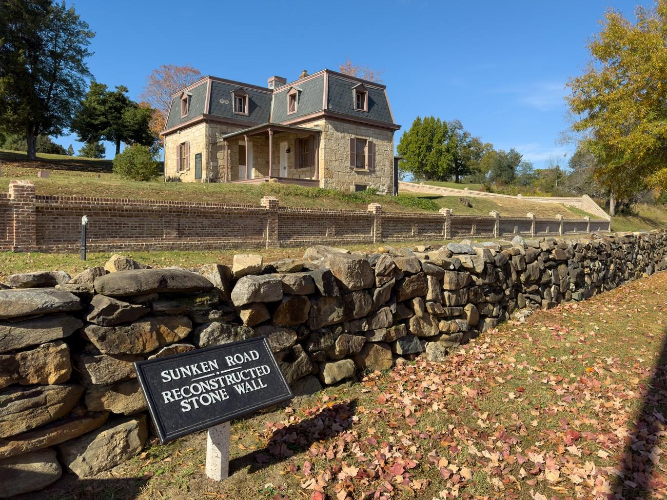 Fredericksburg
Discover Fredericksburg, Virginia: A historic gem with charming streets, vibrant arts, delicious cuisine, and natural beauty, perfect for history buffs, foodies, and nature lovers.
-

-

-

-


Swipe for more cities
Neighbouring destination travel guides
The closest destinations to George Washington and Jefferson National Forests, if you have time for more than one.
-

-

-

-

-


Swipe for more destinations
Explore more

Explore more of Northern Virginia
Explore Northern Virginia for historic Alexandria, Civil War sites, Potomac landscapes, diverse dining and the vineyards and farms of Loudoun County.
Explore Northern Virginia
Explore more of Virginia
Discover Virginia: A blend of historic landmarks, natural beauty, and vibrant culture perfect for history buffs, nature lovers, and culture seekers.
Explore Virginia