

Cahaba River Travel Guide - Free Web & App
Your ultimate guide to Cahaba River. Discover top landmarks, proposed trips, and local tips. Free on the web or via the Evendo companion app.


Cahaba River, Alabama, United States: explore wildflower shoals, paddling routes, wildlife, riverfront parks and layered history near Birmingham and Selma.
A River Through Central Alabama
The Cahaba River runs for roughly 190 miles through central Alabama, beginning in the wooded uplands south-east of Birmingham and joining the Alabama River near Selma. Its course passes through limestone valleys, forested banks, shoals, agricultural country and the expanding outer communities of the Birmingham metropolitan area. The river is not a single, neatly contained attraction but a broad landscape of public parks, protected habitat, working countryside and small settlements, best understood through a series of access points.Read more about Cahaba River
Wildlife, Shoals and Cahaba Lilies
Communities and Cultural Landscapes
When is the best time to visit Cahaba River?
Best: April–May, October · 23–28°C| Month | High (°C) | Rainfall (mm) |
|---|---|---|
| January | 13 | 109 |
| February | 16 | 118 |
| March | 19 | 141 |
| April (best) | 23 | 122 |
| May (best) | 28 | 114 |
| June | 31 | 110 |
| July | 32 | 132 |
| August | 32 | 118 |
| September | 29 | 109 |
| October (best) | 23 | 91 |
| November | 17 | 109 |
| December | 14 | 118 |
Getting to and around Cahaba River
How to get there
Transportation
Best attractions in Cahaba River
The Cahaba River’s attractions are dispersed along its course, beginning with riverfront parks and walking areas around Helena and the southern Birmingham suburbs. The Cahaba River National Wildlife Refuge near West Blocton protects a particularly important stretch of river habitat and is known for opportunities to observe the landscape and seasonal Cahaba lilies. Rocky shoals, wooded banks and clear shallows form the river’s defining scenery, although access and water conditions vary from site to site. West Blocton also offers connections with the area’s coal-mining past, while Centreville provides a gateway to quieter middle-river landscapes. Near the lower river, Old Cahawba Archaeological Park preserves the remains of Alabama’s first capital at the confluence of the Cahaba and Alabama rivers; it is a nearby historic landscape rather than a continuous riverfront attraction. Birmingham’s surrounding green spaces and conservation areas offer additional ways to understand the upper watershed without implying that every section is publicly accessible.
-
Tourist attraction
Birmingham Zoo
Explore wildlife from around the world at the Birmingham Zoo, a conservation leader and family-friendly destination in Alabama.
-
Tourist attraction
Vulcan Park and Museum
Discover Birmingham's history and iconic cast-iron statue at Vulcan Park and Museum, offering stunning city views and interactive exhibits.
-
Tourist attraction
Barber Vintage Motorsports Museum
Home to the world's largest motorcycle collection, showcasing a century of motorsports history and design in a unique, immersive setting.
-
 Tourist attraction
McWane Science Center
Explore interactive science exhibits, an aquarium, and an IMAX Dome Theater at Birmingham's leading science museum. A great family adventure!

Best landmarks in Cahaba River
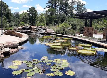
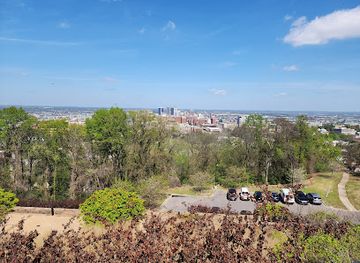
The Cahaba River itself is the destination’s principal landmark, recognised through its long free-flowing course, limestone shoals, wooded floodplains and exceptional freshwater biodiversity. The seasonal Cahaba lily is its most distinctive natural emblem, flowering in shallow river habitats where conditions allow. The Cahaba River National Wildlife Refuge near West Blocton marks an important protected section of this living landscape, while riverfront parks around Helena provide more accessible urban-edge views. At the lower confluence, Old Cahawba Archaeological Park preserves the remains of Alabama’s first capital and connects the river to the state’s early political history. West Blocton’s coal heritage provides another human landmark within the wider watershed, reflecting the industries that shaped central Alabama. These features are spread across a substantial area, and their significance lies in the relationship between river ecology, settlement, industry and conservation rather than in a single monumental structure.
-
Museum
Vulcan Park and Museum
Discover Birmingham's iconic Vulcan statue, explore history exhibits, and enjoy panoramic city views at this symbol of the Magic City's enduring spirit.
-
State park
Oak Mountain State Park
Explore Alabama's largest state park: hiking, biking, lakes, and wildlife await just south of Birmingham in this natural playground.
-
Local history museum
Sloss Furnaces National Historic Landmark
Explore Birmingham's industrial past at Sloss Furnaces, a National Historic Landmark offering history, art, and unique events in a preserved ironworks.
-
State park
Tannehill Ironworks Historical State Park
Discover Alabama's industrial heritage at Tannehill Ironworks Historical State Park. Explore historic ironworks, museums, and scenic trails.

Explore Cahaba River on the map
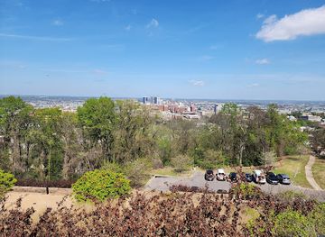
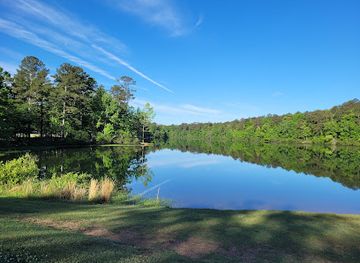
Plan your trip on one map. See where the top attractions, landmarks, restaurants and hotels are, and book hotels and experiences in a few clicks.
Best hotels in Cahaba River
Best restaurants in Cahaba River
Dining is concentrated in the communities bordering the watershed rather than along isolated riverbanks. Birmingham and its southern suburbs provide the broadest choice, from casual restaurants and cafés to the barbecue, fried chicken, biscuits, greens and other Southern dishes associated with Alabama cooking. Helena, West Blocton and Centreville offer more limited local options, including everyday restaurants and places suited to a meal before or after time outdoors. Selma serves visitors approaching the lower Cahaba and the historic Cahawba area. Seasonal produce, farm products and regional comfort food reflect the river country’s agricultural setting, while independent cafés and small-town eateries provide a stronger sense of local character than facilities at remote access points. Visitors heading to a refuge, park or rural launch should obtain food and water in a gateway community rather than expect restaurant services beside the river.
-
Steak
Perry's Steakhouse & Grille
Experience culinary excellence at Perry's Steakhouse & Grille in Birmingham – where exquisite steaks meet exceptional service.
-
American
Cracker Barrel Old Country Store
Savor authentic Southern cuisine at Cracker Barrel Old Country Store – where comfort food meets nostalgia in Pelham.
-
Hamburger
Jack Brown's Beer & Burger Joint Birmingham
Experience unique burgers and an extensive craft beer selection at Jack Brown's Beer & Burger Joint in Birmingham.
-
Barbecue
SAW’s Soul Kitchen
Discover authentic Southern barbecue at SAW's Soul Kitchen in Birmingham – where flavor meets hospitality in every bite.


Best bars in Cahaba River
The Cahaba River is not a nightlife destination, and evening activity is usually quiet and community-based. Birmingham and its southern metropolitan area have the widest selection of bars, breweries, restaurants with evening service and live entertainment, while Helena and nearby towns offer a smaller-scale selection of pubs and dining venues. West Blocton and Centreville are more useful as rural bases than as nightlife centres, with evenings generally focused on local hospitality, seasonal community events or relaxation after time outdoors. Selma provides additional restaurants, bars and cultural programming for visitors exploring the lower river, although its entertainment scene belongs to the town rather than the river corridor itself. Opening days, performances and seasonal events vary, so rural visitors should plan evening meals and transport before leaving larger settlements.
-
Sports bar
Twin Peaks
Experience the excitement of live sports and delicious American cuisine at Twin Peaks, Hoover's ultimate sports bar destination.
-
Restaurant
Dave & Buster's Birmingham
Experience the ultimate fusion of dining and entertainment at Dave & Buster's Birmingham with delicious food, thrilling games, and a lively atmosphere.
-
Grill
Black Market Bar + Grill
Experience the best of Southern cuisine at Black Market Bar + Grill in Birmingham, where delicious food meets a vibrant atmosphere.
-
Bar
Perfect Note
Discover Perfect Note in Hoover, Alabama – where delicious cuisine meets captivating live music in a vibrant bar atmosphere.


Best nightclubs in Cahaba River
The Cahaba River is not a nightlife destination, and evening activity is usually quiet and community-based. Birmingham and its southern metropolitan area have the widest selection of bars, breweries, restaurants with evening service and live entertainment, while Helena and nearby towns offer a smaller-scale selection of pubs and dining venues. West Blocton and Centreville are more useful as rural bases than as nightlife centres, with evenings generally focused on local hospitality, seasonal community events or relaxation after time outdoors. Selma provides additional restaurants, bars and cultural programming for visitors exploring the lower river, although its entertainment scene belongs to the town rather than the river corridor itself. Opening days, performances and seasonal events vary, so rural visitors should plan evening meals and transport before leaving larger settlements.
-
Lounge
V lounge The Vault Bar and Lounge
Discover the vibrant nightlife of Birmingham at V Lounge The Vault Bar and Lounge, where chic decor meets a lively atmosphere and exceptional drinks.
-
Cocktail bar
The Onyx of Birmingham
Discover the vibrant nightlife at The Onyx of Birmingham, where expertly crafted cocktails meet a lively atmosphere for an unforgettable evening.
-
Night club
Al's on 7th
Discover the heartbeat of Birmingham's nightlife at Al's on 7th, a vibrant night club and gay bar offering unforgettable entertainment.
-
Gay night club
The Quest Club
Experience the vibrant atmosphere of The Quest Club, Birmingham's premier gay nightclub, where excitement and inclusivity meet for an unforgettable night out.


Best shops in Cahaba River
Shopping opportunities are modest along the rural river corridor and are concentrated in Birmingham, Helena, Centreville, West Blocton and Selma. Birmingham offers the widest range of independent shops, food businesses, outdoor retailers and locally produced goods, while smaller communities are more likely to provide everyday supplies, cafés, community businesses and occasional local crafts. Regional food products, Alabama-made art, pottery, woodwork and goods connected with Southern cooking may be found through independent retailers, seasonal markets or farm-oriented businesses, although availability changes. Visitors exploring the refuge or lower river should buy specialist outdoor supplies and provisions in a larger town before setting out. West Blocton’s local identity is closely associated with coal-mining heritage, and Selma provides additional opportunities to browse regional products and historic-town businesses near the lower Cahaba.
-
Shopping mall
Riverchase Galleria
Explore Riverchase Galleria, Alabama's premier shopping destination with over 150 stores and diverse dining options, perfect for shoppers and families alike.
-
Antique store
Irondale Pickers
Explore Irondale Pickers – A Treasure Trove of Unique Antiques and Vintage Finds in Alabama.
-
Business center
Cahaba Village
Explore Cahaba Village, a vibrant business center in Mountain Brook, Alabama, filled with unique shops, delicious dining, and community charm.
-
Clothing store
Old Navy
Explore Old Navy in Hoover, a vibrant clothing store offering stylish and affordable fashion for the whole family in a welcoming environment.


Get your free copy of our complete guide to Cahaba River, delivered straight to you.
Everything on this page, from attractions and restaurants to essentials and local phrases, in one PDF you can read offline, print or share.
Already have an account? Sign in
Your Cahaba River guide is ready.
We'll send it to · Not you? Sign out

Getting your guide ready…
We are putting together a fresh copy of the Cahaba River guide. This can take up to a minute.
This can take a few moments. If your browser asks, choose Allow so the download can start. You'll find the guide in your Downloads folder.
Nothing happened? Download it again
Sorry, the guide is taking longer than usual. Please try again in a minute, or get it by email instead.
Cahaba River essentials
Currency and Payment
Safety
Emergency Situations
Do's and Don'ts
Local Tips
From Eve
Local phrases worth knowing
You don't need to get them perfect. A few words go a long way, and locals appreciate the effort.
Basics
| English | Local | Say it |
|---|---|---|
| Hello | Hey y'all | [Hey y'all] |
| Goodbye | See ya later | [See ya later] |
| Yes | Yessir | [Yessir] |
| No | Nah | [Nah] |
| Please/You're welcome | Please/No problem | [Please/No problem] |
| Thank you | Thank ya | [Thank ya] |
| Excuse me/Sorry | Pardon me/My bad | [Pardon me/My bad] |
| How are you? | How y'all doin'? | [How y'all doin'?] |
| Fine. And you? | Fine. And you? | [Fine. And you?] |
| Do you speak English? | Ya speak English? | [Ya speak English?] |
| I don't understand | I don't get it | [I don't get it] |
Eating & Drinking
| English | Local | Say it |
|---|---|---|
| I'd like to see the menu, please | Can I see the menu? | [Can I see the menu?] |
| I don't eat meat | I don't eat meat | [I don't eat meat] |
| Cheers! | Cheers! | [Cheers!] |
| I would like to pay, please | I'd like to pay now | [I'd like to pay now] |
Emergencies
| English | Local | Say it |
|---|---|---|
| Help! | Help! | [Help!] |
| Go away! | Git! | [Git!] |
| Call the Police! | Call the Po-lice! | [Call the Po-lice!] |
| Call a doctor! | Call a doc! | [Call a doc!] |
| I'm lost | I'm lost | [I'm lost] |
| I'm ill | I'm sick | [I'm sick] |
Shopping
| English | Local | Say it |
|---|---|---|
| I'd like to buy... | I wanna buy... | [I wanna buy...] |
| I'm just looking | Just lookin' | [Just lookin'] |
| How much is it? | How much does it cost? | [How much does it cost?] |
| That's too expensive | That's too pricey | [That's too pricey] |
| Can you lower the price? | Can ya lower the price? | [Can ya lower the price?] |
Time & Numbers
| English | Local | Say it |
|---|---|---|
| What time is it? | What time is it? | [What time is it?] |
| It's one o'clock | It's one o'clock | [It's one o'clock] |
| Half past (10) | Half past ten | [Half past ten] |
| Morning | Mornin' | [Mornin'] |
| Afternoon | Afternoon | [Afternoon] |
| Evening | Evenin' | [Evenin'] |
| Yesterday | Yest'day | [Yest'day] |
| Today | Today | [Today] |
| Tomorrow | Tomorra | [Tomorra] |
| 1 | One | [One] |
| 2 | Two | [Two] |
| 3 | Three | [Three] |
| 4 | Four | [Four] |
| 5 | Five | [Five] |
| 6 | Six | [Six] |
| 7 | Seven | [Seven] |
| 8 | Eight | [Eight] |
| 9 | Nine | [Nine] |
| 10 | Ten | [Ten] |
Transport & Directions
| English | Local | Say it |
|---|---|---|
| Where's a/the...? | Where's the...? | [Where's the...?] |
| What's the address? | What's the address? | [What's the address?] |
| Can you show me (on the map)? | Can ya show me? | [Can ya show me?] |
| When's the next (bus)? | When's the next bus? | [When's the next bus?] |
| A ticket (to ....) | A ticket to... | [A ticket to...] |
History of Cahaba River
A Limestone River Landscape
The Cahaba occupies a long geological corridor through central Alabama, where limestone bedrock, rocky shoals and wooded floodplains create varied aquatic habitats. Its physical character has shaped settlement and land use: shallow sections encouraged local crossings and mills, while fertile floodplain areas supported agriculture. The river’s free-flowing character and diversity of aquatic life later became central to conservation efforts, although dams, pollution, mining and urban growth have affected parts of the watershed.
Indigenous Homelands and Early Routes
Long before the arrival of colonial and American settlers, the Cahaba watershed was used and managed by Indigenous communities whose presence forms part of Alabama’s deeper history. The river and its tributaries served as routes through the interior, while the surrounding forests and floodplains supplied food and materials. Written accounts from the colonial and early American periods reflect a landscape already connected to established Indigenous territories, though surviving interpretation varies between sections of the watershed.
Cahawba and Alabama’s First Capital
In 1819, Cahawba was selected as Alabama’s first state capital at the meeting of the Cahaba and Alabama rivers. Its position reflected the importance of river transport and the expectation that the confluence would support a growing political and commercial centre. The capital moved to Tuscaloosa in 1826, after which Cahawba declined. The abandoned town, now preserved as Old Cahawba Archaeological Park, retains archaeological evidence of streets, civic buildings, homes and later settlement, although it is near the lower Cahaba rather than representative of the whole river corridor.
Industry, Agriculture and Birmingham’s Growth
During the nineteenth and twentieth centuries, the Cahaba watershed was increasingly influenced by farming, coal mining, iron production, timber cutting and the expansion of Birmingham. Tributaries and river valleys connected rural communities with growing industrial markets, while extraction and urban development placed pressure on water quality and wildlife habitat. West Blocton and other communities reflect the area’s coal heritage, whereas the river’s lower reaches remain linked to agricultural land and scattered rural settlement.
Conservation of a Living River
Modern conservation developed in response to the Cahaba’s ecological importance and the pressures placed on its watershed. Researchers, local organisations, public agencies and communities have worked to protect river habitat, improve water quality and promote responsible recreation. The Cahaba River National Wildlife Refuge, established in 2002, safeguards important habitat along the river, while the Cahaba River Society and other regional initiatives have helped raise awareness of its biodiversity. Conservation remains an ongoing task involving landowners, municipalities, industry and visitors.
Cahaba River in Photos
Browse through our photo collection highlighting the charm and character of the destination.
Cities in Cahaba River
The towns and cities of Cahaba River, and the easiest places to base yourself.
-

-

-

-


Swipe for more cities
Neighbouring destination travel guides
The closest destinations to Cahaba River, if you have time for more than one.
-

-

-

-

-


Swipe for more destinations
Explore more

Explore more of Hill Country
Explore Alabama's Hill Country for Appalachian ridges, waterfalls, forests, industrial heritage, Civil Rights history and welcoming small-town food culture.
Explore Hill Country
Explore more of Alabama
Discover Alabama: A Southern state rich in history, culture, and natural beauty, offering unforgettable experiences from vibrant cities to serene beaches and majestic mountains.
Explore Alabama