

Buffalo National River Travel Guide - Free Web & App
Your ultimate guide to Buffalo National River. Discover top landmarks, proposed trips, and local tips. Free on the web or via the Evendo companion app.


Buffalo National River in Arkansas combines Ozark bluffs, clear water, caves, hiking, paddling, wildlife and historic homesteads in a protected river corridor.
A River Through the Ozark Plateau
Buffalo National River follows a free-flowing course through northern Arkansas, where clear water winds beneath limestone bluffs, wooded hills and broad meadow valleys. Protected by the National Park Service since 1972, it was the first national river designated in the United States. The protected corridor extends for roughly 135 miles from the upper river near Ponca to its confluence with the White River, although the character of the landscape changes considerably between its upper, middle and lower districts.Read more about Buffalo National River
Bluffs, Caves and Forested Valleys
Human History and Outdoor Life
When is the best time to visit Buffalo National River?
Best: April, September–October · 22–30°C| Month | High (°C) | Rainfall (mm) |
|---|---|---|
| January | 8 | 83 |
| February | 11 | 78 |
| March | 17 | 92 |
| April (best) | 22 | 98 |
| May | 28 | 115 |
| June | 32 | 103 |
| July | 35 | 78 |
| August | 34 | 76 |
| September (best) | 30 | 89 |
| October (best) | 23 | 93 |
| November | 15 | 103 |
| December | 10 | 101 |
Getting to and around Buffalo National River
How to get there
Transportation
Best attractions in Buffalo National River
The upper Buffalo around Ponca combines river access with some of the park's best-known bluff scenery, including the Big Bluff overlook reached by the Goat Trail and the imposing walls around Steel Creek and Roark Bluff. Nearby, the Lost Valley area offers a forested walk through karst terrain towards Eden Falls, subject to current trail and cave conditions. Tyler Bend in the central district provides river views, hiking, historic interpretation and access to the Collier Homestead. Farther east, Rush Historic District preserves the remains of a former zinc-mining community, while Buffalo Point offers lower-river recreation, trails and broad views across the wooded hills. Wildflower-rich banks, springs, caves and quiet tributaries add variety between the major sites, and the river itself remains the principal attraction for canoeing, kayaking, fishing, swimming where appropriate, birdwatching and seasonal wildlife observation.
-
Tourist attraction
Pedestal Rocks & Kings Bluff Trailhead
Explore unique rock formations and breathtaking views at Pedestal Rocks & Kings Bluff Trailhead in the heart of the Ozark National Forest.
-
Visitor center
Tyler Bend Visitor Center
Discover the Buffalo National River: History, nature, and adventure await at the Tyler Bend Visitor Center in the heart of the Ozarks.
-
Swimming basin
Grinder's Ferry
Escape to Grinder's Ferry on the Buffalo National River for swimming, camping, and scenic beauty in the heart of the Arkansas Ozarks.
-
Museum
Saint Joe Historic Depot Museum
Explore railroad and local history at the beautifully restored Saint Joe Historic Depot Museum in the heart of the Arkansas Ozarks.

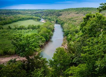


Explore Buffalo National River on the map
Plan your trip on one map. See where the top attractions, landmarks, restaurants and hotels are, and book hotels and experiences in a few clicks.
Best hotels in Buffalo National River
Best restaurants in Buffalo National River
Buffalo National River has no continuous dining strip, and meals are generally found in surrounding gateway communities rather than beside remote trailheads or river access points. Jasper, often used for the upper river, has the broadest choice near Ponca, while Marshall, Yellville, Harrison and Mountain Home provide additional restaurants, cafés, groceries and take-away provisions for different sections. Rural diners and family restaurants reflect the food traditions of the Ozarks, with familiar American cooking, barbecue, burgers, biscuits, fried fish and locally sourced seasonal produce appearing more often than elaborate destination dining. Farm shops and small community stores can be useful for picnic supplies, though opening arrangements vary. Visitors planning a full day on the water or a remote trail should carry food and water rather than assume that refreshments will be available at the river.
-
Southern
Big Springs Trading Company
Experience authentic Southern barbecue at Big Springs Trading Company in St. Joe - where every meal tells a story.

Best bars in Buffalo National River
Evenings around Buffalo National River are quiet and rural, with no recognised nightlife district or concentration of nightclubs inside the protected corridor. The most characteristic options are relaxed restaurants, cafés, local taverns and traditional community bars in gateway settlements such as Jasper, Marshall, Yellville and Mountain Home, where the atmosphere is usually informal rather than late-night. Some accommodation areas and seasonal recreation communities may offer social spaces, but entertainment and opening patterns vary. After dark, the river country is better suited to sitting outdoors, listening to the water, observing the night sky where conditions allow or joining a campsite conversation than seeking organised entertainment. Anyone returning from a river access or trailhead should plan transport in advance, as roads are rural and services are widely spaced.
-
American
Daisy Queen
Experience classic American fast food at Daisy Queen in Marshall, Arkansas, where delicious flavors and a nostalgic atmosphere await.
-
Restaurant
Cliff House Inn
Experience the breathtaking beauty and culinary delights of Cliff House Inn, a unique restaurant and inn in the heart of the Ozarks.
-
American
Fergusons Country Store & Restaurant, solid Cherry & Oak Furniture
Discover the charm of Fergusons Country Store & Restaurant: where delicious American breakfasts meet exquisite handcrafted furniture in St. Joe, Arkansas.
-
Mexican
Los Locos Mexican Restaurant Marshall Ar
Experience the rich flavors of authentic Mexican cuisine at Los Locos, a must-visit restaurant in Marshall, Arkansas.


Best nightclubs in Buffalo National River
Evenings around Buffalo National River are quiet and rural, with no recognised nightlife district or concentration of nightclubs inside the protected corridor. The most characteristic options are relaxed restaurants, cafés, local taverns and traditional community bars in gateway settlements such as Jasper, Marshall, Yellville and Mountain Home, where the atmosphere is usually informal rather than late-night. Some accommodation areas and seasonal recreation communities may offer social spaces, but entertainment and opening patterns vary. After dark, the river country is better suited to sitting outdoors, listening to the water, observing the night sky where conditions allow or joining a campsite conversation than seeking organised entertainment. Anyone returning from a river access or trailhead should plan transport in advance, as roads are rural and services are widely spaced.
-
River
Buffalo National River
Discover the natural beauty and adventure of Buffalo National River, a pristine oasis in the heart of Arkansas, perfect for outdoor activities and relaxation.

Best shops in Buffalo National River
Shopping within Buffalo National River is limited and practical rather than extensive, with supplies concentrated in gateway towns and villages outside the protected river corridor. Jasper, Marshall, Yellville, Harrison and Mountain Home provide groceries, fuel, outdoor provisions and locally owned shops, while farm stands and small community stores may offer seasonal produce or regional food products. Visitors may also find Ozark-inspired crafts, pottery, artwork, quilts, woodwork and locally made gifts in galleries, craft businesses and visitor-oriented shops around the wider region, although the selection and opening arrangements vary. Outdoor equipment and paddling supplies are most likely to be available through specialist businesses or outfitters near the principal access areas. Purchasing from local producers and taking reusable supplies into the park is more realistic than expecting a large retail centre near the river.
-
American
Fergusons Country Store & Restaurant, solid Cherry & Oak Furniture
Experience the charm of Americana at Fergusons Country Store & Restaurant, where hearty breakfasts meet handcrafted furniture in St. Joe, Arkansas.
-
Canoe & kayak rental service
Buffalo River Outfitters
Explore the beauty of the Buffalo National River with Buffalo River Outfitters - your gateway to canoeing, kayaking, and cabin rentals in Arkansas.
-
Gift shop
Scenic Point Gift Shop
Explore Scenic Point Gift Shop in Arkansas for unique souvenirs, local crafts, and a friendly shopping experience in a picturesque setting.
-
Southern
Big Springs Trading Company
Experience authentic Southern barbecue and deli delights at Big Springs Trading Company in St. Joe, Arkansas, where flavor meets a warm atmosphere.


Get your free copy of our complete guide to Buffalo National River, delivered straight to you.
Everything on this page, from attractions and restaurants to essentials and local phrases, in one PDF you can read offline, print or share.
Already have an account? Sign in
Your Buffalo National River guide is ready.
We'll send it to · Not you? Sign out

Getting your guide ready…
We are putting together a fresh copy of the Buffalo National River guide. This can take up to a minute.
This can take a few moments. If your browser asks, choose Allow so the download can start. You'll find the guide in your Downloads folder.
Nothing happened? Download it again
Sorry, the guide is taking longer than usual. Please try again in a minute, or get it by email instead.
Buffalo National River essentials
Currency and Payment
Safety
Emergency Situations
Do's and Don'ts
Local Tips
From Eve
Local phrases worth knowing
You don't need to get them perfect. A few words go a long way, and locals appreciate the effort.
Basics
| English | Local | Say it |
|---|---|---|
| Hello | Howdy | [haw-dee] |
| Goodbye | See ya | [see yuh] |
| Yes | Yep | [yep] |
| No | Nah | [nah] |
| Please/You're welcome | Please/You're welcome | [please/yur welcome] |
| Thank you | Thanks | [thanks] |
| Excuse me/Sorry | Excuse me/Sorry | [excuse me/sorry] |
| How are you? | How y'all doin'? | [how y'all doin'] |
| Fine. And you? | Fine. And you? | [fine. and y'all?] |
| Do you speak English? | Ya speak English? | [ya speak english?] |
| I don't understand | I don't get it | [I don't get it] |
Eating & Drinking
| English | Local | Say it |
|---|---|---|
| I'd like to see the menu, please | Can I see the menu, please | [can I see the menu, please] |
| I don't eat meat | I don't eat meat | [I don't eat meat] |
| Cheers! | Cheers! | [cheers!] |
| I would like to pay, please | I need to pay now, please | [I need to pay now, please] |
Emergencies
| English | Local | Say it |
|---|---|---|
| Help! | Help! | [help!] |
| Go away! | Git! | [git!] |
| Call the Police! | Call the Sheriff! | [call the sheriff!] |
| Call a doctor! | Call a doc! | [call a doc!] |
| I'm lost | I'm lost | [I'm lost] |
| I'm ill | I'm sick | [I'm sick] |
Shopping
| English | Local | Say it |
|---|---|---|
| I'd like to buy... | I wanna buy... | [I wanna buy...] |
| I'm just looking | I'm just lookin' | [I'm just lookin'] |
| How much is it? | How much does it cost? | [how much does it cost?] |
| That's too expensive | That's too pricey | [that's too pricey] |
| Can you lower the price? | Can ya lower the price? | [can ya lower the price?] |
Time & Numbers
| English | Local | Say it |
|---|---|---|
| What time is it? | What time is it? | [what time is it?] |
| It's one o'clock | It's one o'clock | [it's one o'clock] |
| Half past (10) | Half past (10) | [half past (10)] |
| Morning | Mornin' | [mornin'] |
| Afternoon | Afternoon | [afternoon] |
| Evening | Evenin' | [evenin'] |
| Yesterday | Yesterday | [yesterday] |
| Today | Today | [today] |
| Tomorrow | Tomorrow | [tomorrow] |
| 1 | One | [one] |
| 2 | Two | [two] |
| 3 | Three | [three] |
| 4 | Four | [four] |
| 5 | Five | [five] |
| 6 | Six | [six] |
| 7 | Seven | [seven] |
| 8 | Eight | [eight] |
| 9 | Nine | [nine] |
| 10 | Ten | [ten] |
Transport & Directions
| English | Local | Say it |
|---|---|---|
| Where's a/the...? | Where's a/the...? | [where's a/the...?] |
| What's the address? | What's the address? | [what's the address?] |
| Can you show me (on the map)? | Can you show me (on the map)? | [can you show me (on the map)?] |
| When's the next (bus)? | When's the next (bus)? | [when's the next (bus)?] |
| A ticket (to ....) | A ticket (to ....) | [a ticket (to ....)] |
History of Buffalo National River
The Ozark Limestone Landscape
The Buffalo River occupies a landscape shaped over immense geological timescales within the Ozark Plateau. Its bed and surrounding hills are largely formed from limestone, a soluble rock that has been eroded by water into bluffs, caves, springs, sinkholes and narrow valleys. These geological processes created the river's distinctive topography long before human settlement and continue to influence its channels, floodplains and underground drainage. The exposed cliffs and karst features are not merely scenic backdrops: they determine where roads, farms, footpaths and settlements could develop and help explain the concentration of caves and springs throughout the river corridor.
Indigenous Presence and Early Settlement
The Buffalo region has a long history of Indigenous occupation, including use by peoples associated with the Osage and other Native nations before and during the period of Euro-American expansion. Later settlers established small farms and homesteads in the river valleys and on more accessible uplands, raising livestock and crops in a landscape where transport was difficult. Cabins, cemeteries, field patterns and place names preserve evidence of these communities. The river served as a practical corridor for movement and local exchange, though its steep bluffs and uneven terrain kept settlement dispersed rather than allowing a large urban centre to develop.
Farming, Mills and Mountain Industry
For much of the nineteenth and early twentieth centuries, life along the Buffalo depended on small-scale agriculture, timber, mills and river-valley resources. Settlers used the relatively level bottomlands for cultivation and grazed animals in the surrounding hills. In the lower river region, the Rush area became associated with zinc mining, which expanded during the late nineteenth century and reached particular importance during the First World War before declining. The remains of mines, roads, buildings and other traces at Rush Historic District illustrate the short-lived industrial cycles that affected remote Ozark communities.
A River Under Pressure
During the twentieth century, proposals for dams and other development raised concerns about the future of the Buffalo's free-flowing character. Local residents, conservationists and national organisations argued that the river's bluffs, wildlife, archaeological resources and rural heritage warranted lasting protection. These debates formed part of a wider American conservation movement that increasingly recognised rivers as cultural and natural landscapes rather than simply sources of power or transport. Protection also reflected the importance of the river to communities whose identity was closely tied to the Ozark environment.
National River Protection
Congress established Buffalo National River in 1972, creating the first national river in the United States and placing the protected corridor under National Park Service management. The designation preserved a long free-flowing reach while allowing carefully managed recreation, including paddling, hiking, fishing and camping in appropriate areas. Historic structures and cultural landscapes became part of the park's interpretation alongside geology and ecology. Today, management must balance public access with fluctuating water levels, sensitive caves, wildlife habitat, historic preservation and the continuing relationship between the river and neighbouring Ozark communities.
Buffalo National River in Photos
Browse through our photo collection highlighting the charm and character of the destination.
Neighbouring destination travel guides
The closest destinations to Buffalo National River, if you have time for more than one.
-

-
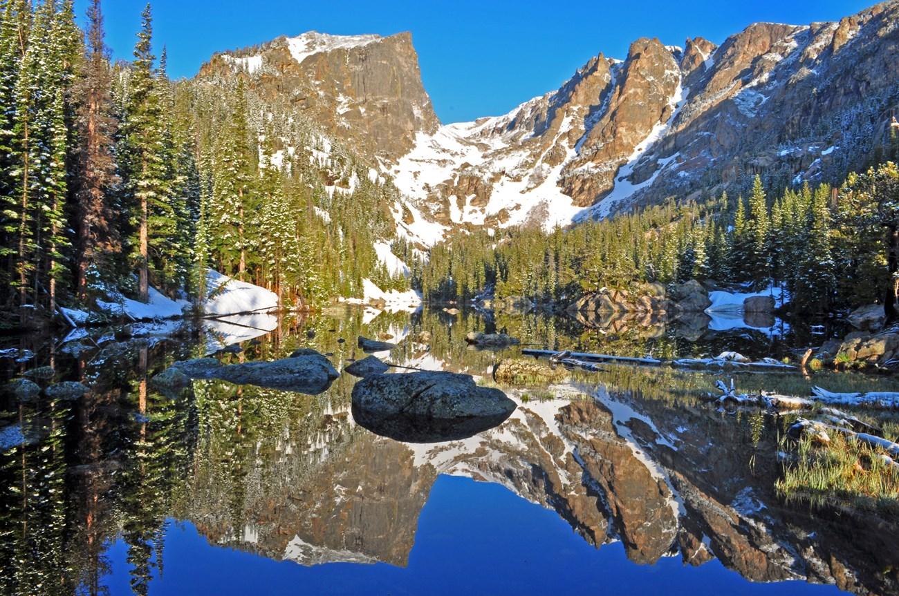 Table Rock Lake
, Missouri, pairs clear water, wooded shores and Ozark scenery with boating, fishing, hiking and lively lakeside towns in the United States.
-

-

-


Swipe for more destinations
Explore more
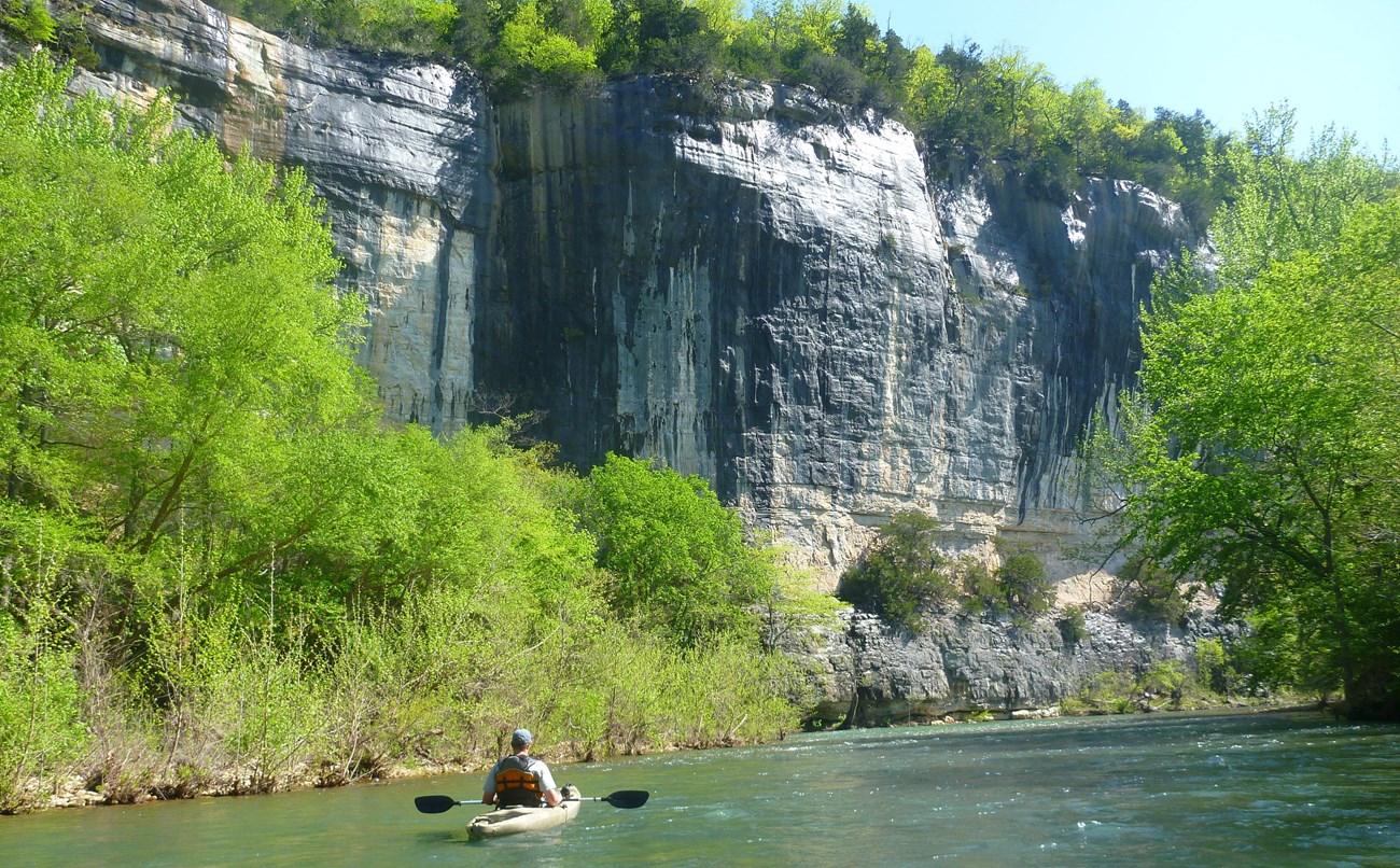
Explore more of Ozark Mountains
Explore Arkansas's Ozark Mountains for limestone bluffs, clear rivers, forest trails, historic towns and enduring music traditions.
Explore Ozark Mountains
Explore more of Arkansas
Explore Arkansas: The Natural State with its stunning landscapes, rich history, and vibrant cultural experiences. Perfect for adventurers and culture seekers alike.
Explore Arkansas