

Ottakring (Vienna) Travel Guide - Free
Explore Ottakring in Vienna with Evendo's free guide. Find the best shops, historic streets, restaurants, and gems on web or mobile.


Ottakring, Vienna’s 16th district, blends Brunnenmarkt flavours, Ottakringer beer, Red Vienna housing, vineyards and wooded hillsides in one local neighbourhood.
From Working-Class Streets to Wine-Growing Slopes
Ottakring occupies Vienna’s 16th district, stretching from the dense inner-city edge around Thaliastrasse and Brunnenmarkt towards the wooded heights of Gallitzinberg and Wilhelminenberg. Its character changes noticeably as the streets climb: apartment blocks, workshops, cafés and busy tram corridors give way to quieter lanes, allotments, vineyards and panoramic paths. This contrast is one of the district’s defining pleasures. Ottakring feels urban and residential at once, with daily life unfolding in neighbourhood squares rather than around a single monumental centre.Read more about Ottakring
Markets, Courtyards and Everyday Culture
Beer, Architecture and the Green Heights
Best attractions in Ottakring
Ottakring’s principal attractions are closely tied to its everyday urban life. Brunnenmarkt offers a long walk through food shops, cafés, market stalls and small businesses, while neighbouring Yppenplatz provides a social square with outdoor seating and a distinctly local rhythm. The Ottakringer Brauerei is another defining destination, combining industrial architecture with occasional cultural programming and brewing-related experiences. On the district’s upper slopes, Schloss Wilhelminenberg and the paths around Gallitzinberg open onto greener scenery and broad views across Vienna. Sandleiten, one of the city’s major interwar housing estates, is worth exploring for its courtyards and communal architecture rather than as a conventional sightseeing stop. The district’s parish churches, market lanes, wine-growing terraces and ordinary residential streets complete the picture, offering a more layered experience than a list of isolated monuments.
-
Tourist attraction
Kongresspark
Escape to Kongresspark in Vienna's Ottakring: A historic green space offering recreation, culture, and community in a beautifully landscaped setting.
10 min walk · 0.8 km from neighbourhood centre
-
Tourist attraction
Kuffner Observatory
Explore the cosmos at Vienna's historic Kuffner Observatory: Discover 19th-century instruments and witness the wonders of the night sky.
10 min walk · 0.8 km from neighbourhood centre
-
Tourist attraction
Grünes Licht
Experience Vienna's vibrant nightlife at Grünes Licht in Ottakring, a local hotspot offering a unique and authentic Viennese atmosphere.
10 min walk · 0.8 km from neighbourhood centre
-
Tourist attraction
Bezirksmuseum Ottakring
Explore Ottakring's captivating past at the Bezirksmuseum, a treasure trove of local history and Viennese culture.
7 min drive · 2.2 km from neighbourhood centre


Best landmarks in Ottakring
Ottakring’s landmarks express its development as a village, industrial district and municipal housing area. Ottakringer Brauerei is the most recognisable industrial landmark, its brewery buildings representing the district’s long association with production and local commerce. Brunnenmarkt is significant less for a single historic structure than for the continuity of its market corridor and the way it has absorbed successive commercial influences. Yppenplatz marks the southern end of that market environment, while the Sandleiten housing estate stands as a major example of Red Vienna’s socially planned architecture, with courtyards and communal design shaping daily life. On the hills, Schloss Wilhelminenberg gives the upper district a landmark associated with villas, gardens and wide views. Parish churches, older village streets and the Ottakringer Friedhof add quieter historical markers to a district whose identity is spread across many buildings rather than concentrated in one monumental centre.
-
Park
Kongresspark
Escape to Vienna's Kongresspark in Ottakring: a historic green space offering recreation, culture, and community in a beautifully landscaped setting.
10 min walk · 0.8 km from neighbourhood centre
-
Observation deck
Jubiläumswarte
Experience Vienna from above at the Jubiläumswarte: panoramic views, rich history, and natural beauty atop the Gallitzinberg in Ottakring.
8 min drive · 2.6 km from neighbourhood centre
-
Park
Steinbruchwiese
Escape to nature in Vienna's Ottakring district at Steinbruchwiese, a park offering recreation, history, and scenic views for all ages.
6 min drive · 1.9 km from neighbourhood centre
-
Catholic church
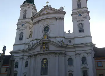
Zum Heiligen Geist
Discover a peaceful Catholic church in Vienna's Ottakring, offering a serene escape and a glimpse into local community life.
6 min drive · 2.0 km from neighbourhood centre


Explore Ottakring on the map
A handpicked selection of must-see spots in Ottakring, mapped for you.
Best hotels in Ottakring
Best restaurants in Ottakring
Ottakring’s dining culture is concentrated around Brunnenmarkt, Yppenplatz and the streets connecting them, where Viennese cafés and bakeries sit alongside restaurants and food businesses shaped by the district’s international communities. Visitors can browse ingredients at market shops, eat casually at small restaurants or settle into a café for coffee and pastries, with menus varying from Austrian staples to Balkan, Turkish, Middle Eastern and other Mediterranean-influenced cooking. The market is particularly useful for understanding how shopping and eating overlap in Vienna’s outer districts: some businesses serve local residents first, while others have developed a more contemporary café character. Uphill, traditional wine taverns and seasonal Heuriger-style establishments appear around the vineyards and village-like streets, although the selection is less concentrated than in the lower district. Specific venues, opening days and menus change, so current local information matters.
-
Greek
Achillion
Experience authentic Greek cuisine at Achillion in Ottakring, Vienna – where every meal feels like a Mediterranean getaway.
7 min walk · 0.5 km from neighbourhood centre
-
Austrian
Gelbmanns Gaststube
Discover authentic Austrian flavors at Gelbmanns Gaststube in Vienna's Ottakring district - where tradition meets taste.
12 min walk · 1.0 km from neighbourhood centre
-
Restaurant
Blunzenstricker
Discover Blunzenstricker in Vienna: A must-visit restaurant offering authentic Austrian cuisine in a warm and inviting atmosphere.
6 min drive · 2.1 km from neighbourhood centre
-
European
VIER SINNE
Experience the thrill of dining in darkness at VIER SINNE - where taste transcends sight and culinary creativity flourishes.
12 min walk · 1.0 km from neighbourhood centre


Best bars in Ottakring
Ottakring’s evening life is varied but not dominated by large nightclubs. Yppenplatz and the surrounding streets are the main focus for relaxed bars, cafés that stay open later and informal gatherings, while Brunnenmarkt becomes quieter as retail activity winds down. The district also has a strong connection with beer through Ottakringer Brauerei, whose premises may host cultural events, performances or seasonal gatherings depending on the programme. Small music and arts events appear in independent spaces, though they should be treated as changing local programming rather than a fixed nightlife circuit. Traditional wine taverns on or near the upper slopes offer a slower evening centred on local wine and food. Visitors staying in residential streets should keep voices low when returning late, since much of Ottakring remains a lived-in neighbourhood rather than an entertainment quarter.
-
Brewpub
Schwarzer Rabe
Discover local craft beers and hearty Austrian cuisine at Schwarzer Rabe, a cozy brewpub in Vienna's charming Ottakring district.
13 min walk · 1.1 km from neighbourhood centre
-
Bar
Vienna Lounge
Experience the vibrant atmosphere and diverse offerings at Vienna Lounge, a premier bar and lounge in Ottakring, Vienna.
18 min walk · 1.5 km from neighbourhood centre
-
Cocktail bar
BEIMIR
Discover the vibrant cocktail culture at BEIMIR, a stylish bar in Ottakring, Vienna, where every drink is a masterpiece and every night a celebration.
16 min walk · 1.3 km from neighbourhood centre
-
Wine bar
Weinschenke the Blue Nos'n
Experience the best of Vienna's wine culture at Weinschenke the Blue Nos'n, a cozy bar offering a fantastic selection of local and international wines.
9 min walk · 0.7 km from neighbourhood centre


Best nightclubs in Ottakring
Ottakring’s evening life is varied but not dominated by large nightclubs. Yppenplatz and the surrounding streets are the main focus for relaxed bars, cafés that stay open later and informal gatherings, while Brunnenmarkt becomes quieter as retail activity winds down. The district also has a strong connection with beer through Ottakringer Brauerei, whose premises may host cultural events, performances or seasonal gatherings depending on the programme. Small music and arts events appear in independent spaces, though they should be treated as changing local programming rather than a fixed nightlife circuit. Traditional wine taverns on or near the upper slopes offer a slower evening centred on local wine and food. Visitors staying in residential streets should keep voices low when returning late, since much of Ottakring remains a lived-in neighbourhood rather than an entertainment quarter.
-
Disco club
Club Weberknecht
Discover Vienna's nightlife at Club Weberknecht, a lively disco club offering diverse music, live performances, and a vibrant atmosphere for an unforgettable experience.
9 min drive · 2.9 km from neighbourhood centre
-
Night club
The Loft
Discover The Loft, Vienna's ultimate destination for nightlife, where music, dance, and vibrant vibes create unforgettable experiences.
9 min drive · 3.0 km from neighbourhood centre
-
Lounge
Hill Vienna Club Lounge Bar
Discover the lively atmosphere of Hill Vienna Club Lounge Bar, where trendy cocktails meet vibrant nightlife in Ottakring.
8 min drive · 2.6 km from neighbourhood centre
-
Disco club
Cafe Dance Club U3
Discover the electrifying nightlife at Cafe Dance Club U3 in Vienna's Ottakring district, where music, dance, and fun collide.
11 min walk · 0.9 km from neighbourhood centre


Best shops in Ottakring
Shopping in Ottakring is strongest around Brunnenmarkt and Brunnengasse, where market stalls, grocers, bakeries, specialist food shops and small retailers create a long, mixed commercial street. The range reflects the district’s diverse communities, with spices, preserved foods, fresh produce and everyday household goods appearing alongside more conventional Viennese shopping. Around Yppenplatz and the nearby streets, independent cafés, design-minded businesses, studios and smaller contemporary shops add a newer layer without replacing the market’s practical role. Thaliastrasse and the routes towards Ottakring station provide further everyday retail, though they are better understood as local shopping corridors than as a specialist fashion district. Visitors should expect changing stock, independent opening patterns and a strong emphasis on food and daily necessities rather than a curated souvenir quarter; the appeal lies in the mixture of long-established businesses and newer local enterprises.
-
Gift shop
GAG Shop
Explore the GAG Shop in Vienna for unique gifts, colorful balloons, and whimsical party supplies that make every occasion special.
5 min drive · 1.6 km from neighbourhood centre
-
Gift shop
Action Wien
Explore Action Wien, a vibrant DIY and gift shop in Vienna's Ottakring district, offering everything from home goods to creative supplies.
8 min drive · 2.6 km from neighbourhood centre
-
Used clothing store
Second Hand Vienna Sylvi's Tauschecke
Explore vintage fashion treasures and sustainable shopping at Sylvi's Tauschecke in Vienna's Ottakring district.
12 min walk · 1.0 km from neighbourhood centre
-
Used clothing store
Vinzi Shop
Explore Vinzi Shop in Vienna for unique, sustainable fashion. A vintage paradise for eco-conscious shoppers seeking one-of-a-kind treasures.
9 min drive · 2.9 km from neighbourhood centre


Ottakring essentials
Getting There
Getting Around
Safety
Emergency Situations
Do's and Don'ts
Local Tips

From Eve
Local phrases worth knowing
You don't need to get them perfect. A few words go a long way, and locals appreciate the effort.
Basics
| English | Local | Say it |
|---|---|---|
| Hello | Servus | [Ser-voos] |
| Goodbye | Auf Wiedersehen | [Owf Vee-der-sey-en] |
| Yes | Ja | [Ya] |
| No | Nein | [Nine] |
| Please/You're welcome | Bitte | [Bit-te] |
| Thank you | Danke | [Dank-eh] |
| Excuse me/Sorry | Entschuldigung | [Ent-shool-di-gung] |
| How are you? | Wie geht's? | [Vee geyts] |
| Fine. And you? | Gut. Und dir? | [Goot. Oond deer] |
| Do you speak English? | Sprichst du Englisch? | [Spritst doo Eng-lish] |
| I don't understand | Ich verstehe nicht | [Ikh fer-shtey-eh nikht] |
Eating & Drinking
| English | Local | Say it |
|---|---|---|
| I'd like to see the menu, please | Ich hätte gerne die Speisekarte, bitte | [Ikh hetteh gehr-neh dee Shpy-suh-kahr-teh, bit-teh] |
| I don't eat meat | Ich esse kein Fleisch | [Ikh ess-eh kine Fly-sh] |
| Cheers! | Prost! | [Prohst] |
| I would like to pay, please | Ich würde gerne zahlen, bitte | [Ikh vur-deh gehr-neh tsah-len, bit-teh] |
Emergencies
| English | Local | Say it |
|---|---|---|
| Help! | Hilfe! | [Hil-feh] |
| Go away! | Geh weg! | [Gey vehg] |
| Call the Police! | Rufen Sie die Polizei! | [Roo-fen zee dee Po-lee-tsey] |
| Call a doctor! | Rufen Sie einen Arzt! | [Roo-fen zee i-nen Ahrts] |
| I'm lost | Ich habe mich verirrt | [Ikh hah-beh meekh feh-rihrt] |
| I'm ill | Mir ist schlecht | [Meer ist shlehkt] |
Shopping
| English | Local | Say it |
|---|---|---|
| I'd like to buy... | Ich möchte kaufen... | [Ikh murk-teh cow-fen] |
| I'm just looking | Ich schaue nur | [Ikh shou-eh noor] |
| How much is it? | Wie viel kostet das? | [Vee feel koh-stet das] |
| That's too expensive | Das ist zu teuer | [Das ist tsoy toy-er] |
| Can you lower the price? | Können Sie den Preis senken? | [Kern-en zee den prise zehn-ken] |
Time & Numbers
| English | Local | Say it |
|---|---|---|
| What time is it? | Wie spät ist es? | [Vee shpet ist es] |
| It's one o'clock | Es ist ein Uhr | [Es ist iyn uur] |
| Half past (10) | Halb zehn | [Halb tsehn] |
| Morning | Morgen | [Mor-gen] |
| Afternoon | Nachmittag | [Nahk-mit-tahk] |
| Evening | Abend | [Ah-bend] |
| Yesterday | Gestern | [Ges-tern] |
| Today | Heute | [Hoy-teh] |
| Tomorrow | Morgen | [Mor-gen] |
| 1 | Eins | [Iyns] |
| 2 | Zwei | [Tsvay] |
| 3 | Drei | [Dry] |
| 4 | Vier | [Feer] |
| 5 | Fünf | [Foonf] |
| 6 | Sechs | [Zeks] |
| 7 | Sieben | [Zee-ben] |
| 8 | Acht | [Ahkt] |
| 9 | Neun | [Noin] |
| 10 | Zehn | [Tsehn] |
Transport & Directions
| English | Local | Say it |
|---|---|---|
| Where's a/the...? | Wo ist ein/der...? | [Voh ist iyn/dayr] |
| What's the address? | Was ist die Adresse? | [Vahs ist dee Ah-drehs-eh] |
| Can you show me (on the map)? | Können Sie mir das zeigen (auf der Karte)? | [Kern-en zee meer das tsee-gen (ouf dayr Kahr-teh)] |
| When's the next (bus)? | Wann kommt der nächste (Bus)? | [Vahn komt dayr nikh-steh (Boos)] |
| A ticket (to ....) | Eine Fahrkarte (nach ...) | [Iyn-eh Fahr-kahr-teh (nahkh ...)] |
History of Ottakring
A Village beside the Vienna Woods
Ottakring began as a settlement on the western edge of Vienna, close to streams and the rising land leading towards the Vienna Woods. The name is generally connected with the local settlement traditionally associated with Otakar, although its precise early linguistic development is debated. Medieval Ottakring was distinct from the walled city and remained largely rural, with fields, gardens and vineyards shaping its economy and landscape. The village’s position beneath the hills later influenced its expansion, providing both agricultural land and an accessible route westwards from Vienna.
Industrial Growth and Urban Incorporation
During the nineteenth century, Ottakring changed from a village into a densely settled working district as Vienna’s population and industrial economy expanded. Workshops, small factories, breweries and tenement housing appeared along the lower streets, while roads and tram connections tied the area more closely to the city. Ottakringer Brauerei, founded in 1837, became an important local institution and a visible expression of the district’s industrial identity. In 1892, Ottakring was incorporated into Vienna, formalising a relationship that had already been strengthened by urban growth and transport.
Housing and the Red Vienna Era
The housing shortage after the First World War brought major municipal building activity to Ottakring. Under Red Vienna, the city developed large communal housing estates intended to provide affordable homes with courtyards, shared facilities and improved sanitary conditions. The Sandleiten housing estate, built during the 1920s, became one of the district’s most substantial examples of this approach. These projects altered Ottakring’s physical and social structure, replacing overcrowded conditions in parts of the older district with planned residential complexes that remain central to its architectural identity.
Migration and a Changing Market District
After the Second World War, Ottakring experienced further social and commercial change as new residents arrived from different parts of Austria and from abroad. The area around Brunnenmarkt developed a particularly varied retail and food culture, with businesses reflecting successive waves of migration and family enterprise. The market’s long, linear form made it an adaptable setting for changing goods and cuisines. From the late twentieth century onwards, cafés, studios and cultural initiatives appeared alongside established shops, while rising interest in the district brought redevelopment and new pressure on its older affordable character.
The Contemporary Hillside District
Modern Ottakring combines several histories rather than replacing one with another. The lower district retains nineteenth-century tenements, market streets, industrial traces and communal housing, while the upper slopes preserve vineyards, wooded paths and villas around Wilhelminenberg. Ottakringer Brauerei continues to anchor the local identity, even as its premises have also supported cultural programming. This mixture of dense urban life, migration-shaped commerce, municipal housing and hillside recreation explains why Ottakring occupies a distinctive place within Vienna: it is both an established residential district and a part of the city still undergoing visible change.
Ottakring in Photos
Browse through our photo collection highlighting the charm and character of the destination.
Neighbourhoods near Ottakring
The closest neighbourhoods to Ottakring, if you have time for more than one stop.
-

-

-

-

-


Swipe for more neighbourhoods
Explore more

Explore more of Vienna
Vienna blends imperial palaces, classical music, grand coffeehouses and contemporary culture in Austria’s elegant capital, rich in history, art and architecture.
Explore Vienna