

Free Sierra Nevada Travel Guide & Mobile App
Explore Sierra Nevada with free travel guides. Discover regional history, expert tips, proposed trips, and audio guides on web or mobile app.


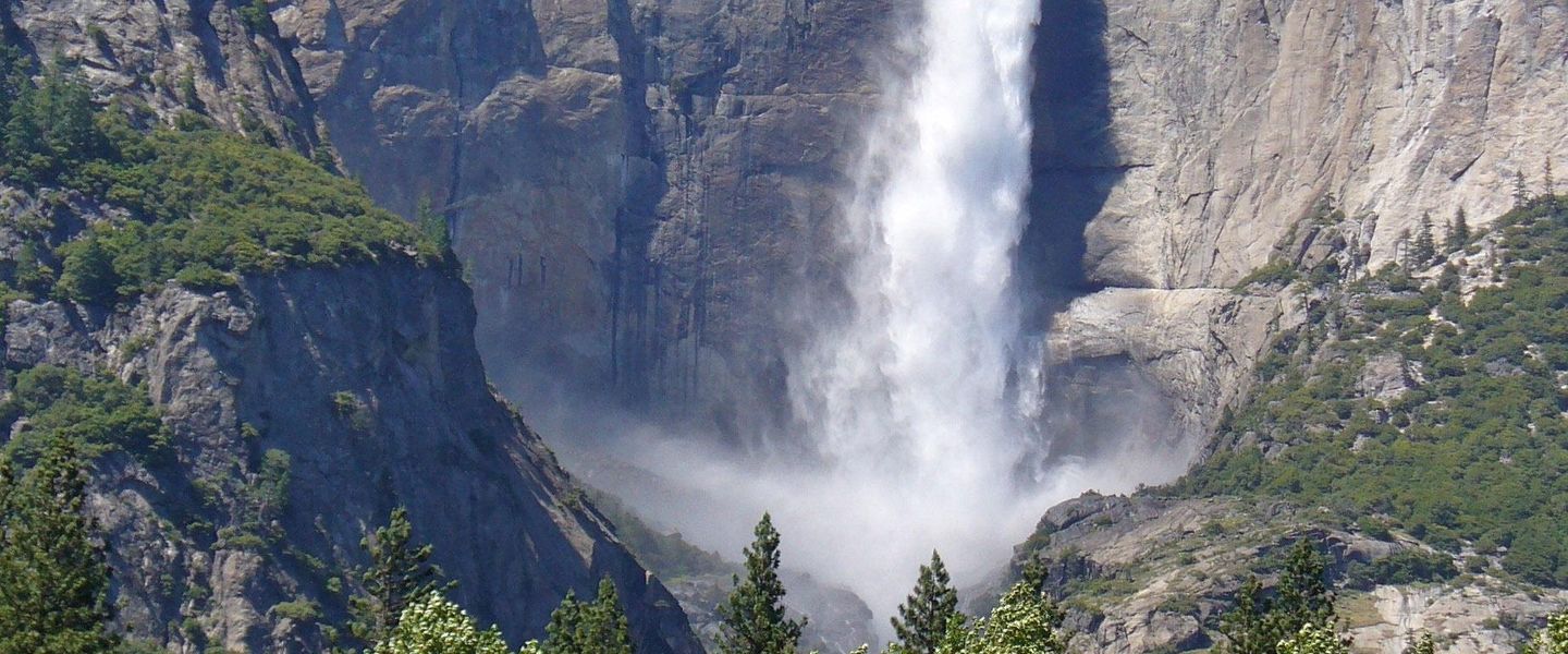


Explore California's Sierra Nevada for granite peaks, sequoia forests, alpine lakes, national parks, mountain towns and seasonal outdoor adventures.
Read more about Sierra Nevada
When is the best time to visit Sierra Nevada?
Best: June–August · 20–25°C| Month | High (°C) | Rainfall (mm) |
|---|---|---|
| January | 4 | 80 |
| February | 5 | 70 |
| March | 7 | 70 |
| April | 10 | 60 |
| May | 15 | 50 |
| June (best) | 20 | 30 |
| July (best) | 25 | 20 |
| August (best) | 24 | 20 |
| September | 20 | 30 |
| October | 15 | 40 |
| November | 8 | 60 |
| December | 4 | 70 |
Getting to and around Sierra Nevada
How to get there
Transportation
Top city travel guides in Sierra Nevada
The cities of Sierra Nevada, and the easiest places to base yourself.
-

-

-

-

-

-


Swipe for more cities
Destinations in Sierra Nevada
Resorts, valleys and scenic spots worth a trip of their own.
-

-

-

-


Swipe for more destinations
Best attractions in Sierra Nevada
The Sierra Nevada's attractions are shaped by scale and elevation. Yosemite National Park provides the most concentrated display of granite cliffs, waterfalls, giant trees and glacial valleys, while Sequoia and Kings Canyon national parks combine giant sequoia groves with deep canyons and high mountain wilderness. Lake Tahoe offers beaches, forests, boating and viewpoints around its Californian shore, and the northern Sierra contains reservoirs, historic mining towns and forest roads. The central and eastern range appeals to hikers, climbers, anglers and photographers with alpine lakes, high passes and volcanic landscapes, particularly around the Mammoth Lakes area and the eastern escarpment. Winter sports are important at established resorts, while summer supports camping, horse riding, mountain biking and scenic driving. Many places require advance planning, permits or seasonal access checks, and the most rewarding areas may be remote rather than densely developed.
-
Tourist attraction
General Sherman Tree
Explore the breathtaking General Sherman Tree, the largest tree on Earth, nestled in the stunning Sequoia National Park's majestic landscape.
-
National forest
Inyo National Forest
Discover California's Eastern Sierra: Home to ancient forests, towering peaks, and pristine alpine lakes in a vast and varied landscape.
-
State park
Emerald Bay State Park
Explore Emerald Bay State Park, where stunning lake views, scenic trails, and rich history await every visitor in the heart of California's wilderness.
-
State park
Columbia State Historic Park
Explore the rich history of California's Gold Rush at Columbia State Historic Park, where the past comes alive in a charming, preserved mining town.
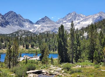
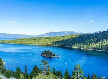
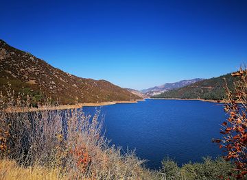
Best landmarks in Sierra Nevada
Yosemite Valley's granite walls, including El Capitan and Half Dome, are the Sierra Nevada's most recognisable natural landmarks. Their sheer forms were shaped by glaciers and remain central to the region's climbing, photography and conservation history. In the southern Sierra, the General Sherman Tree in Sequoia National Park is renowned as the largest known living tree by volume, while the surrounding giant sequoia groves provide a powerful sense of scale. The Sierra's eastern escarpment rises dramatically above Owens Valley, with Mount Whitney occupying the highest part of the contiguous United States in Sequoia National Park. Lake Tahoe's broad blue basin, bordered by forested mountains, is another defining feature. Donner Pass carries significance as both a trans-Sierra route and a reminder of nineteenth-century migration, while historic mining and railway towns in the foothills preserve the built legacy of the Gold Rush and later transport development.
-
Tourist attraction
General Sherman Tree
Encounter the General Sherman Tree, the world's largest living tree, in Sequoia National Park's Giant Forest, a testament to nature's enduring grandeur and a must-see destination.
-
National forest
Tahoe National Forest
Discover rugged beauty, historic sites, and year-round recreation in Tahoe National Forest, a vast Sierra Nevada treasure offering hiking, skiing, and unparalleled natural experiences.
-
State park
Columbia State Historic Park
Experience California's Gold Rush in living color at Columbia State Historic Park, where costumed docents, historic buildings, and authentic activities transport you to the 1850s.
-
National forest
Sierra National Forest
Discover breathtaking mountain scenery and abundant natural resources in the Sierra National Forest, a year-round outdoor paradise in the heart of California's Sierra Nevada.
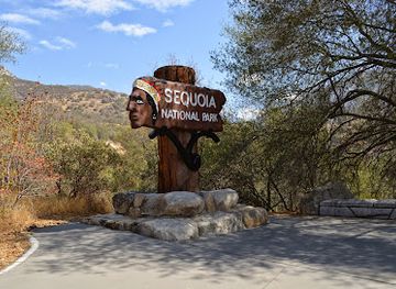
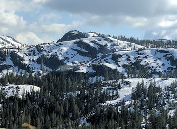
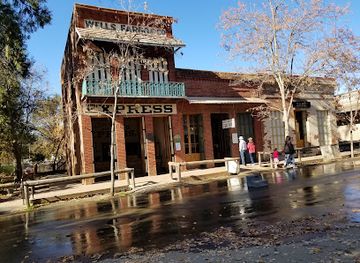
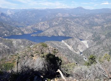
Explore Sierra Nevada on the map
Plan your trip on one map. See where the top cities, national parks and sights are, and book hotels and experiences in a few clicks.
Best hotels in Sierra Nevada
Best restaurants in Sierra Nevada
Dining in the Sierra Nevada reflects mountain communities, resort economies and the agricultural abundance of the Central Valley below. Lake Tahoe, Truckee and Mammoth Lakes have the broadest choice, ranging from cafés and bakeries to contemporary restaurants, family dining and après-ski venues. In smaller towns, independently run cafés, rural inns, barbecue restaurants and traditional American diners are more typical. Menus often make use of Californian produce, craft beer, locally made wine from nearby valleys and seasonal ingredients, while trout and other freshwater fish may appear in mountain cooking without representing a single uniform regional cuisine. Farmers' markets and food shops in gateway towns are useful for picnic supplies, especially before entering national parks or remote forest areas. Expect limited choice at isolated trailheads and park facilities, and plan meals and water stops around long journeys rather than relying on finding a restaurant in the high country.
-
Hamburger
California Burger Company
Discover mouthwatering burgers and vibrant atmosphere at California Burger Company in South Lake Tahoe - perfect for families and food lovers alike!
-
Restaurant
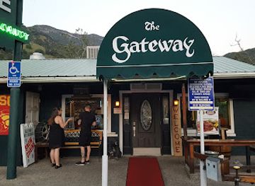
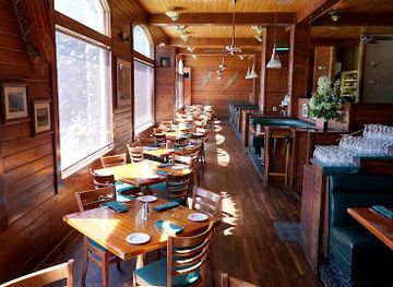
The Gateway Restaurant & Lodge
Experience exceptional American cuisine amid breathtaking Sierra Nevada views at The Gateway Restaurant & Lodge in Three Rivers.
-
American
Ducey's On the Lake & Ducey's Bar & Grill
Experience exquisite American dining at Ducey's On the Lake with stunning views of Bass Lake—perfect for every occasion.
-
Brewery
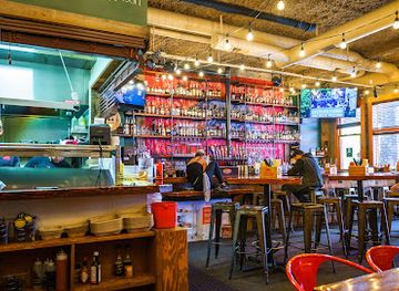
Sierra Nevada Taproom & Restaurant
Experience the best of Chico at Sierra Nevada Taproom & Restaurant – where exceptional craft beer meets delicious cuisine in a vibrant setting.

Best bars in Sierra Nevada
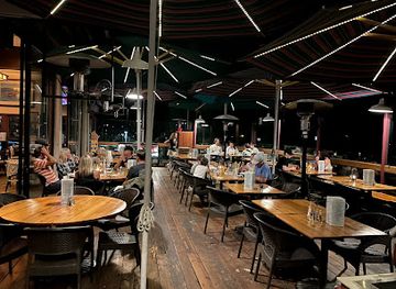
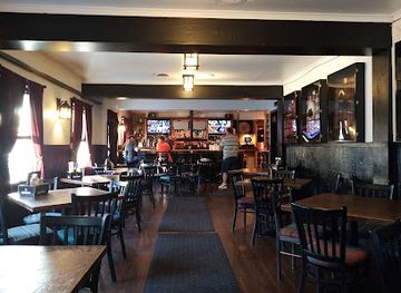
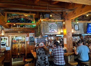
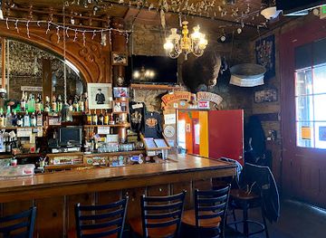
Evening life in the Sierra Nevada is generally relaxed and concentrated in resort towns rather than organised around large nightclub districts. South Lake Tahoe, Truckee and Mammoth Lakes have the widest range of bars, breweries, live-music venues and late-opening restaurants, with busier periods during ski season and summer holidays. Smaller communities tend to favour historic-style pubs, hotel bars, cafés and local gathering places, while evenings in national parks and forest settlements are quiet and oriented towards dining, stargazing or early starts. Après-ski drinking is part of the resort economy, but it is not the only way to experience the mountains. Winter driving after dark can be hazardous, and visitors should plan a safe way back to their accommodation rather than driving after drinking.
-
Californian
Gar Woods Grill & Pier
Discover Gar Woods Grill & Pier: Where Exceptional Californian Cuisine Meets Stunning Lake Tahoe Views.
-
Pub
MacDuff's Pub
Discover the heart of South Lake Tahoe at MacDuff's Pub, where local brews and hearty meals come together in a cozy, welcoming atmosphere.
-
American
Bridgetender Tavern and Grill
Experience the flavors of America at Bridgetender Tavern and Grill, a Tahoe gem offering delicious cuisine and stunning lake views.
-
Grill
Iron Door Saloon
Experience the rich history and delicious grill offerings at California's oldest bar, Iron Door Saloon in Groveland.
Best nightclubs in Sierra Nevada
Evening life in the Sierra Nevada is generally relaxed and concentrated in resort towns rather than organised around large nightclub districts. South Lake Tahoe, Truckee and Mammoth Lakes have the widest range of bars, breweries, live-music venues and late-opening restaurants, with busier periods during ski season and summer holidays. Smaller communities tend to favour historic-style pubs, hotel bars, cafés and local gathering places, while evenings in national parks and forest settlements are quiet and oriented towards dining, stargazing or early starts. Après-ski drinking is part of the resort economy, but it is not the only way to experience the mountains. Winter driving after dark can be hazardous, and visitors should plan a safe way back to their accommodation rather than driving after drinking.
-
Bar
Nevada Club
Discover the lively Nevada Club in Grass Valley, California, where craft drinks and friendly vibes meet local entertainment for an unforgettable night out.
-
Night club
La Sierra Nightclub
Experience the pulse of Panorama City at La Sierra Nightclub - where vibrant nightlife, great food, and unforgettable memories await.
-
Night club
NoVi
Discover NoVi, the ultimate nightlife destination in Reno, where cocktails, dancing, and unforgettable moments await you.
-
Cabaret club
Sucias
Discover a lively nightlife experience at Sucias, the premier cabaret club in Reno, featuring electrifying performances and a vibrant atmosphere.


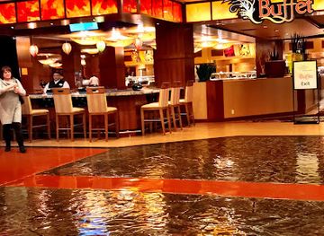

Best shops in Sierra Nevada
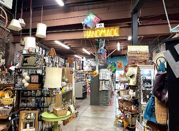
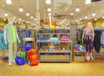
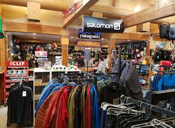
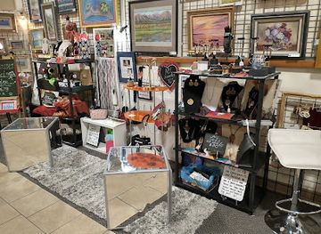
Shopping in the Sierra Nevada is centred on gateway towns and resort communities rather than large metropolitan retail districts. Truckee and Nevada City offer independent galleries, bookshops, outdoor retailers, antiques and locally made goods, while South Lake Tahoe and Mammoth Lakes have extensive practical shops for skiing, camping and other mountain activities. Farmers' markets and specialist food shops provide Californian produce, preserves, baked goods, honey, coffee and regional wine or beer from surrounding areas. Gallery shopping is particularly suited to visitors seeking landscape photography, paintings, ceramics, jewellery and woodwork, although provenance and production claims should be checked rather than assumed. National parks and forests sell educational material and approved souvenirs, but visitors should not buy or remove natural objects such as rocks, plants, feathers or fossils from protected landscapes. In smaller communities, opening patterns can be seasonal, so shopping is best combined with town visits rather than left until a remote trailhead.
-
Used clothing store
Junkee Clothing Exchange & Antique Store
Explore the eclectic charm of Junkee Clothing Exchange & Antique Store, where vintage fashion meets antique treasures in Reno, NV.
-
Department store
Sierra
Explore a world of adventure at Sierra, your ultimate department store in Reno, offering everything from outdoor gear to children's clothing.
-
Outdoor clothing and equipment shop
Mammoth Mountaineering Supply
Gear up for adventure at Mammoth Mountaineering Supply, your premier destination for outdoor equipment and clothing in Mammoth Lakes, California.
-
Gift shop
Buy Nevada First Gift Shop & Visitors Center in the NEVADA MARKETPLACE
Discover local crafts, unique gifts, and insider tips at Buy Nevada First Gift Shop & Visitors Center in Reno's Nevada Marketplace.
Get your free copy of our complete guide to Sierra Nevada, delivered straight to you.
Everything on this page, from attractions and restaurants to essentials and local phrases, in one PDF you can read offline, print or share.
Already have an account? Sign in
Your Sierra Nevada guide is ready.
We'll send it to · Not you? Sign out

Getting your guide ready…
We are putting together a fresh copy of the Sierra Nevada guide. This can take up to a minute.
This can take a few moments. If your browser asks, choose Allow so the download can start. You'll find the guide in your Downloads folder.
Nothing happened? Download it again
Sorry, the guide is taking longer than usual. Please try again in a minute, or get it by email instead.
Sierra Nevada essentials
Currency and Payment
Safety
Emergency Situations
Do's and Don'ts
Local Tips
From Eve
Local phrases worth knowing
You don't need to get them perfect. A few words go a long way, and locals appreciate the effort.
Basics
| English | Local | Say it |
|---|---|---|
| Hello | Howdy | [haʊdi] |
| Goodbye | See ya later | [siː jə ˈleɪtə] |
| Yes | Yep | [jɛp] |
| No | Nah | [nɑ] |
| Please/You're welcome | No problem | [noʊ ˈprɒbləm] |
| Thank you | Thanks a lot | [θæŋks ə lɒt] |
| Excuse me/Sorry | Sorry 'bout that | [ˈsɔri baʊt ðæt] |
| How are you? | How's it going? | [haʊz ɪt ˈgoʊɪŋ] |
| Fine. And you? | Good. You? | [ɡʊd ju] |
| Do you speak English? | Do ya speak English? | [du jə spiːk ˈɪŋɡlɪʃ] |
| I don't understand | I don’t get it | [aɪ doʊnt ɡɛt ɪt] |
Eating & Drinking
| English | Local | Say it |
|---|---|---|
| I'd like to see the menu, please | Can I see the menu? | [kæn aɪ siː ðə ˈmɛnju] |
| I don't eat meat | I’m a vegetarian | [aɪm ə ˌvɛdʒɪˈtɛriən] |
| Cheers! | Cheers! | [tʃɪrz] |
| I would like to pay, please | Can I get the check? | [kæn aɪ ɡɛt ðə tʃɛk] |
Emergencies
| English | Local | Say it |
|---|---|---|
| Help! | Help! | [hɛlp] |
| Go away! | Get lost! | [ɡɛt lɔst] |
| Call the Police! | Call 911! | [kɔl naɪn wʌn wʌn] |
| Call a doctor! | Get a doctor! | [ɡɛt ə ˈdɒktə] |
| I'm lost | I’m lost | [aɪm lɔst] |
| I'm ill | I’m not feeling well | [aɪm nɑt ˈfiːlɪŋ wɛl] |
Shopping
| English | Local | Say it |
|---|---|---|
| I'd like to buy... | I want to buy... | [aɪ wɒnt tu baɪ] |
| I'm just looking | Just browsing | [dʒʌst ˈbraʊzɪŋ] |
| How much is it? | What's the price? | [wʌts ðə praɪs] |
| That's too expensive | That's way too much | [ðæts weɪ tu mʌtʃ] |
| Can you lower the price? | Can you give me a better price? | [kæn jə ɡɪv mi ə ˈbɛtər praɪs] |
Time & Numbers
| English | Local | Say it |
|---|---|---|
| What time is it? | What time is it? | [wɑt taɪm ɪt] |
| It's one o'clock | It’s one o'clock | [ɪts wʌn əˈklɒk] |
| Half past (10) | Half past ten | [hɑf pæst tɛn] |
| Morning | Morning | [ˈmɔrnɪŋ] |
| Afternoon | Afternoon | [ˌæf.tɚˈnun] |
| Evening | Evening | [ˈiːv.nɪŋ] |
| Yesterday | Yesterday | [ˈjɛstərdeɪ] |
| Today | Today | [təˈdeɪ] |
| Tomorrow | Tomorrow | [təˈmɔroʊ] |
| 1 | One | [wʌn] |
| 2 | Two | [tu] |
| 3 | Three | [θri] |
| 4 | Four | [fɔr] |
| 5 | Five | [faɪv] |
| 6 | Six | [sɪks] |
| 7 | Seven | [ˈsɛvən] |
| 8 | Eight | [eɪt] |
| 9 | Nine | [naɪn] |
| 10 | Ten | [tɛn] |
Transport & Directions
| English | Local | Say it |
|---|---|---|
| Where's a/the...? | Where's the...? | [wɛrz ðə] |
| What's the address? | What's the address? | [wʌts ði əˈdrɛs] |
| Can you show me (on the map)? | Can you show me on the map? | [kæn ju ʃoʊ mi ɒn ðə mæp] |
| When's the next (bus)? | When's the next bus? | [wɛn ðə nɛkst bʌs] |
| A ticket (to ....) | One ticket to... | [wʌn ˈtɪkɪt tə] |
History of Sierra Nevada
Indigenous Landscapes Before American Settlement
The Sierra Nevada has been home to Indigenous peoples for thousands of years. Different communities, including the Washoe, Miwok, Paiute, Shoshone and Western Mono, developed distinct relationships with the range's valleys, forests, lakes and eastern slopes. Seasonal movement, gathering, hunting, fishing, trade and cultural practice connected lower elevations with the high country. Place names and surviving traditions reflect only part of this history, while many Indigenous communities continue to maintain cultural ties to the region. Visitors should understand that national parks and forests occupy landscapes with much older histories than the protected-area boundaries created by the United States.
Gold Rush and the Transformation of the Foothills
The discovery of gold in the Sierra foothills in 1848–49 brought a rapid influx of prospectors, merchants and engineers to California. Although the principal mining camps lay in the lower foothills rather than the highest mountains, the Gold Rush transformed rivers, forests and transport routes throughout the western Sierra. Towns such as Auburn, Placerville and Nevada City preserve parts of this era, while hydraulic mining scarred river systems and altered landscapes far downstream. Mining also intensified dispossession of Indigenous peoples and established economic networks that later supported logging, agriculture, railways and tourism.
Railways, Timber and Mountain Settlement
During the late nineteenth century, railways and improved roads penetrated the Sierra, linking mountain communities with California's growing cities and creating access for mining, logging and recreation. The transcontinental railway crossed the range through the Donner Pass corridor, while narrow-gauge lines served timber and mining districts elsewhere. Commercial logging removed extensive stands of forest, and settlements developed around sawmills, rail depots and mineral extraction. The surviving railway routes, historic downtowns and old industrial landscapes help explain how a difficult mountain barrier became connected to California's wider economy.
Yosemite and the Rise of Conservation
The landscapes of Yosemite helped shape the modern American conservation movement. Artists, writers and photographers brought national attention to the valley and its waterfalls, cliffs and groves, while campaigns led to protective measures in the nineteenth century. Yosemite became a national park in 1890, following earlier federal and state protection. The broader Sierra later saw the creation and expansion of other parks and wilderness areas. Conservation brought important safeguards for forests, wildlife and watersheds, but it also involved the removal or restriction of Indigenous people and the continuing debate over access, dams, roads and public land management.
Water, Dams and California's Growing Cities
Snowfields and alpine watersheds in the Sierra have long been central to California's water system. From the late nineteenth century onwards, reservoirs, aqueducts and hydroelectric projects redirected mountain water towards farms and expanding cities, particularly in the Central Valley and southern California. The Hetch Hetchy controversy in Yosemite National Park became a defining conservation dispute when the valley was dammed to supply San Francisco. Today, snowpack, drought, wildfire and competing demands for water continue to make the Sierra important far beyond its recreation economy.
Modern Outdoor Recreation and Protected Landscapes
In the twentieth and twenty-first centuries, the Sierra became one of the United States' major destinations for hiking, climbing, skiing, camping and nature study. National parks, national forests and wilderness areas protect large sections of the range, while communities such as South Lake Tahoe, Mammoth Lakes and Truckee have developed around year-round visitation. Recreation now coexists with Indigenous cultural interests, habitat protection, forest management, wildfire mitigation and pressure on roads and accommodation. The modern Sierra is therefore both a cherished outdoor landscape and a working region facing complex environmental and social decisions.
Sierra Nevada in Photos
Browse through our photo collection highlighting the charm and character of the destination.
Neighbouring regions of Sierra Nevada
The closest regions to Sierra Nevada, if you have time for more than one.
-

-

-

-

-


Swipe for more regions
Explore more
Explore more of California
Discover California: A land of diverse landscapes, iconic cities, and endless adventures, from sun-soaked beaches to towering redwoods and vibrant cultural experiences.
Explore California