

Mammoth Lakes Travel Guide - Free Web & App
Your ultimate guide to Mammoth Lakes. Discover top landmarks, proposed trips, and local tips. Free on the web or via the Evendo companion app.


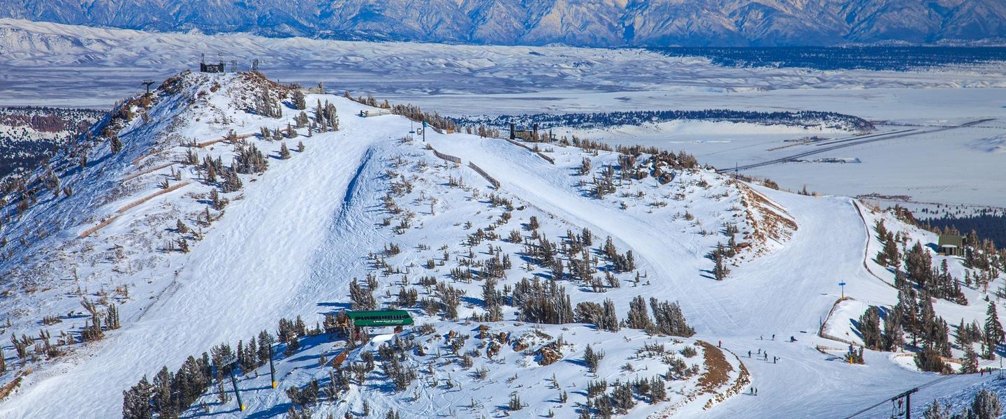


Mammoth Lakes, California combines Sierra Nevada scenery, alpine lakes, skiing, hiking, hot springs and access to Devils Postpile in every season.
Mountain Landscapes and Alpine Water
Mammoth Lakes lies on the eastern side of California’s Sierra Nevada, a high-elevation mountain community surrounded by volcanic peaks, glacial basins, conifer forests and clear alpine water. The town is best known as the gateway to Mammoth Mountain Ski Area, but its appeal extends well beyond winter sports. Mammoth Mountain rises to the west, while the Lakes Basin, reached by a scenic road from town, contains a chain of mountain lakes framed by granite slopes and walking routes. The surrounding landscape changes markedly with the seasons: snow dominates the high country in winter and spring, wildflowers brighten open meadows in summer, and aspen foliage brings colour to the eastern Sierra in autumn.Read more about Mammoth Lakes
Natural Heritage and Outdoor Life
A Mountain Town with Four-Season Character
When is the best time to visit Mammoth Lakes?
Best: July–September · 21–24°C| Month | High (°C) | Rainfall (mm) |
|---|---|---|
| January | 1 | 91 |
| February | 2 | 81 |
| March | 6 | 71 |
| April | 10 | 41 |
| May | 15 | 20 |
| June | 20 | 10 |
| July (best) | 24 | 8 |
| August (best) | 23 | 6 |
| September (best) | 21 | 10 |
| October | 15 | 32 |
| November | 9 | 61 |
| December | 2 | 81 |
Getting to and around Mammoth Lakes
How to get there
Transportation
Best attractions in Mammoth Lakes
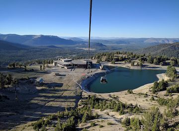
Mammoth Mountain is the area’s principal winter and summer recreation centre, with skiing and snowboarding in the colder months and hiking, mountain biking and scenic mountain access in warmer weather. The Lakes Basin, reached west of town when the road is open, offers a cluster of alpine lakes and routes through conifer forest and granite scenery. South-west of Mammoth Lakes, Reds Meadow Valley contains Devils Postpile National Monument and Rainbow Falls, although access is seasonal and may involve a mandatory shuttle arrangement. Minaret Vista provides an expansive outlook towards the Minaret peaks, while Hot Creek Geological Site offers a close view of a geothermal landscape where water and vapour emerge from the earth; visitors must observe all warnings and stay within permitted areas. The Mammoth Lakes Basin and surrounding national forest also provide settings for fishing where authorised, wildlife observation, photography, snowshoeing and summer walking, with conditions changing sharply according to elevation and season.
-
Tourist attraction
Mammoth Mountain Ski Area
Experience the thrill of Mammoth Mountain, California's premier year-round alpine destination, offering world-class skiing, snowboarding, hiking, and breathtaking scenery in the Eastern Sierra Nevada.
-
National reserve
Devils Postpile National Monument
Discover a geological marvel and stunning waterfalls in the heart of the Sierra Nevada at Devils Postpile National Monument, a gateway to the Ansel Adams Wilderness.
-
Tourist attraction
Hot Creek Geologic Site
Witness the raw power of geothermal activity at Hot Creek Geologic Site, a stunning landscape of boiling hot springs and fumaroles nestled in the heart of the Eastern Sierra near Mammoth Lakes.
-
Mountain peak
Mammoth Mountain
Experience the majesty of the Sierra Nevada at Mammoth Mountain, a year-round destination for outdoor adventure, stunning scenery, and unforgettable memories in the heart of California.


Best landmarks in Mammoth Lakes
The most recognisable natural landmark near Mammoth Lakes is Devils Postpile, a wall of tall, closely packed basalt columns formed when volcanic lava cooled and fractured; it is protected within Devils Postpile National Monument in Reds Meadow Valley. Nearby Rainbow Falls is a major waterfall on the Middle Fork of the San Joaquin River, while the Minarets form a sharp skyline of alpine rock visible from viewpoints around Mammoth Mountain and Minaret Vista. The Lakes Basin’s interconnected waters and granite surroundings represent the glacial landscape that defines the region. Hot Creek Geological Site is another significant feature, where geothermal activity produces hot water and vapour in a volcanically active part of the Long Valley area. Mammoth Mountain itself is both a physical landmark and the centre of the destination’s resort identity, rising above town and shaping views, recreation and local history.
-
National reserve
Devils Postpile National Monument
Explore the breathtaking geological marvels and scenic beauty of Devils Postpile National Monument in California's Sierra Nevada mountains.
-
Hiking area
Hot Creek Geologic Site
Discover the breathtaking beauty of Hot Creek Geologic Site, a unique hiking area featuring stunning geothermal features and picturesque landscapes in Mammoth Lakes, California.
-
Vista point
Minaret Vista
Experience breathtaking views at Minaret Vista, a scenic overlook in California's Sierra Nevada mountains, ideal for nature lovers and photographers.
-
Scenic spot
Twin Falls Overlook
Discover stunning vistas and serene landscapes at Twin Falls Overlook, a scenic gem in Inyo National Forest near Mammoth Lakes, California.


Explore Mammoth Lakes on the map
Plan your trip on one map. See where the top attractions, landmarks, restaurants and hotels are, and book hotels and experiences in a few clicks.
Best hotels in Mammoth Lakes
Best restaurants in Mammoth Lakes
Mammoth Lakes has the eastern Sierra’s most substantial concentration of places to eat, particularly around the village and central town, where visitors can find casual restaurants, cafés, bakeries, bars serving food and establishments suited to après-ski evenings. Dining is shaped more by the resort and mountain community than by one narrowly defined local cuisine, with menus commonly drawing on American comfort food, burgers, pizza, Mexican influences, salads, breakfast dishes and contemporary cooking. Groceries and provisions are useful for picnics and self-catering trips to the Lakes Basin or longer drives, since facilities are sparse once visitors leave town. Seasonal businesses and mountain access can affect availability, and remote sites such as Reds Meadow are not restaurant districts. Nearby communities along U.S. Route 395 offer additional roadside and small-town options, but Mammoth Lakes remains the most practical base for varied meals and supplies.
-
Pizza
John's Pizza Works
Discover Mammoth Lakes' culinary gem at John's Pizza Works - where pizza dreams come true!
-
Mexican
Roberto's Cafe
Discover authentic Mexican flavors at Roberto's Cafe in Mammoth Lakes – where every bite is a celebration of culinary delight amidst stunning natural beauty.
-
American
The Stove
Discover The Stove in Mammoth Lakes - where hearty American breakfasts meet cozy mountain charm.
-
American
Good Life Cafe
Experience delicious American cuisine at Good Life Cafe in Mammoth Lakes, where fresh ingredients meet cozy ambiance.


Best bars in Mammoth Lakes
Evenings in Mammoth Lakes are centred on après-ski hospitality, restaurants, breweries, pubs and bars rather than a large club scene. The Village at Mammoth and the town’s main commercial areas provide the strongest concentration of evening venues, with atmospheres ranging from relaxed drinks after a day outdoors to busier seasonal entertainment. Live music and special events may occur, but programmes and opening arrangements change, so they should be checked locally rather than assumed. Outside the central settlement, the mood becomes markedly quieter: accommodation properties, restaurants and traditional-style mountain bars provide the main evening options, while the Lakes Basin, Reds Meadow and other natural areas have no nightlife infrastructure. Visitors staying in isolated cabins or campgrounds should plan transport and food in advance, particularly in winter, when darkness, snow and road conditions can make late travel more difficult.
-
Pizza
John's Pizza Works
Indulge in delicious pizzas, crispy chicken wings, and delightful ice cream at Mammoth Lakes' favorite eatery, John's Pizza Works.
-
Brewery
Mammoth Brewing Company
Experience the best of Mammoth Lakes at Mammoth Brewing Company, where craft beer meets breathtaking scenery and great food.
-
Bar
The Mill
Discover The Mill in Mammoth Lakes: A perfect blend of American BBQ, cozy lodge ambiance, and stunning mountain views for an unforgettable dining experience.
-
Espresso bar
Black Velvet Coffee Roaster | Espresso & Wine Bar
Discover Black Velvet Coffee Roaster, a delightful espresso bar in Mammoth Lakes offering artisanal coffees and exquisite wines in a cozy atmosphere.


Best nightclubs in Mammoth Lakes
Evenings in Mammoth Lakes are centred on après-ski hospitality, restaurants, breweries, pubs and bars rather than a large club scene. The Village at Mammoth and the town’s main commercial areas provide the strongest concentration of evening venues, with atmospheres ranging from relaxed drinks after a day outdoors to busier seasonal entertainment. Live music and special events may occur, but programmes and opening arrangements change, so they should be checked locally rather than assumed. Outside the central settlement, the mood becomes markedly quieter: accommodation properties, restaurants and traditional-style mountain bars provide the main evening options, while the Lakes Basin, Reds Meadow and other natural areas have no nightlife infrastructure. Visitors staying in isolated cabins or campgrounds should plan transport and food in advance, particularly in winter, when darkness, snow and road conditions can make late travel more difficult.
-
Bar
Mammoth Tavern - Mammoth
Discover the vibrant Mammoth Tavern in Mammoth Lakes, where cozy atmospheres meet delicious cocktails and delightful dining experiences.
-
Grill
Lakanuki
Experience the vibrant atmosphere and delicious grill cuisine at Lakanuki, the ultimate pub destination in Mammoth Lakes, California.
-
Bar
Clocktower Cellar
Discover the charm of Clocktower Cellar, a delightful bar and restaurant in Mammoth Lakes, renowned for its extensive wine selection and inviting atmosphere.
-
American
Mountainside Bar & Grill
Experience the best of American cuisine with stunning mountain views at Mountainside Bar & Grill in Mammoth Lakes.


Best shops in Mammoth Lakes
Shopping in Mammoth Lakes is practical and recreation-focused, with the town and The Village at Mammoth offering outdoor equipment, ski and snowboard services, clothing, footwear, groceries, gifts and locally oriented souvenirs. Independent retailers and seasonal businesses reflect the community’s relationship with the mountains, selling items suited to hiking, cycling, snow sports and changing weather rather than providing an extensive luxury shopping scene. Visitors may also find artwork, photographs and small craft products associated with the eastern Sierra, although stock and business hours vary. Food shops are useful for assembling packed lunches and supplies for mountain outings, since there are few retail facilities beyond the main settlement. Communities along U.S. Route 395 may provide additional basic services, but Mammoth Lakes is the main shopping base for visitors exploring the surrounding mountain landscapes.
-
Shopping mall
The Village At Mammoth
Discover The Village At Mammoth: A charming shopping destination in the heart of California's breathtaking Mammoth Lakes, perfect for all adventurers.
-
Business center
Minaret Village Shopping Center
Discover unique shopping and dining in the heart of Mammoth Lakes at Minaret Village Shopping Center, your go-to destination for all things local.
-
Grocery store
Grocery Outlet
Discover budget-friendly shopping at Grocery Outlet in Mammoth Lakes - your go-to destination for fresh produce and unique local products.
-
Outdoor clothing and equipment shop
Mammoth Mountaineering Supply
Your ultimate destination for outdoor gear and apparel in Mammoth Lakes, perfect for skiing, snowboarding, and hiking adventures.


Get your free copy of our complete guide to Mammoth Lakes, delivered straight to you.
Everything on this page, from attractions and restaurants to essentials and local phrases, in one PDF you can read offline, print or share.
Already have an account? Sign in
Your Mammoth Lakes guide is ready.
We'll send it to · Not you? Sign out

Getting your guide ready…
We are putting together a fresh copy of the Mammoth Lakes guide. This can take up to a minute.
This can take a few moments. If your browser asks, choose Allow so the download can start. You'll find the guide in your Downloads folder.
Nothing happened? Download it again
Sorry, the guide is taking longer than usual. Please try again in a minute, or get it by email instead.
Mammoth Lakes essentials
Currency and Payment
Safety
Emergency Situations
Do's and Don'ts
Local Tips
From Eve
Local phrases worth knowing
You don't need to get them perfect. A few words go a long way, and locals appreciate the effort.
Basics
| English | Local | Say it |
|---|---|---|
| Hello | Howdy | [haw-dee] |
| Goodbye | See ya | [see yah] |
| Yes | Yep | [yep] |
| No | Nah | [nah] |
| Please/You're welcome | Please/No worries | [pleez/no wor-eez] |
| Thank you | Thanks | [th-anks] |
| Excuse me/Sorry | Pardon me/My bad | [par-dun me/my bad] |
| How are you? | Howdy partner? | [haw-dee par-tner?] |
| Fine. And you? | Feelin' good. You? | [feel-in good. yoo?] |
| Do you speak English? | You talk English? | [yoo talk ing-lish?] |
| I don't understand | I ain't gettin' ya | [I aint get-tin yah] |
Eating & Drinking
| English | Local | Say it |
|---|---|---|
| I'd like to see the menu, please | Gimme that menu, please | [gim-me that men-yoo, please] |
| I don't eat meat | No meat for me | [no meat for me] |
| Cheers! | Cheers! | [cheers!] |
| I would like to pay, please | Check please! | [check please!] |
Emergencies
| English | Local | Say it |
|---|---|---|
| Help! | SOS! | [SOS!] |
| Go away! | Get lost! | [get lost!] |
| Call the Police! | Ring the cops! | [ring the cops!] |
| Call a doctor! | Doctor needed! | [doc-tor needed!] |
| I'm lost | I'm lost | [I'm lost] |
| I'm ill | Feelin' sick | [feel-in sick] |
Shopping
| English | Local | Say it |
|---|---|---|
| I'd like to buy... | I wanna buy... | [I wanna buy...] |
| I'm just looking | Just browsing | [just brows-ing] |
| How much is it? | How much? | [how much?] |
| That's too expensive | Too pricey | [too pry-see] |
| Can you lower the price? | Can ya do a deal? | [can yah do a deal?] |
Time & Numbers
| English | Local | Say it |
|---|---|---|
| What time is it? | What's the time? | [whats the time?] |
| It's one o'clock | It's one | [its one] |
| Half past (10) | Ten-thirty | [ten-thur-tee] |
| Morning | Mornin' | [mornin'] |
| Afternoon | Afternoon | [after-noon] |
| Evening | Evenin' | [evenin'] |
| Yesterday | Yest'day | [yest-day] |
| Today | Today | [to-day] |
| Tomorrow | Tomorrer | [tom-or-er] |
| 1 | One | [wun] |
| 2 | Two | [too] |
| 3 | Three | [three] |
| 4 | Four | [four] |
| 5 | Five | [fiv] |
| 6 | Six | [six] |
| 7 | Seven | [sev-en] |
| 8 | Eight | [ate] |
| 9 | Nine | [nine] |
| 10 | Ten | [ten] |
Transport & Directions
| English | Local | Say it |
|---|---|---|
| Where's a/the...? | Where's the...? | [wheres the...?] |
| What's the address? | What's the addy? | [whats the addy?] |
| Can you show me (on the map)? | Show me on the map? | [show me on the map?] |
| When's the next (bus)? | When's the next bus? | [whens the next bus?] |
| A ticket (to ....) | Ticket to ... | [ticket to ...] |
History of Mammoth Lakes
Volcanic Origins and Glacial Landscapes
Mammoth Lakes occupies a landscape shaped by both volcanism and glaciation. The Long Valley Caldera, east of the town, formed after a major volcanic eruption roughly 760,000 years ago, and later volcanic activity created features including the Devils Postpile basalt columns and the geothermal areas around Hot Creek. During the Ice Age, glaciers carved valleys, polished granite and deepened basins that later filled with mountain water. These geological processes explain the region’s combination of rugged peaks, broad meadows, lava formations and closely grouped alpine lakes, giving the modern destination a character that is more complex than a conventional ski resort.
Indigenous Eastern Sierra Homelands
The eastern Sierra has long been home to Indigenous peoples, including the Paiute communities associated with the valleys and high country around present-day Mammoth Lakes. Seasonal movement through mountain passes and valleys supported hunting, gathering and exchange across the Sierra Nevada, while plants, animals and waterways formed part of a deeply connected cultural landscape. Visitors encounter a place whose history predates the town and its resort identity by thousands of years. Interpretation of the region should therefore recognise continuing Indigenous presence and avoid treating the surrounding mountains as an empty wilderness before American settlement.
Mining and the Birth of Mammoth Camp
Non-Indigenous settlement in the Mammoth Lakes area expanded during the nineteenth-century mining era. A gold discovery on the slopes of the Sierra Nevada led to the formation of Mammoth Mining Company interests and the settlement known as Mammoth Camp in the late 1870s. The mining venture was short-lived, but prospecting, timber cutting and transport routes helped establish a continuing pattern of resource use in the eastern Sierra. The settlement later declined, yet the name Mammoth endured and became attached to the community that developed around the mountain and the surrounding valleys.
Forestry, Roads and Early Recreation
After mining faded, forestry and public-land management became important influences on the local economy and landscape. Roads gradually improved connections through the eastern Sierra, making the area more accessible to visitors interested in fishing, camping, hiking and mountain scenery. The establishment of protected areas and national forest management helped preserve major landscapes, although access and land use have continued to require careful balancing. Devils Postpile National Monument, created in 1911, formally protected one of the region’s most notable volcanic formations and helped establish the area’s modern conservation identity.
From Ski Hill to Four-Season Resort
Mammoth Mountain’s modern tourism history began in the twentieth century, when skiing developed from a local winter pastime into the foundation of a major resort economy. The ski area expanded its lifts and facilities over subsequent decades, while Mammoth Lakes grew as a service centre for visitors and seasonal workers. Summer recreation became increasingly important, supported by hiking, mountain biking, fishing and scenic access to the surrounding Sierra. Today, tourism coexists with national forest, monument and watershed management, and the community’s future remains closely tied to snow conditions, changing climate patterns and responsible use of high-elevation environments.
Mammoth Lakes in Photos
Browse through our photo collection highlighting the charm and character of the destination.
Neighbouring destination travel guides
The closest destinations to Mammoth Lakes, if you have time for more than one.
-

-

-

-

-


Swipe for more destinations
Explore more
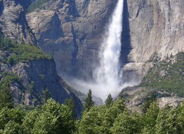
Explore more of Sierra Nevada
Explore California's Sierra Nevada for granite peaks, sequoia forests, alpine lakes, national parks, mountain towns and seasonal outdoor adventures.
Explore Sierra Nevada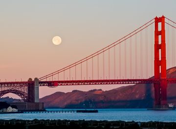
Explore more of California
Discover California: A land of diverse landscapes, iconic cities, and endless adventures, from sun-soaked beaches to towering redwoods and vibrant cultural experiences.
Explore California