

Free Central California Travel Guide & Mobile App
Explore Central California with free travel guides. Discover regional history, expert tips, proposed trips, and audio guides on web or mobile app.


Explore Central California for Pacific coast drives, fertile valleys, historic towns, wine country and Sierra Nevada landscapes shaped by layered cultures.
Read more about Central California
Getting to and around Central California
How to get there
Transportation
Top city travel guides in Central California
The cities of Central California, and the easiest places to base yourself.
-

-

-

-

-

-


Swipe for more cities
Destinations in Central California
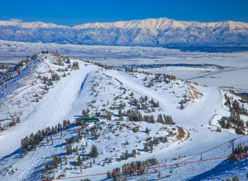
Resorts, valleys and scenic spots worth a trip of their own.
-

-

-

-


Swipe for more destinations
Best attractions in Central California
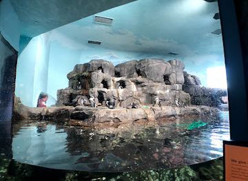
Central California's attractions range from marine science and historic ports to national parks, working farms and wine country. The Monterey Peninsula combines the Monterey Bay Aquarium, Cannery Row's industrial history, coastal paths and the historic atmosphere of Carmel Mission and Carmel-by-the-Sea. Big Sur offers redwood forests, ocean overlooks and state parks, while the coast around Morro Bay and Pismo Beach brings beaches, estuaries and accessible seaside recreation. Inland, Pinnacles National Park protects volcanic rock formations and condor habitat, and the San Joaquin Valley provides routes through orchards, farm stands, museums and cultural centres in cities such as Fresno, Visalia and Bakersfield. Eastern Central California leads to Yosemite, Sequoia and Kings Canyon, where hiking, waterfalls, giant sequoias and high-country scenery require more preparation. Wine landscapes around Paso Robles, the Santa Maria Valley and Monterey County add cellar doors and culinary experiences, while historic missions, adobe buildings and railway-era districts provide cultural context. The region is best understood as a collection of contrasting corridors rather than one compact sightseeing circuit.
-
Aquarium
Monterey Bay Aquarium
Experience the magic of marine life at the Monterey Bay Aquarium, a top tourist attraction showcasing ocean conservation and biodiversity.
-
History museum
California State Capitol Museum
Discover California's political history and lush gardens at the California State Capitol Museum, a unique blend of heritage and natural beauty in Sacramento.
-
Tourist attraction
General Grant Tree
Experience the awe of the General Grant Tree, a natural wonder nestled in Kings Canyon National Park, California, embodying the beauty of ancient sequoias.
-
Park
Courthouse Park
Experience the serene beauty of Courthouse Park in downtown Fresno, a perfect urban oasis for relaxation and leisure activities.


Best landmarks in Central California
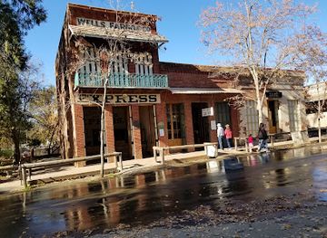
Central California's most recognisable landmarks express its meeting of ocean, agriculture, history and mountains. The Bixby Creek Bridge on the Big Sur coast is an iconic road structure framed by steep cliffs and Pacific views, while Point Sur Lighthouse stands on a volcanic rock as a reminder of the hazards faced by coastal shipping. Monterey's historic Custom House and Cannery Row reflect the development of a major fishing and processing port, and Carmel Mission preserves one of the region's most important Spanish colonial-era complexes. Inland, the historic Fresno Water Tower symbolises the valley's irrigation and civic development, while the Santa Barbara Mission, at the southern edge of the broad Central Coast, is a prominent example of mission architecture. Farther east, Yosemite Valley's granite walls and waterfalls, the giant sequoias of Sequoia National Park and the canyons of Kings Canyon are natural landmarks of national importance. These places are widely separated, so each belongs to a different itinerary rather than a single day trip.
-
 Castle
Hearst Castle
Explore Hearst Castle, an architectural masterpiece blending history, art, and breathtaking coastal views along California's stunning coastline.
-
History museum
California State Capitol Museum
Discover the rich history and stunning architecture of the California State Capitol Museum, a must-visit for all tourists in Sacramento.
-
Tourist attraction
General Grant Tree
Discover the awe-inspiring General Grant Tree in Kings Canyon National Park, a living shrine and the Nation's Christmas Tree, offering a memorable experience for all visitors.
-
State park
Columbia State Historic Park
Experience the charm of the Gold Rush era at Columbia State Historic Park, where history, nature, and culture converge in a captivating state park.


Explore Central California on the map
Plan your trip on one map. See where the top cities, national parks and sights are, and book hotels and experiences in a few clicks.
Best hotels in Central California
Best restaurants in Central California
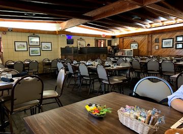
Central California's dining reflects its position between Pacific waters, productive farmland and multicultural inland communities. Coastal menus commonly feature Dungeness crab when in season, local rockfish, oysters, abalone where legally available, sardines and other regional seafood, while inland restaurants draw on almonds, citrus, grapes, stone fruit, tomatoes, vegetables, beef and dairy. Mexican, Central American, Asian American and Indigenous influences are important parts of the region's food life, particularly in San Joaquin Valley cities. Farmers' markets, roadside produce stalls and fruit stands are useful places to follow the agricultural calendar. Wine areas around Paso Robles, Santa Barbara County, the Santa Maria Valley and Monterey County support tasting rooms, bistros and contemporary restaurants, while coastal towns offer cafés, bakeries, seafood houses and casual dining. Historic inns, farm-to-table restaurants and polished urban venues provide variety without defining the whole region.
-
Tourist attraction
General Grant Tree
Explore California's Kings Canyon National Park and stand in awe before the magnificent General Grant Tree – nature's ancient giant.
-
Steak
Jocko's
Discover Jocko's Steakhouse in Nipomo - where exceptional steaks meet warm hospitality in a cozy atmosphere.
-
Seafood
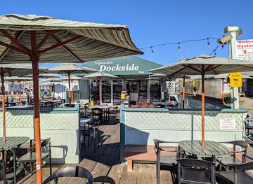
Tognazzini's Dockside Restaurant
Experience fresh seafood and stunning waterfront views at Tognazzini's Dockside Restaurant in Morro Bay.
-
New American
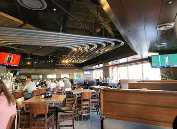
Yard House
Discover the vibrant flavors of New American cuisine at Yard House in Fresno—where delicious food meets an energetic atmosphere.

Best bars in Central California
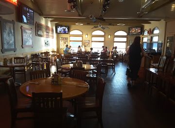
Evening life in Central California is shaped more by pubs, wine rooms, breweries, live music and restaurants than by a dense nightclub culture. Monterey, Santa Barbara, San Luis Obispo, Fresno and Bakersfield have the broadest choice of bars, music venues and late-evening restaurants, while smaller coastal towns generally favour relaxed cocktail spots, hotel bars and traditional pubs. Wine tasting rooms are prominent around Paso Robles, the Santa Maria Valley, Monterey County and Santa Barbara County, although many operate with daytime or early-evening schedules rather than as nightclubs. Breweries and taprooms are common in larger towns, and university communities can add a livelier calendar of performances and social venues. In rural areas, evenings often centre on a local restaurant, inn or community event, so check transport arrangements before drinking and do not expect late-night services between towns.
-
Bar
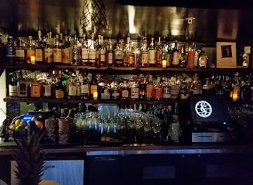
Smuggler's Cove
Experience the tropical vibes and exceptional cocktails at Smuggler's Cove, San Francisco's premier nautical-themed bar, perfect for cocktail lovers.
-
Bar
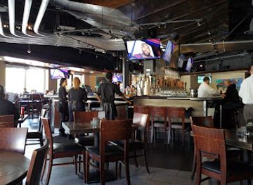
Yard House
Discover Yard House in Fresno, where delicious New American cuisine meets an extensive craft beer selection in a lively sports bar atmosphere.
-
American
Lazy Dog Restaurant & Bar
Experience the cozy charm and diverse menu at Lazy Dog Restaurant & Bar, a must-visit American eatery in Fresno for food lovers and travelers.
-
American
Ducey's On the Lake & Ducey's Bar & Grill
Experience the best of American dining at Ducey's On the Lake, where stunning views and delicious cuisine await in the heart of Bass Lake.

Best nightclubs in Central California
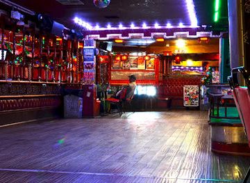
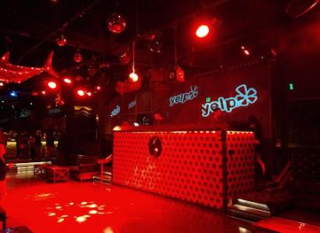
Evening life in Central California is shaped more by pubs, wine rooms, breweries, live music and restaurants than by a dense nightclub culture. Monterey, Santa Barbara, San Luis Obispo, Fresno and Bakersfield have the broadest choice of bars, music venues and late-evening restaurants, while smaller coastal towns generally favour relaxed cocktail spots, hotel bars and traditional pubs. Wine tasting rooms are prominent around Paso Robles, the Santa Maria Valley, Monterey County and Santa Barbara County, although many operate with daytime or early-evening schedules rather than as nightclubs. Breweries and taprooms are common in larger towns, and university communities can add a livelier calendar of performances and social venues. In rural areas, evenings often centre on a local restaurant, inn or community event, so check transport arrangements before drinking and do not expect late-night services between towns.
-
Bar
La Cita Bar
Discover the vibrant nightlife at La Cita Bar in Los Angeles, where great music, a lively crowd, and unique cocktails create an unforgettable experience.
-
Night club
The Valencia Room
Experience the pulse of San Francisco's nightlife at The Valencia Room, where live music, dancing, and great drinks come together in a lively atmosphere.
-
Hotel
Gena's Sierra Inn and Restaurant LLC
Experience the beauty of the Sierra Nevada at Gena's Sierra Inn and Restaurant, a perfect blend of comfort, cuisine, and adventure.
-
Night club
Sound Nightclub
Sound Nightclub in Hollywood: A vibrant nightlife experience with world-class DJs and an unforgettable atmosphere for party enthusiasts.


Best shops in Central California
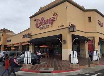
Shopping in Central California is strongest in independent coastal towns, historic city centres, wine areas and agricultural communities rather than in one dominant retail district. Carmel-by-the-Sea is known for galleries, design-led boutiques and specialist shops, while Monterey and Santa Barbara combine visitor-oriented streets with local businesses and established commercial areas. San Luis Obispo has an active central shopping area, and inland cities such as Fresno, Bakersfield, Visalia and Modesto offer larger retail centres alongside independent stores and cultural markets. Farmers' markets and farm stands are particularly worthwhile for seasonal fruit, nuts, olive oil, preserves, wine and other products from the valley and coast. Wine-country shops sell regional bottles and food gifts, while galleries and craft studios offer ceramics, jewellery, textiles and paintings. Check agricultural regulations before carrying fresh produce across state or international borders, and remember that product selection and market days vary seasonally.
-
Outlet mall
Citadel Outlets
Discover unbeatable deals and a variety of shops at Citadel Outlets, a premier shopping destination in Commerce, California.
-
Shopping mall
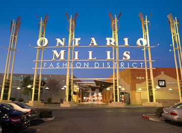
Ontario Mills
Explore Ontario Mills, California's premier shopping destination with over 200 stores and diverse dining experiences for an unforgettable retail adventure.
-
Outlet mall
Las Americas Premium Outlets
Shop, dine, and enjoy the vibrant culture at Las Americas Premium Outlets in San Diego, where unbeatable deals meet an unforgettable experience.
-
Outlet mall
The Outlets at Orange
Discover unbeatable deals and a vibrant shopping atmosphere at The Outlets at Orange, where retail therapy meets culinary delights.
Get your free copy of our complete guide to Central California, delivered straight to you.
Everything on this page, from attractions and restaurants to essentials and local phrases, in one PDF you can read offline, print or share.
Already have an account? Sign in
Your Central California guide is ready.
We'll send it to · Not you? Sign out

Getting your guide ready…
We are putting together a fresh copy of the Central California guide. This can take up to a minute.
This can take a few moments. If your browser asks, choose Allow so the download can start. You'll find the guide in your Downloads folder.
Nothing happened? Download it again
Sorry, the guide is taking longer than usual. Please try again in a minute, or get it by email instead.
Central California essentials
Currency and Payment
Safety
Emergency Situations
Do's and Don'ts
Local Tips
From Eve
Local phrases worth knowing
You don't need to get them perfect. A few words go a long way, and locals appreciate the effort.
Basics
| English | Local | Say it |
|---|---|---|
| Hello | Hey | [Hey] |
| Goodbye | See ya | [See ya] |
| Yes | Yep | [Yep] |
| No | Nah | [Nah] |
| Please/You're welcome | No problem | [No prob-lum] |
| Thank you | Thanks | [Thanks] |
| Excuse me/Sorry | My bad | [My bad] |
| How are you? | How’s it going? | [How’s it going?] |
| Fine. And you? | Good. You? | [Good. You?] |
| Do you speak English? | You speak English? | [You speak English?] |
| I don't understand | I don’t get it | [I don’t get it] |
Eating & Drinking
| English | Local | Say it |
|---|---|---|
| I'd like to see the menu, please | Can I see the menu? | [Can I see the menu?] |
| I don't eat meat | I’m vegetarian | [I’m vege-tarian] |
| Cheers! | Cheers! | [Cheers!] |
| I would like to pay, please | Can I get the check? | [Can I get the check?] |
Emergencies
| English | Local | Say it |
|---|---|---|
| Help! | Help! | [Help!] |
| Go away! | Leave me alone! | [Leave me alone!] |
| Call the Police! | Call 911! | [Call nine-one-one!] |
| Call a doctor! | Get a doctor! | [Get a doctor!] |
| I'm lost | I’m lost | [I’m lost] |
| I'm ill | I’m not feeling well | [I’m not feeling well] |
Shopping
| English | Local | Say it |
|---|---|---|
| I'd like to buy... | I want to buy... | [I want to buy...] |
| I'm just looking | Just browsing | [Just browsing] |
| How much is it? | What’s the price? | [What’s the price?] |
| That's too expensive | That’s way too pricey | [That’s way too pricey] |
| Can you lower the price? | Can you drop the price? | [Can you drop the price?] |
Time & Numbers
| English | Local | Say it |
|---|---|---|
| What time is it? | What time? | [What time?] |
| It's one o'clock | It's one | [It's one] |
| Half past (10) | Ten-thirty | [Ten-thirty] |
| Morning | Morning | [Morning] |
| Afternoon | Afternoon | [Afternoon] |
| Evening | Evening | [Evening] |
| Yesterday | Yesterday | [Yesterday] |
| Today | Today | [Today] |
| Tomorrow | Tomorrow | [Tomorrow] |
| 1 | One | [One] |
| 2 | Two | [Two] |
| 3 | Three | [Three] |
| 4 | Four | [Four] |
| 5 | Five | [Five] |
| 6 | Six | [Six] |
| 7 | Seven | [Seven] |
| 8 | Eight | [Eight] |
| 9 | Nine | [Nine] |
| 10 | Ten | [Ten] |
Transport & Directions
| English | Local | Say it |
|---|---|---|
| Where's a/the...? | Where’s the...? | [Where’s the...?] |
| What's the address? | What’s the address? | [What’s the address?] |
| Can you show me (on the map)? | Can you show me on the map? | [Can you show me on the map?] |
| When's the next (bus)? | When’s the next bus? | [When’s the next bus?] |
| A ticket (to ....) | One ticket to ... | [One ticket to ...] |
History of Central California
Indigenous California Before European Colonisation
Central California has long been home to diverse Indigenous peoples, including the Ohlone, Salinan, Yokuts, Miwok, Chumash and other communities whose territories extended across coast, valley and mountain environments. Communities managed landscapes through sophisticated ecological knowledge, gathered acorns and native plants, fished rivers and the Pacific, and maintained extensive trade networks. European settlement, introduced diseases, forced labour and displacement caused catastrophic population loss, but Indigenous peoples and cultural organisations remain part of Central California's contemporary life. Museums, tribal cultural programmes and place names offer only partial views of histories that continue rather than belonging solely to the past.
Spanish Missions and Mexican Ranchos
From the late eighteenth century, Spanish missions and military settlements altered the coastal geography and economies of Central California. Mission San Carlos Borromeo de Carmelo near Carmel, Mission San Luis Obispo de Tolosa and Mission Santa Inés are among the surviving mission sites in the broad Central Coast region. After Mexico gained independence from Spain in 1821, mission lands were secularised and extensive ranchos developed. The rancho era shaped landholding, cattle raising and adobe architecture, while Indigenous communities endured coercion and continuing loss of land and autonomy.
The Gold Rush and American Statehood
The discovery of gold in the Sierra foothills in 1848 transformed California and accelerated American migration, commercial development and political change. Central California's inland routes, rivers and settlements became connected to mining supply networks, while San Francisco and coastal ports helped move people and goods through the region. California entered the United States in 1850. The period brought rapid growth but also violence, dispossession and discriminatory laws directed at Indigenous people, Chinese immigrants and other communities. Remnants of mining landscapes, historic roads and early towns remain in parts of the foothills.
Railways, Irrigation and the Agricultural Valley
During the late nineteenth and early twentieth centuries, railways linked Central California's towns and farms to national markets. Irrigation and water infrastructure made it possible to expand orchards, vineyards, cotton, vegetables and livestock production across the San Joaquin Valley, whose dry climate required carefully managed water supplies. Fresno, Bakersfield, Modesto, Merced and surrounding communities grew as agricultural and processing centres. The system created substantial wealth and employment but also entrenched unequal land ownership, difficult seasonal labour conditions and long-running debates over water, groundwater, soil health and environmental sustainability.
Migration and Multicultural Agricultural Communities
Central California's farms and towns were shaped by successive migrations, including Chinese, Japanese, Filipino, Punjabi, Mexican and other communities. Their labour, businesses, religious organisations and civic institutions transformed places such as the San Joaquin Valley and the Central Coast. Japanese American farmers achieved notable success before the United States government forcibly incarcerated Japanese Americans during the Second World War; many lost homes and farms as a result. Later migration from Mexico and Latin America became especially important to agriculture, food processing and regional culture, contributing to the languages, festivals, cuisine and public life visible today.
National Parks and Conservation
The Sierra Nevada's giant sequoias, granite valleys and alpine ecosystems became central to the American conservation movement. Yosemite, Sequoia and Kings Canyon gained national park protection between the late nineteenth and early twentieth centuries, although Indigenous displacement and restricted traditional practices were part of that history. Conservation gradually changed the region's economy and public identity, bringing tourism, research and outdoor recreation alongside agriculture and resource industries. Today the parks face pressures from wildfire, drought, heavy visitation and climate change, making responsible access and seasonal awareness important parts of visiting.
Modern Coast, Valley and Water Debates
Twentieth-century highways, aviation, university growth, defence-related industries, tourism and large-scale farming connected Central California more closely to the rest of the state. Coastal communities developed around fishing, recreation, marine research and wine, while inland cities expanded as agricultural, logistics and service centres. The region continues to negotiate competing demands for housing, farmland, habitat, river health and water. Drought, wildfire, heat and changing agricultural conditions are now central to its future, while coastal restoration, Indigenous stewardship and sustainable food production are increasingly prominent themes.
Central California in Photos
Browse through our photo collection highlighting the charm and character of the destination.
Neighbouring regions of Central California
The closest regions to Central California, if you have time for more than one.
-
-

-
-

-


Swipe for more regions
Explore more
Explore more of California
Discover California: A land of diverse landscapes, iconic cities, and endless adventures, from sun-soaked beaches to towering redwoods and vibrant cultural experiences.
Explore California