

Free Semienawi Keyih Bahri Travel Guide & Mobile App
Explore Semienawi Keyih Bahri with free travel guides. Discover regional history, expert tips, proposed trips, and audio guides on web or mobile app.


Explore Semienawi Keyih Bahri for Massawa’s port heritage, ancient Adulis, Dahlak islands and stark Red Sea landscapes in Eritrea.
Read more about Semienawi Keyih Bahri
When is the best time to visit Semienawi Keyih Bahri?
Best: March–April, October · 24–26°C| Month | High (°C) | Rainfall (mm) |
|---|---|---|
| January | 20 | 5 |
| February | 22 | 4 |
| March (best) | 24 | 3 |
| April (best) | 26 | 2 |
| May | 28 | 3 |
| June | 29 | 5 |
| July | 29 | 8 |
| August | 28 | 7 |
| September | 27 | 6 |
| October (best) | 25 | 5 |
| November | 22 | 4 |
| December | 20 | 5 |
Getting to and around Semienawi Keyih Bahri
How to get there
Transportation
Top city travel guides in Semienawi Keyih Bahri
The cities of Semienawi Keyih Bahri, and the easiest places to base yourself.
-

-

-

-

-

-


Swipe for more cities
Destinations in Semienawi Keyih Bahri
Resorts, valleys and scenic spots worth a trip of their own.
-

-

-

-

-


Swipe for more destinations
Best attractions in Semienawi Keyih Bahri
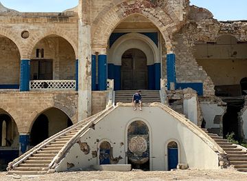
Semienawi Keyih Bahri’s attractions are defined by the meeting of Red Sea history, desert landscapes and island ecology. Massawa’s old town is the region’s most accessible cultural experience, with coral-stone buildings, mosques, colonial structures and a harbour whose working character remains evident. The archaeological area of Adulis, near Zula, offers a more remote encounter with the ancient Aksumite trading world, although visits require planning and authorised access. The Dahlak Archipelago provides opportunities for boating, diving, fishing and bird observation, with reefs and island settlements that are best visited through locally arranged expeditions. Inland routes towards Nakfa pass through austere terrain associated with Eritrea’s liberation struggle and reveal the dramatic transition from coast to escarpment. Wildlife and landscape interest is strongest in the marine environment, tidal flats and sparsely settled desert rather than in developed parks. Heat, permits and limited infrastructure mean that the region rewards carefully organised travel rather than spontaneous sightseeing.
-
Mosque
Sheikh Hanafi Mosque
Discover the breathtaking beauty and spiritual serenity of Sheikh Hanafi Mosque in Mitsiwa, a true gem of Eritrean architecture and culture.
-
Memorial
Imperial Palace
Discover the rich history and cultural significance of Eritrea at the Imperial Palace, a must-visit memorial in Mitsiwa.
-
 Tourist attraction
شاطي دعيلي
Experience the stunning beauty and tranquility of شاطي دعيل in Eritrea, a perfect destination for beach lovers and nature enthusiasts.

Best landmarks in Semienawi Keyih Bahri
Massawa’s historic port quarter is the region’s principal architectural landmark, distinguished by coral masonry, narrow streets and buildings shaped by centuries of Red Sea commerce. The Sheikh Hanafi Mosque is among the city’s most recognisable Islamic monuments, while the Imperial Palace and surviving Italian-era structures illustrate the successive powers that used the harbour. The old railway and port infrastructure, though altered and in places damaged, convey Massawa’s former role as a strategic transport centre. Further south, the ruins of Adulis near the Gulf of Zula are a landmark of ancient maritime history: their remains mark the port through which Aksum participated in long-distance trade. Across the water, the Dahlak Archipelago itself is a geographical landmark, formed by low islands, reefs and tidal channels rather than dramatic mountains. Inland, Nakfa is associated with the physical and symbolic landscape of Eritrea’s independence struggle.
-
Historical landmark
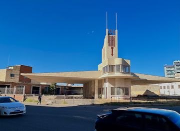
Fiat Tagliero ፡ፍያት ታሌሮ
Discover the breathtaking Fiat Tagliero in Asmara, Eritrea, a historic landmark showcasing stunning modernist architecture and rich cultural heritage.
-
Catholic cathedral
ኣስመራ ካቴድራል | Cathedral Our Lady of the Rosary
Discover the architectural marvel of the Cathedral of Our Lady of the Rosary, a serene spiritual hub in Asmara, Eritrea, embodying rich culture and history.
-
Mosque
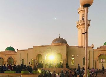
Khulafa al-Rashidun Mosque - ጃምዕ ኹለፋእ ኣልራሺዲን
Explore the Khulafa al-Rashidun Mosque in Asmara, Eritrea, a stunning example of Islamic architecture and a center of spiritual life.
-
Hotel
Dahlak Hotel
Discover the charm of Dahlak Hotel in Mitsiwa, Eritrea, where comfort meets culture for an unforgettable travel experience.

Explore Semienawi Keyih Bahri on the map
Plan your trip on one map. See where the top cities, national parks and sights are, and book hotels and experiences in a few clicks.
Best hotels in Semienawi Keyih Bahri
Best restaurants in Semienawi Keyih Bahri
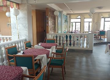
Dining in Semienawi Keyih Bahri reflects both the Red Sea coast and Eritrea’s wider culinary traditions. In Massawa, fish and other seafood are central to the local food culture, particularly in simple restaurants and near the harbour, while spiced stews, injera and shared platters connect coastal dining with the highland traditions found across Eritrea. Grilled fish, rice and pasta also reflect the port’s long history of Arabic, Ottoman, Italian and regional African influences. Tea and coffee are widely encountered, and cold drinks are especially welcome in the hot climate. Food options become much more limited outside Massawa, so travellers heading towards Adulis, Nakfa or the islands should confirm meals and carry suitable provisions. Markets and small food stalls offer a more direct view of everyday life, though visitors should choose busy, clean establishments and take care with water and food hygiene.
-
Restaurant
Ghibabo Restaurant And Pizzeria
Discover Ghibabo Restaurant And Pizzeria in Asmara for an unforgettable fusion of Eritrean and Italian cuisine amidst a cozy atmosphere.
-
Hotel
Dahlak Hotel
Discover comfort and cultural richness at Dahlak Hotel in Mitsiwa, your gateway to exploring the beauty of Eritrea.
-
Eritrean
Golden Fork Fast Food
Experience authentic Eritrean cuisine at Golden Fork Fast Food in Asmara – a culinary delight awaits every visitor!
-
Restaurant
The Roof Garden
Experience authentic Eritrean cuisine amidst breathtaking views at The Roof Garden in Asmara.

Best bars in Semienawi Keyih Bahri
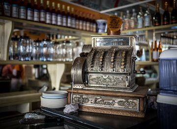
Evening life in Semienawi Keyih Bahri is concentrated in Massawa and is generally more social and low-key than club-oriented. Cafés, hotel lounges and local bars provide places to sit, talk and drink coffee, tea, soft drinks or, where available, beer and spirits. Music may feature in restaurants or informal gatherings, but the region does not have a large, dependable nightclub circuit, particularly away from the port. The waterfront and old town are more atmospheric after the intense daytime heat has eased, although visitors should follow local guidance about movement and photography after dark. On the islands and in remote districts, evenings are shaped by the landscape, group meals and early starts rather than entertainment venues. Alcohol should never be assumed to be available during organised excursions, and respectful behaviour is important in predominantly Muslim coastal communities.
-
Cafe
Bar Pasticceria Vittoria
Experience the rich flavors of Eritrea at Bar Pasticceria Vittoria, where delicious pastries and artisanal coffee await in the heart of Asmara.
-
Bar
Bar selam ባር ሰላም ( እንዳ ሳባ)
Discover Bar Selam in Adi Kontsi, Eritrea, where vibrant culture meets refreshing drinks and unforgettable local experiences.
-
Bar
Bar Jima
Discover the vibrant ambiance of Bar Jima in Asmara, Eritrea, a perfect spot for local drinks and cultural experiences.
-
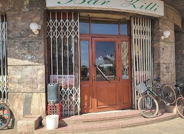
Grill
Bar Zilli
Discover the vibrant flavors of Eritrea at Bar Zilli, a premier grill and bar in Asmara offering an unforgettable dining experience.
Best nightclubs in Semienawi Keyih Bahri
Evening life in Semienawi Keyih Bahri is concentrated in Massawa and is generally more social and low-key than club-oriented. Cafés, hotel lounges and local bars provide places to sit, talk and drink coffee, tea, soft drinks or, where available, beer and spirits. Music may feature in restaurants or informal gatherings, but the region does not have a large, dependable nightclub circuit, particularly away from the port. The waterfront and old town are more atmospheric after the intense daytime heat has eased, although visitors should follow local guidance about movement and photography after dark. On the islands and in remote districts, evenings are shaped by the landscape, group meals and early starts rather than entertainment venues. Alcohol should never be assumed to be available during organised excursions, and respectful behaviour is important in predominantly Muslim coastal communities.
-
Hotel
Dahlak Hotel
Experience comfort and local culture at Dahlak Hotel in Mitsiwa, Eritrea, your perfect base for coastal adventures.
-
Bar
Bar Jima
Discover the vibrant atmosphere of Bar Jima in Asmara, where local culture meets delightful drinks and warm hospitality.
-
Restaurant
Bar Hiwnet
Discover the culinary delights of Bar Hiwnet in Asmara, where Eritrean flavors meet international cuisine in a vibrant atmosphere.
-
Bar
Mary's Bar
Discover the vibrant atmosphere of Mary's Bar in Mitsiwa, offering a unique blend of local culture and delightful beverages for an unforgettable experience.
Best shops in Semienawi Keyih Bahri
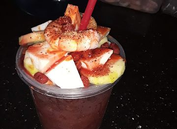
Shopping in Semienawi Keyih Bahri is modest and practical, with the greatest choice found in Massawa rather than in remote coastal or island communities. Small markets and local shops sell food, household goods, clothing and everyday supplies, while the port setting makes fish and other marine products particularly relevant to the local economy. Visitors may find woven items, simple handicrafts and locally produced goods, but availability is variable and should not be confused with a large, formal souvenir industry. Purchases connected with the sea, such as shells or coral, should be avoided unless their legal and environmental status is clear; removing natural material from reefs or islands is inappropriate. Travellers should carry sufficient cash in nakfa, compare prices politely and avoid buying archaeological objects or old military artefacts. For a broader selection of Eritrean crafts and packaged products, Asmara outside the region generally offers more retail choice.
-
Hotel
Dahlak Hotel
Discover the charm of Dahlak Hotel in Mitsiwa - a unique retreat in Eritrea's stunning coastal paradise, the Pearl of the Red Sea.
-
Mosque
Sheikh Hanafi Mosque
Experience the tranquility and stunning architecture of Sheikh Hanafi Mosque in Mitsiwa, a cultural gem in the heart of Eritrea.
-
Memorial estate
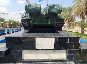
memorial plaza for victims of massawa battle
Discover the solemn beauty of the Memorial Plaza for Victims of Massawa Battle, reflecting Eritrea's resilience and honoring its heroes.

Get your free copy of our complete guide to Semienawi Keyih Bahri, delivered straight to you.
Everything on this page, from attractions and restaurants to essentials and local phrases, in one PDF you can read offline, print or share.
Already have an account? Sign in
Your Semienawi Keyih Bahri guide is ready.
We'll send it to · Not you? Sign out

Getting your guide ready…
We are putting together a fresh copy of the Semienawi Keyih Bahri guide. This can take up to a minute.
This can take a few moments. If your browser asks, choose Allow so the download can start. You'll find the guide in your Downloads folder.
Nothing happened? Download it again
Sorry, the guide is taking longer than usual. Please try again in a minute, or get it by email instead.
Semienawi Keyih Bahri essentials
Currency and Payment
Safety
Emergency Situations
Do's and Don'ts
Local Tips
From Eve
Local phrases worth knowing
You don't need to get them perfect. A few words go a long way, and locals appreciate the effort.
Basics
| English | Local | Say it |
|---|---|---|
| Hello | ሰላም | [Selam] |
| Goodbye | ደህና መርጣ | [Dehna Merita] |
| Yes | አዎን | [Awen] |
| No | አይ | [Ay] |
| Please/You're welcome | እቅፍ በቅርቡ | [Eqif Beqirbu] |
| Thank you | የእናቱ እንደምን | [Ye'enatu Endemin] |
| Excuse me/Sorry | እቅፍ | [Eqif] |
| How are you? | እንዴት ነህ? | [Endet Neh?] |
| Fine. And you? | ጥሩ እና አንተ? | [Tiru Ena Ante?] |
| Do you speak English? | እንግሊዝኛ ትናገራለህ? | [Ingilizigna Tinageraleh?] |
| I don't understand | አልተረዳኩም | [Alteradakum] |
Eating & Drinking
| English | Local | Say it |
|---|---|---|
| I'd like to see the menu, please | እቅፍ እንዴት ይሳይ እባክህ | [Eqif Endet Yisayi Ebakeh] |
| I don't eat meat | እኔ ስግር አልበላም | [Ene Sigir Albelam] |
| Cheers! | ይንቀባ! | [Yinqeba!] |
| I would like to pay, please | እቅፍ እንዴት ከይ እባክህ | [Eqif Endet Key Ebakeh] |
Emergencies
| English | Local | Say it |
|---|---|---|
| Help! | እባክህ ይረዳኝ! | [Ebakeh Yiredany!] |
| Go away! | ወደ ቅንድ ይሂዱ! | [Wede Qend Yihidu!] |
| Call the Police! | ፖሊስ ይደውሉ! | [Polis Yidewulu!] |
| Call a doctor! | ዶክተር ይደውሉ! | [Dokter Yidewulu!] |
| I'm lost | እኔ እንደ አላስ ነኝ | [Ene Enda Alas Neny] |
| I'm ill | እኔ በደህነት ነኝ | [Ene Bedhenet Neny] |
Shopping
| English | Local | Say it |
|---|---|---|
| I'd like to buy... | እቅፍ እንዴት እንደምን እገዛለሁ | [Eqif Endet Endemin Igezalehu] |
| I'm just looking | እኔ ይቀባይ | [Ene Yiqebay] |
| How much is it? | ስንት ነው? | [Sinet New?] |
| That's too expensive | ይህ በጣም ውድ ነው | [Yih Bet'am Wud New] |
| Can you lower the price? | እቅፍ ዋጋ ይቀነስ? | [Eqif Waga Yiqenes?] |
Time & Numbers
| English | Local | Say it |
|---|---|---|
| What time is it? | ምን ወቅት ነው? | [Min Waqt New?] |
| It's one o'clock | አንድ ሰዓት ነው | [And Se'at New] |
| Half past (10) | ምስ እንዴት ይሳይ በሁለት | [Mys Endet Yisayi Behulat] |
| Morning | ጠዋት | [Tewat] |
| Afternoon | ከሰዓት | [Kes'at] |
| Evening | ከምሽት | [Kemeshit] |
| Yesterday | ከወቅት ወቅት | [Kewaqt Waqt] |
| Today | ዛሬ | [Zare] |
| Tomorrow | ነገ | [Neger] |
| 1 | አንድ | [And] |
| 2 | ሁለት | [Hulat] |
| 3 | ሶስት | [Sost] |
| 4 | አራት | [Arat] |
| 5 | አምስት | [Amsit] |
| 6 | ስድስት | [Sidsit] |
| 7 | ሰባት | [Sebat] |
| 8 | ስምንት | [Simint] |
| 9 | ዘይት | [Zayit] |
| 10 | አስር | [Asir] |
Transport & Directions
| English | Local | Say it |
|---|---|---|
| Where's a/the...? | የተን አንድ እንዴት? | [Yet'en And Endet?] |
| What's the address? | አድራሻ ምን ነው? | [Adirasha Min New?] |
| Can you show me (on the map)? | ወይም በካርታ እንዴት ይደውሉ? | [Weym BeKartah Endet Yidewulu?] |
| When's the next (bus)? | ወቅቱ ምን ነው? | [Waqtu Min New?] |
| A ticket (to ....) | አይታ ወደ .... | [Aita Wede ...] |
History of Semienawi Keyih Bahri
Adulis and the Ancient Red Sea Trade
The archaeological site of Adulis, near the Gulf of Zula, was one of the most important ports serving the ancient kingdom of Aksum. From the first centuries of the Common Era, the settlement connected the Eritrean hinterland with trading networks reaching Egypt, Arabia, the eastern Mediterranean and the Indian Ocean. Excavations have revealed substantial buildings, religious structures and imported materials, illustrating the movement of goods and ideas across the Red Sea. Adulis’s decline did not erase its importance: the site remains central to understanding how maritime trade supported the formation of states in the Horn of Africa.
The Dahlak Islands and Medieval Muslim Polities
The Dahlak Islands became an important stopping point in Red Sea navigation during the medieval period. Their position encouraged links with Arabian and African ports, while local Muslim communities developed distinctive island societies shaped by fishing, seafaring and commerce. The Dahlak Sultanate, centred in the archipelago during part of the medieval era, issued coins and participated in regional trade. Inscriptions, Islamic burial sites and changing settlement patterns record the islands’ long connection with the wider Muslim world, although physical survival in the harsh marine environment is uneven.
Ottoman and Egyptian Control of Massawa
Ottoman forces established influence over Massawa and nearby Red Sea territories during the sixteenth century, incorporating the port into a strategic chain of possessions linking the Arabian and African shores. Ottoman authority varied over time and was mediated through local leaders and commercial communities. In the nineteenth century, Egyptian rule replaced Ottoman control as Egypt expanded along the Red Sea coast. These successive administrations reinforced Massawa’s importance as a customs post, naval station and trading port, while adding layers to the town’s Islamic, African and Ottoman architectural character.
Italian Colonial Rule and Port Development
Italy occupied Massawa in 1885 and made the port one of the foundations of its colony in Eritrea. Italian engineers expanded harbour facilities and developed roads, rail connections and industrial infrastructure linking Massawa with the highlands. Colonial architecture appeared alongside older mosque quarters and coral-stone buildings, producing the mixed urban landscape still visible in the town. The port also became a military and logistical centre during Italy’s campaigns in the Horn of Africa. Colonial development was imposed through an unequal system of political control and labour, rather than being a neutral process of modernisation.
The Second World War and British Administration
The British conquest of Italian Eritrea in 1941 brought a new administrative period for Massawa and the surrounding coast. The harbour had strategic value in the Red Sea campaign, and wartime damage and changing military priorities affected port activity. British Military Administration continued until Eritrea’s post-war constitutional future was decided. The period also formed part of the wider political transition that eventually placed Eritrea in federation with Ethiopia, a settlement that altered the region’s administration without resolving competing ideas about Eritrean autonomy.
War, Massawa and the Road to Independence
The Eritrean War of Independence profoundly shaped Semienawi Keyih Bahri. Massawa was a major Ethiopian military and logistical base, and the city suffered heavy bombardment and fighting during the conflict. In February 1990, the Eritrean People’s Liberation Front captured Massawa in a major offensive, disrupting Ethiopian control of the coast and its supply routes. The war ended with Eritrea’s de facto independence in 1991 and formal independence in 1993. War memorials, damaged structures and the continuing importance of Massawa’s harbour keep this recent history visible.
The Contemporary Red Sea Region
Since independence, Semienawi Keyih Bahri has remained strategically important because of its coastline, ports and proximity to the Arabian Peninsula. Massawa continues to serve as Eritrea’s principal historic coastal city, while fishing, port activity and limited tourism coexist with restricted development and demanding environmental conditions. The Dahlak Archipelago retains ecological and cultural significance, and sites such as Adulis and Nakfa connect the region’s contemporary identity to much older histories. Travel is controlled in several areas, so the region’s heritage is often encountered through planned, guided journeys rather than independent touring.
Semienawi Keyih Bahri in Photos
Browse through our photo collection highlighting the charm and character of the destination.
Neighbouring regions of Semienawi Keyih Bahri
The closest regions to Semienawi Keyih Bahri, if you have time for more than one.
-

-

-

-

-


Swipe for more regions
Explore more

Explore more of Eritrea
Discover Eritrea: A land of ancient history, stunning coastlines, and vibrant cultures nestled in the heart of the Horn of Africa.
Explore Eritrea