

Big Cypress National Preserve Travel Guide - Free Web & App
Your ultimate guide to Big Cypress National Preserve. Discover top landmarks, proposed trips, and local tips. Free on the web or via the Evendo companion app.


Big Cypress National Preserve in Florida offers cypress swamps, wildlife encounters, scenic drives, hiking and a close look at Everglades ecosystems.
A Vast Wetland Landscape
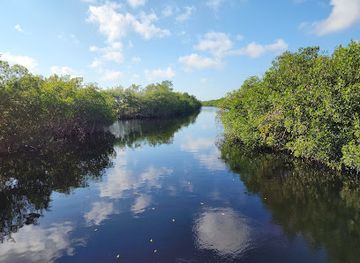
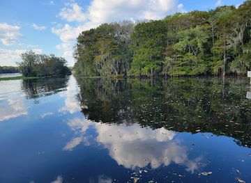
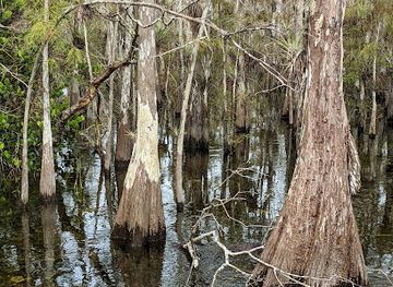
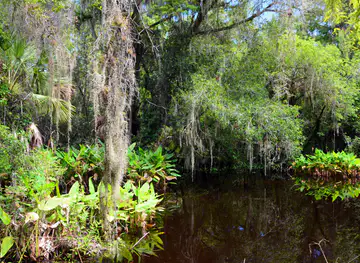
Big Cypress National Preserve occupies roughly 729,000 acres of freshwater marsh, cypress forest, sawgrass prairie, hardwood hammock and slow-moving swamp in south-west Florida. Although it forms part of the wider Everglades ecosystem, the preserve has a distinct character: its landscape is shaped by a shallow, gently sloping sheet of water flowing towards the Gulf of Mexico, with bald cypress trees rising from seasonally flooded ground. The preserve lies north of the Everglades and west of the Miami metropolitan region, crossed by the Tamiami Trail, or US 41, and approached from gateway communities including Ochopee, Everglades City, Naples and Miami.Read more about Big Cypress National Preserve
Wildlife and Human History
Ways to Explore
When is the best time to visit Big Cypress National Preserve?
Best: December–February · 23–24°C| Month | High (°C) | Rainfall (mm) |
|---|---|---|
| January (best) | 23 | 51 |
| February (best) | 24 | 53 |
| March | 26 | 66 |
| April | 29 | 67 |
| May | 32 | 126 |
| June | 33 | 206 |
| July | 34 | 223 |
| August | 34 | 229 |
| September | 33 | 219 |
| October | 31 | 124 |
| November | 27 | 72 |
| December (best) | 23 | 58 |
Getting to and around Big Cypress National Preserve
How to get there
Transportation
Best attractions in Big Cypress National Preserve
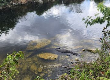
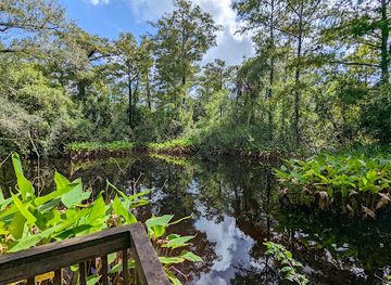
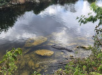
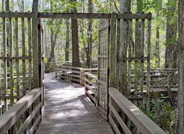
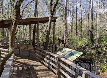
Big Cypress is experienced through a scattering of wetland sights rather than a single marquee attraction. The Kirby Storter Boardwalk near the preserve’s western side leads through a cypress strand and offers an accessible introduction to the swamp, while Big Cypress Bend Boardwalk, near the eastern approach along US 41, provides another interpretive walk through forested wetland. Loop Road is a contrasting experience, following an unpaved route through cypress, prairie and hammock landscapes when conditions allow. Along the Tamiami Trail, roadside pull-offs and short walks reveal alligators, wading birds and changing water levels, and the Oasis Visitor Center area provides useful orientation to the preserve’s ecology. Turner River and nearby waterways are associated with paddling and guided wetland excursions, subject to conditions and regulations. The preserve’s greatest attraction is its varied mosaic of habitats, where a short boardwalk, long scenic drive and carefully planned backcountry journey can each present a different view of south Florida.
-
National park
Everglades National Park
Discover the breathtaking landscapes and rich wildlife of Everglades National Park, a must-visit destination for nature lovers in Florida.
-
Visitor center
Shark Valley Visitor Center
Discover the beauty of Florida's Everglades at the Shark Valley Visitor Center, your gateway to nature's wonders and wildlife adventures.
-
Visitor center
Big Cypress Oasis Visitor Center
Discover the beauty and biodiversity of Big Cypress National Preserve at the Big Cypress Oasis Visitor Center, your gateway to adventure.
-
Visitor center
Ernest F. Coe Visitor Center
Discover the Everglades at the Ernest F. Coe Visitor Center, your gateway to Florida’s breathtaking wetlands and rich biodiversity.
Best landmarks in Big Cypress National Preserve
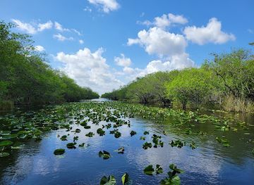
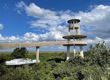
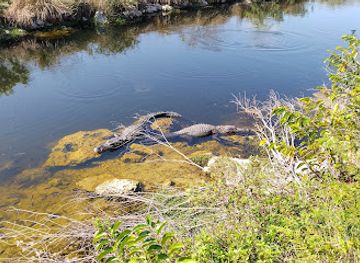
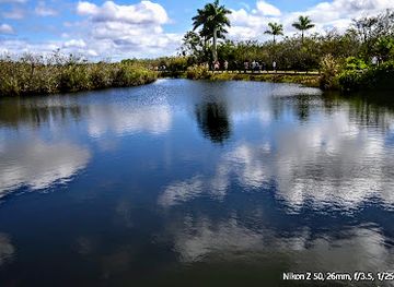
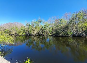
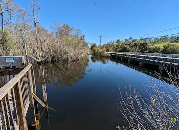
The defining natural landmark of Big Cypress is its broad cypress swamp, where bald cypress trees stand among wet prairies, hardwood hammocks and slow-moving waterways within the greater Everglades watershed. The Tamiami Trail is both a transport route and a historic human landmark, cutting across the wetland and offering repeated views of changing habitats. Kirby Storter Boardwalk and Big Cypress Bend Boardwalk are important interpretive landmarks because they reveal the structure of the swamp without requiring a deep backcountry journey. The Oasis Visitor Center area is associated with one of the preserve’s recognised wildlife-viewing landscapes, particularly around open water and drainage features. Loop Road provides a close view of the preserve’s roadless-looking interior while remaining a managed route when open. Rather than monumental architecture, Big Cypress is defined by the relationship between water, forest, wildlife and the roads that made this remote landscape accessible.
-
Visitor center
Big Cypress Oasis Visitor Center
Discover the beauty of Big Cypress National Preserve at the Big Cypress Oasis Visitor Center, your gateway to adventure and nature's wonders.
-
Park
H.P. Williams Roadside Park
Explore the natural beauty at H.P. Williams Roadside Park, a peaceful picnic ground in Big Cypress National Preserve, perfect for nature lovers and explorers.
-
Visitor center
Nathaniel P. Reed Visitor Center
Explore the natural beauty and rich ecosystems of Big Cypress at the Nathaniel P. Reed Visitor Center, your gateway to adventure in Florida's wilderness.
-
Nature preserve
Big Cypress Bend Boardwalk
Explore the enchanting Big Cypress Bend Boardwalk in Florida, where serene wetlands and vibrant wildlife create an unforgettable nature experience.
Explore Big Cypress National Preserve on the map
Plan your trip on one map. See where the top attractions, landmarks, restaurants and hotels are, and book hotels and experiences in a few clicks.
Best hotels in Big Cypress National Preserve
Best restaurants in Big Cypress National Preserve
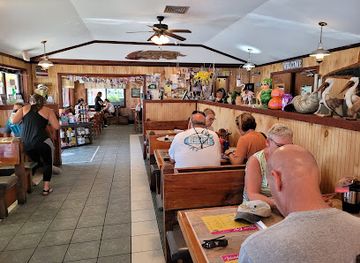
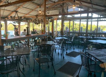
Big Cypress itself has limited dining infrastructure, so most visitors eat before entering the preserve, carry provisions or use businesses clustered along US 41 and in gateway communities. Ochopee provides a small number of services along the Tamiami Trail, while Everglades City is a useful base for seafood restaurants, cafés and casual local dining associated with the Gulf Coast fishing community. Naples offers the broadest choice of restaurants for visitors approaching from the west, and Miami serves the eastern approach with a much larger urban dining scene. Regional menus may draw on Gulf seafood, stone crab when in season, local fish, citrus and other ingredients associated with south Florida, alongside familiar American fare. Food and drink options become sparse away from settled areas, so a day in the preserve should be planned with sufficient water, snacks and any required picnic supplies rather than relying on finding a meal deep inside the wetlands.
-
Nature preserve
Big Cypress National Preserve
Discover the natural beauty and diverse ecosystems of Big Cypress National Preserve – a true Floridian gem perfect for adventure seekers.
-
Visitor center
Big Cypress Oasis Visitor Center
Explore Florida's ecological treasures at Big Cypress Oasis Visitor Center – your gateway to adventure in nature's paradise.
-
Breakfast
Island Cafe
Discover the charm of Island Cafe in Everglades City – where every breakfast is an adventure waiting to unfold!
-
Restaurant
Camellia Street Grill
Discover authentic Florida seafood at Camellia Street Grill in Everglades City – where fresh ingredients meet delightful coastal flavors.
Best bars in Big Cypress National Preserve
Big Cypress is not a nightlife destination, and within the preserve evening entertainment is limited to the quiet atmosphere of rural roadside communities and accommodation outside the protected area. Ochopee and the US 41 corridor may offer informal places to eat or drink, but opening patterns and availability can be seasonal or limited. Everglades City has the most characteristic small-town evening setting on the western approach, with casual restaurants and local establishments linked to the fishing and boating community rather than a club scene. Visitors seeking extensive bars, live entertainment or late-night venues will need to base themselves in Naples or Miami, both outside Big Cypress. In the preserve itself, darkness, wildlife and dispersed facilities make stargazing, listening to the wetland and returning early to a gateway base more realistic than conventional nightlife.
-
Nature preserve
Big Cypress National Preserve
Explore the breathtaking wilderness and diverse wildlife of Big Cypress National Preserve, a must-visit nature preserve in the heart of Florida.
-
Breakfast
Island Cafe
Discover Island Cafe in Everglades City, where delicious breakfasts and a warm atmosphere await you in the heart of Florida's natural paradise.
-
Restaurant
Camellia Street Grill
Experience the best of Everglades dining at Camellia Street Grill, where fresh seafood and grilled delights await in a charming atmosphere.
-
Restaurant
Little Bar Restaurant
Discover the vibrant flavors of the Caribbean and fresh local seafood at Little Bar Restaurant in Goodland, Florida, where food and fun meet by the water.
Best nightclubs in Big Cypress National Preserve
Big Cypress is not a nightlife destination, and within the preserve evening entertainment is limited to the quiet atmosphere of rural roadside communities and accommodation outside the protected area. Ochopee and the US 41 corridor may offer informal places to eat or drink, but opening patterns and availability can be seasonal or limited. Everglades City has the most characteristic small-town evening setting on the western approach, with casual restaurants and local establishments linked to the fishing and boating community rather than a club scene. Visitors seeking extensive bars, live entertainment or late-night venues will need to base themselves in Naples or Miami, both outside Big Cypress. In the preserve itself, darkness, wildlife and dispersed facilities make stargazing, listening to the wetland and returning early to a gateway base more realistic than conventional nightlife.
-
Visitor center
Big Cypress Oasis Visitor Center
Explore the natural beauty and rich biodiversity of Big Cypress with an informative visit to the Oasis Visitor Center.
-
Park
Audubon Corkscrew Swamp Sanctuary-ONLINE TICKETS RECOMMENDED
Immerse yourself in the stunning biodiversity of Audubon Corkscrew Swamp Sanctuary, a must-visit park for nature lovers in Naples, Florida.
Best shops in Big Cypress National Preserve
Shopping within Big Cypress is limited and practical rather than extensive. Small services along the Tamiami Trail and in Ochopee may provide everyday supplies, souvenirs or refreshments, while Everglades City offers a broader selection of locally oriented businesses connected with fishing, boating and life on the Gulf Coast. Naples has the nearest substantial concentration of shops, galleries, outdoor retailers and food producers for visitors approaching from the west, and Miami provides extensive retail options on the eastern side, both outside the preserve. Appropriate purchases associated with the region can include locally produced food, nature books, artwork, outdoor equipment and crafts reflecting south Florida landscapes, but visitors should distinguish genuine local products from generic souvenirs. Because facilities are sparse between settlements, buy fuel, water, insect repellent and other essentials before travelling into remote sections of the preserve.
-
Nature preserve
Big Cypress National Preserve
Discover the ecological treasures of Big Cypress National Preserve, a wildlife-rich haven in Florida offering breathtaking landscapes and diverse outdoor activities.
-
Visitor center
Big Cypress Oasis Visitor Center
Discover the Big Cypress Oasis Visitor Center: Your gateway to Florida's stunning wetlands and rich wildlife.
-
Park
Audubon Corkscrew Swamp Sanctuary-ONLINE TICKETS RECOMMENDED
Explore the enchanting Audubon Corkscrew Swamp Sanctuary, a wildlife haven in Florida with diverse ecosystems and stunning landscapes.
-
Park
H.P. Williams Roadside Park
Experience the serene beauty of H.P. Williams Roadside Park, a perfect picnic spot in Big Cypress with stunning waterway views and abundant wildlife.
Get your free copy of our complete guide to Big Cypress National Preserve, delivered straight to you.
Everything on this page, from attractions and restaurants to essentials and local phrases, in one PDF you can read offline, print or share.
Already have an account? Sign in
Your Big Cypress National Preserve guide is ready.
We'll send it to · Not you? Sign out

Getting your guide ready…
We are putting together a fresh copy of the Big Cypress National Preserve guide. This can take up to a minute.
This can take a few moments. If your browser asks, choose Allow so the download can start. You'll find the guide in your Downloads folder.
Nothing happened? Download it again
Sorry, the guide is taking longer than usual. Please try again in a minute, or get it by email instead.
Big Cypress National Preserve essentials
Currency and Payment
Safety
Emergency Situations
Do's and Don'ts
Local Tips
From Eve
Local phrases worth knowing
You don't need to get them perfect. A few words go a long way, and locals appreciate the effort.
Basics
| English | Local | Say it |
|---|---|---|
| Hello | Howdy | [hau-dee] |
| Goodbye | See ya later | [see ya lay-ter] |
| Yes | Yep | [yep] |
| No | Nah | [nah] |
| Please/You're welcome | Please/No problem | [pleez/no pro-blem] |
| Thank you | Thanks | [thanks] |
| Excuse me/Sorry | Pardon me/My bad | [par-dun me/my bad] |
| How are you? | How y'all doin'? | [how y'all doin'] |
| Fine. And you? | Good. How 'bout y'all? | [good. how bout y'all] |
| Do you speak English? | Ya speak English? | [ya speak English] |
| I don't understand | I ain't gettin' it | [i ain't get-tin it] |
Eating & Drinking
| English | Local | Say it |
|---|---|---|
| I'd like to see the menu, please | Can I check out the menu, please | [can i check out the menu please] |
| I don't eat meat | I don't do meat | [i don't do meat] |
| Cheers! | Cheers! | [cheers] |
| I would like to pay, please | I'm ready to settle up, please | [i'm ready to settle up please] |
Emergencies
| English | Local | Say it |
|---|---|---|
| Help! | Help! | [help] |
| Go away! | Back off! | [back off] |
| Call the Police! | Ring up the Sheriff! | [ring up the sheriff] |
| Call a doctor! | Get a doc on the line! | [get a doc on the line] |
| I'm lost | I'm all turned around | [i'm all turned around] |
| I'm ill | I'm feelin' poorly | [i'm feelin' poorly] |
Shopping
| English | Local | Say it |
|---|---|---|
| I'd like to buy... | I wanna pick up... | [i wanna pick up] |
| I'm just looking | Just browsin' | [just browsin'] |
| How much is it? | How much does it run? | [how much does it run] |
| That's too expensive | That's a bit steep | [that's a bit steep] |
| Can you lower the price? | Can ya knock it down some? | [can ya knock it down some] |
Time & Numbers
| English | Local | Say it |
|---|---|---|
| What time is it? | What's the time? | [what's the time] |
| It's one o'clock | It's one | [it's one] |
| Half past (10) | Ten thirty | [ten thirty] |
| Morning | Mornin' | [mornin'] |
| Afternoon | Afternoon | [afternoon] |
| Evening | Evenin' | [evenin'] |
| Yesterday | Yest'day | [yest'day] |
| Today | Today | [today] |
| Tomorrow | Tomorrah | [tomorrah] |
| 1 | One | [one] |
| 2 | Two | [two] |
| 3 | Three | [three] |
| 4 | Four | [four] |
| 5 | Five | [five] |
| 6 | Six | [six] |
| 7 | Seven | [seven] |
| 8 | Eight | [eight] |
| 9 | Nine | [nine] |
| 10 | Ten | [ten] |
Transport & Directions
| English | Local | Say it |
|---|---|---|
| Where's a/the...? | Where's the...? | [where's the] |
| What's the address? | Where's it located? | [where's it located] |
| Can you show me (on the map)? | Can ya point it out (on the map)? | [can ya point it out on the map] |
| When's the next (bus)? | When's the next one (bus)? | [when's the next one bus] |
| A ticket (to ....) | One ticket (to ....) | [one ticket to] |
History of Big Cypress National Preserve
A Wetland Shaped by Water
Big Cypress developed within the low-lying south Florida landscape as freshwater moved slowly south and west across porous limestone towards the coast. Seasonal flooding, fire and changing water levels helped create a mosaic of cypress strands, wet prairies, pinelands and hardwood hammocks. This geological and ecological history is inseparable from the neighbouring Everglades, although Big Cypress is generally more forested and contains deeper, slower-moving channels in places. The preserve’s natural history is therefore best understood as the long interaction of limestone terrain, subtropical climate, freshwater flow and periodic disturbance rather than as a single historic event.
Indigenous Wetland Homelands
People have lived in and travelled through the south Florida wetlands for thousands of years. The wider region was associated with Indigenous cultures including the Calusa, while Miccosukee and Seminole communities maintained detailed knowledge of the cypress country, its waterways, plants and seasonal resources. During the nineteenth century, conflict and forced removal transformed Indigenous life across Florida, but not all people left the wetlands. Families continued to use remote areas for refuge, hunting, fishing and settlement, forming an essential part of the living cultural history that visitors encounter around Big Cypress today.
Drainage, Roads and Modern Development
During the nineteenth and twentieth centuries, south Florida was increasingly reshaped by drainage schemes, canals, roads, logging and speculative development. The Tamiami Trail, completed in the 1920s, created an important east-west route across the wetlands and remains one of the principal ways to experience the preserve. Cypress logging and wider plans to convert wetlands for agriculture and urban growth intensified pressure on the landscape. These changes also made clear how closely Big Cypress was connected to the hydrology of the Everglades, since altering water flow in one area affected habitats and communities elsewhere.
Creation of the National Preserve
Big Cypress National Preserve was established by Congress in 1974 after sustained efforts to protect the swamp from large-scale development. Its designation was significant because it preserved a vast wetland while allowing certain established uses, including private inholdings, hunting, fishing and off-road vehicle access under regulation. Unlike a more restrictive national park model, the preserve’s management has had to balance ecological protection with longstanding community relationships and practical land uses. The National Park Service now works with other agencies, tribes, local communities and landowners to protect water flow, habitats and wildlife.
Conservation in a Changing Climate
Contemporary management focuses on maintaining the wetland processes that sustain Big Cypress and the wider Everglades system. Water management, invasive species, wildfire, road impacts, habitat fragmentation and the recovery of rare wildlife all influence the preserve’s future. Restoration of more natural water movement in south Florida has made Big Cypress an important part of broader Everglades conservation, while changing rainfall patterns, rising temperatures and sea-level rise add further uncertainty. Visitor access, recreation and interpretation are consequently managed within a landscape whose environmental conditions can change markedly between seasons.
Big Cypress National Preserve in Photos
Browse through our photo collection highlighting the charm and character of the destination.
Cities in Big Cypress National Preserve
The towns and cities of Big Cypress National Preserve, and the easiest places to base yourself.

Swipe for more cities
Neighbouring destination travel guides
The closest destinations to Big Cypress National Preserve, if you have time for more than one.
-
-

-

-

-


Swipe for more destinations
Explore more
Explore more of Southeast Florida
Explore Southeast Florida for Miami culture, Atlantic beaches, Caribbean flavours, waterways, museums and subtropical landscapes from Palm Beach to Miami.
Explore Southeast Florida
Explore more of Florida
Discover Florida: A Sunshine State full of dazzling beaches, iconic theme parks, rich history, and stunning natural parks, offering endless adventures for every traveler.
Explore Florida