

Duna-Ipoly National Park Travel Guide - Free Web & App
Your ultimate guide to Duna-Ipoly National Park. Discover top landmarks, proposed trips, and local tips. Free on the web or via the Evendo companion app.


Duna-Ipoly National Park in Hungary spans the Danube Bend, Pilis and Börzsöny mountains, offering caves, forests, wildlife, villages and walking routes.
A Protected Landscape around the Danube
Duna-Ipoly National Park occupies a varied belt of northern Hungary, extending from the wooded Buda Hills and Pilis Mountains towards the Danube Bend, the Visegrád Mountains, the Börzsöny and the valleys of the Ipoly River. It is not one continuous wilderness but a linked collection of protected landscapes, forests, limestone hills, riverbanks, wetlands and cultivated margins. The Danube forms its most recognisable southern and eastern axis, while the Ipoly marks much of the northern frontier with Slovakia.Read more about Duna-Ipoly National Park
Forests, Caves and Wildlife
Villages, Fortresses and Outdoor Exploration
When is the best time to visit Duna-Ipoly National Park?
Best: June–August · 25–26°C| Month | High (°C) | Rainfall (mm) |
|---|---|---|
| January | 3 | 30 |
| February | 4 | 30 |
| March | 8 | 30 |
| April | 14 | 40 |
| May | 19 | 40 |
| June (best) | 25 | 50 |
| July (best) | 26 | 50 |
| August (best) | 25 | 50 |
| September | 21 | 50 |
| October | 14 | 40 |
| November | 8 | 30 |
| December | 4 | 30 |
Getting to and around Duna-Ipoly National Park
How to get there
Transportation
Best attractions in Duna-Ipoly National Park
The park's attractions are spread across several distinct landscapes. Around Visegrád, the Danube Bend combines wooded hills, river panoramas and the medieval Visegrád Citadel, while nearby Börzsöny routes lead through forested mountain country and towards Királyrét. The Pilis offers extensive marked walking routes, limestone scenery and viewpoints such as Dobogókő, a well-known high point above the Danube Bend region. In the Buda Hills, the Pál-völgyi Cave system and Szemlő-hegyi Cave provide accessible introductions to the area's subterranean geology through managed visitor experiences. Along the Ipoly Valley, quieter paths, meadows and wetlands reveal a more open river landscape, with settlements including Szob and Drégelypalánk acting as regional gateways. Forest railways around Királyrét add a heritage dimension to the Börzsöny, while Esztergom and Szentendre provide nearby cultural attractions at the edges of the protected landscape.
-
Hiking area
Dera Gorge
Experience the breathtaking beauty of Dera Gorge, a premier hiking destination in Csobánka, Hungary, where adventure meets tranquility in nature's embrace.
-
Hiking area
Rám-szakadék
Explore Rám-szakadék: A breathtaking hiking area in Dömös, Hungary, offering stunning landscapes and thrilling outdoor adventures.
-
Scenic spot
Juliánus Kilátó
Explore the breathtaking views from Juliánus Kilátó in Nagymaros, a scenic lookout that showcases the beauty of the Danube River and surrounding landscapes.
-
Tourist attraction
Dömör-kapu
Explore Dömör-kapu in Szentendre, a serene tourist attraction blending nature's beauty with rich cultural experiences.


Best landmarks in Duna-Ipoly National Park
The Danube itself is the park's defining natural landmark, narrowing and turning through the hills at the celebrated Danube Bend. The Visegrád Citadel occupies a commanding hill above the river and remains the area's most recognisable historic structure, while the royal palace below reflects the town's medieval importance. Dobogókő marks a prominent high point in the Pilis and is associated with broad forested upland scenery. The limestone cave systems of the Buda Hills, including Pál-völgyi Cave and Szemlő-hegyi Cave, reveal the subterranean character of the protected landscape through managed visits. Farther north, the volcanic Börzsöny and the quieter Ipoly floodplain present a contrasting geography of ridges, valleys, meadows and river habitats. These features together explain why the park is understood as a connected natural region rather than a single scenic viewpoint.
-
National park
Duna-Ipoly Nemzeti Park
Explore the breathtaking landscapes and rich biodiversity of Duna-Ipoly National Park, a hidden gem just outside Budapest.
-
Hiking area
Rám-szakadék
Experience the stunning natural beauty of Rám-szakadék, a premier hiking area near Dömös, known for its breathtaking views and serene trails.
-
Hiking area
Spartacus hiking trail
Discover the breathtaking Spartacus Hiking Trail in Visegrád, where nature meets history in a stunning outdoor adventure.
-
Nature preserve
Domini-forrás
Explore the serene beauty of Domini-forrás Nature Preserve in Pomáz, Hungary, a perfect retreat for nature lovers and adventure seekers.


Explore Duna-Ipoly National Park on the map
Plan your trip on one map. See where the top attractions, landmarks, restaurants and hotels are, and book hotels and experiences in a few clicks.
Best hotels in Duna-Ipoly National Park
Best bars in Duna-Ipoly National Park
Evening entertainment is modest and settlement-based, with the most dependable choice of wine bars, cafés, traditional pubs and restaurant terraces found in Szentendre, Esztergom and Visegrád. Danube Bend towns can feel lively during summer weekends, while smaller Pilis and Börzsöny villages generally offer a quieter pub culture rather than dedicated nightlife. Local wines, beer and fruit brandies may appear on regional drinks lists, although the selection varies between establishments. Hiking bases such as Királyrét are primarily suited to daytime outdoor activities, and visitors should not expect a nightclub scene in the mountains. Cultural programmes, concerts and seasonal events may take place in larger settlements, but dates and venues should be checked locally.
-
National park
Duna-Ipoly Nemzeti Park
Discover the enchanting landscapes and rich biodiversity of Duna-Ipoly National Park, a serene escape near Budapest, perfect for hiking and nature exploration.

Best shops in Duna-Ipoly National Park
Shopping within the national park is limited and is generally combined with visits to gateway settlements. Szentendre has the most concentrated selection of galleries, independent craft shops and places selling locally themed art, ceramics and gifts, although not every product is necessarily made in the surrounding region. Visegrád and Esztergom provide practical shops, food stores and souvenirs, while villages in the Pilis, Börzsöny and Ipoly Valley may offer honey, preserves, fruit, wine or other produce through small producers and farm shops. Regional food products are often a more meaningful purchase than generic souvenirs, and seasonal availability varies. Outdoor equipment and everyday supplies are easier to find in larger towns, so walkers heading into remote mountain areas should obtain essentials before reaching the trailhead.
-
National park
Duna-Ipoly Nemzeti Park
Explore the breathtaking landscapes and diverse wildlife of Duna-Ipoly National Park, a natural paradise near Budapest for outdoor enthusiasts and nature lovers.
-
Dessert shop
Hilda Cukrászda
Discover Hilda Cukrászda in Pilisszentkereszt, the ultimate destination for dessert lovers seeking sweet treats and frozen yogurt delights.
-
Serviced accommodation
Apátkúti Vadászház Étterem és Fogadó
Experience the serene beauty and culinary delights at Apátkúti Vadászház, where nature meets exceptional dining in the heart of Visegrád.
-
Fireplace store
BEN-KEL KFT.
Explore BEN-KEL KFT. in Pilisszentlászló, a charming fireplace store offering quality designs and expert advice for your home.


Get your free copy of our complete guide to Duna-Ipoly National Park, delivered straight to you.
Everything on this page, from attractions and restaurants to essentials and local phrases, in one PDF you can read offline, print or share.
Already have an account? Sign in
Your Duna-Ipoly National Park guide is ready.
We'll send it to · Not you? Sign out

Getting your guide ready…
We are putting together a fresh copy of the Duna-Ipoly National Park guide. This can take up to a minute.
This can take a few moments. If your browser asks, choose Allow so the download can start. You'll find the guide in your Downloads folder.
Nothing happened? Download it again
Sorry, the guide is taking longer than usual. Please try again in a minute, or get it by email instead.
Duna-Ipoly National Park essentials
Currency and Payment
Safety
Emergency Situations
Do's and Don'ts
Local Tips
From Eve
Local phrases worth knowing
You don't need to get them perfect. A few words go a long way, and locals appreciate the effort.
Basics
| English | Local | Say it |
|---|---|---|
| Hello | Szia | [see-ah] |
| Goodbye | Viszontlátásra | [vee-sont-la-tash-ra] |
| Yes | Igen | [ee-gen] |
| No | Nem | [nem] |
| Please/You're welcome | Kérem | [kay-rem] |
| Thank you | Köszönöm | [kur-suh-nurm] |
| Excuse me/Sorry | Elnézést | [el-nay-zayst] |
| How are you? | Hogy vagy? | [hoj vaj] |
| Fine. And you? | Jól vagyok. És te? | [yol vaj-ock. ays teh] |
| Do you speak English? | Beszélsz angolul? | [bes-aylss on-go-lull] |
| I don't understand | Nem értem | [nem air-tem] |
Eating & Drinking
| English | Local | Say it |
|---|---|---|
| I'd like to see the menu, please | Szeretnék látni az étlapot, kérem | [seh-reh-tnek laht-nee ahs ate-loh-pot, kay-rem] |
| I don't eat meat | Nem eszem húst | [nem es-em hoo-sht] |
| Cheers! | Egészségedre! | [eh-gay-shayg-eh-dreh] |
| I would like to pay, please | Szeretnék fizetni, kérem | [seh-reh-tnek fee-zeht-nee, kay-rem] |
Emergencies
| English | Local | Say it |
|---|---|---|
| Help! | Segítség! | [sheh-geet-sayg] |
| Go away! | Menj el! | [men yel] |
| Call the Police! | Hívd a rendőrséget! | [heed ah ren-dur-say-get] |
| Call a doctor! | Hívd az orvost! | [heed ahz or-vosh-t] |
| I'm lost | Elvesztem | [el-veh-stem] |
| I'm ill | Beteg vagyok | [beh-teg vaj-ock] |
Shopping
| English | Local | Say it |
|---|---|---|
| I'd like to buy... | Szeretnék vásárolni... | [seh-reh-tnek vah-shah-rohl-nee] |
| I'm just looking | Csak nézelődöm | [chahk nay-zeh-loh-dohm] |
| How much is it? | Mennyibe kerül? | [men-yee-beh keh-rool] |
| That's too expensive | Ez túl drága | [ehz tool drah-gah] |
| Can you lower the price? | Le tudnád engedni az árat? | [leh too-dnahd eng-ehd-nee ahs ah-raht] |
Time & Numbers
| English | Local | Say it |
|---|---|---|
| What time is it? | Mennyi az idő? | [men-nyee ahz ee-doh] |
| It's one o'clock | Egy óra van | [edj oh-rah vahn] |
| Half past (10) | Fél 10 | [fayl tiz] |
| Morning | Reggel | [rehg-gel] |
| Afternoon | Délután | [deh-loo-tahn] |
| Evening | Este | [ehs-teh] |
| Yesterday | Tegnap | [teg-nahp] |
| Today | Ma | [mah] |
| Tomorrow | Holnap | [hol-nahp] |
| 1 | Egy | [edj] |
| 2 | Kettő | [ket-toh] |
| 3 | Három | [hah-rom] |
| 4 | Négy | [naydg] |
| 5 | Öt | [oht] |
| 6 | Hat | [haht] |
| 7 | Hét | [hayt] |
| 8 | Nyolc | [nyolts] |
| 9 | Kilenc | [keel-ents] |
| 10 | Tíz | [teedz] |
Transport & Directions
| English | Local | Say it |
|---|---|---|
| Where's a/the...? | Hol van a... | [hol vahn ah] |
| What's the address? | Mi a cím? | [mee ah seem] |
| Can you show me (on the map)? | Meg tudnád mutatni (a térképen)? | [mehg too-dnahd moo-taht-nee ah tair-kay-pen] |
| When's the next (bus)? | Mikor jön a következő (busz)? | [mee-kor yern ah koh-veht-keh-zoh boos] |
| A ticket (to ....) | Egy jegy (.... felé) | [edj yedj .... feh-lay] |
History of Duna-Ipoly National Park
A Landscape Shaped by River and Volcano
The national park brings together landscapes with different geological histories. The Pilis and Buda Hills are strongly associated with limestone and karst formations, including cavities and caves created by water moving through soluble rock. The Börzsöny is a volcanic mountain massif, while the Danube has cut a major valley through the surrounding uplands and the Ipoly has formed a quieter network of floodplain and meadow habitats. These geological contrasts explain the park's changing scenery, from rocky hills and cave systems to river islands, wetlands and forested mountain slopes.
Early Settlement and Medieval Routes
The Danube Bend and its surrounding hills have been occupied and crossed since prehistoric times, although surviving evidence is distributed across the wider region rather than concentrated in one park settlement. The river corridor became strategically important in the Roman period and during the medieval Kingdom of Hungary. Esztergom developed as a major ecclesiastical and political centre, while Visegrád became a royal residence and fortified settlement overlooking the Danube. Paths through the Pilis and Börzsöny connected villages, estates and market centres, and the river provided an important route for travel and trade.
Forts, Estates and Rural Land Use
The region's medieval and early modern history is visible in fortifications, churches, village layouts and agricultural landscapes. Visegrád's hilltop citadel and royal palace complex reflect the Danube Bend's strategic and political importance, while Esztergom's religious heritage gives the southern part of the broader landscape a different historical character. Forests supplied timber and other resources, and valleys and foothills supported farming, orchards and grazing. The relationship between woodland, river and settlement remained fundamental even as political control and land ownership changed over the centuries.
Forestry, Railways and Mountain Communities
In the Börzsöny and other upland districts, forestry became a defining economic activity, with roads, forestry settlements and narrow-gauge railways developed to move timber and serve mountain communities. Some of these railways later acquired a recreational role, notably in the Királyrét area. Villages in the Pilis and Danube Bend likewise retained strong associations with woodland management, farming and craft traditions. The modern landscape therefore reflects both natural succession and long human use, rather than an untouched wilderness separate from surrounding communities.
Conservation and the National Park
Duna-Ipoly National Park was established in 1997 to protect a broad range of habitats in the Danube Bend, the Pilis, the Börzsöny and the Ipoly Valley. Its work encompasses forests, caves, riverine environments, wetlands, grasslands and species-rich habitats close to a densely populated part of Hungary. Conservation has had to balance recreation, forestry, agriculture, settlement and the protection of sensitive sites. Today, marked routes, interpretation, habitat management and visitor education help make the area accessible while reducing pressure on caves, wildlife habitats and vulnerable vegetation.
Duna-Ipoly National Park in Photos
Browse through our photo collection highlighting the charm and character of the destination.
Neighbouring destination travel guides
The closest destinations to Duna-Ipoly National Park, if you have time for more than one.
-

-
-

-


Swipe for more destinations
Explore more
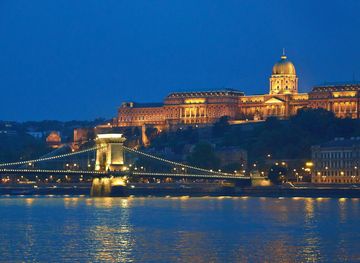
Explore more of Central Hungary
Central Hungary brings together Budapest’s thermal baths and heritage with Danube Bend towns, royal estates, wine country and accessible countryside.
Explore Central Hungary
Explore more of Hungary
Discover Hungary: A land of historic cities, scenic landscapes, thermal baths, and rich culinary traditions in the heart of Europe.
Explore Hungary