

Free Southern Region Travel Guide & Mobile App
Explore Southern Region with free travel guides. Discover regional history, expert tips, proposed trips, and audio guides on web or mobile app.


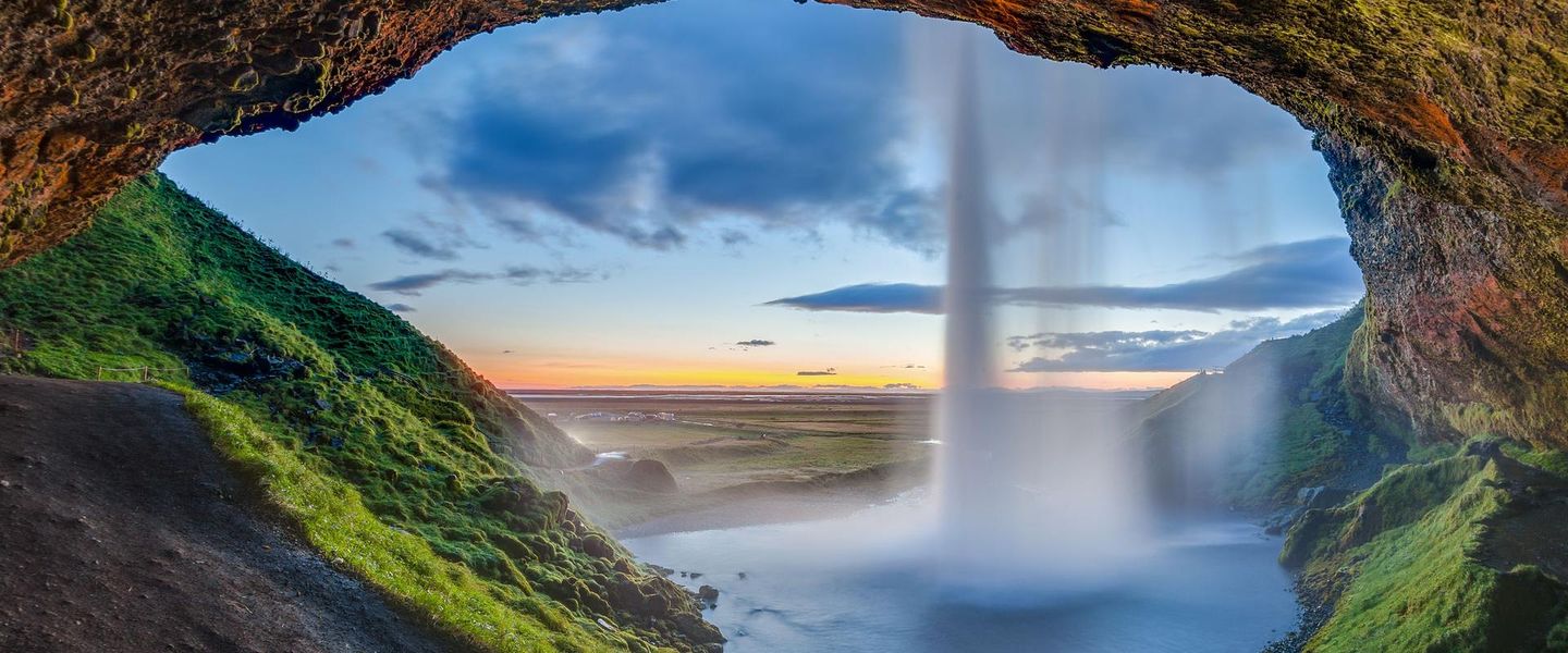


Southern Region Iceland combines glaciers, volcanoes, waterfalls, black-sand beaches, farm country and the Westman Islands along a dramatic coastal route.
Read more about Southern Region
When is the best time to visit Southern Region?
Best: June–August · 12–14°C| Month | High (°C) | Rainfall (mm) |
|---|---|---|
| January | 2 | 60 |
| February | 2 | 50 |
| March | 3 | 60 |
| April | 6 | 50 |
| May | 9 | 50 |
| June (best) | 12 | 50 |
| July (best) | 14 | 60 |
| August (best) | 13 | 60 |
| September | 10 | 50 |
| October | 7 | 50 |
| November | 4 | 60 |
| December | 2 | 60 |
Getting to and around Southern Region
How to get there
Transportation
Top city travel guides in Southern Region
The cities of Southern Region, and the easiest places to base yourself.
-

-

-

-

-

-


Swipe for more cities
Destinations in Southern Region
Resorts, valleys and scenic spots worth a trip of their own.
-

-

-

-

-

-


Swipe for more destinations
Best attractions in Southern Region
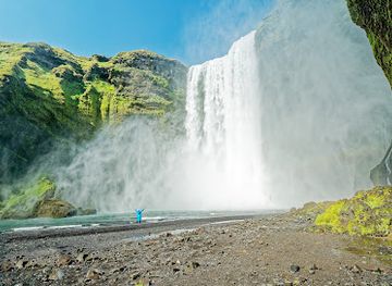
The Southern Region’s attractions follow a remarkable chain of geological and cultural contrasts. Þingvellir National Park combines a rift-valley landscape with the historic site of Iceland’s Alþingi, while the Golden Circle continues to the geothermal basin of Geysir and the broad cataract of Gullfoss. Along the coast, Seljalandsfoss and Skógafoss are major waterfalls, and the Skógar area adds museums and a view into the region’s farming and transport history. The beaches near Vík, including Reynisfjara, are visually striking but require strict attention to surf warnings. Further east, the Eldhraun lava field, Skaftafell and the glacier landscapes of Vatnajökull National Park offer hiking, ice formations and guided glacier activities. Jökulsárlón and nearby Breiðamerkursandur provide close views of floating glacial ice, while the Westman Islands offer volcanic scenery, seabird cliffs and museums centred on the 1973 eruption. Smaller museums, swimming pools, farms, cafés and marked walking routes help connect these headline sights with everyday southern Iceland.
-
National park
Thingvellir National Park
Explore Thingvellir National Park, Iceland's stunning UNESCO World Heritage site, rich in natural beauty, history, and unique geological wonders.
-
Tourist attraction
Seljalandsfoss
Discover the enchanting Seljalandsfoss waterfall, where you can walk behind cascading waters and immerse yourself in Iceland's stunning natural beauty.
-
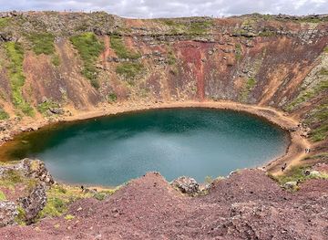
Kerid Crater
Explore the stunning Kerid Crater in Iceland, a vibrant volcanic lake surrounded by colorful cliffs, perfect for nature lovers and photographers alike.
-
Tourist attraction
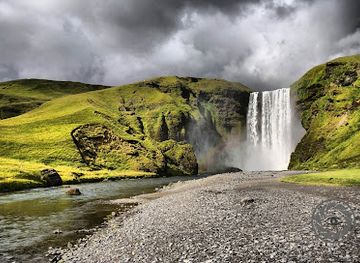
Skógafoss
Explore the captivating beauty of Skógafoss, one of Iceland's most stunning waterfalls, and experience the magic of nature's artistry.


Best landmarks in Southern Region
Þingvellir’s Almannagjá gorge is one of the Southern Region’s most important landmarks, both as an exposed geological rift and as the historic setting of Iceland’s national assembly. Gullfoss is another defining sight: the Hvítá river drops through two main limestone steps before entering a narrow canyon. On the south coast, Skógafoss and Seljalandsfoss mark the former coastline with contrasting forms, one broad and powerful, the other famed for the path behind its falling water when conditions allow. The black cliffs and sea stacks at Reynisfjara express the region’s volcanic character, although dangerous surf makes them places for caution rather than carefree bathing. Eldfell on Heimaey records the 1973 eruption, while the snow-covered profiles of Eyjafjallajökull and Mýrdalsjökull dominate wide views inland. In the east, Vatnajökull, Skaftafell’s mountain valleys and the ice-filled waters of Jökulsárlón form a changing landscape shaped by glaciers, rivers and the sea.
-
National park
Thingvellir National Park
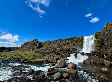
Explore the stunning landscapes and rich history of Thingvellir National Park, a UNESCO World Heritage Site in Iceland, perfect for nature lovers and history enthusiasts.
-
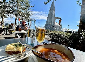
Church
Hallgrimskirkja
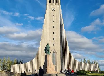
Discover Hallgrimskirkja, Reykjavik's towering architectural marvel, offering breathtaking views and a glimpse into Icelandic heritage.
-
Tourist attraction
Kerid Crater
Experience the breathtaking beauty of Kerid Crater, a stunning volcanic lake offering vibrant colors and serene landscapes in the heart of Iceland.
-
Tourist attraction
Skógafoss
Discover the enchanting beauty of Skógafoss, one of Iceland's most iconic waterfalls, where nature's power meets stunning landscapes.
Explore Southern Region on the map
Plan your trip on one map. See where the top cities, national parks and sights are, and book hotels and experiences in a few clicks.
Best hotels in Southern Region
Best restaurants in Southern Region
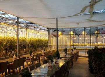
Dining in the Southern Region reflects Iceland’s combination of farming, fishing and a growing visitor economy. Lamb, dairy products, rye bread, potatoes, root vegetables and seafood feature prominently, while greenhouse cultivation supported by geothermal energy provides tomatoes and other produce in several farming districts. Coastal settlements and south-coast restaurants commonly serve fish, and rural cafés offer soups, cakes, pastries and simple meals suited to travellers on the Ring Road. Vík, Selfoss, Hvolsvöllur, Hella and Höfn have the broadest concentration of places to eat, while farms and guesthouses provide more dispersed options. Höfn is particularly associated with langoustine, although menus throughout the country vary with season and supply. Local food shops and farmers’ markets can be useful for assembling provisions, especially before travelling into sparsely settled stretches. Booking ahead is sensible for popular restaurants in summer, as alternatives may be many kilometres away.
-
Icelandic
Café Loki
Experience authentic Icelandic cuisine at Café Loki in Reykjavík – where tradition meets taste in every delicious bite.
-
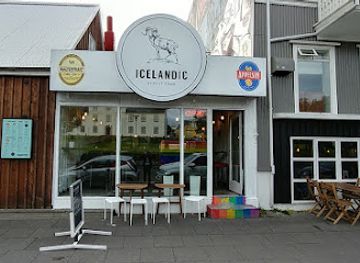
Icelandic
Icelandic Street Food
Discover authentic Icelandic cuisine at Icelandic Street Food in Reykjavík – where every bite tells a story.
-
Restaurant
Friðheimar
Discover Friðheimar: A unique farm-to-table restaurant in Iceland featuring greenhouse-fresh ingredients and delightful tomato-based dishes.
-
Icelandic
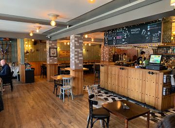
Íslenski barinn
Discover authentic Icelandic cuisine at Íslenski Barinn, where tradition meets flavor in Reykjavík's vibrant dining scene.
Best bars in Southern Region
Evening life in the Southern Region is generally quieter and more locally focused than Reykjavík’s nightlife. Pubs, hotel bars, cafés and restaurants in Selfoss, Hella, Hvolsvöllur, Vík, Höfn and Heimaey provide places for a drink or conversation, while some venues host occasional live music or cultural events. Traditional Icelandic beer and contemporary craft beers are widely available, and a few restaurants have developed thoughtful drinks lists alongside regional food. The Westman Islands can feel more social during summer and local festival periods, but events and opening arrangements vary. In rural districts, darkness, long driving distances and early starts for outdoor activities mean that nightlife tends to centre on dining and relaxed gatherings rather than nightclubs. Visitors should never drink and drive, and should plan transport before consuming alcohol because public transport is limited outside the larger settlements.
-
Bar
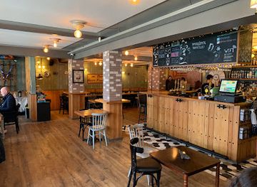
Íslenski barinn
Discover the essence of Icelandic culture through authentic cuisine at Íslenski Barinn in the heart of Reykjavík.
-
Bar
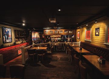
Lebowski Bar
Experience the quirky charm of Reykjavík's Lebowski Bar, a unique destination for fans of 'The Big Lebowski' with great drinks and a lively atmosphere.
-
Brewpub
Bastard Brew & Food
Discover Bastard Brew & Food, Reykjavik's premier brewpub, where craft beers and delectable dishes create a delightful dining experience.
-
Bar
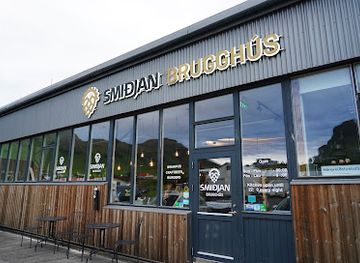
Smiðjan Brugghús
Explore the flavors of Iceland at Smiðjan Brugghús, a cozy brewpub in Vík known for its craft beers and delicious grilled dishes.

Best nightclubs in Southern Region
Evening life in the Southern Region is generally quieter and more locally focused than Reykjavík’s nightlife. Pubs, hotel bars, cafés and restaurants in Selfoss, Hella, Hvolsvöllur, Vík, Höfn and Heimaey provide places for a drink or conversation, while some venues host occasional live music or cultural events. Traditional Icelandic beer and contemporary craft beers are widely available, and a few restaurants have developed thoughtful drinks lists alongside regional food. The Westman Islands can feel more social during summer and local festival periods, but events and opening arrangements vary. In rural districts, darkness, long driving distances and early starts for outdoor activities mean that nightlife tends to centre on dining and relaxed gatherings rather than nightclubs. Visitors should never drink and drive, and should plan transport before consuming alcohol because public transport is limited outside the larger settlements.
-
Night club
Pablo Discobar
Discover the lively atmosphere and innovative cocktails at Pablo Discobar, a top night club and cocktail bar in Reykjavík's vibrant nightlife scene.
-
Lounge
Vinnustofa Kjarval
Discover the charm of Vinnustofa Kjarval, a cozy lounge in Reykjavík featuring local art, delightful beverages, and a welcoming atmosphere.
-
Bar
Grillby’s
Discover the vibrant local scene at Grillby’s, a cozy bar in Iceland offering craft drinks and a welcoming atmosphere.
-
Club
Paloma Club
Discover the energetic nightlife at Paloma Club, a top destination for dancing and socializing in Reykjavik's vibrant club scene.

Best shops in Southern Region
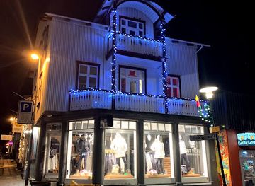
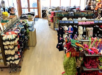
Shopping in the Southern Region is concentrated in market towns and service centres rather than large retail districts. Selfoss has the most extensive range of everyday shops, while Hella, Hvolsvöllur, Vík, Höfn and Heimaey provide groceries, outdoor equipment, souvenirs and smaller independent businesses. Farm shops and local food outlets are useful places to look for Icelandic lamb products, dairy goods, preserves, confectionery, rye bread and greenhouse vegetables, subject to seasonal availability. Craft shops and galleries may offer woollen goods, ceramics, jewellery, artwork and practical outdoor items, with selections varying between towns. Museums and heritage sites often sell books and locally themed products that explain the region’s volcanic, maritime or farming history more meaningfully than generic souvenirs. Travellers driving the south coast should buy essential supplies in larger settlements, since retail choices become limited between them and many rural establishments are small or seasonal.
-
Wool store
The Icelandic Store
Explore the enchanting world of Icelandic wool at The Icelandic Store, where tradition meets craftsmanship in every stitch.
-
Outdoor clothing and equipment shop
Icewear / Vík Wool
Discover authentic Icelandic wool clothing and outdoor gear at Icewear / Vík Wool, where quality meets the spirit of Iceland.
-
Clothing store
IcelandCover Outdoor Clothing Rental
Discover the best outdoor clothing and gear rentals in Reykjavík for your Icelandic adventures, ensuring comfort and safety in every journey.
-
Children's clothing store
Yrja barnavöruverslun
Discover stylish children's clothing at Yrja Barnavöruverslun in Selfoss, your go-to destination for fashionable baby and kids' attire.

Get your free copy of our complete guide to Southern Region, delivered straight to you.
Everything on this page, from attractions and restaurants to essentials and local phrases, in one PDF you can read offline, print or share.
Already have an account? Sign in
Your Southern Region guide is ready.
We'll send it to · Not you? Sign out

Getting your guide ready…
We are putting together a fresh copy of the Southern Region guide. This can take up to a minute.
This can take a few moments. If your browser asks, choose Allow so the download can start. You'll find the guide in your Downloads folder.
Nothing happened? Download it again
Sorry, the guide is taking longer than usual. Please try again in a minute, or get it by email instead.
Southern Region essentials
Currency and Payment
Safety
Emergency Situations
Do's and Don'ts
Local Tips
From Eve
Local phrases worth knowing
You don't need to get them perfect. A few words go a long way, and locals appreciate the effort.
Basics
| English | Local | Say it |
|---|---|---|
| Hello | Howdy | [haʊdi] |
| Goodbye | See ya | [si jə] |
| Yes | Yep | [jɛp] |
| No | Nope | [noʊp] |
| Please/You're welcome | Sure thing | [ʃʊr θɪŋ] |
| Thank you | Thanks a lot | [θæŋks ə lɑt] |
| Excuse me/Sorry | Excuse me | [ɪkˈskjus mi] |
| How are you? | How ya doin'? | [haʊ jə ˈduɪn] |
| Fine. And you? | Good. And you? | [ɡʊd. ənd ju] |
| Do you speak English? | Do ya speak English? | [du jə spiːk ˈɪŋɡlɪʃ] |
| I don't understand | I don't get it | [aɪ doʊnt ɡɛt ɪt] |
Eating & Drinking
| English | Local | Say it |
|---|---|---|
| I'd like to see the menu, please | Can I see the menu? | [kæn aɪ si ðə ˈmɛnju] |
| I don't eat meat | I'm a vegetarian | [aɪm ə ˌvɛdʒəˈtɛriən] |
| Cheers! | Cheers! | [tʃɪrz] |
| I would like to pay, please | Can I get the check, please? | [kæn aɪ ɡɛt ðə tʃɛk, pliz] |
Emergencies
| English | Local | Say it |
|---|---|---|
| Help! | Help! | [hɛlp] |
| Go away! | Leave me alone! | [liv mi əˈloʊn] |
| Call the Police! | Call the cops! | [kɔl ðə kɑps] |
| Call a doctor! | Get a doctor! | [ɡɛt ə ˈdɑktər] |
| I'm lost | I'm lost | [aɪm lɔst] |
| I'm ill | I'm not feeling well | [aɪm nɑt ˈfilɪŋ wɛl] |
Shopping
| English | Local | Say it |
|---|---|---|
| I'd like to buy... | I want to buy... | [aɪ wɑnt tu baɪ] |
| I'm just looking | Just browsing | [dʒʌst ˈbraʊzɪŋ] |
| How much is it? | What’s the price? | [wʌts ðə praɪs] |
| That's too expensive | That's too pricey | [ðæts tu ˈpraɪsi] |
| Can you lower the price? | Can you give me a better deal? | [kæn jə ɡɪv mi ə ˈbɛtər dil] |
Time & Numbers
| English | Local | Say it |
|---|---|---|
| What time is it? | What time is it? | [wʌt taɪm ɪz ɪt] |
| It's one o'clock | It's one o'clock | [ɪts wʌn əˈklɑk] |
| Half past (10) | Half past ten | [hæf pæst tɛn] |
| Morning | Morning | [ˈmɔrnɪŋ] |
| Afternoon | Afternoon | [ˌæftərˈnun] |
| Evening | Evening | [ˈivnɪŋ] |
| Yesterday | Yesterday | [ˈjɛstərdeɪ] |
| Today | Today | [təˈdeɪ] |
| Tomorrow | Tomorrow | [təˈmɑroʊ] |
| 1 | One | [wʌn] |
| 2 | Two | [tu] |
| 3 | Three | [θri] |
| 4 | Four | [fɔr] |
| 5 | Five | [faɪv] |
| 6 | Six | [sɪks] |
| 7 | Seven | [ˈsɛvən] |
| 8 | Eight | [eɪt] |
| 9 | Nine | [naɪn] |
| 10 | Ten | [tɛn] |
Transport & Directions
| English | Local | Say it |
|---|---|---|
| Where's a/the...? | Where's the...? | [wɛrz ðə] |
| What's the address? | What's the address? | [wʌts ði əˈdrɛs] |
| Can you show me (on the map)? | Can you point it out? | [kæn jə pɔɪnt ɪt aʊt] |
| When's the next (bus)? | When's the next bus? | [wɛn z ðə nɛkst bʌs] |
| A ticket (to ....) | A ticket to... | [ə ˈtɪkɪt tu] |
History of Southern Region
Settlement and the Alþingi at Þingvellir
Norse settlement of Iceland began in the late ninth century, and the fertile south-west became one of the country’s important early centres. Around 930, the Alþingi, Iceland’s national assembly, was established at Þingvellir, where representatives met to debate laws and settle disputes. The site’s position beside the dramatic Almannagjá gorge also reflects the geological separation of the North American and Eurasian tectonic plates. Although the assembly’s later history was connected with changing political power across Iceland, Þingvellir remains a central symbol of the country’s medieval commonwealth and national identity.
Medieval farms, churches and literary culture
During the medieval period, farming communities occupied the south’s river plains, coastal districts and sheltered valleys. The region appears in Icelandic sagas, whose narratives preserve memories of family disputes, political alliances and settlement-era life, though they were written down centuries after many events. Christianity was adopted around the year 1000, and churches became important local institutions. Turf buildings, historic farm sites and later church traditions reveal how difficult agriculture was organised in a landscape exposed to volcanic eruptions, flooding, harsh winters and shifting sand.
Agriculture, fishing and changing coastal communities
For centuries, Southern Region communities combined livestock farming with fishing and the use of coastal resources. Estuaries and sheltered shore settlements such as Eyrarbakki and Stokkseyri developed connections with maritime trade, while inland farms depended on haymaking and sheep husbandry. Rivers and sandur plains could be both productive and destructive, and transport was difficult before modern roads. The region’s contemporary food culture, museums and surviving historic buildings reflect this mixed economy, in which seasonal work, self-sufficiency and links between farms and fishing settlements were closely connected.
Volcanic disasters and the Skaftáreldar eruption
Volcanism has repeatedly transformed the south. In 1783–84, the Skaftáreldar eruption in the Lakagígar fissure system produced extensive lava flows and poisonous emissions. The resulting famine and livestock losses affected Iceland far beyond the immediate area and contributed to severe population hardship. The Eldhraun lava field, now partly covered by pale green moss, remains a vast physical reminder of the event. Nearby communities also experienced destructive glacial floods, ashfall and the long-term effects of environmental change after major eruptions.
The 1918 Katla eruption and coastal vulnerability
Katla, beneath the Mýrdalsjökull ice cap, has been one of Iceland’s most active and closely watched volcanoes. Its 1918 eruption generated a major jökulhlaup, or glacial outburst flood, which transported ice and sediment towards the coast and altered the surrounding landscape. Earlier eruptions had repeatedly threatened farms and routes near Vík and Mýrdal. Katla’s history explains why volcanic monitoring, evacuation planning and respect for official warnings remain important parts of life and travel in southern Iceland.
The 1973 Heimaey eruption
On 23 January 1973, an eruption began unexpectedly on Heimaey in the Westman Islands. Much of the island’s population was evacuated by fishing boats, while residents and emergency workers battled lava flows that threatened the harbour. Seawater was pumped onto the advancing lava in an attempt to slow it, helping protect the harbour entrance. The eruption lasted several months and created the Eldfell crater, now a defining feature of Heimaey. The event reshaped the town, its economy and international understanding of volcanic emergency response.
Modern roads, tourism and environmental stewardship
The expansion of paved roads, bridges and ferry services transformed access to the south during the twentieth century, linking dispersed communities more reliably with Reykjavík and the rest of Iceland. Tourism grew rapidly as visitors came to see waterfalls, glaciers, volcanic landscapes and the national park. This growth has brought new accommodation and guiding work, but also pressure on fragile moss, beaches, trails and roadside sites. Modern Southern Region history is therefore also a story of balancing farming, fishing, conservation, public safety and an internationally visible tourism economy.
Southern Region in Photos
Browse through our photo collection highlighting the charm and character of the destination.
Neighbouring regions of Southern Region
The closest regions to Southern Region, if you have time for more than one.
-

-
-

-
-


Swipe for more regions

